
Scan the QR code and open PeakVisor on your phone
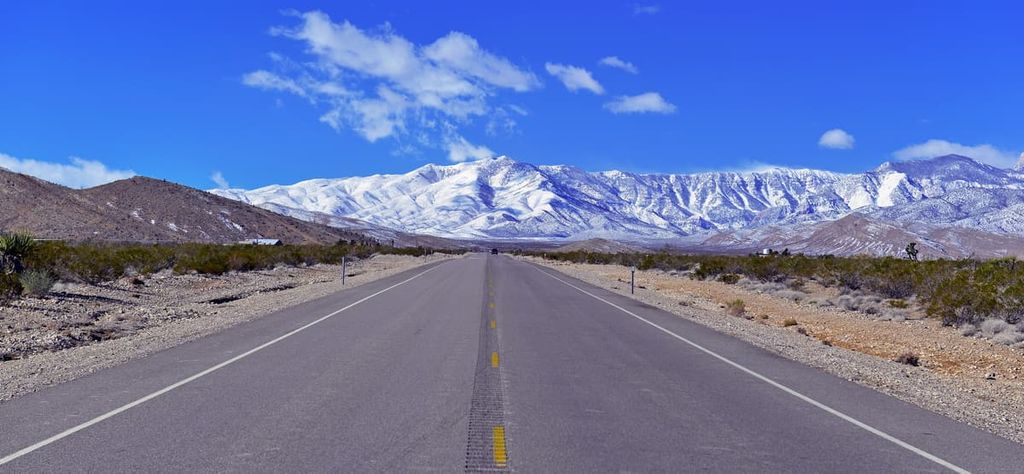
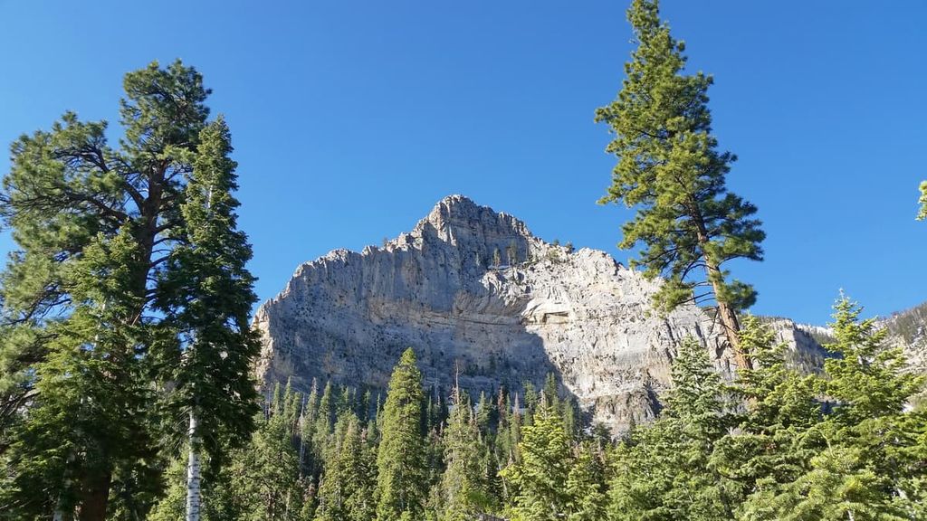
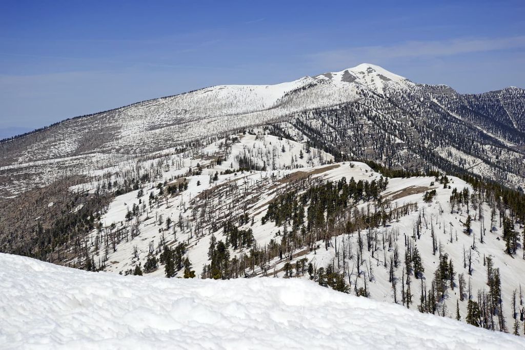
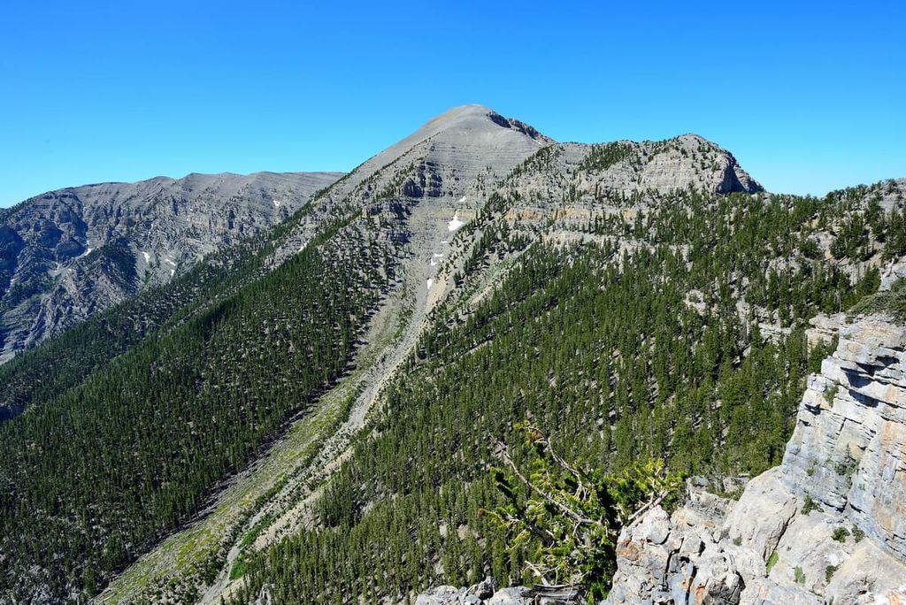
Located in the southern part of the US state of Nevada, the Mount Charleston Wilderness extends across the highest elevations of the Spring Mountains, protecting 57,442 acres (23,246 ha) of lofty summits, natural springs, and evergreen forest. The Mount Charleston Wilderness contains 12 named mountains, the highest and most prominent of which is Charleston Peak (11,916 ft/3,632 m).
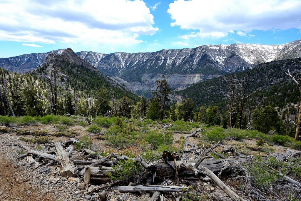
The Mount Charleston Wilderness extends across the highest summits of the Spring Mountains, a north-south trending range in southern Nevada that divides the Amargosa River Basin into two valleys, the Pahrump Valley and Las Vegas Valley.
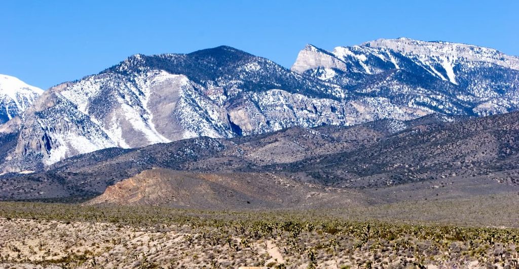
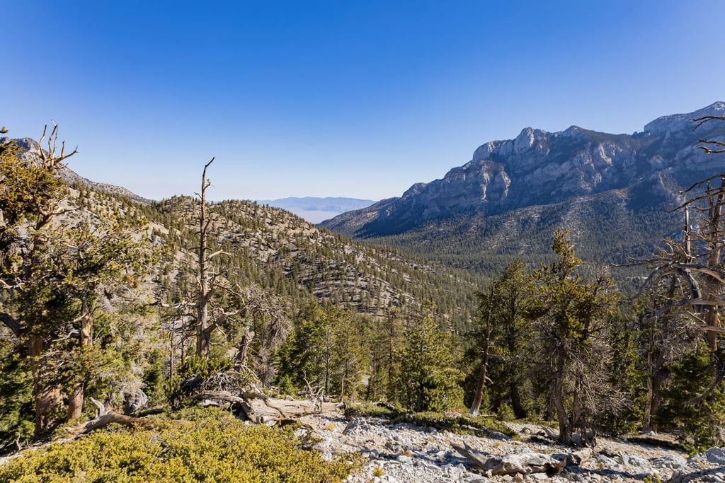
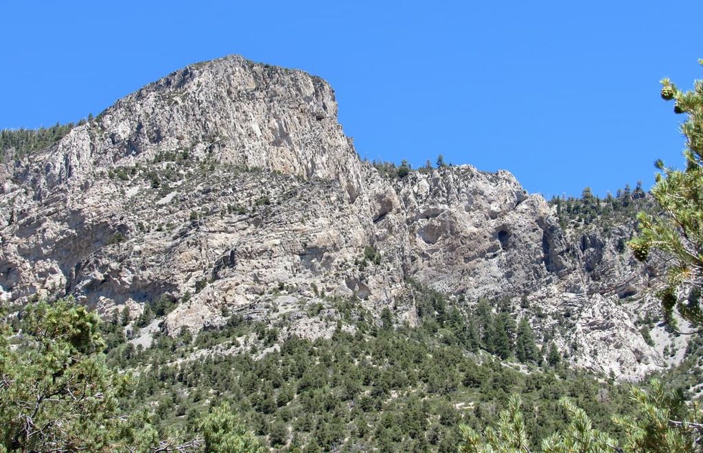
The Spring Mountains define part of the Great Basin boundary and boast more than 8,000 feet (2,439 m) of vertical relief. Notable peaks in the Spring Mountains include Charleston Peak (also known as Mount Charleston), Bonanza Peak, McFarland Peak, Mummy Mountain, and Griffith Peak.
The Mount Charleston Wilderness lies within the Spring Mountains National Recreation Area, which adjoins the Red Rock Canyon National Conservation Area and protects over 316,000 acres (127,880 ha) of the Toiyabe National Forest.
Additionally, the Mount Charleston Wilderness borders the La Madre Mountain Wilderness Area, which in turn borders the Rainbow Mountain Wilderness Area. Together, these three wilderness areas protect over 120,000 acres (48,560 ha) of the Spring Mountains National Recreation Area in the Toiyabe National Forest, as well as portions of the Red Rock National Conservation Area, which lies just 15 miles (24 km) from downtown Las Vegas.
To the north, the Mount Stirling Wilderness Study Area covers over 69,000 acres (27,923 ha) of the rugged northern Spring Mountains to the northeast of the Mount Charleston Wilderness. Meanwhile, the Desert National Wildlife Refuge protects 1.6 million acres (647,497 ha) of the Mojave Desert to the north of Las Vegas.
The Mount Charleston Wilderness lies within the Basin and Range Province, a massive geomorphic province that covers portions of Nevada, California, Oregon, Idaho, and Utah. The Basin and Range Province is believed to have been formed by widespread tectonic extension that began in the early Miocene.
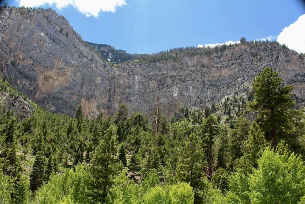
The wilderness, which protects the highest elevations of the Spring Mountains, is composed primarily of limestone that amassed in a westward-deepening sea between 520 million and 280 million years ago. It also features dolomite that’s filled with the fossils of marine organisms that inhabited the floor of prehistoric seas.
Charleston Peak, for example, is composed of fossiliferous marine limestones that were driven nearly 12,000 feet (3,658 m) above sea level. Fossilized remains of sponges, corals, crinoids, brachiopods, and other marine organisms can also be found in the limestone outcrops of Griffith Peak.
The Mount Charleston Wilderness area also has an extensive mining history as the region is rich in minerals like lead, zinc, and gold. Today, over 50 mine prospects, 9 mineshafts, and 13 mine pits have been established in the Spring Mountains National Recreation Area.
Bounded by more than 100 miles (161 km) of Mojave Desert, Mount Charleston rises abruptly from the surrounding desert lowlands, earning the moniker “sky island,” for its biological diversity and extraordinary population of endemic species.
The Mount Charleston Wilderness lies within a broad transition zone in the Spring Mountains, between the southern Mojave Desert and the northern Great Basin Desert. As a result, the wilderness serves as a high-elevation refuge to roughly 28 unique species of plants, animals, and insects.
Desert shrublands cover most of the valley floor, while conifer forest, dominated by evergreen pinyon pine and juniper trees, as well as ponderosa pine, shrub live oak, white fir, and limber pine thrive at higher elevations. The lower ridges of Mount Charleston also sustain the most extensive stand of bristlecone pine trees in the Intermountain West, including at least one tree that is nearly 3,000 years old.
Approximately 15 endemic mountain flowers, including the Charleston Mountain Angelica, bloom among the region’s pinyon-juniper woodlands. At least seven endemic species of butterflies have formed symbiotic relationships with the flowering plants of the wilderness. The endangered Mount Charleston blue butterfly, for example, survives on mountain oxytrope and Torrey’s milkvetch in the area.
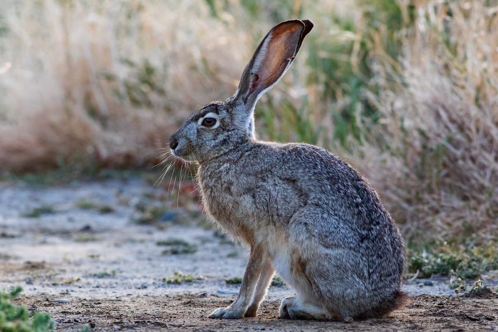
Black-tailed jackrabbits, kit foxes, burros, elk, mule deer, mountain lion, and white-tailed antelope squirrels are inhabitants of the Mount Charleston Wilderness. However, the wilderness also serves as a critical habitat for the Palmer’s chipmunk, an endangered species that occupies the upper end of the pinyon-juniper and fir-pine and bristlecone pine communities of the region.
Clovis and stem spear points uncovered in the Las Vegas Wash suggest that the Great Basin region has been inhabited for roughly 12,000 to 13,000 years.
Many Indigenous peoples, including the Southern Paiute, Chemehuevi, Colorado River Yuman, and Western Shoshone have lived in the region since time immemorial. There are also many tribal nations that continue to live on their ancestral homelands in the region to this day. Charleston Peak, or ‘Nuvant,’ remains a sacred place to the Southern Paiute, who consider it to be the center of creation.
The first Europeans reached the Mount Charleston area during the Spanish Exploration Period (1500–1700 CE) and the period where the region was under Mexican rule (1822–1846 CE).
During this time, the Southern Paiute, in particular, were progressively displaced from their ancestral lands after the arrival of Spanish conquistadors and the construction of the Old Spanish Trail.
In the mid-1800s, the Old Spanish Trail became the Mormon Road, and an increasing number of settlers began traveling to the region with hopes of becoming rich from mining or ranching. Small communities and mining camps covered the Las Vegas, Pahrump, Amargosa, and Mesquite Valleys by the mid 1850s.
By 1869, the Army Corp of Engineers had designated Charleston Peak as the highest summit of the Spring Mountains. In 1906, the Charleston Forest Reserve was established to protect the southern part of the Spring Mountains and a year later, the Vegas National Forest was created to protect the northern Spring Mountains and the Sheep Range.
Eventually, the two areas were combined to form the Moapa National Forest, which in turn was combined with Toiyabe National Forest in 1915. In 1989, after a series of administrative changes, roughly 43,000 acres (17,401 ha) of the Mount Charleston National Recreation Area was designated as the Mount Charleston Wilderness Area.
More than 60 miles (97 km) of hiking trails traverse the Mount Charleston Wilderness. Here are some of the best trails in the area:
Mary Jane Falls can be accessed via a 3.2 mile (5.1 km), moderately difficult trail in Kyle Canyon. The trail begins on an abandoned road, winding through a forest of ponderosa pine, white fir, rocky mountain maple, and mountain mahogany, before ascending to the base of the falls. Two seasonal springs cascade off the limestone cliff walls above.
The moderately strenuous Bristlecone trail winds through the upper reaches of Lee Canyon, traversing through pine-fir and Bristlecone forests, as well as groves of quaking aspen.
The 3.4-mile (5.5 km) Fletcher Canyon trail climbs through a pine forest, eventually reaching a deep, slot-like canyon framed by polished 200-foot (61 m) limestone walls. As an added bonus, at the end of the trail hikers are greeted by a beautiful view of Mummy Mountain, the second-highest peak in the Spring Mountains.
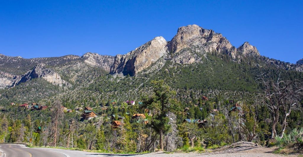
Located just 45 minutes from downtown Las Vegas, Charleston Peak (often referred to as Mount Charleston), is a popular destination for local hikers and outdoor enthusiasts. From the summit, hikers are rewarded with incredible views of the surrounding desert, as well as nearby Las Vegas.
The summit of Charleston Peak can be accessed from two well-maintained trails: South Loop trail and North Loop trail (or Deer Creek trail). The 20-mile (32-km) Deer Creek trail is the more scenic of the two trails but traverses a series of cliff edges.
Though not as lofty as nearby Mount Charleston, Griffith Peak is the third highest summit in southern Nevada and a worthy accomplishment for any avid hiker. Griffith peak is accessible from two trails, the South Loop trail and the Harris Springs trail.
The South Loop is roughly 9.7 miles (15.6 km) long and leads directly to Griffith Saddle. From here, hikers can opt to summit both Griffith and Charleston Peak.
Just a few miles from the summit of Mount Charleston, the 0.2-mile (300-m) Robbers Roost Trail leads to a series of unique, eroded caves tucked within limestone cliffs.
According to local legend, the caves were once used by outlaws on the Old Spanish Trail in the 1880s. Though historians insist that this is unlikely, these wind and rain-swept caves are still worth exploring.
If you’re looking for a place to stay near the Mount Charleston Wilderness, here are a few good options:
Located at 8,600 feet (2,621 m) in elevation, the Lee Canyon Ski Resort offers day-lodge facilities and more than 445 acres of skiable terrain.
Lee Canyon is home to 860 vertical feet (262 m) of lift-served terrain, 24 serviced snow trails, a tubing area, and 1,919 vertical feet (585 m) of hiking. The annual snowfall total at the resort is about 161 inches (409 cm), but the resort sees over 300 days of sunshine. This makes it the perfect destination for both summer and winter recreation.
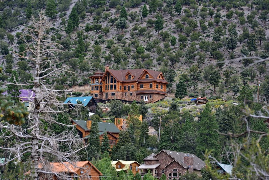
The Retreat on Charleston Peak is a rustic lodge nestled within Kyle Canyon. Though the lodge has retained much of its historic charm, it also offers modern day amenities, including a full-service restaurant, gaming bar, a pet-friendly patio, and high-speed internet.
Located at the end of Kyle Canyon, the historic Mount Charleston Lodge boasts 23 log cabins, a scenic restaurant, and a cozy lounge that serves breakfast, lunch, dinner, and world-famous coffee daily. The ambiance in the lodge is meant to evoke feelings of relaxation and allows visitors to escape to nature without needing to sacrifice modern comforts.
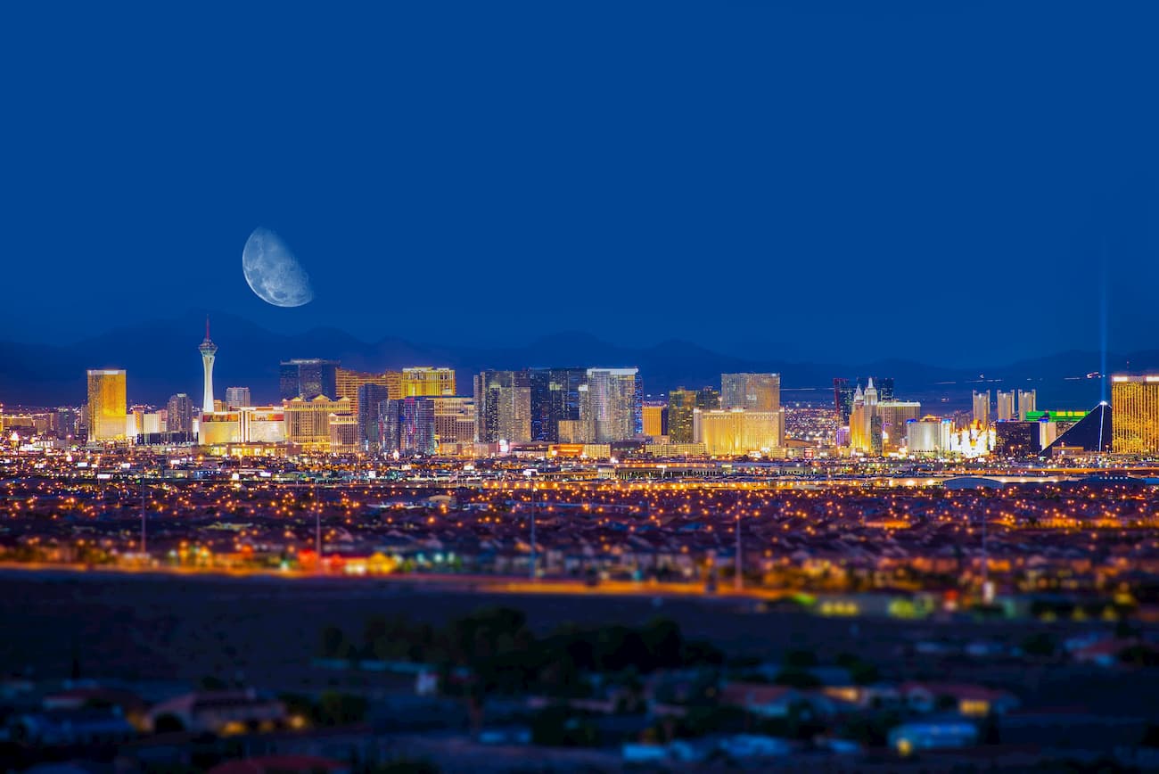
Situated just 45 minutes from the Mount Charleston Wilderness, Las Vegas is a vibrant city packed with extravagant entertainment, fine-dining, and accommodations.
Las Vegas is also centrally located to several scenic parks and recreation areas, including the Desert National Wildlife Refuge, Red Rock Canyon National Conservation Area, Lake Mead National Recreation Area, Valley of Fire State Park, and Spring Mountains National Recreation Area.


ultra
nevada-11ers
nevada-peaks-club
las-vegas-mountaineers-classics
nevada-peaks-club-emblem
western-state-climbers
western-state-climbers-star
desert-summits-book
sierra-club-desert
desert-peaks-section-emblem
great-basin
great-basin-star
nevada-ultras
nevada-11ers
nevada-peaks-club
las-vegas-mountaineers-classics
desert-summits-book
sierra-club-desert
great-basin
nevada-11ers
las-vegas-mountaineers-classics
desert-summits-book
great-basin


