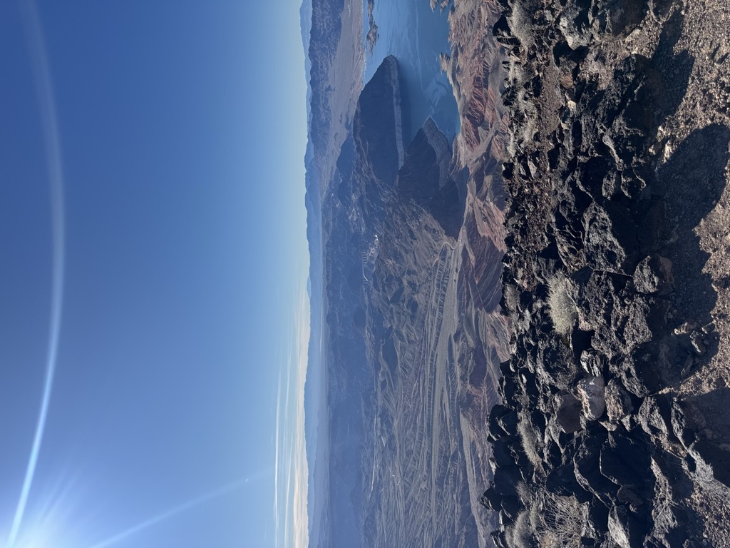
Fortification Hill is a prominence adjacent to Lake Mead in the Lake Mead National Recreation Area; it is located at the northwest terminus region of the Black Mountains (Arizona), and specifically the north region of the Black Mountains. It is near a southern section of Lake Mead, and just northeast of Hoover Dam. It can easily be seen eastward across Las Vegas Bay or from the two northern mountain terminuses of Eldorado Mountains (Nevada), or the Black Mountains (Arizona).
The mountain prominence is plateau-like, or mesa-like with its highpoint at the southeast terminus, and sloping north and northwestwards toward Lake Mead. The prominence is 3,719 feet (1,134 m).
The flat mountaintop, sloping northwards is composed of Tertiary basaltic lava flows.
There's a trail called Fortification Hill Trail leading to the summit.
By elevation Fortification Hill is
# 15 out of 85 in Lake Mead National Recreation Area # 9 out of 26 in the Black Mountains (Nevada)
By prominence Fortification Hill is
# 51 out of 296 in Mohave County # 9 out of 85 in Lake Mead National Recreation Area # 4 out of 26 in the Black Mountains (Nevada)
We use GPS information embedded into the photo when it is available.
3D mountains overlay
Adjust mountain panorama to perfectly match your photos because recorded by camera photo position might be imprecise.
Move tool
Rotate tool
Zoom
More customization
Choose which peak labels should make into the final photo and what photo title should be.
Next
Photo Location
Satellitte
Flat map
Relief map
Latitude
Longitude
Altitude
OR
Latitude
°'''
Longitude
°'''
Apply
Register Peak
Peak Name
Latitude
Longitude
Altitude
Register
Teleport
PeakVisor
This 3D model of Sagarmatha National Park in Nepal was made using the PeakVisor app topographic data. The mobile app features higher precision models worldwide, more topographic details, and works offline. Download PeakVisor maps today.
Download OBJ model
PeakVisor
The download should start shortly. If you find it useful please consider supporting the PeakVisor app.
PeakVisor for iOS and Android
Be a superhero of outdoor navigation with state-of-the-art 3D maps and mountain identification in the palm of your hand!