
Scan the QR code and open PeakVisor on your phone
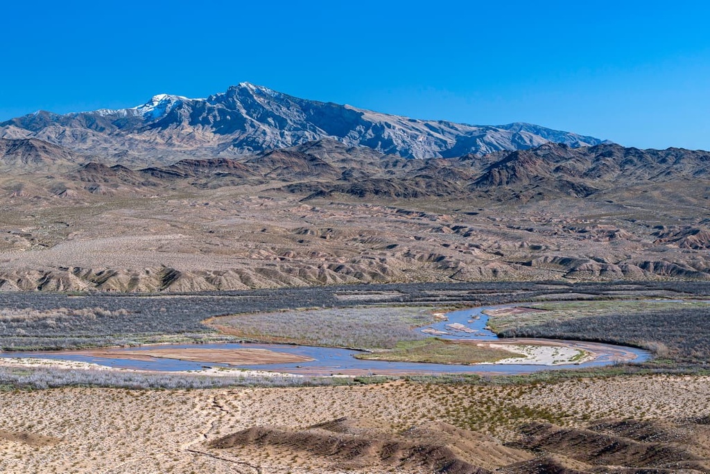
Established in 2016, the Gold Butte National Monument covers nearly 300,000 acres (121,405 ha) of the Mojave Desert in the southeastern part of the US state of Nevada. This rugged desert landscape features sandstone towers, ancient rock art, and historic sites. There are 23 named mountains in the monument, the highest of which is Virgin Peak (8,087 ft/2,465 m) and the most prominent of which is Mica Peak (5,755 ft/1,754 m).
Gold Butte National Monument is located in a remote region of Clark County, Nevada between Lake Mead National Recreation Area and Grand Canyon-Parashant National Monument. Just west of the monument is Valley of Fire State Park.
There are two designated wilderness areas in the Gold Butte National Monument: Lime Canyon (23,233 acres) and Jumbo Springs (4,631 acres). Two additional areas in the monument are currently managed as wilderness: the Million Hills Wilderness Study Area (21,296 acres/8,618 ha) and the Virgin Mountain Instant Study Area (6,560 acres/2,654 ha).
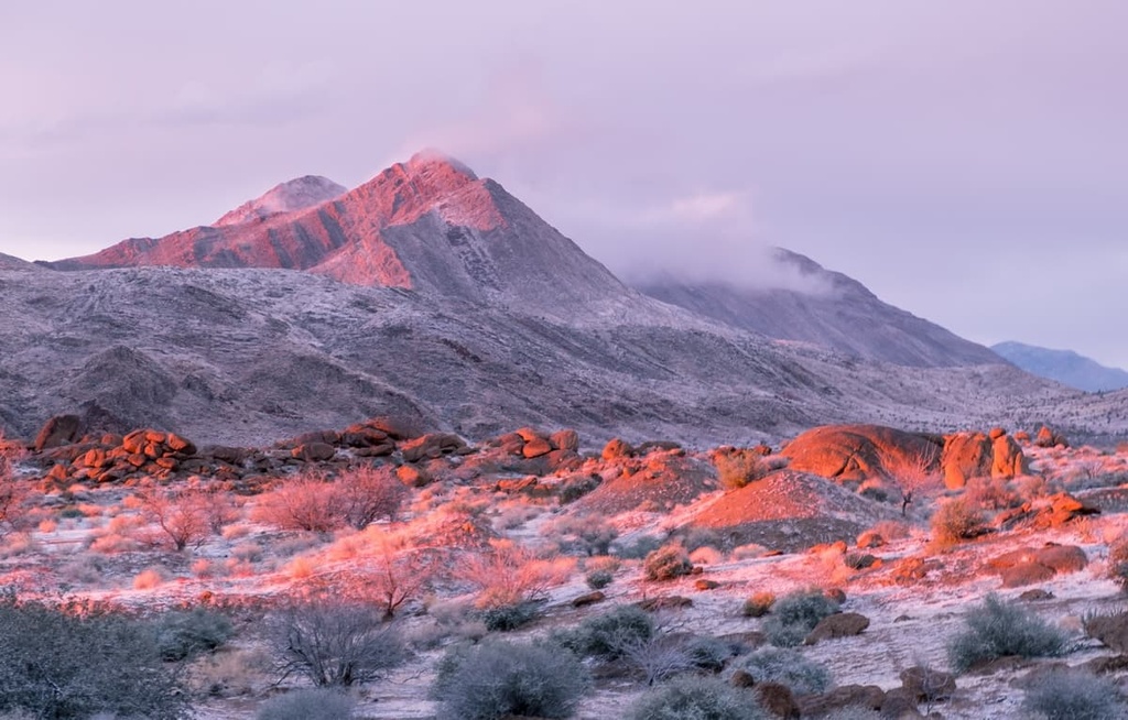
The Virgin Mountains dominate the northeastern corner of Gold Butte. Standing in stark contrast to the surrounding desert landscape, the Virgin Mountains cover roughly 885 square miles and span three states: Utah, Arizona, and Nevada. The tallest peak in the Virgin Mountains, Virgin Peak, lies within the Gold Butte National Monument.
Gold Butte National Monument contains over 500 million years of geologic history. Over the course of millions of years, the landscape occupied by the monument has been shaped by the eroding forces of water, wind, heat, and pressure.
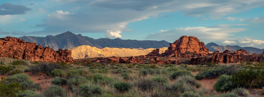
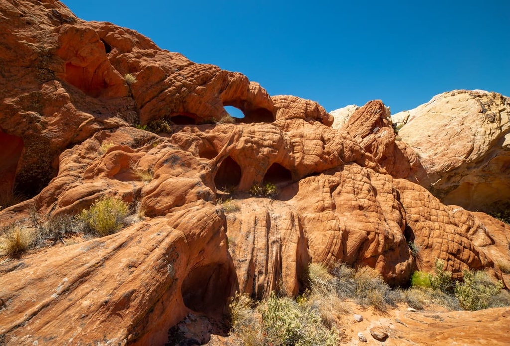
Incredible 180-million-year-old Jurassic sandstone formations, akin to those of the nearby Valley of Fire State Park, can be seen at Whitney Pocket and other areas of the park.
The southern region of the monument contains wide granitic ridges and metamorphic rocks that are believed to be roughly 1.7 billion years old. These Precambrian crystalline rocks were exposed as prominent peaks when Paleozoic strata that rested above them moved west during the Miocene.
The northern reaches of the monument are characterized by limestone that was deposited on the shallow sea floor during the Paleozoic, roughly 540 and 250 million years ago. The southern Virgin Mountains occupy the northeastern corner of the monument and contain both faulted carbonate and silicate rock.
Three major ecosystems, the Mojave Desert, Great Basin Desert, and Colorado Plateau, meet in Gold Butte National Monument. As a result, the monument boasts a variety of flora and fauna.
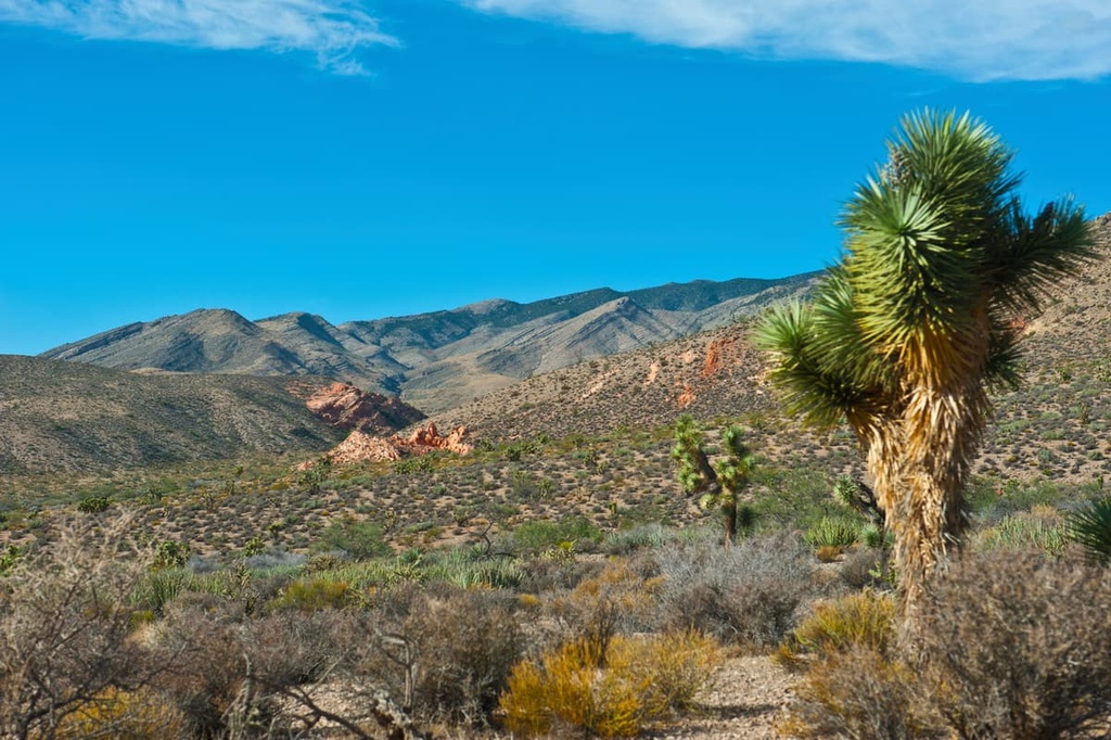
The vast, arid eastern Mojave Desert ecoregion covers most of the Gold Butte National Monument. This ecoregion is dominated by creosote bush and white bursage vegetation, but also contains populations of Mojave yucca, cacti, and classic chaparral species.
Gypsum deposits are also a distinctive feature of the Mojave Desert ecosystem. These deposits support a variety of endemic and rare species, including sticky ringstem, Las Vegas buckwheat, and Las Vegas bear poppy.
Other rare plants in the Gold Butte National Monument include sand-dependent threecorner milkvetch and sticky wild buckwheat, as well as Rosy two-tone beardtongue and the Mokiak milkvetch.
Standing in stark contrast to the barren Mojave Desert region, higher elevations of the Gold Butte National Monument are dotted with stands of pinyon pine, Utah juniper, sagebrush, and acacia woodlands.
Ponderosa Pine and white fir forests also thrive at the highest points of the monument in the Virgin Mountains. In fact, the Virgin Mountains are home to the southernmost stand of Douglas fir and the only stand of the Arizona cypress in Nevada.
The Gold Butte National Monument serves as a critical wildlife corridor between Lake Mead and the Virgin Mountains. It is frequently traversed by large mammals, including desert bighorn sheep and mountain lion, as well as smaller mammals like the white-tailed antelope squirrel, desert kangaroo rat, and the desert pocket mouse.
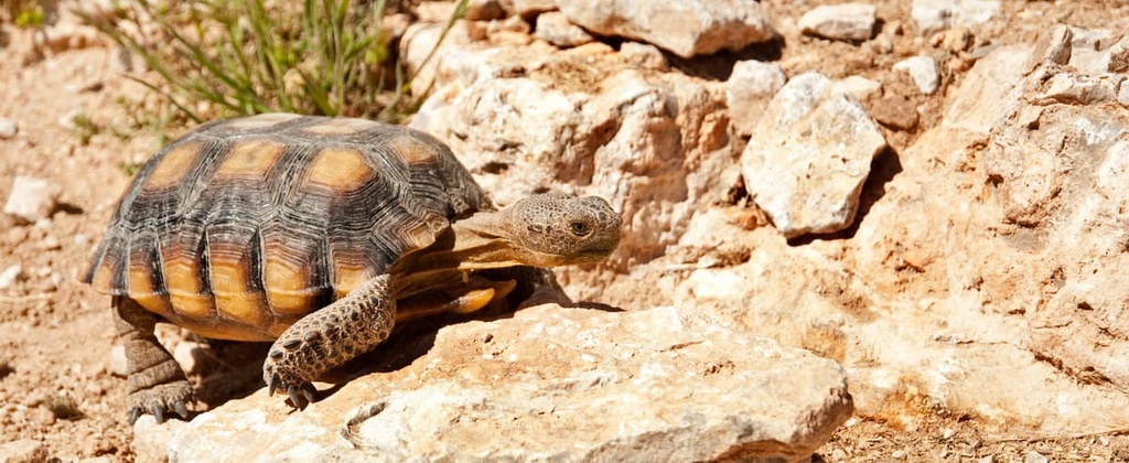
The Mojave Desert tortoise, a threatened species, relies on the region’s creosote-bursage ecosystem for sustenance. The monument also supports several species of bat, the northern Mojave blue butterfly, and a variety of amphibians.
The only recorded venomous lizard in the region, the banded Gila monster, has been documented in the Gold Butte National Monument. There are also many other reptile species found in the monument, including the banded gecko, California kingsnake, desert iguana, glossy snake, Mojave green rattlesnake, and western long-nosed snake.
Human history in the Gold Butte National Monument dates back at least 12,000 years. The land now occupied by the monument is sacred to the Moapa Band of Paiutes and the Las Vegas Paiute Tribe, who to this day, retain a spiritual and cultural connection with the land.
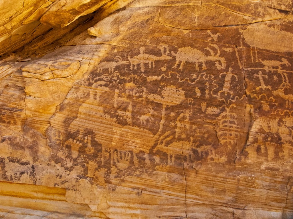
Today, the monument protects a wide range of important archeological artifacts, including the remnants of ancient rock shelters, agave roasting pits, projectile points, pottery, and bone fragments, as well as a spectacular display of rock art. Archaeologists estimate that over 2,000 archaeological sites are tucked within the Gold Butte complex.
Spanish settlers arrived in the region in the late eighteenth century, followed by Mormon settlers in the 1850s and 1860s. Early settlers of European descent in the region utilized the area’s natural resources to graze livestock and established mining operations.
In 1905, gold was discovered in Gold Butte, Nevada, a mining district that included land between the Nevada-Arizona border and the Virgin River. Though the townsite saw an initial boom of hopeful miners in the early 1900s, it was all but abandoned by 1910.
Several decades later, during the depression era, the Civilian Conservation Corps established camps in the area and constructed the Whitney Pocket Dam to catch rainwater for ranching.
Though the Gold Butte region eventually became a popular destination for off-the-grid exploration, the region’s many cultural and historic treasures were susceptible to vandalism and theft. In 2005, the Nevada Site Stewardship Program was established to help monitor and protect the site. In 2016, after a multi-year campaign by local conservation groups, Gold Butte was designated as a national monument.
These are a few of the best hiking trails and natural attractions in the Gold Butte National Monument:
Located at the foot of Virgin Peak, Whitney Pocket is a primitive camping and picnic area that contains several fascinating historic artifacts, including rock art, agave roasting pits, and structures left over by early ranchers and the Civilian Conservation Corps.
Whitney Pocket is one of the first attractions visitors will encounter when they leave the interstate. It is an excellent starting point for campers, off-road enthusiasts, and hikers.
The Devil’s Throat is one of the most intriguing features of the Gold Butte National Monument. This massive sinkhole has continued to expand since it was first discovered in the early 1900s. It is currently over 120 feet wide (37 m) and 120 feet (37 m) deep. Fences have been erected to keep visitors at a safe distance.
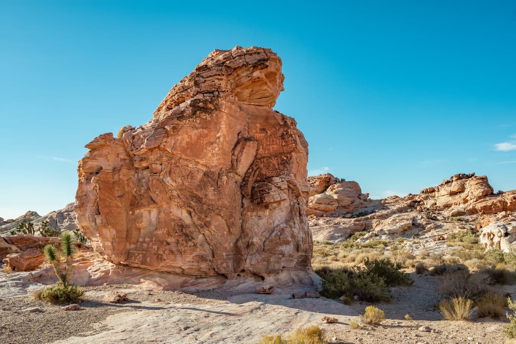
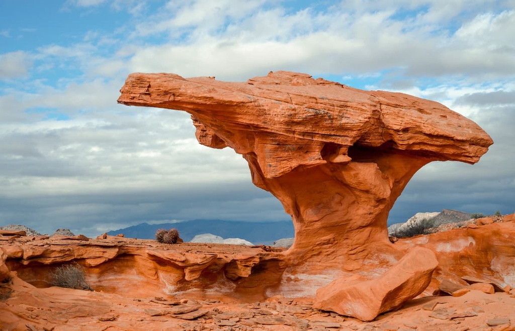
Arguably the most photographed feature of the Gold Butte National Monument, Little Finland features a series of vibrant Aztec sandstone formations.
Visitors to Little Finland can explore dozens of unusual rock formations that have been eroded and chiseled into otherworldly structures. A 4WD vehicle is needed to access the region.
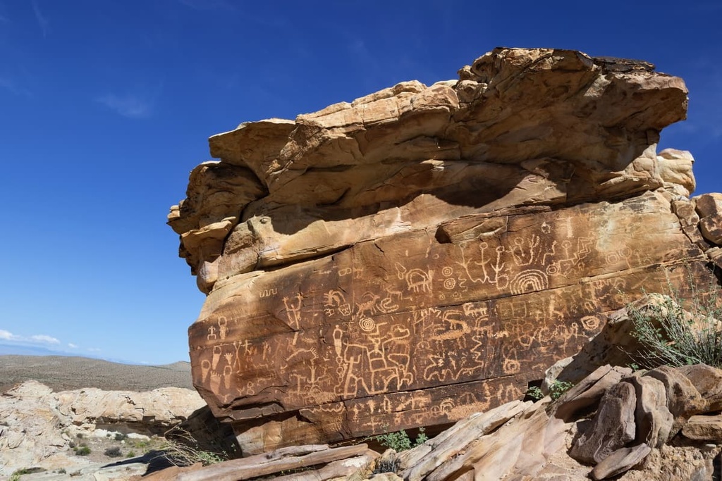
Aptly named, Newspaper Rock features petroglyphs of the region’s earliest inhabitants, including the Fremont, Ute, and Anasazi tribes. It’s estimated that Newspaper Rock contains over 650 pieces of rock art, making it one of the largest collections of petroglyphs in the US.
There are no facilities or services within the Gold Butte National Monument and visitors are urged to bring enough food, water, and supplies to be self-sufficient during their trip. If you’re visiting the Gold Butte National Monument, these are a few of the nearby towns to check out:
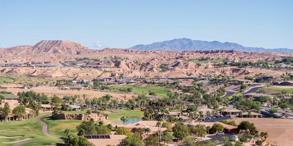
Located just 10 miles (16 km) from the Nevada-Utah border, Mesquite is the nearest town to Gold Butte. Mesquite isn’t a particularly large community, especially when compared to nearby Las Vegas. However, it boasts a variety of lodging options and modern amenities, including casinos, resorts, RV parks, and campgrounds.
Nearby parks and attractions include the Cedar Breaks National Monument, Valley of Fire State Park, Cathedral Gorge, the Dixie National Forest, Great Basin National Park, and Bryce Canyon National Park.
Known as the gateway to Valley of Fire State Park and Lake Mead, Moapa Valley is a small community packed with outdoor recreation opportunities, including the Lost City Museum, Moapa Valley National Wildlife Refuge, and Overton Wildlife Management Area. Moapa Valley isn’t a major metropolis, but it offers travelers a nice mix of shopping, dining, and lodging options.
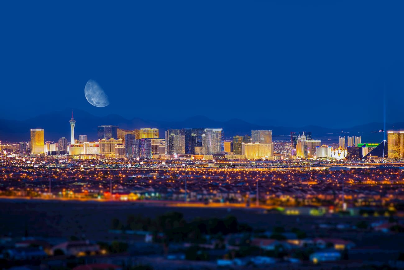
Located roughly 2.5 hours from Gold Butte, Las Vegas is the closest major city to the monument. Las Vegas is internationally recognized for its lively entertainment and nightlife.
However, just a short distance from the city lies a variety of incredible natural attractions, including the Red Rock Canyon National Conservation Area, Lake Mead National Recreation Area, Valley of Fire State Park, Spring Mountains National Recreation Area, and Mount Charleston.
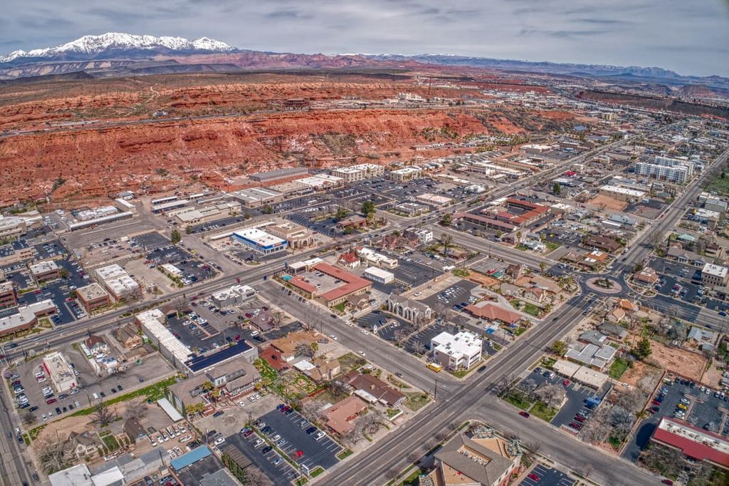
St. George is best-known for its proximity to Zion National Park, but it also serves as the perfect basecamp for exploring Bryce Canyon, the Grand Canyon, Great Basin, Capitol Reef, Lake Mead, and the Gold Butte National Monument.
Visitors to St. George can opt to stay in a local lodge, inn, hotel, campground, or cabin. The city hosts a variety of delicious restaurants, coffee shops, and breweries to choose from.


nevada-peaks-club
desert-summits-book
sierra-club-desert
great-basin
nevada-peaks-club
desert-summits-book
sierra-club-desert
great-basin


