Scan the QR code and open PeakVisor on your phone
Cedar Breaks National Monument is a natural red rock canon amphitheater within the US state of Utah. The red rock terrain is marked by unique outcroppings and rock formations. The national monument contains 11 named peaks with the tallest and most prominent being Columbine Ridge at 10,619 feet (3,234 m) tall with 190 feet (58 m) of prominence.
Cedar Breaks National Monument is located in the southwestern portion of the US state of Utah, just outside of Cedar City. This natural amphitheater has been carved and eroded into the red rock of the region.
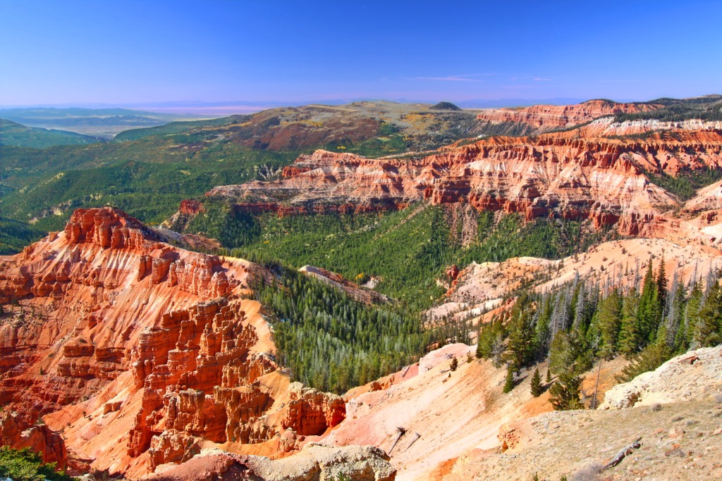
The amphitheater spans for 3 miles (4.8 km) and reaches a depth of over 2,000 feet (610 m). The protected region covers 6,155 acres (2,491 ha) of land across Iron County. Elevations range from around 8,000 feet (2,438 m) up to the summit of Columbine Ridge.
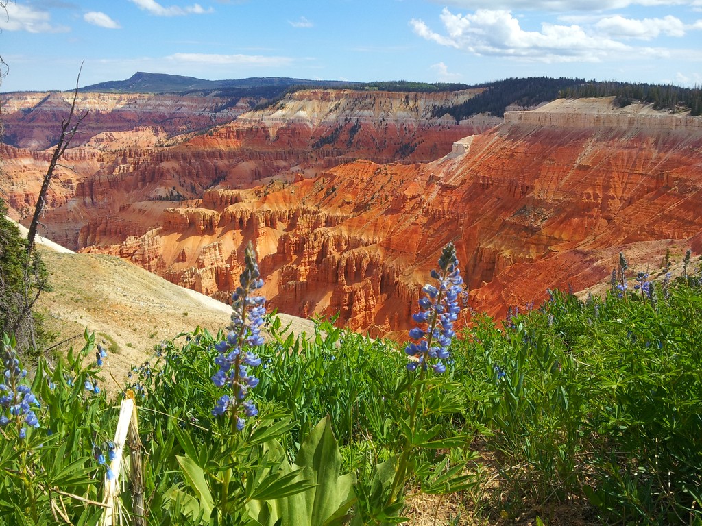
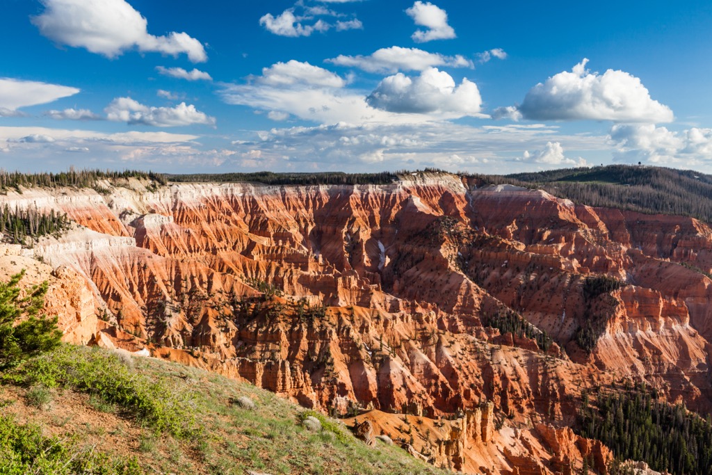
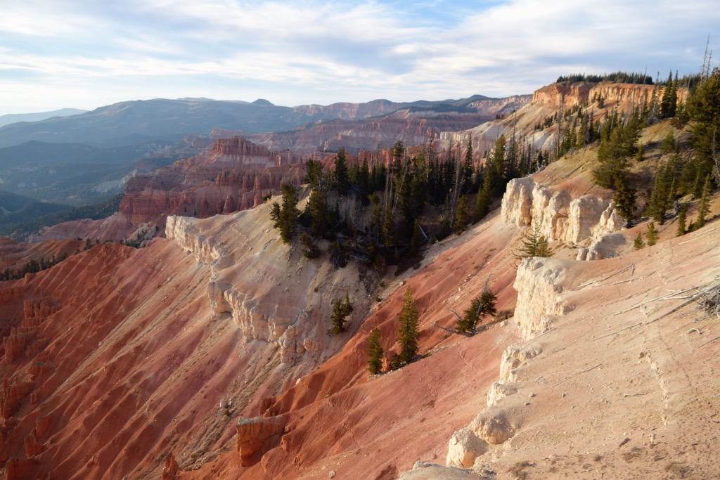
Within this sweeping amphitheater lie numerous arches, pinnacles, hoodoos, columns, and spires. Visitors can see the distinct layers of rock with various shades of red, orange, yellow, and purple being visible.
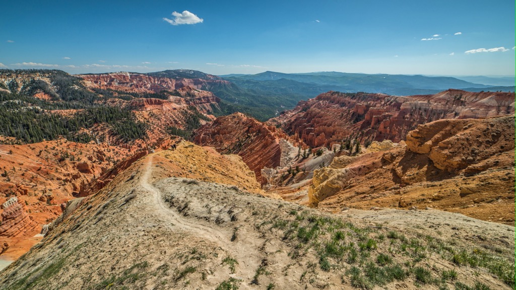
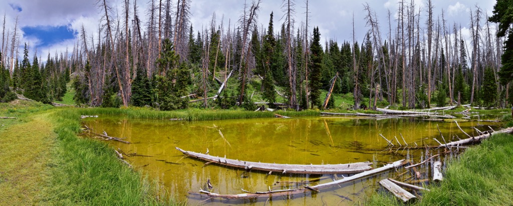
While the rim of the canyon is forested, much of the canyon itself is free of dense vegetation, instead defined by the unique rock formations. Trails wind along the rim of the canyon, showcasing views of the unique rocks that are similar to those found in Bryce Canyon National Park.
The headwaters for Mammoth Creek, a tributary of the Sevier River, are located within the monument. Crow, Coal, and Ashdown creeks lie just west of the monument. Nearby lakes include Navajo Lake to the south and Panguitch Lake to the northeast.
Additionally, Cedar Breaks National Monument is surrounded by other popular outdoor recreation areas. The monument is surrounded by Dixie National Forest, which marks the largest national forest in the state. Zion National Park and the Springs Creek Canyon Wilderness Study Area are situated to the southwest. Bryce Canyon National Park is located to the east while the Deep Creek North Wilderness is to the south.
Cedar Breaks National Monument lies along the western edge of the Colorado Plateau. This section of terrain marks part of the Markagunt Plateau, which also helped form nearby Zion National Park.
As the plateau was slowly uplifted, the region experienced widespread erosion. This erosion wore down the limestone, shale, and sandstone that are still visible today. These sediments were deposited at the bottom of the ancient Lake Claron.
Around 60 million years ago, this lake covered an area spanning 70 miles by 250 miles (112km by 402 km). As the lake receded due to the shifting landscape, the plateau continued to be eroded. Sediments were carried away by waterways, leaving behind the unique rock formations visible today.
The massive canyon is still being eroded at a rate of 2 inches (50 mm) every 5 years. Volcanic rock known as tuff is found near the top of the surrounding plateau, having been formed by eruptions roughly 35 million years ago.
Deposits of iron and manganese in the canyon help provide the unique colors in the monument. As these mineral oxides, vibrant colors of red, purple, yellow, and orange become visible. These colors are what led the Indigenous people of the region to call the canyon “Circle of Painted Cliffs” in their native language.
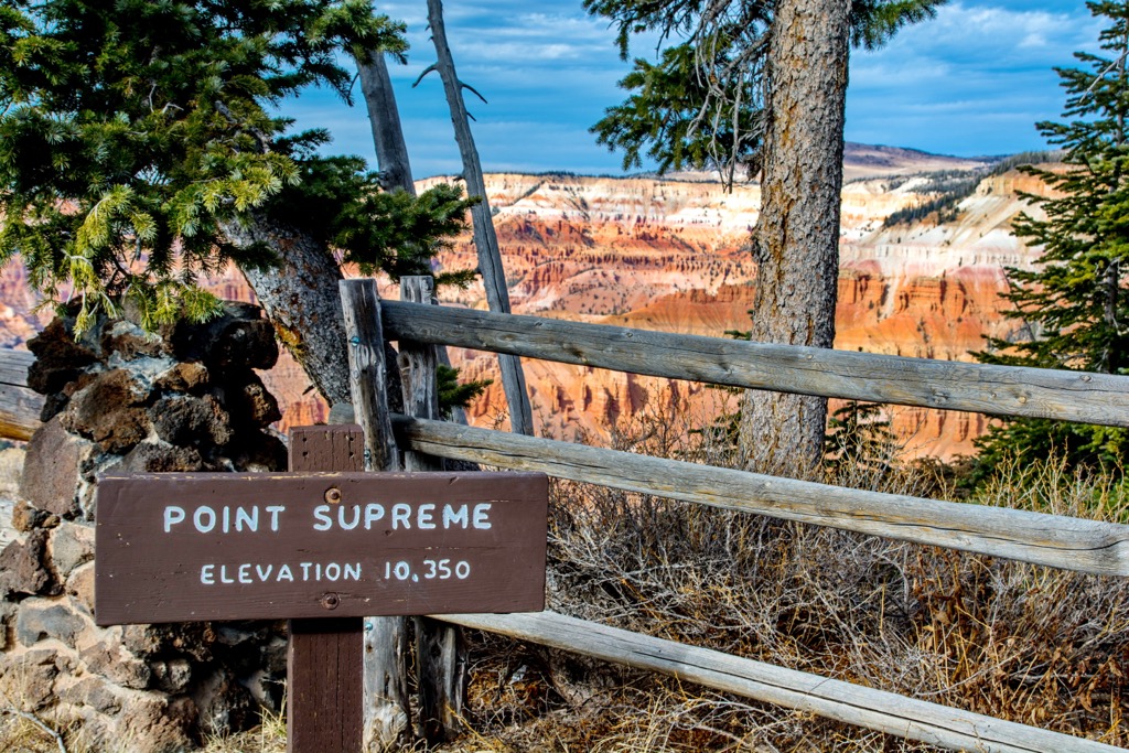
Major peaks within the monument include Columbine Ridge, Meadow Hill, Orange Ridge, and Cedar Breaks.
The canyon rim is populated by stands of bristlecone pine, with some specimens being over 1,000 years old. Dixie National Forest surrounds the monument, with some of the high nearby peaks being populated with species of spruce, pine, and fir.
While some trees grow amidst the rock formations, much of the canyon features smaller low growing plants. Various species of grasses and wildflowers thrive amidst the rocky conditions. Hikers may spot Colorado columbine, pretty shooting star, prairie smoke, scarlet paintbrush, Parry primrose, and various other flowers.
The high altitude of the monument helps support a variety of wildlife. Populations of porcupines and mule deer inhabit the region along with chipmunks, squirrels, marmots, and pocket gophers.
The surrounding forested landscape helps support a population of mountain lions though they are rarely seen within the monument. Hikers are more likely to spot species of birds such as the common raven, Clark’s nutcracker, or the violet-green swallow.
Humans have inhabited the region in and surrounding Cedar Breaks National Monument for thousands of years. Cultural artifacts and petroglyphs found in the surrounding area date back over 2,000 years.
The oldest artifacts are tied to the ancestral Puebloans, with the national monument being located on the edge of their traditional territory. This land marks part of the ancestral homelands of multiple Indigenous peoples, particularly the Nuwuvi (Southern Paiute). Descendants of the Paiute people are now part of the Paiute Indian Tribe of Utah, the Las Vegas Paiute Tribe, the Kaibab Band of Paiute Indians, the Moapa Band of Paiutes, and the San Juan Southern Paiute Tribe.
The Indigenous peoples of the region traditionally migrated throughout the Colorado Plateau, often inhabiting lower elevations during the winter months. Many of these Indigenous peoples lived harmoniously with one another and the land.
The 1770s marked the arrival of the first Europeans in the region. Early colonizers to the region traveled through present-day Utah in hope of finding passage to the western US. Many of these early settlers were fur trappers and miners searching for a route that would connect present day New Mexico and California.
Over the following decades, a group of Mormons arrived in present-day Utah sent by Brigham Young in order to claim and colonize what they believe to be their promised land. These missionaries arrived in northern Utah in the early 1800s and began establishing communities throughout the state by the mid-1800s.
These groups of Mormons, along with other colonizers, repeatedly harassed, attacked, murdered, and displaced the Indigenous peoples of the region. Often backed by the US government, these groups forcibly and brutally moved the Indigenous peoples from their ancestral homelands.
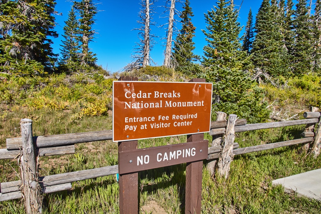
The surrounding landscape was originally established as Dixie Forest Reserve in 1905, later becoming a national forest in 1907. Cedar Breaks National Monument was established in 1933 and featured the smallest park lodge in the American southwest. Today the monument garners nearly one million visitors per year.
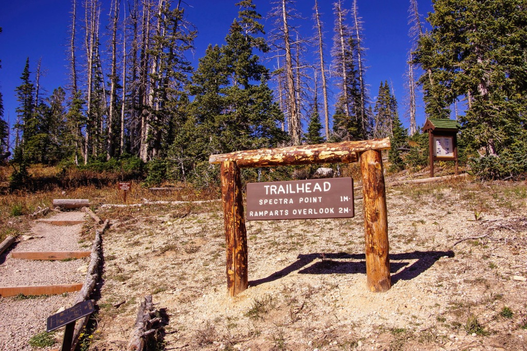
Cedar Breaks National Monument is home to just two established hiking trails though there are numerous trails in the surrounding protected regions. Here are some of the top hiking areas to visit in and near the monument
This out and back route follows along the southern edge of the canyon, steadily dropping in elevation. Throughout the route hikers show stunning views of the distinct layers of rock, outcroppings, and hoodoos.
Hikers can see Meadow Hill down at the bottom of the canyon, amidst the forested landscape. Those visiting the region should note that the entire route lies above 9,500 feet (2,896 m), adding to the difficulty of the route. The out and back trail is 3.8 miles (6 km) long and features 830 ft (253 m) of total elevation gain.
The Alpine Pond Trail marks the other designated hiking route within the monument. This short loop trail travels along the eastern edge of the monument, amidst the alpine landscape that encompasses the canyon rim.
Hikers pass by Alpine Pond while traveling through the pine trees, with expansive views of the red rock canyon to the west. This route also features wildflowers during the warmer months. The loop trail is 2.2 miles (3.5 km) and features 196 feet (60 km) of elevation gain.
The route to Bartizan Arch begins the same as Spectra Point, along the southern edge of the canyon. Hikers then continue a gradual descent of the canyon, traveling west towards The Bartizan peak.
This out and back trail extends beyond Ramparts Trail and involves traversing over technical terrain. Hikers are rewarded with views of the waterfall along Shooting Star Creek and Bartizan Arch which features a triple arch. The route is 5 miles (8 km) long and features 1,138 feet (347 m) of total elevation gain.
Looking for a place to stay near Cedar Breaks National Monument? Here are some of the best cities and towns to check out in the region.
Cedar City lies a short drive west of the national monument, marking the closest city to the protected region. Home to 35,000 residents, the city also features the headquarters of the Dixie National Forest.
Surrounded by Dixie National Forest, Cedar City also lies in close proximity to Zion National Park, making it a hub for accessing the natural terrain that defines the region.
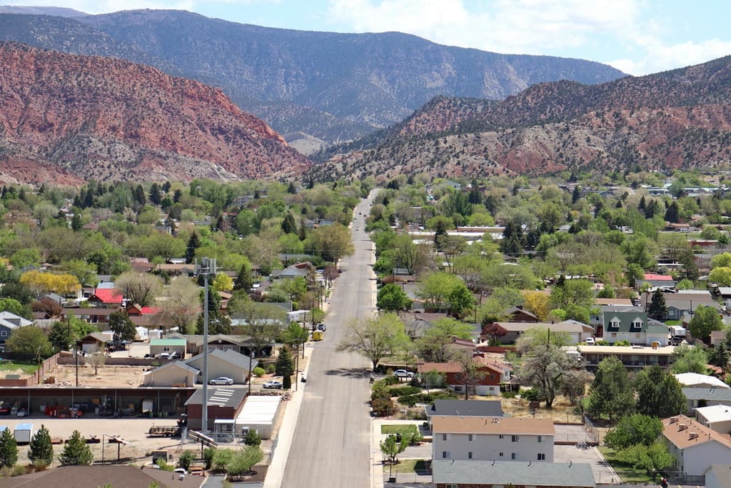
Besides its easy access to the outdoors, Cedar City is also home to Southern Utah University. Each year Cedar City hosts the Utah Shakespeare Festival, Utah Summer Games, and Simon Fest Theater. Local shops and restaurants line the downtown streets, offering an ideal way to relax after exploring the red rock canyons of Cedar Breaks National Monument.
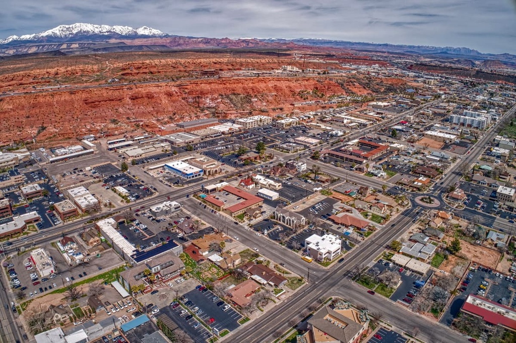
St. George lies south of Cedar City, located southwest of the monument. Home to 70,000 residents, St. George acts as a hub for southwestern Utah. Home to Dixie State University, St. George is surrounded by a diverse landscape allowing for year round outdoor recreation.
Both Snow Canyon State Park and Zion National Park are located just outside the city. Numerous trails surround the city, with opportunities for hiking, mountain biking, trail running, canyoneering, and skiing during the winter months. Other popular attractions include the Tuacahn Amphitheater and Southwest Symphony Orchestra.