
Scan the QR code and open PeakVisor on your phone
Connecticut is home to 1,260 named mountains. The highest is Mount Frissell at 747 m.
Known as ‘the nutmeg state,’ Connecticut is the southernmost state in the New England region of the northeastern United States. Rectangular in shape, Connecticut is bordered by Rhode Island to the east, Long Island Sound to the south, Massachusetts to the north, and the state’s panhandle extends to the southwest on the New York border. Ironically, the state has an extensive maritime history, despite having no direct oceanfront.
Despite being the third smallest state, Connecticut ranks among the most densely populated in the country. Fortunately, despite its growing population, more than half of the state is covered in forest. The state’s name derives from the Mohegan-Pequot word for “long tidal river,” which is said to refer to the Connecticut River, the longest river in the New England region.
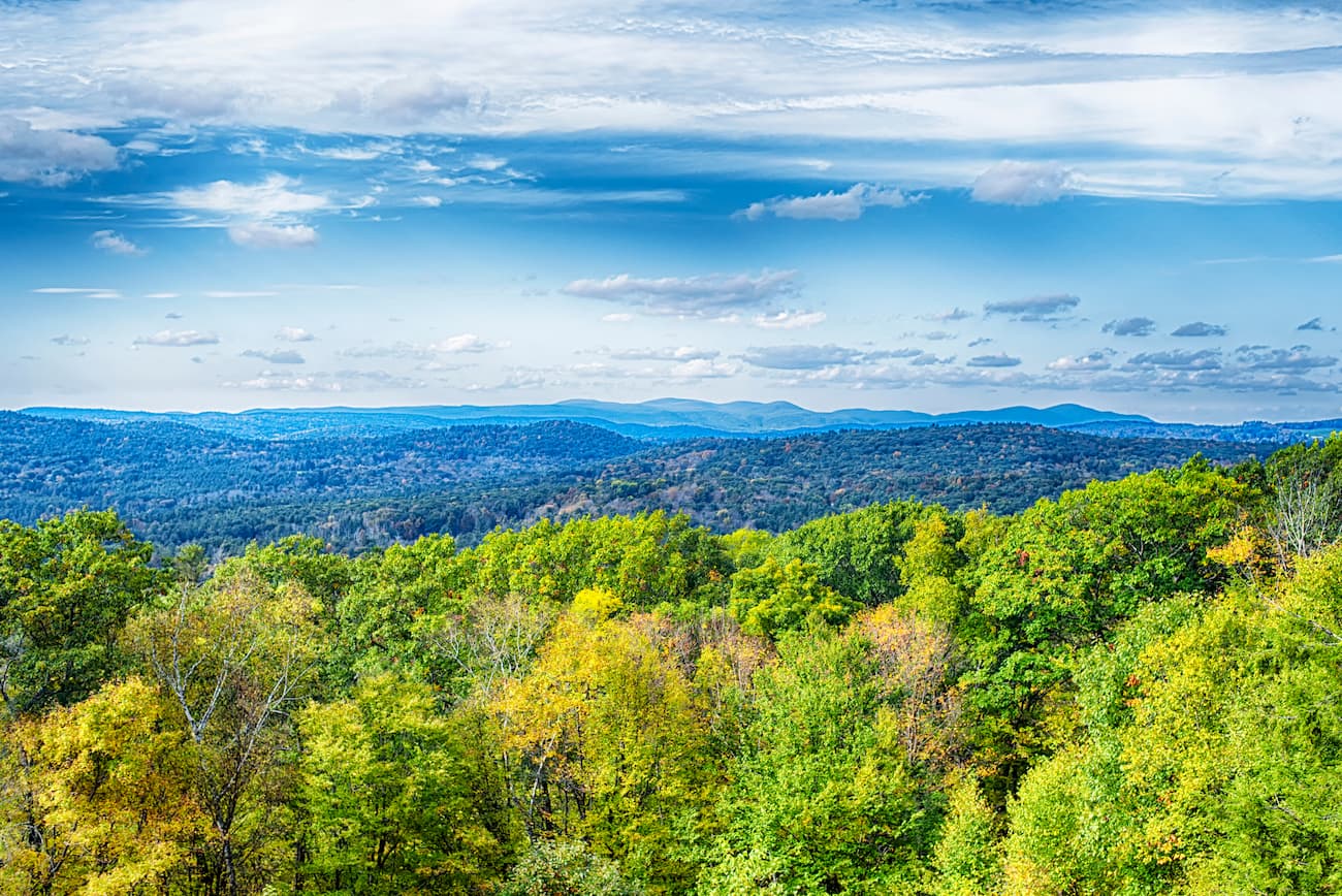
Generally, Connecticut can be divided into five physiographic regions: the Taconic Section, Western New England Upland, Connecticut Valley Lowland, Eastern New England Upland, Coastal Lowlands.
Nestled in the northwestern corner of the state, the Taconic Section sits between the Housatonic River and the New York border. This region houses the illustrious Taconic Range, home to the state’s tallest summits, including Mount Frissell, Bear Mountain, Round Mountain, Gridley Mountain, and Bald Peak. Interestingly, although Bear Mountain is Connecticut’s tallest summit, Mount Frissell is technically the highest point in the state. Mount Frissell’s true summit is located in neighboring Massachusetts, but the peak’s southern slope rises to over 2,300 feet in Connecticut.
The Northwest Hills, or Litchfield Hills, are also tucked in the northwest corner of Connecticut. The Northwest Hills are technically a continuation of the Berkshires that stretch into Connecticut from Massachusetts, which are, in turn, a continuation of the Green Mountains in Vermont.
The Northwest Hills are notoriously forested and rocky, with farmland and small towns interspersed in flatter areas. Like the Taconics, the Northwest Hills contain some of the state’s tallest peaks, including Bradford Mountain and Stone Man Mountain.
The most populated metropolitan region of Connecticut is found in the Connecticut River Valley. In contrast to the rolling hills and tall mountains in the northwestern part of the state, the Central Valley region is characterized by small rivers and basalt ridges.
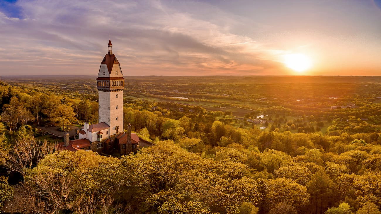
Just 10 miles from over a million Connecticut residents, the Metacomet Ridge (also known as the Metacomet Ridge Mountains or Metacomet Range), stretches from Long Island Sound to northern Franklin, Massachusetts. This narrow and steep fault-block mountain ridge is known as a ‘mini wilderness in an urban setting’ and is a popular destination for local day hikers.
The lowest elevations in Connecticut are found in the Coastal Lowlands. This region of Connecticut spans the entire New England Coast and forms a narrow strip of land between 6 to 16 miles wide along the southern shore of Long Island Sound. The Coastal Lowlands in Connecticut are the extreme opposite of the northwest region and contain coastal marshes, beaches, and large-scale maritime activities.

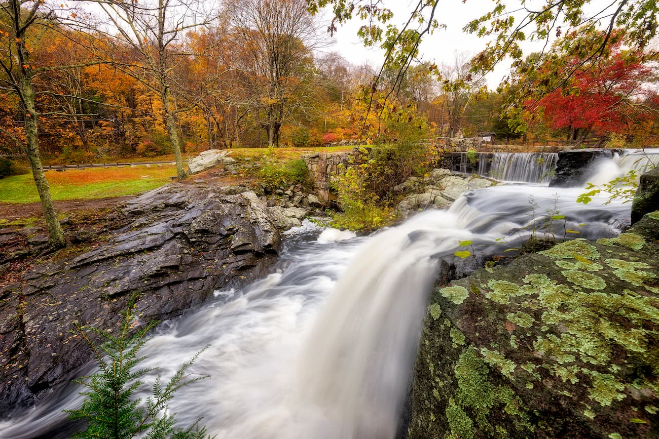
Tucked in the northwest corner of Connecticut, the Litchfield Hills region is a quintessential New England vacation destination packed with cascading waterfalls, rolling hills, quaint small towns, and stunning fall foliage. The Litchfield Hills region contains over 540 miles of hiking trails, including 47 miles of the infamous Appalachian Trail and 163 miles of the Blue-blazed trails.
Popular destinations in this region of Connecticut include Kent Falls, The Great Falls, Macedonia Ridge, Mount Tom State Park, and Haystack Mountain State Park.

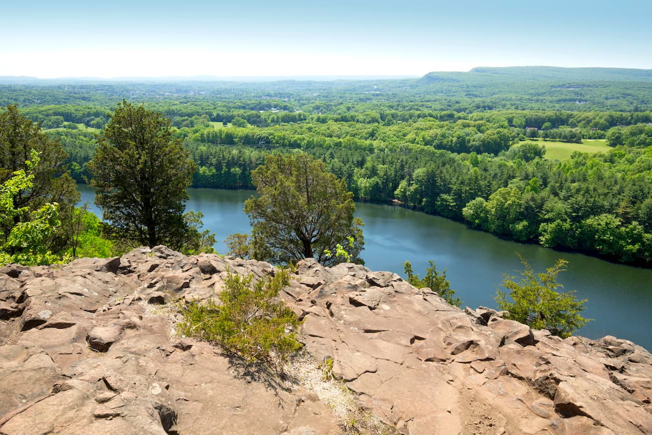
Located in central Connecticut, the Mattabesett Trail is a 61-mile footpath that leads to some of the state’s most iconic views. The trail, which forms a large horseshoe, begins at River Road in Middletown and travels to the Berlin Turnpike in Berlin. Along the way, hikers will encounter high, craggy ledge, traprock ridges, and bald knobs with sweeping vistas of the Connecticut River. Some of the highlights of this footpath include the climb from Meriden’s Giuffrida Park to Chauncey Peak and Lamentation Mountain, the Chinese Wall in Middletown, Pisgah Mountain in Durham, Beseck Mountain in Middlefield, and Mount Higby in Middletown. The Mattabesett Trail is part of the 215-mile New England National Scenic Trail, which connects from Long Island Sound to the Massachusetts/New Hampshire border.
The trek to the summit of Bear Mountain is relatively popular and, despite a short Class 1 rock scramble on one side of the mountain, not particularly challenging. Bear Mountain sits about a half-mile south of the Massachusetts state line on the Appalachian Trail and contains the remnants of an old stone tower. There are a few options to choose from to ascend Bear Mountain, but most hikers opt to take the well-maintained and clearly marked Undermountain Trail, which intersects with the Appalachian Trail, off of Route 41. This 6-mile trek is steep and requires a brief scramble, but the summit views are well-worth the effort.
For skiing and snowboarding enthusiasts, there are more than 5 ski resorts in Connecticut.
The largest is the Mohawk Mountain Ski Area with more than 5 km (3 mi) of slopes and more than 5 ski lifts in the northwest of the state. Other major areas for skiing in Connecticut include several ski resorts near Hartford such as Powder Ridge Park, Mount Southington Ski Area, Sundown, and others.
Check the Connecticut ski resorts map and the larger USA ski resorts map in the World Mountain Lifts section of the site. It includes information about open ski lifts / slopes in Connecticut in real-time with opening dates and hours. There are also year-round cable cars, funiculars, cog railways, aerial tramways, and all other types of mountain lifts.

Home to the prestigious Yale University, New Haven is a coastal city on Long Island Sound teeming with New England ambiance. The city is known as “a mecca for the active and adventurous,” and is packed with both arts and antiquities. Visitors can explore a network of nature trails at East Rock Park, hit the slopes at Powder Ridge Mountain Park, or kick off their shoes and watch the sunset at Sea bluff Beach – there’s a little bit of something for everyone in New Haven.

Mount Southington is a ski area that covers 51 acres of Plantsville, Connecticut. The resort is a quick drive from two of Connecticut’s busiest cities, New Haven and Hartford, and features 14 trails, a 425-foot vertical drop, and two terrain parks. Skiers can easily take a break and grab a bite to eat at The Mountain Room, Red Barn Cafeteria, or Waffle Haus and accommodations can be found in nearby Southington or Bristol.
Mohawk Mountain is the oldest and largest ski area in Connecticut and is unanimously considered the snowmaking capital of the state. Mohawk features 107-acres of skiable terrain, a 650-foot vertical drop, and 25 trails of variable difficulty. Lodging and dining can be found on the mountain or in the nearby town of Cornwall.

The capital of Connecticut, Harford is one of America’s oldest and most historic cities. From beautiful sandy beaches to a billion-dollar entertainment district, Hartford has it all. Booklovers, in particular, will appreciate the city’s history and can tour the homes of two American literary masterminds: Mark Twain and Harriet Beecher Stowe. However, Hartford is also home to beautiful rose gardens, America’s first public park, and a Civil War Memorial.


Yes. Connecticut has 1,260 named mountains. The highest is Mount Frissell at 747 m.
The highest mountain in Connecticut is Mount Frissell, at 747 m.
Connecticut has 1,260 named mountains.


