Scan the QR code and open PeakVisor on your phone
The Rincon Mountains are a prominent mountain range in the southeastern region of the US state of Arizona. The range is relatively less rugged than the nearby Coronado National Forest mountains. Nevertheless, the Rincon Mountains feature 28 named peaks; the tallest and most prominent is Mica Mountain at 8,665 feet (2,641 m) tall with 4,587 feet (1,398 m) of prominence.
The Rincon Mountains are a prominent mountain range in southern Arizona. These peaks are one of the five major mountain ranges surrounding the Tucson Valley. The other significant ranges include the Santa Catalina Mountains to the north, Tucson Mountains to the west, Santa Rita Mountains to the south, and the Tortolita Mountains to the northwest.
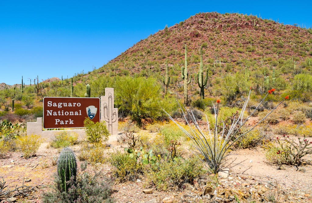
These peaks lie within the Saguaro National Park- Rincon Mountain District and the Rincon Mountain Wilderness, extending into Cochise and Pima counties. Directly east lies the Happy Valley, with the Little Rincon Mountains along the valley's eastern side.
Elevations range from around 2,800 feet (853 m) up to the summit of Mica Mountain at 8,665 feet (2,641 m). The range spans 33 miles (53 km), trending southwest to northeast. The Rincons are roughly 28 miles (45 km) wide.
“Rincón” is Spanish for “corner,” referring to the range’s shape. Mica Mountain, the tallest peak, forms the center of this shape. Tanque Verde Peak marks the western point of the corner shape, while Rincon Peak marks the southern end.
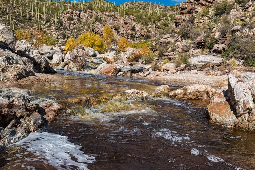
The Pantano Wash runs along the western edge, while the Tanque Verde Wash lies north of the Rincon Mountains. Further west lies the Santa Cruz River.
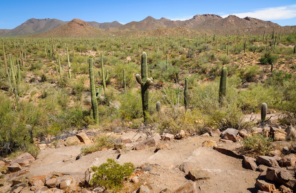
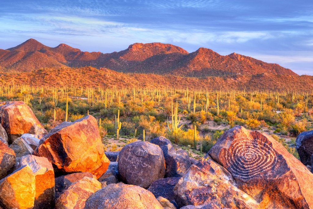
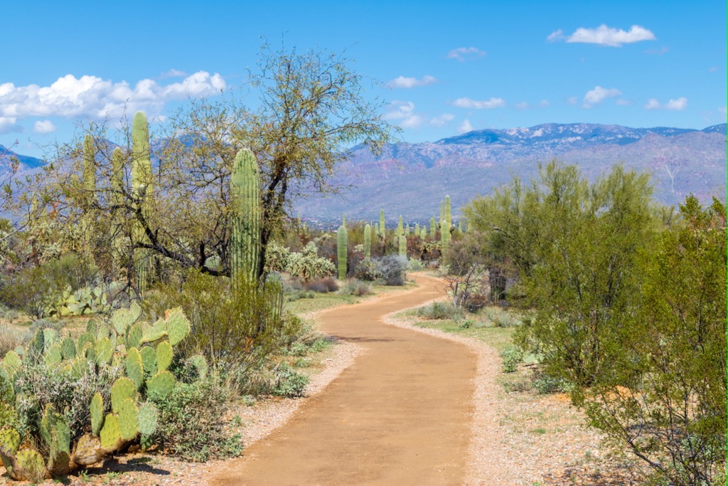
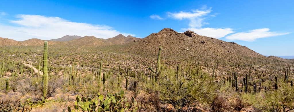
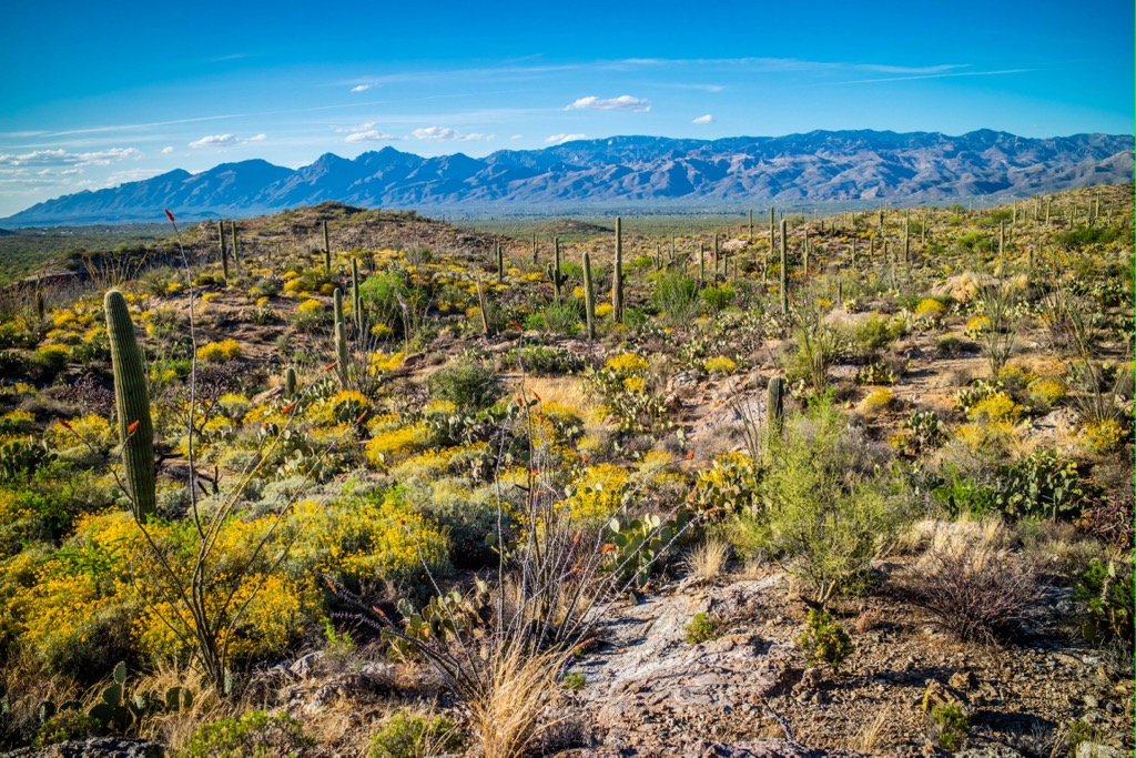
Numerous valleys, canyons, and limestone caves lie amid the range's peaks. Lower elevations feature a desert landscape marked by rocky terrain and cacti. As the elevation increases, the desert transitions to scrub oak-covered hills and dramatic rock outcroppings.
Popular outdoor recreation areas surround the Rincon Mountains. Besides being located in the Saguaro National Park- Rincon Mountain District and the Rincon Mountain Wilderness, other sections of Coronado National Forest extend to the north. The Pusch Ridge Wilderness also lies north of the range, while the Galiuro Wilderness is to the northeast. Other sections of the Coronado National Forest and the Mount Wrightson Wilderness are south of the range.
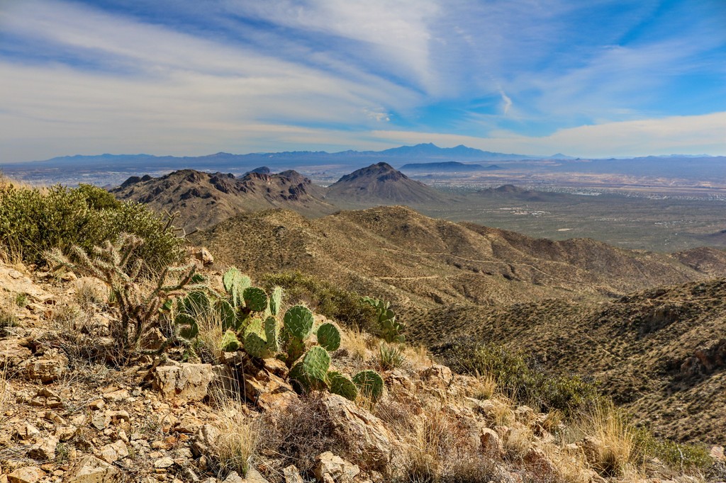
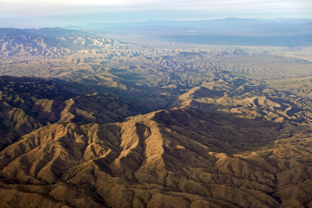
The Rincon Mountains are a sky island mountain range, meaning they’re surrounded by relatively flat desert terrain. Many sky island ranges define this region of Arizona, and most are within the Coronado National Forest boundaries.
These peaks and other nearby sky island ranges share a unique geological history. The range was formed by volcanic activity and fault blocking beginning around 50 million years ago. Southeastern Arizona was subject to widespread volcanic activity caused by the North American tectonic plate thrusting over the Pacific Plate.
Since volcanic activity subsided, continual erosion due to flash flooding has been the primary geologic driver. Immense pressure from floods has carved out deep canyons here and throughout the desert Southwest. Peaks visible today showcase only a portion of the range, with the rest buried beneath the accumulated sediment.
Major peaks within the range include Mica Mountain, Rincon Peak, Forest Hill, Spud Rock, and North Star Peak.
The dramatic elevation changes have allowed diverse flora and fauna to thrive within the Rincon Mountains.
The range's foothills feature a desert landscape, extending throughout much of southeastern Arizona. The signature saguaro cactus grows alongside low-growing shrubs and grasses. As elevations increase, the desert landscape gives way to juniper, pinyon, and oak woodlands.
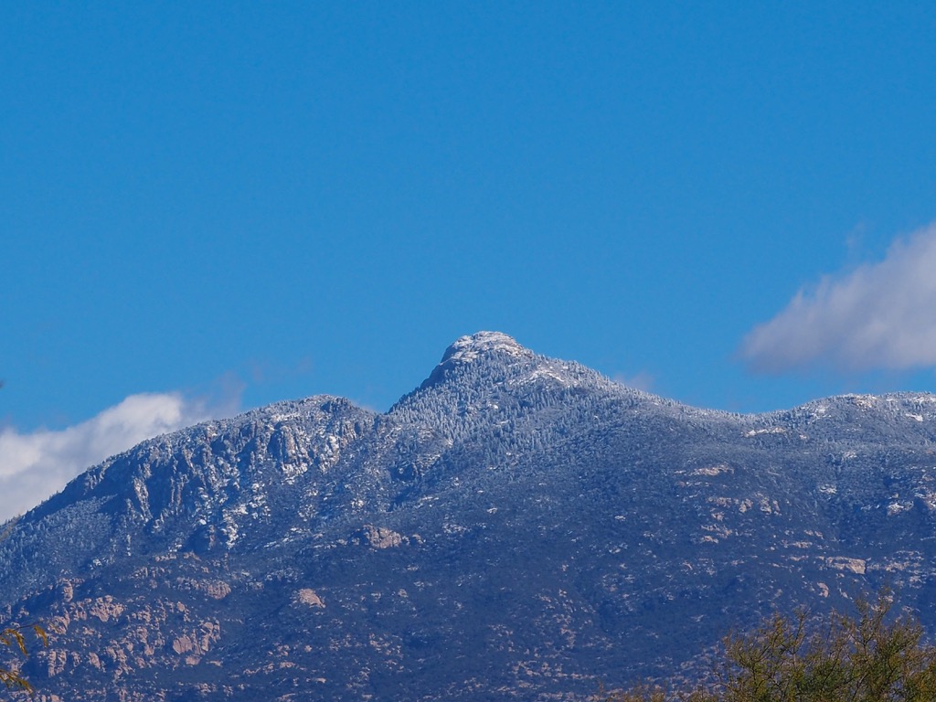
Stands of fir and aspen trees populate some of the highest peaks and ridgelines. Some of the tallest peaks are alpine, featuring only the occasional tuft of grass.

The region's network of protected land helps make the Rincon Mountains an ideal habitat for various animal species. Larger mammals include black bears, mountain lions, wolves, and deer.
The endangered Mexican gray wolf once roamed throughout Arizona, New Mexico, Texas, and Mexico. In the U.S., its range has been reduced to the mountainous regions of Southeastern Arizona and Western New Mexico, including the Rincon Mountains. A 2019 survey documented 163 individuals; after centuries of decimation, the population is again increasing due to its protected status and a gradual decrease in the importance of livestock.
Other animal species that can withstand the harsh desert conditions are the bunchgrass lizard, banded rock rattlesnake, and ornate box turtle. Amidst the forested landscape lie populations of the sharp-shinned hawk, Mexican jay, and acorn woodpecker, amongst other bird species.

The land surrounding Tucson Valley, including the Rincon Mountains, has a long and rich human history. Archaeological evidence estimates that humans have inhabited this region for nearly 11,000 years. Remnants of the Mogollon, Sobaipuri, and Hohokam cultures have been documented throughout this area.
The region marks part of the ancestral homelands of many peoples, including the Tohono O’Odham Nation, Chiricahua Apache Nation, and the Salt River Pima-Maricopa Indian Community.
During the seventeenth century, the first people of European descent arrived in the region. The Spanish missionary Eusebio Francisco founded the Mission San Xavier del Bac in 1700 near the present-day city of Tucson.
Spaniard Hugh O’Conor established a military fort in the region during the eighteenth century. The increased presence of Spanish forces led to numerous disputes between the Spaniards and Indigenous Tribes.
After the Mexican War for Independence, the surrounding region became part of the Mexican state of Sonora. Following the Mexican-American War, in 1848, the US annexed the land, and it became the state of Arizona.
The following decades saw a rapid expansion of the mining industry, bringing more people to Arizona; the increased population led to the construction of the railroad through Arizona, which in turn brought more settlers. Tucson quickly became one of the largest commercial centers of the southwest.
In 1902, the government authorized the Santa Rita Forest Reserve and began a pattern of protecting the region’s remote wilderness areas. Over the following years, various forest reserves eventually consolidated into the Coronado, Apache, and Tonto National Forests by 1953. Saguaro National Park was later established in 1994.
The Rincon Mountains are home to numerous trails and hiking opportunities. Most trails exist in the Saguaro National Park portion rather than the more remote regions. Here are some of the top hiking spots to visit:

This Rincon Mountain District of Saguaro National Park spans 67,000 acres (27,000 ha), encompassing most of the Rincon Mountains. Towering cactus, forested hillsides, and stunning rock outcroppings define the region. Here are a few popular hikes to check out on your next visit:
The Rincon Mountain Wilderness extends along the southern, eastern, and northern stretches of the Rincon Mountain District of the national park. Though this area features fewer hiking trails than the national park, it offers a more remote and rugged experience of the range:
Looking for a place to stay near the Rincon Mountains? Here are some of the best cities and villages to check out in the region:
Just a few miles west of the Rincon Mountains lies Tucson. Home to around 550,000 residents with a metropolitan population of over a million, it marks the second-largest city in Arizona. The University of Arizona, located in Tuscon, boasts an undergraduate enrollment of about 40,000 students.
Along the downtown streets, visitors can explore the thriving food scene, home to some of the best authentic Mexican cuisine in the country. Other sites include the Tucson Museum of Art, Colossal Cave Mountain Park, Old Tucson, DeGrazia Gallery in the Sun, and the Arizona-Sonora Desert Museum.
Although Tucson is a major city, it is surrounded by national parks, forests, and wilderness areas. A short drive from the city lies the Kitt Peak National Observatory, one of the best places in the world to view the night sky.

Oro Valley lies northwest of the Rincon Mountains, in the foothills of the Santa Catalina Mountains. Home to around 45,000 residents, the city lies just outside the Pusch Ridge Wilderness, Santa Catalina Research Natural Area, and Coronado National Forest.
The city’s proximity to the surrounding wilderness has allowed it to thrive as a gateway to the region. Local shops, restaurants, and art galleries line the downtown streets. A short drive takes visitors into the stunning natural landscape of the Rincon Mountains or the thriving nightlife of Tucson.