Scan the QR code and open PeakVisor on your phone
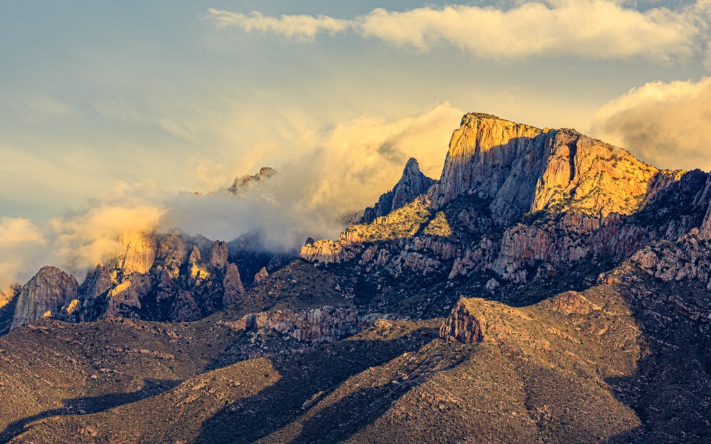
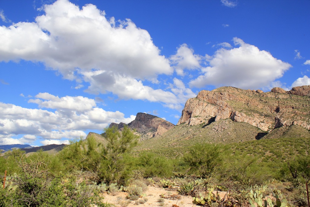
The Pusch Ridge Wilderness lies within Coronado National Forest in southern Arizona, USA, just north of Tucson. Spanning 56,933 acres (23,040 ha), the wilderness area contains 26 named mountains within the Santa Catalina range. Marshall Peak is the highest at 8,304 ft (2,531 m) and Cathedral Rock is the most prominent, climbing 1,923 ft (586 m) to its summit at 7,940 ft (2,420 m).
Covering part of the Santa Catalina Mountains in southern Arizona, the Pusch Ridge Wilderness stretches across 56,933 acres (23,040 ha) of Coronado National Forest.
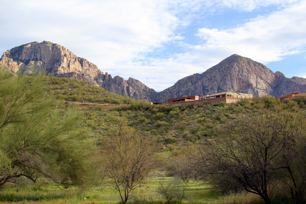
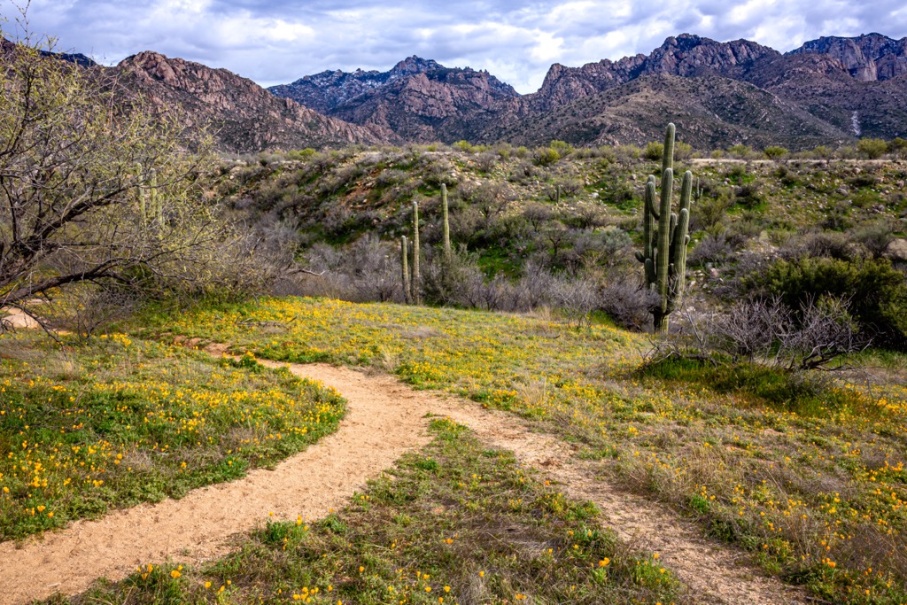
Elevations range from 2,800 to 8,800 ft (855 to 2,530 m). Spring is the best time of year to visit as the weather turns nice but before summer heat sets in. Catalina State Park lies to the west and can be used to access the western side of the wilderness. Access to the eastern side comes from trailheads along Catalina Highway.
The tallest peaks in the wilderness are Marshall Peak (8,304 ft/2,531 m), Spencer Peak (8,215 ft/2,504 m), Cathedral Rock (7,940 ft/2,420 m), and Window Peak (7,470 ft/2,277 m).
Volcanism and block faulting are the two main architects of the landscape seen today. Block faulting is the process where earth’s surface is split into blocks which then shift up or down as pressure continues. This creates patches of high ground, or ranges, and wide flat valleys, or basins.
There were three main geologic events in the region. The first period took place from about 75 to 50 million years ago. At this time, the Laramide Orogeny began as the North American Plate slid over the Pacific Plate, resulting in explosive volcanic activity and uplift.
Millions of years of erosion followed by two more episodes of volcanism and block faulting shaped the desert, sky islands, and canyons present today.
The sky islands of southeastern Arizona are mountain groupings that rise up from the surrounding desert floor. While all have similarities, different sky islands have different unique geological compositions. For example, the Santa Catalina Mountains are made of erosion-resistant granite and gneiss that formed underground, rather than neighboring mountains where lava flowed above ground.
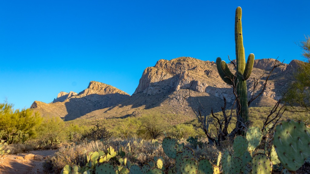
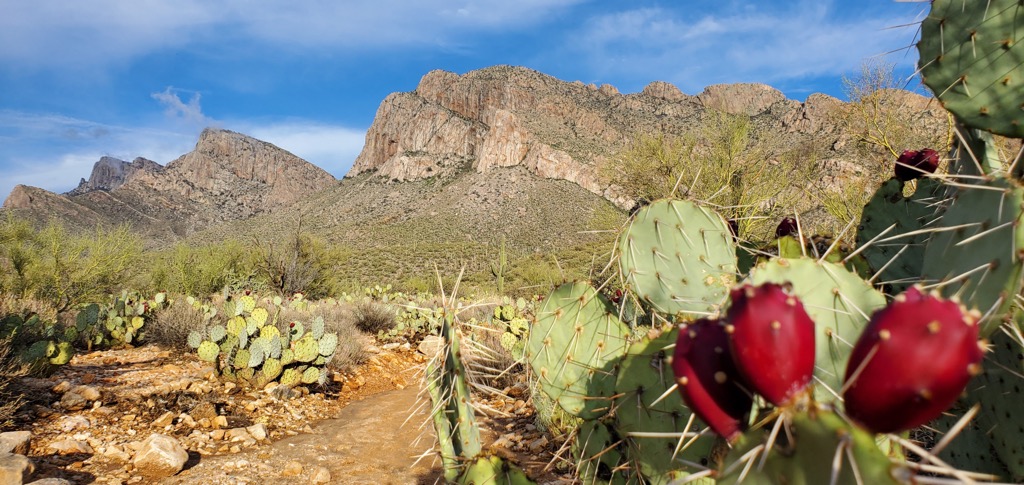
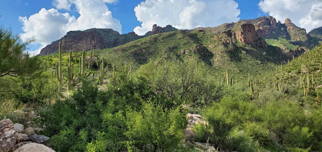
The Pusch Ridge Wilderness and Coronado National Forest house high levels of ecological diversity across varying elevations. From Sonoran Desert and saguaro cacti along the lower slopes to Douglas fir, aspen, and pines at higher elevations, different moisture levels and temperatures create a wide array of habitats.
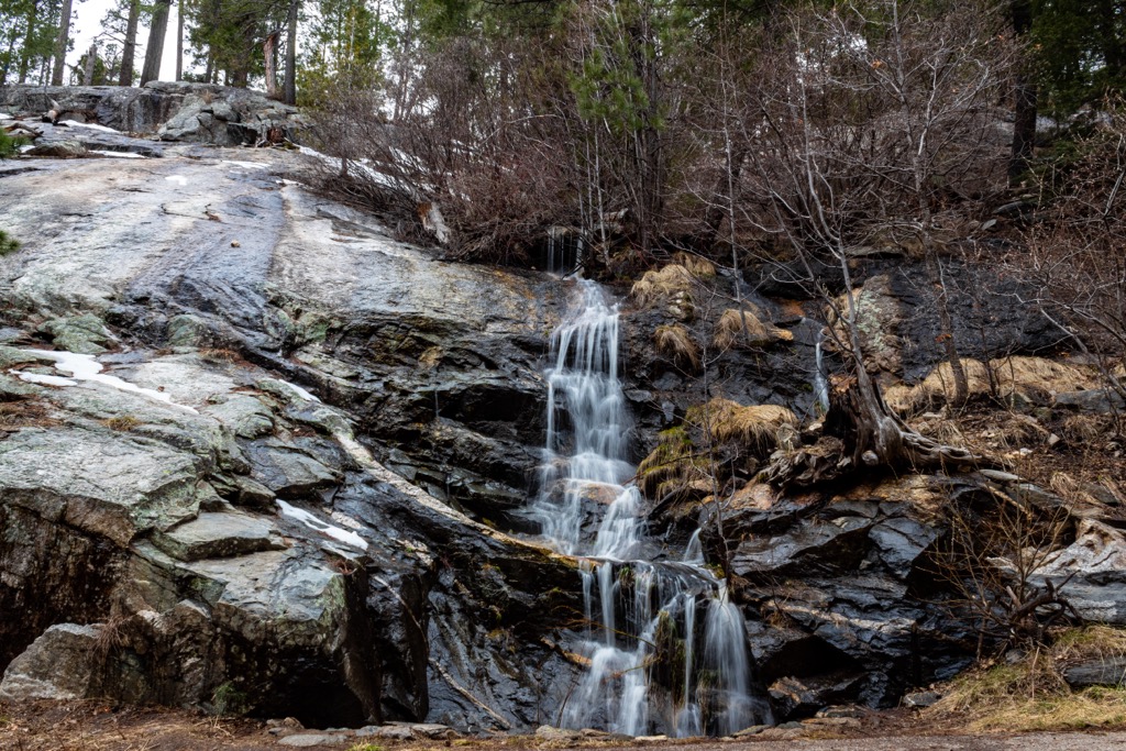
Several streams flow from the wilderness and temperatures can be significantly cooler in the mountains than in the nearby city of Tucson in summer. Given its proximity to the city, this wilderness area receives a high number of visitors compared to other wilderness areas.
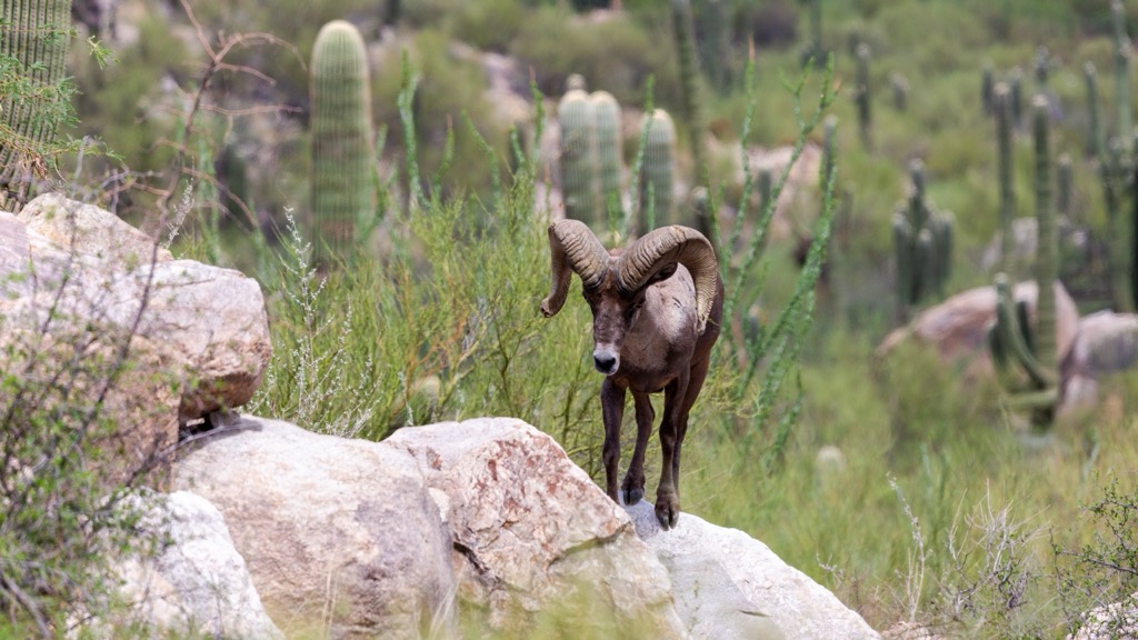
No dogs are allowed in the wilderness as there are ongoing efforts to protect desert bighorn sheep populations. A fire from 2003 damaged some trails and it is possible that some trails may still have fallen trees along them.
In addition to bighorn sheep, common animals in the region include numerous hummingbirds, javelinas, coatimundi, coyotes, ringtails, white-tailed deer, kangaroo rats, and skunks.
Human inhabitation of southeastern Arizona can be dated back to around 11,200 years ago. Stone points from the Clovis culture have been discovered near remains of ice age mammoths. The Cochise Culture followed the Clovis Culture, their tools representing lifestyle adaptations as large mammals died off and more plants and small game were utilized.
Next came the Mogollon and Hohokam cultures, both further refining their tools and lifestyles to fit local conditions. The Apaches, an Athabascan tribe migrating down from the north, and the Spaniards coming up from Mexico both arrived in the region in the early to mid-1500s.
In 1539 and 1540, a Spanish friar arrived, followed by a Spanish expedition in search of valuable resources. The expedition came up mostly empty handed and the Spaniards abandoned their exploration of the region for almost a century.
They returned in the late 1660s leading missions and religious conversions, and were followed shortly thereafter by silver miners. Of the tribes in the region, the Apache proved the most resistant and conflict existed between colonizing foreigners and the Apaches for nearly 300 years.
The Mexican-American War ended in 1848 and the subsequent Treaty of Guadalupe Hidalgo transferred most of New Mexico and Arizona to the United States. New routes opened up across the region and brought with them waves of new immigrants.
There was constant conflict between Apache groups and new outposts, a period known as the Apaches Wars. Most of the conflict ended when the Apache chief Geronimo was forced to surrender and sent to a reservation in Florida in 1886.
However, even before the end of the Apache Wars, mining booms brought more settlers to the region, leading to the rapid creation of new towns and cattle ranching operations to feed and support the new communities.
Coronado National Forest went through several stages to reach its current size and status. The first forest reserve was created in 1902. The next five decades saw the creation and consolidation of new forest reserves and national forests until the national forest attained its final size. Pusch Ridge Wilderness was designated in 1978.
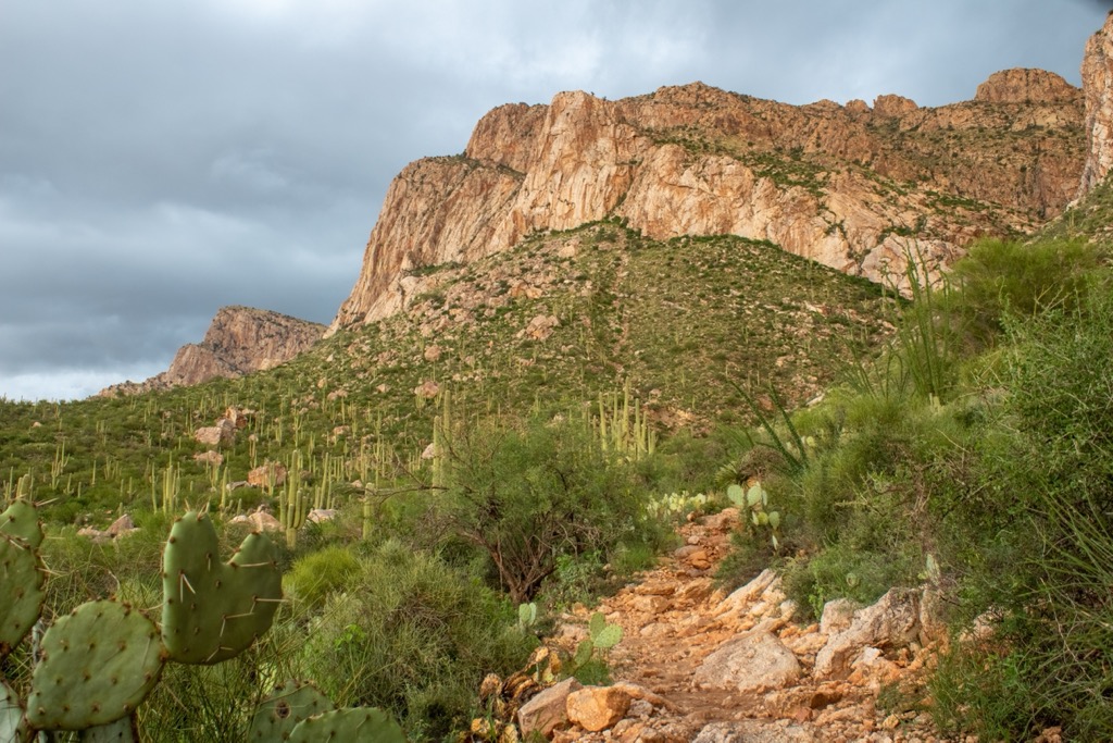
There are a number of trails in canyons and along Pusch Ridge in the wilderness. Trails can be accessed to the west from Catalina State Park and to the east along Catalina Highway.
Finger Rock Trail climbs from 3,120 ft (951 m) to 6,880 ft (2,097 m) and is 6.3 mi (10.1 km) one way. As an out and back with the potential to connect to other trails at the end, there are several good turn around points.
The first is Finger Rock Spring about 1 mi (1.6 km) in. Next are Wind Cave, about 2 mi (3.2 km) in, Linda Vista Saddle 3.5 mi (5.6 km) in, and Mount Kimball 4.2 mi (6.8 km) in. The trail ends at a junction with Espero Trail #25 that leads towards Mt. Lemmon and a series of switchbacks heading into Ventana Canyon.
Esperero Trail leads to The Window, a large hole in a ridge jutting off of Window Peak along Pusch Ridge. The most common way to access this trail is from the Sabino Canyon Recreation area. It is 10.1 mi (16.3 km) and climbs from 2,700 ft (823 m) to 7,400 ft (2,256 m).
The trail winds through saguaro cactus and canyons, across meadows, and over creeks (which usually have some water in them during rainy seasons). This trail is quite steep and can be challenging at times. Hikers should be careful once they reach The Window as the other side is a sheer drop to the base.
The Marshall Gulch Trail is one of the more highly trafficked upper elevation areas of the wilderness. It traverses diverse habitats including riparian areas and ponderosa pine forests. The trail wraps around the false summit of Marshall Peak. Along the way you'll pass forests of aspen, Douglas fir, white fir, gambel, silverleaf oak, and madrone. It is approximately 1 mi (1.6 km).
The Cathedral Rock Trail doesn’t receive many visitors, due to the long trek along other trails to access it. It can be reached 6.5 mi (10.5 km) in along the Esperero Trail or 7.5 mi (12.1 km) along the West Fork Trail. Parts of the trail are steep and it is not recommended for beginners. The trail itself is 2.9 mi (4.7 km) and climbs from 5,320 ft (1,622 m) to 6,920 ft (2,109 m).
This trail doesn’t summit Cathedral Rock but does get close to the base and offers spectacular views. Those who wish to summit will have to have technical rock climbing experience.
There are a number of campsites in Coronado National Forest and Catalina State Park bordering the Pusch Ridge Wilderness.
Only a 30 minute drive from the Pusch Ridge Wilderness, many visitors to the wilderness pass through or live in Tucson. The city has a population of 545,000 people and is surrounded by Sonoran Desert. From the city, it is only a short jaunt to visit Saguaro National Park, Sabino Canyon Recreation Area, Coronado National Forest, and Catalina State Park.
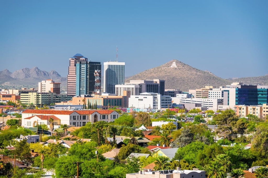
The city is chock full of museums, historic sites, and a rich arts culture that draws from a diverse cultural heritage. Tucson was also the first city to receive the designation of a UNESCO City of Gastronomy. You’ll find some of the best Mexican food in the United States here, as well as locally sourced flavors like mesquite smoked whiskey, chile spiced coffee, prickly pear meat glazes, and breads made with native seeds and grains.
Accommodation options include hotels, motels, B&Bs, spas, rentals, RV parks, campgrounds, and guest ranches.
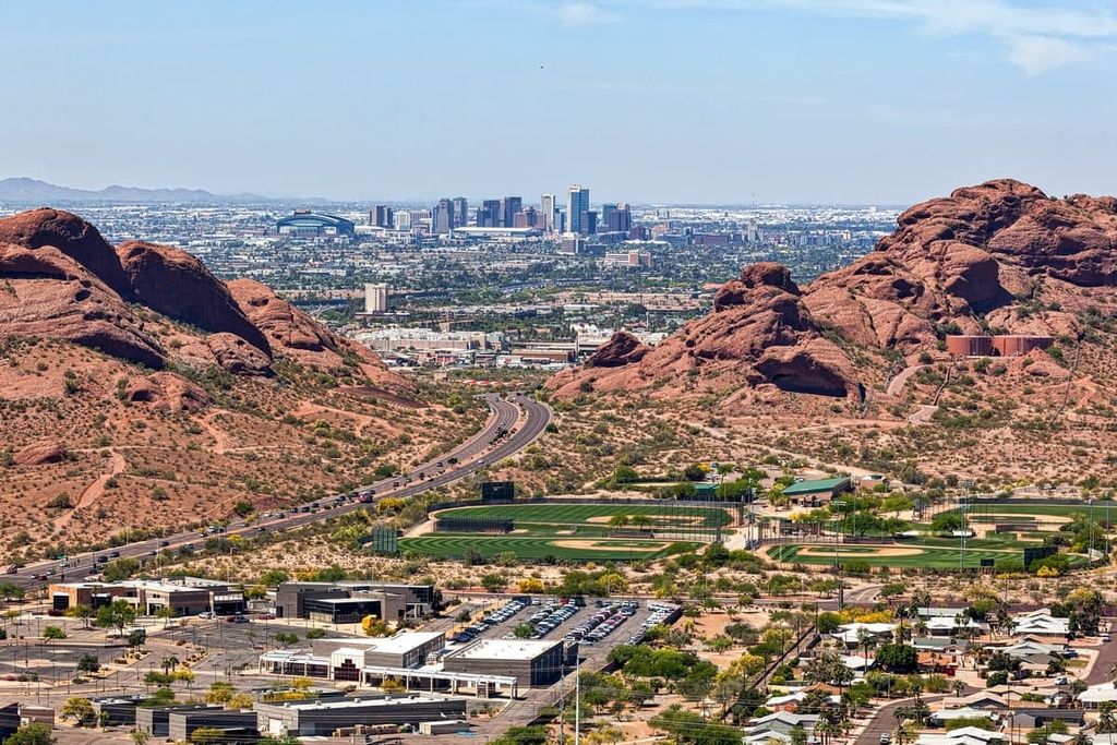
With a population of 1.65 million people and only a two hour drive away, Phoenix is the closest large city to the wilderness area. Popular outdoor recreation near the city includes Camelback Mountain, offering stunning views out across the Phoenix Mountains Preserve from the summit, and Papago Park with miles of trails through the red rock buttes.
There is plenty to explore in the city from museums to botanical gardens to quirky neighborhoods like Roosevelt Row, the city’s art district. There is a rich food scene here with an emphasis on Mexican dishes, in addition to a variety of other cuisines such as Asian, Italian, and BBQ joints. Lodging options run from campsites and RV rentals to hotels, resorts, and guest ranches.