
Scan the QR code and open PeakVisor on your phone
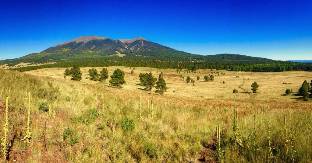
Home to Humphrey’s Peak (12,635 ft/3,851 m), the tallest point in Arizona, the San Francisco Peaks lie in north-central Arizona, USA, about 20 mi (30 km) north of Flagstaff. This range is composed of extinct volcanoes and cinder cones and contains 91 mountains. Humphrey’s Peak is the tallest and the most prominent (6,037 ft/1,840 m).
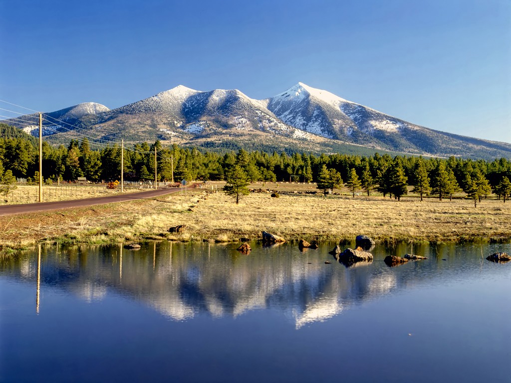
Located in north-central Arizona, the San Francisco Peaks contain the highest summit in the state in addition to a few other impressive peaks. Humphrey’s Peak, the tallest, measures in at 12,635 ft (3,851 m), Agassiz Peak at 12,356 ft (3,766 m), Fremont Peak at 11,967 ft (3,648 m), and Aubineau Peak at 11,837 ft (3,608 m). The range is part of Coconino National Forest.
The main section of the range is about 10 mi (16 km) across and surrounding hills and cinder cones are part of the San Francisco Volcanic Field. Most of the lower slopes are forested and there are basalt scree slopes and exposed rock above the treeline. Part of the range is protected by the Kachina Peaks Wilderness.
The Peaks are just north of Flagstaff and south of Kaibab National Forest and Grand Canyon National Park. On a clear day, it is possible to see the Grand Canyon from some of the summits.
The San Francisco Peaks are part of a volcanic field that rises above the Colorado Plateau. The Peaks represents the largest volcano in the Plio-Pleistocene-Holocene San Francisco Volcanic Field. Composed in alternating layers of loose volcanic tephra (ash, lapilli, and bombs) and dense lava flows, erosion has worked away at the weaker of the two layers to leave behind erosion-resistent ridges and deep gaps carved out between them.
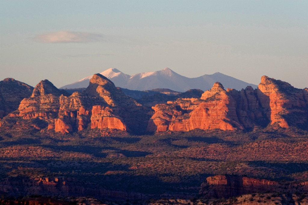
Volcanic activity began over one million years ago and tapered off by a few hundred thousand years ago. The volcano that formed the San Francisco Peaks was the longest active volcano in the field and erupted with enormous force.
The region is distinct because volcanoes typically form along plate tectonic boundaries and this volcanic field is situated in the middle of a plate. As the North American plate shifts west, it moves across a hot spot where molten rock periodically pushes up.
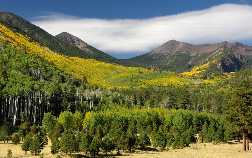
From base to summit, four ecological zones exist in the range. The lowest level is ponderosa pine forest, followed by mixed conifer forest, then subalpine conifer. Tundra appears over 11,000 ft (3,350 m), the only place this ecosystem occurs in Arizona. Common tree species across elevations include ponderosa pine, Gambel oak, Douglas fir, aspen, bristlecone pine, and limber pine.
The San Francisco Peaks ragwort (Packera franciscana) is a notable species endemic to the mountains. Due to its small range, some sections are off limits for recreation. This includes the area above the treeline on Agassiz Peak during the summer.
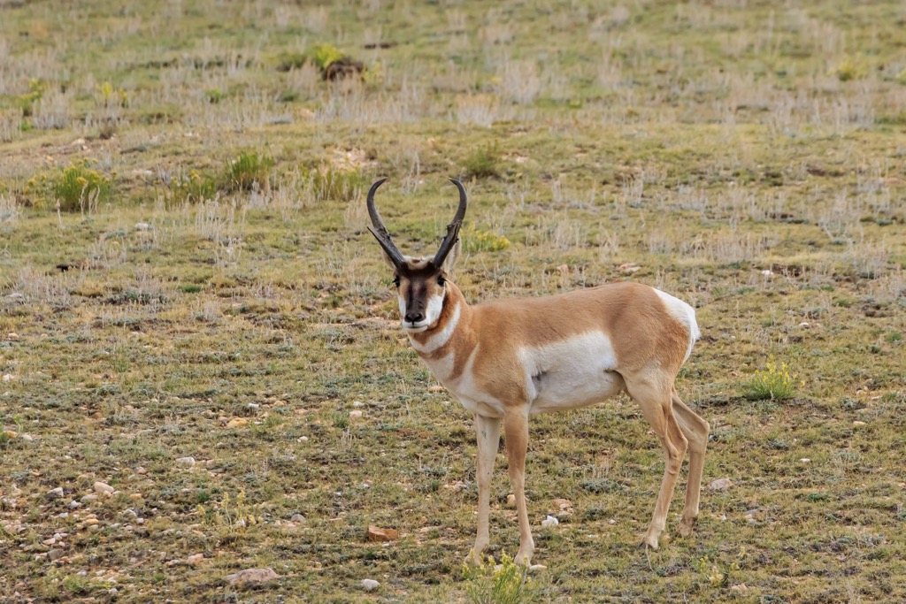
Common wildlife in the mountains include elk, mule deer, pronghorns, porcupines, coyotes, black bears, bald eagles, osprey, ravens, and turkey vultures.
During the 1500s, Spanish conquistadors arrived in the region and named the peaks Sierra Sinagua (Spanish for ‘mountains without water’). However, they did not stay in the region for long and the name didn’t stick. In 1629, a group of Franciscan friars on a mission trip to convert Native Americans to Christianity spent some time in the area. They were the ones to coin the name The San Francisco Peaks (sometimes referred to simply as “The Peaks”).
However, prior to Spanish influence, this region has long been the territory of a number of Native American tribes, each with their own names and ties to the mountains. The Navajo, Hopi, Kachinas, Zuni, Havasupai, and Yavapai-Apache are a few of the tribes connected to the range. The Navajo named the mountains Dook’o’oosłííd meaning ‘summit that never melts’.
Today the main human activities in the mountains are lumbering and recreation such as hiking, backpacking, and skiing.
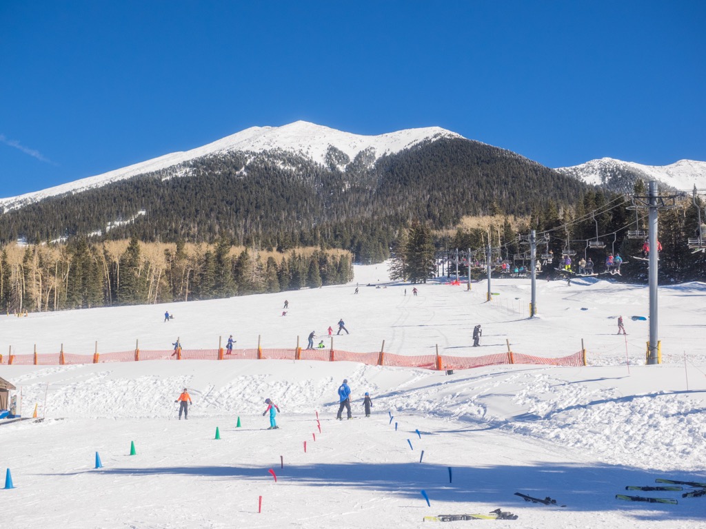
With more than 30 mi (48 km) of trails in the Peaks Ranger District, there is a nice blend of strenuous trails to summit and easier trails that take in the scenic forest and wildlife viewing opportunities. During winter, the Snowbowl Ski Area, Wing Mountain, and Flagstaff Nordic Center offer downhill and cross country skiing.
There are several large peaks in the range – Humphrey’s Peak, Fremont Peak, Doyle Peak – but Agassiz Peak, the second tallest, is only open to climbers in the winter. During warmer months, the mountain is closed above treeline to protect the habitat of the endemic San Francisco Peaks ragwort.
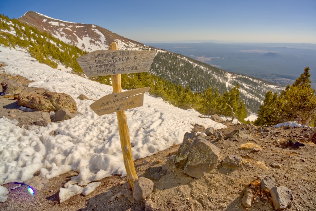
The trail to summit Humphrey’s Peak is 4.8 mi (7.7 km) one way and begins at the Arizona Snowbowl ski resort. While the destination is important, the scenic trail itself is a feature of this hike. It passes rock slides and prairie, and cuts through bristlecone pine forest before breaking above treeline.
Above the treeline the trail becomes steep and rocky. Snow can remain late in the season and hikers should keep an eye out for afternoon thunderstorms in the summer. The views from the top are incredible, sweeping across the Grand Canyon, the Painted Desert, and numerous mesas, valleys, and canyons.
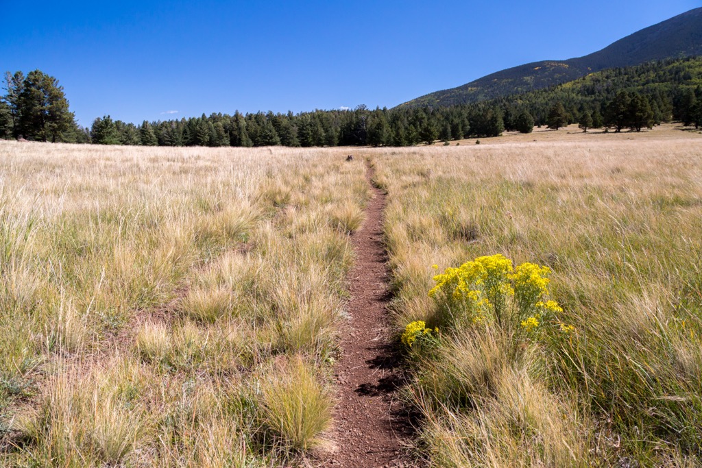
Those looking for a longer route can take the Arizona Trail Section 34 that runs along the San Francisco Peaks. Measuring 34.7 mi (55.8 km) point to point, this route is popular for hiking, backpacking, and camping. It is part of the 800 mi (1,290 km) Arizona Trail and Section 34 runs between the southern trailhead at Schultz Pass and the northern trailhead at Cedar Ranch.
Hikers are recommended to have a GPS device. While there may be water along the way, it shouldn’t be relied upon.
A gentler hiking option, the Bismark Lake Trail passes along the western side of the San Francisco Peaks and measures 1.5 mi (2.4 km) to its intersection with the Arizona Trail. The path skirts around Bismark Lake. Although the lake is dry during parts of the year, it serves as an important water source for wildlife. It is common to spot elk, mule deer, and birds of prey on this trail.
The O’Leary Lookout Trail ascends O’Leary Peak (8,917 ft/2,718 m), a lava dome volcano. The 5 mi (8 km) trail begins at 6,950 ft (2,118 m) and follows a worn out road for most of the way up. A section of the hike traces the Sunset Crater’s lava flow. The trail leads to a tower but this is not the summit. The true summit lies on the western side. Between the mountain’s two summits, leave the road to head towards the top. This final push after leaving the road is the hardest part of the trail.
Views from the top take in the inner basin of the San Francisco Peaks, Sunset Crater, and the Painted Desert.
A combination of two trails get you to the top of Elden Mountain (9,298 ft/2,834 m), the third most prominent peak in the range. Little Bear Trail is 3.5 mi (5.6 km) one way between Little Elden Trail and Sunset Trail. The Little Bear Trail winds through sections of the mountains that were damaged during the Schultz Fire in 2010, although patches of ponderosa pine and Gambel oak still remain. As the trail climbs, it passes through Douglas fir, limber pine, and aspen groves.
From Little Bear Trail, it is another 4 mi (6.4 km) along Sunset Trail to reach the eastern edge of Elden Mountain’s summit plateau. From the top, you can look out across Sunset Crater and the Bonito Lava Flow that borders it. The upper parts of the trail pass through a site burned by a wildfire in 1977 where aspen and Gambel oak have begun to regrow. The trail is open to hikers, horses, and mountain bikers.

The San Francisco Peaks lie close to Flagstaff and less than three hours north of Phoenix. There are a number of camping options both at campgrounds and dispersed within Coconino National Forest.
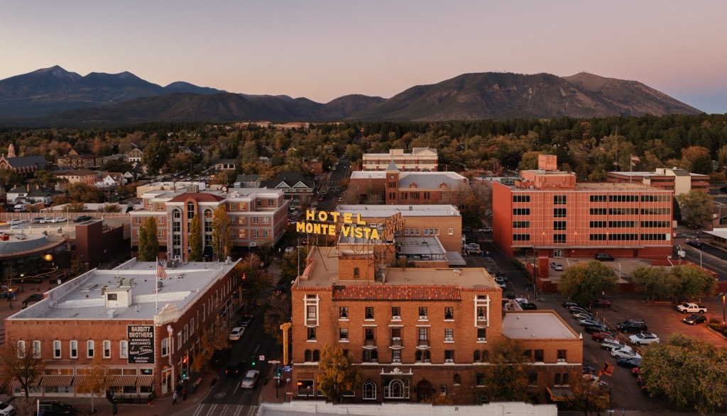
Flagstaff, Arizona has a population of 73,500 people and sits around 7,000 ft (2,130 m). The city’s high elevation summers feature blue skies and moderate dry heat while winters see over 100 in (255 cm) of snowfall, making it a four season area perfect for hiking, biking, rock climbing, and skiing. The city is surrounded by miles of trails and the world’s largest contiguous ponderosa pine forest.
Flagstaff is a great jumping off point for several natural and cultural attractions of the southwest. Grand Canyon National Park, the Walnut Canyon National Monument, the Wupatki National Monument, and the Sunset Crater Volcano National Monument are all an easy day trip away.
The downtown is packed with a variety of international restaurants, cute coffee shops, dog friendly patios, and a number of breweries perfect for coming off the trail. It’s easy to find the perfect spot to stay whether you’re looking for a historic hotel downtown, a cozy B&B, or nearby campsites and RV parks.
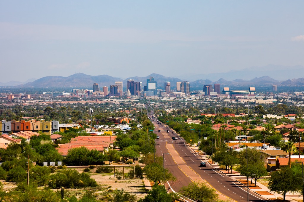
Home to 1.66 million people, Phoenix sits in the Sonoran Desert. A visit to Camelback Mountain, the trails winding through red rock formations at Papago Park, or the Desert Botanical Garden are great ways to take in the area’s natural beauty.
For a taste of the city’s art and culture, visit the arts district at Roosevelt Row, the Heard Museum for an in-depth look at the region’s indigenous heritage and artistic traditions, or Taliesin West, Frank Lloyd Wright’s winter home.
Whatever your style, there is a wide range of accommodation available including centrally-located hotels, remote resorts and guest ranches, and campgrounds. The food scene is brimming with southwestern and Mexican flavors featuring local ingredients like peppers, citrus, and prickly pear. There are also James Beard award-winning restaurants, steakhouses, international cuisines, and hip coffee shops.


ultra
arizona-10ers
las-vegas-mountaineers-classics
arizona-20-20-challenge
sierra-club-desert
fred-beckey-great-peaks
arizona-ultras
ultra
arizona-10ers
las-vegas-mountaineers-classics
arizona-20-20-challenge
sierra-club-desert
fred-beckey-great-peaks
arizona-ultras


