
Scan the QR code and open PeakVisor on your phone
The Chiricahua Mountains are a sprawling massif located in the southeastern part of the US state of Arizona. The range contains 85 named peaks within the Basin and Range Province. The tallest and most prominent peak is Chiricahua Peak, at 9,750 feet (2,972 m) tall with 5,134 feet (1,565 m) of prominence.
The Chiricahua Mountains are massif in southeastern Arizona, within Cochise County and the expansive Coronado National Forest.
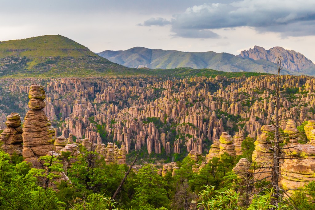
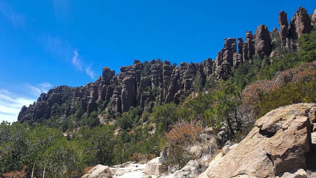
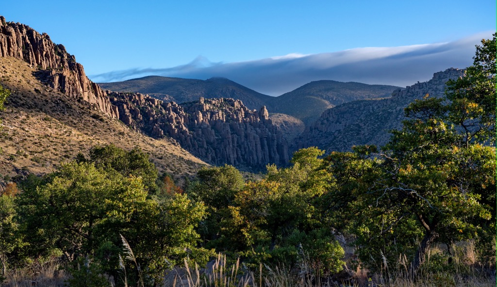
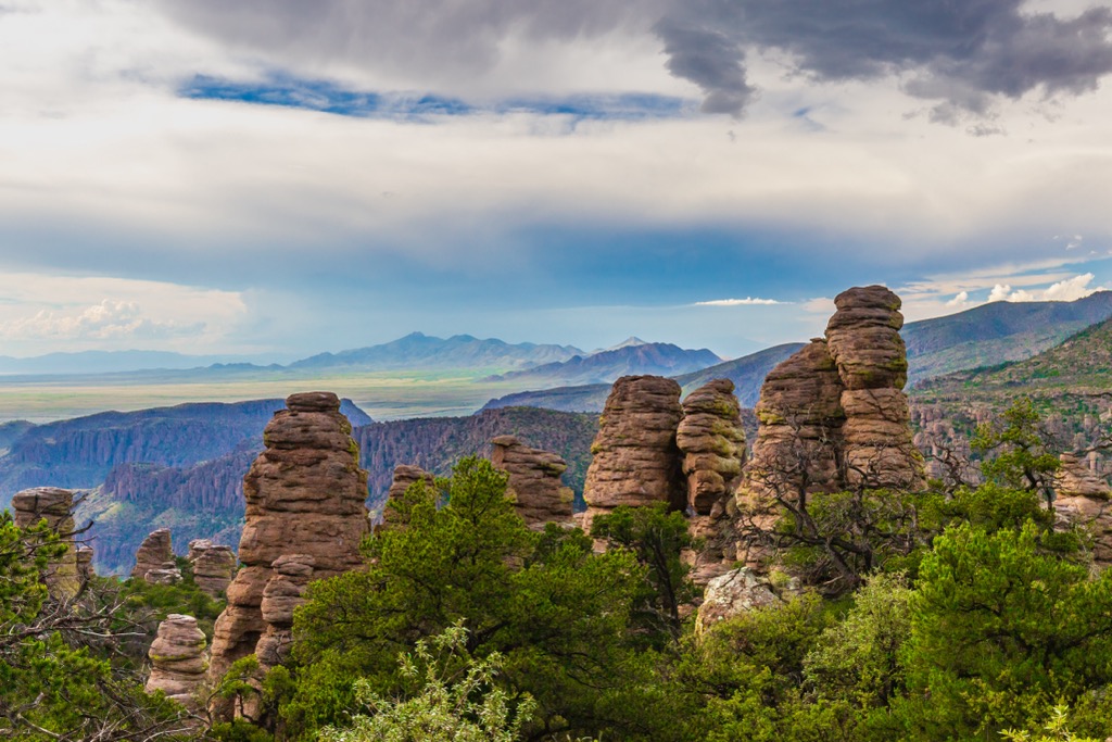
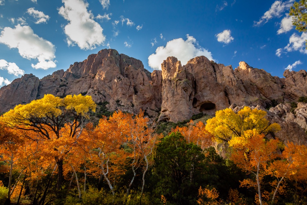
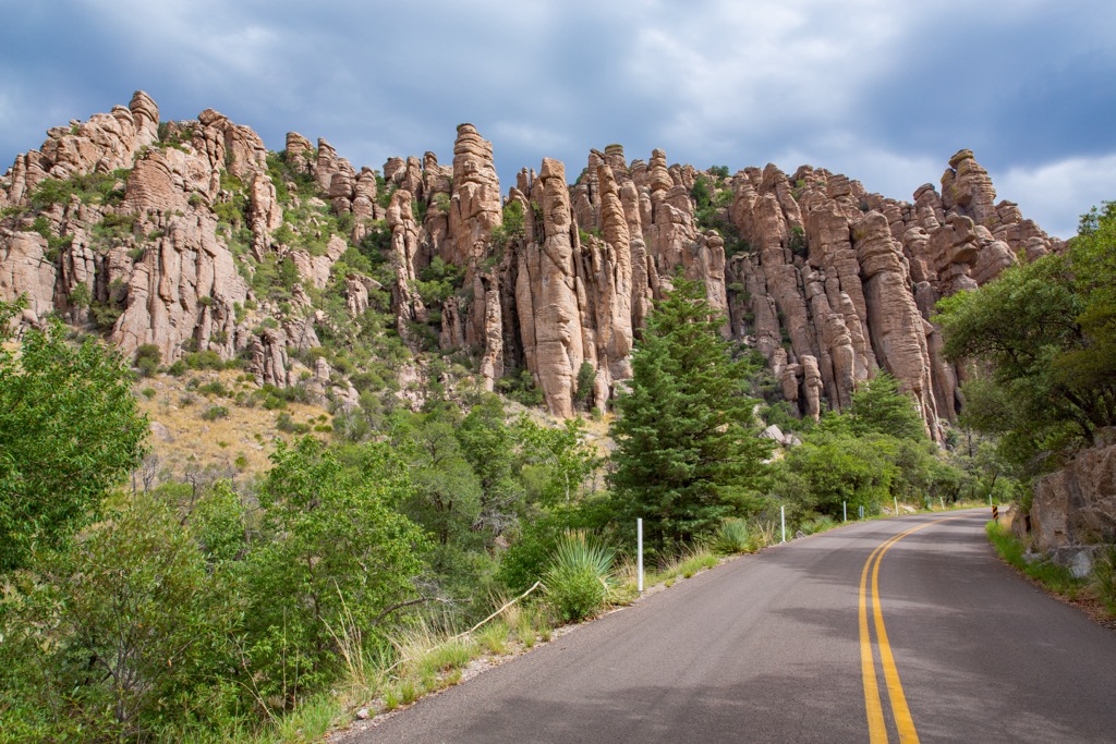
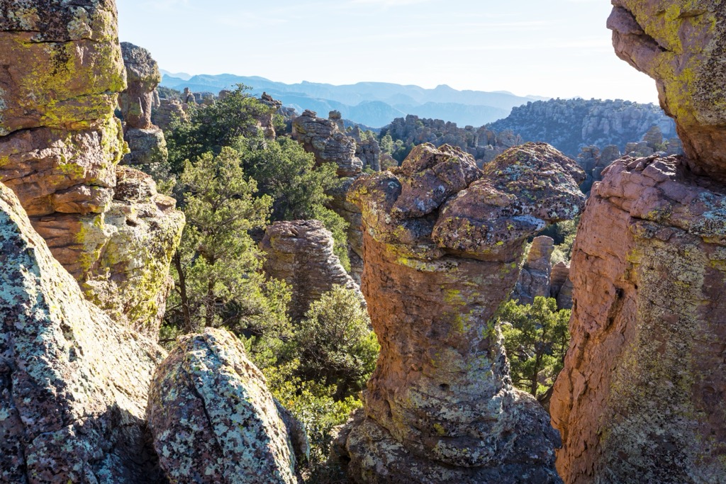
Elevations in the Chiricahua Mountains range from around 3,800 ft (1,158 m) up to the summit of Chiricahua Peak (9,750 feet / 2,972 m). The peaks rise steeply from the valley floor, providing a dramatic backdrop for the region. The range’s defining feature is the plethora of hoodoos and balancing rocks.
Often called a “Wonderland of Rocks,” this massif is nestled between two sweeping valleys. The Chircahua Mountains run 35 miles (56 km) in a northwest direction and roughly 21 miles (34 km) in width in a north-to-south arc shape, with the Sulphur Springs Valley to the west and the San Simon Valley to the east.
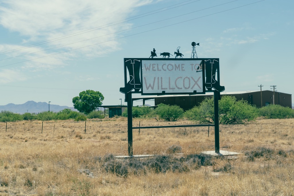
Along the southern edge of the range sit the Swisshelm Mountains and Pedregosa Mountains, while the Dos Cabezas Mountains lie to the northwest. Small towns dot the perimeter of the massif, with Willocx, Douglas, and Rodeo providing access to the Chiricahuas.
A portion of the range lies within the Chiricahua Wilderness, one of the eight wilderness areas in Coronado National Forest. The other wilderness areas in the forest include:
Other popular outdoor recreation areas surround the Chiricahua Mountains. These peaks lie within the Coronado National Forest, Chiricahua Wilderness, and the Chiricahua National Monument. Other nearby sites include the Dos Cabezas Mountains Wilderness to the northwest, Miller Peak Wilderness to the southwest, and the Peloncillo Mountains Wilderness to the north.
The entire Chiricahua Mountain massif is a part of the Basin and Range province. An uplift structural block formation created these peaks, along with the surrounding ranges.
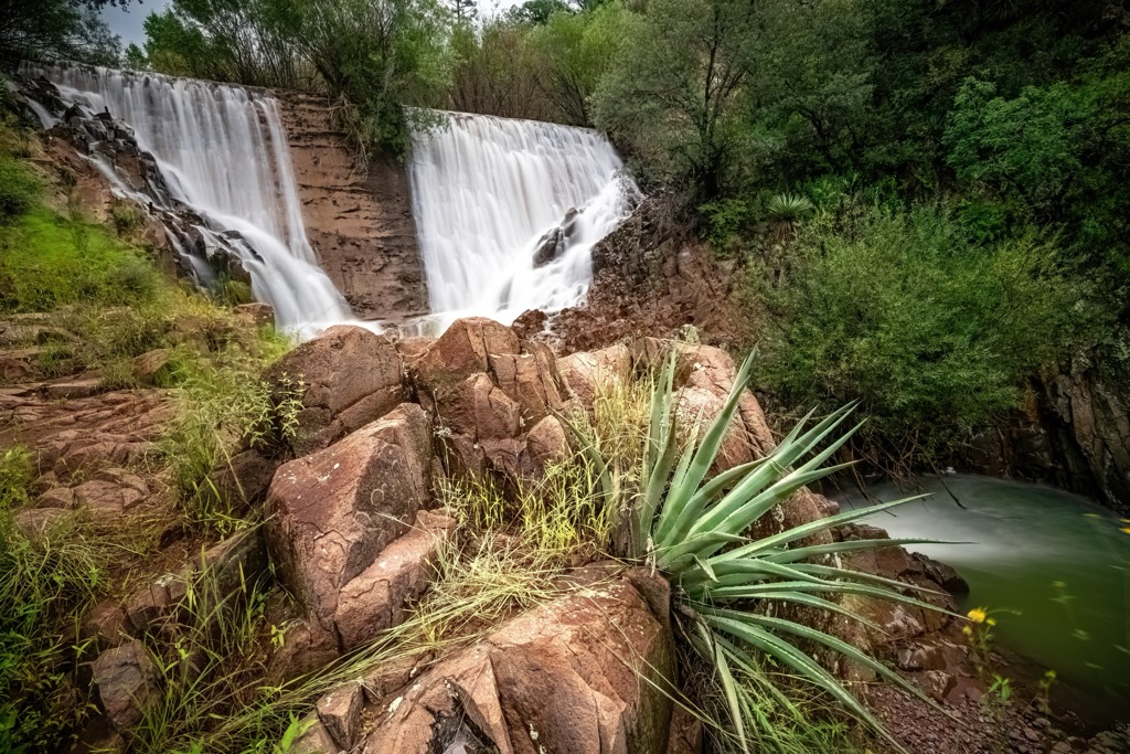
A series of volcanic eruptions and intrusions formed the base roughly 27 to 35 million years ago. The Turkey Creek Caldera erupted 27 million years ago, marking the last significant volcanic activity in the area.
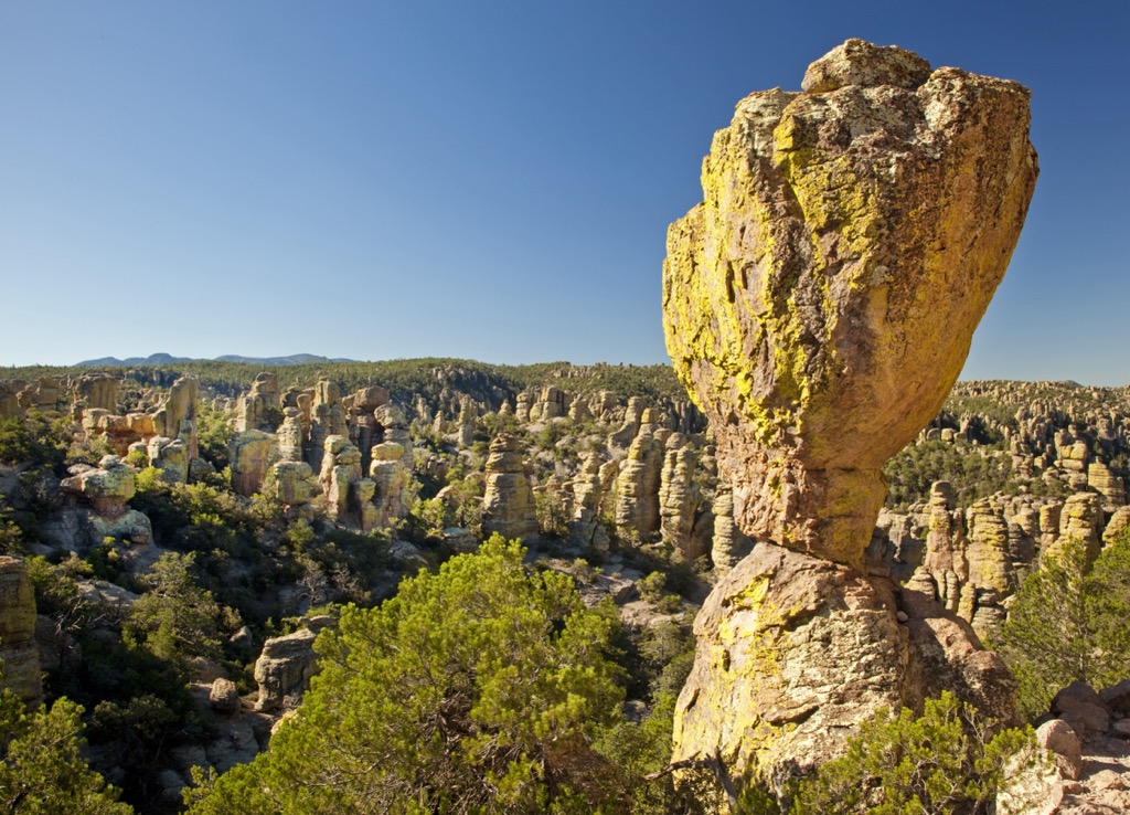
The Turkey Creek Caldera deposited nearly 2,000 feet (610 m) of volcanic ash. Millions of years of erosion carved out the rocks, leaving behind distinct rock formations. Hikers can see the various rock layers enshrined within the hoodoos, pillars, and outcroppings.
The massif features Precambrian basement and sedimentary rocks from the Paleozoic and Cretaceous periods, but the unique rock formations consist of Rhyolite Canyon Tuff.
A band of sedimentary rock runs throughout the range and is rich in mineralized deposits. Minerals such as Wulfenite led to mining, but not to the same extent as other parts of the state.
Major peaks within the range include Chiricahua Peak, Swisshelm Mountain, Mount Sceloporus, Cochise Head, and Fly Peak.
The dramatic changes found in the Chiricahua Mountains allow for a variety of flora and fauna to thrive in these sky islands of southeastern Arizona.
Despite being in the desert, the range features five of the nine life zones throughout its varying landscape. The Chiricahua Mountains are home to 375 avian species. Many of these species predominantly exist in Mexico, with the Chiricahuas marking the northern limits of their range.

Other animal species include black bears, white-tailed deer, mountain lions, jaguars, and ocelots. Some reptile species of the lower elevations include the bunchgrass lizard and banded rock rattlesnake.
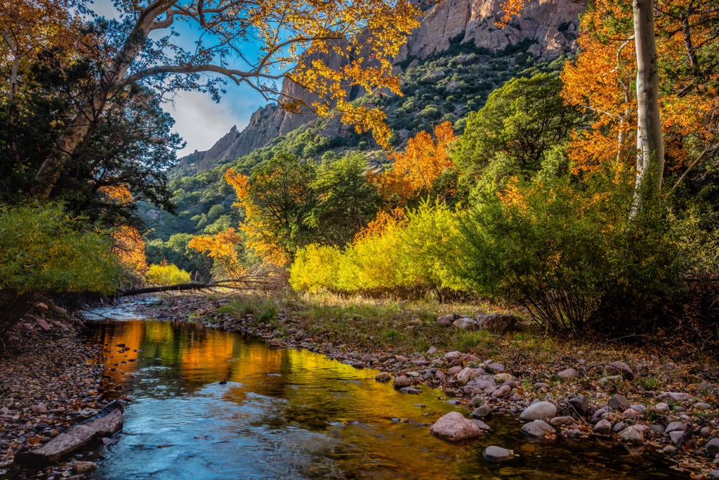
Lower elevations feature a desert landscape. Here, hikers will spot various species of cacti, succulents, and low-growing grasses.
As elevations increase, the desert terrain gives way to forest amidst rock features. Arizona sycamore, ponderosa pine, Douglas fir, and Madrean pine-oak woodlands are common.

The land within and surrounding the Chiricahua Mountains has a human history dating back over 11,000 years. These earliest traces of human settlement showcase the Clovis culture, as seen in the Double Adobe Site.
Artifacts of the Mogollon and Mimbres cultures exist throughout the region, dating from 150 BCE to 1450 CE. This land is part of the ancestral homelands of numerous tribes, including the Chiricahua Apache Nation (for whom the range is named), Tohono O’odham Nation, and the Salt River Pima-Maricopa Indian Community, among others.
People of European descent began arriving in the region during the seventeenth century. The Spanish missionary Eusebio Francisco Kino founded the Mission San Xavier del Bac in 1700 in what later became the city of Tucson. In 1775, the Spaniard Hugh O’Conor established a military fort nearby.
The increased presence of settlers led to several violent battles between the Spaniards and the region’s Indigenous Tribes. Following the Mexican War of Independence, the land became part of the Mexican state of Sonora. It was ceded to the US in 1848 following the outcome of the Mexican-American War.
As settlers began to venture west across the US, the population grew, and Tucson quickly became one of the largest commercial centers in Arizona. The mining industry continued to expand in the late 1800s, bringing more people to the Southwest.
The construction of the railroad and increased population ultimately led to the forced removal of Indigenous Peoples from their native homelands and onto reservations.
In the early 20th century, there was a push to preserve the nation’s wild lands for future tourism and harvesting natural resources like timber. The Chiricahua Mountains and the other portions of the Coronado National Forest were first included as part of the Santa Rita Forest Reserve in 1902. The government established the Mount Graham, Santa Catalina, and Chiricahua forest reserves the same year. The Dragoon National Forest and the Tumacacori, Baboquivari, Peloncillo, and Huachuca forest reserves followed a few years later.
In 1908, these reserves became the Garces, Chircahua, Crook, and Coronado National Forests. These forests were further consolidated in 1953 to form the Coronado, Apache-Sitgreaves, and Tonto National Forests we know today.
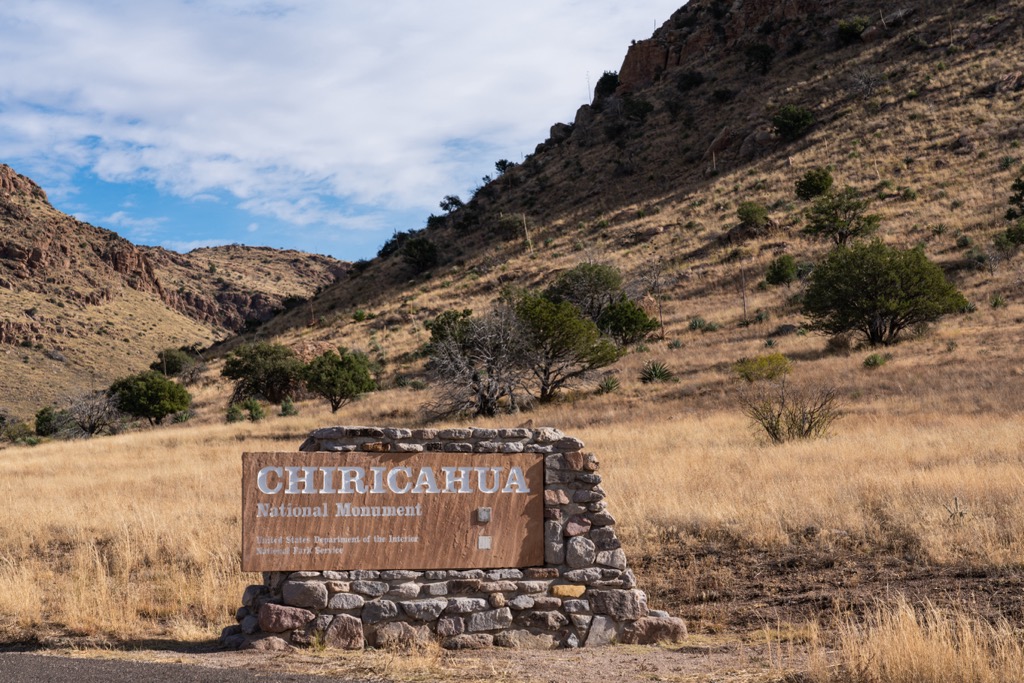
In 1924 the Chiricahua National Monument was created to protect the range's unique hoodoos and balancing rocks. The Chiricahua Wilderness was established in 1964 and spans 87,182 acres (353 sq km).
The Chiricahua Mountains are home to numerous trails and hiking opportunities.
The Chiricahua Wilderness spans across the central portion of the massif, covering 87,182 acres (353 sq km). Here hikers will find trails, sweeping viewpoints, and the range’s tallest peaks. Although not all listed here, many backpacking routes exist in this remote and pristine wilderness. Here are a few of the most popular hiking trails in the area:
This national monument is situated at the northwestern edge of the massif and features distinct hoodoos. The Chiricahua National Monument spans 12,025 acres (48.6 sq km) and has a visitor center located a few miles outside the monument's entrance. Here are some of the popular hiking trails in the area:
Looking for a place to stay near the Chiricahua Mountains? Here are some of the region's best cities and villages to check out.
While the mountains stay relatively cool throughout the summer, the lowland deserts and cities can be dangerously hot. Preparing for extreme heat is essential if you plan on traveling here in the summer. On the other hand, winters in the lowland deserts are sunny and mild, making them a perfect getaway for snowbirds.
The town of Willcox lies just northwest of the range. The Coronado National Forest surrounds Willcox, the closest city to the Chiricahua National Monument. Situated in the Sulphur Springs Valley, the town lies on the unceded homeland of the Chiricahua Apache Nation. Today Willcox is home to around 10,000 residents.
Six of the ten tallest peaks in Arizona lie within a 75-mile (120 km) radius of the city. Protected land has helped make Willcox a hub for year-round outdoor recreation. Seasonal lakes form in the cooler winter and spring months, and the region also features a burgeoning wine scene with several vineyards.
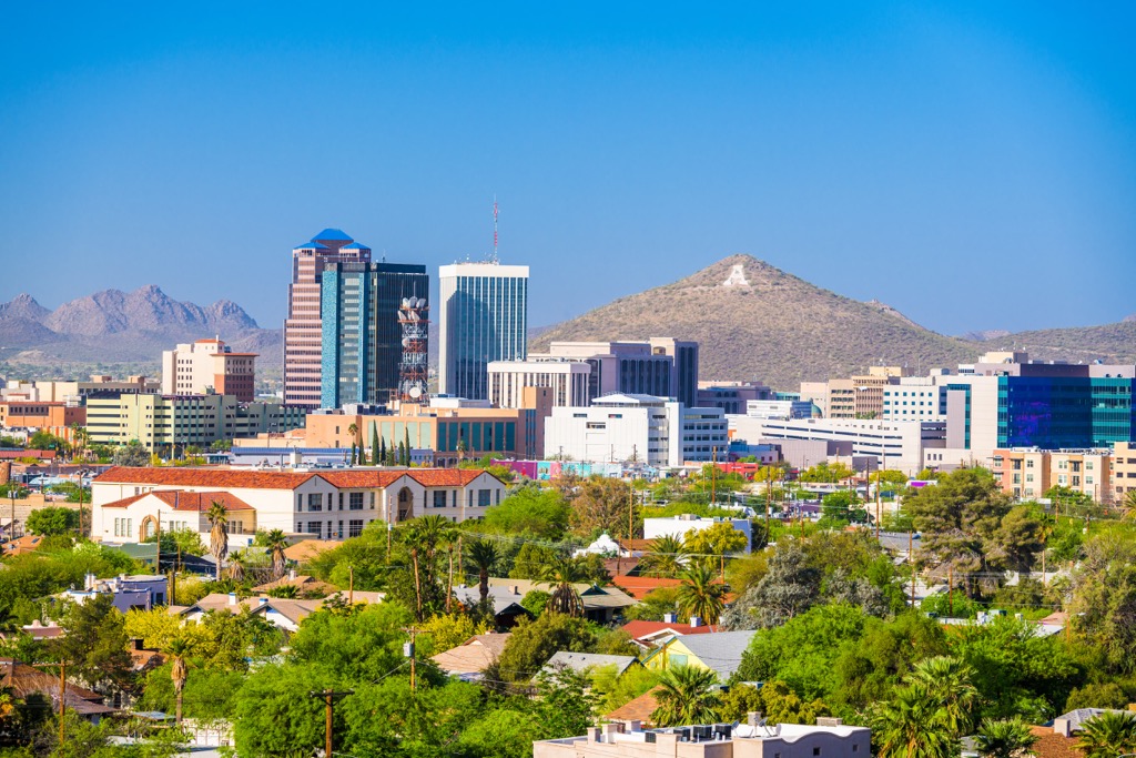
Tucson lies further west of the range and is home to a metro population of over one million; it’s the second-largest city in Arizona and the closest major city to the Chiricahuas.
Tucson is home to the University of Arizona and is known for its desert landscape and proximity to National Parks, National Forests, and wilderness areas. Tucson has a significant Mexican influence, featuring a thriving food scene showcasing some of the country's best Mexican cuisine.


ultra
arizona-20-20-challenge
southern-arizona-hiking-club
southern-arizona-hiking-club-emblem
southern-arizona-hiking-club-coronado-12
arizona-ultras
arizona-fire-lookouts
arizona-20-20-challenge
southern-arizona-hiking-club
southern-arizona-hiking-club-emblem
ultra
arizona-20-20-challenge
southern-arizona-hiking-club
southern-arizona-hiking-club-emblem
southern-arizona-hiking-club-coronado-12
arizona-ultras


