Scan the QR code and open PeakVisor on your phone
The Blue Range Primitive Area is an outdoor recreation destination located in the east-central portion of the US state of Arizona. The region contains 36 named peaks, and it is the only primitive area left in the US National Forest System. The highest peak in the primitive area is Blue Peak with an elevation of 9,344 ft (2,848 m). Meanwhile, the most prominent peak in the area is Maple Peak, which has 2,391 ft (729 m) of prominence.
The Blue Range Primitive Area encompasses a swath of east-central Arizona near the state’s border with New Mexico. The primitive area covers 173,762 acres (70,300 ha) of land within the Apache-Sitgreaves National Forest.
Elevations in the forests range from 3,500 ft (1,067 m) up to the summit of Blue Peak. Situated on the edge of the Mogollon Rim, the region is home to the Blue River Valley and rolling forested hillsides. The Mogollon Rim extends beyond the primitive area, spanning 200 miles (322 km) across the region from the city of Flagstaff in Arizona to the state of New Mexico.
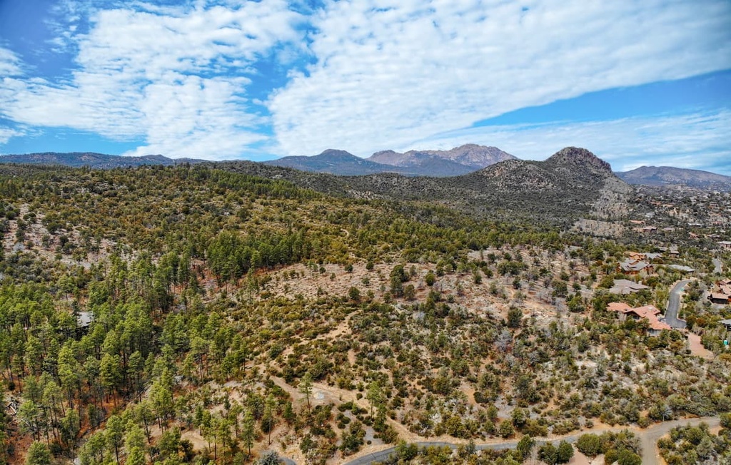
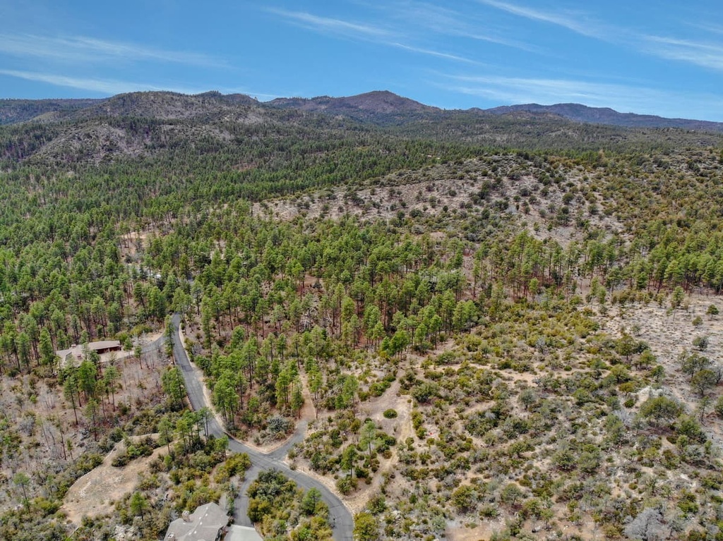
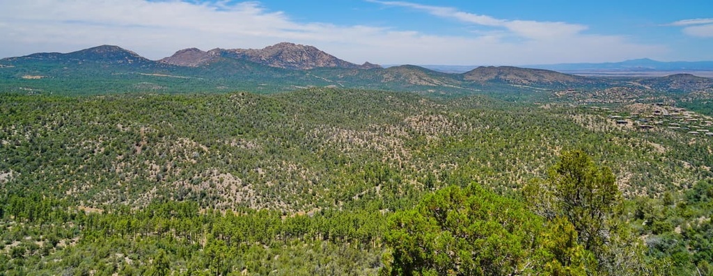
The primitive area features a plethora of hiking trails and rugged terrain. The ponderosa pine forests in the region are met with jagged mountains, steep canyons, and rocky ridgelines. Though there are some seasonal ponds and lakes in the primitive area, water supply is often extremely limited within the region.
Remnants of the Wallow Forest Fire in 2011 are still present throughout the region. The Wallow Forest Fire was one of the largest fires in the state of Arizona in recent history. Higher elevation areas in the region were once covered in dense forests, though they now feature barren trees and sweeping views.
Both white-rock and red-rock formations can be spotted throughout the primitive area, primarily along the bluffs and canyons. The Blue River runs from north to south through the region, roughly dividing the primitive area into eastern and western portions. At higher elevations in the Blue Range Primitive Area, hikers may occasionally come across mountain meadows.
Additionally, the Blue Range Primitive Area is surrounded by other popular outdoor recreation areas. The primitive area is situated within the Apache-Sitgreaves National Forests, while the Blue Range Wilderness is located directly to the east of the area in New Mexico. The Gila National Forest lies to the northeast and southeast of the primitive area and the Bear Wallow Wilderness is located to the west.
The Blue Range Primitive Area lies within the Arizona transition zone, which is situated between the Colorado Plateau to the north and the Basin and Range region to the south.
The primitive area is situated along the edge of the Mogollon Rim, which runs throughout the Apache-Sitgreaves National Forests. The Mogollon Rim marks the southern border of the Mogollon Plateau portion of the Colorado Plateau. The rest of the Colorado Plateau extends to the north and east of the primitive area.
As a whole, the Colorado Plateau is known for being relatively geologically stable. Over the past 600 million years, the plateau has experienced minimal amounts of folding and thrusting, making it a useful region for studying geological history.
The peaks in this primitive area were formed by the Mogollon-Datil volcanic field. This region experienced frequent volcanic eruptions around 40 to 25 million years ago, which helped to create the mountains and valleys that we see in the area to this day.
Continual eruptions in the region slowly formed the Mogollon Mountains, which extend to the east of the primitive area into the Gila National Forest in New Mexico. During these eruptions, a sheet of ash was deposited over much of the region, including the nearby Blue Range Wilderness and Gila Wilderness.
The waterways in the region further carved out the landscape in recent millennia, leaving behind the steep valleys and canyons that are still visible in the primitive area. Some of the deeper basins in the region were formed by thrust faulting and crustal extension.
Major peaks within the primitive area include Blue Peak, Maple Peak, Red Mountain, Bear Mountain, and Horse Mountain.
The diversity of landscapes and the abrupt changes in elevation found throughout the region have allowed a variety of flora and fauna to thrive in the Blue Range Primitive Area. As it is situated along the Mogollon Rim, the primitive area marks a transition zone between ponderosa pine forest ecosystems and desert landscapes.
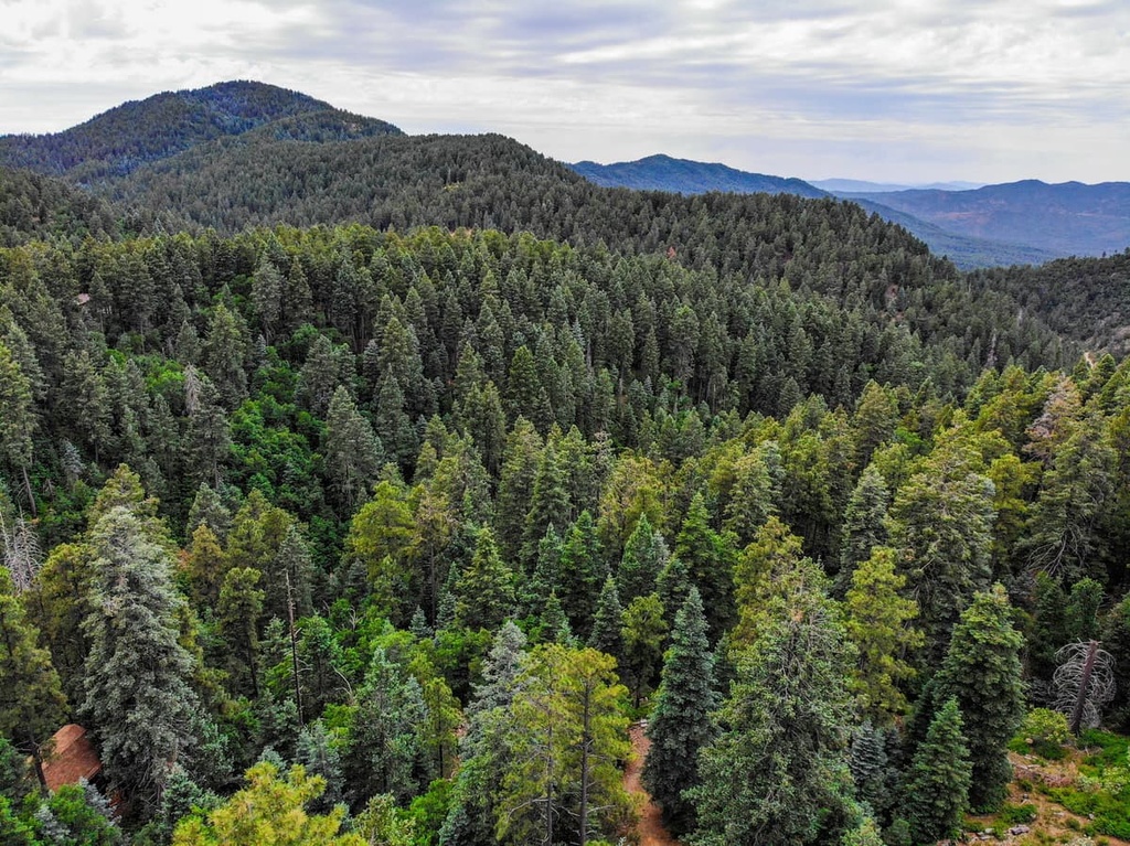
At the highest elevations in the primitive area, the flora primarily consists of spruce-fir and aspen trees. A majority of the primitive area lies between 6,500 ft (1,981 m) and 9,000 ft (2,743 m) in elevation, where ponderosa pine forests dominate the landscape. Common tree species that are found at lower elevations in the region include Apache pine, mesquite, and Chihuahua pine.
Lower elevations in the southern stretches of the primitive area often feature pinyon-juniper woodlands and desert succulents. Drought-tolerant plants in the region are occasionally surrounded by stands of alder, ash, maple, cottonwood, and Arizona sycamore.
The vast network of national forests in the region allows for animals such as cougars, bobcats, white-tailed deer, black bears, collared peccary, and pronghorns to thrive. Both birds of prey and game birds live in the region, too. Common bird species in the area include bald eagles, goshawks, wild turkeys, common black hawks, zone-tailed hawks, and dusky grouse.
The creeks, streams, and rivers in and around the primitive area often include populations of catfish, bass, brown trout, and rainbow trout.
The land in and surrounding the Blue Range Primitive Area has been inhabited by humans for thousands of years. Indigenous communities lived throughout eastern Arizona long before the arrival of European settlers. Rock art and petroglyphs found in the nearby Apache-Sitgreaves National Forests date back between 900 to 600 years ago.
The region encompasses part of the ancestral homelands of numerous Apache tribes, more specifically the Chiricahua Apache (Tsokanende) along with the Yavapai and Apache bands.
Prior to the arrival of European settlers, the Chiricahua Apache lived as hunters and gatherers, and they thrived off the land despite its arid and sometimes harsh climate. But by the nineteenth century, European settlers began arriving in the region.
Conflicts and battles quickly arose as the settlers disregarded the land claims of the Apache and other tribal nations. Instead, the settlers tried to forcibly remove Indigenous people in the region from their homelands. This conflict eventually led to a series of battles between 1849 and 1924 called the Apache Wars.
Throughout the Apache Wars, the settlers were often backed by the US Army in their efforts to forcibly remove, attack, and murder Indigenous people in the region. Those who remained were forced onto reservations in the region, and some Chiricachua were even deported to Florida in 1866.
The San Carlos Reservation, which lies directly to the west of the primitive area, eventually became the home of some of the Apache bands who remained in the region. The US General George Crooks forced multiple Indigenous groups onto this one small reservation in an effort to turn the Apache tribes against one another.
During this time, a majority of Chiricahua Apache children were forced to leave the region and attend the residential Carlisle Indian School in Pennsylvania. The school was part of a much larger network of institutions that forced Indigenous children to assimilate into Western culture and prevented them from learning about or engaging with their heritage.
Eventually, these various Apache groups formed a united government following the Indian Reorganization Act of 1934. They are now recognized as the San Carlos Apache Nation.
The San Carlos Reservation spans 1.8 million acres (728,400 ha) of land and is home to the San Carlos Apache Tribe Wellness Center, San Carlos Apache Tribe’s Language Preservation Program, and Apache Gold and Apache Sky Casinos. Around 10,000 of the Tribe’s 15,400 total enrolled members live on the reservation.
The Blue Range Primitive Area became a designated primitive area in 1933. In 1980, the New Mexico portion of the area was designated as a wilderness while the Arizona portion remains a primitive area to this day.
The Blue Range Primitive Area is home to numerous trails for outdoor adventure. Here are some of the top hiking areas to visit in the Blue Range Primitive Area during your next trip to the region.
The Lanphier Canyon–Blue River Loop is a popular backpacking trail that winds its way through the center of the primitive area. This trail begins along the top of a mesa and follows along a stream. The route then travels along Cow Flat Trail through an old-growth ponderosa pine forest.
Afterward, the loop descends down to the Blue River, and the trail makes numerous river crossings. Small pools are common near the river, though there is minimal shade available on this trail. The entire loop is 31 miles (50 km) long and it has 4,950 feet (1,509 m) of elevation gain.
The Steeple Creek–Grant Creek Trail is a shorter hike in the primitive area that begins near Hannagan Meadow. The route begins by descending slowly through the forested landscape. During the summer months, the route also features a wide variety of wildflowers.
The trail then reaches the confluence of Steeple Creek and Grant Creek with the option to continue the route along Grant Creek. Creek crossings are common in the area so hikers should wear appropriate footwear. This out-and-back trail is 3.8 miles (6.1 km) in length and it has 669 ft (204 m) of elevation gain.
The Lamphier Canyon Loop is a shorter backpacking trail in the heart of the primitive area. This route takes hikers through the forested hillsides of the primitive area, so trekkers often encounter groups of grazing cows during their adventures on this trail.
This trail takes you along many creeks and streams, though hikers should check the water status during the summer months as many of these creeks tend to run dry. The loop trail is 15.7 miles (25.3 km) in length and it has 3,116 feet (950 m) of elevation gain.
Looking for a place to stay near the Blue Range Primitive Area? Here are some of the best cities and villages to check out in the region.
The town of Safford lies to the southwest of the primitive area, near the southern edge of the San Carlos Reservation. Safford has a population of around 10,000 residents, and it is situated along the Gila River. The small town of Safford is known for its local shops and authentic Mexican cuisine.
The remote location of the town means that it has minimal light pollution. This makes Safford the perfect location for both stargazing and the Mount Graham International Observatory. Those visiting the town can book a tour to the observatory, which just happens to be located at the highest point in the Pinaleno Mountains.
Other nearby attractions around Safford include the Gila River, Gila Box Riparian National Conservation Area, Bonita Creek, Riggs Lake, and Roper Lake State Park, the latter of which features natural mineral springs. This small town offers a remote getaway with easy access to the nearby national forests.
The city of Tucson lies just a two-hour drive to the southwest of Safford. Coronado National Forest also lies directly to the east of the city, and it is a great spot for year-round outdoor recreation. Tucson is home to around 550,000 residents, and it has a metro population of just over 1 million, which makes it the second-most populous city in the state.
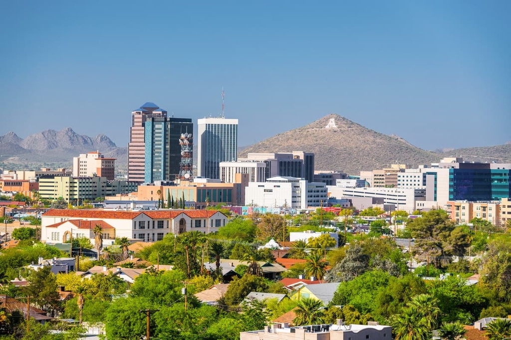
Despite the relatively large population of the city, Tucson is surrounded by national forests and is situated directly next to Saguaro National Park. The city is a hub for hiking, mountain biking, and camping throughout the year due to its warmer temperatures. Tucson is also home to a thriving food scene featuring a plethora of restaurants that serve authentic Mexican cuisine.