Scan the QR code and open PeakVisor on your phone
The San Carlos Reservation (Western Apache: Tsékʼáádn) is home to the federally recognized Chiricahua Apache Nation. It is located in the southeastern portion of the US state of Arizona. There are 67 named mountains in the reservation, the highest and most prominent of which is Mount Turnbull at 8,291 ft (2,527 m) in elevation.
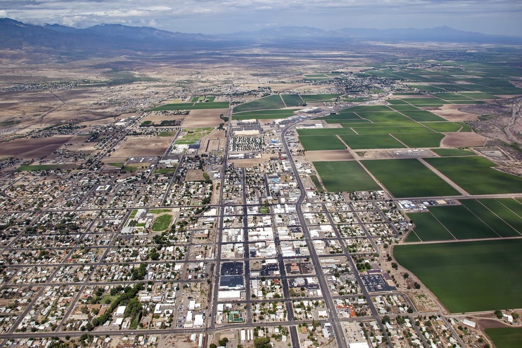
The San Carlos Reservation, which is home to the Chiricahua Apache Nation (Tsokanende), is situated in southeastern Arizona. The reservation encompasses a diversity of landscapes in the southeastern part of the state. It includes 1.8 million acres (728,400 ha) of land, making it the tenth-largest reservation in the US by total land area.
This large reservation includes ponderosa pine forest, desert landscapes, and alpine meadows. Steep cliffs and valleys can be found throughout the region as can stunning red rock outcroppings and formations.
Within the reservation, most of the forested areas are part of the largest contiguous ponderosa pine forest in the US, which extends northward across multiple national forests. However, the desert landscape that dominates the bulk of the reservation can support only a small amount of flora and fauna.
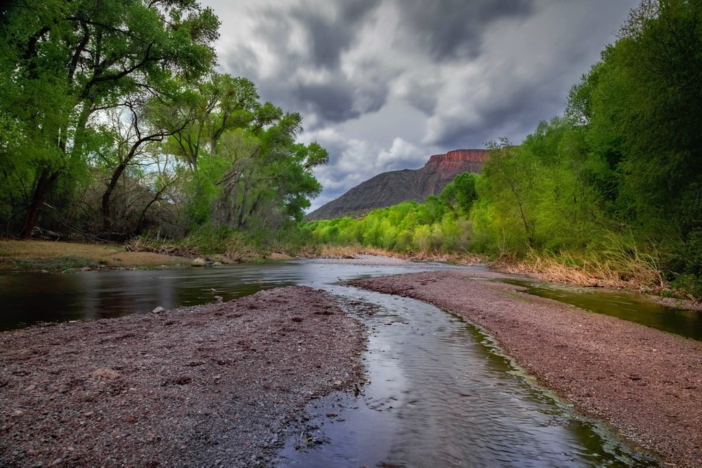
Various rivers and creeks run throughout the reservation. Some of the largest rivers in the region include the Gila River, which runs from east to west, and the San Carlos River, which runs from north to south. A dam along the Gila River has led to the formation of San Carlos Lake, which features 158 miles (254 km) of shoreline.
The San Carlos Reservation is situated near numerous other reservations and sovereign nations. This includes the Fort Apache Reservation of the White Mountain Apache Tribe, the Hopi Reservation of the Hopi Tribe, and the Navajo Nation to the north, along with the Gila River Indian Reservation of the Gila River Indian Community to the west.
Additionally, the San Carlos Reservation is surrounded by popular outdoor recreation areas. For example, Tonto National Forest and Petrified Forest National Park are located to the north of the reservation while Apache-Sitgreaves National Forests lies to the east and both the Coconino National Forest and Kaibab National Forest lie to the northwest.
The San Carlos Reservation is situated in the northern portion of the Basin and Range province to the south of the Colorado Plateau. This Basin and Range province began forming around 17 million years ago during the early Miocene epoch. During this time, the extension and thinning of the lithosphere stretched out the region, leaving behind the alternating series of ranges and basins that we see in the area to this day.
Prior to this period of lithospheric extension, the Farallon Plate was subducted underneath the west coast of the North American tectonic plate. As a result, volcanic activity was widespread throughout the region, causing the ranges to rise even higher above the surrounding basins.
Ever since the formation of the ranges in the region, the rest of the landscape has been relatively stable from a geological perspective. Major waterways further carved out the landscape, leaving behind deep canyons and valleys.
Conversely, the Colorado Plateau lies just to the north of the reservation. It is an incredibly stable geological feature that has experienced minimal amounts of folding and thrusting over the course of millions of years. As a result, the plateau stands in stark contrast to the relatively geologically active area of the Basin and Range province.
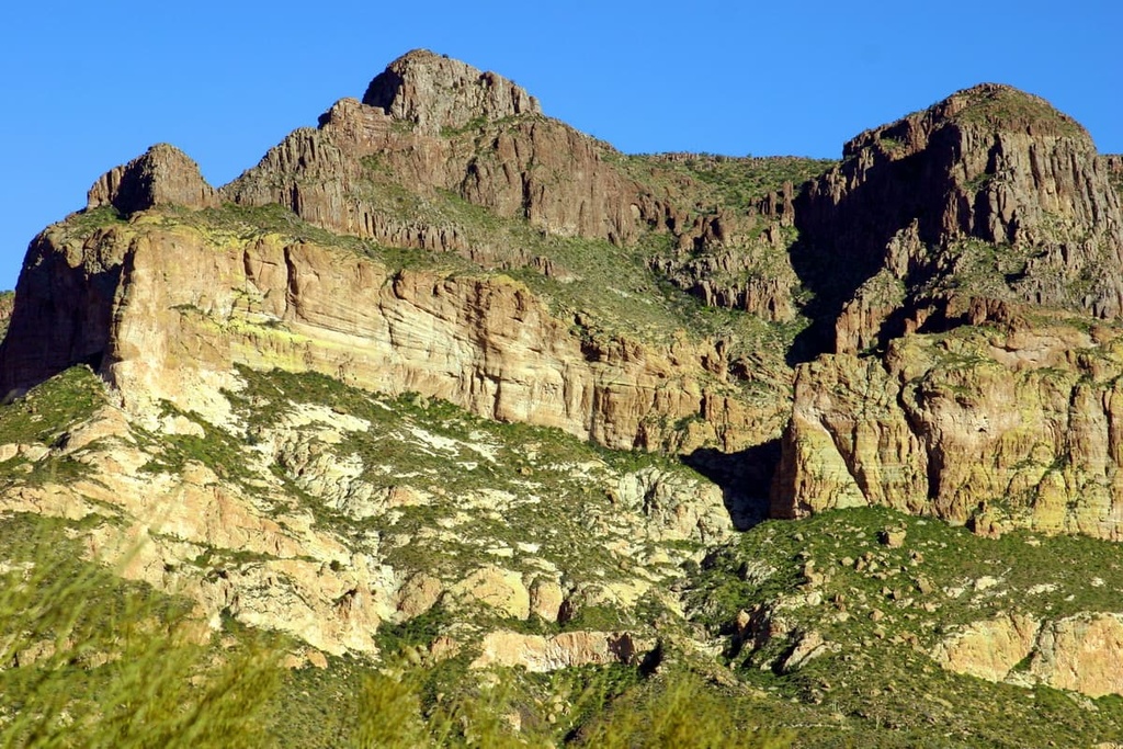
Major peaks found in the reservation include Mount Turnbull, Bryce Mountain, Turtle Mountain, Stanley Butte, and Hog Mountain.
The flora and fauna found throughout the San Carlos Reservation are similar to that of the surrounding region. Large mammals that live within the reservation include white-tailed deer, black bears, elk, coyotes, pronghorns, javelinas, and cougars.
Common bird species in the region include long-eared owls, barn owls, bald eagles, American kestrels, great blue herons, roadrunners, and various species of falcons.
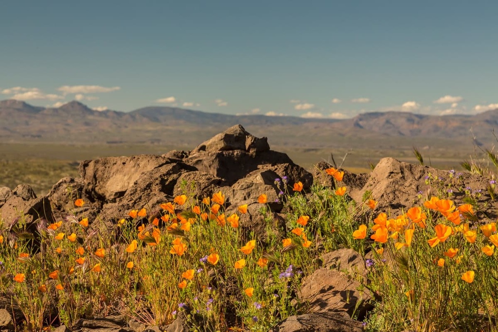
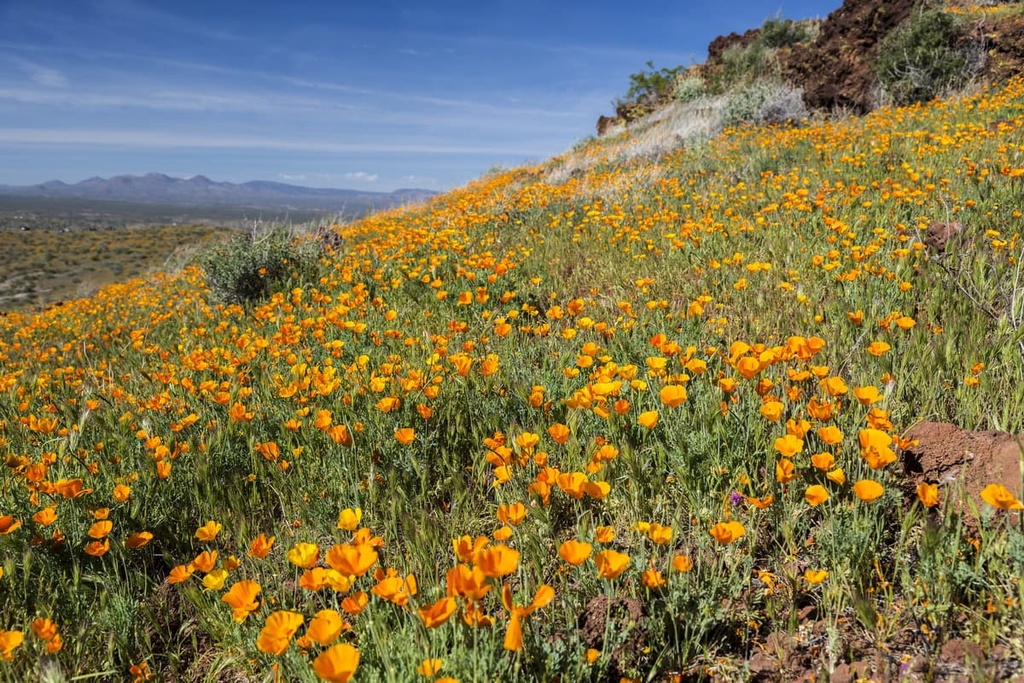
A forested landscape covers a large portion of the reservation. A majority of the forest includes ponderosa pine trees along with small patches of brittlebush, Arizona sycamore, desert willow, and creosote bush. The higher elevations in the reservation are home to alpine meadows full of wildflowers and various low-growing grasses.
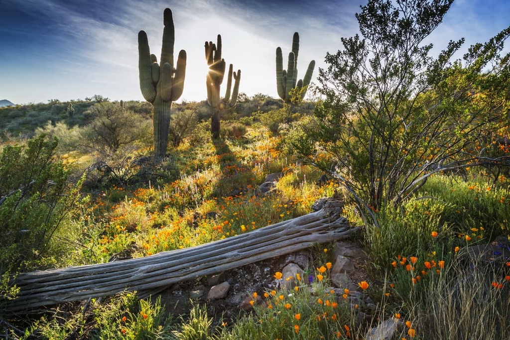
The drier parts of the reservation are characterized by numerous species of succulents and cacti. As a result, a majority of the region’s fauna can be found in the forested areas of the reservation.
The land that is now part of southeastern Arizona has been inhabited by humans for thousands of years. The region is part of the ancestral homelands of many of the Apache tribes, more specifically the Chiricahua Apache (Tsokanende) along with the Yavapai and Apache bands.
Long before the arrival of European settlers, the Chiricahua Apache thrived as hunters and gatherers who lived harmoniously with the land. The various bands of Apache often traded with one another and they shared similar languages and traditions. During this time, many of the Apache tribes also grew crops such as corn, squash, beans, and sunflowers.
European settlers arrived in the region throughout the nineteenth century. Conflict arose between the Indigenous people and the settlers from the beginning of their interactions as the settlers disregarded the Apache’s claims to their ancestral lands. The Apache Wars followed as a result of these conflicts, and they consisted of a series of battles that lasted from 1849 to 1924.
Throughout this period, the settlers were backed by the US Army as they forced the Apache from their homelands and onto reservations. In 1886, many of the remaining Chiricahua were deported to Florida while the San Carlos Reservation became a place for other relocated Apache bands.
Forcing different Indigenous groups onto one reservation was part of US General George Crook’s plan to turn the Apache tribes against one another. Many Chiricahua Apache children were also forced to attend the residential Carlisle Indian School in Pennsylvania. The sole purpose of the school, which was part of a much larger network of institutions, was to forcibly assimilate the Apache children into Western culture.
Following the Indian Reorganization Act of 1934, the various Apache groups formed a united government and were federally recognized as the San Carlos Apache Nation. Today, the San Carlos Reservation is home to the San Carlos Apache Tribe Wellness Center, San Carlos Apache Tribe’s Language Preservation Program, and the Apache Gold and Apache Sky Casinos.
The San Carlos Apache currently has about 15,400 enrolled Tribal members. Around 10,000 of these members live on the reservation.
There are numerous trails surrounding the San Carlos Reservation. However, there are relatively few trails within the reservation that are open to the general public.
Before setting out on a route, hikers should check to ensure that a given trail is open to visitors. Be sure to check the San Carlos Apache website for further information about hiking and hunting on the reservation before visiting.
With that in mind, here are some of the best hikes surrounding the reservation that are worth checking out if you’re visiting the region.
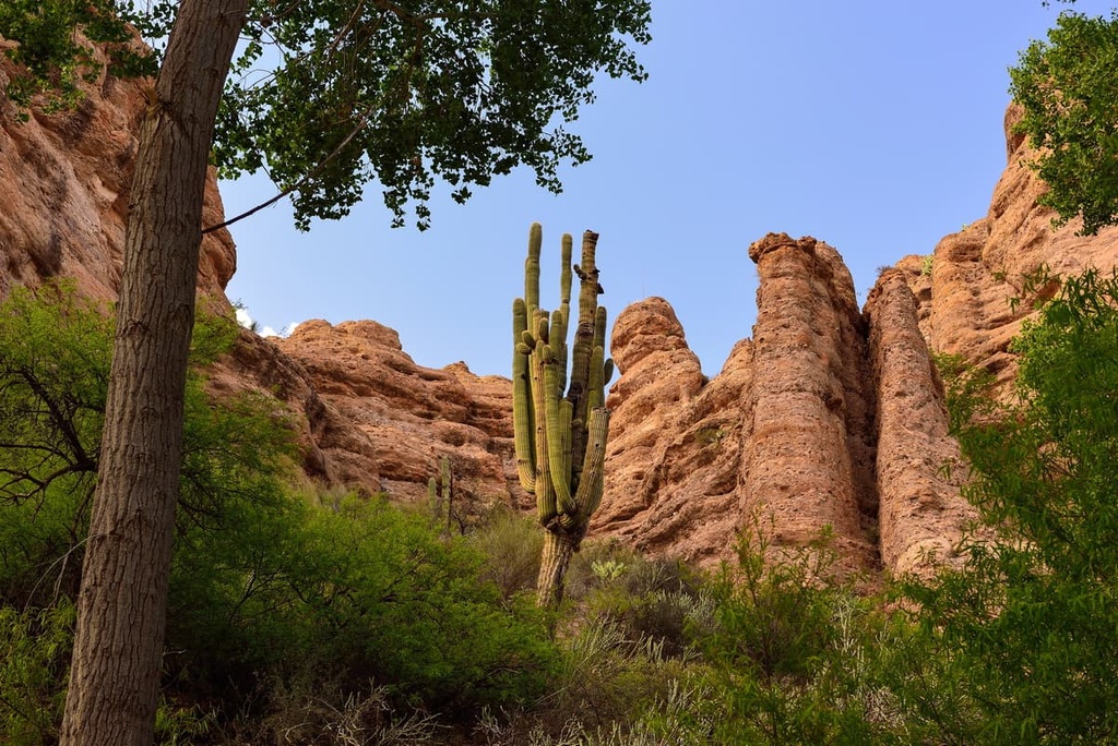
The Aravaipa Canyon Trail is situated near the southern border of the reservation. This out-and-back trail climbs steadily through its namesake canyon along Aravaipa Creek. The route has multiple creek crossings, so hikers should wear shoes that can get wet.
The trail features red rock canyons and outcroppings throughout. This route is 9.6 miles (15.4 km) in length and it has 649 ft (198 m) of elevation gain.
Round Mountain Park lies along the western edge of the reservation, outside the city of Globe. There are multiple trails of varying lengths that travel throughout the park for visitors to choose from.
Most of the park’s trails wind through the desert hillsides, providing excellent views of the surrounding region along the way. There are a handful of different hiking routes in the park, including the West Round Mountain Trail, the Boulder Canyon Trail, and the Box Canyon Trail. Head to the park's official website for more information about each of these trails.
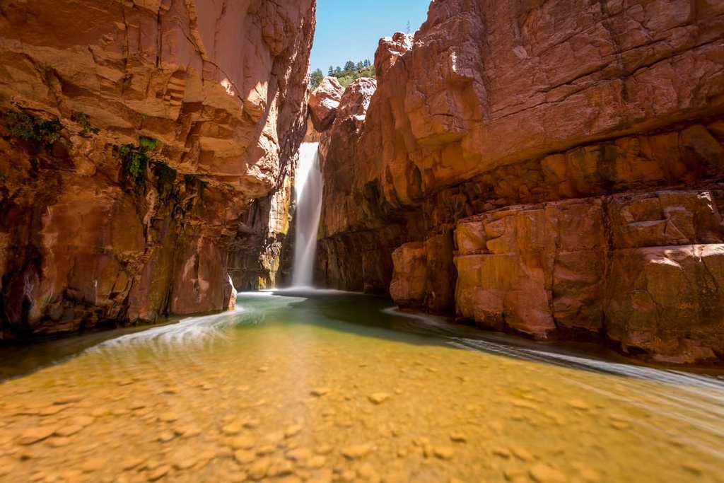
This trail is located just outside the San Carlos and Fort Apache Reservations and it leads to the beautiful Cibecue Falls. Do note, however, that you need to pay for a $30 permit from the White Mountain Apache Tribe to access the falls.
After departing the trailhead, this trail winds its way through red rock canyons before reaching the falls. The trail is 3 miles (4.8 km) in length with 623 ft (190 m) of elevation gain. Hikers should wear shoes and clothes that can get wet as there are multiple river crossings along the route.
Situated in the nearby Tonto National Forest, the East Mountain Trail provides hikers with stunning views of the landscape surrounding the San Carlos Reservation. This trail showcases both a dry desert landscape along with stunning sections of ponderosa pine forest.
Once at the summit of East Mountain, you can sit back and enjoy the view of the rolling hillsides, mountains, and basins of the San Carlos Reservation. The trail is 6.4 miles (10.3 km) in length and it has 1,564 ft (477 m) of elevation gain.
Looking for a place to stay near San Carlos Reservation? Here are some of the best cities and villages to check out in the region.
The small town of Globe (Western Apache: Bésh Baa Gowąh or “Place of Metal”), lies along the western edge of the San Carlos Reservation. The city is home to around 7,200 residents and was originally founded as a mining town.
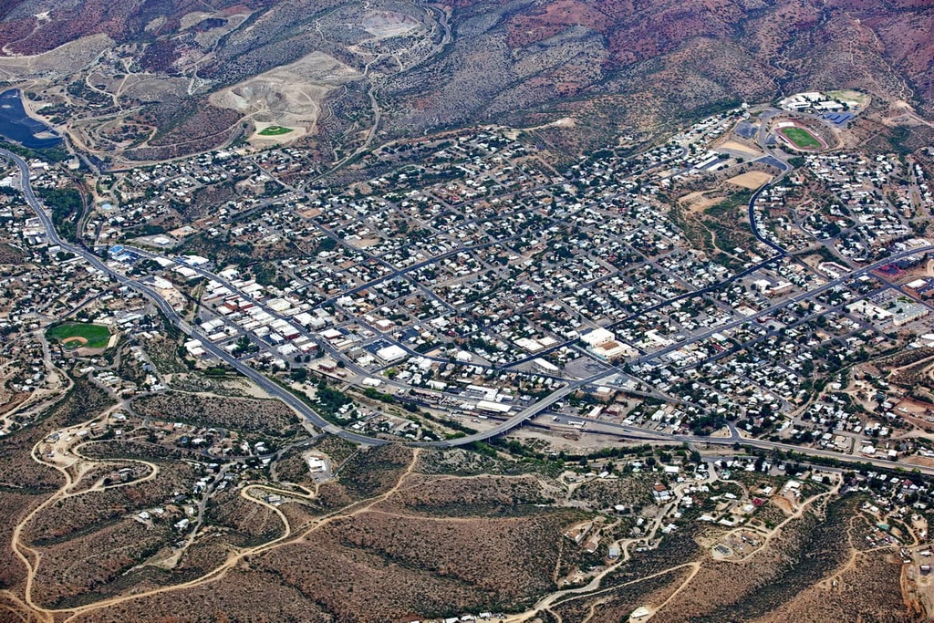
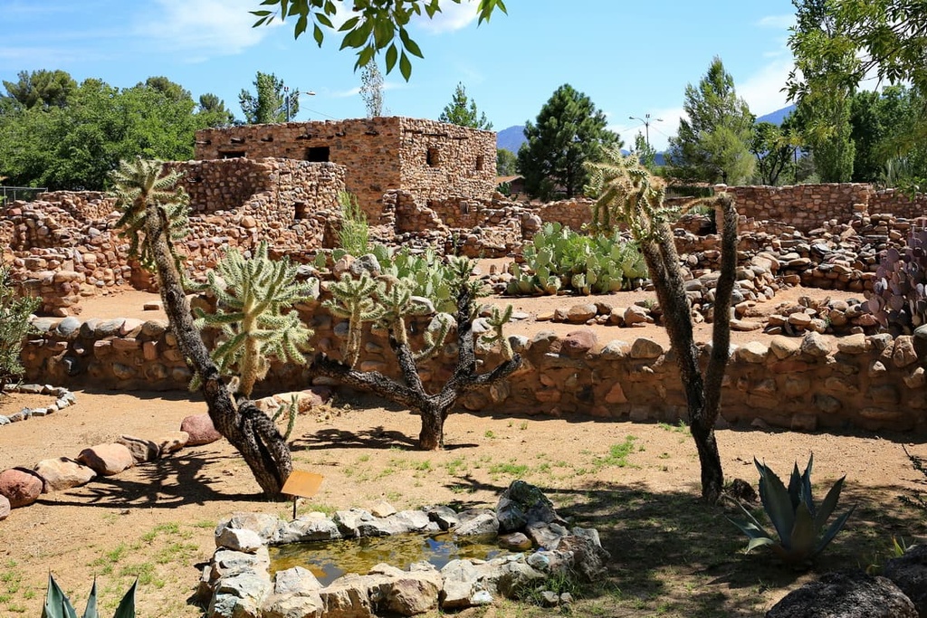
Situated along the Historic Old West Highway, Globe provides easy access to viewing the Salado Indian Ruins at the Besh-Ba-Gowah Archeological Park. The quaint downtown streets of Globe are lined with local shops, restaurants, and antique shops. In the town, you’ll also find the Cobre Valley Center for the Arts, which features work from local artists.
Safford is a town that lies along the southern edge of the San Carlos Reservation. It has a population of around 10,000 residents.
The town’s local restaurants and shops are known for their authentic Mexican cuisine and goods. Visitors to Safford can also book a guided tour to visit the Mount Graham International Observatory, which is located at the highest point in the Pinaleno Mountains.
Some of the many outdoor attractions located near Safford include the Gila Box Riparian National Conservation Area, Bonita Creek, the Gila River, Riggs Lake, and the natural mineral springs at Roper Lake State Park. This makes the small town of Safford a remote and beautiful getaway destination if you want to escape from the hustle and bustle of the Phoenix metropolitan area.