Scan the QR code and open PeakVisor on your phone
The Fort Apache Reservation is home to the federally recognized White Mountain Apache Tribe. It is located in the eastern portion of the US state of Arizona. The Fort Apache Reservation is the third largest reservation in the country. There are 120 named mountains in the reservation, the highest and most prominent of which is Mount Baldy (Dził Łigai Sí'án/White Mountain) at 11,421 ft (3,481 m) in elevation.
The Fort Apache Reservation, which is home to the White Mountain Apache Tribe (Dził Łigai Si'án N'dee), is situated in eastern Arizona. The reservation is home to a diverse range of landscapes and it includes 1.6 million acres (647,500 ha) of land, making it the third largest reservation in the US.
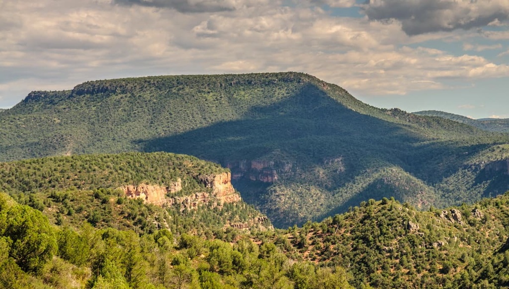
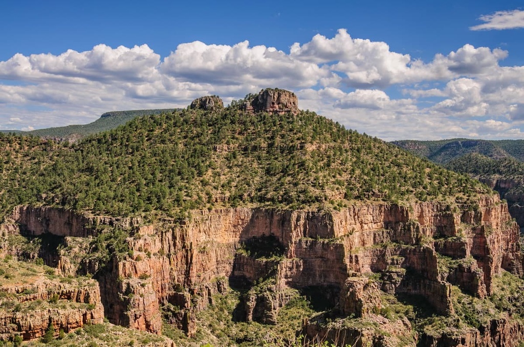
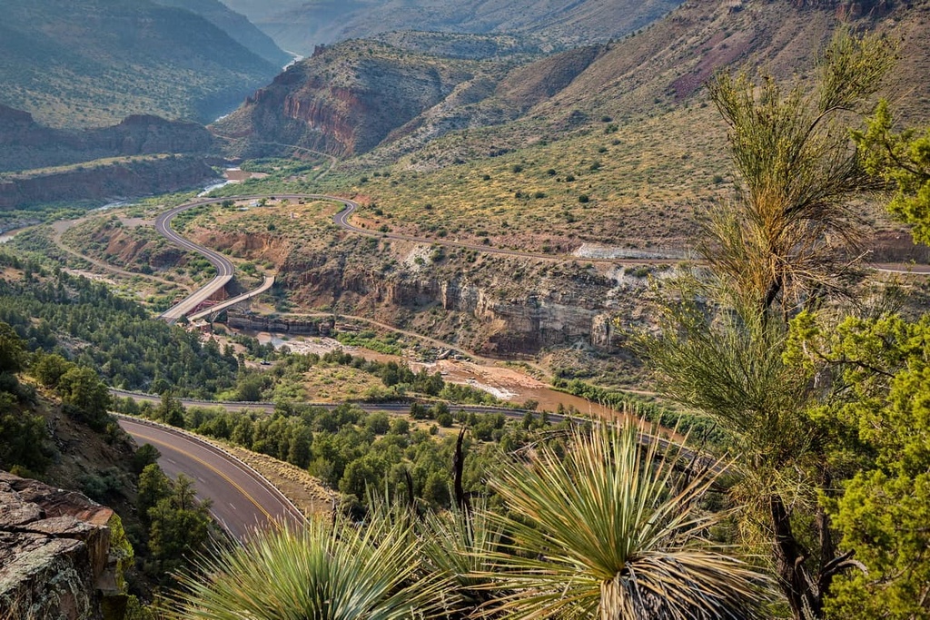
As it is situated just to the south of the Mogollon Rim, elevations change drastically throughout the forested landscape of the Fort Apache Reservation. A large portion of the reservation is covered by pine forests that extend into nearby national forests and parks.
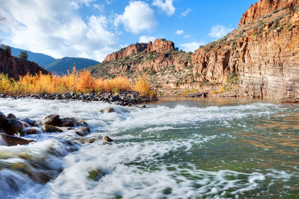
The high desert landscape of the reservation transitions from rolling hillsides into steep cliffs, canyons, and valleys. The reservation receives more rainfall than land to the west, making it a rather lush region compared to much of the state. Though much of the land is forested, there are portions that are free of tree coverage. These areas often feature sweeping red rock valleys and plateaus.
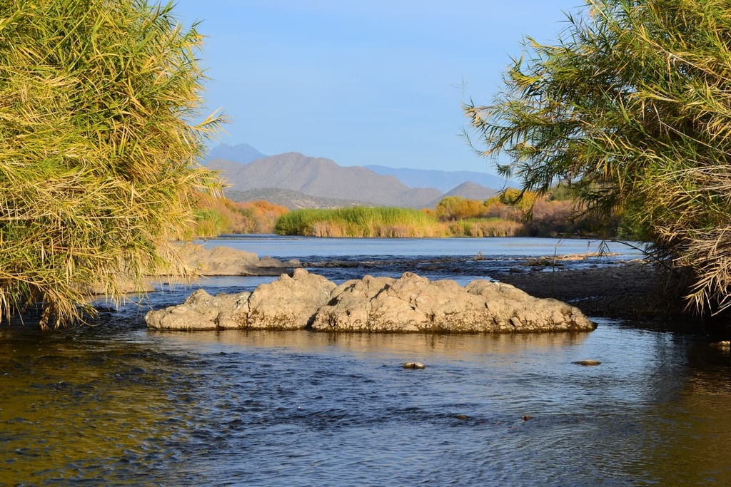
Various creeks and streams run throughout the reservation, allowing for a variety of wildlife to flourish. Some higher elevation peaks on the reservation are free of trees, too, so they provide excellent views of the surrounding region.
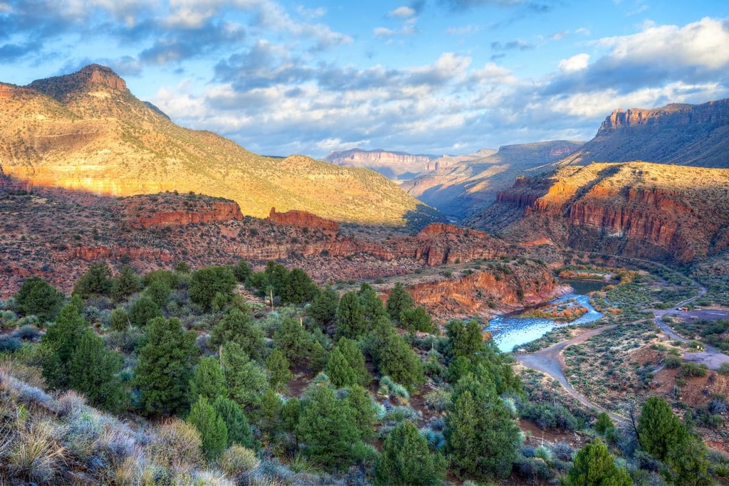
Rugged red rock canyons can be found just outside the reservation boundaries within the Sonoran Desert. Major rivers in the area include the White River and the Salt River, which then flow through the nearby Tonto National Forest.
The Fort Apache Reservation is situated within driving distance of a number of other reservations and sovereign nations. This includes the San Carlos Reservation of the San Carlos Apache Nation to the south, the Hopi Reservation of the Hopi Tribe and the Navajo Nation to the north, and the Gila River Indian Reservation of the Gila River Indian Community to the west.
Additionally, the Fort Apache Reservation is surrounded by popular outdoor recreation areas. For example, Tonto National Forest and Apache-Sitgreaves National Forests lie to the west, Coconino National Forest and Kaibab National Forests lie to the northwest, and Petrified Forest National Park lies to the north.
The Fort Apache Reservation lies in what is known as the geologic Transition Zone of present day Arizona, as the Colorado Plateau is located to the north and the Basin and Range region is situated to the south. The Mogollon Rim portion of the Colorado Plateau lies directly north of the reservation.
Many millions of years ago, ancient seas covered the region’s landscape. These seas left behind sedimentary deposits as they began to retreat. While the Colorado Plateau is a relatively stable geological feature, the Transition Zone, along with the rest of the Basin and Range region, experienced folding and tectonic shifts during the Mazatzal Revolution.
The limestone surface of the region was further eroded during the Paleozoic, which created the sweeping plateaus and plains found around the reservation to this day. Further folding and thrusting occurred around 10 to 30 million years ago, giving rise to the mountains and valleys that we currently see in the region.
The landscape was further carved out by major waterways such as the Salt and White Rivers. The geological features of the Fort Apache Reservation combine the two distinct regions which lie to its north and south.
Major peaks found in the reservation include Mount Baldy, Sombrero Peak, Silver Butte, McKays Peak, and Cerro Gordon Mountain.
The ecology of the Fort Apache Reservation is similar to that of the surrounding region. Populations of white-tailed deer, elk, coyotes, black bears, ring-tailed cats, elk, pronghorns, cougars, and javelinas are all present in the reservation.
The skies of the region are inhabited by numerous species of birds. Common birds in the region include barn owls, bald eagles, great blue herons, falcons, roadrunners, long-eared owls, and American kestrels.
A majority of the landscape is covered in pine forests, which also includes pockets of Arizona sycamore, brittlebush, creosote, and desert willow. Alpine meadows often feature low growing grasses and summer blooming wildflowers. The drier parts of the reservation are home to numerous species of cacti and succulents.
The reservation is also home to the Apache trout, a rare and critically endangered freshwater fish that was once very close to extinction. Thanks to the efforts of the White Mountain Apache Tribe and its partners, the Apache trout still swims throughout the region’s many waterways.
The land in and surrounding the Fort Apache Reservation has been inhabited by humans for thousands of years. The region is part of the ancestral homelands of the White Mountain Apache and a number of other Tribal nations.
The White Mountain Apache are closely related to many of the other Apache nations in the region, including the Tonto Apache Tribe, San Carlos Apache Nation, and the Yavapai-Apache Nation.
For generations before the arrival of Europeans, the White Mountain Apache traditionally lived in family bands and groups along the region’s major waterways, such as the North Fork of the White River and Carrizo Creek. The Apache traditionally crops such as beans, corn, squash, and sunflowers, and they have long been known as skilled hunters.
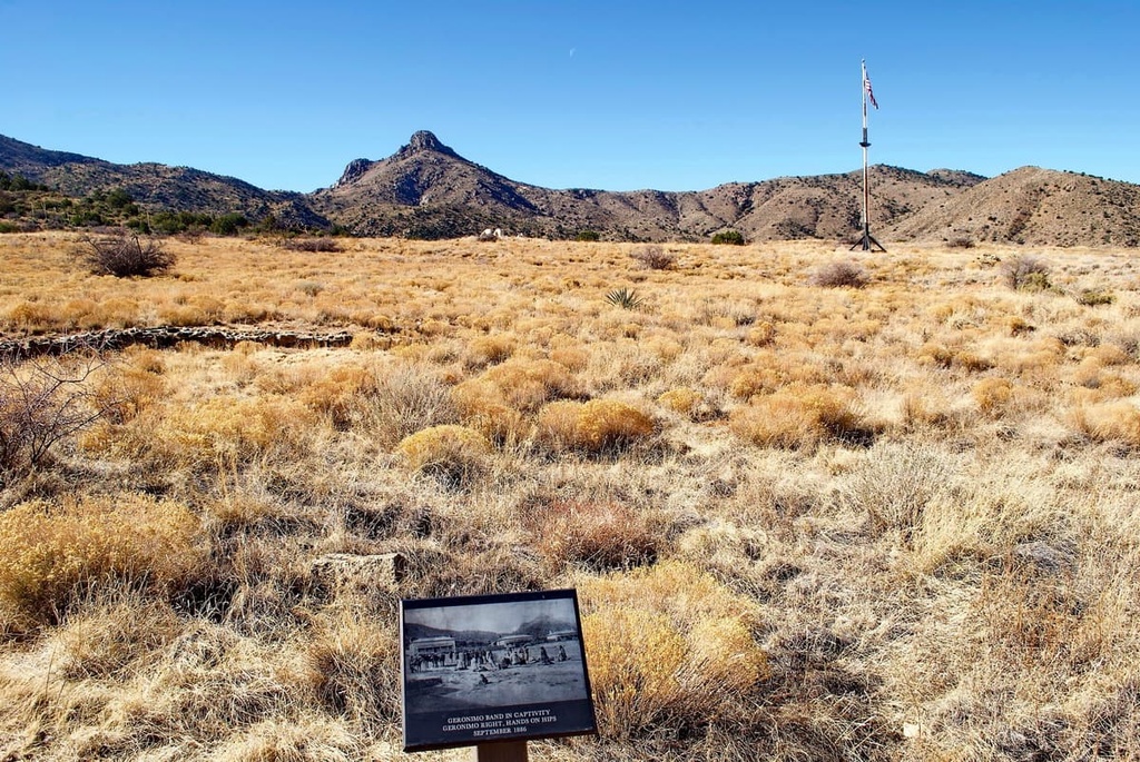
Settlers of European descent began arriving in the region throughout the nineteenth century, often disregarding the White Mountain Apache’s ancestral claims to their land. This eventually led to the Apache Wars, which consisted of a series of armed conflicts between the Apache nations and the United States Army that took place between 1849 and 1924.
Over the course of 20 years in the nineteenth century, the US Army forced the Apache onto reservations. The US Army eventually established a camp that came to be known as Fort Apache.
In 1871, US General George Crook forced around 50 White Mountain Apache men to act as scouts in the subsequent Apache Wars. The US Army finally left the region in 1922 and transferred the fort to the Bureau of Indian Affairs.
The Bureau of Indian Affairs then established the Theodore Roosevelt Indian Boarding School at the fort. This school was intended to house and forcibly assimilate Diné (Navajo) children, though it eventually became a school for Apache children. The school was part of a much larger network of similar institutions that were used by the US government to oppress Indingenous peoples and assimilate them into Western culture.
Interestingly, the school continues to exist, but it is now a public middle school that serves young residents of the reservation. The school is operated under the administration of the Tribal Council.
Nowadays, the Sunrise Ski Resort, Fort Apache Historic Park, and the Kinishba Ruins can all be found on the reservation.
The White Mountain Apache Tribe currently has about 16,000 enrolled Tribal members, many of whom live on Tribal lands. The Tribe continues to honor its rich culture by teaching its language and by continuing the tradition of ceremonies, songs, and dances that have existed for countless generations.
There are numerous trails in and around Fort Apache Reservation. However, before you set out on a hike, you should check your route to confirm that it is open to visitors. Be sure to check the White Mountain Apache website for further information before your trip.
Mount Baldy is under the jurisdiction of the White Mountain Apache and hikers must get permission in order to complete this route. The loop trail is 16.5 miles (27 km) in length with 2,572 ft (784 m) of elevation gain.
From the summit of this rocky peak, hikers can enjoy panoramic views of the region’s rolling forested hills and alpine meadows. This route begins at the East Baldy Trail and returns along the West Baldy Trail to Mount Baldy Crossover Trail.
A $30 permit is required to access this stunning hike to Cibecue Falls and can be purchased at the trailhead. This route winds through a red rock canyon along the Cibecue Creek before reaching the cascading falls.
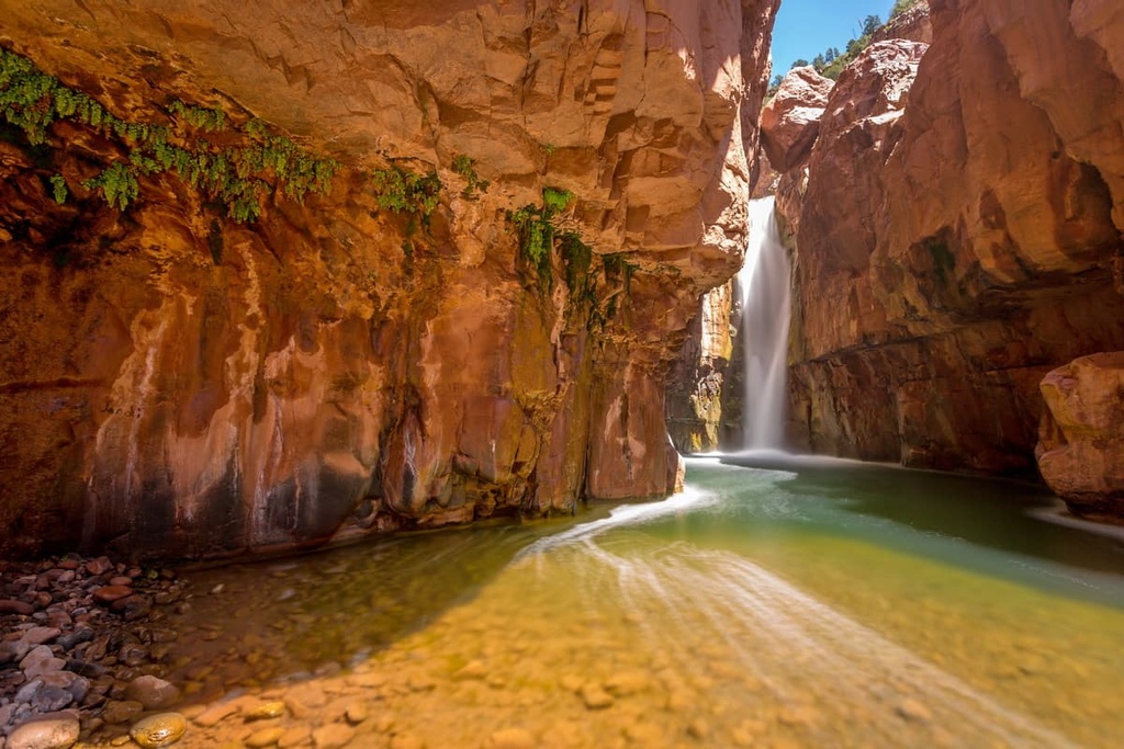
The trail is 3 miles (4.8 km) in length with 623 ft (190 m) of elevation gain. The hike climbs moderately along the creek and hikers should wear clothes and shoes that can get wet as there are multiple creek crossings.
The Timber Mesa Trail is a loop route located just south of Show Low. The trail is 7.6 miles (12.2 km) in length with 583 ft (178 m) of elevation gain.
Along this well marked trail are patches of forest, small ponds, views of the nearby valley, and wildflowers. Viewpoints can be found throughout the route.

Looking for a place to stay near Fort Apache Reservation? Here are some of the best cities and villages to check out in the region:
Show Low is a city that lies along the northern edge of the Fort Apache Reservation. The city is situated on the Mogollon Rim as it transforms into the transition zone of eastern Arizona. Show Low is home to around 12,000 residents and is situated at an elevation of 6,400 ft (1,951 m).
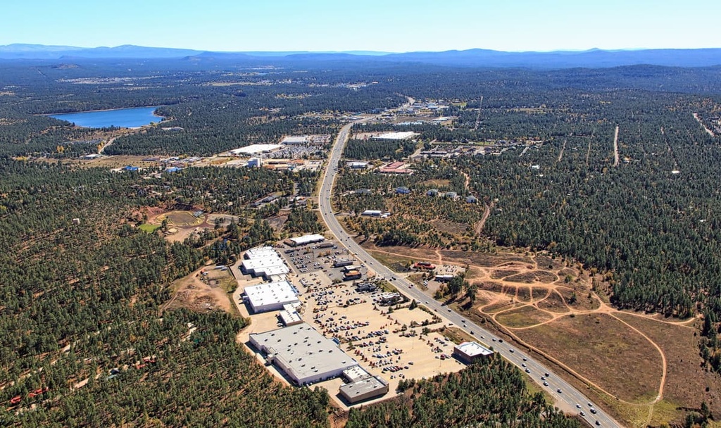
Nestled along the edge of the White Mountains, locals and visitors alike can enjoy the four seasons of this mountainous town. Though small in size, the town is a popular tourist destination. Besides hiking and backpacking, the town of Show Low is known for its exceptional fishing opportunities, as it is one of the few places where you can find Apache trout.
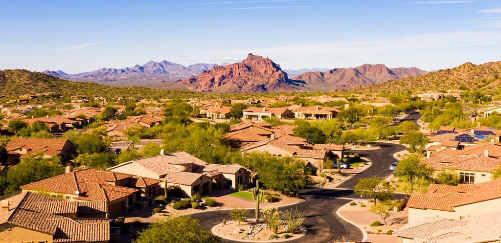
Mesa lies an hour and half’s drive to the west of the Fort Apache Reservation. Situated in the greater Phoenix area, the city provides easy access for outdoor recreation in the region. Mesa lies 20 miles (32 km) to the east of Phoenix near the edge of Tonto National Forest. The city is home to around 520,000 residents.
Although it’s situated close to many of Arizona’s major cities, Mesa’s central location allows for easy access to the hundreds of miles of trails found throughout the nearby national forests and parks. Mesa is also home to many great destinations for trail running, cycling, and kayaking.