Scan the QR code and open PeakVisor on your phone
Sierra Ancha (meaning “broad range” in Spanish) is a mountain range located in the central region of the US state of Arizona. These mountains, along with the surrounding ranges, are part of the transitional zone of Arizona, where the Colorado Plateau descends into the southern desert lowlands. The Sierra Ancha features 86 named peaks; Aztec Peak (7,733 feet / 2,357 m) is the tallest and the most prominent, with 2,493 feet (760 m) of prominence.
Sierra Ancha, which translates to “broad range” in Spanish, is a sweeping mountain range in central Arizona. It lies in Gila County and is protected within the Tonto National Forest, Sierra Ancha Wilderness, and Salome Wilderness.
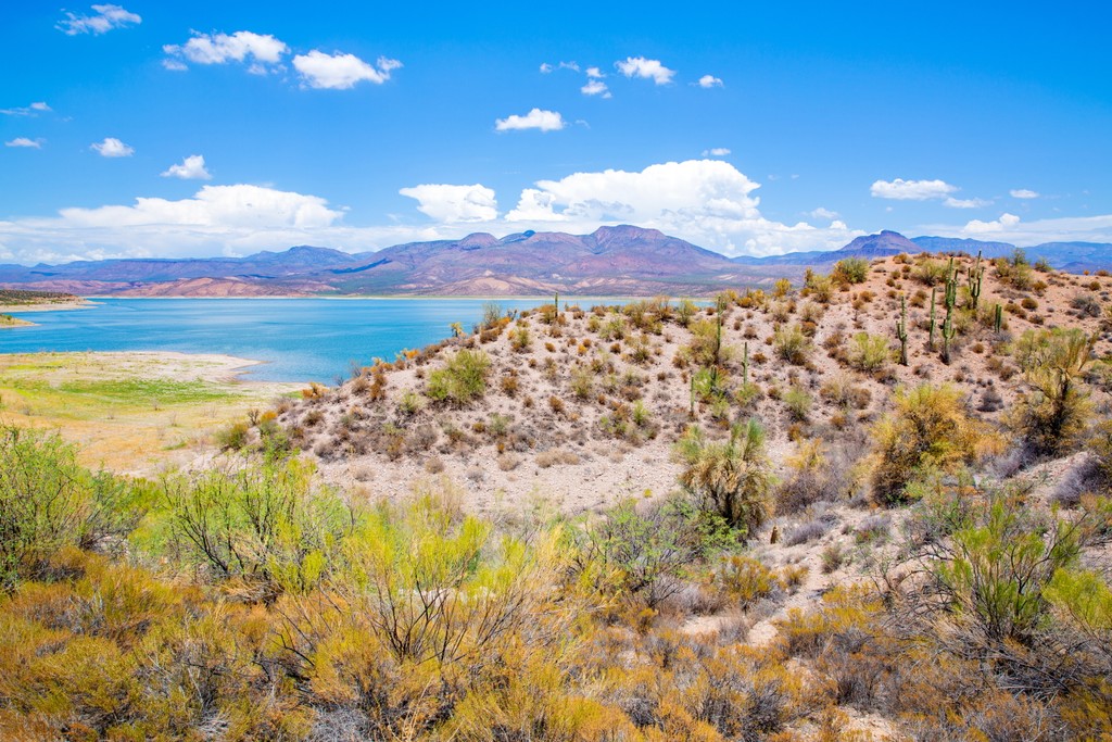
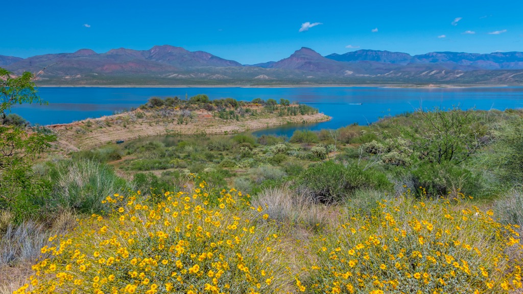
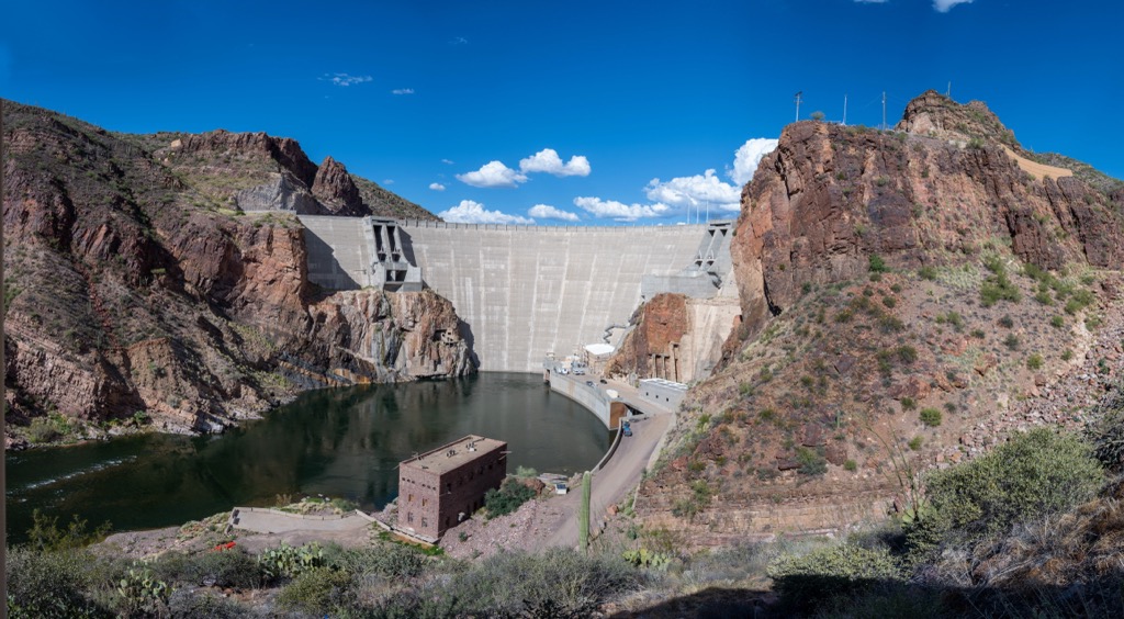
Geographic features surrounding the range include Roosevelt Lake to the south, Cherry Creek to the east, Pleasant Valley to the north, and the Tonto Basin to the west.
The Sierra Ancha, along with the Bradshaw Mountains, Black Hills, and Mazatzal Mountains, is part of the transition zone between the desert lowlands of southern Arizona and the Colorado Plateau portion of northeastern Arizona.
The Sierra Ancha lies within the central portion of the Tonto National Forest. While sections feature a forested landscape, there are also desert and alpine landscapes with few trees. The tallest peaks offer panoramic views of the range and the surrounding national forest.

Deep canyons cut across the range, especially in the eastern flank. The relatively remote landscape features minimal trails and roads, making it one of the state's most rugged and inaccessible regions.
The box canyons meet impressive peaks covered in pine forests and rocky buttes and outcroppings. Elevations in the Sierra Ancha range from around 2,100 feet (640 m) along the shores of Lake Roosevelt to 7,733 feet / 2,357 m at Aztec Peak’s summit.
Prominent streams include Salome Creek and Workman Creek. The Salome Wilderness protects the watershed around Salome Creek.
The Sierra Ancha is near numerous other outdoor recreation zones, including Superstition Wilderness and Four Peaks Wilderness to the south, Salt River Canyon Wilderness to the southeast, and the Mazatzal Wilderness to the west. A portion of the Apache-Sitgreaves National Forest lies north.
The Sierra Ancha lies within the Tonto Basin, which began forming 1.5 to 2 billion years ago. The seas that once covered the region began retreating, leaving behind sedimentary deposits.
The Mazatzal Revolution uplifted and folded the landscape through a series of tectonic shifts. Around 10 to 30 million years ago, the once flat plain abruptly uplifted, creating the series of ranges and basins that define the eponymous Basin and Range region.
The Salt River and other waterways further carved out the landscape, creating deep canyons and basins. Even though the region is arid, the movement of water is today’s primary geologic driver.
Rock in the Sierra Ancha consists of shale, quartzite, and dolomitic limestone. The unique color of the cliffs is the result of Dripping Spring Quartzite and Troy Quartzite. The purplish and white-pinkish appearance is visible because the surrounding rock is less weather-resistant. These sandstones erode faster and expose the magnificent Quartzite.
Basement rock primarily consists of Proterozoic Ruin Granite, while the summit of Aztec Peak features Cambrian sandstone, similar to that found in the Grand Canyon.
Significant peaks within the Sierra Ancha include Aztec Peak, Armer Mountain, Jess Peak, Chubb Mountain, and Black Mesa.
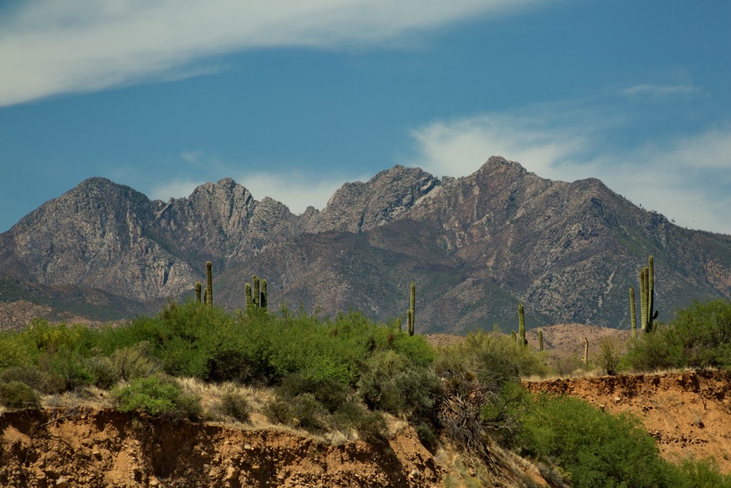
The dramatic changes in elevation in the range allow for a wide variety of flora and fauna to thrive. Plants common in the Sonoran Desert landscape thrive throughout the lowest elevations. Hikers will likely spot palo verde, saguaro cactus, and creosote bush.
Juniper and oak scrub populate the mid-elevations. Above 6,000 feet (1,829 m), the range is home to extensive ponderosa pine forests, like much of Tonto National Forest, while the highest peaks feature Douglas fir.
The surrounding network of Wilderness areas and National Forests provides an ideal habitat for black bears, coyotes, bobcats, cougars, ring-tailed cats, raccoons, elk, white-tailed deer, pronghorns, and even javelinas.
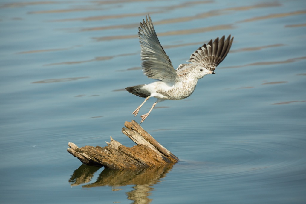
Numerous bird species inhabit the landscape with common species including bald eagles, barn owls, American kestrels, Great blue herons, greater roadrunners, and long-eared owls. The Fish and Wildlife Service stocks the waterways with rainbow, brown, and brook trout.
The land surrounding Tonto National Forest has a long history of human inhabitation, dating back thousands of years. Numerous Indigenous Tribes lived throughout the region.
From 500 to 950 CE, three distinct Indigenous cultures inhabited the Sierra Ancha: the Mogollon to the east, the Hohokam to the west, and the Sinagua to the north. The Salado culture appeared around 950 CE and spanned roughly 100 miles (161 km) around the range.
The Hohokam people were traditionally hunter-gatherers, but their culture slowly developed to include farming, trading, and craftsmanship. The region’s inconsistent and meager rainfall led the Hohokam people to build hundreds of miles of irrigation canals across the desert.
A megadrought during the fifteenth century led the Salado, Hohokam, and other Indigenous peoples to leave the region, with many never returning. Many of the descendants of these Indigenous Peoples and Tribes are part of the contemporary Pima, Hopi, and Zuni.
Some Indigenous Peoples stayed near the Sierra Ancha. As settlers began arriving in the area, those who had remained were eventually forcibly removed from their native homelands.
The US Army forced the Apache and Yavapai people onto reservations during the nineteenth century. Today, nearby reservations include the Tonto Apache Reservation of the Tonto Apache Tribe, White Mountain Reservation of the White Mountain Apache Tribe, the San Carlos Apache Reservation of the San Carlos Apache Nation, and the Fort McDowell Yavapai Reservation of the Fort McDowell Yavapai Nation.
Following the brutal removal of the Indigenous Tribes, settlers began arriving in the region. Many of the early settlers were miners and Mormon missionaries. Cattle and sheep ranches proliferated while the city of Phoenix steadily increased in size following the railroad's completion through present-day Arizona.
The surrounding Tonto National Forest was established in 1905 to protect the Salt and Verde River watersheds. The Sierra Ancha Wilderness was established as a primitive area in 1933 and became a wilderness in 1964. The Salome Wilderness was designated in 1984.
The Sierra Ancha is home to minimal trails for outdoor adventure. Here are some of the top hiking areas to visit in the region:
The Jug Trail lies in the range’s southern portion, within the Salome Wilderness. This trail winds through the desert landscape just north of Lake Roosevelt. Hikers pass along many creeks and streams throughout the route.
Situated in a slot canyon, the Jug Trail is a natural waterpark featuring multiple rock waterslides, swimming holes, and waterfalls. Those wishing to explore the slot canyon should carry proper gear and ropes to ensure safety. The out-and-back trail is 6.5 miles (10.4 km) long and features 905 feet (275 m) of total elevation gain.
Hell’s Hole Trail lies in the heart of the Sierra Ancha. As elevations increase, hikers transition away from the desert landscape and into the forested hillsides. The route passes along numerous creeks and streams with multiple descents and climbs.
The trees begin to thin at higher elevations, giving way to sweeping views and red rock buttes. The out-and-back trail is 10.8 miles (17.4 km) long and features 2,693 feet (820 m) of total elevation gain.
Though the summit of Aztec Peak can be reached by road, a trail also winds up to the mountain’s summit for the more adventurous. This trail climbs gradually before reaching the flat butte, marked by a lookout tower.
Hikers have unobstructed views of the surrounding peaks, ridgelines, canyons, red rock formations, and forested hillsides. This out-and-back trail is 3.2 miles (5 km) long and features 823 feet (250 m) of elevation gain.

Looking for a place to stay near the Sierra Ancha? Here are some of the best cities and villages to check out in the region:
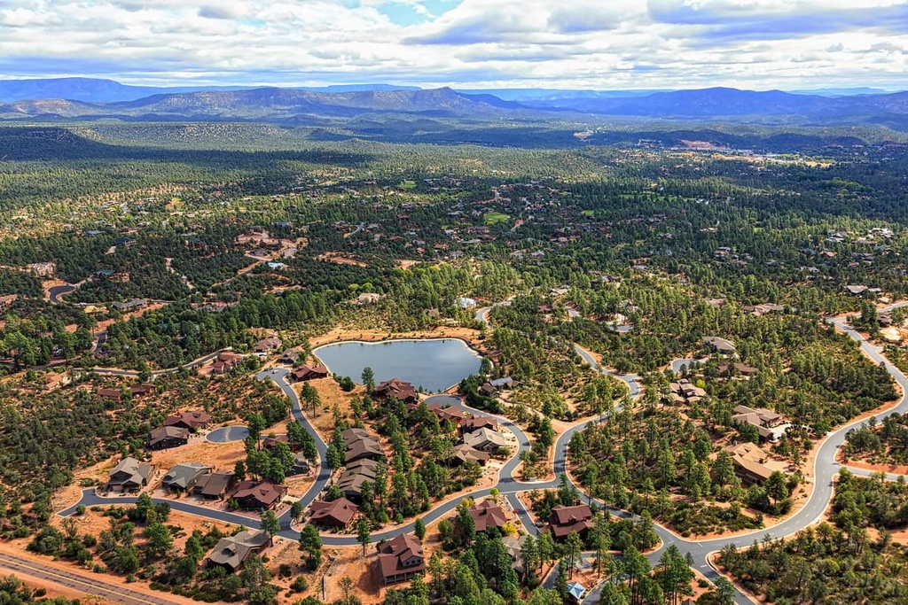
Payson is a town just northwest of the Sierra Ancha, near the state’s geographic center, leading to its nickname, “The Heart of Arizona.” The Tonto National Forest surrounds Payson, home to around 17,000 residents.
This area near the Mogollon Rim has also been dubbed “Rim Country.” The Mogollon Rim stands at around 7,000 feet (2,134 m) and drops over 2,000 feet (610 m).
Outdoor activities in Payson include hiking, kayaking, mountain biking, camping, fishing, bird watching, and rock hunting. Those who visit the region should also be sure to go stargazing at night, as the limited amount of light pollution and dry, thin air make Payson one of the best places in the world to view the night sky.
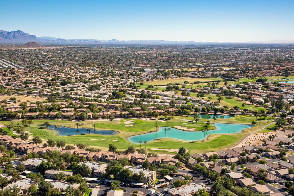
Located in the greater Phoenix area is the city of Mesa. The suburb lies 20 miles east of Phoenix and marks the closest major city to the Sierra Ancha. Mesa is home to around 520,000 residents, making it one of the most populated cities in the state.
Despite its large population, Mesa is surrounded by National Parks and National Forests, making it a hub for outdoor recreation. Outdoor activities near the city include hiking, backpacking, mountain biking, and trail running, as well as various watersports on the region’s rivers and lakes.