Scan the QR code and open PeakVisor on your phone
The Mazatzal Wilderness is a federally protected area that encompasses roughly 252,500 acres (102,183 ha) of rugged terrain in Yavapai and Gila counties in the US state of Arizona. There are 46 named mountains in the Mazatzal Wilderness, the highest and most prominent of which is Mazatzal Peak (7,894 ft/2,406 m).
The Mazatzal Wilderness is a rugged wilderness area located in central Arizona that features high-elevation mountains dissected by vertical canyons and rolling riparian terrain. The wilderness lies mostly within the Tonto National Forest, but it also extends north into the Coconino National Forest.
There are many other wilderness areas that surround the Mazatzal Wilderness. Located directly to the north of Mazatzal is the Fossil Springs Wilderness, which protects about 11,550 acres (4,674 ha) of the Coconino National Forest. To the northwest of the Mazatzal Wilderness, the 29,100-acre (11,780 ha) Pine Mountain Wilderness sits along the Verde Rim, straddling the boundary between the Tonto National Forest and Prescott National Forest.
Furthermore, to the north of the Pine Mountain Wilderness, the Cedar Bench Wilderness encompasses almost 15,000 acres (6,070 ha) of terrain on the eastern edge of the Mogollon Rim in the Prescott National Forest.
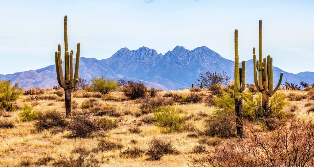
Directly to the east of the Mazatzal Wilderness, you can also find the 37,440-acre (15,150 ha) Hellsgate Wilderness, and to the south, there are the Four Peaks, Superstition, Salome, Sierra Ancha, and Salt River wilderness areas—all of which are located in the Tonto National Forest.
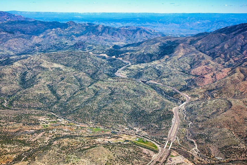
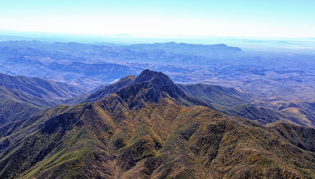
The Mazatzal Mountains are one of the most dominant features in the Mazatzal Wilderness. The eastern slopes of the range rise to over 7,900 feet (2,408 m) in elevation at the summit of Mazatzal Peak, which is the highest peak in the wilderness. The East Verde River, a tributary of the Verde River, travels through a deep canyon that separates the Mazatzal Mountains from the mesas to the north.
To the west of the Mazatzal Mountains, the range slopes more gently as it runs along the lower flanks of the Verde River, one of Arizona’s main drainage channels. The lowest elevations in the Mazatzal Wilderness are found near Sheep Bridge in the southwestern region of the park, where elevations reach a maximum of just 2,100 feet (640 m).
Other prominent peaks in the Mazatzal Wilderness include Cypress Butte, Table Mountain, Lion Mountain, Cane Springs Mountain, and North Peak.
The most prominent feature of the Mazatzal Wilderness, the Mazatzal Mountains, are part of what is known as the Mazatzal Group, a collection of Precambrian-aged geologic formations located in central Arizona.
Although they are surrounded by alluvial fan deposits that were produced in the Pliocene and Pleistocene periods, the Mazatzal Mountains are believed to have been uplifted during the Tertiary period.
In the northern Mazatzal Mountains, the Mazatzal Group is separated into three distinct rock formations: Deadman Quartzite, Maverick Shale, and Mazatzal Peak Quartzite.
Mazatzal Quartzite is thought to have been deposited in a coastal delta that later transitioned into a terrestrial river delta. It’s extremely hard and resistant to erosion. It also sits above the 500 to 800-foot-thick (152 m to 244 m) Maverick Shale, which consists of shale, silt, and varying amounts of interbedded quartzite. Deadman Quartzite sits beneath this layer of Maverick Shale.
The northeastern region of the Mazatzal Wilderness and the northern terminus of the Mazatzal Mountains also contain Tapeats Sandstone, an erosion-resistant type of sandstone that is common in the Grand Canyon.
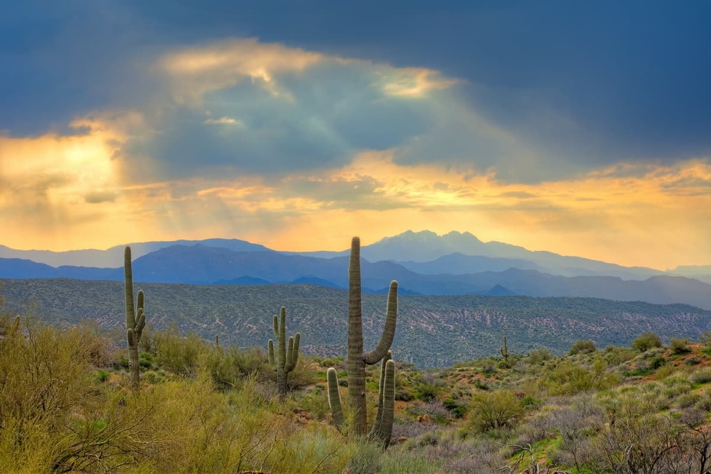
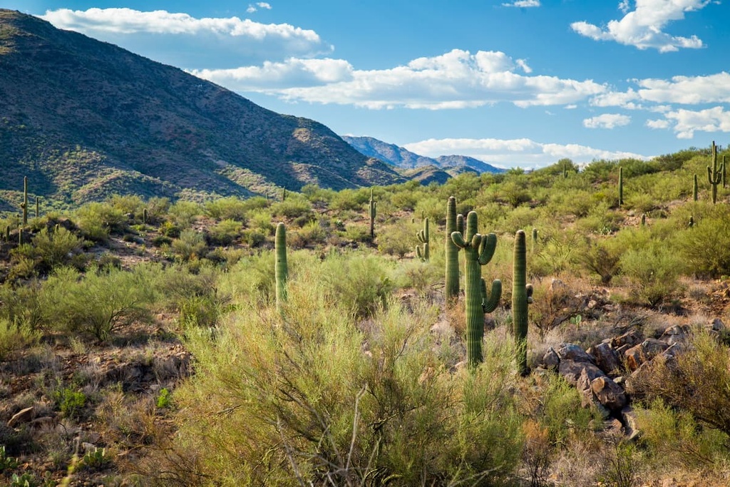
The Mazatzal Wilderness provides the ideal habitat for a wide range of flora and fauna. In the western part of the wilderness area, you’ll find Sonoran Desert shrublands that transition to semi-desert grasslands, pine-covered mountains, and mountain shrubs as you move toward the east.
Higher elevations in the wilderness support scattered stands of Pinyon-juniper woodland, ponderosa pine, and Douglas-fir. Near its northernmost boundary, the wilderness abuts the Mogollon Rim and the largest contiguous stand of ponderosa pine in the world.
Watersheds carved from the area’s deep, rugged canyons and associated riparian habitats sustain a wealth of wildlife and vegetation, including more than 50 threatened, endangered, or sensitive species.
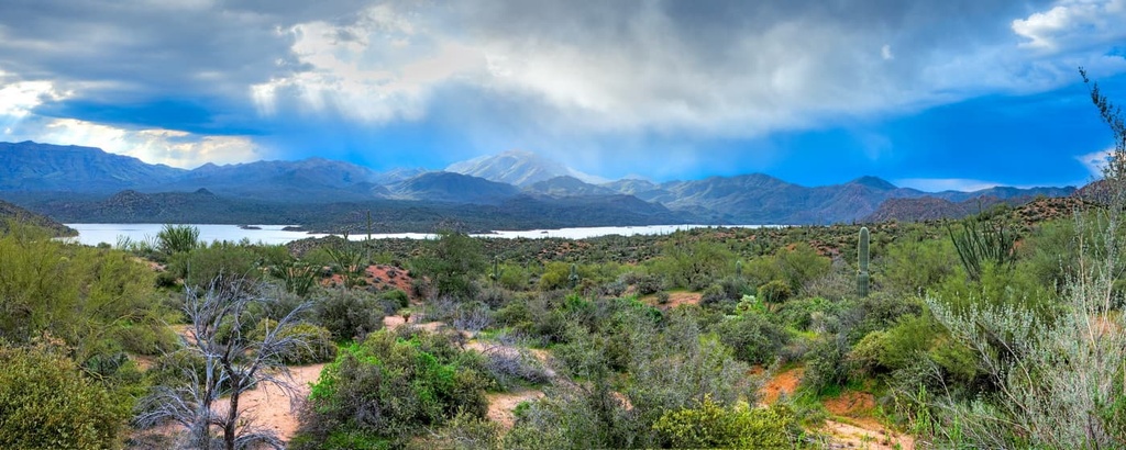
The Verde River Watershed, the largest in the wilderness, provides habitat to more than half of the vertebrate species that inhabit the Coconino, Prescott, and Tonto national forests. This area is also a critical nesting habitat for bald eagles.
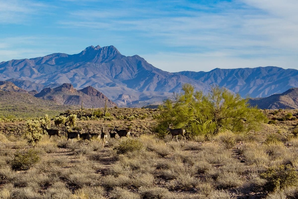
Other wildlife known to thrive in the Mazatzal Wilderness includes river otters, beavers, waterfowl, deer, bears, and kit foxes.
Wildfires have played a significant role in the Mazatzal Wilderness ecosystem over the last several decades. In 2004, the Willow Fire burned more than half (roughly 120,000 acres/48,562 ha) of the wilderness. Then, in 2012, the Sunflower Fire burned the southern portion of the Mazatzal Mountains up to Mount Peeley.
Archeological evidence unearthed in and around the present-day Mazatzal Wilderness suggests that humans have inhabited the region for at least 5,000 years.
Artifacts belonging to the Hohokam and Salado people have been identified in the valleys and foothills that are located to the east of the Mazatzal Mountains. The Yavapai-Apache Nation and Tonto Apache Tribe also have ancestral ties to the region.
The term ‘Mazatzal’ is said to be of Nahuatl origin, the language of the Aztecs. It roughly translates to “an area inhabited by deer.” Ironically, there’s no indication that Aztecs traveled to or lived in the area, so the origin of this name isn’t particularly clear.
The first Anglo-Americans and people of European descent to enter the Mazatzal region were likely trappers who traveled along the Verde River in 1829. However, many of the Tribal nations in the region resisted the colonization of their homelands. This resistance mostly foiled permanent settlement of the Mazatzal Mountains until the late 1800s.
European settlement of the region grew far more rapidly once US army units from Fort McDowell subjugated both the Apache and Yavapai and forced Tribal members onto reservations. Soon afterward, settlers in the region quickly began to establish mining camps and homesteads. They also brought large numbers of cattle and sheep to the area.
The Mazatzal Wilderness was established as a primitive area in 1938, and it became an unofficial “wilderness” in 1940. In 1964, when the National Wilderness Preservation System was established, the Mazatzal Wilderness became one of Arizona’s first officially designated wilderness areas. In 1984, the wilderness was expanded by about 35,000 acres (14,164 ha) to its current size.
The Mazatzal Wilderness boasts more than 240 miles (386 km) of scenic hiking and equestrian trails that highlight the region’s rugged topography and unique natural features. Here are some of the most popular hiking trails in the wilderness area to check out during your next trip to the region.
The 28-mile (45 km) Verde River Trail runs mostly parallel to the Verde River and is ideal for backpacking and camping in the Mazatzal Wilderness.
Though the trail is generally considered to be moderate in difficulty, it requires river crossings at Red Creek and Pete’s Cabin Mesa that may be dangerous to complete or difficult to locate. Hikers are encouraged to plan accordingly and they should be prepared to turn around if the river levels on this trail are too high to navigate safely during their travels.
Another popular long-distance trail in the Mazatzal Wilderness, the 29-mile (47 km) Mazatzal Divide Trail crosses the wilderness from north to south, and it climbs up to the highest trail-accessible point in the area.
The trail, which follows a rugged ridge between Mount Peeley and North Peak, offers expansive views of the Mazatzal Wilderness. Many day hikes exist along the Mazatzal Divide Trail, too, so visitors don’t necessarily have to hike the entire 29-mile (47 km) trail at once.
The Barnhardt Trail is one of the most dramatic and heavily used trails in the Mazatzal Wilderness. It is regularly referred to as an ‘expressway,’ because it links many other trails in the region.
This 5.9-mile (9.5 km) trail features expansive views of Barnhardt Canyon, a seasonal waterfall, and stands of ponderosa, so it’s a great option for anyone looking for a shorter hike in the wilderness area.
Though it is technically located outside of the wilderness boundary, the Gold Ridge Trail is one of the most popular hikes in the region. It features incredible views of the Mazatzal Mountains, as well as brief vistas of Mount Ord, Four Peaks, and Roosevelt Lake.
The Gold River Trail can also be combined with the South Fork Trail or Deer Creek Trail for a longer trek in the area around the Mazatzal Wilderness.
Looking for a place to stay near the Mazatzal Wilderness? Here are some of the best cities to check out in the region.
Phoenix, the anchor of Arizona’s Phoenix metropolitan area, is home to over 1.6 million residents, making it one of the largest cities in the US. Though the city itself is mostly flat, it’s surrounded by many mountain ranges, including the McDowell Mountains, White Tank Mountains, Superstition Mountains, South Mountains, and the Sierra Estrella.
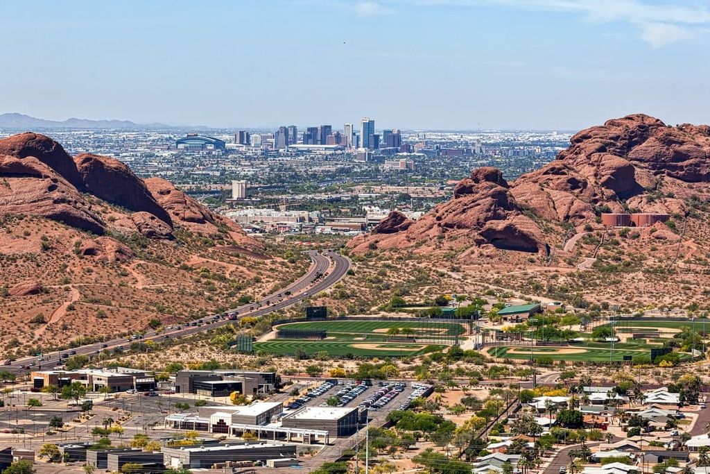
Additionally, Phoenix is a mecca for outdoor recreation, so many miles of hiking and biking trails can be found in the city’s nearby parks, forests, and wilderness areas. This includes the Tonto National Forest, which forms part of the city’s northeast boundary, as well as Echo Canyon, Cholla Double Butte, Pinnacle Peak, and South Mountain Park and Preserve, among many others.
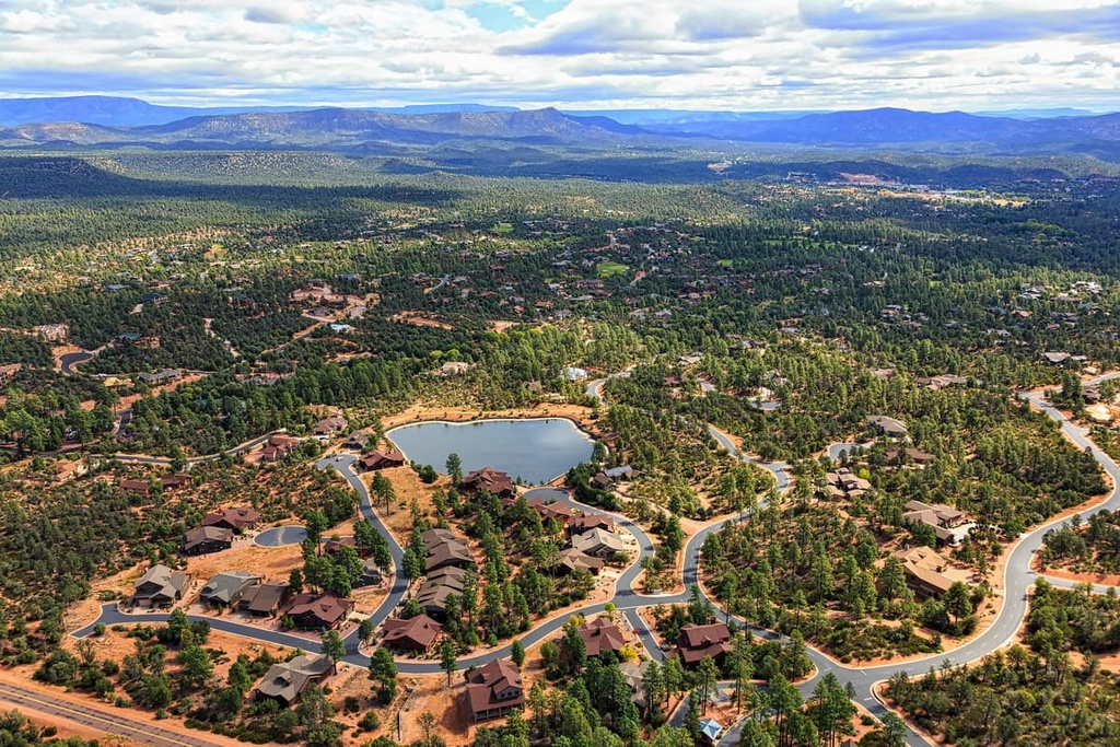
Located in the northern part of Gila County, the town of Payson lies near the geographic center of Arizona, a location that earned it the nickname ‘the Heart of Arizona.”
The town of Payson is surrounded by the Tonto National Forest and serves as a gateway to Arizona’s rugged Mogollon Rim, making it a popular destination for year-round outdoor recreation. In addition to its plethora of outdoor recreation opportunities, Payson boasts a wide range of dining and lodging options for visitors to enjoy.