
Scan the QR code and open PeakVisor on your phone
The Mazatzal Mountains run north-south through central Arizona in the southwestern United States. Falling within Tonto and Coconino National Forests, and Mazatazal and Four Peaks Wildernesses, the range covers a diverse set of habitats from Sonoran desert near the base to ponderosa pine and douglas fir highlands. There are 144 named mountains in the range. At 7,894 ft (2,406 m) and with a prominence of 3,957 ft (1,206 m), Mazatzal Peak is both the highest and most prominent peak.
Located in central Arizona in Gila, Yavapai and Maricopa counties, the Mazatzal Mountains range in elevation from 2,060 ft (628 m) along the Verde River to 7,894 ft (2,406 m) on Mazatzal Peak. The range lies within Tonto and Coconino National Forests. The Mazatzal Wilderness encompasses a northern and central portion of the range, and the Four Peaks Wilderness covers the southern end.
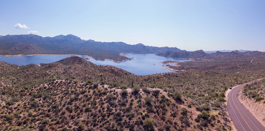
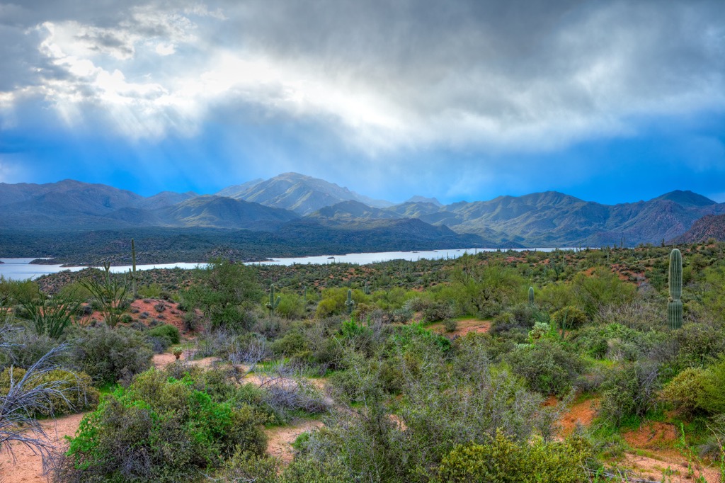
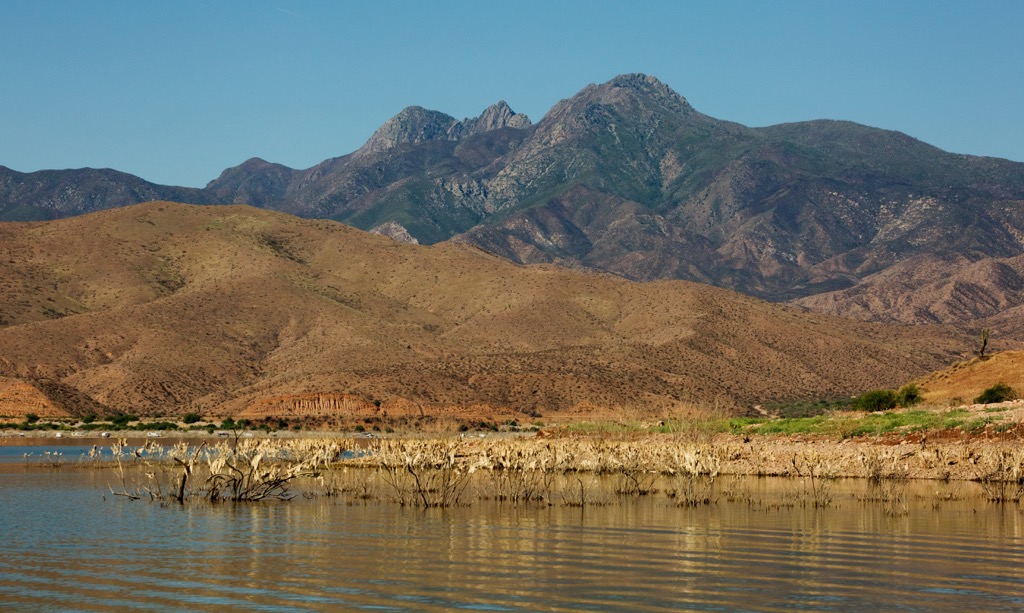
The range houses five watersheds – Verde River, East Verde, Tonto Creek, Sycamore Creek, and Fossil Creek. Verde River and Fossil Creek are Arizona’s two Wild and Scenic Rivers. Over time, streams and rivers in the mountains have carved out deep canyons that support robust riparian ecosystems.
The southern end of the range neighbors Phoenix and the northern extent reaches nearly to Flagstaff. It is located on the Colorado Plateau and the northern edge lies near the Mogollan rim.
The central part of the range is composed of the Mazatzal Group, a series of Precambrian geologic formations. Younger stratified rocks developed during the Tertiary period or later. The Mazatzal Group is surrounded by alluvial fans dating from the Pliocene and Pleistocene periods.
The range’s northern section contains three rock formations called Deadman Quartzite, Maverick Shale, and Mazatzal Quartzite. Mazatzal Quartzite formed via depositions in a coastal delta that later became a terrestrial river delta. This quartzite is erosion resistant and sits above the 500 to 800 ft (150 to 245 m) thick layer of Maverick Shale. Beneath the shale is the Deadman Quartzite.
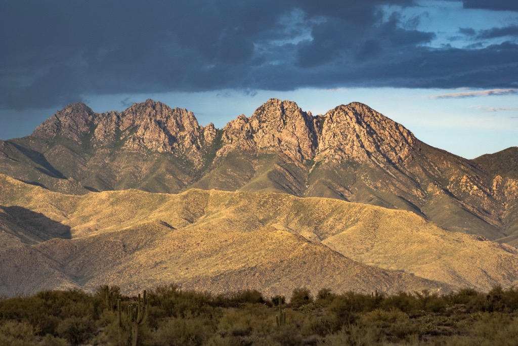
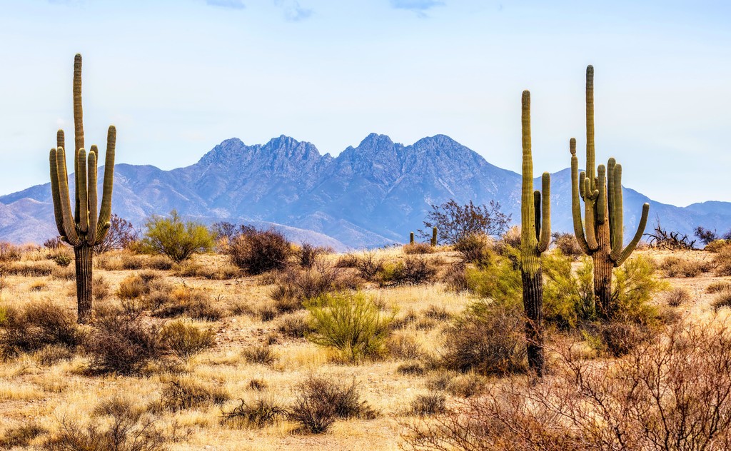
The northeast part of the mountains contains Tapeats Sandstone, which is resistant to erosion and commonly found in the the Grand Canyon. The massif around Four Peaks Wilderness in the south is made up of Precambrian schists and granite. The Painted Cliffs, slightly to the south of the Four Peaks, are made up of ash flows and volcanic tufts from the Cenozoic Age.
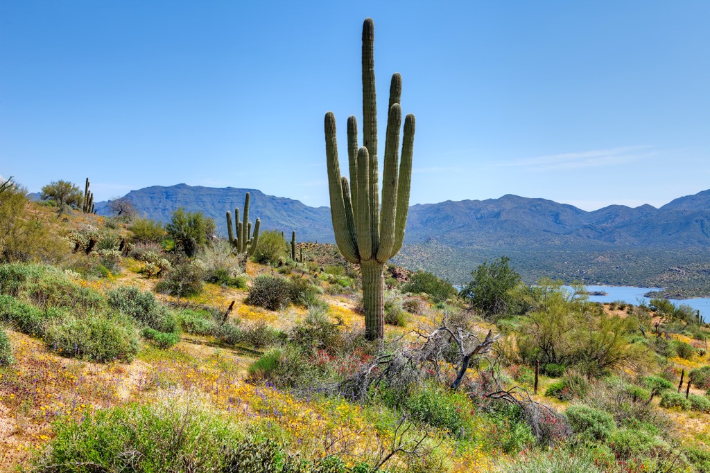
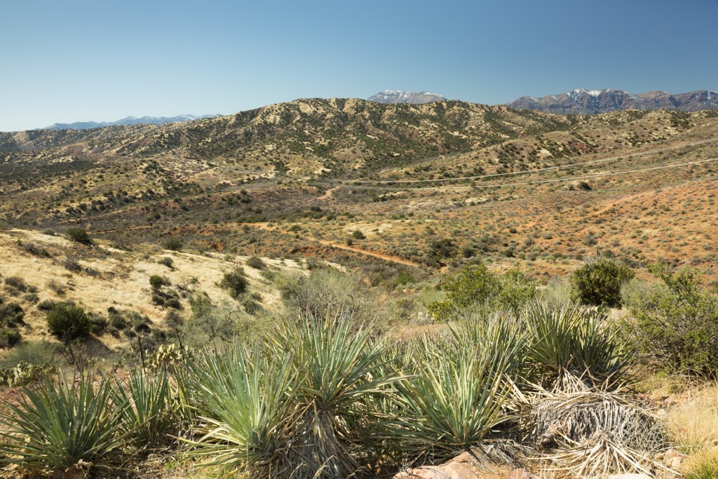
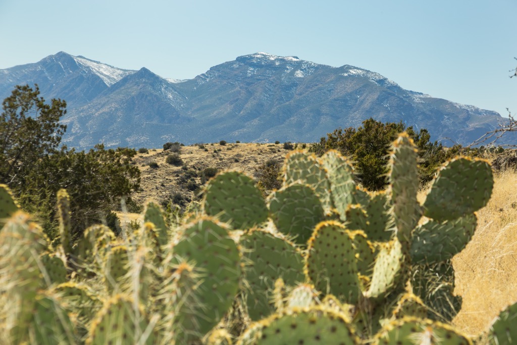
The habitat along the mountains’ base consists of Sonoran Desert shrubland punctuated by enormous saguaro cacti. As the elevation climbs, desert shrubland gives way to semi-desert grasslands, then to mountain shrubs like manzanita, turbinella oak, and gambel oak. At the highest elevations, there are patches of piñon-juniper woodlands and scattered ponderosa pine and Douglas fir. Cottonwoods and sycamores grow along canyons with stream beds.
A number of wildfires, both manmade and natural, have swept across the region over the last few decades, leaving significant portions of the mountains burned and damaged.
That being said, this rugged landscape still supports a diverse range of wildlife, including a number of sensitive, threatened, and endangered species such as the Mexican spotted owl. Past efforts have focused on supporting eagle nesting habitat and reintroducing otters.
Black bear populations thrive here, particularly in the Four Peaks Wilderness area. Other common species include big horn sheep, beavers, javelinas, deer, kit foxes, and mountain lions. Hikers should keep an eye out for rattlesnakes, black widow spiders, centipedes, and milipedes.
Humans have lived along the Verde River as far back as 12,000 years, and have hunted and gathered in the Mazatzal Mountains and Sierra Ancha for thousands of years. Over a thousand years ago, a group called the Hohokam began to make their homes here. They established large villages and had a robust culture of farming, trading, and craft-making. They also constructed hundreds of miles of irrigation ditches near the Salt and Gila Rivers around Phoenix.
Over time the culture split into subcultures, of which the best known is the Salado of Tonto Basin. Around 600 years ago, strain from conflict, droughts and floods caused people living in the area to move out. Their descendants remain today in the Pima, Hopi, and Zuni tribes.
From about 1866 to 1886, conflict between US Army and Native Americans resulted in the forced removal of Apache and Yavapai peoples to reservations at San Carlos and Fort Apache. With Native Americans gone, settlers quickly arrived in the region as miners, farmers, and later sheep and cattle ranchers.
The Mazatzal Wilderness contains nearly 250 mi (400 km) of trails and the Four Peaks Wilderness has a 40 mi (65 km) trail system. Within these wilderness areas, group sizes are limited to 15 people and 15 head of livestock. There can be lightning storms and flash flooding in July and August.
The Mazatzal Divide Trail is a 27 mi (43.5 km) trail running north-south along the range. It is part of an 800 mi (1,287 km) trail that stretches from Mexico to Utah. Elevations along the route range from 3,500 to 7,180 ft (1,065 to 2,190 m). The trail runs between City Creek trailhead along Forest Road 406 and Trail 86 west of the Peeley trailhead.
There are occasional water sources, typically near mile 9 (14.5 km) and about midway, but not consistently available. Parts of the trail are exposed from wildfire damage over the past few years.
Willow Trail is a popular 16.2 mi (26 km) trail that departs from the Sheep Bridge trailhead. It runs east-west and traverses elevations ranging from 2,080 to 6,160 ft (635 to 1880 m). There are several steep sections but excellent views from the trail. A note to horseback riders and packers – the bridge is not recommended for horses.
Another popular route is the Verde River Trail. 27.6 mi (44.4 km) long, it follows the river, at times diverging slightly in the northern section. The trail runs between Willow Spring Trail, a quarter mile east of Sheep Bridge trailhead, and the Twin Buttes trailhead along Forest Road 194.
Several river crossing are required along the way and they may be dangerous depending on water levels and flow. It is best to be cautious when assessing a crossing point.
The Four Peaks Trail is 10 mi (16 km) and traverses the northern and eastern slopes of the Four Peaks and then passes on to Buckhorn Ridge in the southern portion of the Mazatzal Mountains. Both Lone Pine Saddle Trailhead and Mills Ridge Trailhead provide access to it. Elevations along the trail span from 3,800 to 6,600 ft (1,160 to 2,010 m). Some sections are steep and the trail may be hard to follow and it is important to pay attention to markers along the way.
Campgrounds are located throughout Tonto and Coconino National Forests and dispersed camping is allowed in wilderness areas. Nearby cities offer visitors to explore the region’s rich cultural, ecological, and geological diversity.
Home to 1.66 million people, Phoenix, Arizona offers the chance to explore the desert and the Native American heritage of the area. Get outside and enjoy the sunshine by visiting Camelback Mountain, the Phoenix Mountains Preserve, or the red rock formations at Papago Park. But be sure to go early in the day during the heat of summer.
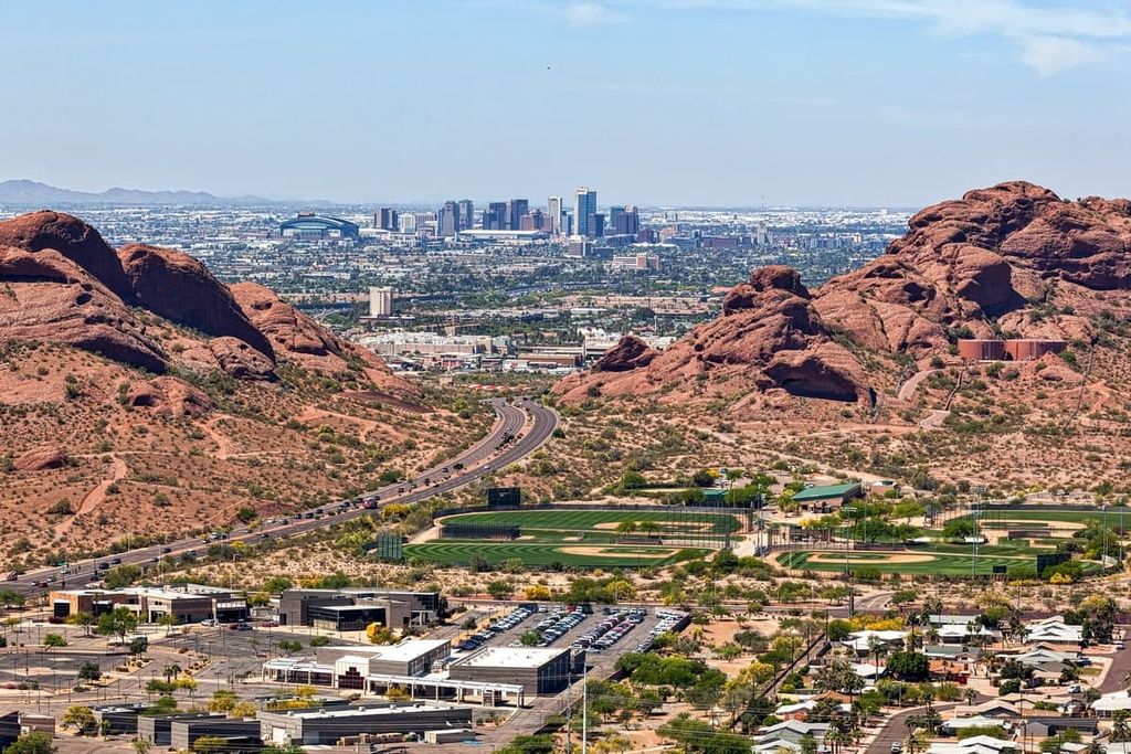
In town, visit the expansive Desert Botanical Garden to experience the beauty and unique adaptations of desert plants. Check out Taliesin West, Frank Lloyd Wright’s winter home, and the Heard Museum with its illuminating exhibits on the culture and history of 22 Native American tribes. Those looking to experience the city’s art district should head to Roosevelt Row.
From resorts and guest ranches to hotels in the city center to campgrounds, a wide range of lodging can be found. The city has a vibrant dining scene offering lots of different cuisines, creative chefs, and an emphasis on local ingredients like peppers, pomegranates, and citrus.
Flagstaff, Arizona has a population of 73,000. This small city in the high country of Arizona boasts beautiful clear summers and more than 100 in (255 cm) of snow in the winter for skiers and snowboarders. It is surrounded by the world’s largest contiguous ponderosa pine forest with miles of trails for hiking and biking.
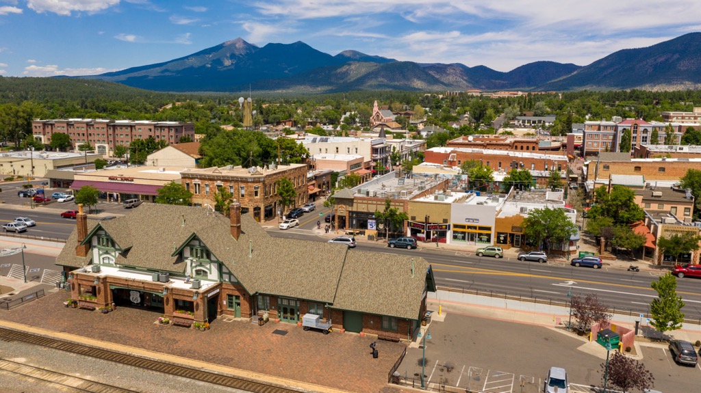
The city is only 80 mi (130 km) from Grand Canyon National Park. Closer still are Walnut Canyon, Wupatki, and Sunset Crater Volcano National Monuments, providing fascinating insight into the Ancestral Puebloan and Sinagua cultures, as well as the region’s geologic history. The Museum of Northern Arizona is also worth a visit as it highlights and celebrates the region’s Indigenous cultures.
There are plenty of options for staying over, whatever your budget and if you want to be in the heart of the city or in the scenic outskirts. Dining options include a wide range of cuisines, a number of breweries, and cute cafes and delis for a quick bite.


