Scan the QR code and open PeakVisor on your phone
The Uinkaret Plateau is located on the Colorado Plateau in the northwestern portion of the US state of Arizona. It lies mainly to the north of Grand Canyon National Park, with portions of the plateau lying within the Grand Canyon-Parashant National Monument, Mount Trumbull Wilderness, and Mount Logan Wilderness. The plateau contains 54 mountains. At 8,015 ft (2,443 m) and with a prominence of 2,959 ft (902 m), Mount Trumbull is both the highest and the most prominent peak.
The Colorado Plateau is composed of a series of smaller plateaus, the Uinkaret Plateau being one of them. The Uinkaret Plateau is located in northwestern Arizona with the majority of the plateau lying north of Grand Canyon National Park. Part of the plateau falls within the boundaries of the Grand Canyon-Parashant National Monument – uniquely situated at the junction of the Mojave Desert and the Colorado Plateau.
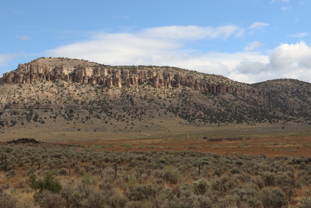
There are two wilderness areas that surround the plateau’s two tallest peaks – Mount Trumbull (8,015 ft/2,443 m) and Mount Logan (7,854 ft/2,394 m). The Mount Trumbull Wilderness occupies 7,880 acres (3,190 ha) north of the Grand Canyon in the southern part of the Uinkaret Plateau. Mount Trumbull is a basalt-capped mesa, its summit hosting ponderosa pine and its slopes supporting piñon pine and juniper forest interspersed with aspen and Gambel oak.
The 14,650 acre (5,930 ha) Mount Logan Wilderness lies to the south of the Mount Trumbull Wilderness and is not well known outside of local knowledge. Elevations range from 5,000 ft (1,525 m) to just under 8,000 ft (2,440 m) on Mount Logan. There is one short hike that offers vistas into a large natural amphitheater known as Hells Hole, and further exploration along the rim rewards hikers with views of the Grand Canyon away from the crowds of the national park.
The Uinkaret Plateau contains the Uinkaret volcanic field with over 213 volcanic cones and numerous basaltic lava flows, though not many tephra deposits remain. The volcanic field spans approximately 600 sq. mi (1,500 sq km) about 50 mi (80 km) north of the Colorado River. It is similar to the better known San Francisco Peaks volcanic field near Flagstaff.
Volcanoes in the field began erupting around 3.6 million years ago but, after initial eruptions, the field experienced a lull of about 2.6 million years. Beginning again around 600,000 years ago, a period of 100,000 years saw intense eruptions. Volcanic eruptions tapered off in frequency and intensity but continued to be active until about 1,000 years ago.
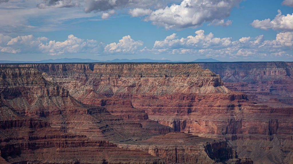
Lava flows from the Uinkaret Plateau spilled into the Grand Canyon creating temporary dams along the Colorado River. The dams have since eroded away but formations remain, such as Vulcan’s Throne, a 705 ft (215 m) cinder cone along the Grand Canyon’s wall.
The plateau’s youngest feature is the 1,000 year old basalt of Little Springs, located just south of Mount Trumbull and north of the Grand Canyon. The basalt is similar to that found at the Sunset Crater Volcano National Monument.
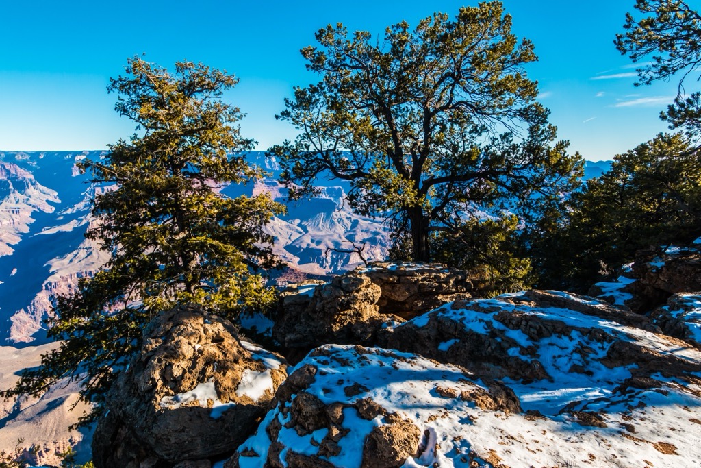
From lowest to highest elevations, the Uinkaret Plateau contains grasslands, sagebrush, piñon-juniper, and ponderosa pine habitats. Thunderstorms are common in the summer, which supports various life zones but should also be a consideration for hikers.
Grasslands typically occur between 4,000 and 5,000 ft (1,220 and 1,525 m) elevation in areas that receive five to eight inches (12 to 20 cm) of rain annually. Common species include blue grama, galleta grass, squirreltail, Indian ricegrass, crested wheatgrass, and Russian wildrye.
Sagebrush habitats grow between 3,000 and 8,000 ft (915 and 2,440 m) in areas that get an average of eight to 16 inches (20 to 40 cm) of precipitation. Various sages and grasses dominate here, including big sagebrush, sandsage, fringed sage, black sagebrush, Begelow sage, squirrel trail, junegrass, western wheatgrass, blue grama, galleta grass, ephedra, cliffrose, and fourwing saltbush. Lower elevations also support agave and a variety of cacti.
Piñon-juniper forest grows between 4,500 and 8,000 ft (1,370 and 2,440 m) and receives between 10 and 20 in (25 and 50 cm) of precipitation each year. In addition to piñon and juniper, sagebrush, cliffrose, blue grama, galleta grass, Indian ricegrass, ring muhly, manzanita, aspen, and Gambel oak are also present here. At the highest elevations, such as the summit of Mount Trumbull, ponderosa pine dominates.
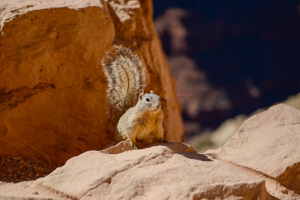
A range of wildlife thrives across the plateau’s ecosystems. Mule deer, Kaibab squirrels, coyotes, bobcats, mountain lions, jackrabbits, skunks, porcupines, bats, wild turkeys, roadrunners, quail, hawks, owls, lizards, skinks, and a handful of snakes are just some of the species that call the plateau home. Bighorn sheep existed historically in the region, although their population suffered a significant decline due to competition and disease from domestic sheep, as well as hunting.
The region around the Uinkaret Plateau has supported human life at least as far back as 7,000 BCE. From the Archaic period (7000 to 300 BCE), humans in the Great Basin region left behind signs of basketry, milling stones, and blankets. The Arizona Strip near the plateau has turned up numerous projectile points dating from this era.
From approximately 300 BCE to 1250 CE, Ancient Puebloan culture developed. This culture practiced corn and squash agriculture. The Southern Paiutes entered between 1200 and 1300, and the Uinkaret Indians also established themselves in the area. With the arrival of explorers, disease and a new slave trade around the Colorado River began to affect Native American tribes in the region before direct conflicts over natural resources.
Beginning around the 1870s, Mormon groups were some of the first settlers to establish themselves in the area. Although not marked by significant violent conflict, Mormon ranchers brought cattle that quickly depleted the natural resources that had been supporting Native tribes. By the 1890s, non-Mormon groups were also vying for land. Surveys on the plateau have shown that there is no mining potential for minerals or oil.
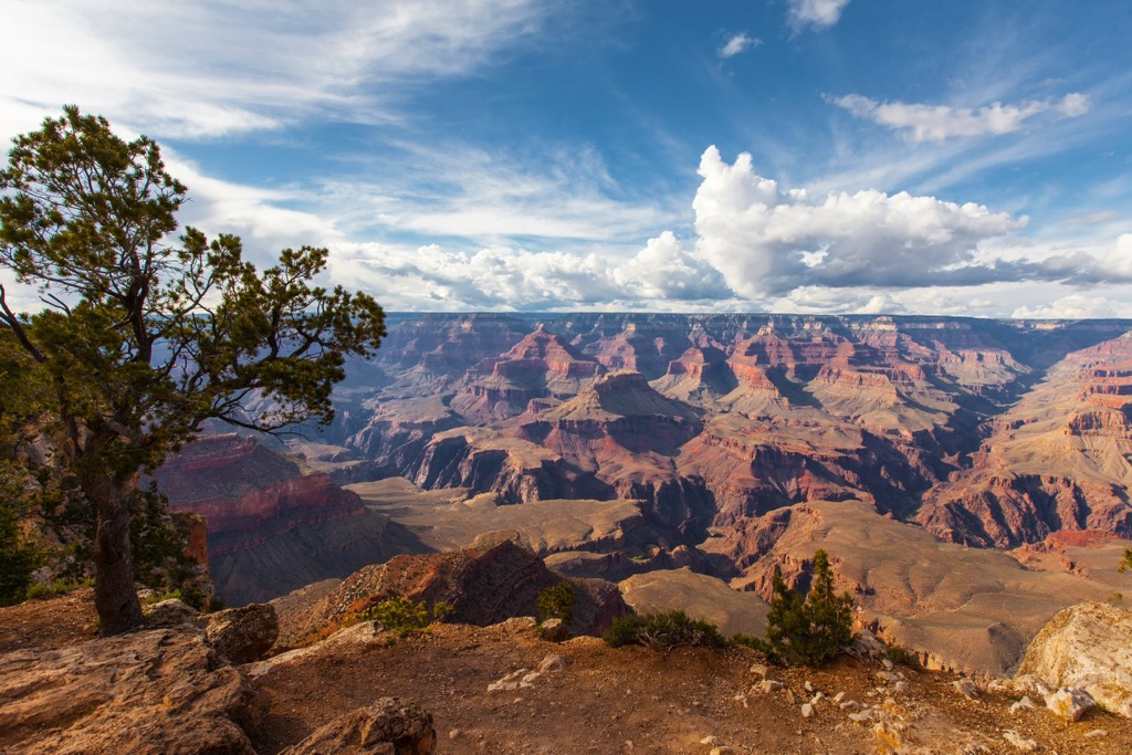
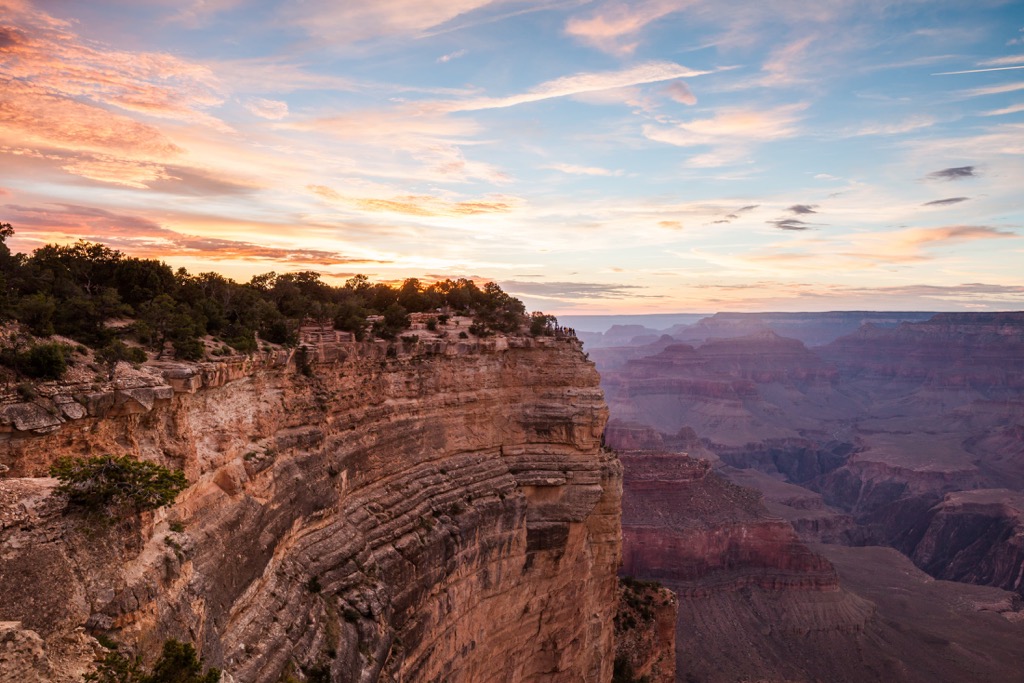
The Uinkaret Plateau occupies a scenic region north of the Grand Canyon and within the Grand Canyon-Parashant National Monument. It is slightly secluded and offers quiet but scenic outdoor opportunities for those looking to miss the crowds of the popular Grand Canyon.
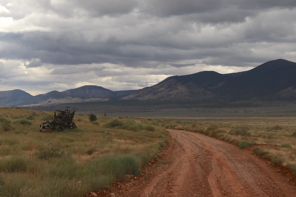
Those looking to cover more ground can take the Mount Trumbull Scenic Loop Drive. The full loop requires a high clearance vehicle and covers around 150 mi (240 km) of unpaved road. Along the way, you’ll pass stunning views of the Grand Canyon and volcanoes, Native American petroglyphs, historic buildings, and herds of cattle, giving a real taste of the American southwest.
The trail to summit Mount Trumbull is about 5 mi (8 km) roundtrip. It climbs through piñon and juniper before entering ponderosa pine near the top. Towards the summit, the trail tapers off. Bring a navigation tool in order to reach the north rim of the mountain. On a clear day, views can sweep up to 90 mi (145 km) away, offering a stunning vantage point over the Colorado Plateau and Basin and Range Province.
Located within the Mount Logan Wilderness, a short one mile (1.6 km) round trip trail ascends Mount Logan with only 245 ft (75 m) elevation gain. The trailhead is located at the end of BLM Road 1064 and the lookout point at the end provides a scenic vantage point into Hells Hole, a colorful natural amphitheater. There are also spectacular views of the Virgin Mountains to the west and the Pine Valley Mountains to the north.
Although there is no trail along the summit rim, hikers can walk through ponderosa pine to reach the south facing rim. This rim looks across the Grand Canyon, allowing one to take in the geologic wonder from the solitude of the wilderness area.
Small towns nearby provide basic amenities and there are options for campsites and dispersed camping around Grand Canyon National Park and the Grand Canyon-Parashant National Monument. Las Vegas, Nevada and Flagstaff, Arizona are two larger cities that can be reached in between five and seven hours by car from the plateau.
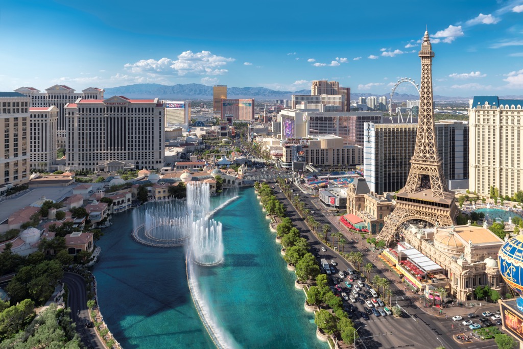
With a full time population of 647,000 people, Las Vegas draws thousands of people with its vibrant city scene. The city is well-known for its casinos, concerts, performances, bars, and dozens of restaurant and lodging options.
Those looking for a quieter experience can explore state parks and wildlife refuges outside the city, staying over in a quiet campsite or RV park.
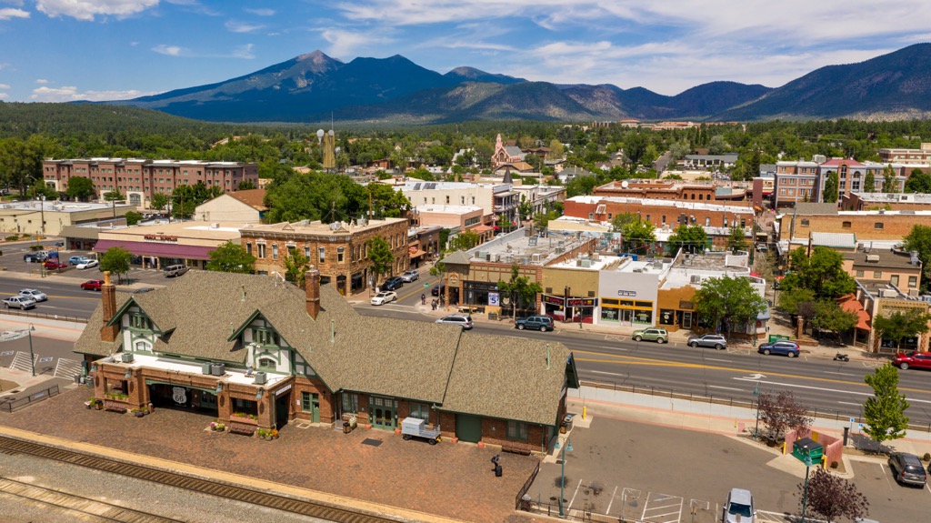
More than seven hours away by car as the road skirts around the Grand Canyon, Flagstaff, Arizona is home to 77,000 people. It is surrounded by the world’s largest contiguous ponderosa pine forest and, at nearly 7,000 ft (2,130 m) elevation, offers clear summer hiking and over 100 in (255 cm) of snow in the winter for winter sport enthusiasts.
The city is ideally located for day trips to the Grand Canyon and the Sunset Crater Volcano National Monument, and to cultural sites at Walnut Canyon National Monument and Wupatki National Monument.
If you’re looking for local flavors, the city’s dining scene does southwestern and Mexican food exceptionally well. There’s also a range of options from breweries and steakhouses to cafes and international cuisines. Lodging around the city is varied whether you prefer a familiar hotel, a quirky B&B, or a scenic campsite outside the city.