Scan the QR code and open PeakVisor on your phone
The Chuska Mountains span 60 mi (97 km) in northwestern New Mexico and northeastern Arizona in the United States and are encompassed by the Navajo Nation. There are 151 peaks. Roof Butte is the highest at 9,780 ft (2,981 m) and the most prominent (3,127 ft/953 m).
Located in San Juan County in northwestern New Mexico and Apache County northeastern Arizona, the Chuska Mountains measure around 60 mi (97 km). The range is located within the Navajo (Diné) Nation and the Navajo name is Níłtsą́ Dził which means “rainy mountain”. In Navajo tradition, Chuska Peak (8,780 ft/2,676 m) is thought to be the head of a man called Y’odí Dził.
The Chuska Mountains are the only native headwaters for the Navajo Nation. They act as a divide between several river drainages – Chaca River to the east, Chinle Wash to the west, and Red Wash to the north. Only the streams on the western side of the range flow perennially. Red Rock Valley separates the Chuska Mountains from the Carrizon Mountains to the north.
The range rises from surrounding lowlands with the mountain bases sitting between 6,500 and 7,000 ft (1,980 and 2,135 m) elevation. The average elevation in the range is 9,000 ft (2,745 m). The landscape is marked by mesas, buttes, and knobs. Roof Butte (9,780 ft/2,981 m) is the tallest point and formed from two volcanic necks at the northern end of the range.
The Lukachukai Mountains are a spur extending to the northwest. This spur contains peaks such as Beautiful Mountain (8,852 ft/2,698 m), the third most prominent peak in the range.
The range lies on the northeastern side of the Defiance Uplift along the southwestern edge of the San Juan Basin. It is part of the Colorado Plateau. The range is primarily composed of blocks of sedimentary rocks overlaid by basaltic volcanic rocks.
The sedimentary rock was laid during the Tertiary period and volcanic activity and intrusions occurred during the mid-Cenozoic, about 30 million years ago. During the Pleistocene, the uplands in the region received more precipitation and cooler temperatures. This led to more colluvial deposits than are found in the surrounding lowlands.
A mix of canyons, meadows, and forests make up the mountain landscape. These uplands receive up to 20 in (50 cm) of rain per year and support numerous lakes and swamps that form in rock basins. Many of these bodies of water evaporate by late summer or early fall.
Thick forests of Colorado blue spruce, alpine fir, and Douglas fir grow above 9,000 ft (2,745 m). Ponderosa pine, piñon pine, and oak grow above 7,000 ft (2,135 m), and are interspersed with meadows. Spruce, fir, and aspens grow in the canyons.
A number of birds make their homes in or pass through the region including orioles, crows, grosbeaks, kestrels, vireos, swifts. Bluebirds, towhees, flickers, chickadees, warblers, hummingbirds, jays, flycatchers, woodpeckers, hawks, nighthawks, and owls. Black bears, coyotes, bobcats, mountain lions, deer, elk, coyotes, foxes, and rabbits are a few of the main mammals that occupy the area.

The first Spanish explorers arrived in the region in the mid-1500s, in a search for precious metals and to convert Native Americans to Christianity. For centuries, Navajo shepherds brought their sheep to the forests and meadows during the summer. Wool from the sheep has supported a long tradition of textile weaving. Today the Chuska Mountains remain part of the Navajo Nation.
In the 1970s, the government enforced stock-reductions which nearly led to the extinction of the Navajo-Churro sheep. Since then, the breed is making a comeback. However, this forced herd reduction forced many Navajo to seek out alternative livelihoods, creating a rift with the traditional way of life.

Hiking permits must be obtained from Navajo Nation prior to any hiking or backpacking in the Chuska Mountains. Trails are usually snowed in during winter and spring.
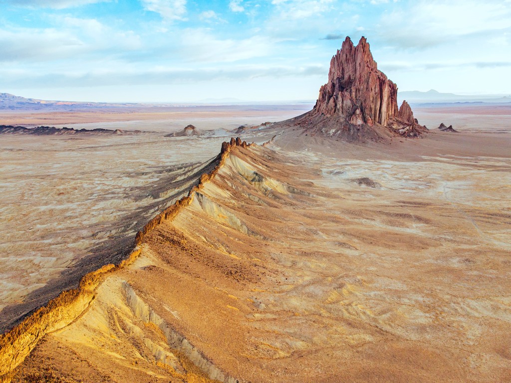
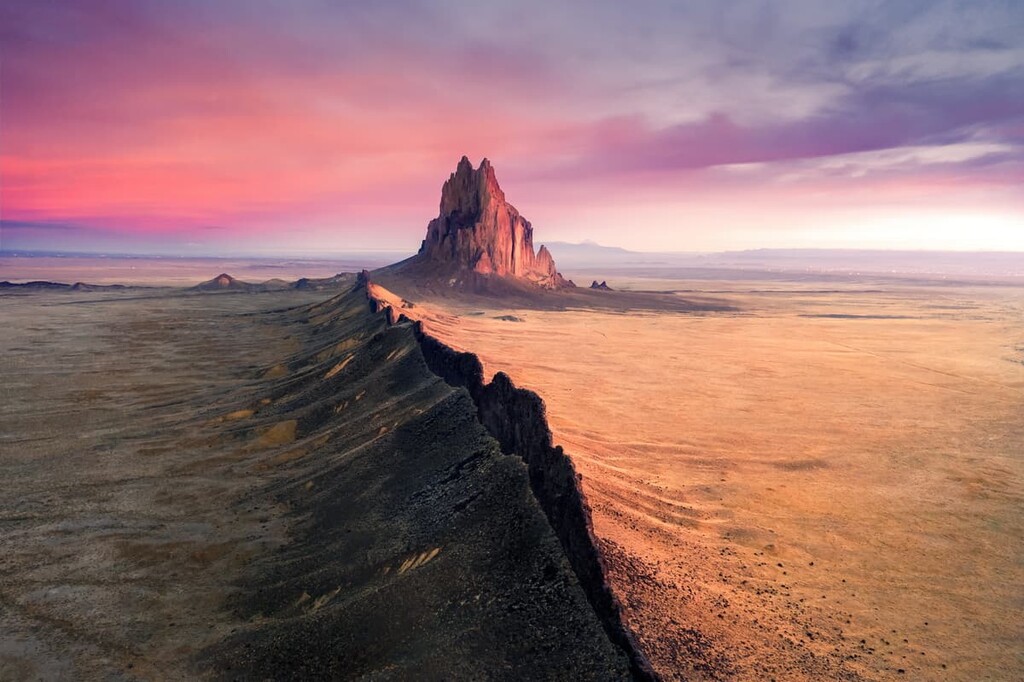
The second most prominent peak in the range, Ship Rock, can be ascended by rock climbers but the permit requirements for doing so are hazy.

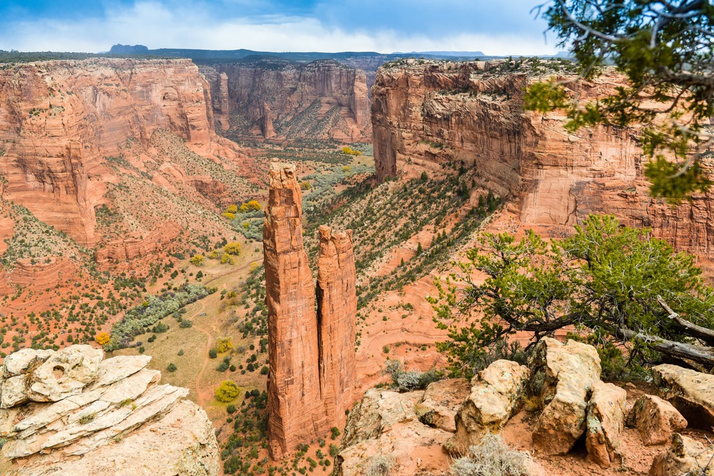
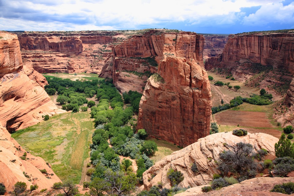
The Canyon de Chelly National Monument preserves a landscape that has been home to humans for the past 5,000 years and is inhabited by the Navajo today. A visit to the national monument can include scenic drives along both rims with overlooks to the canyon below or canyon tours (for a fee) on foot, horseback, or in a vehicle. The White House Trail, when open, is 2.5 mi (4 km) roundtrip with 600 ft (183 m) elevation change. Cottonwood Campground is open on a first-come, first-serve basis.
p>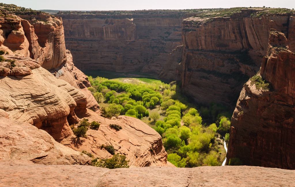
The trail to the top of Roof Butte (9,780 ft/2,981 m), the tallest peak in the range, is straightforward and follows a service road to a fire tower on top. Part of the beauty comes from the drive to the trailhead. The peak is fairly remote and not often visited and the road passes old forests, lush meadows, and streams running through canyons.
The trail to the summit of Beautiful Mountain (8,852 ft/2,698 m) is 1.7 mi (2.7 km) with a little over 1,000 ft (305 m) elevation gain. Views from the summit sweep to the east across the New Mexican landscape. You can also spot Ship Rock, a distinct breccia and basalt formation on the end of an old volcanic rift.
The east route up the mountain is not technical but also does not follow a maintained trail. General directions are to head northwest from the parking area up the brushy slope. The climb to the first ridge is about 250 ft (75 m), including over some open scree areas.
From the first ridge, follow the incline towards the notch in the vertical walls, aiming for the far right side. Near the far right wall, look for a dry stream bed and game trail to follow to reach the top.
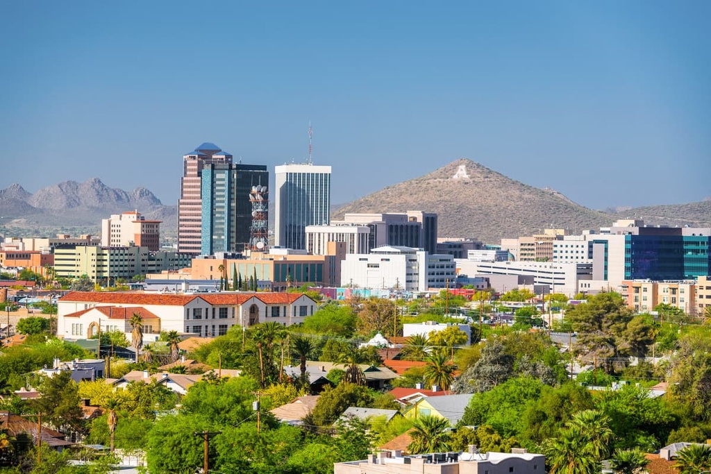
In addition to Albuquerque, Flagstaff, and the slightly smaller town of Farmington, the reservation is also near towns in southwestern Colorado such as Durango.
Albuquerque has a population of 560,000 people and lots to offer by way of outdoor recreation and culture. Hike the Sandia Mountains, paddle in the Rio Grande, bike on the many paths around the city, get a birds eye view from a hot air balloon, or take the Sandia Aerial Tramway to Sandia Peak’s summit at over 10,000 ft (3,050 m).
Explore the culture and history of the area by visiting Petroglyph National Monument, the Indian Pueblo Cultural Center, the Georgia O’Keeffe Museum, or the numerous galleries downtown.
The city offers some of the best of New Mexican cuisine with Mexican, Native American, and Spanish influences. Dining options include Mexican, wineries, food halls, vegetarian cafes, sushi and more. The city has a variety of accommodation for all budgets and styles – hotels, motels, B&Bs, resorts, RV parks, and campgrounds.
Flagstaff, Arizona, population 73,000, is surrounded by the world’s largest contiguous ponderosa pine forest. This mountain city gets more than 100 in (255 cm) of snow per year, making it a perfect destination for hiking and biking in warmer weather and skiing and snowboarding in the winter. It is an International Dark Sky Community and offers spectacular views of the night sky.
Sunset Crater Volcano, Walnut Canyon, and Wupatki National Monuments are all nearby and give visitors a fascinating glimpse of the region's geologic and cultural history. Grand Canyon National Park is a convenient day trip from the city, located only 80 mi (130 km) away. In the city itself, the Museum of Northern Arizona depicts the rich history and culture of the region.
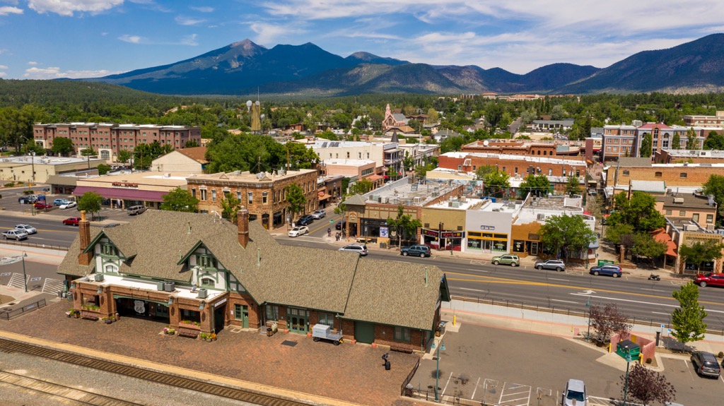
Choices of restaurants include Mexican, burger joints, breweries, cafes, Chinese, Vietnamese, and pizza parlors. Lodging spans from campgrounds and RV parks to rental cabins to hotels.
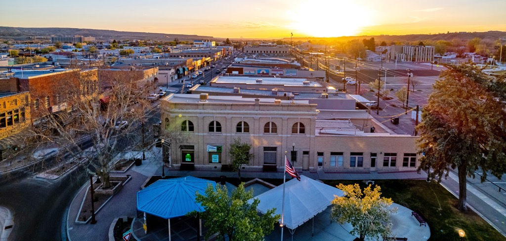
A smaller town but closer to the Chuska Mountains, Farmington, New Mexico has a population of 45,000 people. Explore the Animas River Trails or the Bisti Badlands/De-Na Zin Wilderness to get a sense of the area’s nature. The town is not far from the Four Corners. Hopi, Navajo, Ute, and Jicarilla Apache land neighbors the town. Visit the Museum of Navajo Art and Culture to learn a bit more about the Navajo Nation.
The town has a modest range of restaurants including Asian, New Mexican and Native American cuisines, and BBQ. There are campgrounds, RV parks, hotels, motels, and B&Bs.