Scan the QR code and open PeakVisor on your phone
The Santa Maria Mountains are a 16 mi (25 km) long range located northwest of Prescott, Arizona in Yavapai County in the southwestern US. Prescott National Forest, Apache Creek Wilderness, and Juniper Mesa Wilderness overlap the mountains. There are 45 named mountains in the range. At 7,267 ft (2,213 m), Camp Wood Mountain is the tallest peak and the most prominent (1,663 ft/507 m).
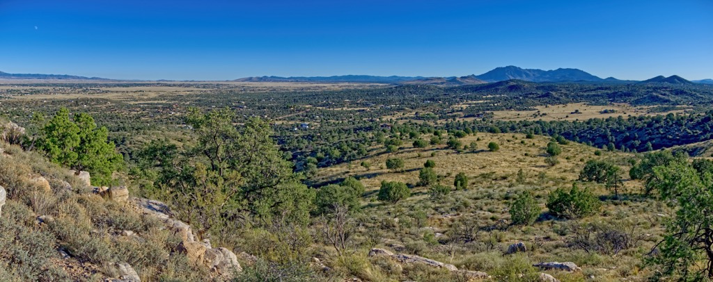
The Santa Maria Mountains of Yavapai County in northwest central Arizona fall within Prescott National Forest. They are neighbored by the Juniper Mountains, Sierra Prieta, Bradshaw Mountains, Black Hills, Mingus Mountains, Black Mesa, and Verde River headwaters. The range is about 16 mi (25 km) long and situated within a landscape of mesas and mountains. Camp Wood Mountain (7,267 ft/2,215 m) and Hyde Creek Mountain (7,260 ft/2,213 m) are the tallest peaks in the range.
There are two wilderness areas preserving sections of the mountains. The Juniper Mesa Wilderness contains Juniper Mesa (7,067 ft/2,154 m) and Gobbler Knob (6,972 ft/2,125 m). It was established in 1984 and spans 7,554 acres (3,057 ha).
A flat-topped mesa is the distinct feature of the wilderness. The primary vegetation is pinyon pine and Utah juniper on southern slopes and ponderosa pine and alligator juniper on northern slopes. Elevations range from about 5,600 ft to 7,000 ft (1,700 m to 2,135 m) and there are seven maintained trails totalling about 15 mi (24 km) of trails. There are no perennial water sources.
Apache Creek Wilderness lies to the north and includes Granite Knob (6,604 ft/2,013 m). Established in 1984, it protects 5,628 acres (2,278 ha) of rolling hills, granite boulder outcroppings, and pinyon, juniper, and ponderosa pine woodland.
The wilderness encompasses three natural springs and important riparian habitats. The water and vegetation make it an appealing habitat for mountain lions and a number of birds. Elevations run between 5,200 ft and 6,900 ft (1,585 m and 2,100 m). There are about 5 mi (8 km) of maintained trails in the wilderness.
The Santa Maria Mountains are part of the Colorado Plateau near the Arizona Transition Zone. This zone separates two significant tectonic provinces – the Colorado Plateau and the south Basin and Ranges province. The region has experienced extensive volcanic activity and tectonic extension in recent geologic history.
During the Proterozoic period, continental blocks collided and led to mountain building events beginning around 1.8 billion years ago. Subsequently, the region experienced metamorphism and volcanism. There are numerous granitic rock intrusions.
The south face of Juniper Mesa features limestone cliff bands, distinct from the surrounding granite landscape. You can spot Tapeats sandstone, Martin limestone, and Redwall limestone. This mesa indicates the historical extent of the Colorado Plateau.
Prescott National Forest encompasses multiple habitats from desert floor to mountain tops. Sonoran Desert transitions to chaparral communities, and from there to pinyon pine, juniper, and eventually Ponderosa pine. Willows thrive along waterways and oak is interspersed throughout the landscape.
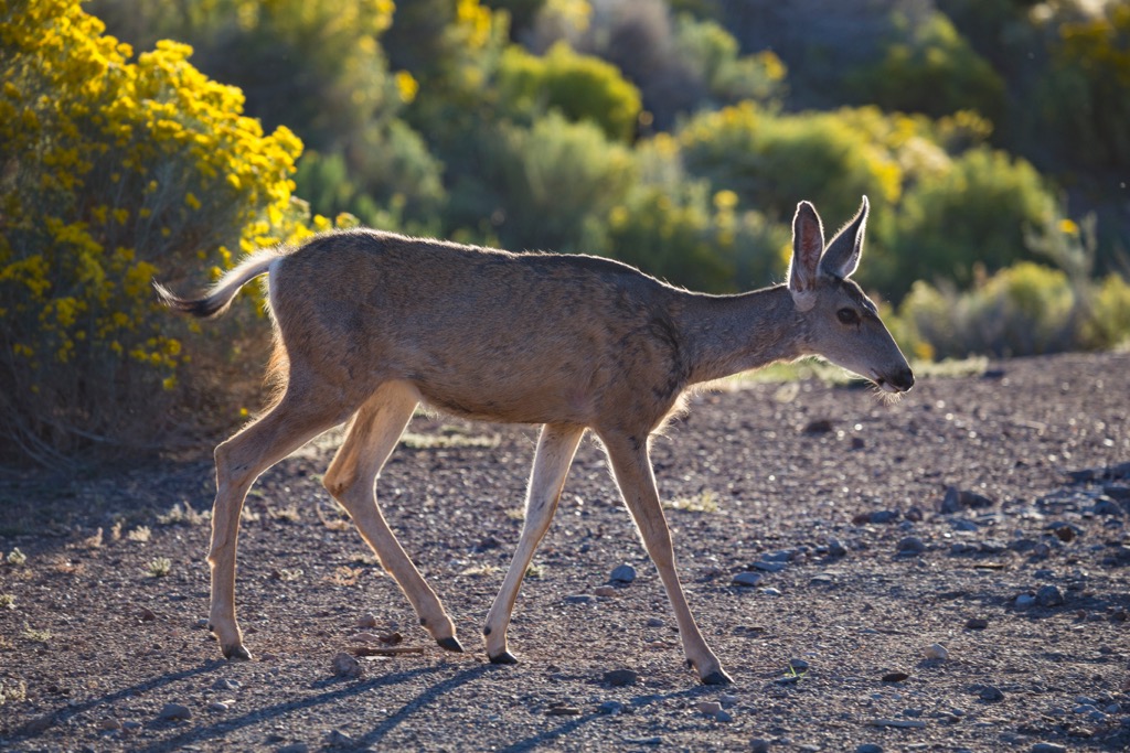
Common species that reside in the mountains include mule deer, elk, javelinas, black bears, coyotes, mountain lions, bobcats, rabbits, and Abert’s squirrels.
The risk of wildfire in this region has increased in recent years. This is due to more contact between humans and wild spaces, as well as the Forest Service suppressing fires. This allows more small trees and chaparral to grow, providing more tinder and bigger blazes when fires do occur.
The Yavapai have lived in central Arizona for centuries. They can be divided into several bands by region with the Yavapai-Prescott tribe living around what is present day Prescott. The tribe made their living by hunting and gathering until the 1860s when they began to clash with settlers.
The Prescott Forest Reserve was created 1898 to protect local watersheds. The mountains surrounding Prescott had been heavily mined and logged beginning in 1863 when gold was found in the Bradshaw Mountains. The reserve had to be expanded the year after its establishment because illegal logging was still occurring on public lands.
The cattle industry arrived in the region in 1869 and quickly became one of the state’s leading industries. The construction of railroads, the Southern Pacific Railroad in 1881 and the Atlantic and Pacific Railroad in 1882, facilitated the growth of ranching.
In 1908, Prescott National Forest was established. Management continued to struggle to prevent illegal logging. By the 1920s, more enforcement helped reduce logging but overgrazing continued to be an issue for a number of years.
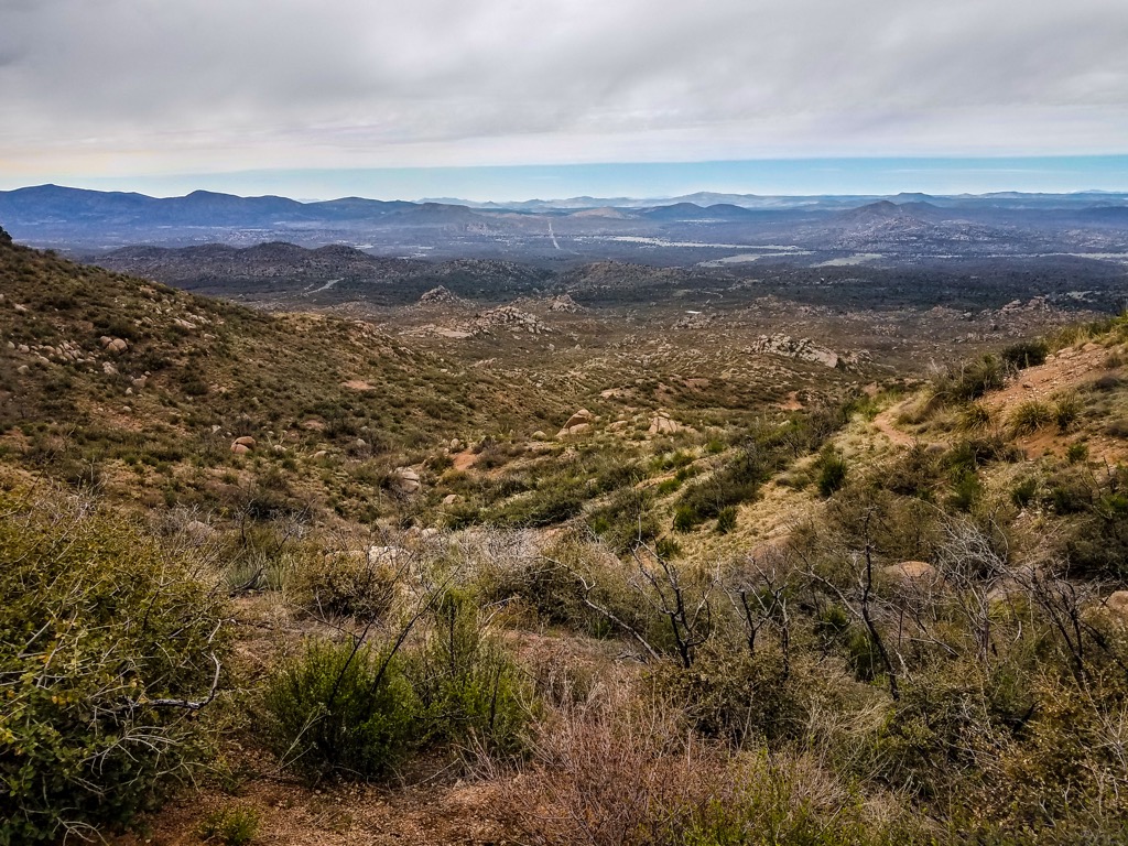
The hikes in the Santa Maria Mountains are scenic but sometimes overlooked for taller peaks in nearby ranges. There are trails in both Apache Creek and Juniper Mesa Wilderness, as well as a scenic off-road driving loop.
The trailhead for Hyde Creek Mountain is near the historic cavalry post Camp Wood. A high clearance vehicle is recommended to reach the trailhead.
The trail passes through oak, juniper and ponderosa pine woodlands. After passing through a metal gate, the trail forks and a spur trail for Brown Spring shoots off to the left. Stay right for Hyde Mountain. Once past the treeline, the vistas begin. Climbing along two saddles to reach the summit, a historic fire tower from 1936 marks the top. It is 4.4 mi (7.1 km) roundtrip with the elevation climbing from 5,780 ft to 7,260 ft (1,760 m to 2,213 m).
Apache Creek Trail #9905 is 5.6 mi (9 km) one way and the best maintained trail in the Apache Creek Wilderness. It skirts north-south along the western side of the wilderness. Where it crisscrosses Apache Creek, walnuts and willows shade the trail. The remoteness of this area, the water, and the lush riparian habitat attract a lot of wildlife. The trail ends at the junction with Graver Wash Trail #9904 in an open meadow.
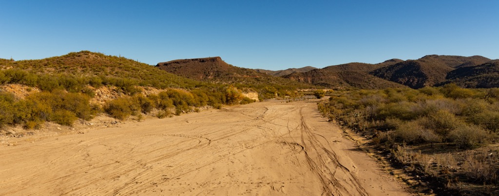
The Santa Maria Mountain Loop is a 35 mi (56 km) off-road driving loop through the range. It is best done with a high clearance vehicle. The route passes historical sites such as Old Walnut Creek Cemetery and Walnut Creek Station. Although there are no official campgrounds, there are plenty of great spots to set up camp.
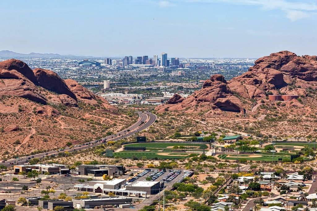
About an hour away to the southeast, Prescott Arizona is a small city with a lot to offer. Slightly further south is the state capitol, Phoenix.
Home to 47,000 people, Prescott has lots of options for those looking to get outside or soak up some regional culture. Eight wilderness areas and Prescott National Forest surround the city, and miles of trails invite hikers and mountain bikers to explore. The Prescott Lakes are ideal for kayaking and paddleboarding.
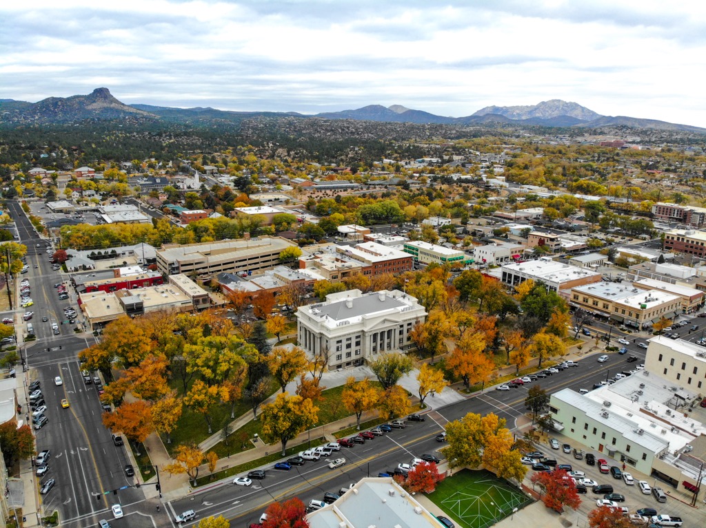
If you’re interested in Prescott’s Native American and Old West history, check out the Sharlot Hall Museum, the Phippen Museum, and the Museum of Indigenous People. Explore Whiskey Row – a historic neighborhood with Old West Saloons – or time your visit to catch the world’s oldest rodeo.
The city has a modest range of restaurants, featuring American classics, pizzerias, and Mexican and southwestern food. Hotels, motels, cabins, campgrounds, and RV parks are all accommodation options.
Phoenix has a population of 1.625 million people. Popular outdoor spots include Camelback Mountain, Papago Park – a series of paths through impressive red rock formations, and the Desert Botanical Garden. Top cultural attractions include the Heard Museum, celebrating the culture of 22 regional Native American tribes; Frank Lloyd Wright’s winter home Taliesin West; the Musical Instrument Museum; and the Phoenix Art Museum.
If you’re exploring around town, be sure to visit a few of Phoenix’s distinct neighborhoods. Roosevelt Row houses the city’s arts district. Old Town Scottsdale is best for shopping, dining, and nightlife. Head to Melrose District for antiques, art, dining, and dancing. There is no shortage of dining options in the city. In particular look for top notch Mexican and southwestern restaurants. Hotels range from budget to luxury, and B&Bs, campgrounds, and RV parks are also readily available.