
Scan the QR code and open PeakVisor on your phone
Oaxaca is one of 31 states in Mexico. Located in the southwest, it is the country’s most culturally and biologically diverse state. Oaxaca has a significant coastline along the Pacific Ocean and both the Sierra Madre del Sur and Sierra Madre del Norte (an extension of the Sierra Madre Oriental) mountain ranges run through it, making for incredible hiking opportunities in multiple ecosystems including temperate forest and humid or dry tropical forest. There are 2786 mountains in the region. The tallest is Cerro Nube Flane at 3,720 m (12,205 ft). It is also the most prominent and rises 2,153 m (7,064 ft) from its surrounding landscape. However, nestled deep in the surrounding mountain range, this peak is fairly inaccessible.
Oaxaca is located in the southwest of Mexico and, at 93,952 km2 (36,275 mi2), is the fifth largest state. It contains 570 municipalities and supports more cultural and biological diversity than any other part of the country. It is bordered by the states of Veracruz to the north, Chiapas to the east, Guerrero to the west, and Puebla to the northwest. Oaxaca’s southern border constitutes a significant stretch of coastline along the Pacific Ocean. The capital city is Oaxaca de Juárez, often referred to simply as Oaxaca, and is located in the center of the state.
There are three national parks in Oaxaca – Parque Nacional Lagunas de Chacahua, Huatulco National Park, and El Chico National Park. Many of the mountains, forests, and other lands are managed by local communities, creating a unique and extensive range of idigenous and community conservation areas. For this reason, there are fewer national parks but still ample opportunities to enjoy the region’s natural features.
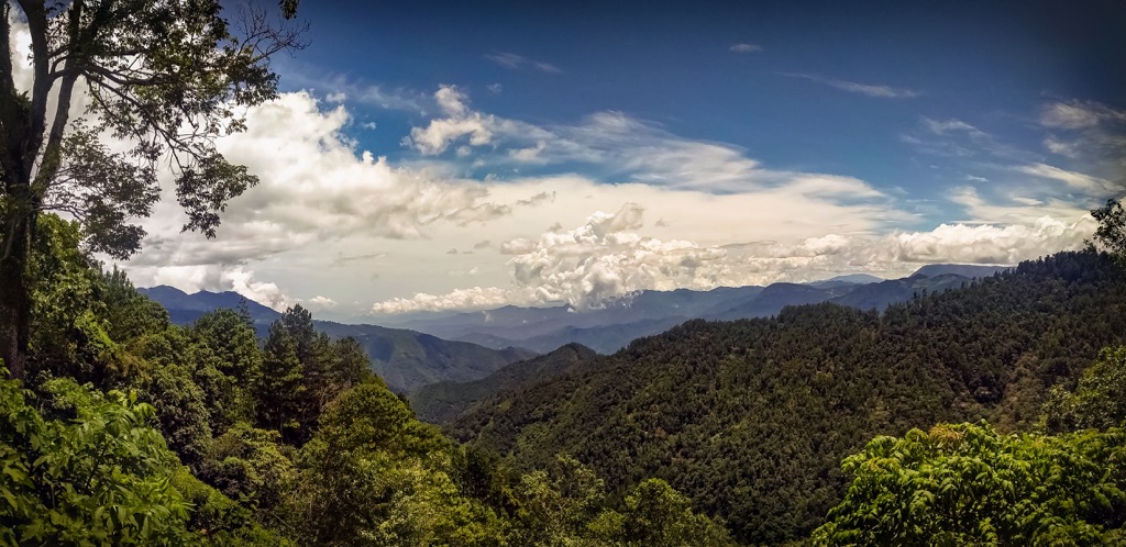
The state is home to two mountain ranges. The Sierra Madre de Oaxaca is also known as the Sierra Norte and, as its name implies, is the northern of the two mountain ranges and runs generally northwest to southeast through the state. The Sierra Madre del Sur lies parallel to the south. Both mountain ranges are extensions of ranges that, further north, are known as the Sierra Madre Oriental (East) and Sierra Madre Occidental (West).
The name change comes from the orientation of Oaxaca at the southern portion of Mexico – what ran along the east coast north of Oaxaca curves to be the northern range, and likewise, the range running along the country’s western coast becomes situated to the south. Between the mountains are raised valleys, typically at elevations between 1,400 and 1,700 m (4,500 and 5,500 ft).
These mountains are composed mainly of ancient metamorphic rocks and younger igneous and sedimentary rocks. Granites and granodiorite are two primary surface rocks, with occasional limestone mixed in. The schists likely date back to the Cenomanian age, 100.5 to 93.9 million years ago; the limestone to the Turonian 93.9 to 89.8 million years ago; and the granodiorite is post-Turonian.
The region lies close to the Tehuantepec fracture zone where the Cocos tectonic plate slips beneath the southern portion of the North American plate. The Cocos plate is moving northeast 5 to 7 cm (2 to 2.8 in) per year, a fairly significant rate of movement for a tectonic plate. Because of this, the area is prone to frequent, and sometimes significant, seismic activity.

Oaxaca is Mexico’s most biologically diverse state and at least 70% is communally managed. These community-run areas include designated agricultural zones, protected forests with comprehensive land-use rules, sacred natural sites, and wildlife management areas.
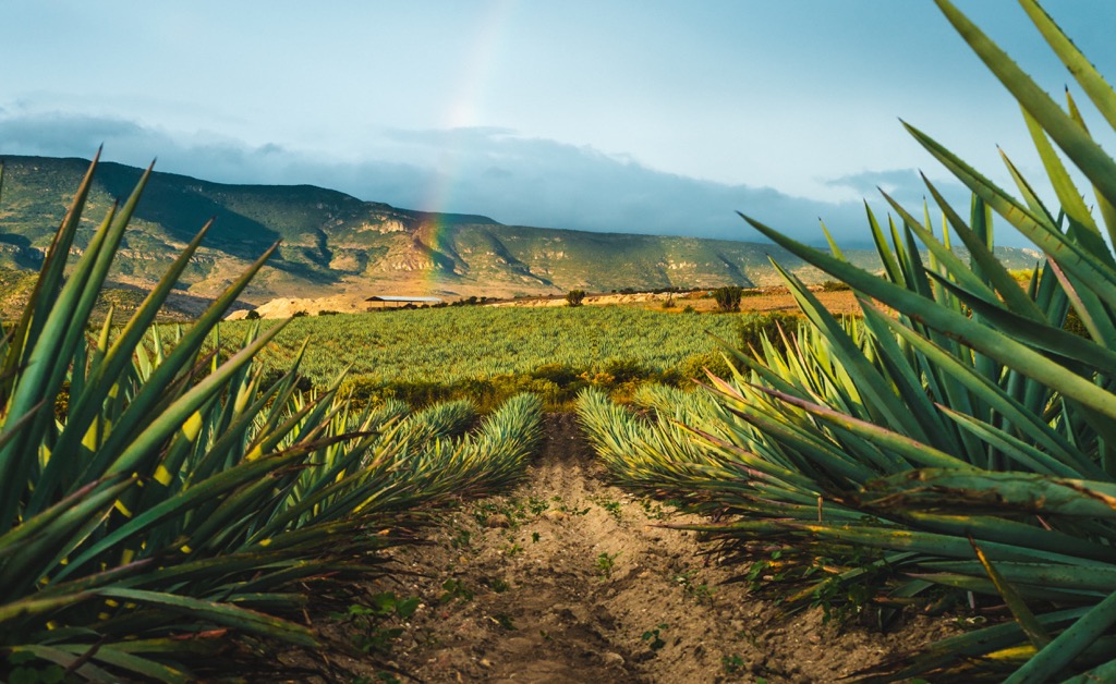
The climate tends to be temperate along the coast and slightly cooler inland due to higher elevations. The capital city of Oaxaca sits just above 1,500 m (5,000 ft) in elevation and one is likely to see lots of cacti and agave around the central valley.
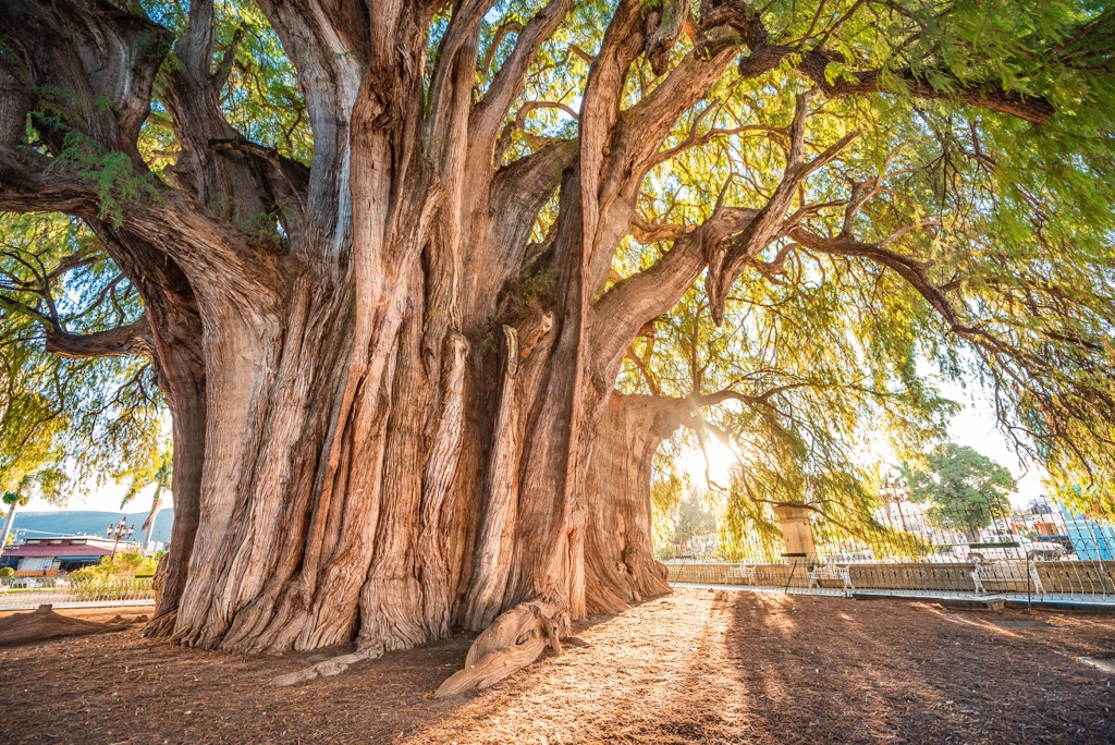
Mexico’s national tree is the Montezuma cypress. This tree is easily distinguished by its enormous, buttressed roots. Several kilometers south of Oaxaca city, one can visit the arbol del Tule (Tule tree), a Montezuma cypress holding the world record for the stoutest trunk. Oaxaca experiences two seasons – the rainy, slightly cooler summer and the dry, warmer winter.
Due to the mountain ranges and their varying elevations, influence from the Pacific Ocean and Gulf of Mexico, and its proximity to Isthmus of Tehuantepec (the narrowest stretch of land between the two bodies of water), Oaxaca has an incredible array of ecosystems and microclimates and biodiversity to match.
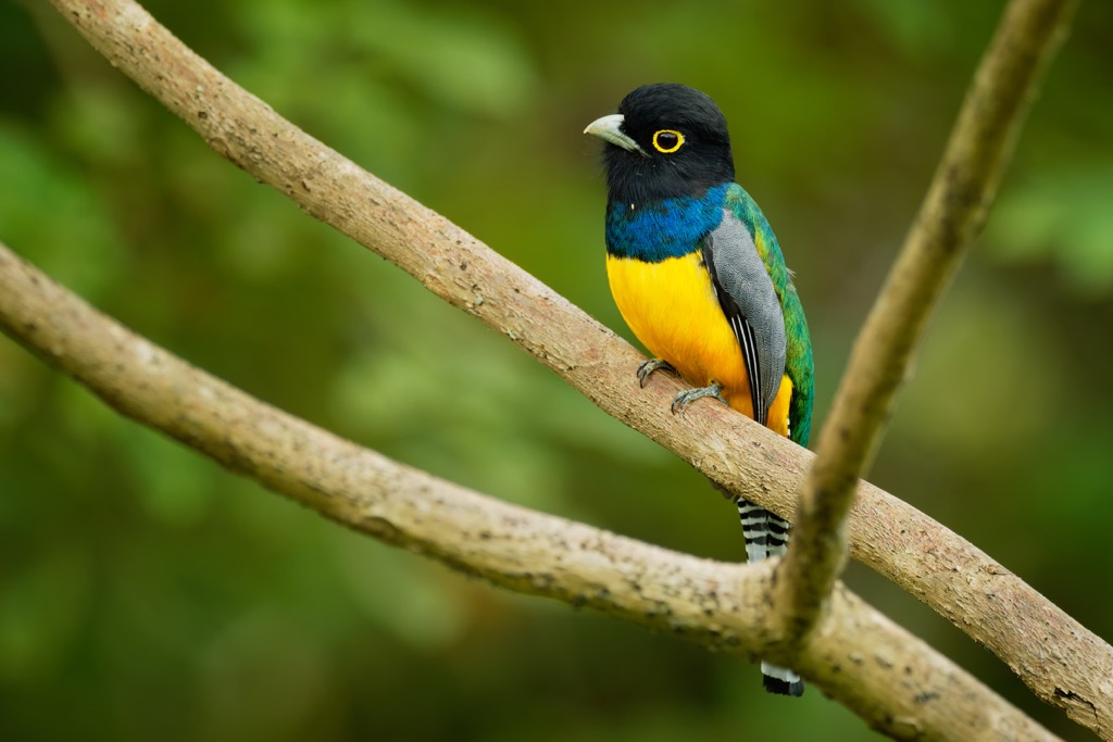
Nearly 750 bird species live in Oaxaca, as well as more reptiles and amphibians than any other state. Oaxaca sits along several major bird migration routes – the Pacific, Central, and Mississippi flyways.

Five main forest systems are present in the state, all with unique flora and fauna compositions.
Temperate pine-oak forests occur primarily between elevations of 2,150 and 3,000 m (7,000 and 10,000 ft). This is the dominant forest type. Pines prefer cooler and wetter areas while oaks tend to favor drier and lower elevation slopes, typically found inland and facing away from the Pacific Ocean.
There are ten pine species, among them the Montezuma pine, Mexican white pine, and Chiapas white pine. There are also several species of oak including yellow oak and netleaf oak. Ferns, bromeliads, agaves, and wildflowers grow in the understory of this forest type and sometimes on the trees themselves.
Among the mammals commonly found here are the white-nosed coati, white-tailed deer, Central American red brocket deer, puma, and margay. A few of the birds that live here are mountain trogons, bue mockingbirds, elegant euphonias, red warblers, berylline hummingbirds, azure-crowned hummingbirds, and the endemic dwarf jay.
You’ll likely spot the southern crevice spiny lizard and emerald spiny lizard, or glimpse a Oaxacan pygmy rattlesnake. Species such as the shiny peeping frog and Cochran’s false brook salamander live within certain microclimates in these forests.
The valley ecosystems occur between 1,400 and 1,700 m (4,500 and 5,500 ft) elevation. They are higher elevation plateaus that receive less precipitation as bordering mountains block rainfall. This landscape is dominated by shrubs, cacti, yucca, agave, morning glories, and grasses.
This type of ecosystem supports higher human populations and has experienced a fair amount urban and agricultural development. For this reason, you are not likely to spot large mammals here as they keep to the more secluded higher slopes of the mountains.
Animals that can be found here include coyotes, gray fox, red squirrels, virginia opossums, rabbits, and ringtails. You’ll likely see vermilion flycatchers, blue grosbeaks, caracaras, and various sparrows, towhees, woodpeckers, and hummingbirds flying around. This drier habitat is home to more than 60 reptile species including the eastern spiny lizard, the regionally endemic Sack’s giant whiptail lizard, and the Oaxacan coral snake.
Occurring along the Pacific Coast, the 10,120 hectares (25,000 acres) Huatulco National Park is a prime example of tropical deciduous forest. During the dry season November through May, many of the trees and shrubs lose their leaves. Rosa amarilla, kapok trees, Pacific coast mahogany, Mexican plumeria, bullhorn acacia, and the tree-like cactus arbol del matrimonio grow here.
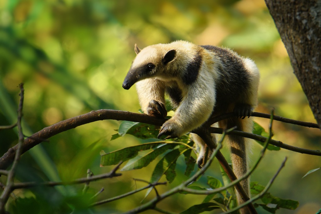
Much of the wildlife that can be spotted here has habitat ranges extending further to the south, such as the northern tamandua, a tree-dwelling anteater. You may also spot white-nosed coatis, pygmy spotted skunks, nine-banded armadillos, Western spiny iguanas (in rocky habitats), and green iguanas (in trees and bushes). Ocelots live here but are elusive. You may also witness a brown basilisk running on water, or spot a marbled toad or Mexican giant tree frog.
A few birds that call this forest home are the white-throated magpie, golden-cheeked woodpecker, orange-breasted bunting, russet-crowned motmot, West Mexican chachalaca, and the citreoline trogon.
Evergreen tropical forest occupies the northern slopes of the Sierra Norte. Spanning elevations between 460 and 1,520 m (1,500 and 5,000 ft), this verdant forest receives enough rainfall that the trees keep their leaves year round. This lush forest is filled with many species of ferns, orchids, vines, and flowering plants such as heliconias. The prime conditions are the reason that many of the state’s coffee plantations are located here.
The Central American red brocket deer, collared peccaries, spotted pacas, Mexican agoutis, Deppe’s squirrels, tayras, pumas, gray foxes, and several species of opossum live here. Reptiles and amphibians like Mexican jumping pit vipers, red coffee snakes, greater scaly anoles, brown basilisks, Fleischmann’s glass frog, and the endemic spiculate toad thrive here.
For bird life, you could see gartered trogons, collared aracaris, white-winged tanagers, Lesson’s motmots, band-backed wrens, montezuma oropendolas, red-legged honeycreepers, and emerald-chinned hummingbirds.
This lush forest supports hundreds of species of trees. In particular, you’ll notice a variety of fig trees, mahogany trees, and trees in the genus Manilkara whose sap served as the earliest chewing gum. This ecosystem is threatened by forest fragmentation.
In addition to its breadth of diversity in flora, the forest equally supports diverse wildlife. It shares much of its wildlife with those that occupy the evergreen tropical forests and iconic species such as ocelots, Central American spider monkeys, and red-eyed tree frogs. Central American crocodiles and boas, brown forest skins, green iguanas, and many anole species live here. You may see flashy birds such as the keel-billed toucan, olive-throated parakeet, and Amazon kingfisher here.

Oaxaca is one of Mexico’s most ethnically diverse states and home to multiple indigenous groups, the Zapotec and Mixtec being the two most prominent groups. Approximately two fifths of the population still speak their indigenous languages. Besides Zapotec and Mixtec, this includes the languages of Mazatec, Chinantec, and Mixé.
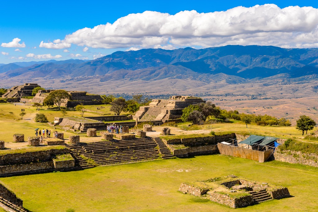
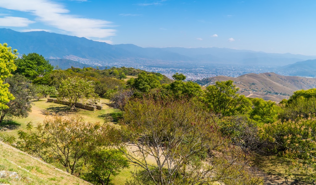
In ancient times there were more than a dozen indigenous groups. Zapotecs founded a cultural center at Monte Albán around the sixth century BC. This archeological site remains today and is located only a few kilometers from Oaxaca city, a perfect day trip for visitors. The Zapotec center at Monte Albán peaked and stayed strong from 300 to 900 CE. Around this time, clashes with the Mixtec began and the Mixtec succeeded in conquering the region by the 13th century.
The Aztec were the next in line to lay claims to the region. They began to invade the Oaxaca Valley in the mid-1400s. Their ultimate success was short-lived as Hernan Cortes and the Spanish conquistadors arrived in 1521. Much of Oaxaca remained under Spanish rule for the next three centuries.
Mexico’s War of Independence lasted from 1810 to 1821 and Oaxaca became an official state in 1824. During the 1850s, a Zapotec native named Benito Juárez rallied liberal forces to push back against the oligarchical system that had replaced colonial rule. He went on to become president from 1861-1872.
Today, much of the population outside of urban centers practices subsistence farming. Agriculture and mining are the region’s main industries. Main crops are maize, wheat, coffee, sugarcane, tobacco, and tropical fruits and mines extract gold, silver, uranium, diamonds, and onyx. In past years, there has been increasing awareness and resources given to ecotourism projects as a sustainable industry.
Bounded by the Sierra Norte and the Sierra Madre del Sur, Oaxaca has plenty of mountains and trails to explore. Hiking and mountain biking are quite popular even in some of the small hills near the valleys.
Many local ecotourism projects require a guide. Hiring a guide is a great way to support the local village economies and to enrich your experience by learning about the ecology and history of the area. Some sites ask for a small entry fee and of the hikes listed below, all are accessible by public or private transportation.
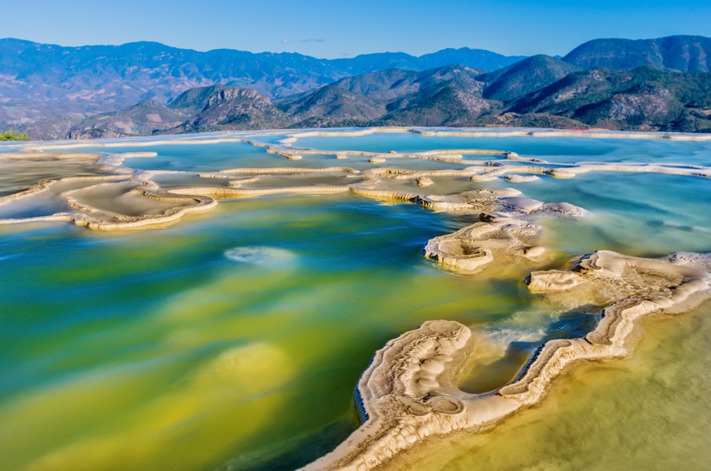
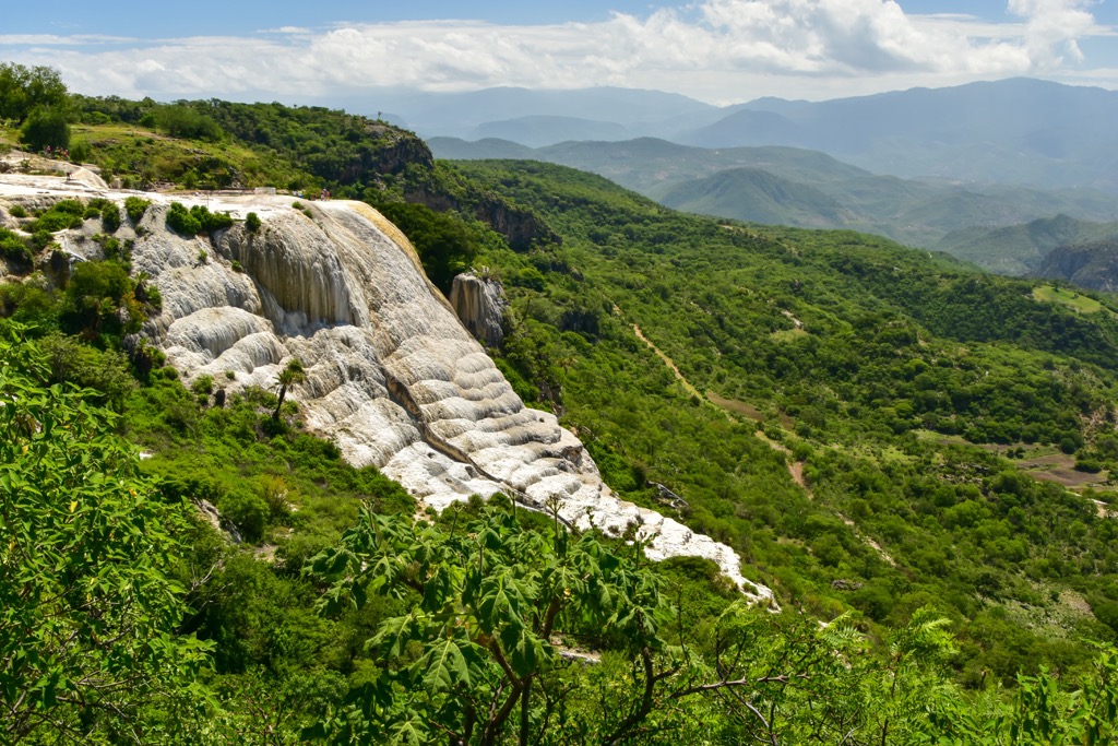
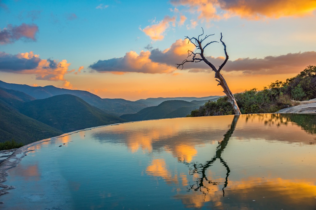
Located 70 km (45 mi) east of the city of Oaxaca, the natural springs at Hierve el Agua form petrified waterfalls. As the natural springs (not hot as their Spanish name implies) bubble up from the ground and drip over the cliff edges, minerals in the water harden. Over thousands of years, these mineral build ups have created impressive, calcified cascades.
One of the best known falls is known as The Amphitheater (El Anfiteatro) and measures 60 m (195 ft) tall. Visitors are allowed to swim in the mineral pools and can wander around the area freely, taking in views of the surrounding mountains. One popular trail around the falls is a 2.6 km (1.6 mi) loop that leads to the base of the waterfalls and includes around 180 m (600 ft) of elevation gain.
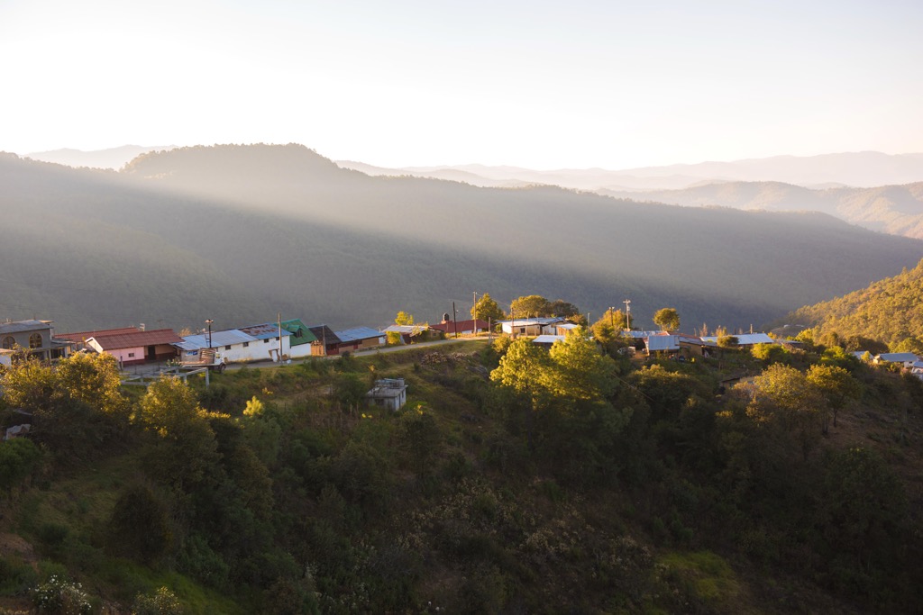
Seven villages are part of Los Pueblos Mancomunados, a joint community project offering extensive ecotourism activities in the Sierra Norte range. The community-managed reserve covers 400,000 hectares (988,400 acres) and over 100 km (60 mi) of trails. The villages are located one and a half to two hours from Oaxaca city.
Hiking, multi-day trekking, mountain biking, horseback riding, and birding are popular activities to do while visiting. A series of forest trails and gravel roads connect the villages and elevations range from 2,130 to 3,050+ m (7,000 to 10,000+ ft). Small cabins and small restaurants are spread between the villages offering clean and simple accommodation and a delicious taste of local foods like tlayudas, tostadas, and rice and beans.
Guides are available and generally required. It is not guaranteed that a guide you hire from the villages will speak English so make sure to find a bilingual guide beforehand if that is important to you. Having a local guide not only supports the community project but will also enrich your time in the mountain as they point out plants and animals and discuss the culture and history of the area.
The village of Lachatao was officially part of the Pueblos Mancomunados until 2007 and still participates in the village ecotourism unofficially. It is located about 65 km (40 mi) from Oaxaca city. It is not overly trafficked and its trails wind through stunning pine-oak forest brimming with bromeliads and orchids along paths the Zapotecs have used for centuries and continue to use today.
There are three main trails – the Sendero de la Virgen, the Ex-Hacienda Minera de 5 Señores, and the Cerro de Jaguar. All three paths traverse through secluded forest. The first two are between five and six hours. The Cerro de Jaguar is only 6 km but it ends at an archaeological site with ancient pyramids.
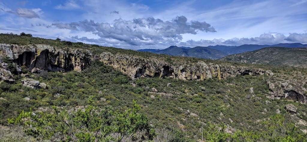
The community is located about two hours southwest from Oaxaca city on the way to Puerto Escondido. Here you will find an impressive network of caves, branching out into several systems spanning nearly half a kilometer and with several cavernous rooms adorned with stalactites and stalagmites.
Tours range from 1.5 to 4.5 hours and can include visiting the caves, a nearby cenote, and the underground river. The village-operated ecotourism project also offers biking and mezcal tours in addition to cave tours.
Slightly off the beaten track, the canyons and waterfalls of Santiago Apoala are in the heart of the Mixtec region. It can take a bit of planning to get here on public transportation (transfers and certain buses leaving only at certain times), but it is well worth the effort. The secluded area offers not only stunning waterfalls up to 50 m (165 ft) tall, but also canyon hiking, swimming, cultural tours, and the option to camp or stay over in cabins. It is located 115 km (70 mi) from Oaxaca city.

A more DIY hike is the path you can use to get to the popular archeological site of Monte Albán by foot. The trail leaves from the village of Xoxocotlan, a short distance to the west of Oaxaca. Beginning around 1,520 m (5,000 ft) elevation in Xoxocotlan, the trails climb to the ruins around 1,890 m (6,200 ft) and is typically a half day hike.
Because this is not a designated or guided trail, do a bit of research online to iron out the details before heading out. The trail takes you very close to the ruins which can be reached fully by jumping on a passing bus or by taxi.

The capital Oaxaca de Juárez is home to the state's main airport and is the state’s cultural center. The coastal town of Puerto Escondido is becoming increasingly popular with visitors. Beyond these two well-known destinations, there are many small pueblos throughout the state that are worthy of visiting for their culture, artisan crafts and foods, and ecotourism opportunities.
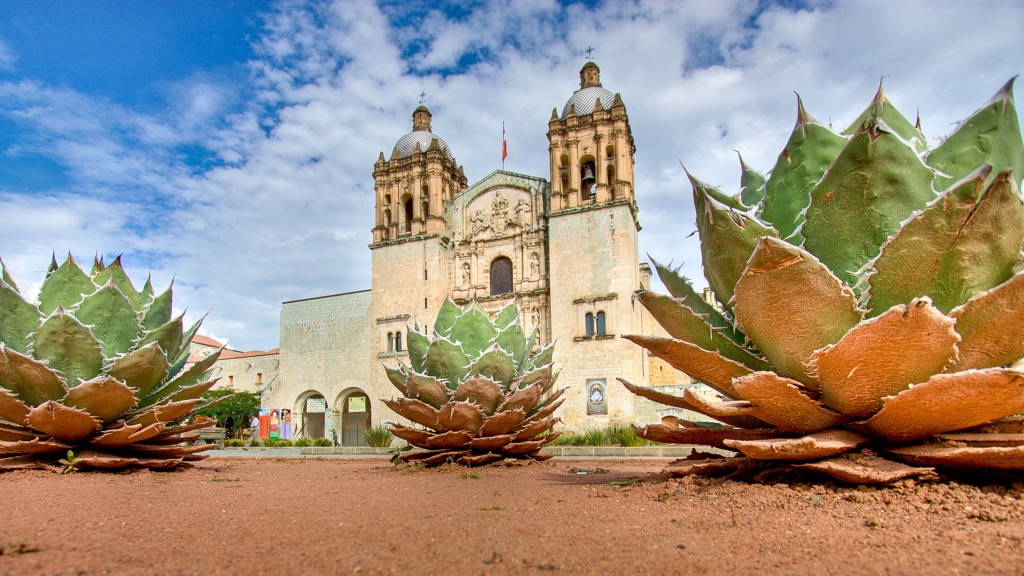
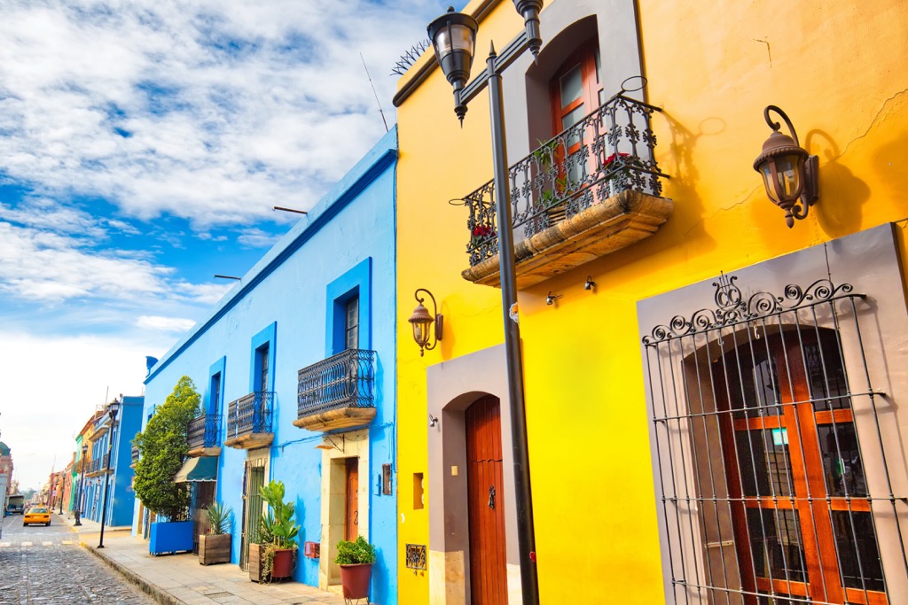
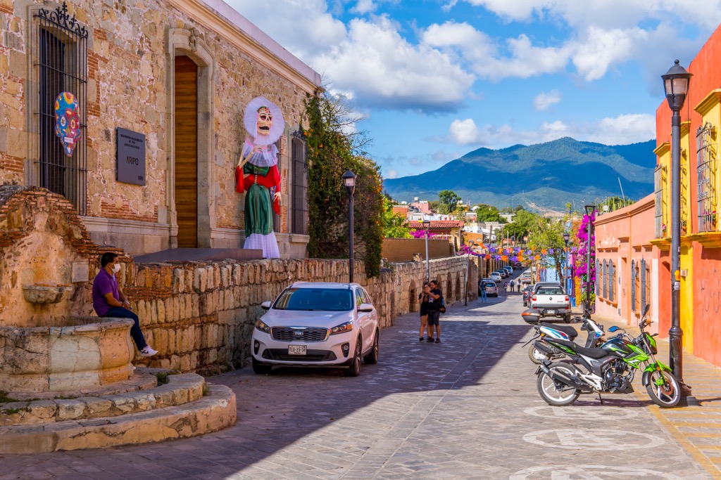
Frequently referred to simply as Oaxaca, the capital city has a population of 300,000 people. The region’s cultural diversity comes to a head here. Numerous art galleries celebrate local artists, while shops and markets brim with artisan rugs, pottery, jewelry, and more. A walk around the historic center takes in brightly painted buildings, striking colonial architecture on several old churches, and colorful papel picado strung across the streets.
There are several art and cultural museums downtown. Popular day trips from the city include visiting the archeological site of Monte Albán or Hierva el agua, a natural spring where limestone and mineral deposits have hardened to look like cascading waterfalls.
Especially well-known for its rich culinary traditions, it wouldn’t be a trip to Oaxaca with sampling one of the many moles the region is known for, or visiting a mezcalería here in the heartland of mezcal production. There are plenty of places to book a stay in the city, ranging from hostels to B&Bs to hotels.
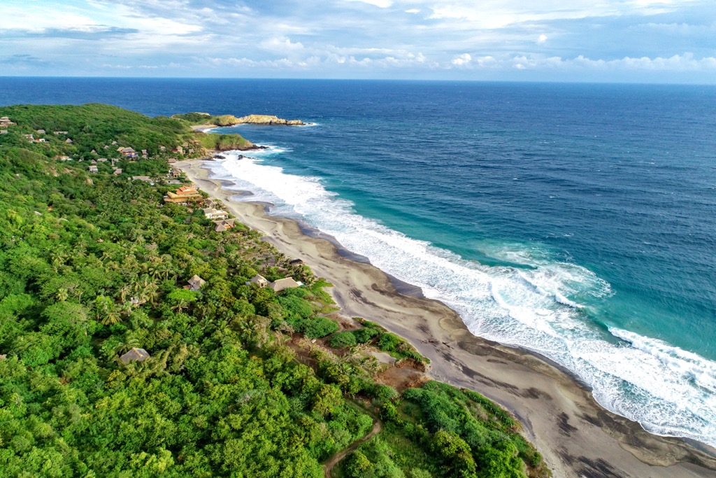
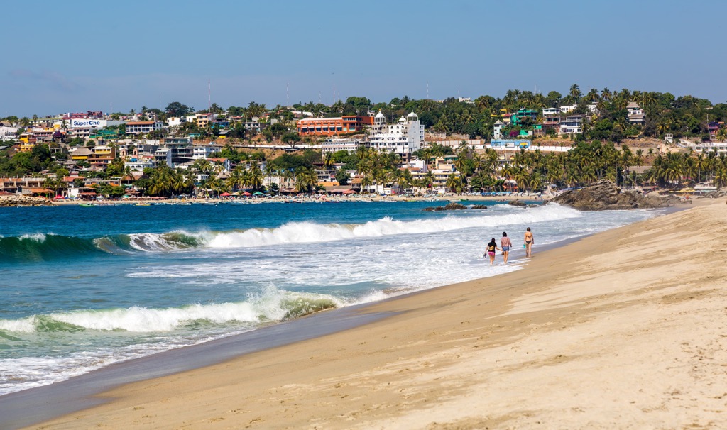
Puerto Escondido has a population of 45,000 and is a laid back beach town. Although becoming more well known among international visitors, it is not as touristy as some of Mexico’s popular beach destinations. There are occasional flights from Oaxaca or Mexico City, but they are not yet very regular and are best booked in advance.
Make the most of your time here by surfing, swimming with dolphins, going whale watching, or releasing sea turtles to support sea turtle conservation. For a nighttime adventure, book a tour to see bioluminescent plankton. You’ll be able to find plenty of classic Oaxacan dishes around town, and plenty of fresh seafood. Accommodation options include budget hostels, hotels, and rental houses and apartments.


