
Scan the QR code and open PeakVisor on your phone
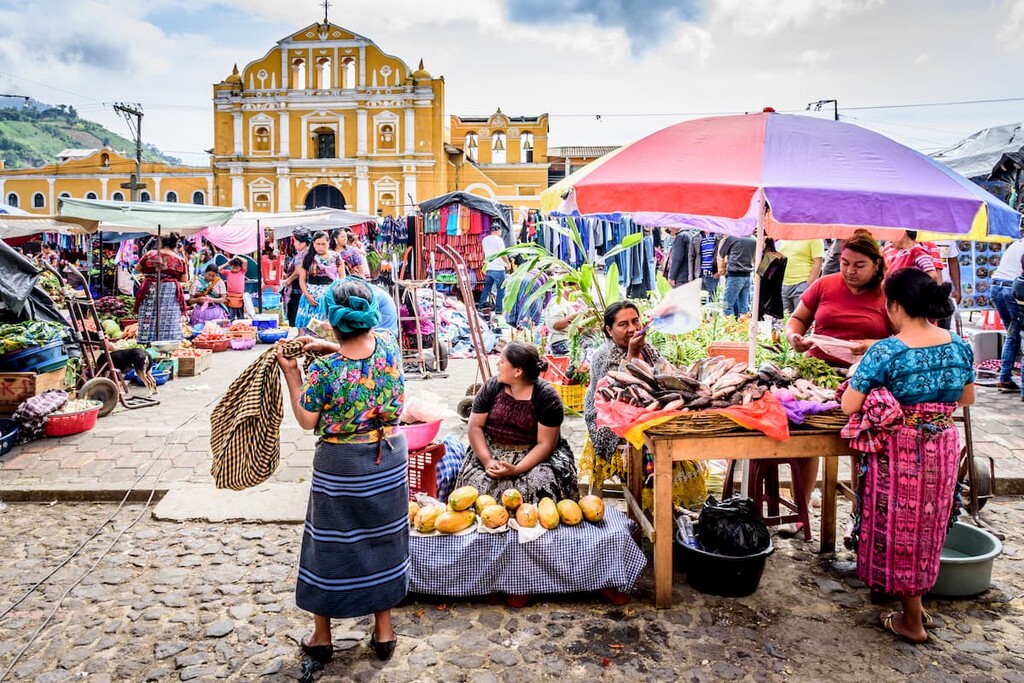
A land of volcanoes, amazing cuisine, and stunning Mayan ruins, Guatemala is a country located in the heart of Central America. The country contains 1,631 named mountains, the highest and most prominent of which is the volcano Tajumulco (4,214m/13,825ft).
The country of Guatemala is located in the northern part of Central America, sandwiched between the Caribbean Sea to the east and the Pacific Ocean to the west. It has a total land area of approximately 108,899 square kilometers (42,042 sq. mi), which places it as the 105th largest country (including dependent territories but not most disputed states) in the world.
Despite its relatively small size, it is home to around 18 million people as of 2021, which places it among the top 70 countries in terms of population. The country is highly mountainous, however, and many Guatemalans live at higher elevations.
Due to its location within Central America, Guatemala actually shares its borders with quite a few other countries. In particular, it is located to the south of Mexico, to the west of Belize, and to the north of both El Salvador and Honduras.
Guatemala is officially divided up into 22 departments (officially: departamentos) for administrative purposes and these departments are further divided into 340 municipalities (officially: municipios). Furthermore, the country can be informally divided into 2 major regions based on topography: the Guatemalan Highlands in the south and the Guatemalan Lowlands in the north.
Encompassing much of the southern part of Guatemala, the Guatemalan Highlands and Sierra Madre de Chiapas are home to the majority of the country’s population as well as nearly all of its mountains.
This region includes nearly all of the country’s departments, including:
Moreover, it includes both the easternmost tip of the Chiapas Ranges (Sierra Madre de Chiapas) and the Guatemala Ranges. The Guatemala Ranges is really just a broad classification for the majority of peaks in the country, and it includes the following subranges:
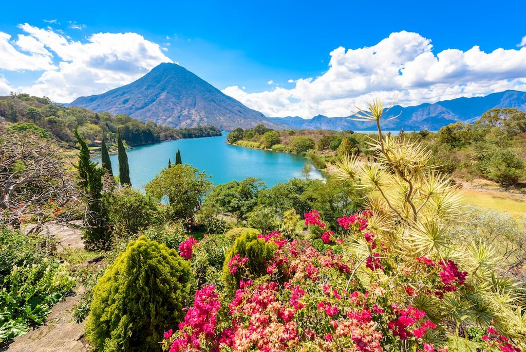
All of Guatemala’s volcanoes and the vast majority of its mountains are located within the Guatemala Highlands, so it’s a great place to visit if you’re looking for an adventure. The country’s major cities are also located in the many valleys of the highlands, so it’s a relatively easy place to get to.
Within the Guatemalan Highlands, there are quite a few national parks, such as:
There are also 3 notable biosphere reserves located within the southern part of the country:
Located in the northern part of Guatemala, the Guatemalan Lowlands (also called the Petén Lowlands) cover all of the Petén department. This region, as the name suggests, is very low-lying and it isn’t home to any proper mountains other than a few high points in the hills of the Yucatan Peninsula.
The Guatemalan Lowlands are one of the most sparsely populated parts of the entire country, with only about 600,000 people living throughout the entire department of Petén. Within the region, the landscape is mostly dominated by karst topography, though the Lake Petén Itza at the center of the department is also a major topographical feature.
Much of the Guatemalan Lowlands are used for agriculture, though a sizable amount of the region is also included within the massive Maya Biosphere Reserve (Reserva de la biosfera maya). Some of the many parks and protected areas within the region include:
Geologically, Guatemala can be divided up into two main regions, similarly to how one can categorize the country geographically. Indeed, due to the sizable differences between the topographical and geological structures of northern and southern Guatemala, it comes as no surprise that the country’s geological history is quite complex.
In particular, however, much of Guatemala’s geologic structures can be attributed to its long history of volcanism. This volcanic activity is the result of widespread plate subduction, which has produced an associated volcanic arc and the many volcanoes we see in the country today.
That being said, Guatemala is actually located at an interesting point from a tectonic perspective. In fact, it’s sandwiched between convergent and transform boundaries and the movement of these plates over the millennia has helped carve out the country’s unique geologic structures.
The northern part of the country, though, is mostly part of the Maya Block, which is a mix of igneous and metamorphic basement rocks that are overlain by much younger metasedimentary rocks. Meanwhile, the southern part of the country is mostly part of the Chortís block, which is widely considered to be part of the Caribbean plate.
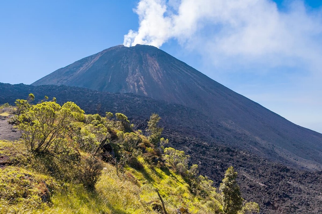
Nevertheless, the most geologically striking aspect of the country is easily its many volcanoes. Some of the major peaks in Guatemala include Tajumulco, Tacaná, Acatenango, Volcán Santa Maria, Volcán de Fuego, Volcán Attilán, and Volcán de Agua.
Guatemala is a highly biodiverse country, thanks to its varied terrain and tropical latitude. There are a number of different ecoregions within the country, each with its own unique mix of flora and fauna.
Covering much of central Guatemala, the Motagua Valley Thornscrub is a desert and xeric shrublands ecoregion that covers an area of some 2,330 square kilometers (900 sq. mi). It is one of the most arid places in Central America as it is surrounded by mountains which prevent moisture from reaching its low-lying topography.
Much of the vegetation in the valley is scrub and succulents, such as prickly pear. There are also a number of bird species and reptiles, such as the Guatemalan spiny-tailed iguana and the Motagua Valley bearded lizards, which call the region home.
However, the region is becoming rapidly fragmented due to ever-expanding agriculture in the area.
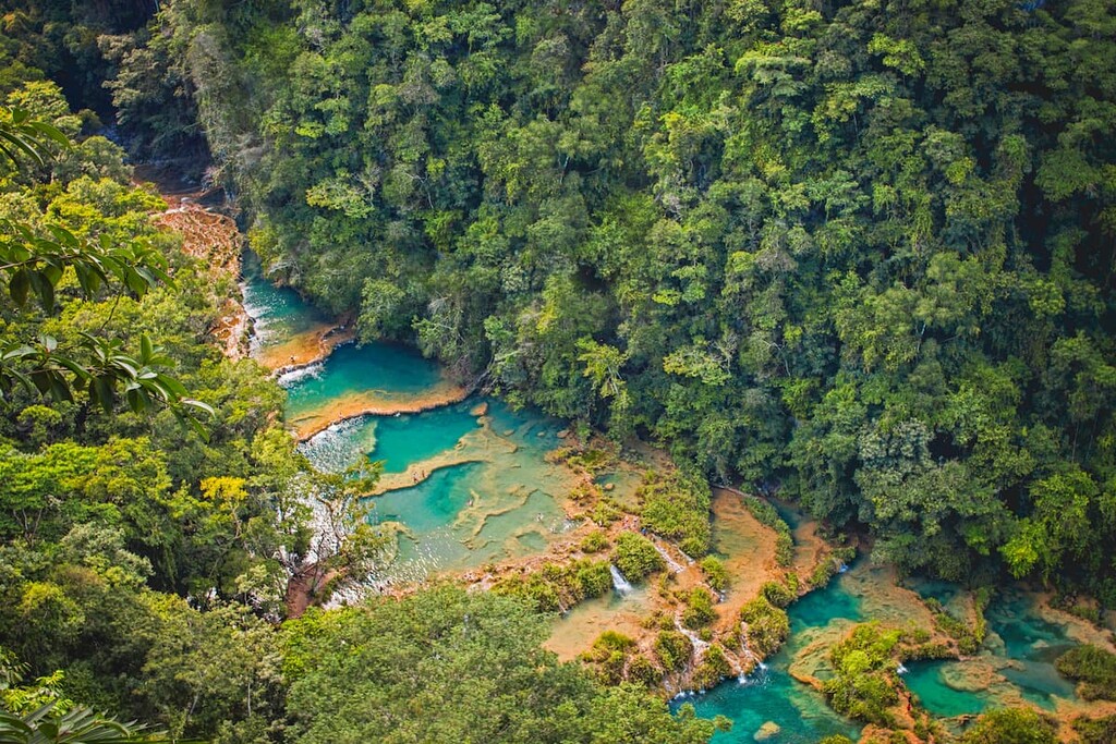
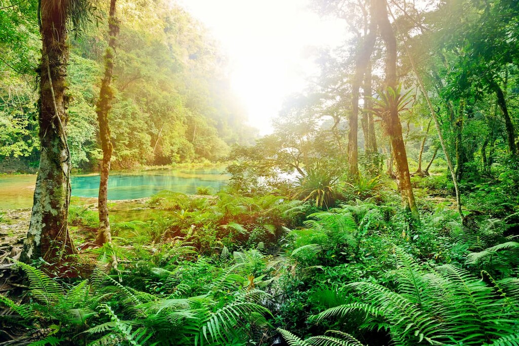
The Petén-Veracruz Moist Forests are a tropical moist forest that encompasses much of northern Guatemala and Belize, as well as parts of the states of Oaxaca, Chiapas, Tabasco, and Campeche in Mexico.
These forests are actually a collection of different ecosystems, which include wetlands, broadleaf forests, and riparian habitats. Nevertheless, the highly fertile soils found in the region mean that it’s a prime place for agriculture, so only about 8% of the original ecoregion actually remains.
Located in southeastern Guatemala, coastal Honduras, and eastern Nicaragua, the Central American Moist Forests are a massive ecoregion that contains a great mix of flora and fauna.
Most of the ecoregion is defined by tall broadleaf evergreen rainforests, though a significant portion has been converted for agriculture.
That being said, some of the largest remaining sections of rainforest in all of Central America are located in this ecoregion, with a decent amount of it being protected by biosphere reserves in all three countries, including the Chocón Machacas Protected Biotope in Guatemala.
Situated at higher altitudes throughout Guatemala, the Central American Montane Forests are most commonly found between 1,800 and 4,000m (5,900 and 13,100ft). These forests are quite humid and they contain a number of different ecosystems.
At higher elevations, subalpine grasslands are dominant, though montane forests are the most common at the mid-elevations. Most of these forests are dominated by pine and oak, and there is a high level of endemism in the region because of the many different ecosystems that can be found in Guatemala’s mountain regions.
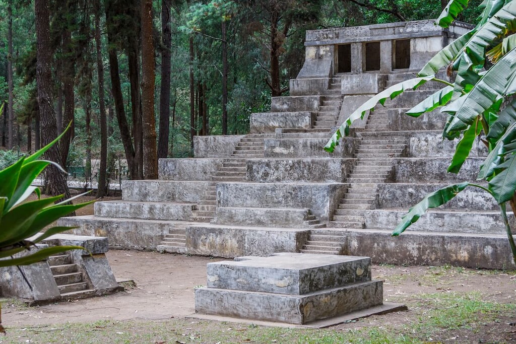
As is evidenced by its many Mayan ruins, the land that is now Guatemala has been inhabited by humans for thousands of years.
Although some of the oldest human settlements in the region are believed to date back to about 6,500 BCE, the people of the Maya civilization are believed to have developed agricultural communities in what is now Guatemala around 2,000 BCE.
From about 750 BCE, the Mayans are believed to have established some of theri first cities, some of which exist in ruins to this day. However by around 900 CE, the Mayan Civilization collapsed, perhaps due to famine.
Afterwards, a number of Indigenous peoples and groups established themselves in the region. While countless peoples consider the region to be part of their ancestral homelands, some of the most prominent include the Q'eqchi', Kaqchikel, Tzʼutujil, and Itza.
By the early sixteenth century, the Spanish conquest of Guatemala was well underway. It’s believed that Spanish sailors first contacted Guatemala’s Indigenous peoples in the early part of the sixteenth century as a number of Spanish expeditions sailed along the Yucatán coast.
One of the earliest Spanish conquistadors to set his sights on the region was Pedro de Alvarado, who had come from what is now Mexico after the fall of the Aztec Empire. Hernán Cortes soon followed in 1525, but at that point, the Spanish conquests were well underway.
The period of Spanish colonization was harsh and many of the region’s Indigenous peoples succumbed to violence, disease, or slavery. This period of colonization continued for centuries, until the early part of the nineteenth century.
By the early nineteenth century, Spain’s power was significantly weakened by its many different conflicts, including those with Mexico and France. As a result, a number of high-ranking Guatemalans seized the opportunity to declare their independence (alongside the rest of Central America) from the Spanish Empire.
They signed the Act of Independence of Central America (Acta de Independencia Centroamericana) in 1821, which sought to establish a new Central American state.
The next few decades were tumultuous, to say the least, as various political and geographical groups in the region attempted to assert their dominance. After a seemingly endless series of battles and treaties, Guatemala declared itself to be an independent republic in 1847 with Rafael Carrera as its president.
Nevertheless, Carrera’s tenure was rife with conflict and he was forced out of the region for a while before returning from his exile a few years later to form a second government. The latter half of the nineteenth century and the beginning of the twentieth century saw a succession of different governments and regimes.
Then, in 1944, Guatemala underwent a revolution after an extended period of economic strife as a result of the Great Depression. The revolution led to the holding of Guatemala’s first deomcratic election, which placed Jacobo Árbenz at the helf of the government.
In an interesting twist of international politics, the US government interfered in Guatemalan politics by installing CIA agents to remote Árbenz from power to help protect the profits of the United Fruit Company (now Chiquita Brands International) and its business dealings in Guatemala.
The next few decades were marred by strife with various overthrown governments and guerrilla warfare characterizing the period. For a while, Guatemala was considered a pariah state among the international community, though the country reached the end of its civil war in the 1990s after the guerrilla groups and the government signed a peace accord that was brokered through UN member nations, including Norway.
Ever since the signing of the peace accords, Guatemala has seen a growth in its economy and a much more stable atmosphere of peace. These days, Guatemala is among the largest of Central America’s economies, though it does have quite a large amount of income inequality.
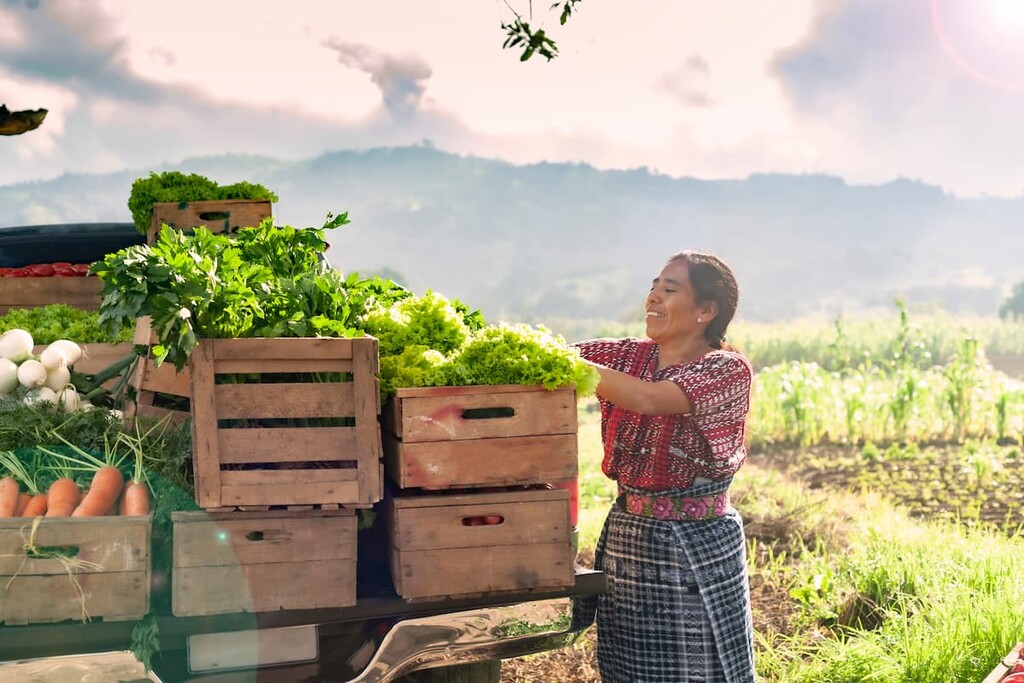
The country’s economy is supported by its major agricultural exports, which include coffee, bananas, palm oil, nutmeg, and sugar cane. It is also a major exporter of manufactured goods, rubber, and precious metals, such as gold.
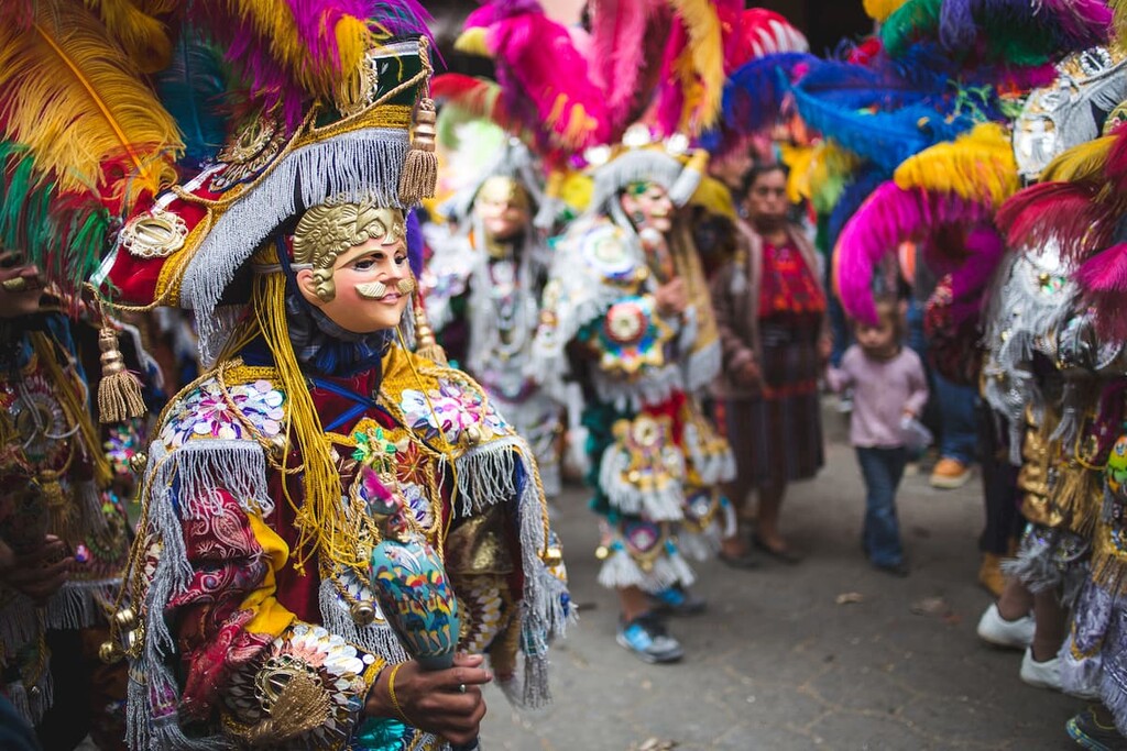
Moreover, Guatemala has a booming tourism industry, which is driven by interest from the international community in the country’s many amazing hiking opportunities, archaeological sites, and rich cultural heritage.
Despite its relatively small size, the sheer concentration of mountains and stunning cultural sites make Guatemala an excellent place to adventure. Here are some of the most popular hiking destinations in Guatemala:
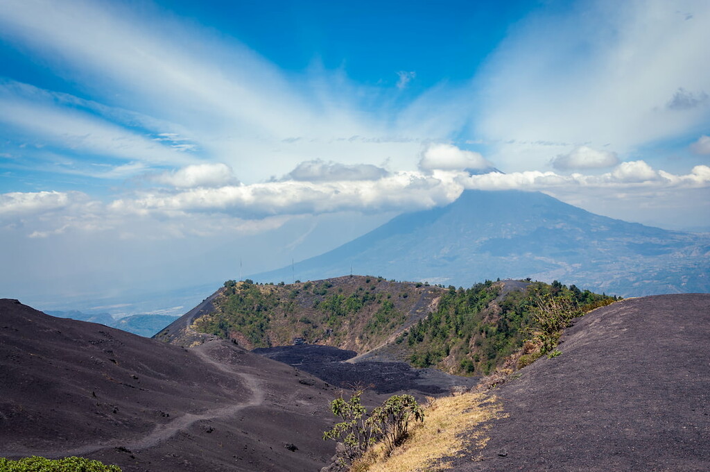
Located in south-eastern Guatemala, just to the south of Guatemala City, Pacaya National Park is a fantastic place to visit if you’re interested in experiencing the geological wonders of a live volcano. The park contains 6 named mountains, the highest and most prominent of which is Pacaya.
As Pacaya is an active volcano complex, caution is needed when visiting the park. However, the park is a popular tourist attraction as it offers great opportunities to see the hardened lava fields. Hiring a guide to check out the volcano from a safe distance is highly recommended, and you may even get a chance to roast marshmallows over the scorching hot heat vents on the side of the volcano!
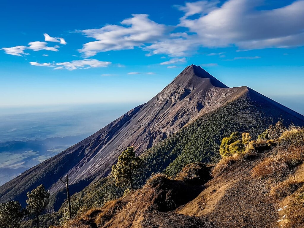
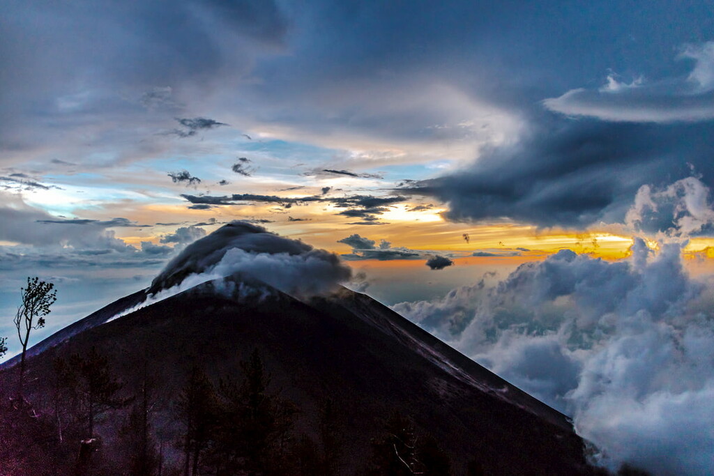
The tallest volcano in all of Guatemala, Volcán Tajumulco is a must-hike for any adventurous visitor. Tajumulco is currently located within a protected area which is one of the most popular places to camp in the western part of the country.
There are a number of hiking routes in the area, though most summit the peak over the course of 2 days. It’s generally recommended to hire a guide (generally quite affordable) to take you to the summit, even if you feel confident in your skills. That’s because the trail can be challenging to follow, especially in the fog that frequently encapsulates the peak.
Perhaps the best way to summit Tajumulco is to time your adventures so that you’re at the top of the peak by sunrise, which makes for an epic journey to the top of Guatemala.
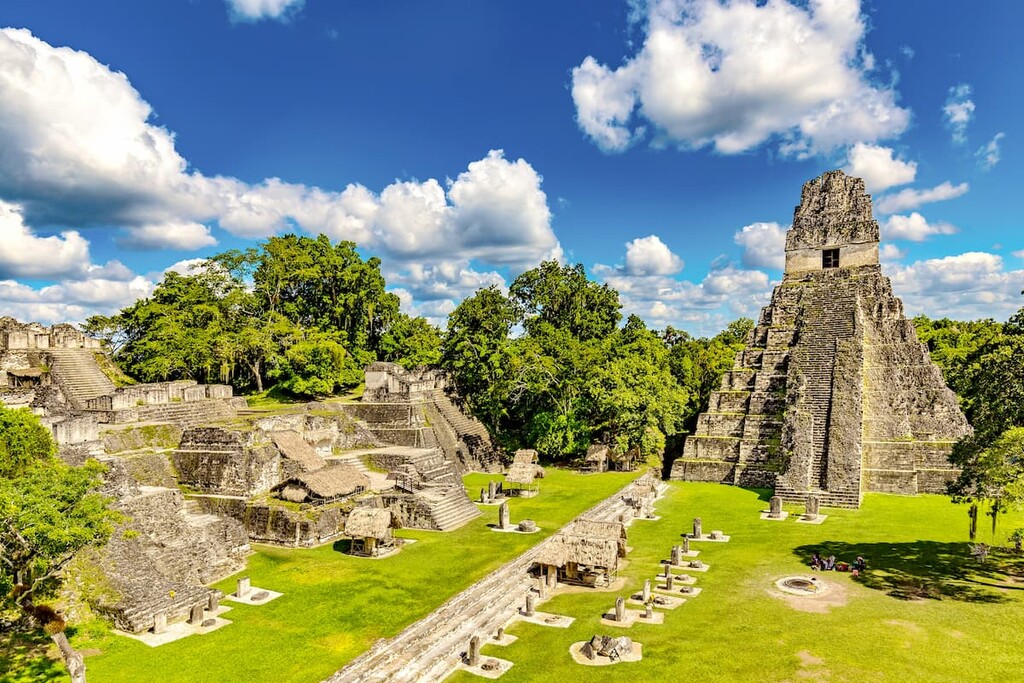
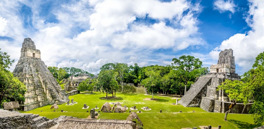
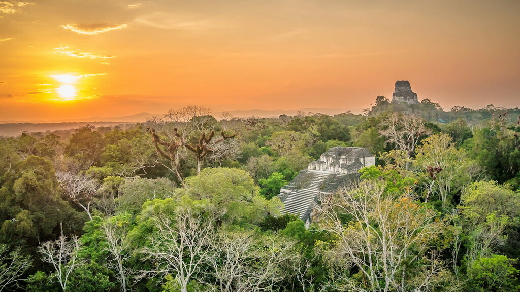
Situated in northern Guatemala in the Petén Lowlands, Tikal National Park is a UNESCO World Heritage Site and a must-visit destination in the country. Although Tikal isn’t known for being mountainous, it is the site of Maya ruins that date back as far as 600 BCE.
The park is located in a lush jungle and is located within the Maya Biosphere Reserve (Reserva de la biosfera maya).
Easily the most popular way to get to Tikal National Park is on an organized tour, many of which leave from the city of Flores in Petén. Alternatively, you can arrange for private transfer from Flores by flying first from Guatemala City and then hiring a driver upon arrival.
Since the park is close to Belize, it is also possible to reach it from Belmopan or Belize City, though this involves a border crossing and more complicated logistics.
Looking for a place to stay in Guatemala? Here are some of the best cities to check out in the country:
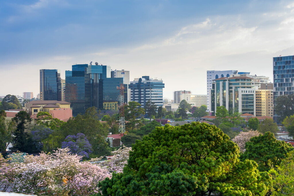
The capital and largest city in the country of Guatemala, Guatemala City (Ciudad de Guatemala or Guate) is home to about 1 million people. Guatemala City is located in the south-central region of the country and it is located on the site of a Mayan city, known as Kaminalijuyu, which is believed to have been occupied from about 1500 BCE to 1200 CE.
These days, Guatemala City is the economic and cultural hub for the country as well as its main transportation center. It has the country’s largest airport (La Aurora International), which offers excellent connections to countries around the world.
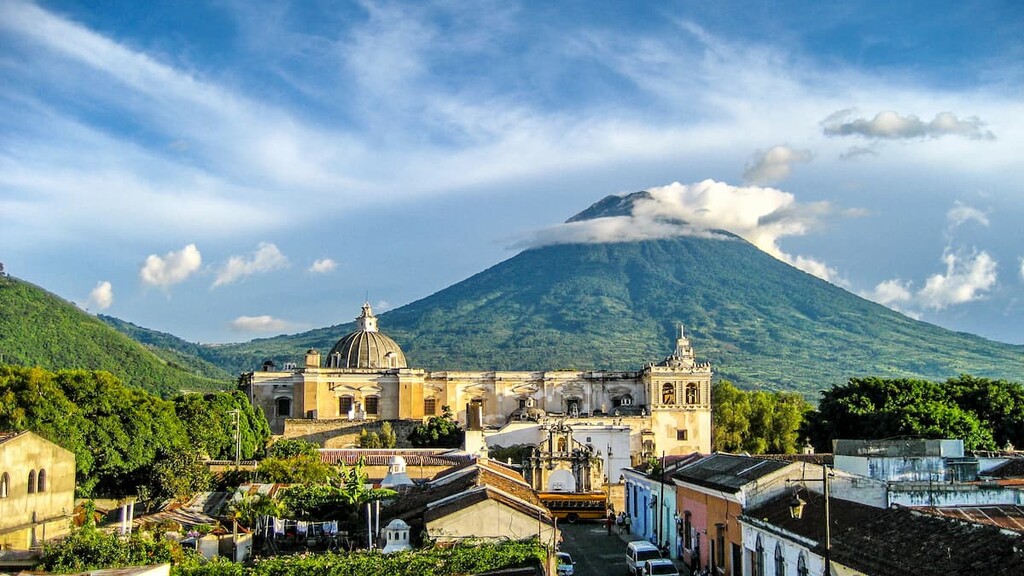
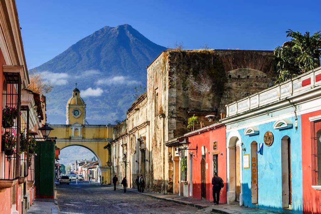
A designated UNESCO World Heritage Site, the city of Antigua Guatemala (commonly just Antigua) is home to about 46,000 people who live in the department of Sacatepéquez. It is perhaps best known for its well-preserved Baroque-inspired architecture and its many colonial ruins. The city was once also the capital of the Kingdom of Guatemala.
These days, Antigua has a booming tourism and coffee industry. Antigua is also just over an hour by road from Guatemala City, so it’s easy to access by road.
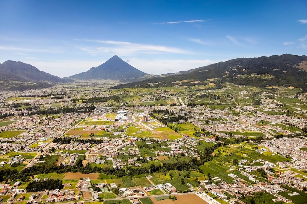
Situated in south-west Guatemala, the city of Quetzaltenango (commonly referred to as Xela; pronounced ‘sheh-lah’) is home to about 180,000 residents and is located relatively high up in the mountains at about 2,330m (7,640ft). It’s also the main starting point for summit attempts on Tajumulco.
Quetzaltenango has a long history of being a major agricultural center as many of the nearby towns produce maize, wheat, vegetables, cacao, sugar, cotton, and wool. The city is accessible by road and is just 3.5 hours from Guatemala City.
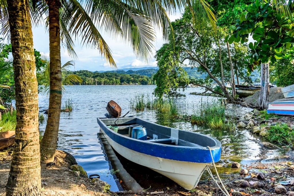
Located in the north-east of Guatemala, the city of Puerto Barrios is a community of some 100,000 people who live on the Gulf of Honduras. The city is actually the country’s main port along the Caribbean Sea, though its neighbor Santo Tomás de Castilla is arguably more modern in terms of infrastructure.
From Puerto Barrios, visitors can check out the Quirigua Mayan ruins as well as the old Spanish fort, Castillo de San Felipe de Lara. Puerto Barrios is about 5.5 hours by road from Guatemala City, though the city’s airport is under construction and hopes to receive passenger flights in the near future.


ultra
volcano
mexico-ultras
guatemala-ultras
ultra
volcano
mexico-ultras
guatemala-ultras


