Scan the QR code and open PeakVisor on your phone
Encompassing much of the southern and central regions of Guatemala, the Guatemala Ranges (Guatemalan Highlands) are a stunning collection of lofty peaks. The range contains 1,257 named mountains, the highest of which is Cumbre el Plato (Cumbre Bonete/Cumbre Sur Volcán Acatenango) at 3,982m (13,064ft), and the most prominent of which is Volcán de Agua at 3,762m (12,343ft).
The Guatemala Ranges (commonly referred to as the Guatemalan Highlands) are the primary mountain range in the country of Guatemala.
Within Guatemala, the range occupies the majority of the country to the south of the Petén Lowlands to the north. The range stretches from Guatemala’s border with the Mexican state of Chiapas to the west all the way to the country’s border with both El Salvador and Honduras to the east.
Furthermore, the range is bordered by the Chiapas Ranges (Sierra Madre de Chiapas) to the west and the mountains of both El Salvador and Honduras to the east. However, the range is not particularly coastal as it is separated from the Pacific Ocean by a low-lying coastal plain to the south. While some high points from the range do extend toward Puerto Barrios on the Caribbean, these peaks are quite minor.
Within the Guatemala Ranges, there are a number of fantastic public and private reserves, which protect the region’s exceptional biodiversity. Some of these reserves include:
Additionally, the Guatemala Ranges contain a handful of national parks, such as Río Dulce National Park (Parque Nacional Río Dulce), Naciones Unidas National Park (Parque Nacional Naciones Unidas), and Volcán de Pacaya National Park (Parque Nacional Volcán de Pacaya).
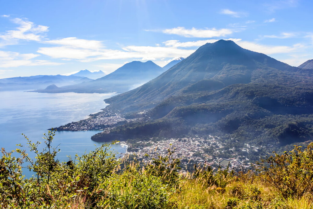
The Guatemala Ranges are part of a much larger volcanic region which stretches across much of Central America and Mexico. This volcanic past is a result of tectonic subduction in the region, which created the volcanic arc and the many volcanoes that we see in the region today.
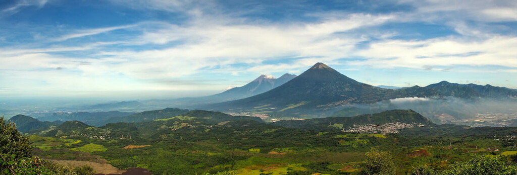
In particular, the Guatemala Ranges are part of the Central American Volcanic Arc, which includes ranges within Guatemala, Honduras, El Salvador, Costa Rica, Nicaragua, and Panama. The arc is about 1,500km (930 miles) long and it contains hundreds of volcanoes, which includes everything from small cinder cones and lava domes to massive stratovolcanoes.
One of the largest and most prominent volcanoes in the range includes Pacaya, which is just to the southwest of Guatemala City in the Escuintla Department. The volcano (along with its many volcanic neighbors) formed as the Cocos Plate subducted under the Caribbean Plate.
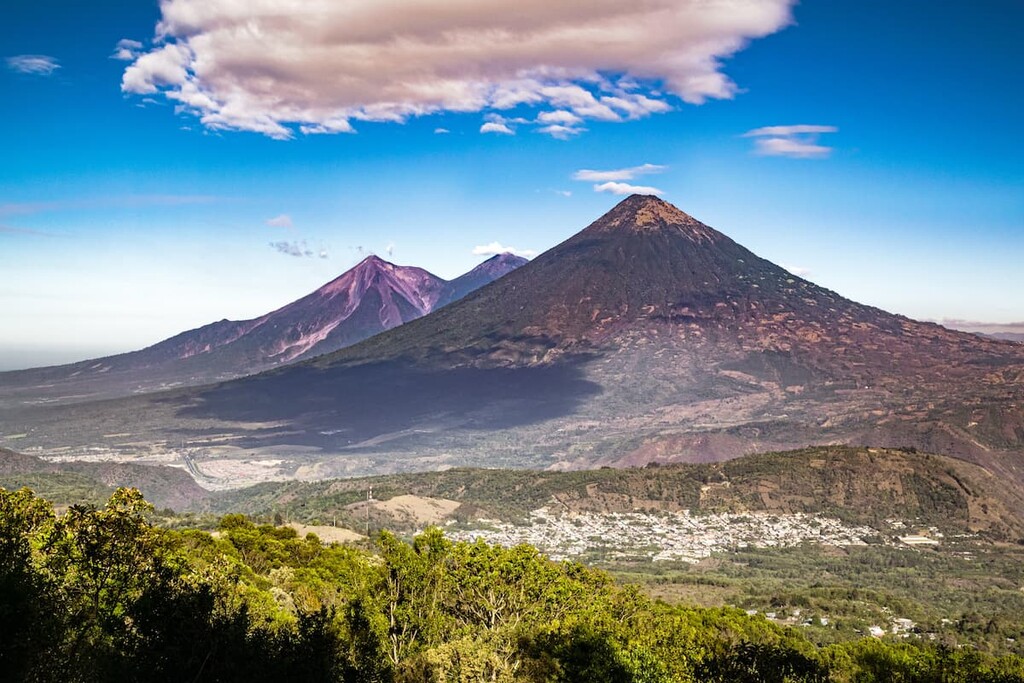
Payaca is among the most active volcanoes in the country, having erupted dozens of times since the arrival of the Spanish colonizers. That being said, it was dormant for a period of about 70 years from the end of the nineteenth century to 1961, at which time it violently erupted.
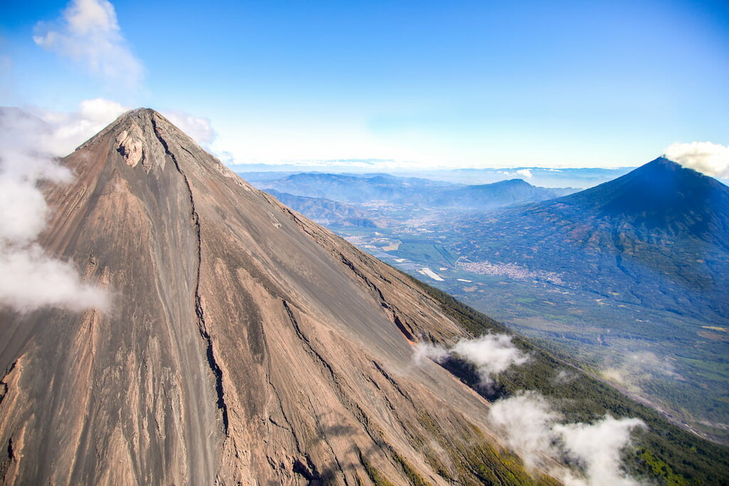
Major peaks in the range include Cumbre el Plato, Acatenango, La Torre, Volcán Santa María, Volcán de Fuego, Volcán de Agua, Volcán Atitlán, and Pacaya.
Home to an exceptional array of flora and fauna, the Guatemala Ranges are among the most biodiverse of the world’s mountain ranges. Within the area, there are 3 primary ecoregions, each with their own unique mix of wildlife and plant species.
Comprising much of the northern part of the range, the Motagua Valley Thornscrub is sort of like a transition zone between the high elevations of the Guatemala Ranges to the south and the Petén Lowlands to the north.
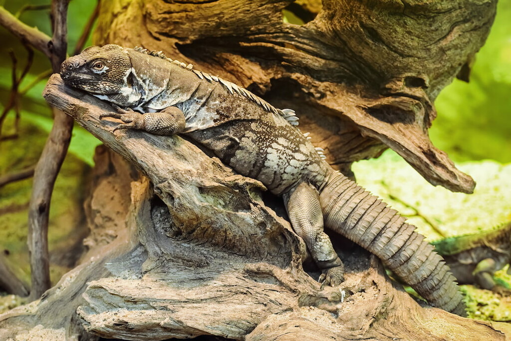
Here, the landscape is mostly succulents and scrubs as the region is much more arid than the mountains. However, there are still plenty of animal species to be found, including the Motagua Valley bearded lizard and the Guatemalan spiny-tailed iguana.
While the Motagua Valley Thornscrub is located in the northern part of the Guatemala Ranges, the Central American Moist Forests cover much of the southern half of the region.
These forests, as the name suggests, are tall, broadleaf and evergreen rainforests. Nevertheless, human activity has resulted in the conversion of much of the landscape into agricultural land.
With that in mind, it’s worth mentioning that some of the largest tropical rainforests left in Central America are situated within the Central American Moist Forests ecoregion.

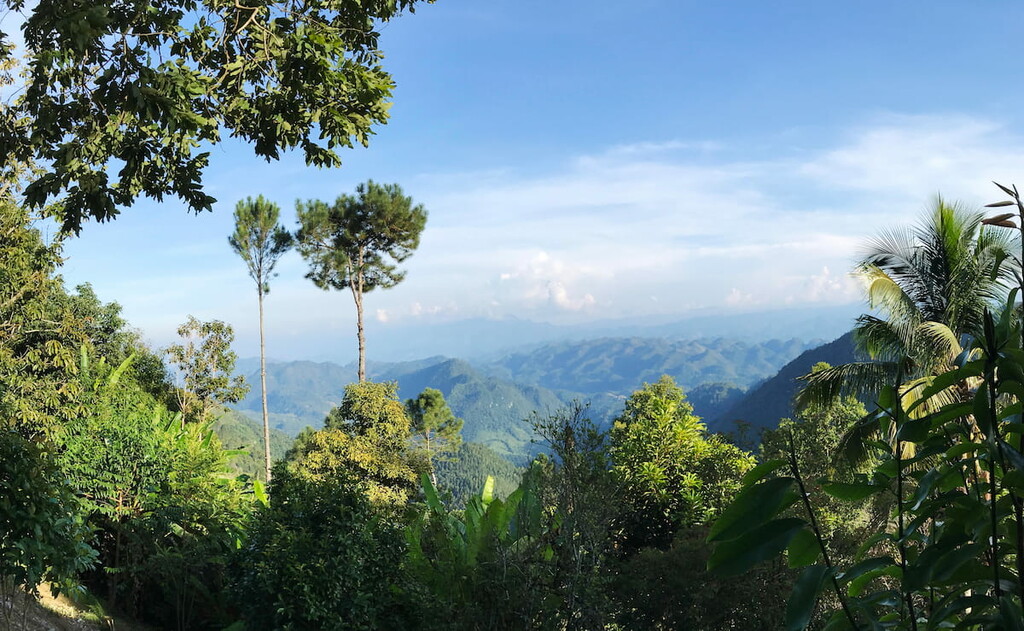
Located primarily at higher elevations throughout the Guatemala Ranges, the Central American Montane Forests are a biodiverse mixed ecoregion with a whole host of different ecosystems. These forests are mostly found on mountain slopes between 1,800 and 4,000m (5,900 and 13,100ft), so you’re most likely to encounter them during your hikes.
There are a number of different plant communities in this ecoregion, including grasslands and subalpine meadows at higher elevations. At mid-elevations, the region is also home to sizable forests of oak and pine where animal species tend to flourish.
Like the rest of the country, the Guatemala Ranges have been continuously inhabited for thousands of years. Maya peoples have lived in the region since time immemorial and the modern-day Guatemala City is built on the city of the Maya capital of Kaminaljuyu.
During the early sixteenth century, the Spanish arrived in what is now Guatemala. The Spanish set out to conquer the region in the 1500s. This period of conquest was brutal and it led to the death of a vast majority of the region’s Indigenous peoples through violence, slavery, or introduced diseases.
Around the turn of the nineteenth century, Spain was embroiled in other conflicts overseas. The Spanish conflicts with both France and Mexico during this period gave Guatemalans a chance to declare their own independence from the Spanish Empire in 1821.
In the years following Guatemala’s independence, the country experienced a number of civil wars, governmental upheavals, and economic depressions. Nevertheless, the country’s civil war ended in the 1990s after the signing of a UN-brokered peace accord.
Throughout the twentieth and twenty-first centuries, Guatemala has experienced an economic rejuvenation.
During this time, many of the country’s most stunning natural areas within the Guatemala Ranges were also placed under federal protection. This includes its many national parks and reserves, which provide exceptional hiking opportunities as well as superb habitat for local wildlife.
These days, the Guatemala Ranges remain one of the most heavily visited parts of the country as tourists flock to its stunning vistas and fantastic cultural sites.
The Guatemala Ranges are a veritable treasure trove of adventure. Here are some of the best places in the range to check out during your visit:
Volcán de Pacaya National Park (Parque Nacional Volcán de Pacaya is a small federally-protected area to the south of Guatemala City. It contains 6 named mountains, the highest and most prominent of which is Pacaya.
The park is situated around a complex of active volcanoes, so it’s a great place to visit if you love learning about geology. Due to the fact that the region’s volcanoes are active, caution is necessary when visiting the area. However, Volcán de Pacaya is a popular tourist attraction and there are many guide services that will offer you a chance to see the landscape from a safe distance.
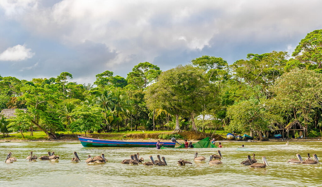
Located near the city of Puerto Barrios, Río Dulce National Park (Parque Nacional Río Dulce) is a federally protected region along the Río Dulce. The park is very low-lying, thanks to its location along the Caribbean Sea.
It was one of the first-ever protected areas in Guatemala, having been established in 1955 to protect the region’s mangrove. It is also an important habitat for both manatees and the American crocodile.
Traveling through the park is best done by boat and there are a number of tour operators located in and around the park to help you during your adventure.
Covering a wide swath of eastern Guatemala, the massive Sierra de las Minas Biosphere Reserve (Reserva de la biosfera Sierra de las Minas) is a major protected area that’s known for its stunning landscapes. The reserve contains 33 named mountains, the highest and most prominent of which is Cerro Raxón.
One of the largest contiguous protected tracts of land in the country, Sierra de las Minas covers some 236,626 ha (584,715 acres) of wild landscapes. It is one of the most biodiverse places in Guatemala as it includes a massive cloud forest with thousands of animal species. In fact, the reserve is so important because it contains a majority of the country's remaining cloud forest.
There are a number of hiking opportunities in the reserve. However, due to the remoteness of the terrain and the difficulty of travel throughout the area, it’s highly recommended that visitors enlist the services of a guide. Guide services are readily available in Guatemala City and other nearby communities to help you arrange your adventure.
Looking for a place to stay during your travels to the Guatemala Ranges? Here are some of the best places to check out:
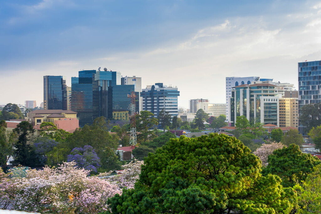
Guatemala City (Ciudad de Guatemala or Guate) is the capital and most populous city in Guatemala. It is home to about 1 million people and is located south-central Guatemala.
The city is actually located on the site of a former Maya City, Kaminalijuyu. However, these days, Guatemala City is now a major hub for commerce, tourism, and culture in the country. Guatemala City is home to the largest airport in the country, so it’s an excellent place to start your adventure.
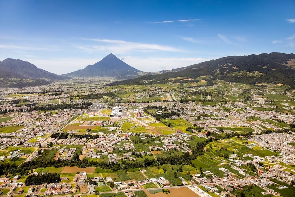
Commonly known as Xela (pronounced ‘sheh-lah’), Quetzaltenango is a city located in southwestern Guatemala. It has about 180,000 residents who live high up in the mountains of the Guatemala Ranges.
While Quetzaltenango is well-known as a major center for agriculture in the country, it has also seen a boom in tourism in recent years.
This boom is driven partially by its proximity to Guatemala City (just 3.5 hours by car) and by its status as the main starting point for climbing attempts on Tajumulco. Although Tajumulco is technically part of the Chiapas Ranges, Quetzaltenango also offers excellent access to some of the region’s other major peaks.
Located about 16 km (10 mi) to the south of Guatemala City, Villa Nueva is the second largest city in the Guatemala Department with some 620,000 residents. It is one of the oldest cities in the country though it has since become heavily industrialized and it now has a strong manufacturing economy.
Villa Nueva also happens to be located just outside of Naciones Unidas National Park (Parque Nacional Naciones Unidas), Volcán de Pacaya National Park (Parque Nacional Volcán de Pacaya), and Volcán Fuego Reserve (Reserva Volcán Fuego), so it’s an excellent place to stay if you’re looking to enjoy the great outdoors.
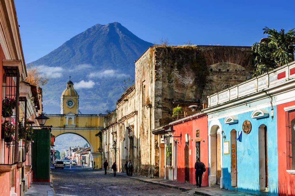
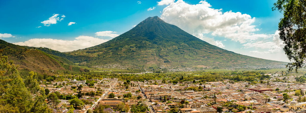
Situated to the west of Guatemala City in the Sacatepéquez Department, Antigua Guatemala is a city of some 46,000 people. Although it is substantially smaller than some of its more metropolitain neighbors, Antigua Guatemala is well worth visiting.
In fact, the city is home to a designated UNESCO World Heritage Site and it contains a number of impressive Baroque-inspired buildings. Antigua Guatemala is also one of the largest coffee-producing regions of the country and it has a bustling tourism industry.