Scan the QR code and open PeakVisor on your phone
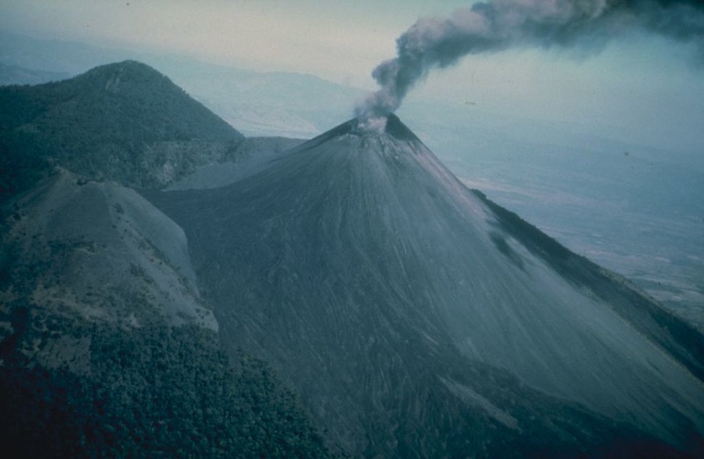
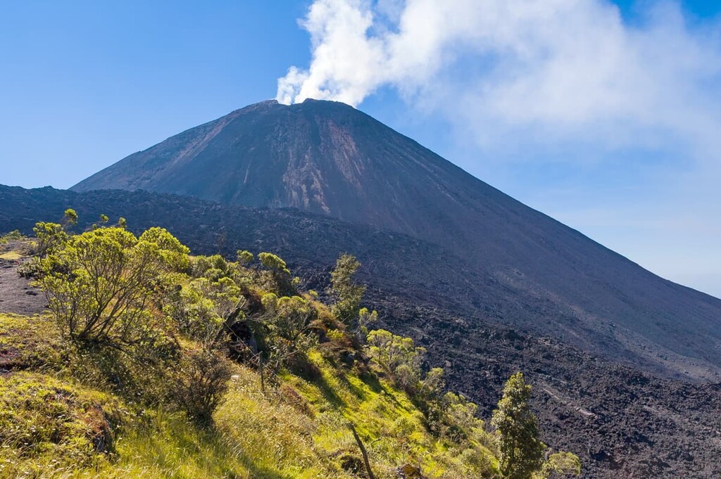
With six named summits, Guatemala’s Parque Nacional Volcán de Pacaya y Laguna de Calderas is a protected area located in the southeastern part of the country. It is dominated by 6 named mountains, the highest and most prominent of which is the active stratovolcano Pacaya (2,552 m/8,373 ft)—the most frequently climbed volcano in Guatemala and one of the most active volcanoes in Central America.
Parque Nacional Volcán de Pacaya y Laguna de Calderas (Volcán de Pacaya y Laguna de Calderas National Park) is located on the border between Escuintla and Guatemala departments in the southeastern part of Guatemala. It is situated within the municipalities of San Vicente Pacaya and Amatitlán.
The park is currently open 365 days a year, from 7:00 a.m. to 5:00 p.m with entry fees at Q50 ($6.50) for international travelers. That said, Pacaya’s frequent eruptions necessitate occasional park closures and a variety of changing restrictions.
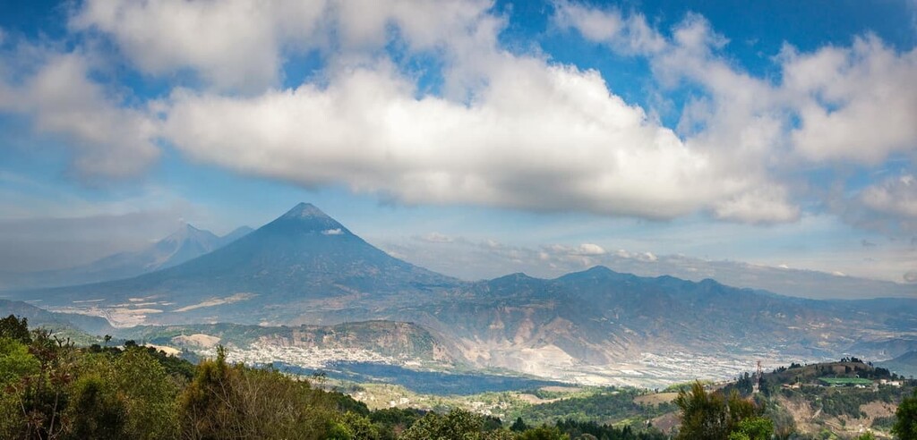
Though it is a relatively small park, with an area of only 22 square kilometers (8.6 sq. mi), Parque Nacional Volcán de Pacaya y Laguna de Calderas is a mere 40 kilometers (25 mi) to the south of Guatemala City and even closer to the tourist hub of Antigua (18 km/11 mi). This makes it the country’s most accessible national park for international travelers.
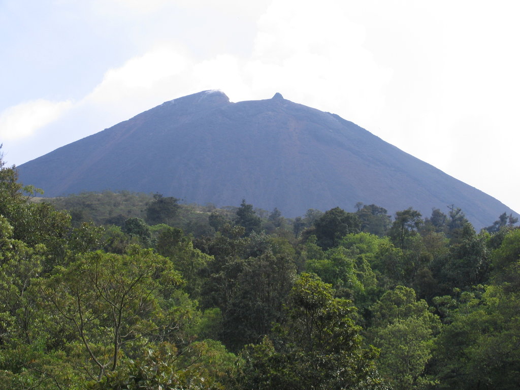
Almost all of the park’s area is covered by its six volcanic peaks: Cerro Grande (2,550 m/8,366 ft), Cerro Chiquito (2,462 m/8,077 ft), Cerro Chino (2,265 m/7,431 ft), Cerro Hoja de Queso (2,098 m/6,883 ft), Montaña Las Granadillas (1,878 m/6,161 ft) and the eponymous Pacaya (2,552 m/8,373 ft), of which the other peaks are all subpeaks.
There are also 14 craters in the park. The large water-filled caldera (Laguna de Calderas), officially known as the San Jose, provides potable water for over 21 communities, with an average water temperature around 10° C (50ºF).
As is common throughout most of Central America, Guatemala has a rainy season that lasts from about May through December (with a short drier period in August). Meanwhile, the primary dry season, and the best time to visit, is January through April. Do note, however, that volcanic eruptions are sporadic and can result in restricted access to the park at any time of year.
Although the park is fairly isolated from other protected areas, there are some other national parks and reserves located nearby. This includes the Reserva Volcán Fuego to the west, which is another popular hiking destination.
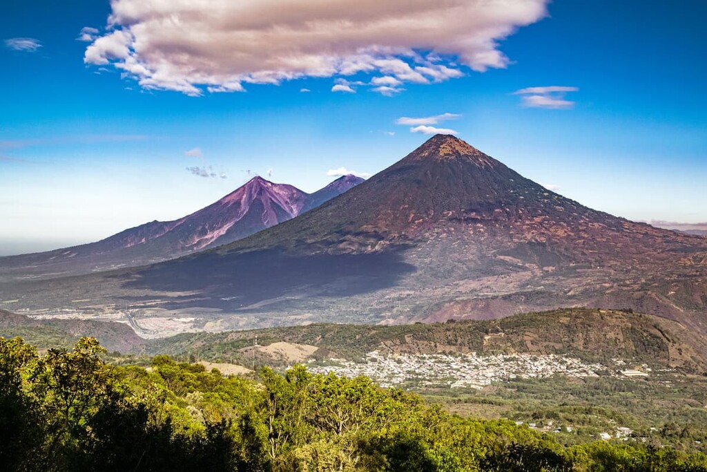
The volcanic complex at Pacaya, which saw its first eruption 23,000 years ago and has most recently been continuously active since the 1960s, is a part of the Central American Volcanic Arc. This volcanic arc contains 33 volcanoes in Guatemala alone.
This range of volcanoes stretches along Central America’s Pacific coastline and was formed via the subduction of the Cocos Tectonic Plate in the west underneath the Caribbean Plate and North American Plate to the east and north, respectively. Guatemala represents the northern terminus of the Central American Volcanic Arc, which stretches down to northern Panama.
Pacaya sits to the south of a large caldera, Amatitlán, which stretches some 224 square kilometers (86 sq. mi) in length. The caldera formed in the Pleistocene era and has spewed an estimated 70 cubic kilometers (17 cubic mi.) of magma over the course of the last 300,000 years.
This caldera contains one of Guatemala’s two famous volcanic lakes, Lago de Amatitlán (the other being Lago Atitlán, Central America’s deepest lake). It is also now known to be the source of several voluminous silicic tephras in Guatemala.
Pacaya itself is composed of a mixture of basalt and basaltic andesite, a volcanic rock that makes up the majority of the geological deposits in the park.
The original Pacaya volcano (Pacaya Viejo) collapsed somewhere between 600 and 1,500 years ago. This collapse resulted in a landslide that traveled all the way to the Pacific coastal plain to the southwest, and left an arcuate somma rim in its place, inside of which the current Pacaya volcano began to grow.
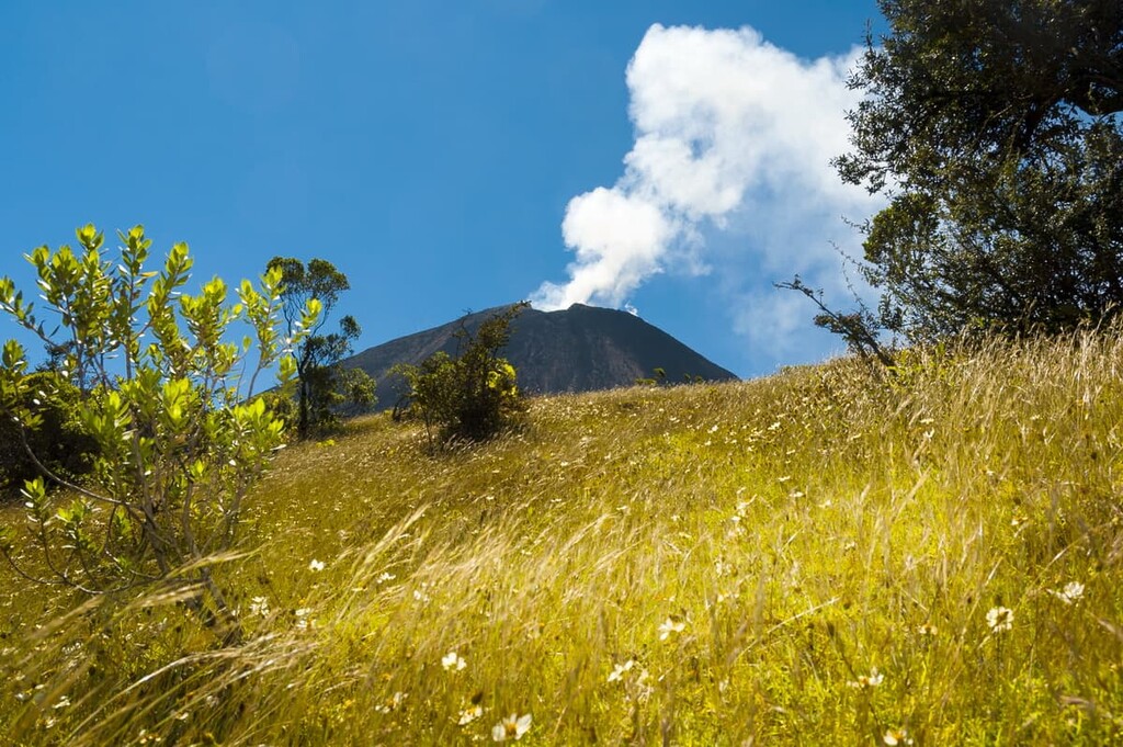
Though the frequent volcanic eruptions in the park leave much of the surrounding terrain barren of plant life, there are numerous reforestation projects in process almost continuously, and at lower elevations, visitors travel through swaths of temperate subtropical humid forest en-route to the summit.
One notable plant species in the park is the “hoja de queso” (leaf of cheese). It is so-called because the leaves of this plant used to be used to wrap up blocks of cheese.
Toucans can also be seen in the park in July and August, while coyotes, armadillos, rabbits, mountain lions, and a variety of snakes are all common. The San Jose caldera contains a variety of fish, mostly tilapia, but also largemouth bass.
The Pacaya volcano has seen over two-dozen major eruptions since the Spanish conquest of the Americas circa 1550, and human history around the park has almost always been inexorably linked to the peak’s activity.
Indeed, the region was long home to the people of the Mayan Civilization, which existed in what is now Guatemala from about 6,500 BCE to about 900 CE. The region is now the ancestral homelands of many peoples, including the Xinca.
Volcán de Pacaya y Laguna de Calderas was declared a national park on July 20, 1963. The word “pacaya” comes from a bitter vegetable commonly prepared in Guatemalan cuisine.
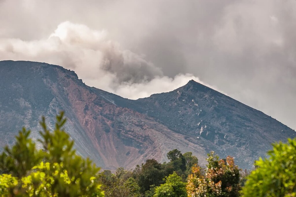
The volcano’s current period of activity, beginning in the late 1960s, has seen several evacuations and earthquakes. In fact, eruptions in 1986 and 1987 resulted in over 3,600 people having to evacuate from the villages of El Caracol, El Rodeo, Los Pocitos, and El Patrocinio.
A 1998 eruption saw ash clouds reach 18,000 feet (5,480 m) in elevation. Another major eruption in 2010 resulted in the destruction of more than 800 buildings in a dozen towns, numerous injuries, and the death of a Guatemalan journalist. Over 700 villagers died in an eruption in 2019.
The main summit of the peak was christened the Mackenney Cone after Dr. Alfredo Mackenney, a 90-year-old Guatemalan volcanologist who summited Pacaya over 1,500 times and spearheaded the scientific study of the volcano.
There are only two authorized trails within the park, both of which are centered around Pacaya. Entry fees are currently Q50 ($6.50) for international travelers.
After an incident in 2019 where a number of tourists became lost on the mountain and had to stay on the mountain overnight unprepared, at least one local guide is now required for all park visitors. Furthermore, groups over 12 people must have one guide for every 10 individuals.
As of the time of writing, a Q200 ($26) guide fee is standard. Horses and walking sticks can also be purchased or rented for a small fee, depending on your bargaining skills. Though trails used to go to the summit, access to the summit cone of Pacaya is now restricted and unlikely to change any time soon, given the volcano's volatility.
(NOTE: As of 2021, this trail is closed due to volcanic activity, but it may reopen soon).
The main trail up Pacaya begins in the village of San Francisco de Sales, at the park’s Visitor Center.
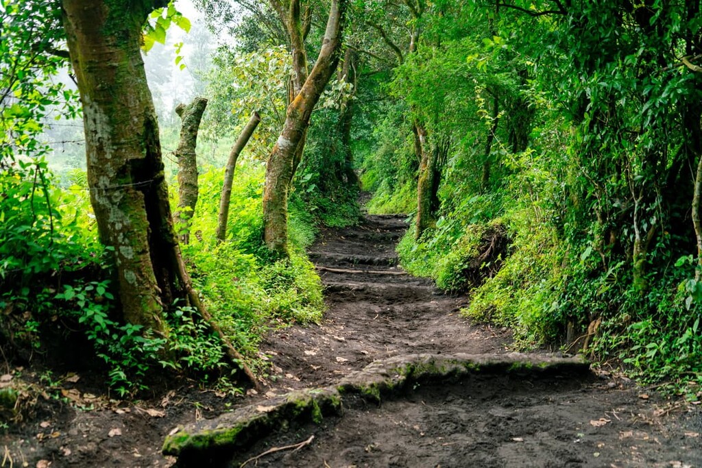
Hikers begin their trek through the Latifoliado Forest of San Francisco, a temperate subtropical humid forest. Eventually, hikers pass by a viewpoint for the San Jose Caldera and a number of other viewpoints, including the Mirador (Viewpoint) Majahue, from which the famous Agua (3,760 m/12,340 ft), Acatenagno (3,976 m/13,045 ft), and Fuego (3,763 m/12,346 ft) volcanoes are all visible.
At the top of the trail, hikers used to be able to reach Pacaya’s high point at the western crater. However, the trail now stops at Cerro Chino’s old crater and connects with La Corona Trail.
La Corona Trail, which is slightly more difficult than the primary trail but is the sole trail that is currently open, begins in the small village of Concepción El Cedro. It takes hikers to the summit of Cerro Chino (2,265 m/7,431 ft), a so-called “parasitic cone” or subpeak, to the north of Pacaya’s main summit and one of the oldest craters of the volcano, before heading on to the summit.
Like the Main Trail, the La Corona Trail takes about two hours round trip. When both are open, hikers can combine the La Corona and Main Trail for a loop, venturing up one and down the other.
Looking for a place to stay during your visit to Parque Nacional Volcán de Pacaya? Here are some of the best cities and towns to check out near the park:
Guatemala City, the country’s capital and largest metropolitan area, harbors an urban area population numbering nearly 3 million people. Nearly 20 percent of the small nation’s population lives in and around the city. Pacaya is a mere 40 kilometers (25 miles) to the south of Guatemala City, making it extremely accessible for international tourists.
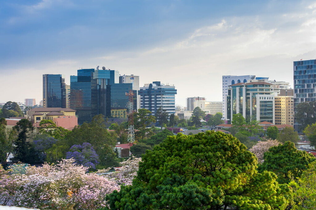
Though most visitors opt to head to the much quieter Antigua upon arrival, there are a handful of interesting sites in Guatemala City. Zone 1, the historic city center, houses the Plaza de Constitución, where you’ll find the National Palace and Cathedral. There are numerous restaurants and bars in the trendy Zona Viva (Zone 10), and Paseo Cayala in Zone 16 offers a number of restaurants, boutiques, coffee shops, and other upscale pedestrian-friendly sites.
Located slightly closer to Pacaya (18 km/11 mi), Antigua Guatemala—the historic colonial Guatemala City—is arguably the country’s main tourist hotspot. As a result, the vast majority of tours to Pacaya leave from Antigua.
Antigua was founded in 1524 as the town of Santiago de Guatemala and it sits at an elevation of about 1,500 meters (4,921 feet). The city was destroyed by earthquakes numerous times throughout its history, most recently in 1774, when the government ordered the nation’s capital relocated to a safer region (which became the modern Guatemala City).
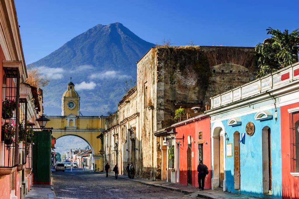
The old city, which then became known as La Antigua (The Ancient) Guatemala, has retained most of its sixteenth through eighteenth-century architecture and Renaissance-style grid layout, including several historic churches and the famous Santa Catalina Arch. There are a plethora of hotels, hostels, and Airbnb lodging options within the city. It is also very walker-friendly, with traditional cobbled roads and a cross-town walking time of only 20 minutes or so.
Camping is traditionally allowed within the park, but as with entry, parties must be accompanied by a local guide at all times. Campfires are also allowed, but only with firewood purchased outside of the park in the surrounding municipalities (firewood collection inside the park is not allowed).
With that said, as of mid-2021, camping is currently prohibited due to Pacaya’s recent eruptions. More information and direct contact can be found on the park website.