Scan the QR code and open PeakVisor on your phone
Sierra de las Minas Biosphere Reserve is a UNESCO World Heritage Site centered around the eponymous mountain range in eastern Guatemala. There are 37 named summits inside the 2,426 sq. km (937 sq. mi) park, the highest of which is Cerro Raxón (3,018 m/9,902 ft).
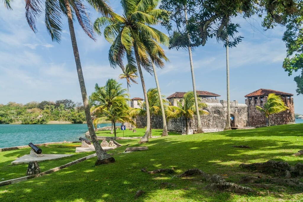
Sierra de las Minas Biosphere Reserve (Reserva de la biosfera Sierra de las Minas) sits just a few kilometers southwest of the shores of Lago de Izabal, the largest lake in Guatemala, which drains into the Caribbean Sea. It is located in the Alta Verapaz, Baja Verapaz, Zacapa, Izabal, and El Progreso departments in the east-central part of the country.
The park’s eponymous mountain range, the Sierra de las Minas, runs nearly 180 kilometers (112 mi) to the west of Lago Izabal, where it intersects with the Salamá river valley, which divides it from the Sierra de Chuacús range. The Sierra del Mico, a smaller mountain range, borders Sierra de las Minas to the northeast.
Hemmed in by the Polochic and Motagua river valleys to its north and south, respectively, the reserve spans a wide variety of elevations. It ranges from sea level near the lake all the way to above 3,000 meters (9,843 ft) at its highest point, Cerro Raxón (3,018 m/9,902 ft). This peak is also the eighth most prominent summit in Guatemala. The park’s lowest named summit is Cerro Caxlampom (697 m/2,287 ft).
The reserve sits on an informal geographic boundary, which splits eastern Guatemala in two with the humid, tropical climes of the aforementioned Polochic Valley to the north and the arid highlands of the Motagua to the south.
Aside from its peaks, of particular note inside the reserve is La Peña del Ángel (The Angel Stone), a large rocky outcropping that resembles the outstretched wings of an angel and was formed in 1976 after an earthquake. It sits at 2,400 meters (7,874 ft) in elevation. El Salto de Chilascó, one of Central America’s tallest waterfalls at 130 meters (427 ft), is another popular destination within Sierra de las Minas.
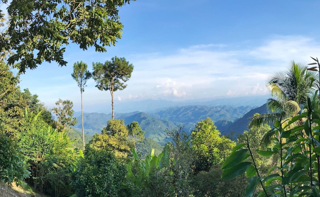
The mountains within the park are the source of over 63 rivers, including the Río Blanco. Additionally, the park is also one of the largest and best-preserved regions of cloud forest in Central America.
Ravines and gullies, with extremely steep slopes (frequently exceeding 65 degrees), scar much of the mountainous terrain in the reserve, particularly in the north and west. The southern highlands of the park are generally less rugged than the terrain in the north, and as such, are much more accessible.
According to an expansive study published by leading twentieth-century American geologist Sidney Powers in The Journal of Geology, the Sierra de las Minas is primarily composed of sedimentary and metamorphic rocks from the Carboniferous and pre-Carboniferous period.
“North of Lago Izabal the rugged country of gradually diminishing relief is underlain by folded limestones of Cretaceous age,” says Powers, while the overall range is composed, “from south to north, of serpentine, crystalline schist and gneiss, granite, Santa Rosa formation schist of the Carboniferous age, and Carboniferous limestone. The belt mapped as serpentine coincides with a belt of very good quality white, crystalline marble which composes the south flank of the mountains.”
The Sierra de las Minas range is home to a large number of blue and green jade mines, hence its name (minas meaning “mines” in Spanish, i.e. “The Mountain Range of Mines”), along with deposits of serpentine, marble, and other valuable resources.
Due to the rugged nature of the terrain in the region, which naturally fosters relatively isolated “island” evolution, there is a high degree of biological diversity and endemism within the reserve.
There is a variety of land cover within the part, including subtropical thorn forest, dry subtropical forest, tropical moist forest, cloud forest, and agricultural systems and pastures with crops like coffee, rice, and corn (in the southern region). There are over 17 species of evergreen forest endemic to the area.
Of particular note, the park contains approximately 60 percent of the remaining cloud forest in Guatemala. It also is the world’s largest habitat for the brightly-colored quetzal (Pharomachrus mocinno), which is both Guatemala’s national bird and the inspiration for its national currency (quetzals).
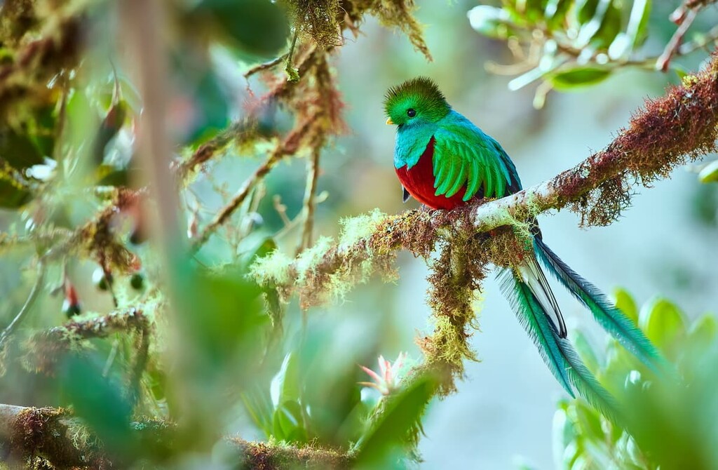
The reserve is home to 885 species, including approximately 70 percent of all the species found in both Guatemala and neighboring Belize. These species include 21 species of endemic birds, among a slew of other avian life, such as the aforementioned quetzal, the harpy eagle (Harpia harpyja), and horned guan (Oreophasis derbianus).
A number of large felines are found in Sierra de las Minas, including jaguar (Panthera onca), cougar (Felis concolor), onza (Puma yagouaroundi), ocelot (Leopardus pardalis), and margay (Leopardus wiedii). Other indigenous mammals include the Guatemalan black howler (Alouatta pigra), Baird's tapir (Tapirus bairdii), and the red brocket (Mazama americana).
As mentioned previously, the region (particularly the Motagua River valley in the south) has been a source of jade and other precious minerals for thousands of years, particularly for major pre-Colombian Mesoamerican civilizations such as the Maya and Olmec peoples.
The jadeite mined here was the primary source of jade for the entire Mayan Empire and it played a major role in influencing Mesoamerican trade. Jade, along with serpentine, salt, and cacao, was one of the empire’s critical exports.
Jade, although an important resource in pre-colonial times, wasn’t as important for European markets, who were obsessed with the search for gold. As a result, the local sources of jade were largely forgotten during the colonial era. Jade began to be rediscovered in the region in the late 1980s. Jade boulders as large as commuter buses (up to 2 m/7 ft wide and 45 m/148 ft long) were found in Sierra de las Minas in the early 2000s.
It’s unknown exactly how many people currently live within the boundaries of the reserve, but recent estimates report that Sierra de las Minas is home to at least 200,000 people, many of whom are members of Indigenous communities. There are approximately 200 small communities inside and around the park.
These people are primarily Q’eqchi’ and Poqomchi. Many communities in the region practice subsistence farming, with major crops such as corn, beans, chili, bananas, sugarcane, citrus, and pumpkins. The 63 rivers originating within the Sierra de las Minas also provide water for over 500,000 people in the surrounding communities.
Five different Guatemalan administrative departments (of the country’s 22 total departments) currently lay claim to portions of the Sierra de las Minas Biosphere Reserve. In the north, the park passes through the southernmost edges of the Baja Verapaz, Alta Verapaz, and Izabal Departments, from east to west, respectively. In the south, it passes through the El Progreso and Zacapa Departments. The latter holds the vast majority of Sierra de las Minas within its borders.
The reserve was designated a UNESCO World Heritage Site in 1992.
Sierra de las Minas is home to some of the most pristine territory for hiking that can be found anywhere in Guatemala, though the park itself is fairly underdeveloped and quite rugged.
There are very few trails within the park, and those that do exist are largely overgrown and poorly marked. It is ill-advised (and technically illegal) to go into the park without an authorized guide from the Defensores de Naturaleza (Defenders of Nature), who manage the reserve.
Many hikers have been lost in the park in recent years, either from using no guide at all or an unauthorized and inexperienced guide. Guided hikes are available ranging in length from two-hour treks to three and four-day adventures deep into the mountains.
This waterfall, one of Central America’s tallest (130 m/112 ft), can be reached via a one-hour hike from the village of San Rafael Chilascó, the main jumping-off point for hiking in the park. A crude shelter is available near the waterfall for visitors to camp overnight.

Angel Rock is another notable sight in the park’s east, reached via a 5-kilometer (3.1 mi) hike from the small community of Los Albores, in El Progreso. The rock sits at 2,400 m (7,874 ft) and holds spectacular views of both the Polochic and Motagua river valleys to the north and south.
Hikers commonly leave from El Progreso’s town of San Agustín Acasaguastlán. Doing so turns this trip into a 20 kilometer (12 mi) round-trip hike. However, the rock can also be reached from San Rafael Chilascó if you’re looking for a shorter adventure.
Looking for a place to stay near Sierra de las Minas Biosphere Reserve? Here are some of the best cities and places to check out:
As it’s easiest to access Sierra de las Minas from the southern and eastern sides as opposed to the rugged north. As such, the closest major city to the reserve is Salamá, which is around 3 ½ hours north of Guatemala City via bus. Public buses run to Salamá en route to Coban, via the Monja Blanca bus line.
The town is the capital of Baja Verapaz and the seat of a municipality that’s home to 65,000 people. It is relatively small, but it is home to a handful of unique attractions, including a replica of the Temple of Minerva.
Salamá is notable as the site of a pitched battle in 1953 between anticommunist rebel forces and Jacobo Árbenz’s government in 1953. The poorly organized rebels, backed by Guatemalan landlords and United Fruit Company executives, invaded the town on March 29 but were swiftly defeated by Árbenz’s forces.
This small village, which is located to the west of the park and just outside of Salamá, is home to Sierra de las Minas’ main tourism office, and perhaps the best spot for organizing a trek into Sierra de las Minas. As mentioned above, though there is often no dedicated stop in the region, public buses run through San Rafael Chilascó from Guatemala City en route to Coban, via the Monja Blanca bus line.
San Rafael Chilascó is also the jumping-off point for the popular hike to El Salto de Chilascó, which is of Central America’s tallest waterfalls, with cascades stretching up 130 meters (427 ft).
Camping or cabin stays can be organized via the Guatemalan NGO Defensores de Naturaleza (Defenders of Nature), though prices and availability vary and are subject to change based on weather and season. Head to the park office in San Rafael Chilascó for current info. Whatever you decide, be sure to use an authorized guide and register your visit with the park office.