Scan the QR code and open PeakVisor on your phone
Tikal National Park is located in the Petén province of northern Guatemala and is a UNESCO World Heritage Site. The national park protects the ruins of Tikal, an archeological site of the Maya civilization between the 6th century BC and the 10th century AD. It exists within the Maya Biosphere Reserve, part of the Maya Forest that reaches neighboring Mexico and Belize. There are 15 named mountains in Tikal National Park. Peak 450 is the highest (471 m/1,545 ft) and most prominent (238 m/781 ft).
Tikal National Park protects the Maya ruins of Tikal in the Petén province of northern Guatemala. The park is surrounded by equatorial rainforest known as the Maya Forest that extends into Mexico and Belize. This forest is protected within Guatemala as part of the more than two million hectares (4.9 million acres) Maya Biosphere Reserve. The park is a UNESCO site with both ecological and archeological significance.
Covering 57,600 hectares (142,330 acres), Tikal houses thousands of archaeological sites and artifacts from the Maya Preclassic period in 600 BC to the civilization’s end around 900 AD. The center boasts temples, palaces, public squares, and residences, while the surrounding area holds signs of outer dwellings, agricultural lands, waterways, and trade routes.
The landscape around the ruins includes wetlands, savanna, tropical broadleaf forest, and palm forest. Laguna del Tigre and Laguna de Yaxha are the main lagoons in the wetlands. Rivers in the park are part of the drainage basin of the Usumacinta River that ultimately flows into the Gulf of Mexico.
Tikal National Park sits on the low, rolling hills of the Yucatan shelf in the northwest. Lacandon highlands cut southeast across the park's center through alluvial plains and lagoons.
The North American and South American tectonic plates separated during the Jurassic Period, forming the volcanic arc in southern Guatemala. During this time, rivers transported alluvial sediment fans to basins throughout the region, leaving behind sedimentary rocks known as the Todos Santos Formation. Around Petén, carbonates mix with these sedimentary rocks.
Marine transgressions formed shelf carbonates during the early Cretaceous period, contributing to central and northern Guatemala’s karst formations. The bedrock around Tikal comprises limestone from the Oligocene period and dolomites.

Limestone is porous, which explains why there is little permanent surface water in the zone, even during the rainy season. Most water brought to the park today comes from Lake Peten Itza, the nearest permanent water source about 24 km (15 mi) south of the park. Soils in El Petén are generally permeable and clay-like and form part of a sedimentary basin with Mesozoic and Tertiary deposits.
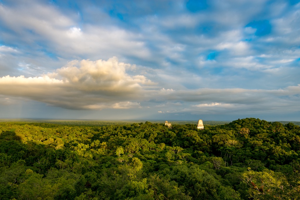
Lush equatorial rainforest encompassing wetlands, savanna, tropical broadleaf, and palm forests surround the ruins of Tikal. The warm and humid environment has an average humidity of 85% and receives an average of 145 cm (57 in) of rain annually. The rainy season lasts from May to December.
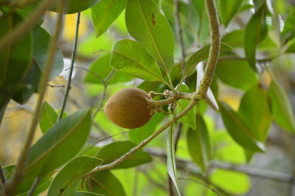
Tikal National Park is a UNESCO World Heritage Site in part for the biodiversity and habitats it contains. The area houses more than 2,000 plant species, including over 200 species of trees.
Several species that are common within the high-altitude forests include chicle (Manilkara zapota), bread-nut tree (Brosimum alicastrum), ceiba (Ceiba sp.), West Indian mahogany (Swietenia macrophylla), and Spanish cedar (Cedrela odorata). The Tinto lowland forest occurs on the floodplains between marshes and savanna. Bloodwood (Haematoxylum campechianum) is one tree commonly found here.
The savanna supports species such as nance (Byrsonima crassifolia). Water hyacinth (Eichhornia crassipes) and cat-tail (Typha latifolia) are abundant in the wetlands.
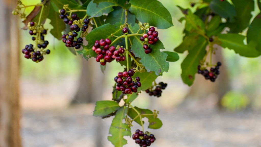
Species found throughout the forests include fiddlewood (Vitex guameri), cedar (Cedrela angustifolia), thatch palm (Sabal mayarum), gumbo limbo (Bursera simaruba), copal (Protium copal), and sweet acacia (Acacia farnesiana). Palms, epiphytes, orchids, and bromeliads grow abundantly here.
Locals make use of many plants for medicine, food, and materials. These include chicle (Marilkara achras), allspice (Pimenta dioica), Mexican mahogany (Swietenia humilis), breadnut (Brosimum alicastrum) and the leaves and flowers from xaté palms (Chamaedorea spp.), (Aechmea magdalenae) and (Araceae spp.).
The landscape is part of the Maya Forest – a large-scale protected area managed by several conservation sites. The region offers a fascinating look at how the landscape has recovered and naturally regenerated after supporting intensive resource use by the Maya civilization for centuries.
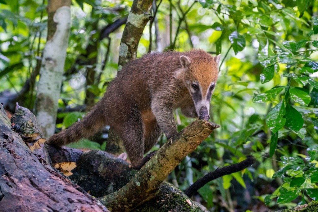
More than 100 mammals make their home in Tikal National Park. Among these are more than 60 species of bat, five feline species (jaguar, puma, ocelot, margay, jaguarundi), monkeys such as the Yucatan spider monkey and mantled howler monkey, tapirs, anteaters, and coatimundis.
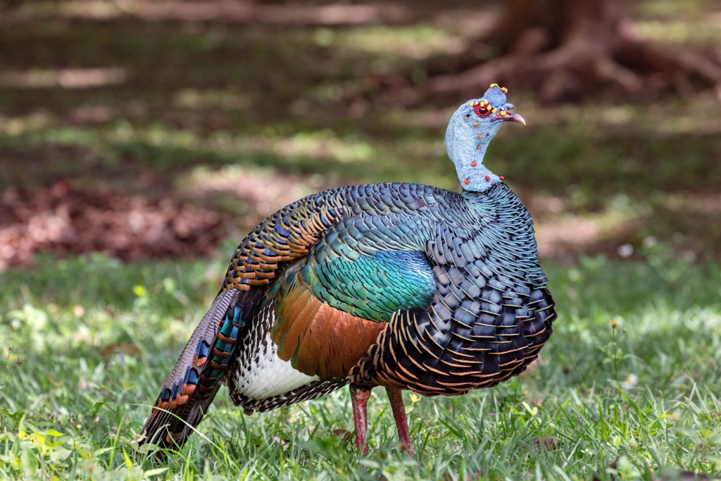
Over 300 bird species thrive in the park, including ocellated turkeys, crested eagles, ornate hawk-eagles, great curassows, toucans, parrots, trogons, motmots, woodpeckers, manakins, and warblers. The hanging nests of the Montezuma oropendola adorn the perimeter of the Great Plaza.
The zone supports 25 amphibians, a wide array of river fish, and numerous invertebrates, including common leaf-cutter ants. More than 100 species of reptiles live here. Of note are the endangered Central American river turtle, Morelet’s crocodile, and 38 snake species.
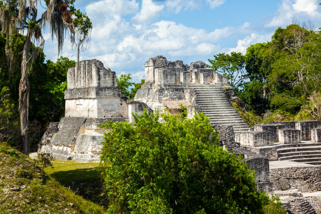
The ruins of Tikal represent a major Pre-Columbian political and economic center of the Maya civilization. The ancient city’s inner zone covers about 400 hectares (988 acres) with numerous palaces, temples, residences, ball-game courts, public squares, roads, and terraces. Most large temples were built during the 8th century AD, when the city is estimated to have up to 100,000 inhabitants.
You can spot surfaces decorated with stone carvings, murals, and hieroglyphics throughout the ruins. These recount the history of Tikal, including relationships with the other major political centers Teotihuacan and Calakmul in Mexico, Copan in Honduras, and Caracol in Belize.
In the 1,200 hectares (2,965 acres) surrounding the urban center, you’ll find signs of residential areas, water reservoirs (known as aguadas), and over two dozen secondary sites such as checkpoints along trade routes and agricultural sites.
Tikal offers essential insight into the Maya’s development from hunting-gathering to farming and their intellectual, artistic, and technical accomplishments. The most noteworthy sites include the Great Plaza, the Twin Pyramid Complexes, the Lost World Complex, and the ball courts and irrigation systems. Although the exact cause of the civilization's decline is unknown, historians believe it was the compound effect of wars, resource depletion, overpopulation, and famine.
Following the decline and dispersion of the Maya civilization, the urban center was abandoned and buried for centuries. Hernan Cortes, the Spanish conquistador who dominated Mexico, passed Tikal in 1525 but did not see the ruins overgrown by towering cotton, silk, cedar, and mahogany trees.
There was some mention by Spanish friars of a city hidden in the forests, but it wasn’t until 1848 that an expedition directed by the Guatemalan government definitively rediscovered the site. Swiss, German, and British archeologists quickly arrived to assist with the unearthing.
The site was declared a national monument in 1931. It became a national park in 1955, with a few adjustments to boundaries and regulations two years later. During the 1950s and 60s, the Guatemalan Institute of Anthropology and History and the Museum of the University of Pennsylvania worked to restore structures. Tikal received its UNESCO designation in 1979, and UNESCO recognized the surrounding Maya Forest Biosphere Reserve in 1990.
Although the park is well protected, weathering and illegal looting are two issues of concern in maintaining the park’s integrity.

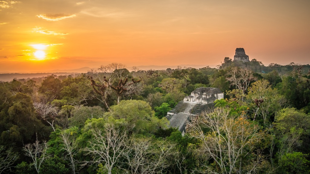
Tikal National Park's primary focus is exploring the remarkably preserved ruins. The park is open daily except on holidays and charges a small entrance fee. The park is free to locals on Sundays, so those looking for a quieter visit should go during the week. It is also possible to visit the park for sunrise.
There are two museums within the park. The Stelae Museum preserves important stelae (stone pillars) and houses a reproduction of one of the most significant images from the site – the bound captive. The Sylvannus G. Morley Museum has a reconstruction of the tomb of one of the city’s builders, Ha Sawa Chaan K’awil.
Below are some of the top landmarks in the park.
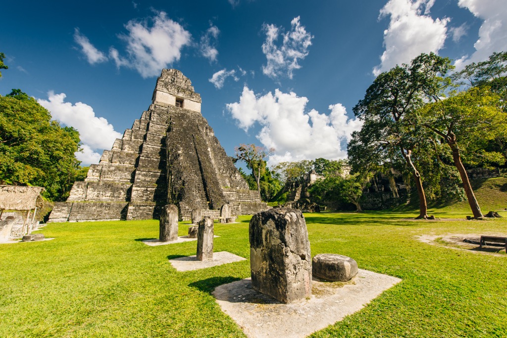
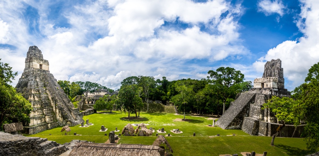
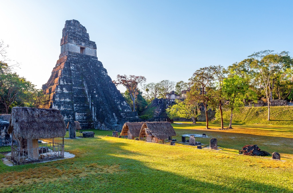
The Temple of the Grand Jaguar (Temple I) and the Temple of the Masks (Temple II) lie on either end of the Great Plaza, with terraces, ball courts, and palaces surrounding the rest of the perimeter.
The Temple of the Grand Jaguar rises 50 m (164 ft) on the plaza's eastern end. The 9-tiered pyramid represents the nine levels of the underworld. In 1958, archeologists discovered the tomb of Ah Cacau, one of the greatest rulers, within the temple. Archeologists found his body with jade ornaments and offerings such as pottery, alabaster, sea shells, and pearls from the Caribbean coast. Visitors are no longer allowed to ascend this temple due to falls in the past.
Stelae, stone pillars with circular altars, are found throughout the plaza. Carvings on the stelae mark important dates and events. Astronomers utilized a 260-day calendar called tzolkin and a 365-day solar calendar in a system that marked 52-year cycles.
The Temple of the Masks is dubbed for the enormous stone masks looming at the stairway. Visitors are allowed to climb the temple. The top offers views throughout the Great Plaza and the North and Central Acropolis, including ceremonial and residential complexes with intricate layouts.
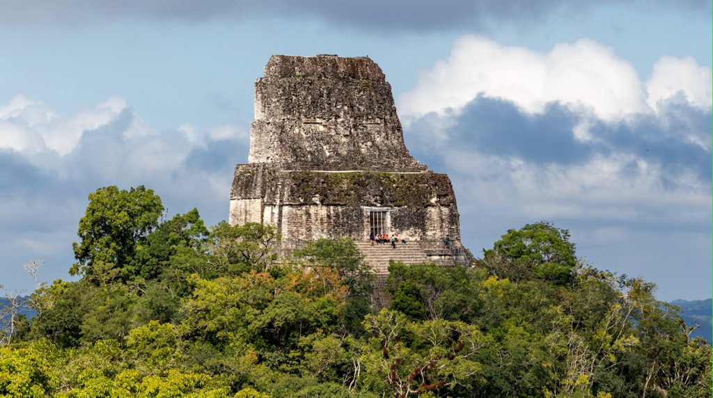
Temple IV, the Temple of the Double-Headed Serpent, is considered the tallest temple erected by the Maya. From the top of the 65 m (213 ft) temple, visitors can take in the landscape from above, with other temples breaking above the forest canopy.
Tikal National Park is relatively remote. The charming town of Flores, about 90 minutes by bus from the park, offers the best access. Flights to Flores arrive from Guatemala City and Belize City. You can travel by road from either of these cities but should expect a full day’s travel.
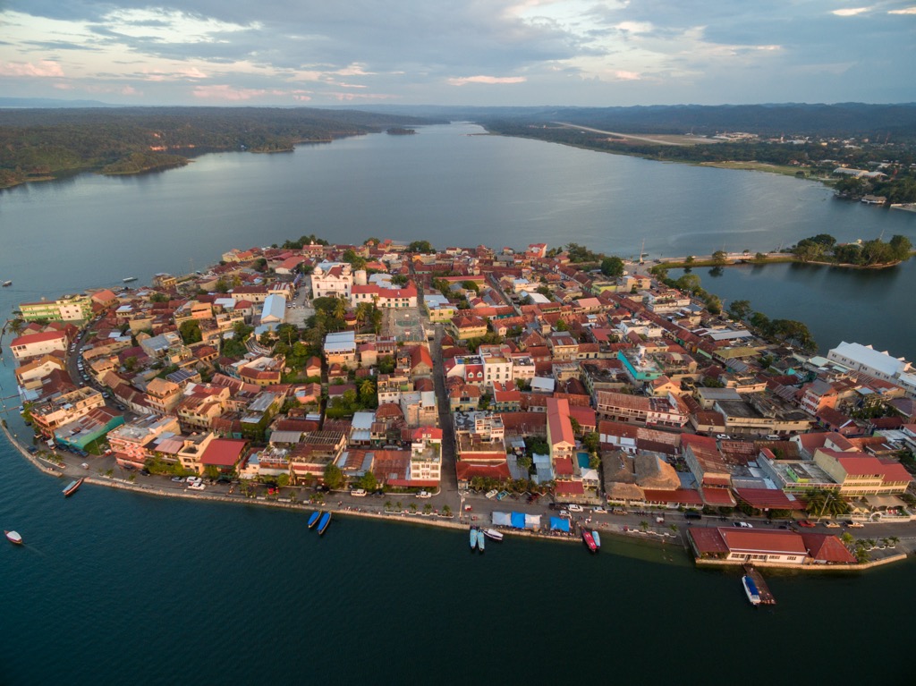
Located on a small island Isla de Flores on Lake Peten Itza, Flores is home to about 15,000 people. You can fly into Flores from Guatemala City and Belize City. A shuttle to Tikal takes around 90 minutes. The town is connected to the nearby larger city of Santa Elena by a causeway.
The cobbled streets, handmade crafts and foods markets, and diverse dining scene make spending a few days in Flores easy. Flores has lots of excellent international and local restaurants. There are lodging options for travelers of all budgets, from cheap hotels and hostels to luxury options. If you have extra time, visit the lesser known Uaxactún ruins. Located slightly further than Tikal, Uaxactún still has locals living among the ruins.
Another option for a day trip is Ixpanpajul Nature Park. Although entry prices are steeper than other activities in the area, those seeking a rush will enjoy the park’s ziplines and canopy walkways.
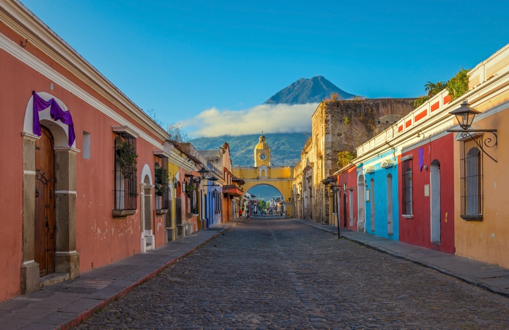
Antigua, Guatemala, is about an hour’s drive outside Guatemala City but a much more charming destination than the large city. It is easy to arrange a shuttle or taxi to the Guatemala City airport and take an hour-long flight to Flores from there.
Antigua has a population of about 45,000 and is a UNESCO World Heritage Site. The historic center has cobbled streets and boasts old churches, plazas, and the popularly photographed Santa Catalina arch. Learn more about the city through a free walking tour or stop by the free Museo Nacional de Arte de Guatemala off the central plaza. Overnight hikes to the nearby volcanoes Acatenango (3,975 m/13,041 ft) and Fuego (3,768 m/12,362 ft) depart from Antigua.
The city offers many accommodations, from hostels to boutique hotels, and has a robust dining scene, including local dishes, international cuisines, and airy rooftop terraces.
As the crow flies, it is only four hours of driving to arrive at Tikal. However, considering a border crossing and the irregularity of public transport, expect a trip by road to take much longer.
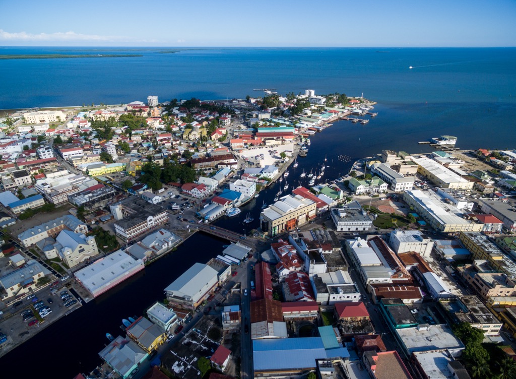
Belize City has around 57,000 inhabitants. It is no longer the official capital but remains a central hub with the country’s main international airport, hotels, and conference centers. The city is not a top tourist destination but suitable for a day or two for those in transit. With some extra time in the city, check out the Museum of Belize, take a city tour to learn about the local history and architecture, or check out the Altun Ha ruins about an hour outside the city.