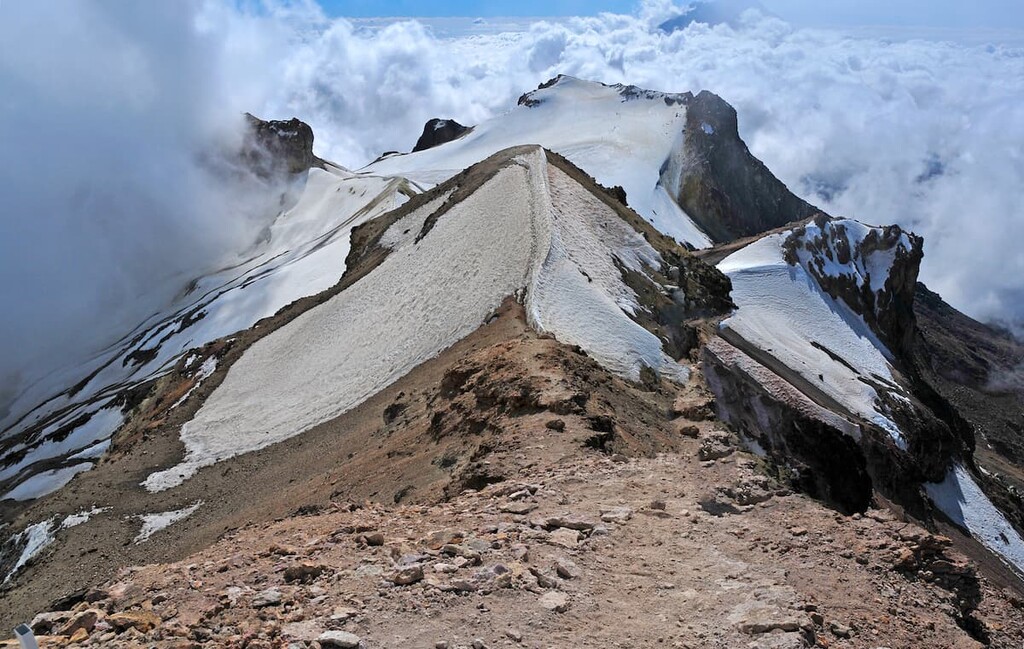
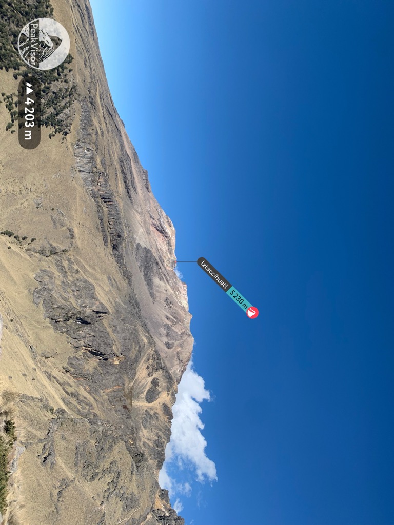
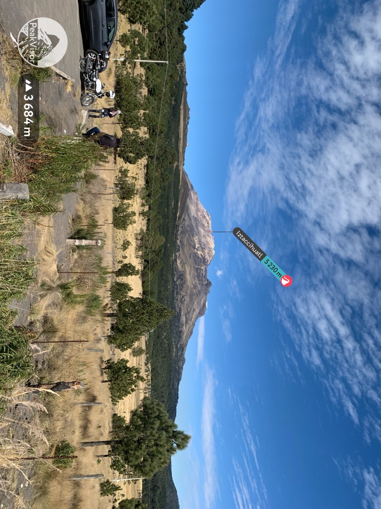
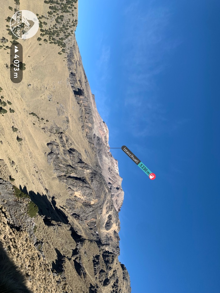
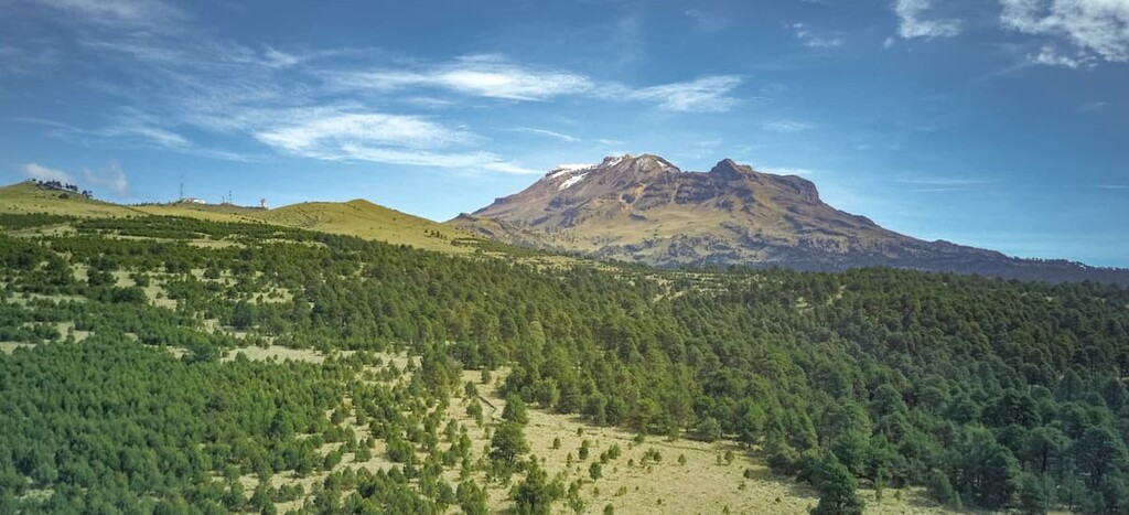
Iztaccíhuatl or Ixtaccíhuatl (both forms also spelled without the accent) (Nahuatl pronunciation: [istakˈsiwat͡ɬ] or, as spelled with the x, [iʃtakˈsiwat͡ɬ]) is a 5,230 m (17,160 ft) dormant volcanic mountain in Mexico located on the border between the State of Mexico and Puebla within Izta-Popo Zoquiapan National Park. It is the nation's third highest, after Pico de Orizaba at 5,636 m (18,491 ft), and Popocatépetl at 5,426 m (17,802 ft).
The name "Iztaccíhuatl" is Nahuatl for "White woman", reflecting the four individual snow-capped peaks which depict the head, chest, knees and feet of a sleeping female when seen from east or west. Iztaccíhuatl is to the north of its twin Popocatépetl, to which it is connected by the high altitude Paso de Cortés. Depending on atmospheric conditions Iztaccíhuatl is visible much of the year from Mexico City some 70 km (43 mi) to the northwest. The first recorded ascent was made in 1889, though archaeological evidence suggests the Mexica and previous cultures climbed it previously. It is the lowest peak containing permanent snow and glaciers in Mexico.
The nearest mountain hut is Refugio located 1 221m/4 006ft SSW of the summit.
By elevation Iztaccíhuatl is
# 4 out of 53002 in Mexico # 2 out of 1238 in Mexico # 4 out of 2629 in Puebla # 3 out of 120 in Parque Nacional Iztaccíhuatl-Popocatépetl # 1 out of 34 in Tlalmanalco # 2 out of 12 in San Salvador el Verde # 4 out of 9767 in the Cordillera Neovolcanica
By prominence Iztaccíhuatl is
# 25 out of 53002 in Mexico # 3 out of 1238 in Mexico # 4 out of 2629 in Puebla # 2 out of 120 in Parque Nacional Iztaccíhuatl-Popocatépetl # 1 out of 34 in Tlalmanalco # 1 out of 12 in San Salvador el Verde # 8 out of 9767 in the Cordillera Neovolcanica
We use GPS information embedded into the photo when it is available.
3D mountains overlay
Adjust mountain panorama to perfectly match your photos because recorded by camera photo position might be imprecise.
Move tool
Rotate tool
Zoom
More customization
Choose which peak labels should make into the final photo and what photo title should be.
Next
Photo Location
Satellitte
Flat map
Relief map
Latitude
Longitude
Altitude
OR
Latitude
°'''
Longitude
°'''
Apply
Register Peak
Peak Name
Latitude
Longitude
Altitude
Register
Teleport
PeakVisor
This 3D model of Sagarmatha National Park in Nepal was made using the PeakVisor app topographic data. The mobile app features higher precision models worldwide, more topographic details, and works offline. Download PeakVisor maps today.
Download OBJ model
PeakVisor
The download should start shortly. If you find it useful please consider supporting the PeakVisor app.
PeakVisor for iOS and Android
Be a superhero of outdoor navigation with state-of-the-art 3D maps and mountain identification in the palm of your hand!