Scan the QR code and open PeakVisor on your phone
Parc national du Mont-Orford (Mont-Orford National Park) is a protected park in the Canadian province of Quebec. There are 18 named mountains within the national park, the highest and the most prominent being the eponymous Mont Orford (853 m/799 ft).
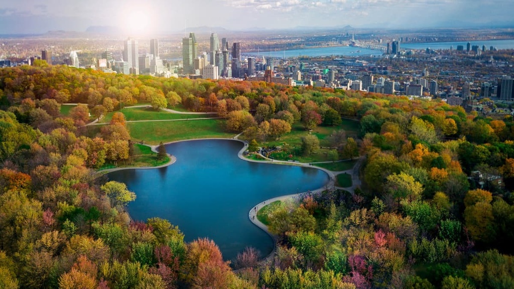
Mont-Orford National Park is on the southern edge of the township municipality of Orford, Quebec. It lies just north of the town of Magog and the province’s Eastern Townships, a popular tourist region. Montreal is 125 km (78 mi) to the west.
Though classified as a national park, Mont-Orford is managed and protected by Sépaq, Quebec’s provincial parks and wildlife agency. The 59.5 sq. km (23 sq. mi) park is a popular spot for hiking, climbing, camping, kayaking, swimming, and birdwatching.
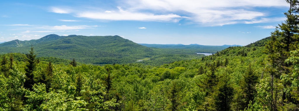
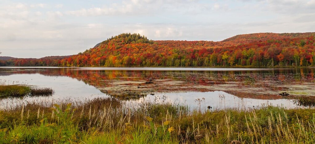
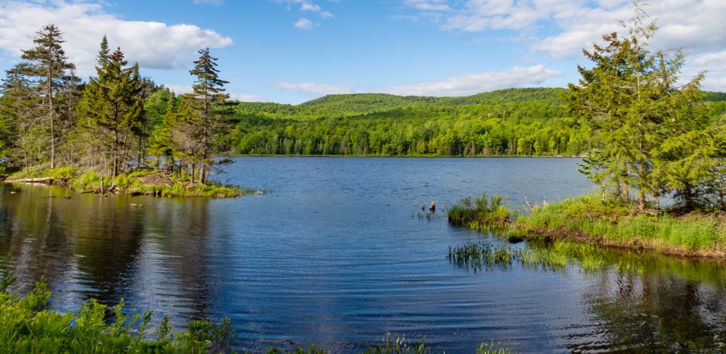
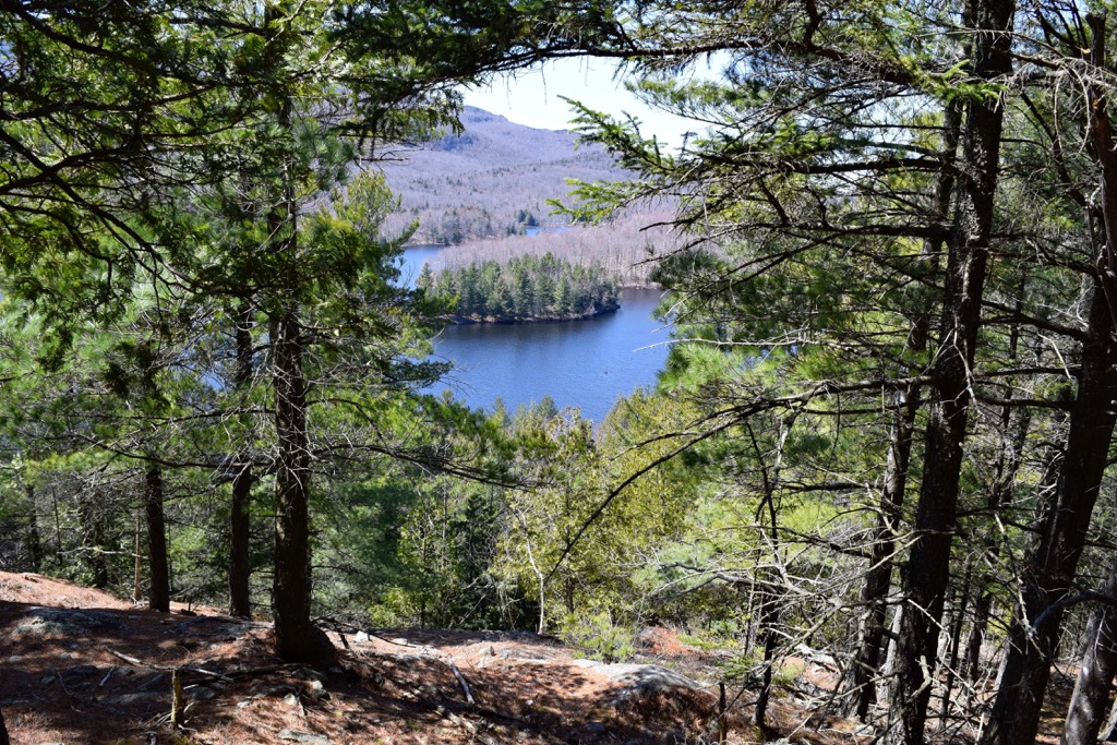
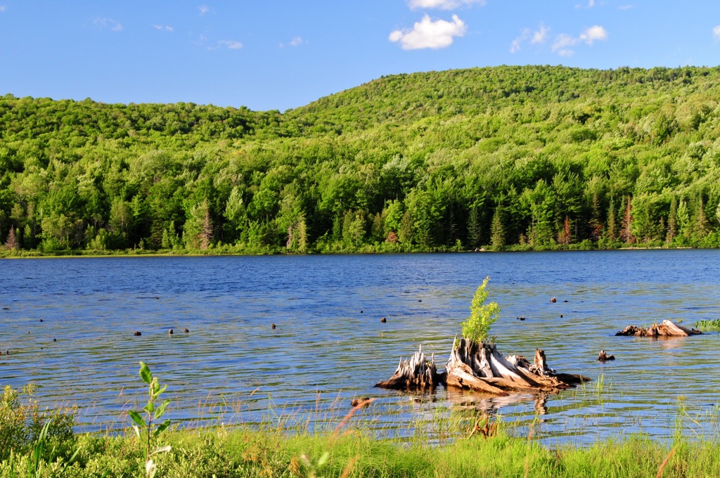
Notable peaks in Mont-Orford National Park include Mont Orford, Mont Giroux (Pic aux Corbeaux), Mont Alfred-Desrochers, Mont Chauve, and Pic de l’Ours. Two large lakes define the park’s distinct sectors: the Lac-Fraser sector to the north and the Lac-Stukely sector to the south.
Part of the Canadian Appalachians, the mountain geology of Mont-Orford still shows traces of the region’s ancient beginnings. In the initial mountain-building event that raised the Appalachian Mountains more than 400 million years ago, layers of the ocean floor were preserved. As the mountains were uplifted and subsequently eroded over millennia, these ancient remnants of ocean crust—called ophiolite—persisted, and can still be seen throughout the Mont-Orford Massif.
Part of the Memphrémagog subrange, the rounded mountain ridges and broad, sweeping valleys of Mont-Orford National Park are characteristic of the Canadian Appalachians. Valley bottoms are replete with wetlands and waterways, including two major rivers—Rivière aux Cerises and Rivière aux Herbages.
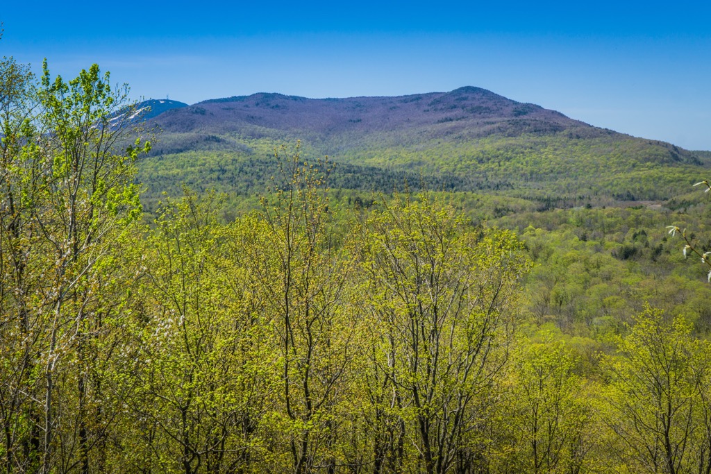
Mont-Orford National Park lies within the North Appalachian/Acadian ecoregion. As a transitional area between vast swaths of boreal forest to the north and more temperate regions to the south, the ecoregion is important for its density and diversity of forest habitats. In Mont-Orford, maple forests dominate, covering about three-quarters of the park’s land area. Balsam fir, red spruce, birch, and boreal oak are also common.
The forests and wetlands also provide habitat to diverse wildlife, including moose, deer, coyote, beaver, river otter, and multiple bat, reptile, and amphibian species. Great blue herons are commonly spotted soaring near lakes and rivers. The park also works to protect and conserve species at risk of extirpation, including peregrine falcon, pickerel frog, and northern spring salamander.
The Mont-Orford region was lightly inhabited by the Missisquoi Abenaki before European settlement in the Eastern Townships began in the late 1700s. Archeological evidence suggests a substantial history of Indigenous agriculture in the region dating back centuries.
The Township of Orford experienced a growth in population in the 1820s as the Canadian government encouraged British immigrants to settle in the area. For the following 120 years, forestry and agriculture were the primary industries.
The initiative to designate the land surrounding Mont-Orford began with Dr. George Austin Brown. Throughout the 1920s and ’30s, he spearheaded an effort to have the 27 municipalities in the area cede territory to the Quebec government to be designated as a national park. Parc national du Mont-Orford was made official on April 8, 1938.
The Mont-Orford Ski Resort opened shortly after, followed by golf courses, hiking trails, and campgrounds. Following an ecological inventory in 1975, park boundaries expanded by nearly 30% to better protect the region’s white-tailed deer.
Mont-Orford truly has something for everyone: sprawling lakes, bike trails, mountain ridges, a ski resort, and groomed cross-country ski trails in the winter. You will never run out of things to do in this relatively small park.
Whatever the season, hiking is always one of the best ways to experience Mont-Orford. An extensive, well-maintained trail network creates endless options for loops and link-ups.
Here are some of the best trails to check out during your visit to the park.
The Mont-Chauve Trail is an 11 km (6.8 mi) loop starting near the shore of Lac Stukely. The trail ascends for nearly 400 m (1300 ft), taking hikers to the rocky summit of Mont-Chauve. Go clockwise to get the steep hiking done early and enjoy panoramic views of Lac Stukley and surrounding peaks from the summit.
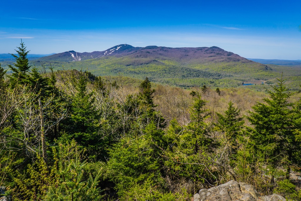
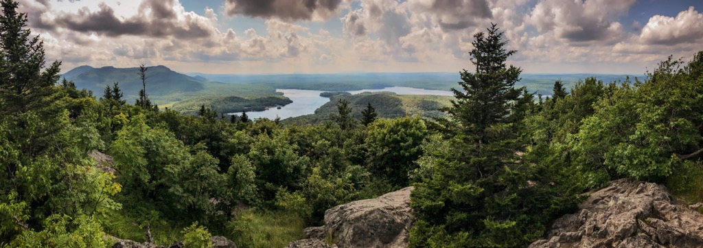
Another excellent option in the Lac Stukely region is to climb Pic de l’Ours via Crêtes Trail. This 11.6 km (7.2 mi) route climbs 587 m (1926 ft) out of verdant maple forests to one of the highest points in the entire park. On clear days, you can even catch glimpses of Vermont’s Green Mountains to the south.
Bring the entire family to explore the forests, lakes, and ponds of Mont-Orford on this pleasant trail. The Trois-Étangs Loop is 5.5 km (3.4 mi), mostly flat, and stroller accessible, enjoyable for hikers of all ability levels. In summer, fresh blackberries and raspberries overflow along the trail. In winter, it transforms into a popular snowshoeing route.
At 150 km (93 mi), Les Sentiers de l'Estrie is the second longest hiking trail in all of Quebec. It starts at the Quebec-Vermont border and bisects Mont-Orford National Park in its entirety. Often completed as a thru-hike, it is possible to day hike or backpack sections of the trail.
For a day hike, follow the trail up to the summit Mont-Orford along the ridgeline of the massif for unmatched views of the surrounding Eastern Townships.
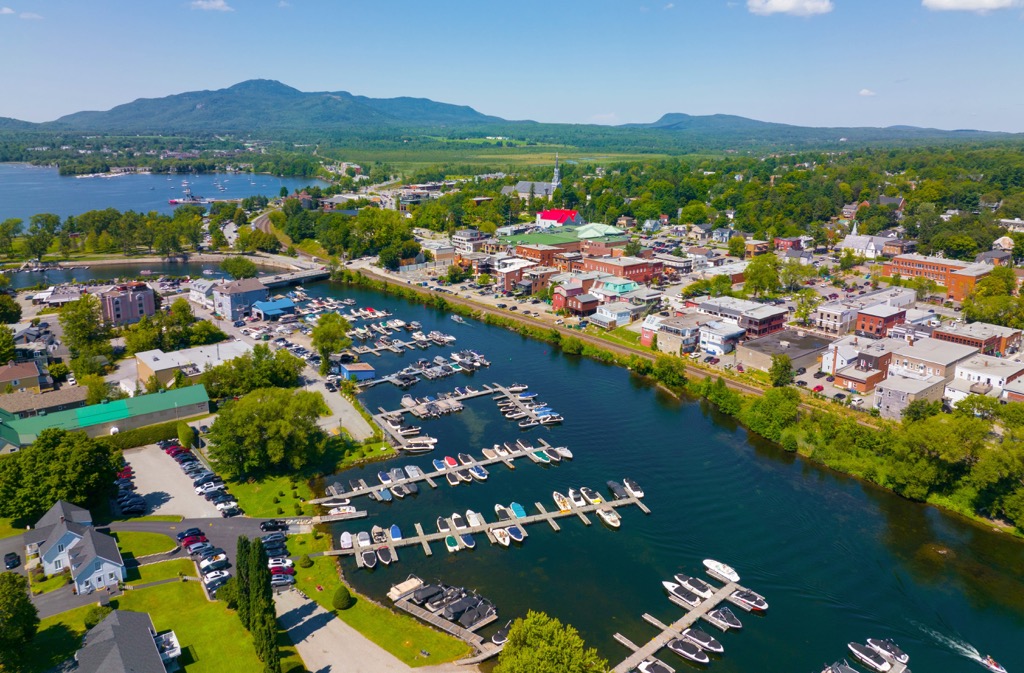
Just a few minutes from Mont-Orford, the municipality of Orford is the most convenient place to stay when visiting the national park. Enjoy the area's vibrant food scene and miles of bike trails when not out exploring the park. Options for accommodation include the Hotel Chéribourg and Motel de la Montagne Orford.
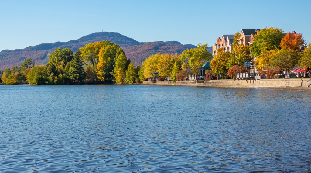
The small but lively town of Magog is just 8 km (5 mi) south of Mont-Orford. Surrounded by mountains and lakes, Magog’s boutiques, art galleries, and excellent restaurants make it worthy of a trip in itself. Stay at historic hotels like the Auberge du Grand Lac or one of the town’s many bed and breakfasts.
Being only a 90 minute drive from Montreal, Quebec’s largest city, Mont-Orford is a favorite for city dwellers looking for a wilderness escape. But if you’re visiting from afar, don’t rush your time in this unique city.
Stay in Old Montreal and explore its impressive architecture, diverse culinary scene, and world-class nightlife. Montreal has an international airport and is the hub of a strong regional train network, making travel to and from the region easy.