
Scan the QR code and open PeakVisor on your phone
La Côte-de-Beaupré is a regional county municipality (MRC) located in the southern part of the Canadian province of Quebec. The MRC is located just to the north of Quebec City along the northern shores of the Saint Lawrence River. There are 49 named peaks in the MRC of La Côte-de-Beaupré, the highest and most prominent of which is Mont Raoul-Blanchard (1,155 m/3,832 ft).
La Côte-de-Beaupré is an administrative subdivision that’s located in the southern part of the Canadian province of Quebec. The region contains a total area of 5,027.8 sq. km (1,941.2 sq. mi). Around 30,000 people live in La Côte-de-Beaupré.
The region is classified as a municipalité régionale de comté (MRC), which translates as a ‘regional county municipality’ in English. MRCs are functionally similar to a regional municipality in many other Canadian provinces, such as Alberta, and they serve a similar role to a county in the US.
La Côte-de-Beaupré is located in the Capitale-Nationale administrative region, which is one of 17 such regions in Quebec. There are no local government structures to these administrative regions, but they’re designed to help allocate and organize provincial governmental services.
There are 7 MRCs (or equivalent territories) in the Capitale-Nationale region, including:
The aptly named Capitale-Nationale (National Capital) region is home to the capital city of the province of Quebec, Quebec City. La Côte-de-Beaupré is situated just to the northeast of the city along the coast of the Saint Lawrence River. One of the largest towns in the MRC, Beaupré, is just around 30 minutes by road from Quebec City.
La Côte-de-Beaupré is a popular day trip spot for residents of Quebec City and it is a worthy tourist destination in its own right. The MRC contains a sizable amount of protected land, including a number of important parks and reserves. Some of the most important outdoor recreation destinations that are located partially or wholly in the MRC include:
La Côte-de-Beaupré is situated in a unique geological area of Quebec. Much of the MRC is dominated by the Laurentian Mountains, though the coastal areas of the region contain substantial fluvial deposits from the Saint Lawrence and Saint Anne rivers.
As far as the mountains go, the Laurentian Mountains are among the oldest mountain ranges that still exist on the planet. They run along the northern shores of the Saint Lawrence in Canada. However, the Grenville orogeny, which was the mountain building event that helped create the Laurentians, was also responsible for creating mountain ranges as far away as southeastern Mexico during the Mesoproterozoic.
The rocks within the MRC are also particularly old. Many of these rocks formed during the Precambrian, about 540 million years ago. Much of the land is also part of the Canadian Shield, which is a huge area of exposed Precambrian rock that covers much of eastern and northern Canada. Most of these rocks are metamorphic or igneous in origin.
The region in and around La Côte-de-Beaupré was also heavily glaciated during the last glacial maximum, as was the case with much of the rest of what’s now Canada. These glaciers helped to carve out many of the valleys, lakes, and other topographical features that we see in the region today.
Major peaks in La Côte-de-Beaupré include Mont Raoul-Blanchard, Mont Belle Fontaine, Mont de la Québécoise, Montagne Brûlée, and Mont François-de-Laval.
The land in and around La Côte-de-Beaupré contains a mix of habitats and ecosystems as well as a diversity of wildlife.
Much of the inland region of the MRC is heavily forested. These forests are primarily boreal forests with trees like white birch, yellow birch, black spruce, and balsam fir. On the summits of the highest peak in the MRC, there are also some alpine areas that are covered by mosses and shrubs.

Within these inland areas, La Côte-de-Beaupré is home to a number of notable species, including black bears, moose, Canada lynx, caribou, mountain lions, and North American beavers.
Near the coast, much of the MRC is home to wetlands and marshes, which are vital habitats for a range of animals, including hundreds of different bird species. In these wetland and marsh areas, you can find greater snow geese, peregrine falcons, and ruby-throated hummingbirds.
Additionally, in these wetland and marsh areas, you can find mammals like white-tailed deer, red foxes, muskrats, black bears, and American porcupines.
The land that is now La Côte-de-Beaupré MRC has long been home to humans. In particular, the region is part of the traditional territory and ancestral homelands of many First Nations, including the Nation Huronne-Wendat.
People of European descent likely first arrived in what is now La Côte-de-Beaupré in 1541 with the establishment of Fort Charlesbourg-Royal by Jacques Cartier of France. The community itself was located in what’s now Quebec City and it was abandoned in 1542, but it was located very close to the current boundaries of the MRC.
In 1608, Samuel de Champlain of France established a colony known as the Habitation de Québec in what is now Vieux-Québec in Quebec City. This was followed by the creation of the Petite-Ferme (Small Farm) in 1626 near what is now Beaupré in order to provide food for the colony.
French colonization of the region increased substantially in the years that followed, despite regular conflict with the British, especially during the seventeenth and eighteenth centuries. This period also saw the forced removal of First Nations from their land as French settlements expanded along the coast to places like Château-Richer and even Baie-Saint-Paul, the latter of which is now in the Charlevoix MRC.
The region that is now La Côte-de-Beaupré became part of the province of Quebec and the newly formed Dominion of Canada in 1867. The MRC itself was created in 1982 and its administrative center is located at Château-Richer.
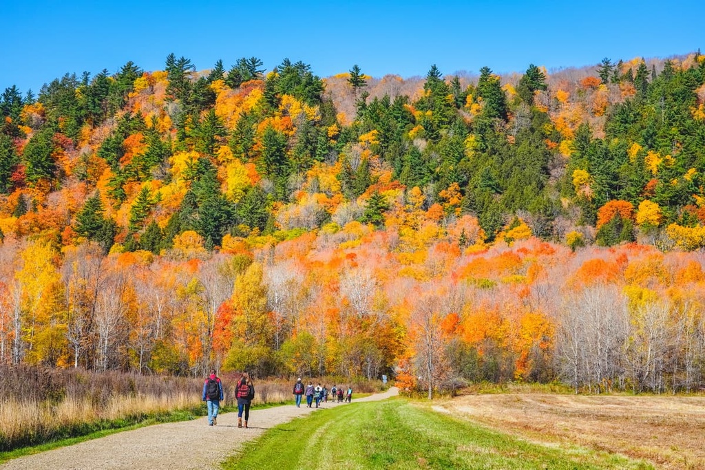
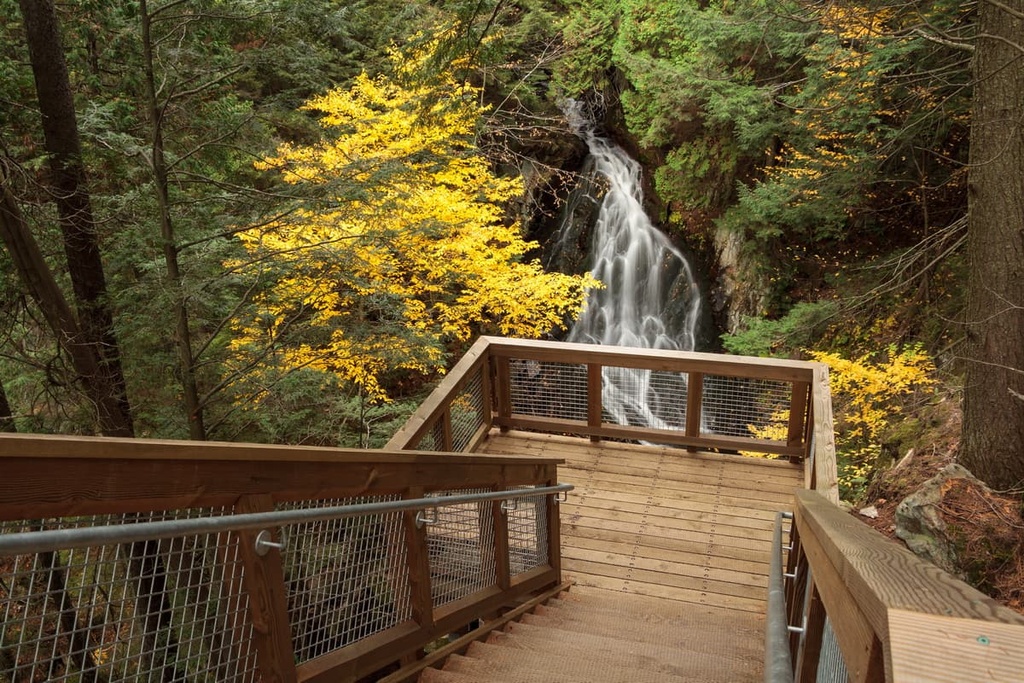
La Côte-de-Beaupré is home to some of the best hiking destinations that are situated within a short drive from Quebec City. Here are a few of the top destinations to check out during your next visit to the region.
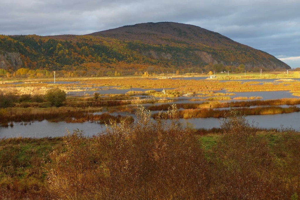
Réserve nationale de faune du cap Tourmente (Cap Tourmente National Wildlife Area) is a federally protected area allocated on the coast of the Saint Lawrence just outside the city of Beaupré. It was established in 1978 and is managed by the Canadian Wildlife Service. The reserve is also an international Ramsar Wetland Site.
Cap Tourmente was originally protected because it is one of the most important habitats in the region for the greater snow goose during its annual migration. The reserve contains a tidal marsh that provides the bullrushes and other food sources that the birds need to feed and gain energy for their long migration each year.
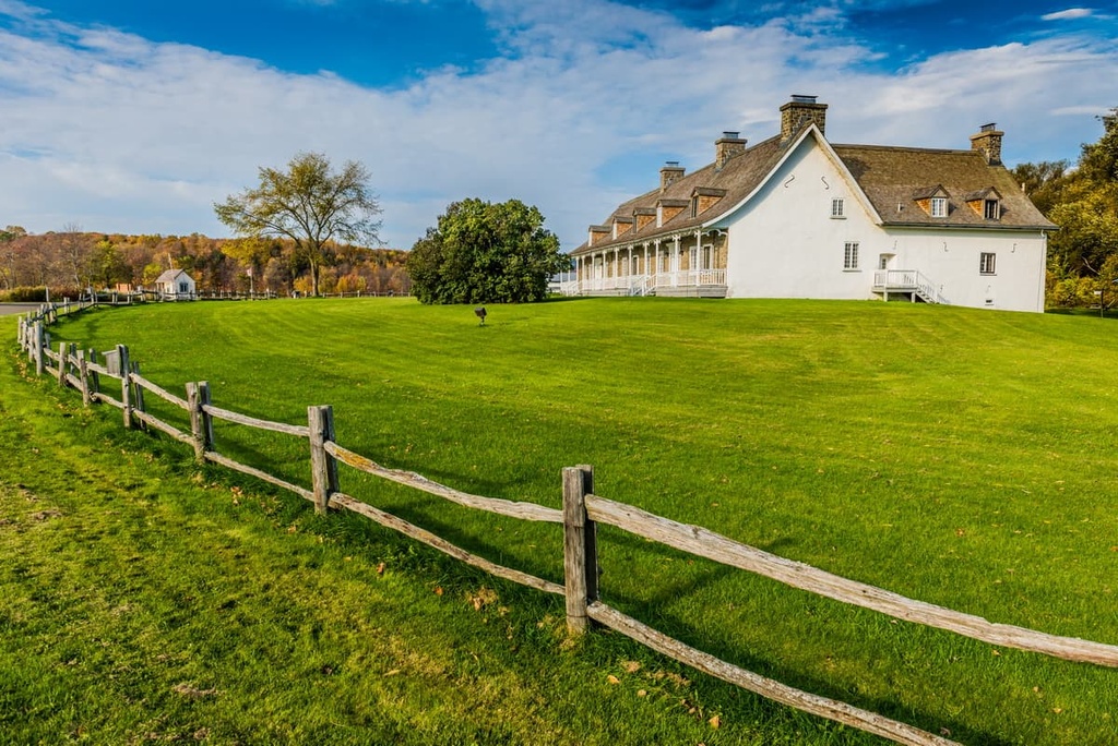
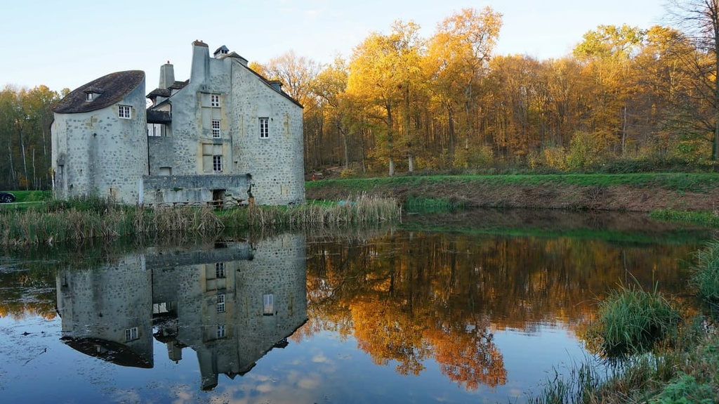
Additionally, Cap Tourmente is home to a handful of historic sites, including Petite-Ferme (Small Farm), which was founded by Samuel de Champlain in 1626 as a way to provide food for the early settlement at Quebec City. The farm was later used as a site for the Seminary of Quebec for 300 years.
Within the reserve, there are more than 20 km (12 mi) of hiking trails for visitors to enjoy during the summer months and a slightly smaller selection of trails for winter hiking. You can also head to the reserve’s interpretation center to learn more about the importance of protecting the area and all of the species that call it home.
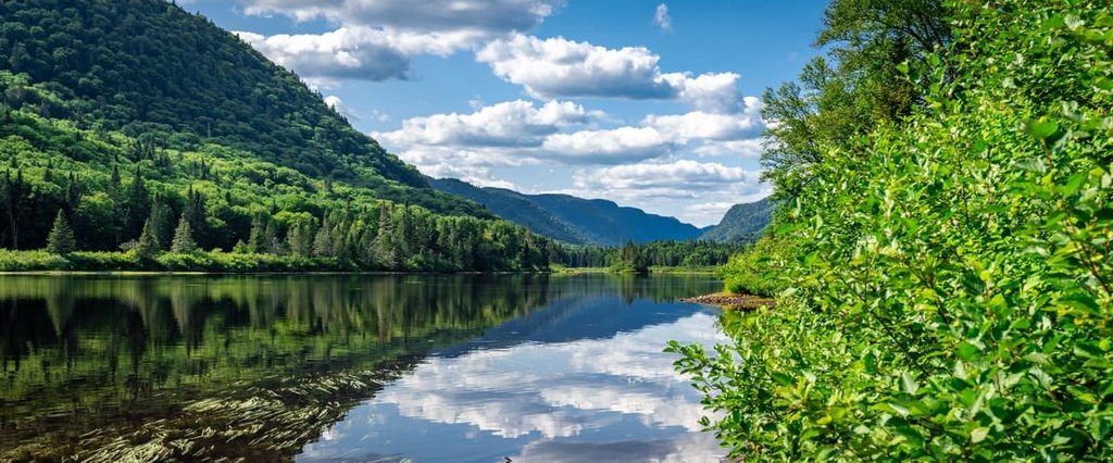
Part of Parc national de la Jacques-Cartier (Jacques-Cartier National Park) is located within La Côte-de-Beaupré. The park contains approximately 670 sq. km (259 sq. mi) of land and it is bordered by both Forêt Montmorency and Réserve faunique des Laurentides.
Of all the protected areas in La Côte-de-Beaupré, Jacques-Cartier provides arguably the best hiking experience. There are many designated trails within the park, including Les Loups Trail, Les Cascades Loop Trail, La Tourbiere Loop, and Le Scotora Trail.
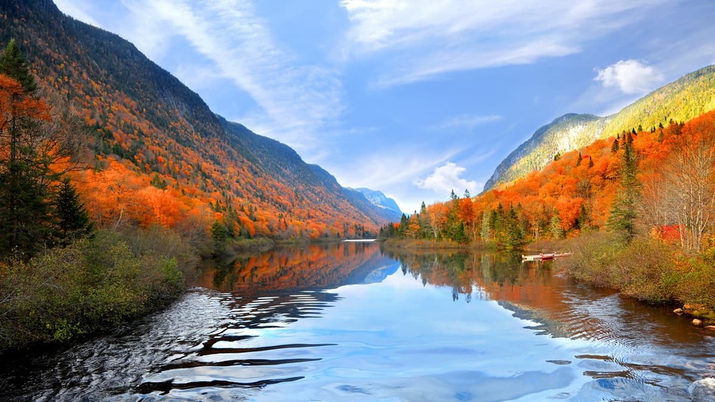
Like other national parks of Quebec, Jacques-Cartier is managed by Sépaq and offers a range of other activities for visitors to enjoy. While in the park, you can also go fishing, paddling, backpacking, skiing, sledding, snowshoeing, and even fat biking. There are many campgrounds, huts, cabins, and backcountry campsites available in the park, too, if you’re looking for a place to stay during your travels.
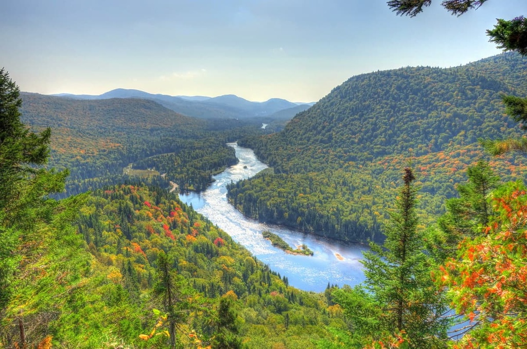
Réserve faunique des Laurentides (Laurentides Wildlife Reserve) is a provincially protected area located to the north of Quebec City and to the west of Baie-Saint-Paul. The reserve has an area of about 7,861 square km (3,035 sq. mi), which makes it one of the largest protected regions in the province.
Laurentides Wildlife Reserve contains over 2,000 lakes and 30 named peaks, making it an excellent destination for any outdoor adventure. The reserve is managed by Sépaq and it is open year-round, though some of the trails and campgrounds may be closed in the winter.
There are relatively few designated hiking trails in the reserve due to the remoteness of the terrain. You can find some trails around popular lakes like the Sables Lake Loop and the Lac-à-Noël and Lac-du-Bec-Croche Loops.
Alternatively, many people venture into the reserve on a canoe, which allows for incredible access to the region’s many lakes. Hunting and fishing are also both allowed in the reserve, though to do so, you need to get a permit from Sépaq before your trip.
Forêt Montmorency (Montmorency Forest) is a research forest that’s located to the north of Quebec City on Route 175. The forest is owned and managed by Université Laval (Laval University) as a forestry education center. It contains a total of 397 sq. km (153 sq. mi) of land.
Although much of the forest is used for educational and research purposes and, as such, is closed to the public, parts of Montmorency are open for outdoor recreation. There is a company called Ski de Fond Forêt Montmorency that offers groomed cross country ski trails and lodging for visitors to the forest during the winter months.
Looking for a place to stay in La Côte-de-Beaupré? Here are some of the best cities and towns to check out in the region.
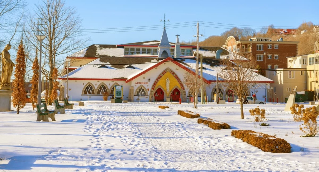
Beaupré is one of the largest towns in the La Côte-de-Beaupré MRC with approximately 3,800 residents. It is located at the mouth of the Sainte-Anne-du-Nord River and along the coast of the Saint Lawrence on Route 138.
The town that is now Beaupré was formally established by sailors from Brittany in France in the seventeenth century (though the region has been home to First Nations for much longer). It’s believed that the name ‘Beaupré’ comes from the phrase “Oh! le beau pré,” (“Oh! the beautiful meadow”) which the first Breton sailors in the area may have said upon their arrival.
Nowadays, Beaupré is perhaps best known as being home to Mont-Sainte-Anne, which is the highest ski resort in eastern Canada. The resort offers both day and night skiing and it is a popular wintertime destination in the province.
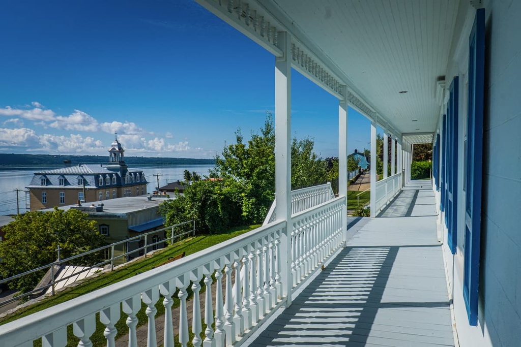
Château-Richer is a town of approximately 4,100 residents that’s located between Quebec City and Beaupré along the coast of the Saint Lawrence River.
Although it is a very small town compared to the bustling metropolis of Quebec City, Château-Richer is famous for being the first French-established rural parish in Quebec (then New France). It was founded in 1678 and many of the oldest French families in the province have their roots at Château-Richer.
The town itself is quite small, but there are a number of great museums and historic sites to check out if you’re driving through. Château-Richer is just a short trip from Quebec City, so it’s worth checking out if you’re in the area.
One of the few large inland towns in La Côte-de-Beaupré, Saint-Tite-des-Caps is a community of some 1,500 people that’s located along Quebec Route 138 to the northeast of Beaupré. The town is situated at the top of a large hill along Route 138, which makes for a fun drive from Quebec City.
Even though Saint-Tite-des-Caps is fairly small, the town is well worth visiting because it's home to the Sentier des Caps de Charlevoix, which is a popular network of hiking trails. The trails are open all year long and they offer great skiing and snowshoeing during the winter months.


