
Scan the QR code and open PeakVisor on your phone
Virginia is home to 2,567 named mountains. The highest is Mount Rogers at 1,744 m.
Nestled between the Atlantic Coast and the Appalachian Mountains, Virginia, officially known as the Commonwealth of Virginia, is shaped by the stunning Blue Ridge Mountains and the Chesapeake Bay. Virginia covers 42,774 square miles and contains just over 3,180 square miles of water, making it the 35th largest state by area. The Chesapeake Bay, a 200-mile-long estuary, separates the contiguous portion of the state from Virginia’s Eastern Shore.
Though mostly flat, the Eastern Shore contains more than 78,000 acres of preserved parks, refuges, preserves, and a national seashore, making it a particularly popular tourist destination. The Eastern Shore also contains the longest chain of undeveloped barrier islands in the global temperate zone.
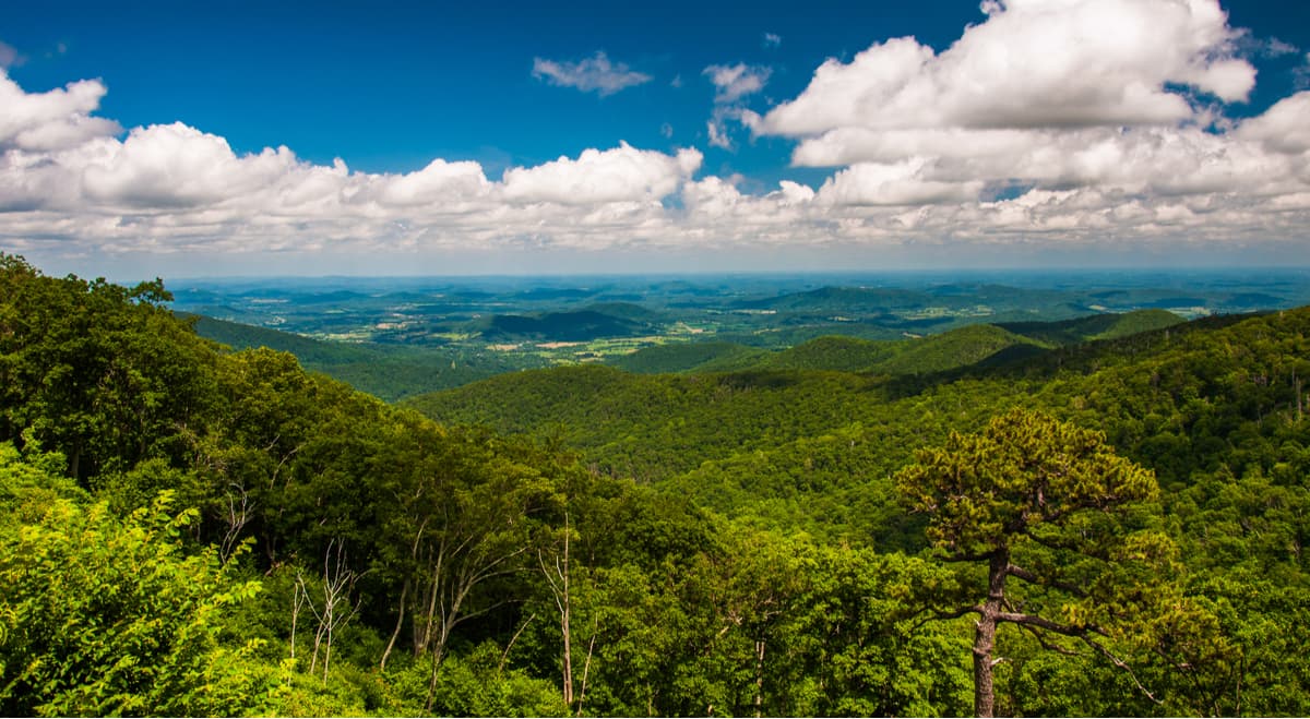
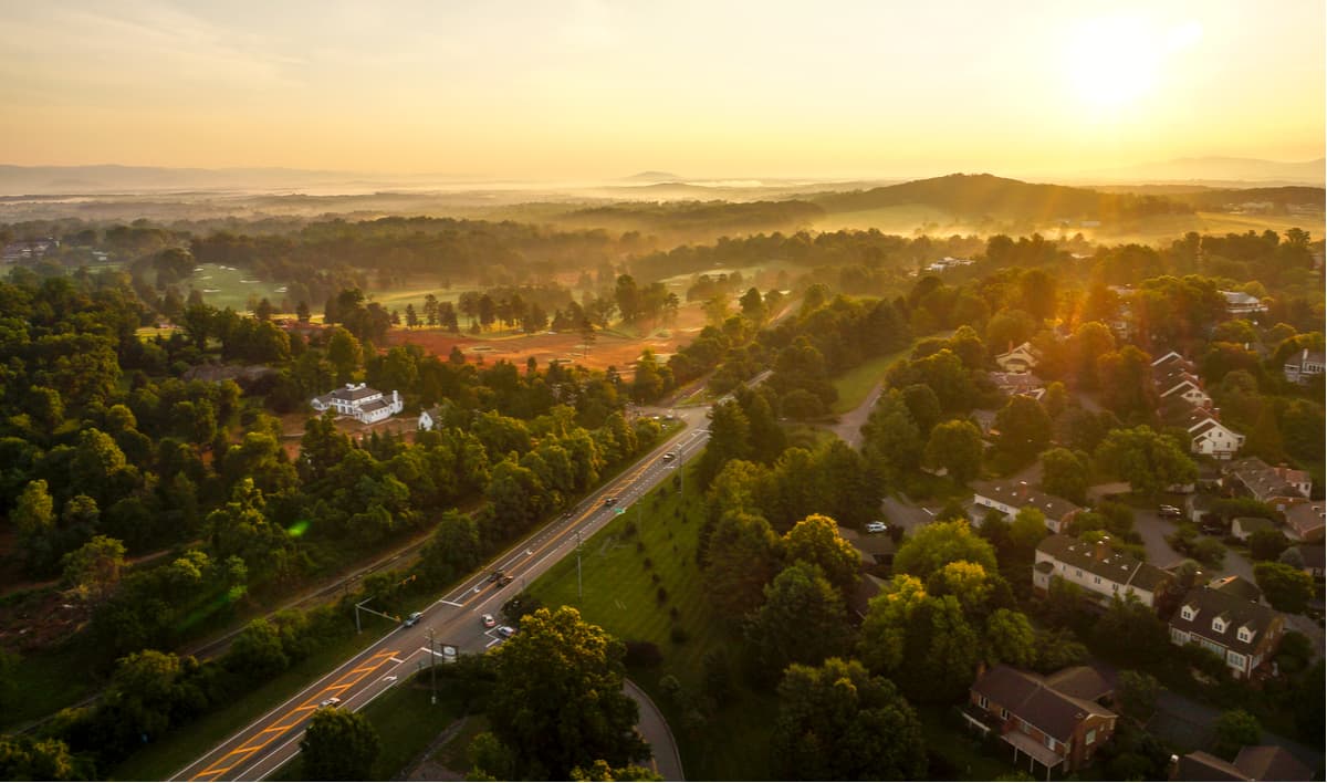
The Piedmont, which translates to “foot of the mountains,” is a plateau that stretches from New York to central Alabama. Virginia’s Piedmont region is separated from the Coastal Plain by a fall line constructed of rivers, waterfalls, and rapids. The rapids in Richmond, for example, where the James River crashes over a series of rapids into a tidal estuary, is a great example of a prominent Virginia fall line feature. The Piedmont is characterized by rolling hills that gently rise to 1,000 feet in elevation. The state’s topography, however, shifts dramatically at the foothills of the Blue Ridge Mountains.
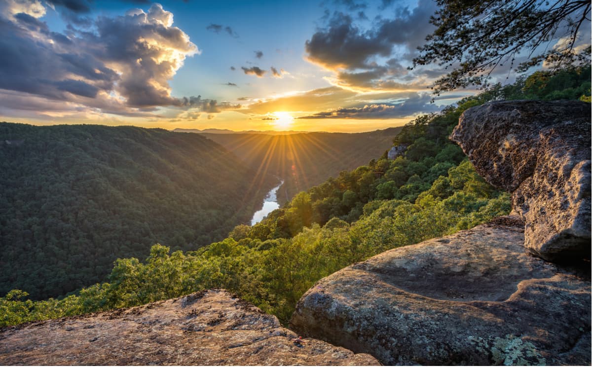
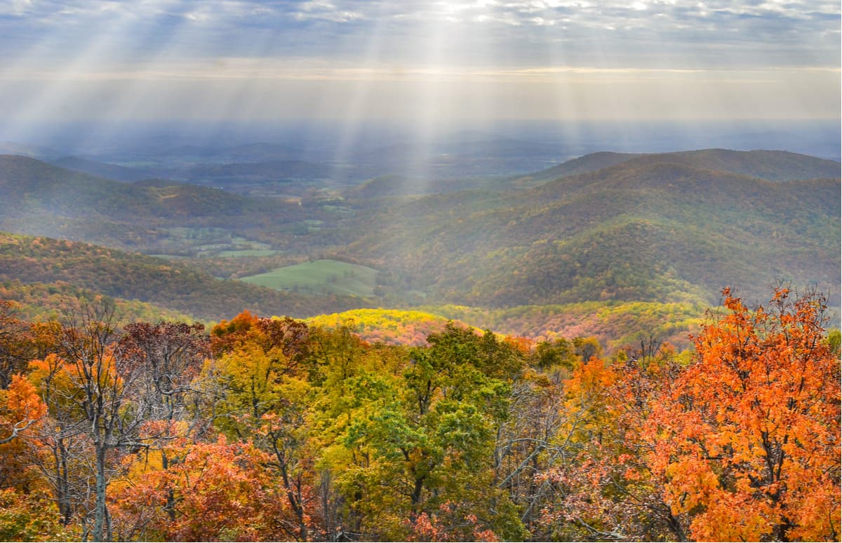
The Blue Ridge region extends for 550 miles from southern Pennsylvania and passes through Maryland, West Virginia, Virginia, North Carolina, South Carolina, Tennessee, and Georgia. This set of summits is rounded in appearance and tends to have a bluish tint when viewed from a distance. In Virginia, the long and narrow Blue Ridge Mountains rise dramatically from the Piedmont, reaching over 5,700 feet at the top of Mount Rogers, the state’s highest point. The Blue Ridge Mountains are understandably popular and this stretch of wilderness not only contains one of the most scenic drives in the eastern United States, the Blue Ridge Parkway, but also houses the majority of Virginia’s most beloved summits including, Sharp Top Mountain, Mcafee Knob, Old Rag Mountain, Cahas Mountain, Short Hill, and Whitetop Mountain.
One of the easternmost ranges, the Southwest Mountains, run parallel to and are geologically associated with the Blue Ridge Mountains. The Southwest Mountains, which contain peaks like Hightop Mountain, Peters Mountain, and Carters Mountain, are not particularly large. However, the estates of Thomas Jefferson, James Madison, and James Monroe are all tucked within this set of summits.
The Allegheny Mountains, another set of Appalachian summits in southwestern Virginia, forms part of the Virginia-West Virginia state line. The Alleghenies form the Eastern Continental Divide and contain noteworthy Virginia summits like Hickory Knob, Smith Knob, Chestnut Knob, Paddy Knob, and Mad Sheep.
The Valley of Virginia lies between the Blue Ridge and the Alleghenies. Virginia’s Valley is part of a larger trough that runs from Canada to Alabama called ‘the Great Valley.’ The Valley is characterized by flat, lush valleys and gentle topography. Elevations range from 300 feet in the northern Shenandoah Valley to 2,400 feet in the Powell Valley.
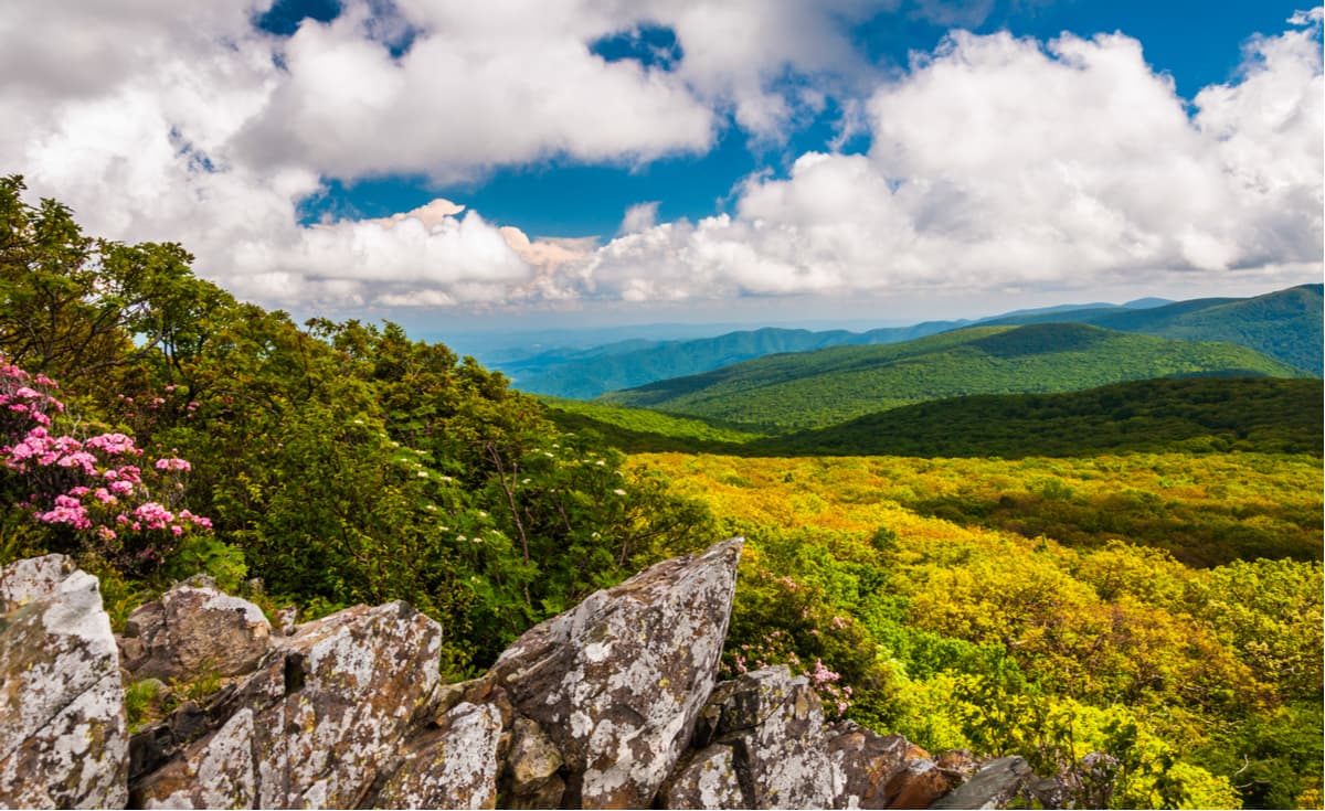
Just outside of the nation’s capital lies 196,000 acres of historic mountain landscape. Shenandoah National Park covers an impressive 311 square miles and receives over a million visitors each year. Soak in awe-inspiring views of the Blue Mountains from over 70 overlooks along Skyline Drive, spend the day fishing in one of 70 mountain streams, or grab your hiking boots and hop on one of the park’s 500 miles of trail. Popular trails and attractions in the park include President Hoover’s summer White House, Hawksbill Mountain, and Dark Hollow Falls.
Spanning an impressive 469 miles through Virginia and North Carolina, the Blue Ridge Parkway is known as one of the most scenic drives on the East Coast. The parkway, which runs from the southern terminus of Shenandoah National Park’s Skyline Drive in Virginia at Rockfish Gap to the U.S. Route 441 in the Great Smoky Mountains National Park in North Carolina, was built in 1983 and has since become one of the most beloved attractions in the United States National Park System.
The drive itself is worth a visit, but Blue Ridge Parkway also offers easy access to a variety of hiking trails, cultural exhibits, and picturesque overlooks. Some of the most popular hiking trails include: The Priest, Big Spy Mountain, Craggy Pinnacle, and Sharp Top Mountain Overlook to Harvey’s Knob Overlook via the Appalachian Trail.
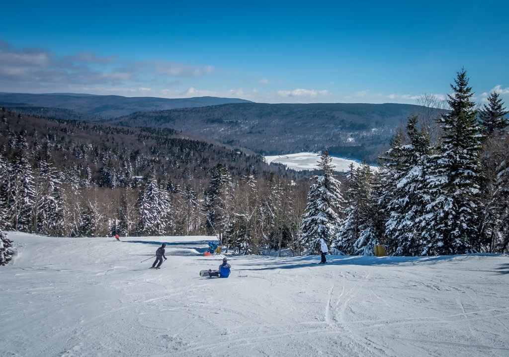
For skiing and snowboarding enthusiasts, there are more than 5 ski resorts in Virginia, which are located in the north of the state.
The largest is Winter Green Resort with more than 10 km (6 mi) of slopes and more than 5 ski lifts. Other two major areas for skiing in Virginia are Massanutten Ski Resort and Bryce Resort. At the same time, all of them are ski resorts near Richmond, as well as Washington, D.C.
Check the Virginia ski resorts map and the larger USA ski resorts map in the World Mountain Lifts section of the site. It includes information about open ski lifts / slopes in Virginia in real-time with opening dates and hours. There are also year-round cable cars, funiculars, cog railways, aerial tramways, and all other types of mountain lifts.
At 3,680 feet, the historic Skyland provides food and lodging at the top of the iconic Skyline Drive in Shenandoah National Park. Skyland offers breathtaking views of the Shenandoah Valley, various hiking trails, and other outdoor recreation opportunities. Lodging ranges from small, rustic cabins to newly renovated premium suites.
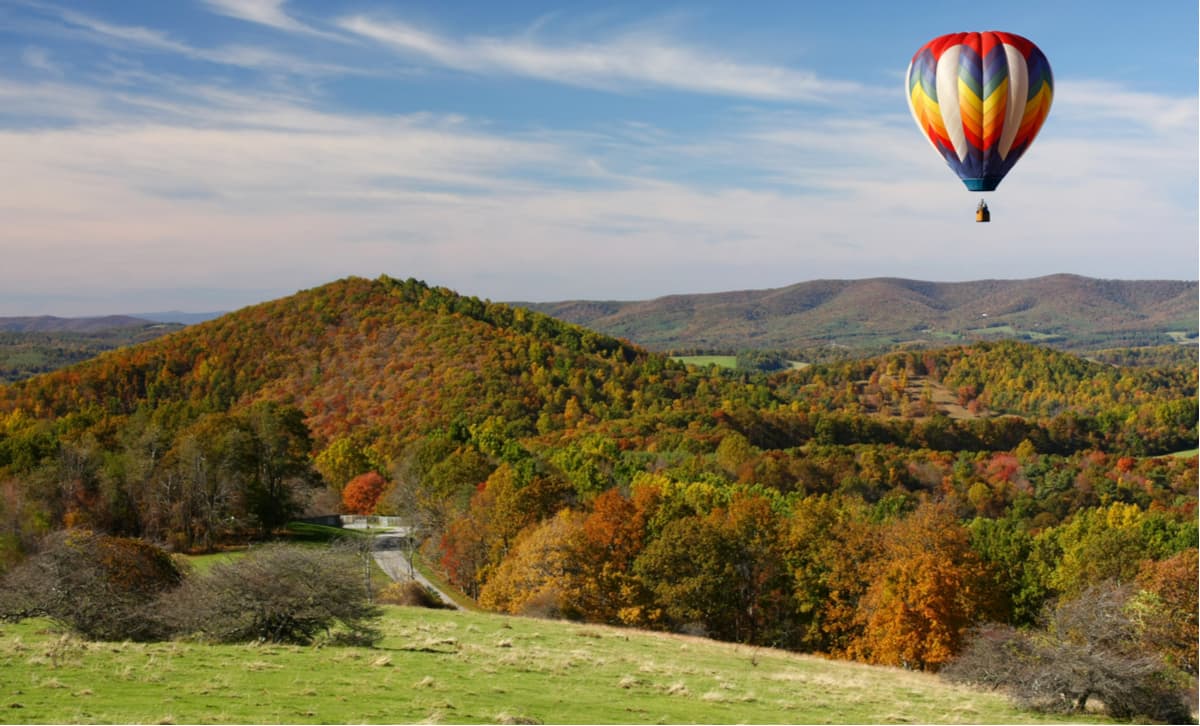
Charlottseville sits within close proximity of the Blue Ridge Parkway, making it an excellent destination for outdoor enthusiasts looking to explore Shenandoah National Park. Charlottesville’s appetite for adventure doesn’t end there - this charming city is also known for its disc golf, horseback riding, tubing, canoeing, kayaking, rafting, and even hot air ballooning.


Yes. Virginia has 2,567 named mountains. The highest is Mount Rogers at 1,744 m.
The highest mountain in Virginia is Mount Rogers, at 1,744 m.
Virginia has 2,567 named mountains.


