Scan the QR code and open PeakVisor on your phone
Lovingly known as the Hoosier State, Indiana is a state located in the midwestern US that’s known for its vast fields of corn, its love of stock car racing, and its superb natural resources. Although Indiana isn’t a particularly mountainous state, it does contain 608 named high points, the highest of which is Hoosier Hill (1,553ft/382m), and the most prominent of which is Hickman Hill (1,004ft/306m).
The state of Indiana is located in the Midwest region of the United States. It shares a border with four other states, including Michigan to the north, Illinois to the west, Kentucky to the south, and Ohio to the east.
With a total area of 36,418 square miles (94,321 square kilometers), Indiana is the 38th largest state in the union. However, it is home to more than 6.7 million residents, which makes it the 17th most populous state and the 16th most densely populated state although it ranks just 35th in terms of median household income.
Indiana is officially divided up into 92 counties, most which, it turns out, were actually named for US Founding Fathers and notable players in both the American Revolutionary War and the War of 1812.
Interestingly enough, Indiana is also one of just 13 states that spans multiple time zones. While 37 US states are wholly located within one time zone, 13, including Indiana, North Dakota, South Dakota, Nebraska, Kansas, Texas, Florida, Tennessee, Kentucky, Michigan, Alaska, Idaho, and Oregon all cover 2 time zones.

Indiana is currently split between Eastern and Central Time with all but the northwestern and southwestern corners of the state adhering to Eastern Time. So, keep this in mind as you travel throughout the state.
Furthermore, the state of Indiana can be unofficially divided up into three different regions. While these regions don’t hold any official status in the state, each has its own distinct topography and regional culture.
Northern Indiana can generally be defined as the northernmost 26 counties in the state, which includes Lake, Porter, La Porte, Newton, Jasper, Elkhart, Fulton, Kosciusko, LaGrange, Marshall, Pulaski, St. Joseph, Starke, Adams, Allen, DeKalb, Huntington, Noble, Steuben, Wabash, Wells, Whitley, Benton, Miami, Cass, and White counties.
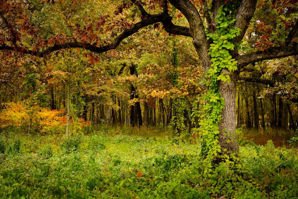
This area is mostly flat, though there are a few rolling hills in the region. Here, the landscape was heavily glaciated during the last major glaciation, so there is evidence of a number of post-glacial features, such as kettle lakes and terminal moraines.
The economy of the northern region of Indiana is highly industrial. Parts of the region are also technically part of the Chicago metropolitan area.
There are a number of notable parks and recreation areas in northern Indiana, such as Indiana Dunes National Park. Other popular recreation destinations include:
The Central Region of Indiana is roughly defined as the middle 33 counties in the state, which includes Vigo, Clay, Owen, Morgan, Johnson, Shelby, Rush, Fayette, Union, Wayne, Henry, Hancock, Marion, Hendricks, Putnam, Parke, Vermillion, Fountain, Montgomery, Boone, Hamilton, Madison, Delaware, Randolph, Jay, Blackford, Grant, Tipton, Howard, Clinton, Carroll, Tippecanoe, and Warren counties.

This area is the state’s most populous, thanks to the fact that Indianapolis is situated nearly in the center of the state. Here, the dominant economy is agriculture, though other industries, such as manufacturing and education are also important. This region also contains a large number of universities, such as Purdue, Ball State, Butler, and Indiana State University.
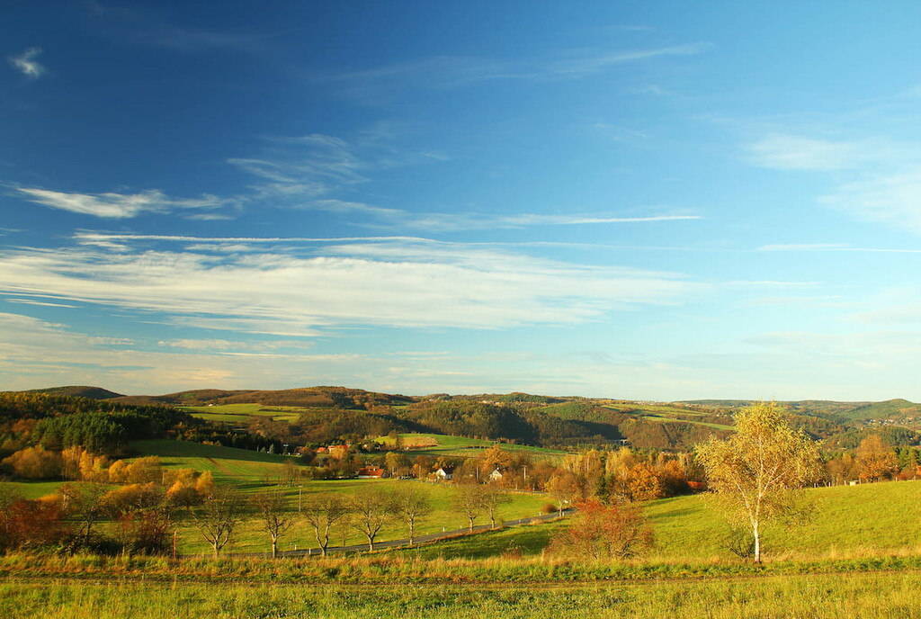
Central Indiana is home to rolling hills, though much of the region is quite flat. Nevertheless, there are quite a few state parks and forests in this part of Indiana, including:
Southern Indiana is generally defined as occupying the southern 33 counties, which includes Posey, Vanderburgh, Warrick, Spencer, Perry, Crawford, Harrison, Floyd, Clark, Jefferson, Switzerland, Ohio, Scott, Washington, Orange, Dubois, Pike, Gibson, Knox, Daviess, Martin, Lawrence, Jackson, Jennings, Ripley, Dearborn, Franklin, Decatur, Bartholomew, Brown, Monroe, Greene, and Sullivan counties.
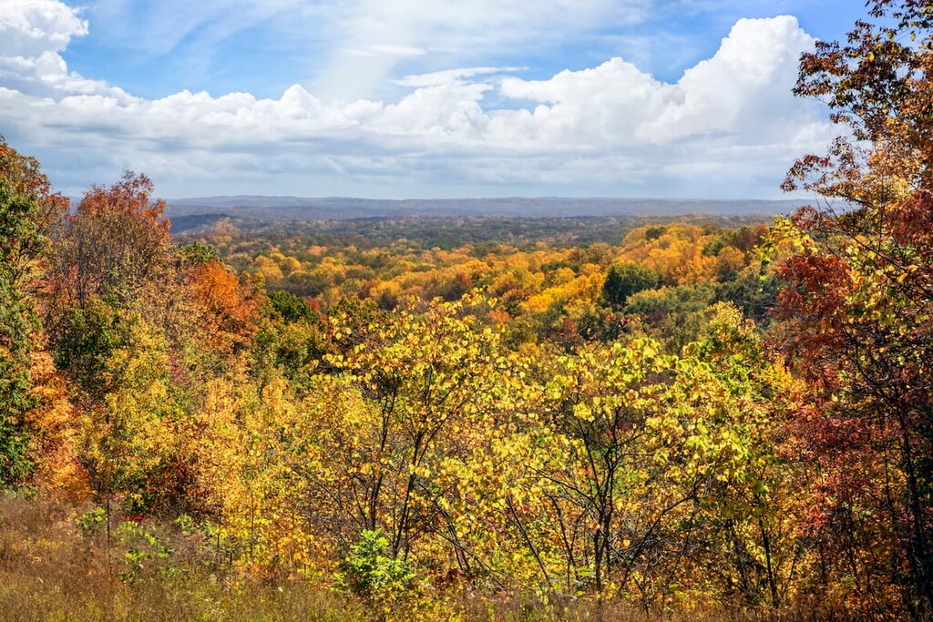
The southern part of the state is by far the hilliest and the most rugged. It is underlain by karst topography, which has led to the formation of many caves and limestone quarries. However, much of the region’s developed land is agricultural.
The majority of Indiana’s outdoor recreation areas are located in the southern part of the state. This includes Hoosier National Forest as well as a number of state parks:
Most of Indiana’s state forests are also located in this part of the state, such as:

Despite being relatively flat and lacking any major mountain ranges, Indiana actually has a very interesting geologic history.
For the most part, Indiana’s bedrock geology is dominated by sedimentary layers. Shales, siltstones, sandstones, clays, mudstones, and conglomerates are all commonly found. Furthermore, limestone is particularly abundant in the state and Indiana happens to be one of the country’s leading limestone production centers.
Meanwhile, Indiana’s surface geology is mostly unconsolidated sediment that dates back to the Wisconsin glaciation. This glaciation took place about 21,000 to 13,600 years ago when massive ice sheets covered much of the state.
As a result of this glaciation, Indiana now contains a number of typical post-glacial landforms, such as kettle lakes, moraines, and drumlins. Glacial till is widespread throughout the state
Major high points in the state include Hoosier Hill, Hickman Hill, Sand Hill, Weed Patch Hill, Buzzard Hill, and Diamond Hill.
Although much of Indiana is now managed as farmlands or urban areas, the state is naturally home to a handful of ecoregions. Here are some of the ecoregions typically found in the state:
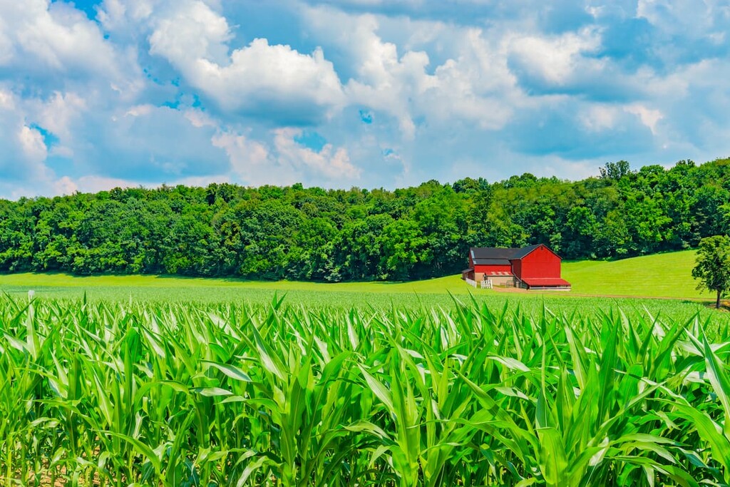
The Central Corn Belt Plains covers the northwestern corner of the state. This ecoregion was mostly prairie with the occasional oak-hickory forest before the time of European settlement. These days, the region is dominated by agricultural land, much of which is dedicated to producing soy and corn, as well as raising livestock such as cows, chickens, and sheep.
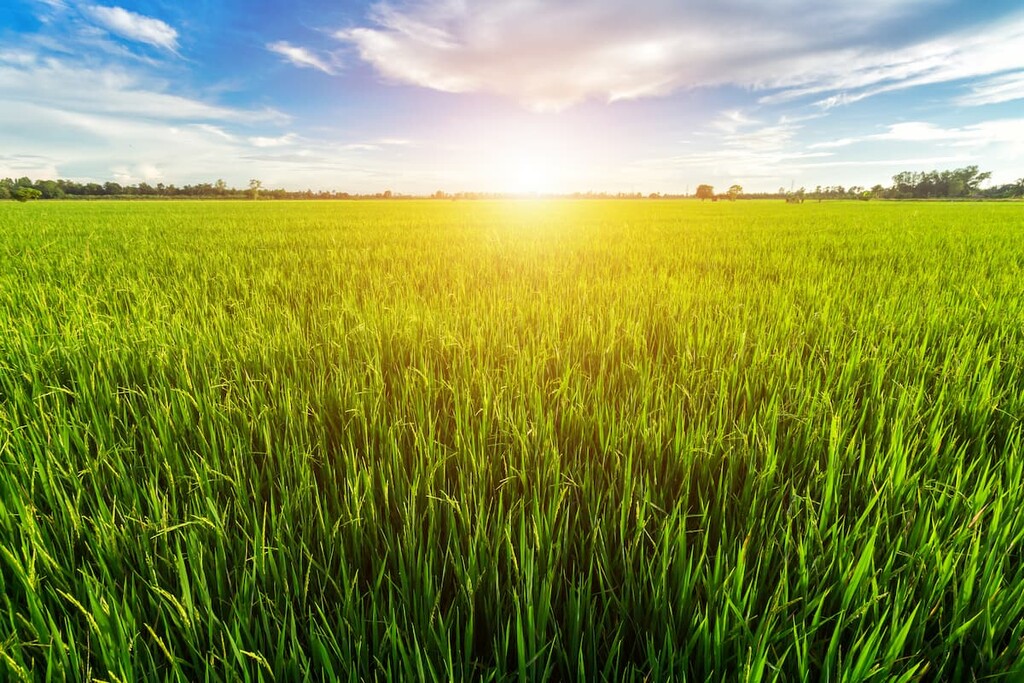
The Eastern Corn Belt Plains cover much of central Indiana. This area used to be more heavily forested prior to European settlement. In particular, beech forests, as well as elm-ash swamps, were fairly common. Nowadays, the region is mostly home to corn and soy-producing farmlands.
Located along the northern shore of Indiana, the Southern Michigan and Northern Indiana Drift Plains is a fairly flat and marshy area. It contains a number of post-glacial features, like kettles, drumlins, kames, and moraines, and it is substantially less agricultural than other regions of the state. However, there are some grain, soy, and livestock-raising operations throughout this region.
The Interior Plateau can be found in south-central Indiana. It is a relatively low-lying region that has some open hills and tablelands. Traditionally, this area was home to both cedar glades and bluestem prairie, as well as oak-hickory forest. These days, it is also fairly agricultural.
The final major ecoregion in Indiana, the Interior River Lowland occupies the southwestern corner of the state. This region is characterized by wide, mostly flat valleys with glacial till plains. It is highly agricultural as corn and soy are major cash crops, though livestock grazing is also common.
Humans have lived in the area that is now part of the state of Indiana for thousands of years. Indeed, the land that is now part of Indiana is part of the ancestral homelands and traditional territories of many peoples, including the Miami.
The Miami were forcibly removed from their homelands in what is now Indiana during the nineteenth century and many settled in what is now Oklahoma. As a result, the federally-recognized Miami Tribe of Oklahoma is based out of Oklahoma, though the Miami Nation of Indiana is also trying to regain its federal recognition status.
In addition to the Miami, the Pokagon Band of Potawatomi (Pokégnek Bodéwadmik) also has traditional territory within the state. Alongside the Miami Tribe of Oklahoma, the Pokagon Band of Potawatomi are the only other Tribal Nation that currently has landholdings in Indiana.
The first peoples of European descent to visit what is now Indiana were likely members of René-Robert Cavalier, Sieur de La Salle of France’s 1679 expedition. Cavalier ventured into what is now south Bend during the late 1670s and then returned soon after to travel more extensively through the region.
During the early eighteenth century, more French and French-Canadian trappers and traders, including Louis Juchereau de St. Denis and Jean Baptiste Bissot, Sieur de Vincennes, traveled into the region. They established a number of trading posts and forts to support their fur trade industry.
However, French domination of the region’s fur trade industry did not sit well with the British and their colonies to the east. This invariably led to the French and Indian War, which ended in 1763 with a British victory. As a result, France ceded its claimed territories to the east of the Mississippi River, including what is now Indiana.
However, in 1763, the British crown made a royal proclamation stating that land to the west of the Appalachians was “Indian Territory,” thereby preventing colonists from settling in that region, at least for a while.
In the aftermath of the American Revolutionary War, the area that is now Indiana became part of the newly-formed United States through the Treaty of Paris. Not long after, the US included what is now Indiana as part of the new Northwest Territory.
Indiana then became its own territory—the Indiana Territory—in 1800 when it was separated from the rest of the Northwest Territory.
The next few decades in Indiana were dominated by frequent trades and treaties that attempted to acquire land from the Tribal Nations in the region. Most of the Tribal Nations in the region had either sold their land or were forcibly removed by it, though forced removal was the more common practice.
Indeed, most Tribal Nations in the region were forcibly removed from what is now Indiana to Oklahoma and other points west in the 1820s and 1830s.
Indiana formally joined the union as a state in 1816. It soon became a popular destination for European immigrants, particularly those from Germany, England, and Ireland. Indiana saw a boom in population after the National Road arrived in the 1830s.
The years after Indiana became a state were dominated by an increase in industrial activity and the establishment of a number of roads and other public works projects. This eventually led the state to bankruptcy, but it helped increase the value of the land.
During the Civil War, Indiana fought on the side of the Union, however, there were only a few battles actually fought in the state, including the Battle of Corydon.
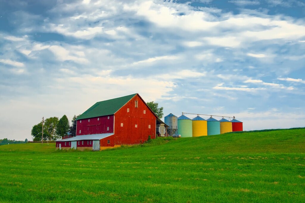
In the years after the war, Indiana remained a highly agricultural area, a practice which continues to this day. Other industries that have dominated the state’s economy over the decades include the natural gas industry, the manufacturing industry, and, in more recent years, an increase in technological and health industries in the state’s larger cities.
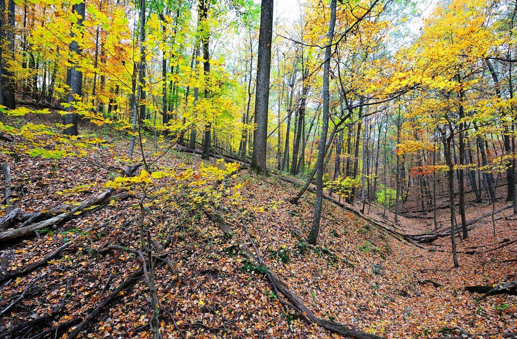
These days, Indiana is known for being a nice, affordable place to live and visit. While it might not offer much in terms of jagged peaks, the Hoosier State’s woodlands, lakes, and other recreation areas make it a great place to hike and wander during your travels.
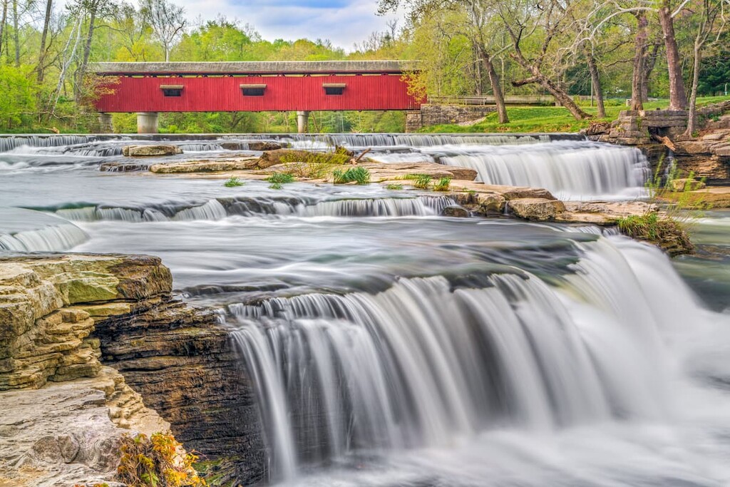
Indiana might have a reputation for being quite agricultural, but there are plenty of excellent outdoor recreation destinations to check out in the Hoosier State. Here are some superb hiking areas to visit during your next trip:
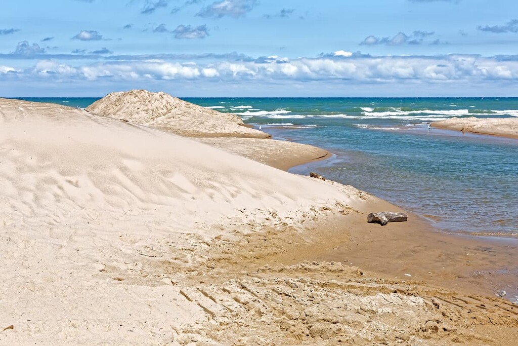
Thought national parks were just found in the mountains? Think again! Indiana Dunes National Park is the Hoosier State’s very own national park. It’s located on the northern shore of the state on Lake Michigan and it contains 13 named high points, the highest of which is Mount Tuthill, and the most prominent of which is Mount Allinson.

Covering about 15 miles (24 km) of shoreline along Lake Michigan, Indiana Dunes National Park is a unique and wonderful place. As the name suggests, Indiana Dunes is home to quite a few sand dunes along the coast.
Furthermore, the park boasts about 50 miles (80.5 km) of hiking trails, so there’s plenty to see and do in the area. In fact, in a single day, you could hang out on a sandy beach, trek through wetlands, or wander through majestic forests. So, there’s something for everyone at Indiana Dunes National Park.
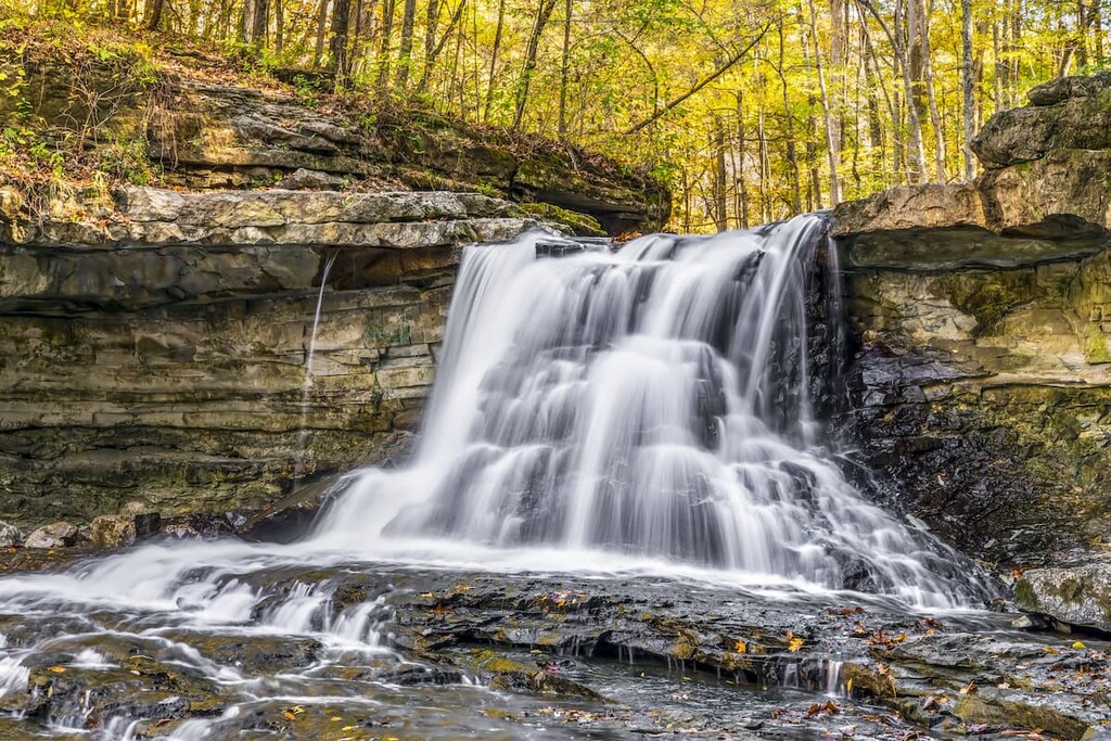
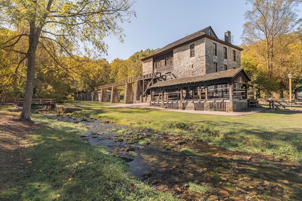
Indiana’s only national forest, Hoosier National Forest is located in the southern part of the state, just outside the city of Evansville. It contains 37 named mountains, the highest of which is Browning Hill, and the most prominent of which is Mount Airie.
The forest is located within a fairly hilly area in the southern part of the state. Interestingly, due to the widespread karst formations in this part of the state, Hoosier National Forest is home to quite a few large caves.
Within Hoosier National Forest, there is one wilderness area: Charles C. Deam Wilderness Area. This wilderness area is the only designated wilderness in the state, so it is a haven for hiking and other non-motorized activities.
There are more than 260 miles (418 km) of hiking trails within Hoosier National Forest. Some popular trails include the Birdseye Trail, the German Ridge Trail, the Hickory Ridge Trail, and the Morgan Ridge West Trail.
For skiing and snowboarding enthusiasts, there are 2 small ski resorts in Indiana with up to 5 km (3 mi) of slopes and a few ski lifts. Both are also the main ski resorts near Indianapolis but ironically they are located closer to the main cities in the neighboring states. These are Paoli Peaks Ski Resort near Louisville in Kentucky and Perfect North Slopes Ski Resort near Cincinnati in Ohio. In addition to this, there are no more major areas for skiing in Indiana, so you need to check these and other neighboring states.
Check the Indiana ski resorts map and the larger USA ski resorts map in the World Mountain Lifts section of the site. It includes information about open ski lifts / slopes in Indiana in real-time with opening dates and hours. There are also year-round cable cars, funiculars, cog railways, aerial tramways, and all other types of mountain lifts.
Looking for a place to stay during your trip to Indiana? Here are some of the best cities to check out during your visit:
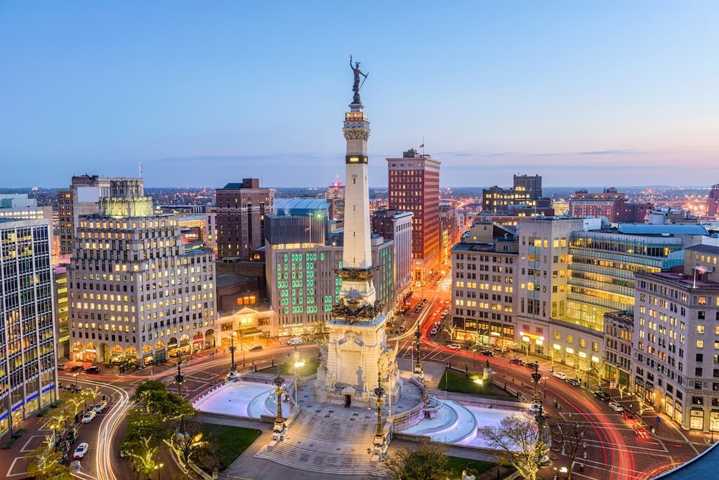
The capital and largest city in Indiana, Indianapolis, or “Indy,” for short, is a city of nearly 900,000 people that’s located in the central part of the state. Indy is one of the largest economic centers in the Midwest, thanks to its rapidly growing finance, insurance, education, health care, and manufacturing industries.
Each year, Indy also hosts one of the largest single-day sporting events in the world: the Indianapolis 500. It is also the site of a massive children’s museum, excellent nightlife, and a great culinary scene.
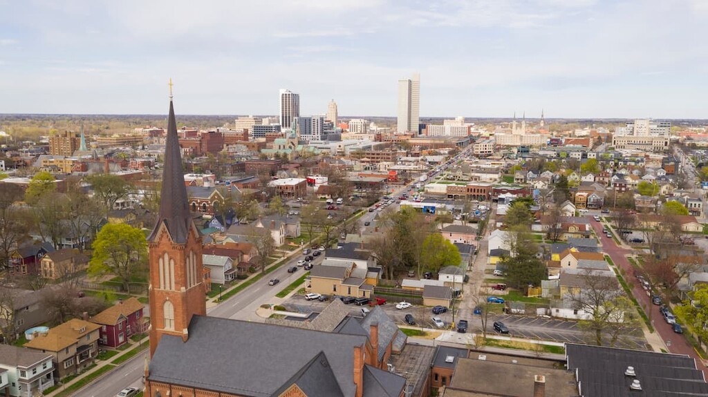
The second-largest city in Indiana, Fort Wayne is a community of some 270,000 people located in the northeastern part of the state. As one of the largest manufacturing hubs in the state, Fort Wayne is one of Indiana’s main economic centers. It is also known for its many festivals, events, museums, and outdoor recreation opportunities.
Plus, Fort Wayne also has a unique claim to fame in that it was the first city to have gasoline pumps. Interestingly, the gasoline pump was invented in the city in the 1880s, a few decades before cars became widespread.
Located in west-central Indiana, Terre Haute is one of the largest cities in the western part of the state in the Wabash Valley. The city is known as the home for a number of major educational institutions, such as Indiana State University. It also has a rapidly growing arts scene, thanks to its superb galleries and museums.
That being said, one of the most famous institutions in Terre Haute is also one of its most controversial. The city is home to the Federal Correctional Complex, Terre Haute, which is home to both medium and high-security facilities. Additionally, it is home to one of the few federal correctional facilities with a federal death row.
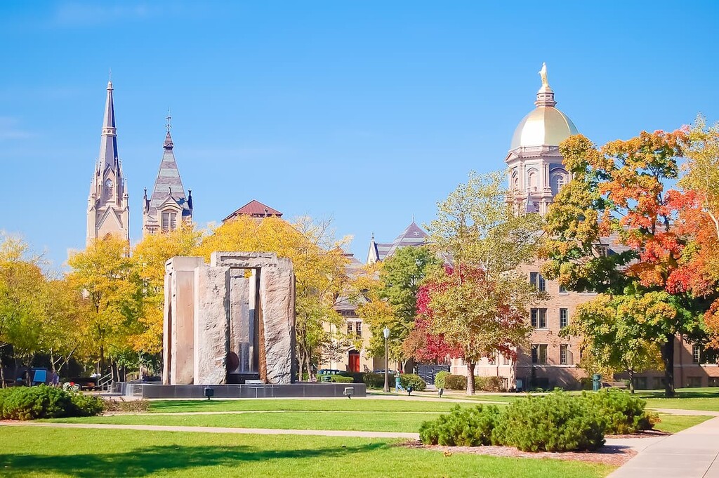
The city of South Bend is situated along the northern border of Indiana. It is home to about 100,000 people, making it the fourth-largest city in the state.
South Bend is perhaps best known as the home of the University of Notre Dame. However, it is also a popular tourist destination as well as a hub for health care, manufacturing, and education. The city is also trying to grow its bustling tech sector to help revitalize the region’s economy.