Scan the QR code and open PeakVisor on your phone
Hoosier National Forest is an area of federally managed land located in the US state of Indiana. This forest features a diverse array of landscapes and has 73 named peaks. The tallest peak in Hoosier National Forest is Browning Hill at 928 ft (283 m) in elevation and the most prominent peak in the forest is Hickory Ridge with 249 ft (76 m) of prominence.
Hoosier National Forest is situated in the southernmost tip of Indiana. The forest is divided into four separate sections and covers 202,814 acres (821,000 ha) of terrain.
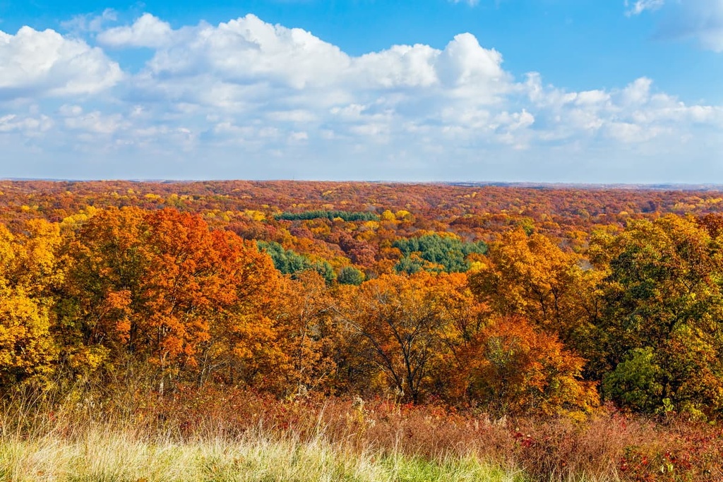
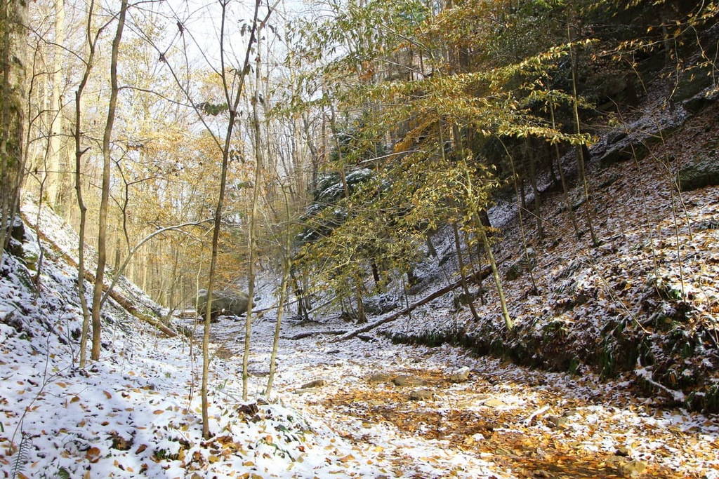
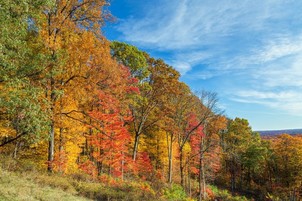
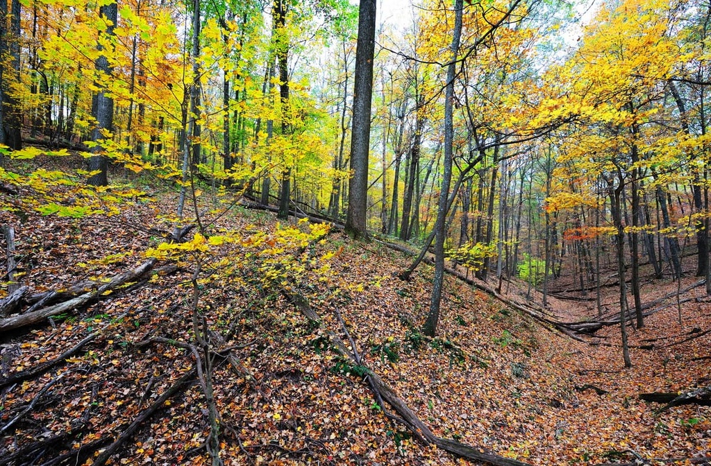
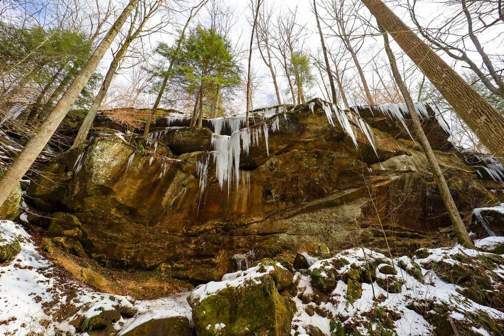
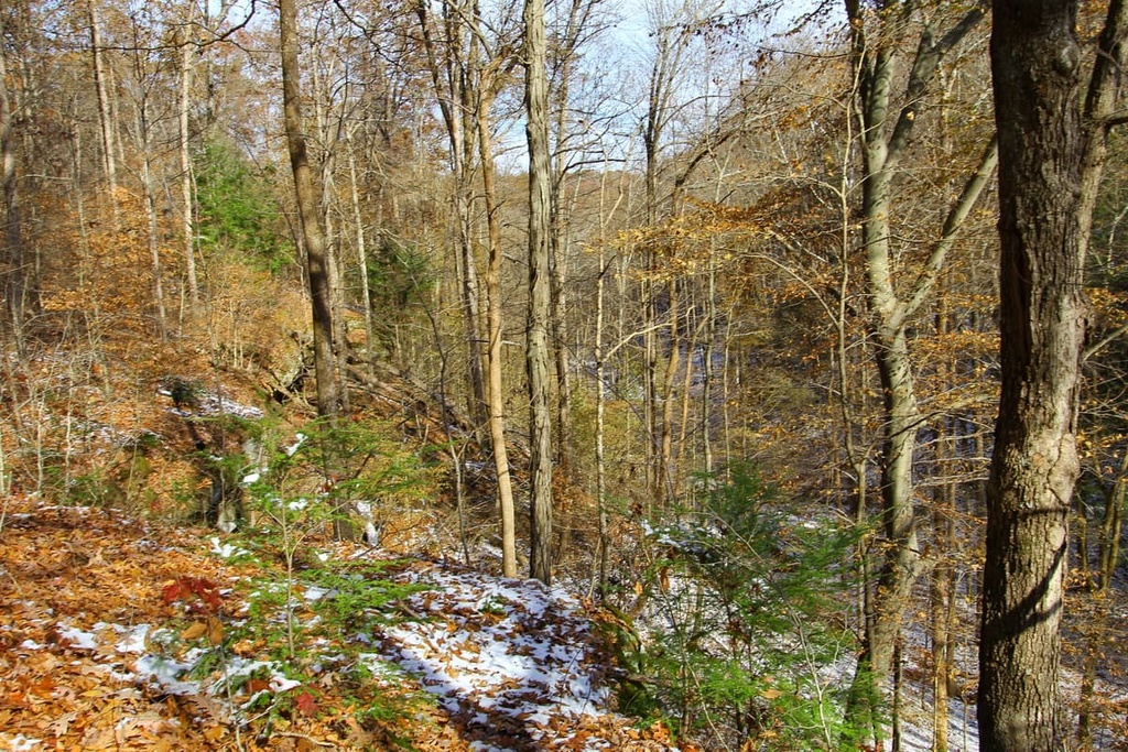
The diverse landscape of Hoosier National Forest includes dense forests, rolling hillsides, rocky bluffs, and roaring waterfalls. Unique rock formations and vistas can be found throughout both the forest and the surrounding region
Major rivers and creeks in the national forest include South Fork Salt Creek, East Fork White River, Lost River, and the Ohio River. The southern boundary of the national forest is marked by the Ohio River. Large lakes in the area include Patoka Lake, Sundance Lake, and Lake Monroe.
Hoosier National Forest is home to Charles C. Deam Wilderness Area, the only wilderness area in the entire state of Indiana. The four sections of forest also cover land in nine different countries throughout southern Indiana: Lawrence, Brown, Perry, Crawford, Dubois, Monroe, Orange, Jackson, and Martin.
Hickory Ridge Lookout Tower is the last remaining fire tower in the entire national forest. The Maumee Scout Reservation also lies within the forest. Southern Indiana, including the landscape throughout Hoosier National Forest, is also particularly well known for its vast network of caves.
Additionally, Hoosier National Forest is surrounded by other popular outdoor recreation areas. This includes Shawnee National Forest and Mark Twain National Forest, which lie to the southwest, as well as Mammoth Cave National Park to the southeast and Rough River Lake Wildlife Management Area to the south.
Hoosier National Forest lies over a karst system, which is why there is a vast network of caves found throughout the southern portion of the state of Indiana.
Much of Indiana’s geology is dominated by the Tipton Till Plain, which formed as a result of glacial activity during the last glacial maximum. Sediments brought to the region by the ice sheets were deposited throughout what is now the southern part of Indiana, leaving behind sand, clay, and silt in the process.
Both these deposits and the erosive forces of the glaciers themselves helped to carve out and create the rolling hills that dominate much of the region’s landscape to this day. Common sedimentary rocks found throughout the forest include dolomite, limestone, sandstone, shale, and siltstone.
As the limestone has continued to erode, it has produced vast caves and sinkholes that you can now see throughout the region’s karst landscapes. The sandstone in the region is more resistant to weathering than some of these other types of rock, which is why many of the rock formations present in the national forest are made primarily of sandstone.
The Illinois Basin extends into southern Indiana. It is often called the Muscatatuck Regional Slope, and it features rocks from the Devonian period. The major rivers and streams found throughout the forest have also further eroded and carved the landscape into its present form.
Today both limestone and gypsum are mined on private land in the region. Hikers can often find geodes throughout the national forest and some visitors even search for gold in the forest’s various streams, though striking it rich is unlikely.
Major peaks found within the forest include Browning Hill, Hickory Ridge, Burton Ridge, Mount Airie, and Polk Hill.
The wide diversity of landscapes found throughout the four sections of Hoosier National Forest allow for a variety of both flora and fauna to thrive in the region.
The southern portion of the forest, near the Ohio River, has vegetation similar to that of the Great Plains, as it consists primarily of barren land and grassy hills. The central forest is dominated by oak and hickory trees. Pine trees are also common, though they are not native to the region as they were planted to help combat the extensive logging that has taken place over the last few centuries.
Mammals in the region include fox, white-tailed deer, gray squirrel, opossum, and woodchuck. A variety of bird species can be found throughout the forest, including wild turkey, pileated woodpecker, migratory waterfowl and migrant songbirds.
The waterways of the national forest provide opportunities for fishing catfish, panfish, and bass species. Endangered species of the region include Indiana bat, rough pigtoe, bald eagle, gray bat, and fan shell mussels.
Humans have inhabited what is now known as southern Indiana for thousands of years, long befores the arrival of European settlers. The surrounding region is part of the ancestral homelands of the Kaskaskia, Kiikaapoi (Kickapoo), Myaamia, and Shawandasse Tula (Shawanwaki/ Shawnee) people.
Many of the Indigenous peoples who lived in the area before European colonization were traditionally hunters and gatherers. Most of the established villages were situated near the various rivers of the region, providing Indigenous people with both a water and a food source.
Colonizers of European descent arrived in the region during the late eighteenth century and quickly began establishing villages. Despite their continual resistance, the settlers forced the Indigenous people off of their native homelands.
In 1817, the Treaty of Fort Meigs forced many Indigenous people in the region onto three reservations. The Indian Removal Act of 1830 further forced the Shawnee people off of their land. As many of the states in the Midwest gained statehood, Indigenous people were again further forced out of the region into present-day Oklahoma.
The late nineteenth century brought a rise in the lodging industry of southern Indiana and, by 1910, nearly all of the forest had been cut. In order to protect the landscape from further harm, the land was purchased in 1935 and would later become known as Hoosier National Forest.
Hoosier National Forest is home to numerous trails and outdoor recreation areas. Here are some of the top hiking areas to visit in the forest:
A trip to Hoosier National Forest isn’t complete without visiting the Hemlock Cliffs National Scenic Trail. The loop route is the most popular trail in the forest and it is 1.2 miles (2 km) long with 147 ft (45 m) of elevation gain.
The route features a slot canyon, towering hemlock and oak trees, and vast rock overhangs. A small waterfall also cascades down near the trail, adding to the splendor of the landscape.
The Pate Hollow Trail is a popular loop hike that can be accessed throughout the year. Situated on the northern shores of Lake Monroe, sections of the trail pass along the lake shores. The rest of the route winds throughout the forested landscape.
Deciduous trees line the Pate Hollow, providing hikers with different views throughout the changing of the seasons. This route is 6.1 miles (9.8 km) long with 898 ft (274 m) of elevation gain.
The Nebo Ridge Trail is an out-and-back route used for hiking, backpacking, mountain biking and horseback riding. The trail is 16 miles (26 km) round-trip with 1,476 ft (450 m) of elevation gain. The trail features less foot traffic than other routes in the forest, allowing for a quiet place to set up camp for a night or two.
Much of the route follows through the forested landscape, and it ranges between a wide sweeping trail to a narrow single track route. Permits must be obtained for those wishing to mountain bike or bring horses on this trail.
Looking for a place to stay near Hoosier National Forest? Here are some of the best cities and villages to check out in the region:
The city of Bloomington lies near the northern edge of Hoosier National Forest. With a population of nearly 80,000 people, it is the seventh largest city within the state of Indiana. Known as the “Gateway to Scenic Southern Indiana,” Bloomington provides easy access to the national forest.
Bloomington is home to Indiana University Bloomington, which is the largest campus of Indiana University. The surrounding landscape features hills, forests, and a plethora of limestone, which many local buildings are constructed of. Each year, the city also hosts the Little 500, which is the largest collegiate bike race in the country.

The downtown of Bloomington is lined with local shops, art galleries, music venues and restaurants. Both Kirkwood Avenue and The Square offer visitors a look into the local cuisine and culture.
Louisville lies just to the southeast of Hoosier National Forest and is home to around 780,000 residents, making it the largest city within the state of Kentucky. The city is famous for a multitude of reasons, including the Kentucky Derby, Kentucky Fried Chicken, University of Louisville. It was even the home of the famous boxer Muhammad Ali.
Louisville is also known as Bourbon City due to the spirit’s influence on the local culture. Besides a multitude of local distilleries and restaurants, downtown Louisville is home to numerous museums. The West Main District is often referred to as “Museum Row,” as it features notable destinations like the Frazier Museum, Kentucky Science Center, Kentucky Museum of Art and Craft, Speed Art Museum, and the Muhammad Ali Center.