Scan the QR code and open PeakVisor on your phone
Shawnee National Forest is an area of federally managed land located in the US state of Illinois. The forest is the largest publicly owned piece of land within the state and contains 78 named mountains. The tallest and most prominent peak in the national forest is Williams Hill at 1,066 ft (325 m) in elevation and with 636 ft (194 m) of prominence.
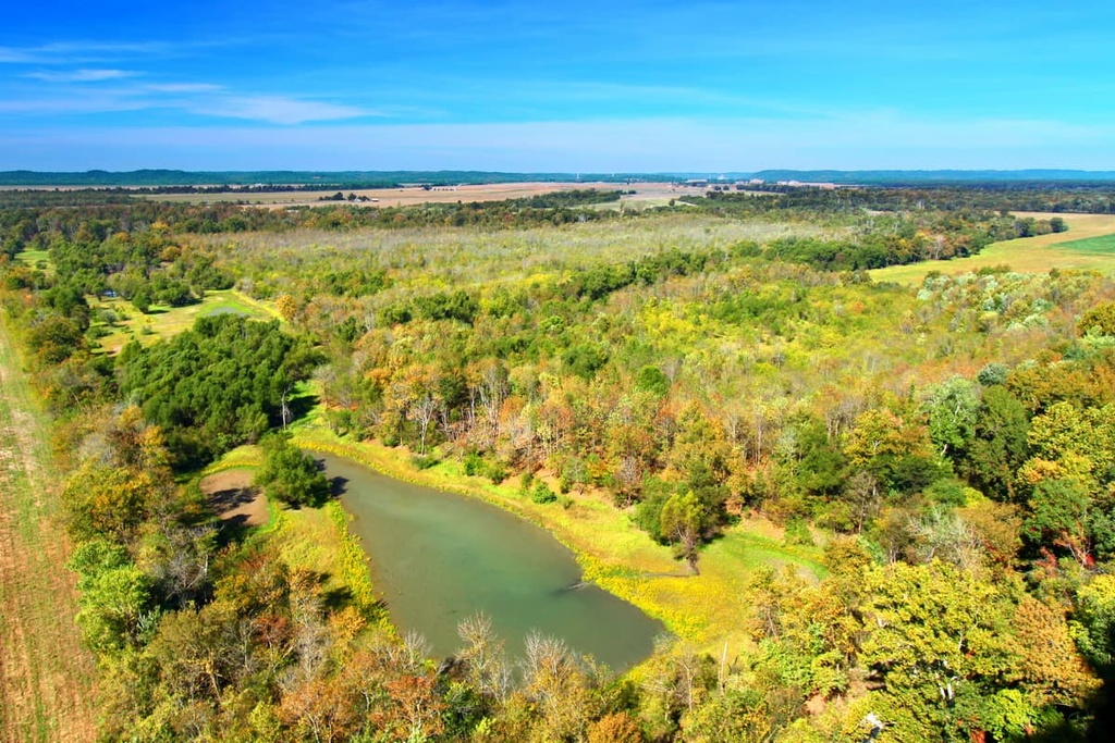
Shawnee National Forest is situated in the southernmost tip of Illinois. It covers 289,00 acres (117,000 ha) of land and is situated between the Ohio and Mississippi rivers. The forest covers parts of the Ozark Mountains and Shawnee Hills that extend across the southern portion of the state.
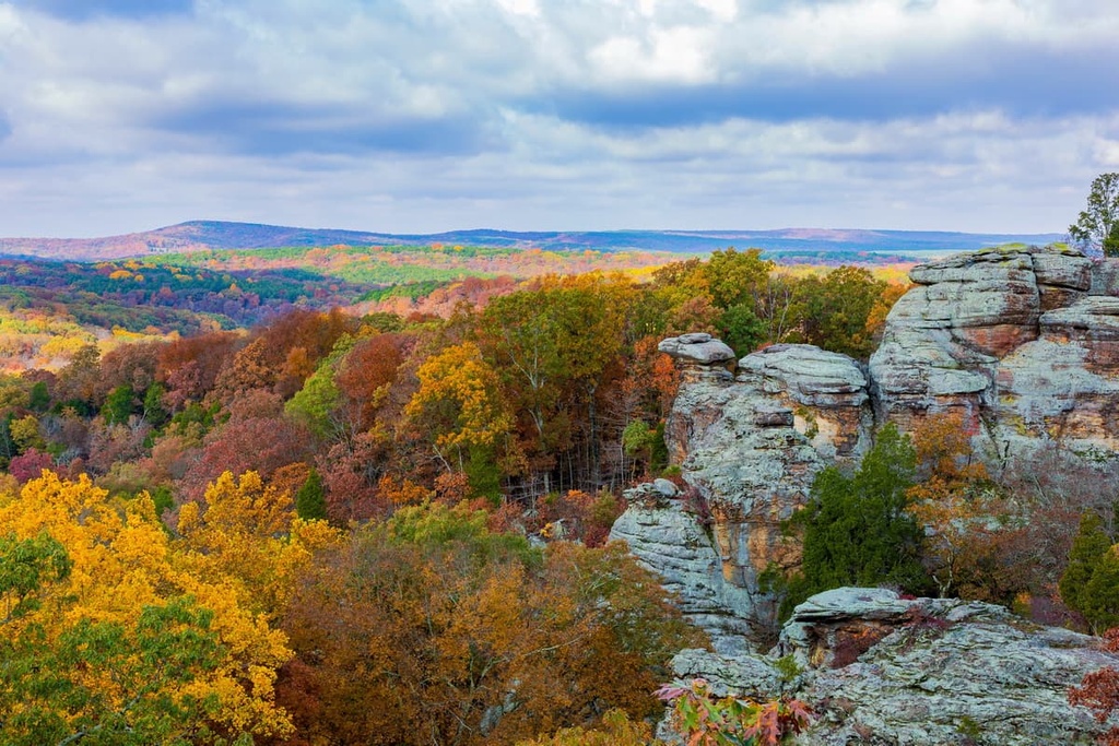
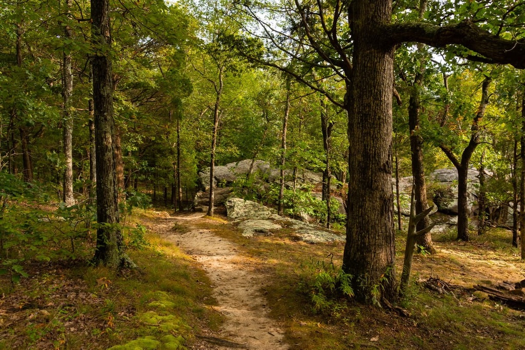
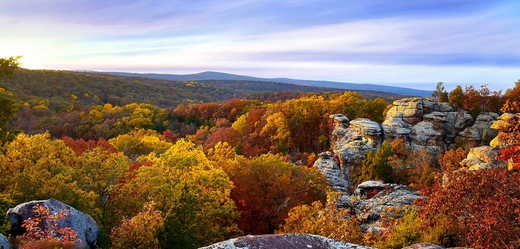
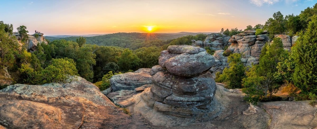
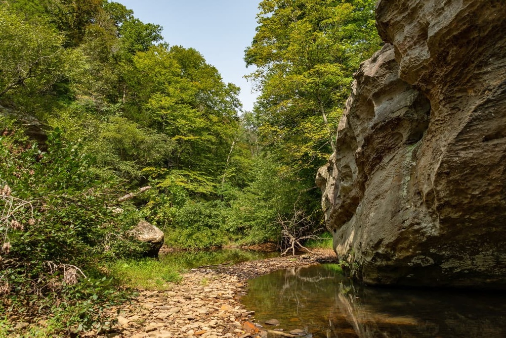
The diverse landscape in the national forest features rolling hills, forested patches, various lakes and creeks, and numerous bluffs. The bluffs within the forest showcase the region’s rugged rock formations, and they often offer visitors excellent views of the surrounding landscape.
Within the forest, there are towering rock walls covered in layers of moss. Sandstone cliffs and freestanding towers can be spotted throughout the landscape, often near major waterfalls and creeks.
Additionally, Shawnee National Forest encompasses land in 9 different counties in Illinois. This includes Pope, Jackson, Union, Hardin, Alexander, Saline, Gallatin, Johnson, and Massac.
There are also seven wilderness areas located within the Shawnee National Forest:
Additionally, Shawnee National Forest is surrounded by other popular outdoor recreation areas. Mark Twain National Forest is located to the west of the national forest while Hoosier National Forest is situated to the east. Both Clarks River National Wildlife Refuge and Land Between the Lakes National Recreation Area are located to the south of Shawnee National Forest, too.
The geological formation of Shawnee National Forest is closely intertwined with the formation of the nearby Ozark Highlands and the Shawnee Hills.
The Ozark Highlands span to the western border of the national forest up to the Mississippi River. The uplift of this region began during the late Paleozoic when present day South America and North America collided with one another.
This immense pressure forced the uplift of the Ozark Plateau, thrusting and folding the mineral sediments to form sandstone uplands. The Illinoian Stage took place between 352,000 to 132,000 years ago. During this time, the Laurentide Ice Sheet covered nearly all of present day Illinois.
Glacial retreat and thousands of years of erosion further carved out the landscape, leaving behind the sweeping valleys, hills and rock outcroppings. The rock structures left in the forest feature the weather-resistant sandstone and limestone.
The plateau region was once much flatter, but continual erosion gave the region its rugged landscape. Nowadays, limestone in the region is quarried from outcrops and coal mining takes place just to the north and south of the national forest. The Shawnee Hills are also home to large deposits of fluorite.
Major peaks within the forest include Williams Hill, Bald Knob, Horton Hill, Atwood Ridge, and Gold Hill.
Though elevations do not change drastically throughout Shawnee National Forest, the region still consists of numerous ecoregions that allow for a diverse array of both flora and fauna to thrive.
The upland forest is the dominant ecoregion in the area, and it consists of post, blackjack, and scarlet oak in the drier regions. Lower elevations in the national forest are home to black, northern red, and white oak trees along with various species of hickory. The more moist parts of the national forest support populations of American beech, sugar maple, river birch and sycamore.
The various other ecoregions within the forest are home to black walnut, bur oak, pecan, and silver maple trees. Other plant life includes woodland sunflower, little bluestem, shaggy mane mushrooms, and species of ivy, fern, moss, and lichen.
Common mammals in the forest include squirrels, chipmunks, skunks, groundhogs, beavers, possums, racoons, and armadillos. Other species that you can find in the region include the eastern hognose snake, checkerspot butterfly, and various species of bats.

Prior to European colonization, the forest was home to many Indigneous communities. The region is part of the ancestral homelands of the Kaskaskia, Kiikaapoi (Kickapoo), Myaamia, Osage, and Oglala Sioux Tribes.
In particular, the Kaskaskia peoples were one of the main Tribes that inhabited the Northeastern Woodlands. Together with other nearby Tribes such as the Moingwena, Tamaroa, Peoria, and Cahokia, the Kaskaskia tribe formed the Illiniwek Confederation, which is also referred to as the Illinois Confederation.
The first recorded contact between Indigenous peoples in the region and the settlers of European descent was in 1667. In 1673, a group of Europeans descended the Mississippi River into the region.
The first permanent mission was established in the region by French immigrants in 1703. In the decades that followed, populations of European settlers continued to grow as they farmed and exploited the natural resources of the region. As French settlers attempted to extend their reach across the region, the Kaskaskia tribe pushed back to fight for their ancestral homelands.
Many of the Tribes of the Illiniwek Confederation were pushed off of their land in the Great Lakes region both by incoming European settlers and by other Tribal nations that had come to the region looking for new hunting grounds. Due to conflict and the introduced diseases brought by the European settlers, a large number of Illiniwek Confederation Tribal members had been killed by the late 1700s.
Eventually, some of the Tribes in the Confederation were forced onto reservations elsewhere in the Midwest, such as in Kansas. Some of the Tribes reorganized into the Confederated Peoria Tribe, which later became the United Peoria and Miami Tribe until the 1920s. Nowadays, many descendants of the Illiniwek Confederation are members of the Peoria Tribe Of Indians of Oklahoma.
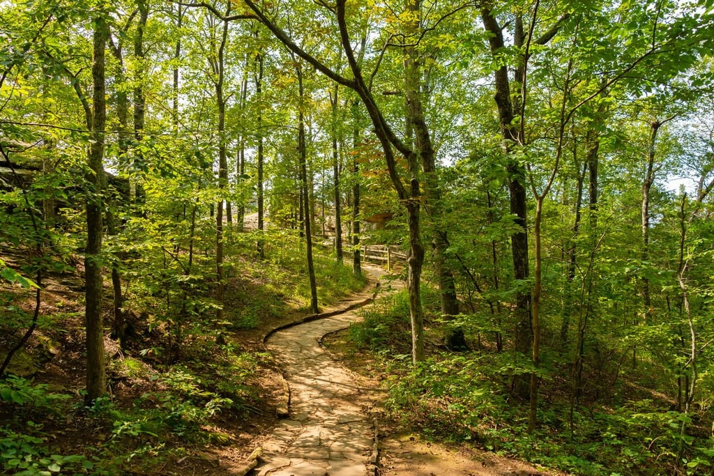
The Shawnee National Forest began as the Illini and Shawnee Purchase Units. In 1939, the purchases officially became known as the Shawnee National Forest. The wilderness areas in the forest were established in 1990 as part of the Illinois Wilderness Act. Today there are over 300 miles (483 km) of marked trails within the forest.
Shawnee National Forest is home to numerous trails and outdoor recreation areas. Here are some of the top hiking areas to visit in the national forest.
The Little Grand Canyon Trail is the most popular hiking trail in the national forest. This loop route is 3.4 miles (5.5 km) long and it has 508 ft (155 m) of elevation gain. This scenic trail winds through the forest’s rugged and rocky landscape, along a canyon and through a creek bed.
Hikers completing this trail should wear good footwear and note that there are a few places where you must climb down into the canyon itself. During the winter months, the creeks will often freeze over, turning the area into a true winter wonderland.
The Jackson Falls Trail takes hikers along a creek to see a series of waterfalls. This loop route follows along a bluff before descending into a canyon. The tallest waterfall on this trail cascades into a small pool of water, which is a true wonder to behold.
The trail is 4.2 miles (6.8 km) in length with 433 ft (132 m) of elevation gain. Rock climbing and bouldering are both popular activities near the rocky waterfalls.
The Garden of the Gods is one of the most visited wilderness areas within the national forest. The loop trail features scenic viewpoints and unique rock formations such as the Arch of the Gods and Anvil Rock.
Unique limestone and sandstone structures can be seen throughout the route. Some rock formations on this trail are part of scenic bluffs while others stand alone within the forested landscape. The loop trail is 6.3 miles (10.1 km) in length and it has 830 ft (253 m) of elevation gain.
The Pomona Natural Bridge is a short hike totaling just 0.3 miles (0.5 km) in length with 68 ft (21 m) of elevation gain.
Though it is just a short trail, hikers on this route get a chance to see the stunning beauty of a naturally formed rock bridge. Some sections of the trail are steep and rocky despite its short length.
Looking for a place to stay near Shawnee National Forest? Here are some of the best cities and villages to check out in the region:
The city of Carbondale lies on the northern edge of the Shawnee National Forest. Regionally known as “Little Egypt,” the city was established back in 1853 during the construction of the railroad. Home to around 25,000 residents, Carbondale is the most populous city in southern Illinois.
The quaint downtown features local shops and restaurants, all while being surrounded by national forests and parks. Hiking trails run throughout the region. There are opportunities for rock climbing at Giant City State Park and kayaking on Cedar Lake. The region is also home to mountain biking and horseback riding trails.
St. Louis is situated at the confluence of the Mississippi and Missoui Rivers along the border of Missouri and Illinois. Shawnee National Forest lies less than a two hour drive to the south. The metro population of St. Louis is 2.8 million people. St. Louis is also located near Mark Twain National Forest, which provides an escape from the fast-paced culture of the city.
Popular sites in the city include the Gateway Art, which marks the world’s tallest arch, St. Louis Forest Park, Cathedral Basilica of Saint Louis, and St. Louis Art Museum, among others. The food scene in St. Louis is on the rise, too, with numerous local restaurants offering a modern twist to regional cuisine.