
Scan the QR code and open PeakVisor on your phone
Rothrock State Forest is an outdoor recreation destination featuring dense forests and a plethora of creeks and streams that’s located in the US state of Pennsylvania. The forest features alternating ridges and valleys, and it contains 39 named mountains. The tallest and most prominent peak in Rothrock State Forest is Little Flat at 2,421 ft (738 m) in elevation and with 1,316 ft (401 m) of prominence.
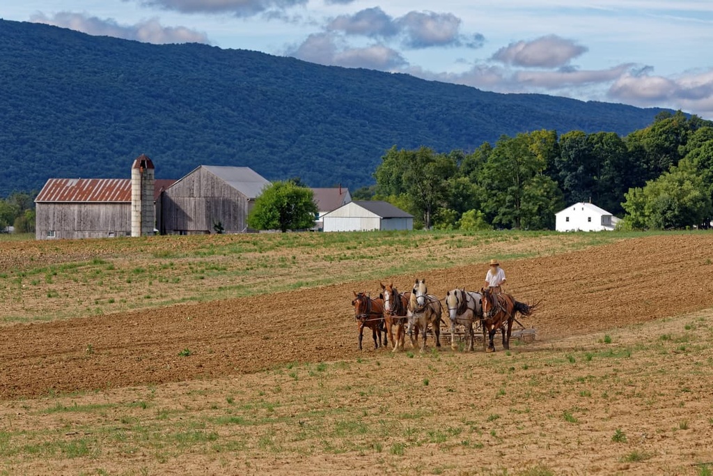
Rothrock State Forest encompasses 215,500 acres (87,200 ha) of terrain, and it is located in central Pennsylvania. The varied landscape and rolling hillsides of the state forest extend into three counties: Centre, Mifflin, and Huntingdon.
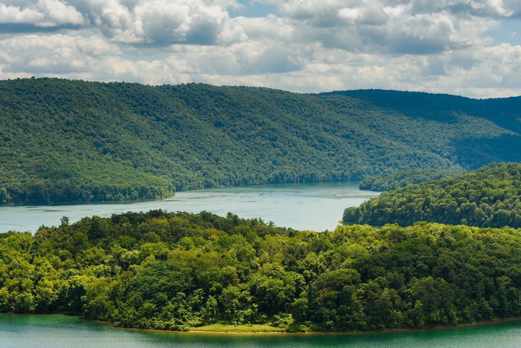
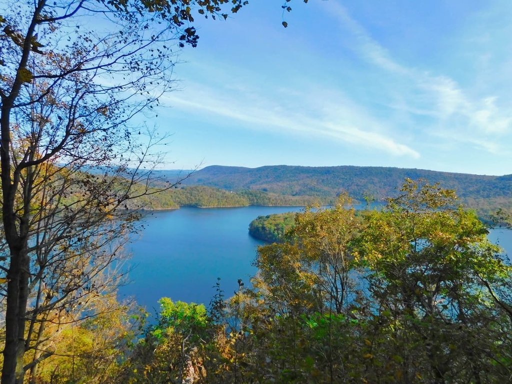
Various creeks and streams run along the valleys of the forest. Notable bodies of water in the state forest include the Juniata River, Standing Stone Creek, and Shaver Creek.
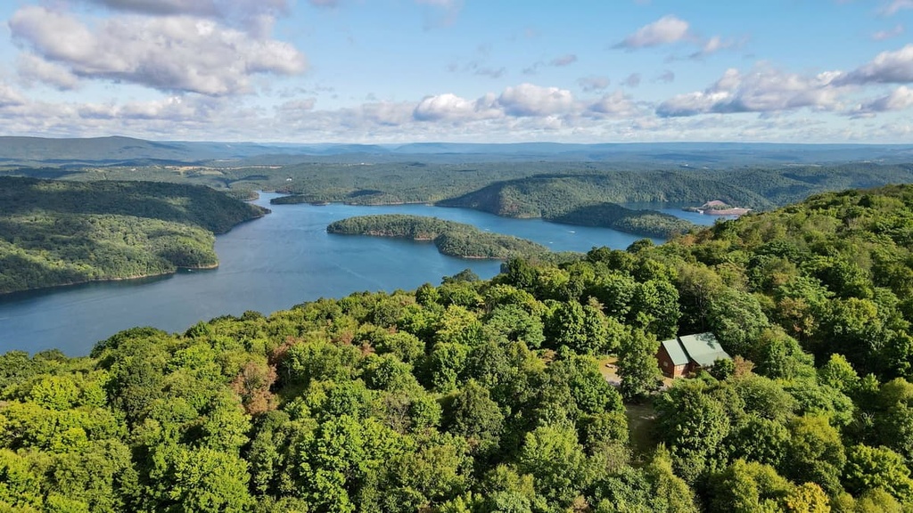
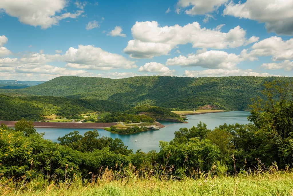
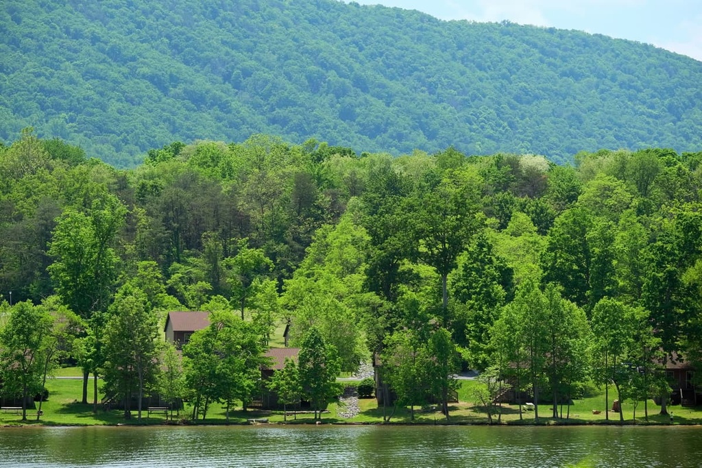
The Raystown Lake Reservoir lies in the southwestern portion of the forest, and it covers an area of 8,300 acres (3,360 ha). The reservoir was formed by a dam situated along the Juniata River, which is part of the Susquehanna River Basin flood control system.
The forest lies within the Allegheny Mountains, a subrange of the larger Appalachian Mountains. Rothrock State Forest is part of a large network of state forests in Pennsylvania, and it is surrounded by a number of other areas of state land. In particular, the Bald Eagle State Forest lies to the east of Rothrock and Tuscarora State Forest is situated to the south.
The densely forested landscape of Rothrock State Forest is also met with steep ridgelines, rock outcroppings, and rocky buttes. Sections of boreal bog and old-growth forests can be found throughout the region. There are also numerous natural areas and wild areas that are located within the forest, such as:
Additionally, Rothrock State Forest lies near numerous other parks and forests for outdoor recreation. Bald Eagle State Forest lies directly to the east of Rothrock while Tuscarora State Forest is situated to the south. Other nearby protected areas include Moshannon State Forest, Tiadaghton State Forest, and Buchanan State Forest.
The geological history of Rothrock State Forest is dominated by the two major topographical features of the area: the Allegheny Mountains and the Susquehanna Valley.
A vast majority of central Pennsylvania lies within the Susquehanna River Basin. Considered one of the oldest rivers in North America, the Susquehanna River has carved out the region over the course of millions of years.
The peaks within Rothrock State Forest lie on the border between the Allegheny Mountains and the rest of the Appalachian Mountains. The Appalachian Mountains, along with its various subranges, started to form around 480 million years ago. As the peaks in the region were thrust upward, the direction of the Susquehanna River was altered, forcing the water to flow to the southeast.
Throughout the following 150 million years, the river carved out the region’s landscape, creating a wide, sweeping valley in the process. An ice sheet covered much of present-day Pennsylvania during the last glacial maximum. As temperatures rose, much of the glacial runoff was added to the Susquehanna River, increasing its rate of erosion. Sediment from the glaciers slowly filled in the once-deep canyon, leaving behind the river valley that is still present today.
The main ridgeline of the Allegheny Mountains lies just to the west of the state forest. The greater Appalachian Mountains span from the US state of Alabama to the province of Newfoundland and Labrador in Canada. The bedrock throughout central Pennsylvania consists primarily of quartzites and sandstones that formed during the Appalachian orogeny.
Major peaks located within Rothrock State Forest include Little Flat, Butler Knob, Short Mountain, Broad Mountain, Round Mountain, Round Top, and Horse Knob.
Rothrock State Forest features flora and fauna that are common throughout central Pennsylvania. The vast network of state forests in Pennsylvania and the area surrounding Rothrock allows for a variety of species to thrive in the various forests, wetlands, lakes, and bogs of the region.
Sections of old-growth trees in the forest often feature groves of Eastern hemlock, Eastern white pine, black spruce, and balsam fir. Maple trees and chestnut oak are also common throughout the forested sections of the region. Popular flowering plants in Rothrock include mountain laurel, asters, goldenrod, dogwoods, and sumacs.
Various low-growing plants such as Queen Anne’s lace, teasel, mayapples, wild carrot, milkweed, and redbud tree can be found in the steep hillsides and ridgelines of the state forest.
The varied topography of the region allows for a plethora of animal species to thrive within Rothrock State Forest. Some of the most commonly spotted mammals in the state forest are white-tailed deer, squirrels, and cottontail rabbits. Bobcats live in the forest, too, though they are rarely spotted by hikers and bikers.
Groups of wild turkeys and porcupines live in the forested regions of Rothrock while the wetlands provide an ideal habitat for great blue heron, bass, snapping turtles, and black crappie. Bald eagles are often spotted near the streams and lakes of the state forest.
Besides hiking and mountain biking, Rothrock State Forest is also known for its impeccable bird-watching opportunities. Species commonly spotted by bird watchers in the state forest include cardinals, northern shrieks, sparrows, northern mockingbirds, finches, wood ducks, and red-eyed vireos. The high concentration of milkweed in the forest allows monarch butterflies to thrive, as milkweed acts as their main food source and host plant.
The region in and around what is now Rothrock State Forest is the ancestral homelands of many Indigenous Tribes, including the Susquehannock. The Susquehannock are an Iroquoian people who traditionally lived throughout the Northeastern Woodlands of the present-day US.
Prior to the arrival of European settlers, the Susquehannock and other Indigenous peoples lived harmoniously with the land for thousands of years. The Susquehannock River runs through the region and was the epicenter for many Susquehannock communities. The Susquehannock people lived throughout what is now central Pennsylvania, though some bands traveled and lived as far west as present-day Ohio.
The Susquehannock people united with other Indigenous peoples as Europeans began arriving in the region. Many of these early settlers lived to the east of the Appalachian Mountains. The seventeenth century marked the first recorded contact between these European settlers and tribal nations in the region.
At the beginning of the seventeenth century, the Susquehannock people were able to resist joining the Haudenosaunee (Iroquois Confederacy). They instead formed alliances with the Swedish and Dutch settlers in the region. Together, the Susquehannock and the Swedes fought against the colony of Maryland during the mid-seventeenth century.
The arrival of more settlers to the region also brought along diseases such as smallpox and measles, to which Indigenous people had no natural immunity. These diseases resulted in a drastic decline in the Susquehannock population during the end of the seventeenth century.
With their population dwindling, many of the remaining Susquehannock tribes were overtaken by the Haudenosaunee, and many Susquehannock relocated to present-day New York, around the territory of the Oneida Nation. It wasn’t until decades later that some of the Susquehannock people were able to return to their ancestral lands near the Susquehannock River.
Despite the Susquehannock’s claim to the land, extensive timber harvesting took place in the region during the nineteenth century. The conservationist Dr. Joseph Rothrork, whom the forest is named after, was appointed the commissioner of the Pennsylvania Department of Forests and Waters in 1895. Just a few years later, a piece of legislation was passed which ultimately led to the beginning of the State Forest system.
Pennsylvania State University’s flagship University Park campus at State College is located just outside the forest. As a result, both professors and students use the state forest for various research projects. Today, the forest is also well-known for its plethora of both hiking and mountain biking trails.
Rothrock State Forest is home to a number of excellent trails for outdoor recreation. Here are a few of the trails that you can find within the forest that are worth checking out during your next visit to the region.
The Colyer Lake Loop is a relatively short trail in the forest that circles around Colyer Lake. This loop trail features views of the lake and surrounding hillsides throughout.
During the summer months, visitors can also enjoy watersports or swimming in the lake. The trail is accessible throughout the year and is commonly used for snowshoeing in the winter. This route is 2.7 miles (4.3 km) long round trip and it has 134 feet (41 m) of elevation gain.
The Little Flat Fire Tower trail takes hikers up to the tallest summit in the forest, Little Flat. Though most of the region is densely forested, hikers can enjoy views of the surrounding landscape once at the summit during the fall and winter months.
This loop trail winds through the region’s forested landscape, though the forest’s deciduous trees provide an ever-changing landscape to keep you entertained as you walk. The route is 3.6 miles (5.8 km) in length and it has 1,079 feet (329 m) of elevation gain.
This loop trail takes hikers through a scenic forest to the Tussy Fire Tower Ruins. Though there are no longer views from the fire tower, hikers can still look out over the rolling hillsides and valleys in the distance.
Sections of the trail are quite rocky, adding to the hike’s level of difficulty. The loop route is 4 miles (6.4 km) long round trip and it has 787 feet (240 m) of elevation gain.
Looking for a place to stay near Rothrock State Forest? Here are some of the best cities and villages to check out in the region.
Home to Pennsylvania State University, the city of State College lies along the northern edge of the state forest. State College is part of the largest designated borough in the state of Pennsylvania, and it is home to around 42,000 residents.
State College is often referred to as “Happy Valley” or “Lion County.” Each year, State College also hosts the Central Pennsylvania Festival of the Arts.
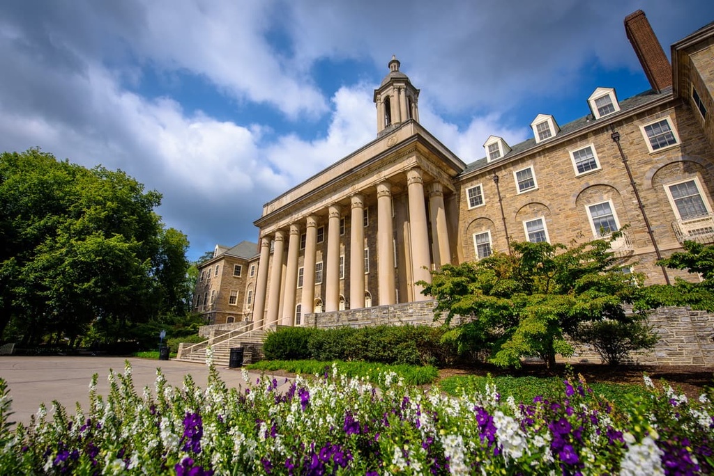
The downtown streets of State College are lined with local cafes, bakeries, galleries, and restaurants. A trip to one of the town’s many restaurants provides the ideal way to relax after exploring the plethora of hiking and mountain biking trails that lie just a short distance away in Rothrock State Forest.
Harrisburg is the capital city of Pennsylvania, and it is located just to the southeast of Rothrock State Forest. As it is home to around 50,000 residents, Harrisburg is the ninth-most populous city in Pennsylvania. Harrisburg lies along the banks of the Susquehanna River and features a historic downtown region.
The city is also home to the State Museum of Pennsylvania and the National Civil War Museum. Riverboat cruises in Harrisburg take you along the Susquehanna River and are a popular tourist attraction.
The city of Hershey, Pennsylvania lies just 10 miles (16 km) to the east of Harrisburg, too. The small town is home to the world-famous Hershey’s chocolate company. While in Hershey, you can check out any one of a number of popular tourist attractions, such as Hershey Park and Hershey’s Chocolate World.


