
Scan the QR code and open PeakVisor on your phone
William B. Bankhead National Forest has 28 named peaks. The highest is Eckerberger Mountain at 345 m. Other notable peaks include Penitentiary Mountain, Cheatham Knob and Kinlock Knob.
The William B. Bankhead National Forest is a protected region that’s located in the northwestern part of the US state of Alabama. The forest is home to the state’s only National Wild and Scenic River, the Sipsey Fork. There are 28 named mountains in the forest with the tallest and most prominent being Eckerberger Mountain.
The William B. Bankhead National Forest, commonly referred to as the Bankhead National Forest, is located in the northwestern portion of the US state of Alabama. It is one of four national forests in the entire state.
Overall, the forest encompasses 181,230 acres (73,341 ha) of land across northern Alabama. The Bankhead National Forest is home to the only National Wild and Scenic River in the state, the Sipsey Fork. The forest contains land that is located within Lawrence, Winston, and Franklin counties.
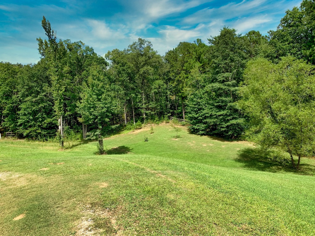
The beautiful landscape consists of forested sections, limestone buttes, and a plethora of creeks and streams. Brushy Creek cuts across the forest in a north to south fashion along with the Sipsey Fork.
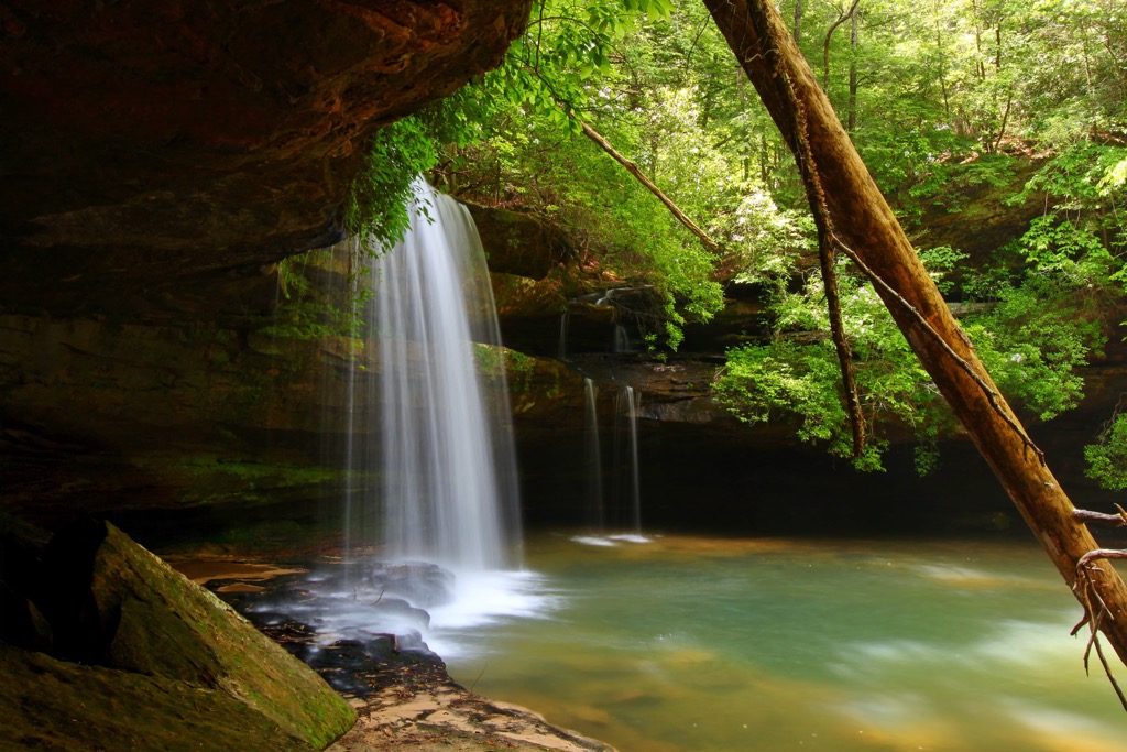
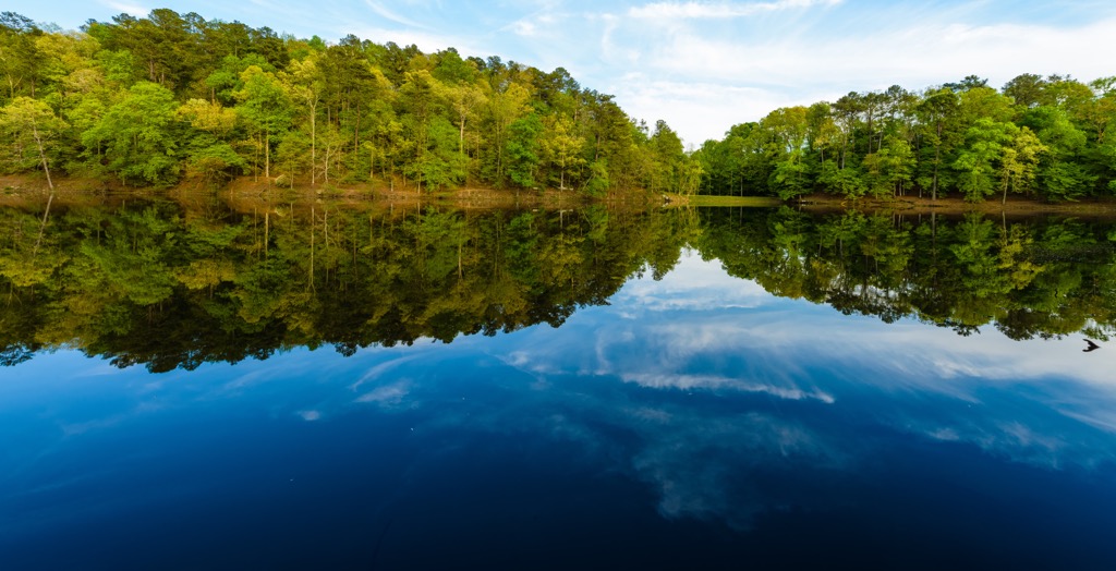
The Lewis Smith Lake lies south of the forest situated along the Sipsey Fork of the Black Warrior River. Wilson Lake and the Tennessee River are situated north of the national forest. The various creeks and streams provide the forested region with a multitude of waterfalls.
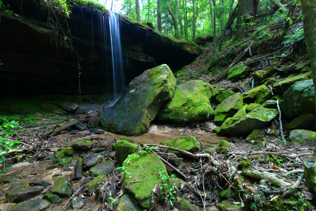
Known as the “land of a thousand waterfalls”, the Bankhead National Forest has become well-known for its fishing, canoeing, and hiking opportunities. Rocky outcroppings and cliffs are common throughout the forest with most of the trees being deciduous.
Additionally, the Bankhead National Forest is surrounded by popular outdoor recreation areas. The Sipsey Wilderness lies within the forest while the Mulberry Fork Wildlife Management Area is situated to the south. Sam R. Murphy Wildlife Management Area is to the west while the Wheeler National Wildlife Refuge is to the northeast.
The peaks and hills in the Bankhead National Forest are part of the larger Cumberland Plateau, a subsection of the larger Appalachian Plateau. The southwestern edge of the Appalachian Mountains lie just northeast of the national forest.
Both the plateau, and the mountain range, extend along the eastern US in a northeastern direction, spanning from the US state of Alabama and extending into the province of Newfoundland and Labrador in Canada.
The geological history of the plateau is closely intertwined with that of the Appalachian Mountains. Base rock found in the region dates back to the Precambrian, often covered by sedimentary rock from the Paleozoic Era. The top layer of rock, visible throughout the forest, is from the Cambrian, Ordovician, and Middle Silurian eras.
These rocks were made visible as the plateau lies along a thrust fault, which ultimately forced up the Paleozoic strata over the younger rocks. As the Appalachian Mountains were uplifted, so was the plateau to their west.
The Appalachian Mountains, and their numerous subranges, began taking shape during the Grenville and Alleghenian orogenies, estimated to be around 1 billion years ago. Today the plateau has become relatively flat with small hills and sweeping valleys, less dramatic than the nearby Appalachian Mountains.
Major peaks within the Bankhead National Forest include Eckerberger Mountain, Milestone Mountain, Sand Mountain, and Cedar Grade Hill.
The forested portions of the national forest consist of loblolly-shortleaf pine along with oak-pine trees. Common species include shortleaf pine, chestnut oak,and white oak. Beech and sugar maple are more common along the ridgelines of the regions.
The flora found in the forest is similar to that found throughout the northern portion of Alabama, and the rest of the Cumberland Plateau. Oak-hickory forests are common along the various waterways of the forest.
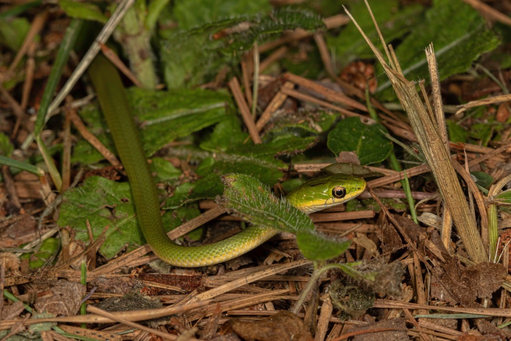
Hikers have the opportunity to spot white-tailed deer, gray and fox squirrels, turkey, rabbit, raccoon, and bobwhite quail. The forest, especially the Sipsey Wilderness, is known for its superb bird watching. Common species include the Cerulean Warbler and Rusty Blackbird.
The land in what is now the Bankhead National Forest has been inhabited by groups of humans for thousands of years. This region marks part of the ancestral homelands of the East Cherokee (ᏣᎳᎫᏪᏘᏱ Tsalaguwetiyi), Shawnee, and Yuchi (S’atsoyaha) Tribes.
The Eastern Band of the Cherokee lived throughout this forested region, they were forced from their ancestral homelands and are now headquartered in western North Carolina. Other Cherokee Tribal Nations are located in neighboring states.
The history of the Eastern Band of Cherokee is closely tied to the history of the Qualla Boundary, a land trust that marked their original territory. Members of the Eastern Band are descendants of the Cherokee people who lived along the Oconaluftee River.
Chief Yonaguska was able to stop his people from being removed during the Indian Removal Act, allowing them to stay on their native homelands rather than endure the grueling journey on the Trail of Tears. Those who remained were forced to revoke their Cherokee tribal citizenship and assimilate as US citizens.
During the 20th century, the tribe was able to gain federal recognition and buy back the Qualla Boundary which is part of their ancestral land. Prior to this purchase, the land had been ceded by the US government during the 19th century. Today the Eastern Band of Cherokee Indians, have headquarters in what is now North Carolina on the Qualla Boundary.
The United States Forest Service purchased land throughout the southern US in the early 20th century. The forest was originally established as the Alabama National Forest in 1918 and was renamed the Black Warrior National Forest before becoming the William B. Bankhead National Forest in 1942.
The Sipsey Wilderness was officially designated in 1975 and later expanded in 1988. Today the forest is known for its hiking, fishing, and canoeing opportunities.
The Bankhead National Forest is home to numerous hiking trails, many centered around the various waterfalls of the region. Here are some of the best hikes to check out during your next trip to the Bankhead National Forest:
The trail to Sougahoagdee Falls winds through the forested landscape, following along Brushy Creek. Sections of the trail are quite rooty so hikers should wear proper footwear. There are some views of the creek though the main viewpoint is the falls.
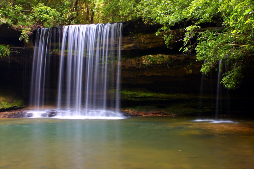
Sougahoagdee Falls cascades down a clif, allowing hikers to access a small trail behind the falls. There is a small pool at the base of the falls which can be used for swimming. This out and back trail is 4 miles (6.4 km) in length with 436 feet (133 m) of elevation gain.
The Caney Creek Falls follows along the Caney Creek before climbing up to the falls. Parts of this trail lie on private property so visitors should abide by all posted signage and stay on the path.
The waterfall drops off a limestone structure allowing hikers to walk behind the falls or swim in the pool at its base. This out and back trail is 1.2 miles (1.9 km) in length and features 308 feet (94 m) of elevation gain.
The trail begins by slowly descending along a rocky path before reaching a creek. This trail has a few visible markers but requires hikers to follow along the rocky creek in order to access the falls. Hikers should also stay alert to try and spot local turtles and snakes.
The secluded falls lie in a forested cove with a small pool at its base. During the summer months the falls have a minimal amount of water flow. This out and back path is 1.4 miles (2.3 km) long with 157 feet (48 m) of elevation gain.
Looking for a place to stay near the Bankhead National Forest? Here are some of the best cities and villages to check out in the region.
The city of Huntsville, Alabama lies a 45 minute drive northeast of the national forest in the Appalachian region of the state. Situated along the Tennessee River, Huntsville is home to around 220,000 residents, making it the most populous city in the state.
Huntsville has been called “Rocket City” due to its close association with US space missions. Visitors can check out some of the historic US rockets in Rocket Park, part of the US Space and Rocket Center within the city.
As the most populous city in the state, Huntsville is home to museums such as the Huntsville Museum of Art, Clay House Museum, and the Alabama Constitution Village. Each year the city hosts the Panoply Arts Festival, Rocket City Brewfest, and the Cigar Box Guitar Festival.

Birmingham, Alabama, lies a 50 minute drive southeast of the national forest. Home to around 200,000 residents, Birmingham acts as a regional hub for the southern US. Known for its incredible barbeque and plethora of outdoor markets, the city is full of fresh and local cuisine.
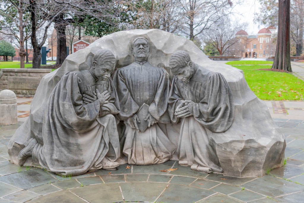
Visitors should also explore the Birmingham Botanical Gardens, Birmingham Museum of Art, and the Birmingham Civil Rights Institute. Each year the city hosts the Southern Heritage Festival, and the Taste of 4th Avenue Jazz Festival.
Throughout the city visitors will find numerous parks and foot paths, allowing for ample space for outdoor activities. Local cuisine, breweries, and cocktail lounges line the downtown streets, making Birmingham a popular destination for foodies.


The highest peak in William B. Bankhead National Forest is Eckerberger Mountain, at 345 m.
Notable peaks in William B. Bankhead National Forest include Eckerberger Mountain, Penitentiary Mountain, Cheatham Knob, Kinlock Knob and Cedar Ridge.


