
Scan the QR code and open PeakVisor on your phone
Qualla Boundary has 26 named peaks. The highest is Bunches Bald at 1,669 m. Other notable peaks include Soco Bald, Lickstone Ridge and Jenkins Ridge.
The Qualla Boundary is a land trust located in the western portion of the US state of North Carolina. The territory is not technically a reservation and marks part of the traditional territory of the Eastern Band of Cherokee. The tallest and most prominent peak in the territory is Bunches Bald at 5,476 ft (1,669 m) tall with 984 ft (300 m) of prominence.
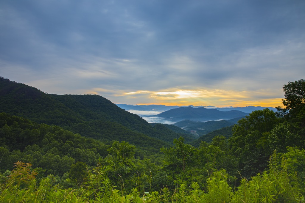
The Qualla Boundary lies in the southwestern portion of the US state of North Carolina and consists of noncontiguous parcels of land. The surrounding region marks one of the wettest regions in the continental US.
Qualla Boundary spans across numerous counties, with the largest contiguous portion covering land in Haywood, Swain, and Jackson counties. The other portions lie within Graham and Cherokee counties.
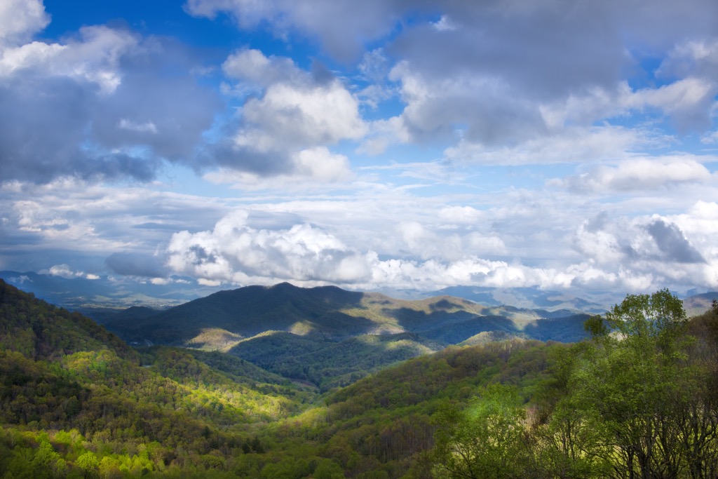
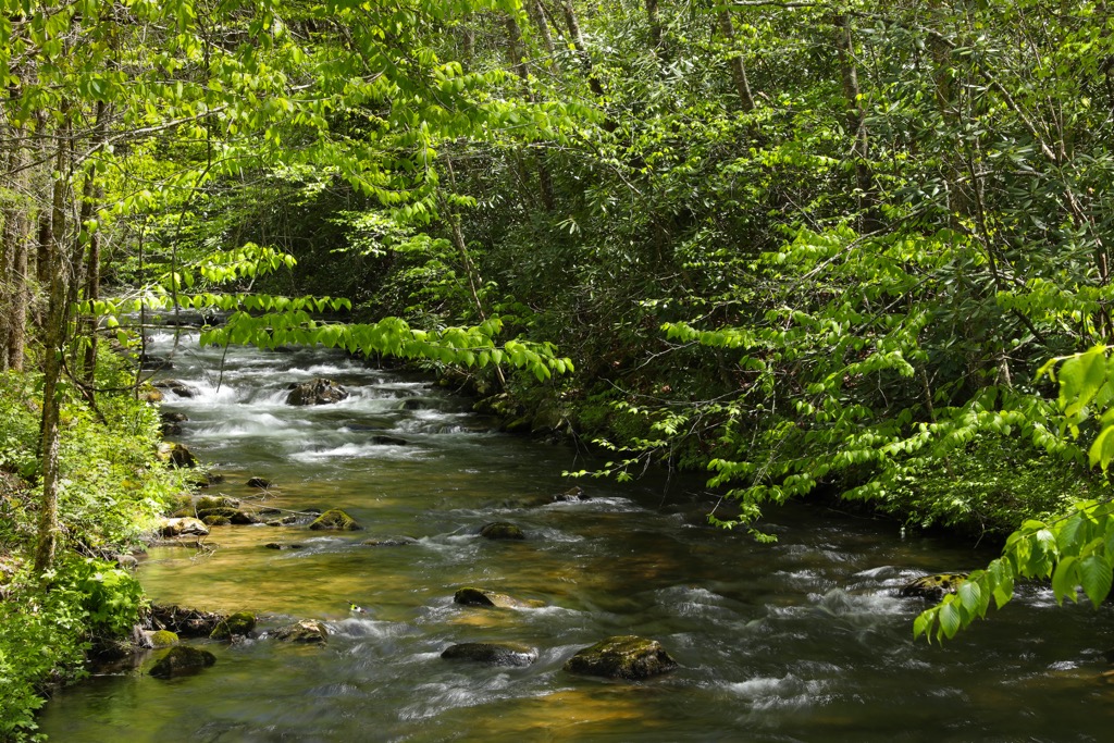
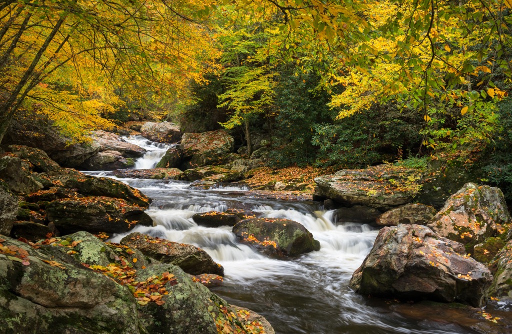
The land consists of densely forested hillsides, sweeping valleys, gorges, and a multitude of rivers and streams. The Oconaluftee River cuts across the northern portion of the territory. Other prominent bodies of water include Valley River, Soco Creek, Raven Fork, and the Lambert Branch.
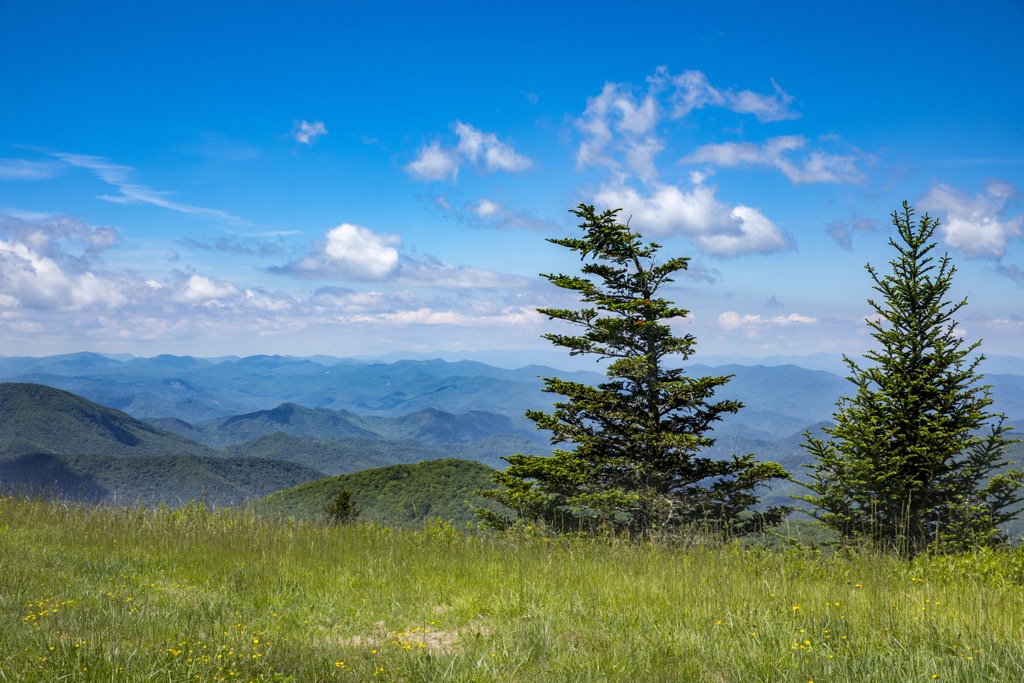
The peaks found throughout the region are part of the Blue Ridge Mountains, a subrange of the larger Appalachian Mountains. The largest parcel of the territory is centered around the community of Cherokee, situated along the northern banks of the Oconaluftee River.
Together, the combined parcels of land cover 57,000 acres (23,067 ha) across southwestern North Carolina. Enrolled members of the Eastern Band of Cherokee can buy, own, and sell the land. Currently around eighty percent of the land is owned by individual tribal members.
Additionally, the Qualla Boundary is surrounded by other popular outdoor recreation areas. The northern portion of the boundary is surrounded by the Cheoah Ranger District of the Nantahala National Forest and the Great Smoky Mountains National Park to the north. The southern parcels of the territory are surrounded by the Tusquitee Ranger District of the Nantahala National Forest.
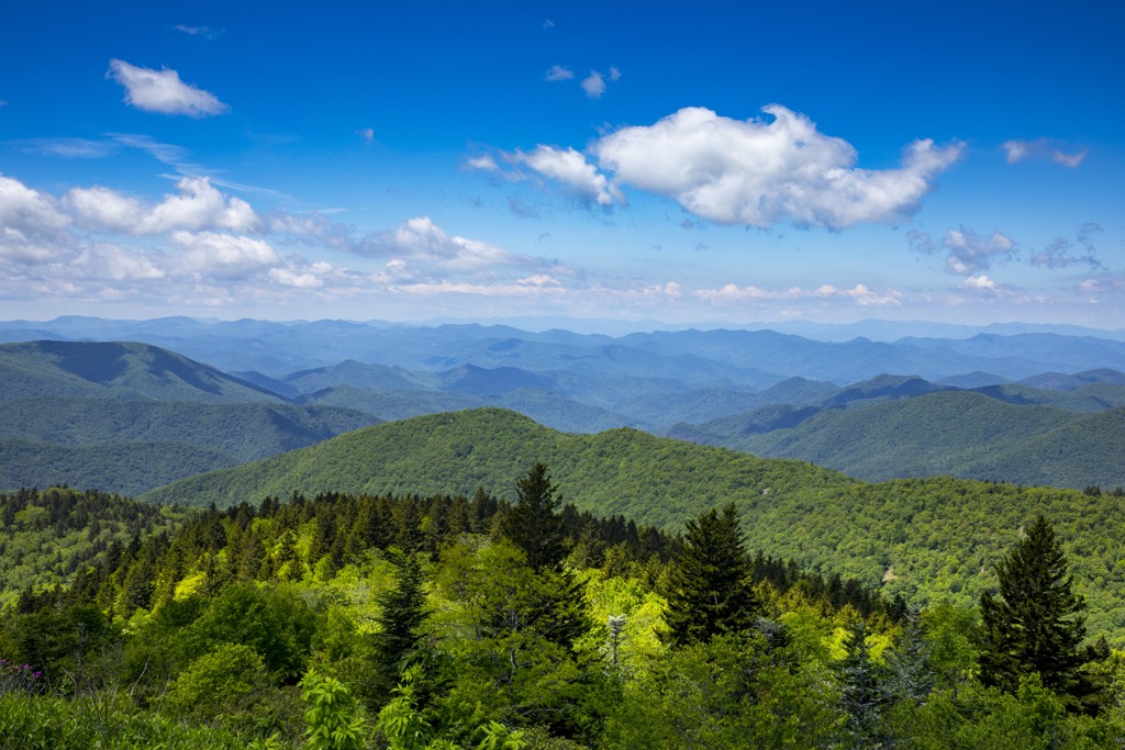
The peaks and ridgelines found within the Qualla District and the surrounding landscape are part of the Blue Ridge Mountains, which marks a subrange of the Appalachian Mountains. The Blue Ridge Mountains span from the US state of Georgia northward into the states of Maryland and Pennsylvania.
These mountains are part of the Blue Ridge geological province, which defines western North Carolina. The ridgelines and landforms in this region are distinct from the rest of the Appalachian Range, often featuring more dramatic changes in elevations.
Igneous and metamorphic rock is found throughout the Qualla Boundary with the oldest rocks in the range dating back to the Precambrian and Paleozoic eras. The Appalachian Mountains began taking shape between 1 billion and 250 million years ago, during the Grenville and Alleghenian orogenies.
As the North American and European plates collided around 320 million years ago, the Blue Ridge Mountains were thrusted upwards. During their formation, it is estimated that the Blue Ridge Mountains were among the tallest peaks in the world at the time.
Continual erosion over the course of hundreds of millions of years, left behind the series of ridges and valleys visible today. The surrounding region is known for being rich in minerals such as sapphires, mica, rubies, emeralds, and amethysts.
Though today the Blue Ridge Mountains are far from the tallest peaks on the planet, they are geologically much older compared to major ranges such as the Alps or Himalaya. Both of these ranges were formed during the Alpine orogeny, around 65 million years ago.
Major peaks within the Qualla Boundary include Bunches Bald, Soco Bald, Hickorynut Knob, Barnett Knob, and Mount Noble.
The Qualla Boundary lies within the larger Blue Ridge ecoregion. This ecoregion encompases land throughout western North Carolina and northeastern Georgia. A variety of flora and fauna are able to thrive in the territory due to the surrounding network of protected lands.
Some of the taller peaks in the territory are populated by both fir and spruce trees while mid-elevations are dominated by northern hardwoods. The lower foothills surrounding the waterways of the region are forested with hickory, chestnut, heath, oak, and shortleaf pine.
The densely forested hillsides provide an ideal habitat for a wide range of animals. Larger mammals throughout the region include black bears, white-tailed deer, bobcats, and coyotes. Visitors may also spot porcupines, beavers, and river otters.
The large population of river otters in the region gave the nearby Cheoah Ranger District its name. ‘Cheoah’ represents the anglicized version of the Indigenous Cherokee word cheeowha, meaning ‘otter.’
The Qualla Boundary marks part of the traditional territory of the Cherokee people. Archaeological evidence indicates that the region has been inhabited by humans for as long as 12,000 years.
Additionally, the traditional territory of the Cherokee people spans across other parts of North Carolina, Southern Carolina, Alabama, Tennessee and Georgia. For thousands of years the various bands of Cherokee people lived harmoniously with the land.
The first recorded contact between the Cherokee people and Europeans occurred in 1540. Hernando de Soto of Spain explored much of the southeastern US during this time, making contact with many of the Indigneous tribes of the region.
Europeans began arriving in the region during the 1600s and the Cherokee people formed treaties and trade agreements with the early Irish, English, and Scottish immigrants. By the early 1700s, the Cherokee people had formed a unified national government.
Gold was discovered in the Blue Ridge Mountains in the early 1800s leading to a large influx of settlers in the region. As populations began to rise, the US government began forcibly attacking, killing, and displacing the Indigneous peoples.
During this time the US government tried to force the Cherokee people to sign the Treaty of Echota. Though the treaty was never signed by the Cherokee, the government began forcibly removing them from their native homelands.
Around 11,000 Cherokee people were relocated to present day Oklahoma between October 1838 and March 1830, a journey that became known as the Trail of Tears. Some Cherokee people were able to remain in the region, hiding in the Great Smoky Mountains. Those who remained, sought out William Holland Thomas and asked him to purchase land on their behalf in 1840.
Thomas was trusted by the Cherokee people and went on to purchase around 50,000 acres of land near the Oconaluftee River in western North Carolina. These purchases makeup a majority of the Qualla Boundary today.
In 1866 the Eastern Band of Cherokee were officially granted freedom to live in North Carolina. The tribe was recognized as a separate entity from the Cherokee people in Oklahoma in 1868. The purchased land officially became a trust for the Eastern Band of Cherokee in 1874.
Today the land is not a reservation but rather a land trust for the Easternn Band of Cherokee. The tribe's capital lies within the boundary in the community of Cherokee. Today, enrolled members of the tribe can buy, own, and sell parcels of land within the Qualla Boundary.
A majority of the hiking trails within the Qualla Boundary are centered around the tribal capital of Cherorkee. Visitors can also explore the surrounding Cheoah District and Great Smoky Mountains National Park for hundreds of miles of trails. Here are some of the most popular routes located within the territory:
The Fire Mountain Trail System lies just northwest of the community of Cherokee. The Owl Branch lies just west of the network of trails which features a multitude of hiking routes. Hikers can explore shorter hikes or complete the entire loop totaling 11.6 miles (18.7 km) and 2,224 ft (678 m) of elevation gain.
This network of trails can be used for both hiking and mountain biking. The forested hillsides provide shade during the climbs with multiple viewpoints throughout. Hikers and bikers can take a relaxing break at one of the covered picnic areas located on the mountain.
Mount Noble marks one of the most prominent peaks in the Qualla Boundary and is situated northeast of Cherokee. The trail climbs steadily along the forested hillside and crosses over the Owl Branch before reaching the fire tower.
Hikers have the option of climbing the steep steps up to the top of the tower. From the summit, hikers have sweeping views of the nearby Smoky Mountain Ridge. This out and back trail is 5.1 miles (8.2 km) in length and features 1,604 feet (489 m) of elevation gain.
Oconaluftee Park lies along the northern part of Cherokee, situated along the Oconaluftee River. This trail crosses a bridge over the river onto the Oconaluftee Islands. The gentle route features views of the river, picnic areas, and informational signs.
The entire out and back route totals 1.5 miles (2.4 km) in length and features 22 feet (7 m) of elevation gain. Hikers also have the option of shortening the route with picnic areas found throughout the park.
Looking for a place to stay near the Qualla Boundary? Here are some of the best cities and villages to check out in the region:
The census-designated community of Cherokee is situated along the Oconaluftee River and acts as the capital for the Eastern Band of Cherokee. Home to around 2,100 residents, the community is known for its close proximity to Great Smoky Mountains National Park. One of the park’s main entrances lies within the community of Cherokee.
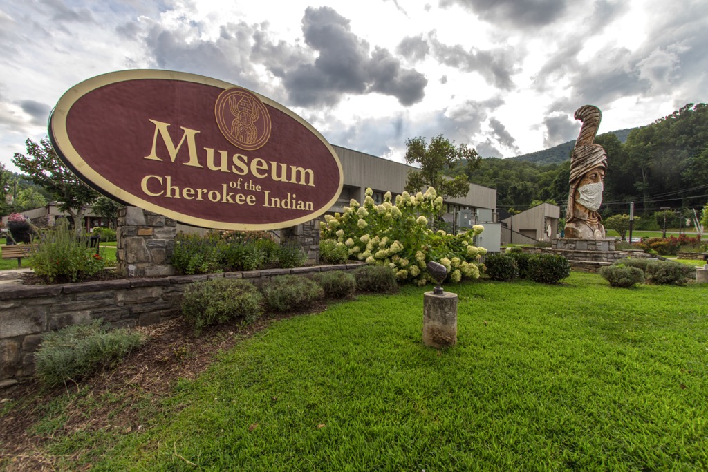
Other nearby outdoor attractions include Blue Ridge Parkway and the Oconaluftee River. Along with opportunities for hiking and mountain biking, Cherokee is also home to the Oconaluftee Indian Village, Qualla Arts and Crafts Mutual, and the Museum of the Cherokee Indian.
Visitors to the region can soak in the plethora of natural beauty while also learning about the Indigneous people and history who have shaped the region for thousands of years. Cherokee is also home to the Harrah’s Cherokee Casino Resort.
Asheville is the closest major city to the boundary, situated an hour’s drive east of the community of Cherokee. Home to around 91,000 residents, Asheville is the most populous city in western North Carolina.
Situated at the confluence of the French Board and Swannanoa rivers, the city has become both a cultural and economic hub for the Blue Ridge Mountain region. Surrounded by stunning mountains and ridgelines, Asheville has become a hub for hiking, trail running and mountain biking.
The city boasts more breweries per capita than nearly any other city in the country, and offers a thriving food scene. Nearby waterways are common spots for world-class whitewater rafting and paddle boarding. Popular sites in the downtown streets include the River Arts District and Biltmore Estate.


The highest peak in Qualla Boundary is Bunches Bald, at 1,669 m.
Notable peaks in Qualla Boundary include Bunches Bald, Soco Bald, Lickstone Ridge, Jenkins Ridge and Sheepback Mountain.


