
Scan the QR code and open PeakVisor on your phone
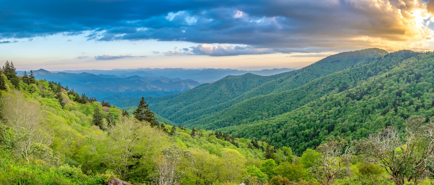
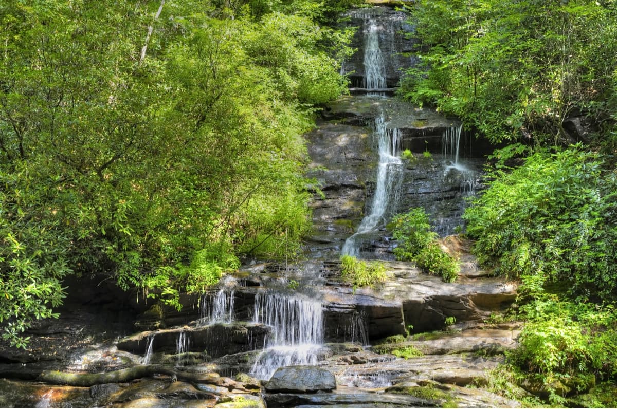
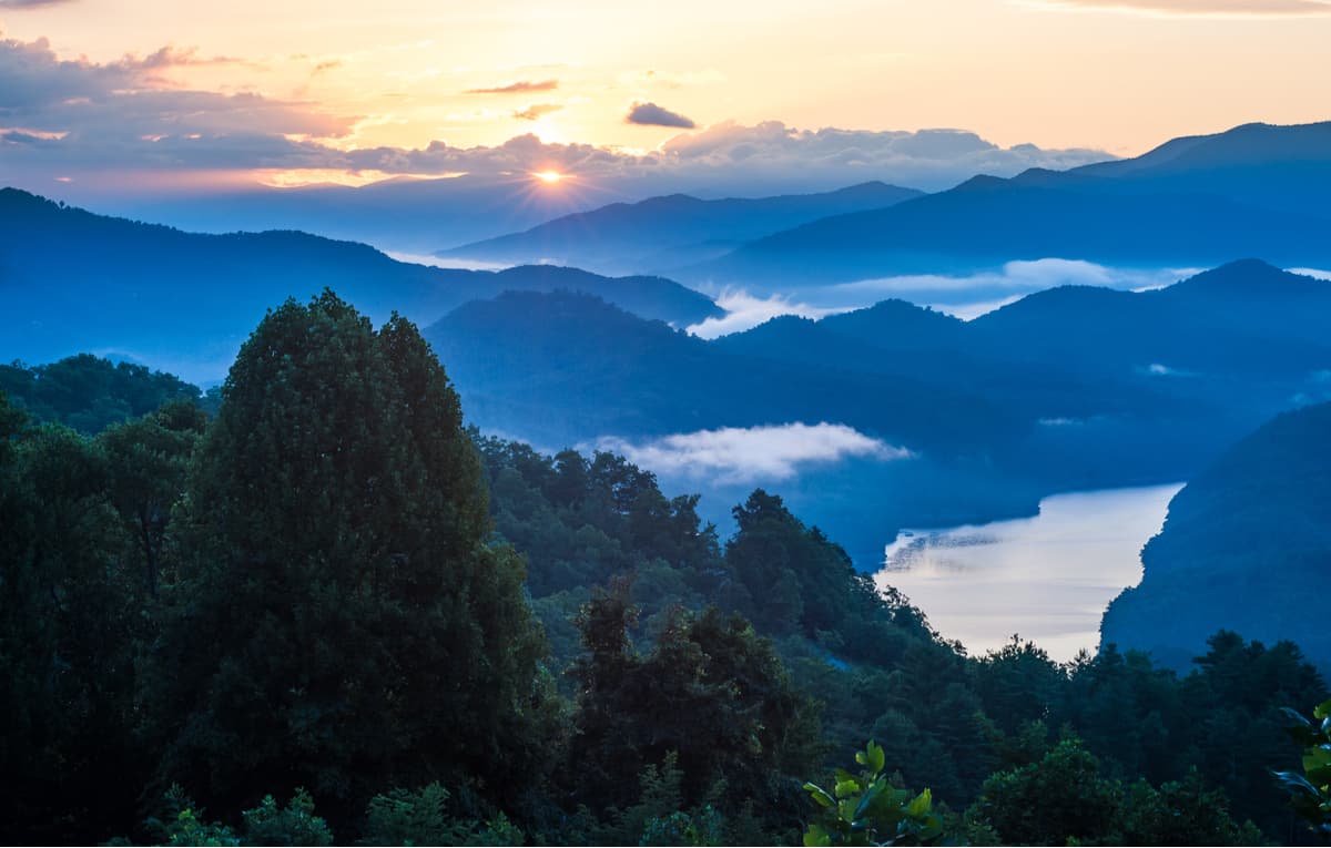
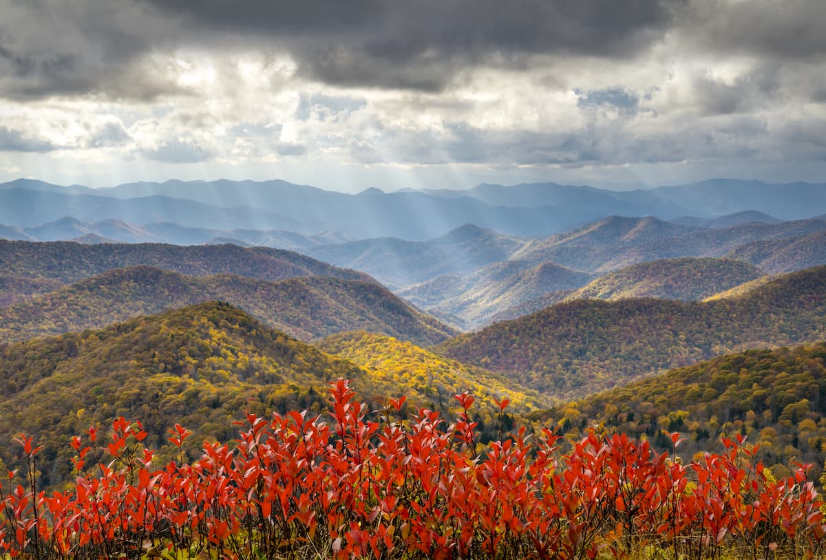
The Great Smoky Mountains National Park is the most visited national park in the entire US, with 11.3 million recreational visitors coming to the park in 2016 alone, and straddles the Great Smoky Mountain Range up to (and encompassing part of) the Blue Ridge Mountains along the Eastern Tennessee and Western North Carolina Border. The park is 522,419 acres total in the heart of the Appalachian Mountains with nearly 95% of the park forested and almost 36% of it, 187,000 acres, estimated by the Park Service to be old growth forest with trees that predate European settlement of the area when the land was largely inhabited by Native American tribes. It is one of the largest deciduous, temperate, old growth forests in North America.
Entrance to the park is free. However, fees are charged for activities such as overnight camping ($14-23 per night) and pavilion rental at picnic areas. Backcountry reservation permits cost $4.00 per person, per night, with a maximum fee of $20.00 per person and are non-refundable. Permits are good for 7 nights total. To reserve a permit ahead of time you can call the Backcountry Office at 865-436-1297.
The region that the Smoky Mountain National Park calls home was originally the home of the Cherokee Tribe. European Settlers began settling the area in the 18th Century. Sadly, the Cherokee tribes in the region, as well as east of the Mississippi River, were forcibly removed by the signing of the Indian Removal Act by Andrew Jackson and were driven to Oklahoma along the infamous Trail of Tears. Those native Americans who stayed were led by renegade warrior Tsali and hid out in what would become the Great Smoky Mountains National Park, the descendants of which now live in the Qualla Boundary to the south of the park.
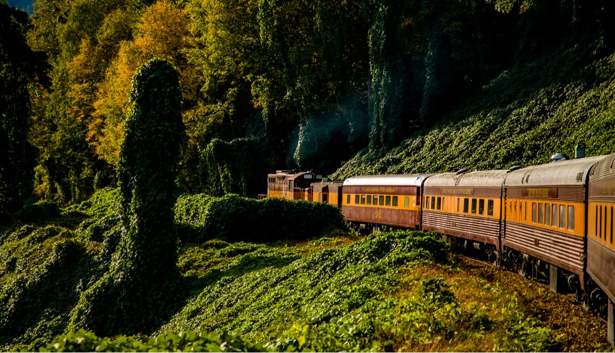
In the late-19th Century, logging in the region expanded and, as a result, the Little River Railroad, was constructed to transport timber out of the region. The clearcut style of logging in the region was cause for locals and impassioned visitors to band together to raise money for the preservation of the land and the eventual creation of the park. The U.S. National Park Service was interested in creating a park in the Eastern US because they did not yet have one, but the lack of funds and a centralized landowning family stalled the project even though Congress had authorized the park in 1926. Eventually, through the partnership of the US government, the Rockefeller family, and locals in Tennessee and North Carolina the park was officially designated and established on 15 June 1934. The park was later designated as an International Biosphere Reserve in 1976, was certified as a UNESCO World Heritage Site in 1983, and became a part of the Southern Appalachian Biosphere Reserve in 1988.
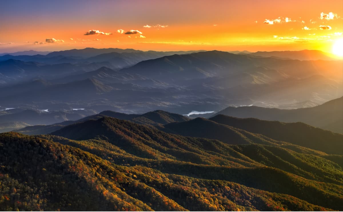
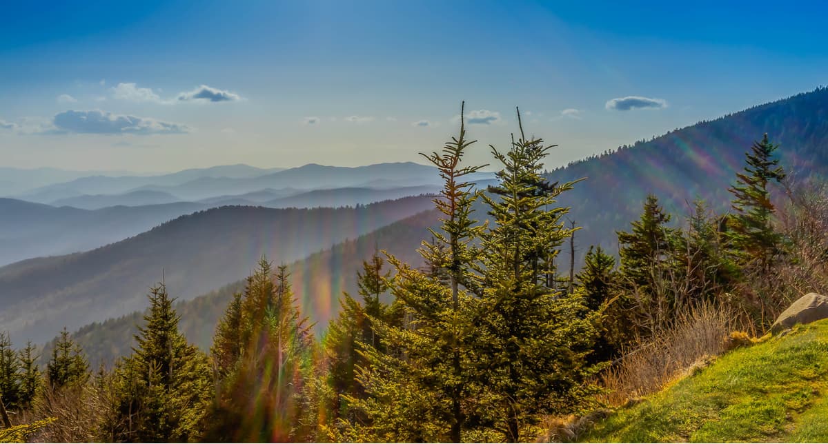
The park rises from about 875 feet (267 m) to 6,643 feet (2,025 m) at the summit of Clingmans Dome on top of Late Precambrian rocks, which are part of the Ocoee Supergroup. Late Precambrian rocks are found in the higher reaches and are largely composed of metamorphosed sandstones, phyllites, schists, and slate. The park also has Early Precambrian rocks, which are found in the lower reaches and are composed of metamorphic gneiss, granite, and schist. Within the park a total of sixteen mountains reach higher than 5,000 feet (1,520 m). The oldest rocks in the park are the Precambrian gneiss and schists which were formed over a billion years ago from the accumulation of marine sediments and igneous rock.
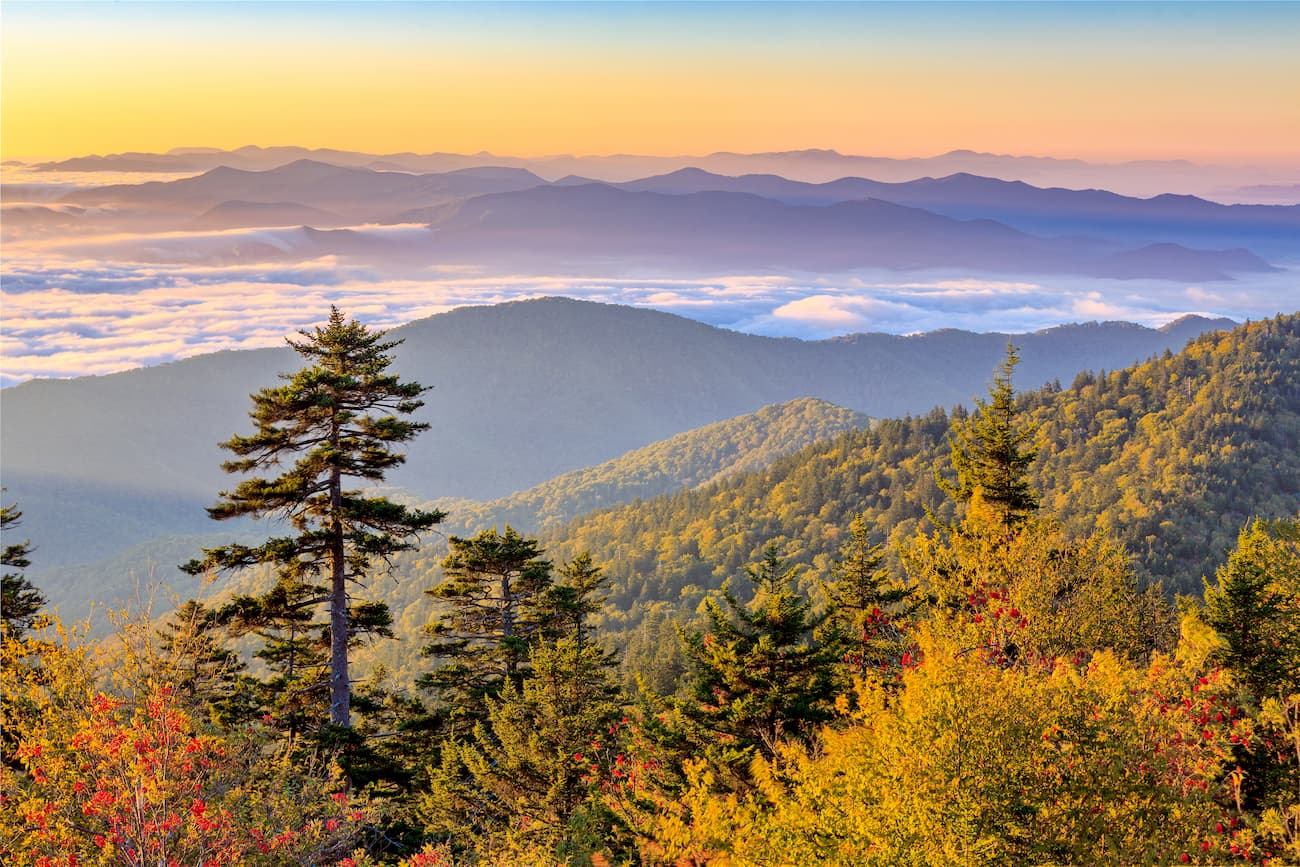
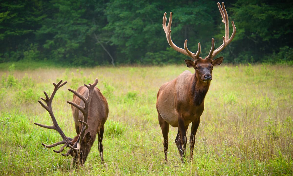
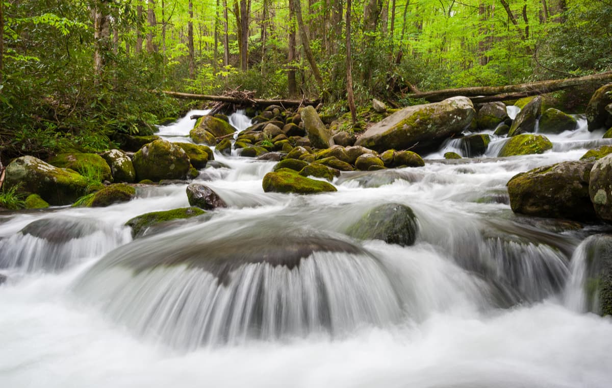
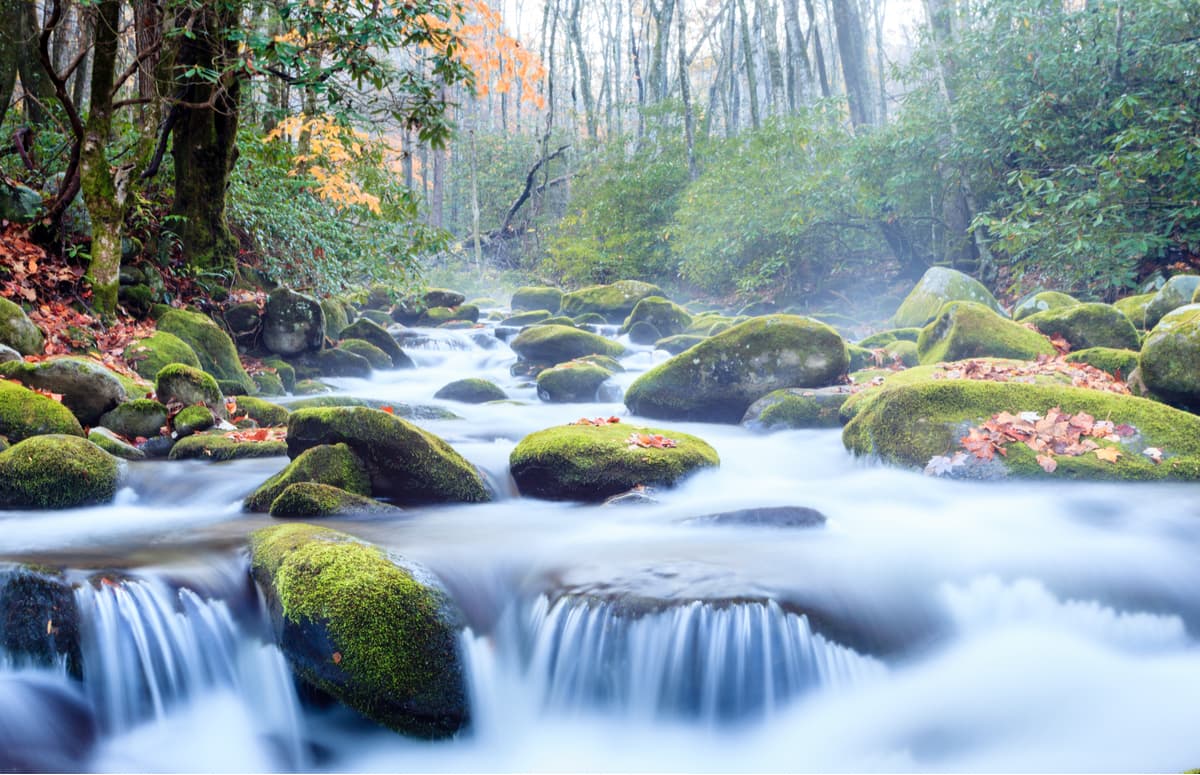
The wide range of elevations in the park, along with the old growth forests, and abundant rainfall have created a number of unique biota allowing for about 19,000 species of organisms in the park, with an estimated additional 90,000 undocumented species that are expected to be present. There are more than 200 species of birds, 50 species of fish, 39 species of reptiles, and 43 species of amphibians, including many lungless salamanders. The park is famously home to over 1500 black bears and in 2001 elk (wapiti) was reintroduced to the park, which largely populates the Cataloochee region of the park.

The park is also home to raccoon, bobcat, two species of fox, river otter, woodchuck, beaver, two species of squirrel, opossum, coyote, white-tailed deer, chipmunk, two species of skunk, and various species of bats. Over 100 species of trees grow in the park with deciduous leafy trees dominating the lower reaches of the park and deciduous forests giving way to coniferous trees like Fraser fir in the higher elevations. The park also has over 1,400 flowering plant species and over 4,000 species of non-flowering plants.
The top 10 highest peaks in the Great Smoky Mountains National Park are:
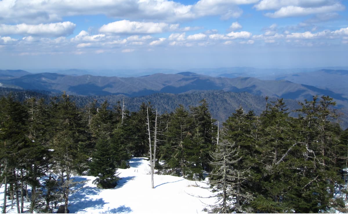
Clingmans Dome - 6,643ft, 2026m with a 1378m prominence. On a clear day visitors can climb to the top of the Observation Tower and see over 100 miles into North Caroline and Tennessee. However, due to air pollution, visibility is often much less. While the peak and the observation tower are open year round, the road leading up to Clingmans Dome is closed between December 1 and March 31, as well as whenever weather conditions are too poor for motor transport.
Mount Guyot - 6,621ft, 2019m with a 495m prominence. Mount Guyot sits right in the middle of the Smoky Mountain Range overlooking Cataloochee. It is the fourth-highest summit in the eastern U.S., and the second-highest in the Great Smoky Mountains National Park. While there are no trails that summit the mountain, the AT traverses its southern slope, passing within 1000ft of its summit. Mount Guyot also helps create the border between Tennessee and North Carolina.
Mount Le Conte (High Top) - 6,593ft, 2010m with a 425m prominence. Though not the highest mountain in the park, Mount LeConte is one of the most popular to visit. Many hikes traverse Mount LeConte including; The Alum Cave, Rainbow Falls, Boulevard, Myrtle Point, Trillium Gap, and Bull Head Trails.

Mount Buckley - 6,580ft, 2004m with a 44m prominence. Mount Buckley is Clingmans Dome’s neighbor to the southwest and is the closest names peak to Clingmans Dome. It is largely overlooked by hikers, however, the AT passes right over its peak as it summits Clingmans Dome and the summit of Mount Buckley offers unobscured views of the surrounding forest due to its rocky typography.
Mount Love - 6,420ft, 1955m with a 27m prominence. Mount Love, like Mount Buckley, is a bit overshadowed by its famous neighbor, Clingmans Dome. Similarly to Mount Buckley, the AT passes right over top Mount Love on its way North through the park. Mount Chapman - 6,417ft, 3879m with a 178m prominence. Mount Chapman, like Mount Guyot, helps create the border between Tennessee and North Carolina. The AT passes directly over its summit as it heads north.

Old Black - 6,370ft. Old Black is the 5th-highest mountain in Tennessee and the 7th-highest in the Great Smoky Mountains National Park and like Mount Guyot and Chapman it helps create the border between Tennessee and North Carolina. The Appalachian Trail crosses its western slope, connecting the Cosby-area trail system with the heart of the Eastern Smokies.
Luftee Knob - 6,234ft, 1894m with a 117m prominence. Luftee Knob is located on the North Carolina side of the park and, while it does not have any trails running through it, you can catch a glimpse of its peak as you cross over Mount Guyot on the AT.
Mount Kephart - 6,217ft, 1895m with a 218m prominence. Mount Kephart is traversed by the AT, as well as Boulevard Trail, which connects with Mount LeConte and helps create the border between Tennessee and North Carolina.
Mount Collins - 6,118ft, 1888m with a 155m prominence. Mount Collins is traversed by the AT, as well as the Fork Ridge and Sugarland Mountain Trails, which traverse its northeastern slope. Mount Collins also helps create the border between Tennessee and North Carolina.
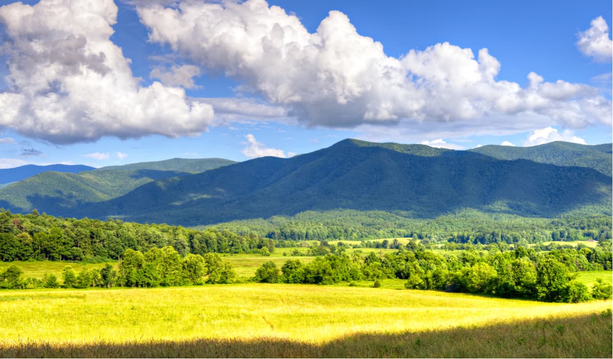
Cades Cove is perhaps the most popular destination in the park and as a result, many of the hikes can be rather crowded depending on the time of year. Cades Cove is ideal for wildlife viewing and provides a glimpse into settlement era towns. Located in an expansive valley visitors can often see white-tailed deer, black bear, coyote, groundhog, turkey, raccoon, skunk, and many other kinds of animals. Some of the waterways encompassed by and leading into Cades Cove include, Freezell, Maple, Cades, McCaulley, Marthas, Bunting, Sea, Fanny, Cooper, and Stillhouse Branches, as well as Rowans Creek.
Cades Coves had been used by local Cherokee tribes as hunting ground for hundreds of years and was settled by Europeans sometime between 1818 and 1821. By 1830, the population of Cades Coves was at 271.
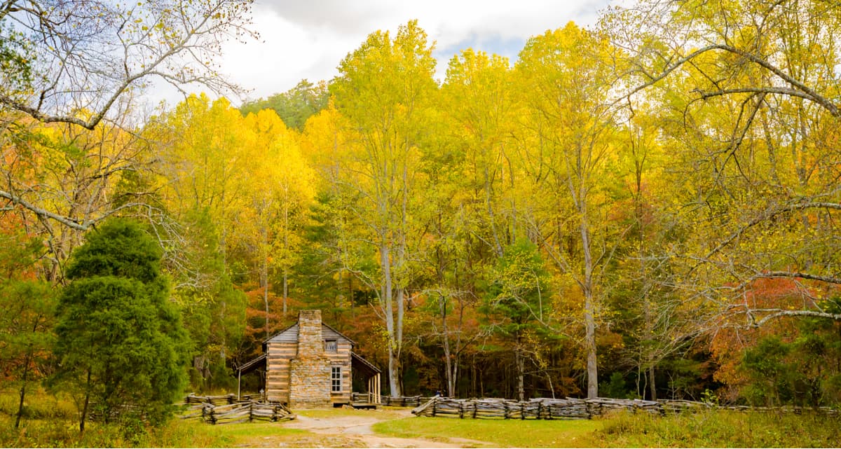
The Cades Cove Loop road is a heavily trafficked road, especially during the high season so hikers should be aware of motorists when hiking through the area and across roadways. Along the road visitors can see three churches, a working grist mill, barns, log houses, and various other restored eighteenth and nineteenth century structures.
Notable Hikes out of Cades Cove include:
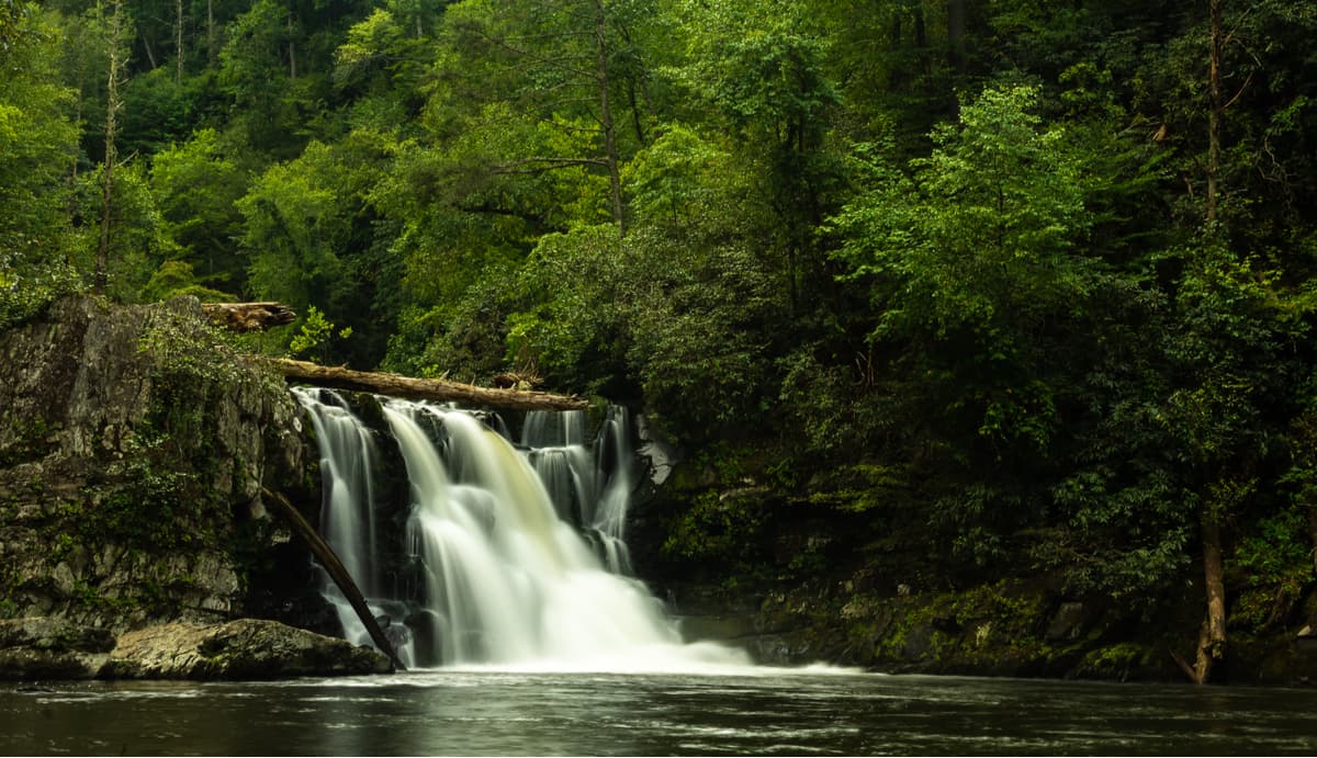
Abrams Falls - Abrams Falls is about 20 feet high, but it has the greatest water volume of any waterfall in the park, as well as the largest plunge pool. The hike will follow along Abrams Creek and connects to the Cades Cove trail at the 11 mile marker.
5 miles out and back; About 3 hours hiking; Moderate difficulty; Best time to hike is in the winter when the crowds are small; Rocks and boot-packed dirt trail; Pit toilets available at trailhead.
Drive 7.5 miles west down Lauren Creek Road from Townsend Y, at the junction of Little River Road and TN 73. Once you get on Cades Cove Road you will drive 4.9 miles and turn right on the gravel road, which you will follow for .4 miles until you reach a large parking lot.
Cades Cove Nature Trail - This is a short, very easy family hike that highlights Cades Coves’ historic buildings. The trail is located off of the Cades Cove Camping area, off of the Cades Cove Campground Segment A Road, near the entrance of the Cades Cove region of the park.
Cooper Road and Rabbit Creek - This hike is fairly low traffic despite starting in the most popular park of the park as a result of it traversing the extreme western edge of the park, which is by and large less popular. This does not however imply that the trails or the sights are any less beautiful, far to the contrary.
16.3 mile loop; About 9 hours hiking with the option of camping in various places along the trail; Moderate difficulty with 3 difficult creek crossings; Best time to hike is from late May to Early June when the water crossings are less frigid; Old forest road and forest trail conditions; Equestrian use as well as hiking.
Start on the Abrams Falls Trail and once you cross Abrams Creek on the footbridge, turn right at the sign for Elijah Oliver Cabin, which is .5 miles ahead. After the cabin, continue along the trail passing by a large barn on the left and then cross a small creek. After the creek take Wet (Also called Little) Bottoms Trail on the left for .25 miles until you reach Cooper Road Trail and turn left (NW), hiking for 5.5 miles. You will then reach the Abrams Creek Campground Access Road. Continue down it and take the Rabbit Creek Trail on the left after the Ranger Station, which will be on the right. You can walk the Rabbits Creek Trail until you hit Campsite 16, Scott Gap. If you choose to make this a two day hike then this is a good place to stop.
After Campsite 16 you will have to walk around a mile nearly continuously uphill over Andy McCully Ridge, after which you will be ridge hiking along Andy McCully. You will eventually cross over Coon Butt, after which you will be heading down the ridge along Licker Branch towards Mill Creek, which you will have to cross before ending your hike at the Abrams Branch parking lot.
Newfound Gap is perhaps the most famous sight in the entire park. The “Gap” of Newfound Gap refers to the lowest possible driving point along the Great Smoky Mountains National Park at an elevation of 5046ft. Driving along the road over Newfound Gap you will have an opportunity to stop at the top and look into North Carolina and put your feet on the Appalachian Trail (AT). From the Gap you will also get an opportunity to see a huge variety of forest ecosystems ranging from cove hardwood, pine-oak, and northern hardwood forest to attain the evergreen spruce-fir forest at the highest elevations. The Gap is considerably cooler than the surrounding areas as well as a result of being almost a mile high. From the Gap you can also drive up to Clingmans Dome, the highest point in the park. The Newfound Gap Road leads straight up to the Gap from Gatlinburg and is very, very highly trafficked.
Cataloochee is a well preserved settlement in the rugged Cataloochee Valley surrounded by 6000-foot peaks and filled with late 19th and early 20th century buildings including two churches, a school, and several homes and outbuildings. At its height, Cataloochee was home to around 1,200 people in 1910. Cataloochee is most popular for wildlife watching, fishing and camping, as well as various equine trail riding and camping.
To get to Cataloochee from Coves Creek Road you will have to drive a pretty rugged dirt road for about 15 minutes that is also filled with equine and equine trail traffic so caution is advised. Take Cove Creek Road and follow the signs 11 miles into the Cataloochee Valley. To reach Cataloochee from Oconaluftee or Cherokee, take the Blue Ridge Parkway to Highway 19 and follow the road through Maggie Valley. Turn left onto Highway 276 N. Just before the entrance ramp to I-40 (but past gas station), turn left and follow the signs 11 more miles to Cataloochee. A more scenic route is to take highway Route 32, from Cosby, TN to the Tennessee-North Carolina state border, where the road becomes gravel.
Roaring Fork is well named as the river is one of the larger and faster flowing mountain streams in the park. Many visitors drive the 5.5 mile Roaring Fork Motor Trail and after high rainfall, the Roaring Fork will be more voluminous than ever. This loop is a popular side trip for many visitors in the spring and summer months with rushing mountain streams, glimpses of old-growth forest, and a number of well-preserved log cabins, grist mills, and other historic buildings. However, the road is closed during the winter.
To access Roaring Fork, turn off the main parkway in Gatlinburg, TN at traffic light #8 and follow Historic Nature Trail Road to the Cherokee Orchard entrance to the national park. After the Rainbow Falls trailhead there will be signs for the one-way Roaring Fork Motor Nature Trail. Buses, trailers, and motor homes are not permitted on this road.
Notable Hikes out of Roaring Fork include:
Noah “Bud” Ogle Self-Guided Nature Trail - This short nature trail leads to an authentic mountain farmstead and surrounding hardwood forest. You can see a streamside tubmill and the Ogle’s handcrafted wooden flume plumbing system. This nature trail also leads to the Rainbow Falls Trail.
.8 mile loop; About 30 minutes of hiking; Easy hike; Best time to hike is in the spring when the wildflowers are in bloom; Forest trail with lots of rocks; This is a great hike to take kids on.
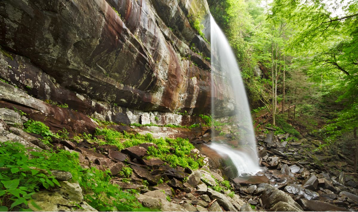
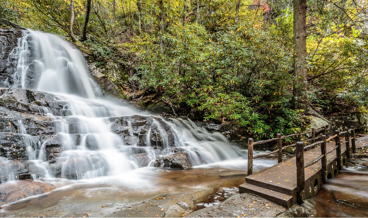
Mount LeConte via Rainbow Falls and Bull Head - Rainbow Falls is created by LeConte Creek spills over an 80ft ledge. Much of the water turns to mist before hitting the ground and creates a beautiful sight. From the right angle the sun will hit the mist and create a rainbow, thus giving the falls its name. During the winter months an impressive ice formation occurs over the falls. This hike is one of the most popular in the park and is highly trafficked. You can take the shorter 5.4 mile Rainbow Falls out and back trail if you are looking for something a bit more manageable.
13.6 mile loop; About 8 hours hiking; Strenuous hiking due to steep grades and rocky trail; Best time to hike is in the spring when the wildflowers are in bloom; Very rocky forest trail; The ruggedness of this trail needs to be kept in mind and may not be the best hike for young children. Additionally, the mist from the falls can freeze on nearby rocks and cause very slippery conditions.
The trail can be reached from Cherokee Orchard Road off of the Historic Nature Trail Road. from the parking lot you can start the Rainbow Falls Trail at the western edge. At the beginning of the trail you will cross the Trillium Gap Trail and begin following the ascending path along the LeConte Creek. A mile or so into the trail you can see views of Gatlinburg during the winter when the vegetation is bare. You will eventually come to Rainbow Falls after about 2.7 miles. After the falls the trail will swing away from LeConte Creek and you will have a couple of small stream crossings before you will leave LeConte Creek altogether and head towards Rocky Spur, which is the prominent ridge that separates the LeConte Creek and Roaring Fork watersheds. You will walk along the northside of Rocky Spur for about a mile before rounding back to the southside. The trail eventually starts skirting Mount LeConte’s summit leading up to the top of Rocky Spur, which you can go to via a side trail if you want. You will later come to a junction with the Bull Head Trail on the right. After this junction it is another approximately .5 miles to the LeConte Lodge. This is a good place to stop for the night if you want to make it a two day hike.
From the LeConte lodge you will turn around and follow the trail you came up on, except you will turn on Bull Head Trail instead of taking Rainbow Falls back. Remember to fill up your water bottle at the lodge as there are no water points on the Bull Head Trail. The Bull Head Trail, unlike the Rainbow Falls Trail is not nearly as steep or rocky so it will be a welcome break after your strenuous ascent for a little while. The trail approached Balsam Point and follows the south side of the ridge going down before leveling out as you approach Bull Head. The trail eventually swings to a cooler northern exposure. The trail’s descent gets much steeper as you reach the end and get to the junction with the Old Sugerlands Trail. Take the right turn and you will have an easy .4 mile walk back to the parking lot.
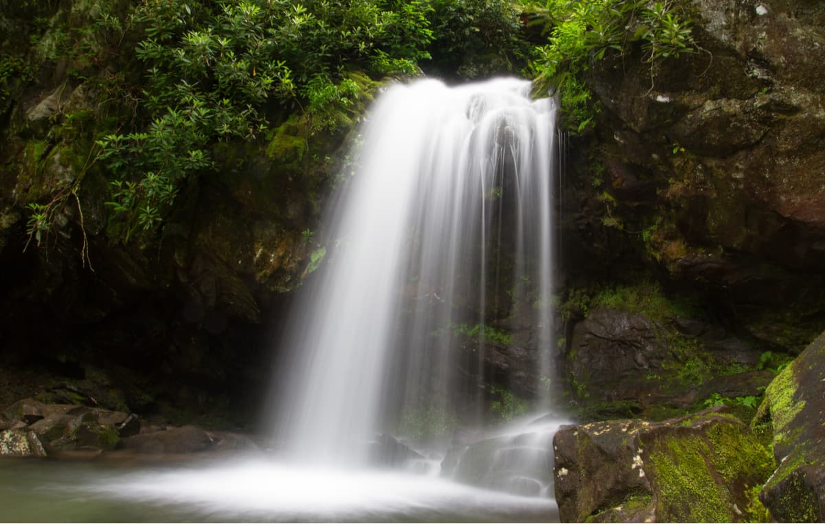
Grotto Falls - Grotto Falls is made by the Roaring Fork spilling over a 20 ft ledge into a small pool with a protected dry space under the falls that hikers can walk through. This is an incredibly popular hike.
2.6 miles out and back; About 2 hours hiking; moderate difficulty; Best time to hike would be towards the beginning of the low season so that traffic is low, but it is not too cold; This is a boot, horse and llama packed trail; The park requests visitors refrain from climbing the rock formations as a number of people have fallen to their deaths. There will be a sign for the Trillium Gap Trail along the motor trail road and you can park in the parking lot. Take the Trillium Gap Trail headed to the summit of Mount LeConte until you reach the falls. If you want a more strenuous hike you can summit Mount LeConte, which is 6.6 miles and 4000 feet of gain.
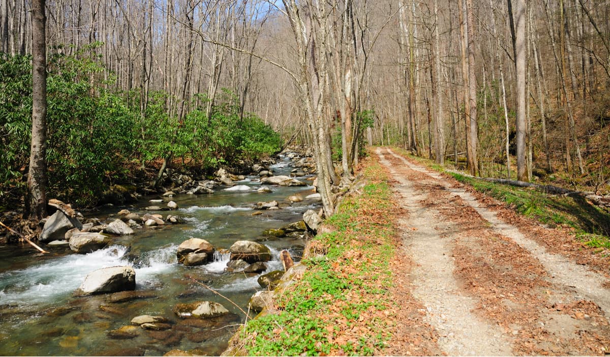
There are hundreds of miles upon miles of trails in the Great Smoky Mountains National Park, 850 miles (1,370 km) to be exact, ranging from less than a mile to over 30 miles for regional hikes, and includes the famous Appalachian Trail that cuts the park almost perfectly in half along the Great Smoky Mountain Ridgeline.
Considering the popularity of the Smoky Mountain National Park, if you are looking to beat the crowds, here are a few hikes to avoid:
You can not talk about Smoky Mountain National Park without mentioning the Appalachian Trail (AT). Of all of the long distance wilderness trails in the US, the Appalachian Trail is the oldest and perhaps the most famous and is traversed in total or in part by thousands of people every year. The nearly 2200 mile long wilderness trail goes from Springer Mountain, Georgia to Mount Katahdin, Maine through 14 states.
The 72 miles of the AT that goes through the Smoky Mountains National Park splits the park almost perfectly in half along its northeastern route from Fontana Dam to Highway 40 along the Smoky Mountains Ridgeline. The section of the AT is some of the most beautiful and most challenging of the entire trail and includes the highest point in the entire trail, Clingmans Dome.
Many people come to the Smoky Mountains National Park with the expressed interest in hiking the AT. If you are going to do this, try to also plan a few other hikes in addition. There are over 800 miles of trails throughout the park and the AT makes up less than 10% of them. Additionally, in the spring, when most northbound thru hikers are passing through the park, the shelters tend to be overcrowded.
The easiest, and really only, entry point to the trail in the park is at Newfound Gap, which hits the trail at around its halfway mark. However, if you wanted to hike the entire section of the AT that runs through the park you could start just north of the park where the AT intersects with Highway 40 and hike southwest to Fontana Dam.
Gregory Bald via Cades Cove - This is a pristine hike that highlights the parks diverse array of flowers, especially in June, when you will see flowers of every color including hundreds of azaleas and fuchsias growing on the bald.
11.4 miles out and back; About 6 hours hiking; Strenuous due to high grades; Best time to hike would be in April when the wildflowers are in bloom; Forest trail conditions and open grassy bald; This trail is also used, in part, by equine tours, though the Gregory Ridge Trail is for hikers only.
Drive 7.5 miles down Lauren Creek Road for Townsend Y to the start of the one way Cades Cove Road, which you will follow for 5.4 miles until you reach Forge Creek Road past the Cades Cove Visitors Center and Cable Mill. You will take the Gravel Road 2.2 miles to the end where you will reach the Gregory Ridge Trail head.
From the Gregory Ridge Trail you will cross the Forge Creek on a foot log and the trail soon goes through old growth forests. The creek will be on your left, but you will only catch glimpses of it before crossing it again two more times and passing through Campsite 12. After the campsite you will ascend .2 miles steadily up to Rich Gap and the trail will level off. At the gap you will reach a four way intersection with George Bald Trail to the left going towards the AT, and Moore Springs straight ahead. You will be turning right (west) on Gregory Bald Trail and follow the ridgeline toward Gregory Bald. If you want to stay overnight there is Campsite 13.4 miles from the Bald, otherwise, you can turn around and go back the way you came.
Indian Flats Falls - This is a moderate stream hike that rewards hikers with a beautiful waterfall at its end. This is a great hike for beginners and is home to some of the most beautiful and popular photo sites in the park. The trail is also covered with wildflowers in the spring and in the fall the foliage is breathtaking.
8 miles out and back; About 4 hours hiking; Moderate Difficulty; Best time to hike would be in the Spring for the wildflowers or October for the Autumn foliage; Old forest road trail; This trail is also used by equine tours. To reach the hike, drive to the end of Trement Road, which you can reach by heading southwest on Townsend Y towards Cades Cove for .2 miles before turning on Trement. After the Great Smoky Mountains Institute at Tremont the road will change to gravel, after which you will drive for 3 miles until you hit the trail head.
The trail is a continuation of the road you just drove in on after the parking lot and follows an old railroad grade built by the Little River Lumber Company in the early 1900s. When you cross Lynn Camp Prong via bridge you will want to stay left on the main gravel road. After half a mile the road bends left toward a large set of cascades on Lynn Camp Prong, which you will follow up the path. You will follow the creek for another 3 miles to Indian Flats Prong, which forms a confluence with Lynn Camp Prong. After crossing the rivers the grade will increase somewhat into a few switchbacks up towards Indian Flats Falls. After you reach the falls you can turn around and come back the way you came.
Porters Creek - The is one of the best spring hikes in the Smoky Mountains and is perfect for both amateaur and professional botanists.
7.2 miles out and back; About 4 hours hiking; Moderate Difficulty; Best time to hike would be in the Spring for the wildflowers; Forest trail and old forest road; Equestrians are permitted on the first mile of this trail. To find the trailhead take US 441 from Gatlinburg by turning at traffic light 3 and driving east on US 321. AFter 5.9 miles you will turn right (south) onto Greenbrier Road following the scene Middle Prong of the Little Pigeon River.After the range station the road will become gravel. Continue straight for 4 miles to a traffic loop where you can park at the end and follow the trail, which is a continuation of the gravel road.
As you follow the trail you will come to Porters Creek and will see a few old foundations of homesteads that used to be in the area. You will cross Porters Creek and pass a cemetery to you right before you cross another stream. After a mile you will reach the old traffic turnaround and the junction of 3 trails; Porters Creek Trail on the left, Brushy Mountain Trail in the middle and a side trail headed to a historic farm site on the right. You will turn left onto the Porters Creek Trail and cross Porters Creek after .5 miles. After another .5 miles you will cross Fern Branch at the base of Fern Branch Falls, a high waterfall cascading over mossy rocks. You will walk another 3.6 miles to the trails end at Campsite 31. After you reach the end you can turn around and go back the way you came.
Maddron Bald and Hen Wallow Falls - This hike is perfect for the more arborist of hikers and goes through old growth forest and the finest virgin woods in the park at Albright Grove. The hike also includes a number of scenic waterfalls, wildflowers, and mountains views.
18.1 miles loop; About 10 hours hiking; Strenuous hike; Best time to hike would be in the Spring for the wildflowers; Forest trail and old forest road; Equestrians are permitted on the first 4.9 miles of this trail.
To reach the trailhead you will take US 321 from the junction at TN31 in Cosby 1.2 miles before turning right at the Cosby Campground. Follow the road 2.1 miles where you will pass the campground registration building and turn left to loop into the hiker parking area where you will follow the road through the camping area toward Campsite B51 to the trailhead.
Stay to the right along the old roadbed. You will pass an old graveyard on the right before reaching a turnaround. If interested, there is a short trail to an overlook of Rock Creek that you can explore before your hike. Take Snake Den Ridge Trail until you cross Rock Creek. After a mile you will also cross Inadu (meaning snake in Cherokee) Creek above a small waterfall. After crossing the creek you will start to ascend up the ridge until you get to a short knife ridge with a 360 view of the park where you can see Mount Cammerer to the east. You will then reach the junction with the Maddron Bald Trail, which you will turn right (west) on going downhill. You will eventually reach campsite 29 at Otter Creek. This is a good place to set up camp if you are planning to make this a two day hike, however, if you want to hike a bit more there is also Campsite 34 further down the trail, which is a bit more secluded.
Continue following Maddron Bald Trail along the ridge separating Otter Creek from Copperhead Branch, which you will eventually cross, as well as Indian Camp Creek where there is a beautiful waterfall. After the waterfall you will cross a side branch and then Indian Camp Creek again before following Otter Creek. You will eventually cross Indian Camp Creek one more time before reaching the upper junction with the Albright Grove Loop Trail. From here follow the Maddron Bald Trail another .3 miles until you get to the lower junction with the Albright Grove Loop Trail where you turn left and follow for another .7 miles.
You will then rejoin the Maddron Bald Trail and then cross Indian Camp Creek one last time after .1 miles. You will then walk .5 miles to the junction with Old Settlers Trail and Gabes Mountain Trail, where you will turn right onto Gabes Mountain Trail. You will hike another 1.8 miles over various small creeks and through some beautiful forest before you reach Campsite 34 next to Greenbrier Creek.
Continue alonge Gabes Mountain Trail where you will cross along the Lower Falling Branch over Hen Wallow Falls. Continue along until you reach the end of the trail where you will find a fork in the trail. Turn right at the fork for .3 miles towards the campground at site A44 and follow the road back to the parking lot.
Charlies Bunion and Bradley Fork - This hike is a great juxtaposition of both the higher altitude hiking and the low valley hiking that can be found in the park and is a great overnight/multi day hike.
27.3 mile lollipop; About 15 hours hiking; Strenuous hiking; It is best to avoid this hike in the icy winter months; Forest trail and old forest road with some very rocky spots; About half of the route is open to equestrians use.
The trailhead is found at the busy Newfound Gap Overlook so you will have no trouble finding it. Drive 15.5 miles along Newfound Gap Road from the Oconaluftee Visitors Center or 12.7 miles south from the Sugarland Visitors Center.
You will begin the hike along the AT from the northeast corner of the parking area. It is the most apparent trailhead at the parking lot. You will begin a steady ascent for 1.5 miles and as you get higher you will get some good views of Mount LeConte to the north until you reach a grassy knoll. From the knoll you will descend .2 miles to a gap and the junction with Sweat Heifer Creek Trail. Continue along the AT and continue your ascent. Your views here will be of North Caroline, Clingmans Dome and Bryson City. You will continue another 2.7 miles to the junction with the Boulevard Trail, which heads to Mount LeConte. You however, will continue to follow the AT heading northeast for another .3 miles until you hit the Icewater Spring Shelter.
Continue along the AT for .4 miles until you reach the junction with Dry Sluice Gap Trail. Continue east along the AT and pass over Sawteeth before making a steep ascent and then turning right (S) to descend along the southeast side of Laurel Top. You will have good views of Mount Chapman, Guyot and Sequoyah here.
At 8.9 miles you will reach Bradley’s View looking over Bradley Fork. You will go another 1.8 miles where you will cut sharply to the Hughes Ridge Trail and continue another. 4 miles to Pecks Corner Shelter. This is a good place to stay the night.
The next day you will leave from Pecks Corner Shelter and head south on Hughes Ridge Trail until you come to the junction with Bradley Fork Trail. Turn right (S) onto Bradley Fork Trail and descend into the valley meeting Taywa Creek. You will continue to the junction with Bradley Fork and Cabin Flats Trail where you will turn right onto Cabin Flats Trail and cross Bradley Fork on a steel bridge.
Turn left on Dry Sluice Gap Trail and follow the Tennessee Branch up, which you will cross about 7 times within the next mile. The trail then switchbacks up Richland Mountain. Dry Sluice Gap Trail will continue north towards the AT for another 1.3 miles. After you cross the gap you will head down over the western edge of Richland Mountain, eventually leading into Kephart Prong and to the Kephart Shelter. This is a good place to stay overnight.
The next day head north on Sweat Heifer Creek Trail, which starts right in front of the shelter and crosses Kephart Prong. The trail will ascend towards the AT for 1.6 miles. You will see a number of small waterfalls along this section. Follow this trail until you hit the AT again where you started 2 days ago. From there, you can retrace your steps back to the parking lot.
Hyatt Ridge - This is a great ‘hidden gem’ of a hike and is a must for wildflower lovers. Not many people hike this trail so if you are looking to beat the crowds then this is a good option.
9.4 mile lollipop; About 5 hours hiking; Moderate difficulty; Best time to hike would be in the Spring for the wildflowers; Forest trail and rocky gravel roads; Equestrians may also use this trail.
To find the trailhead drive south from the Oconaluftee Visitors Center towards Cherokee and turn left at the sign for Big Cove Road. Take the .2 mile connector over the Oconaluftee River and turn left on Big Cove Road. Drive 8.6 miles to Raven Fork, which you will cross, and come to a fork in the road. You will turn right at the fork and go straight over Straight Fork Road, then following it for .9 miles to a fish hatchery where there will be a gravel road. Follow the gravel road for 3.9 miles to a narrow pullout on the right just before a truss bridge.
Take the Beech Gap Trail on the west side of the road. You will ascend to Straight Fork before the trail curves west. After 2 miles you will swing around a spur from Hyatt Bald before climbing to the junction with Hyatt Ridge Trail at the top of the ridge. Turn right (N) and summit Hyatt Bald. Follow the ridge towards the bald towards a grassy opening with great views before heading back down into the forest and coming to Campsite 44, which sits on McGee Spring at around 5000ft.
Backtrack from the campsite to the junction with Beech Gap Trail and then continue on Hyatt Ridge Trail descending steeply into the valley. You will eventually come to the junction with Enloe Creek Trail. Keep right on Hyatt Ridge Trail and continue to descend towards Straight Fork Road. You can follow the road back to your car.
Deep Creek - This hike follows the entire headwaters of Deep Creek from its birth as a small stream through its growth as a wider and wider Creek by the mile eventually ending at the Deep Creek Campground.
14.2 miles point to point; About 7 hours hiking; Moderate difficulty; Best time to hike would be in the Spring for the wildflowers; Forest trail and old forest road; This hike is best done on a drier warmer day due to its many river crossings and wet conditions.
Starting from the Oconaluftee Visitors Center you will drive 13.9 miles north on Newfound Gap Road until you reach a small parking area on the left (W) side of the road, which is 1.7 miles south of Newfound Gap itself. If this parking lot is full there is another .1 miles down the road. Since this hike is point to point you may want to park a second car at the Deep Creek Campground if you do not want to hike back. To get to the Deep Creek Campground you will follow signs from downtown Bryson City and follow the road past the campground entrance and picnic area to where the road terminates at a parking lot at the end of the trail.
From the trailhead you will descend along a series of switchbacks across various small stream crossings until the trail levels out at 1.5 miles. You will continue to pass several branches until you reach the head of Deep Creek and begin to follow it. After 3.9 miles you will reach Campsite 53 and you will see Fork Ridge Trail branch off here. Do not take it. Instead continue along Deep Creek Trail and follow the creek. You will eventually come to Cherry Creek, which you will have to cross.
At about 6.5 miles you will cross two creeks, one after the other, before arriving at Campsite 54. Further down the trail is another small campsite and less than a mile down is yet another campsite, 55, which is a horse camp and where the Pole Road Creek Trail branches off towards Upper Sassafras Gap on Noland Divide. You however, will stay straight on Deep Creek.
You will then pass Campsite 56 after some climbing and descent before the trail swings away from the creek for a bit towards Campsite 57, also known as Bryson Place, which was Horace Kephart’s permanent camp in the Smokies, at the junction with Martins Gap Trail. You will see a plaque honoring Horace Kephart a few feet to the right of the trail.
Stay on Deep Creek Trail. You will reach Campsite 58 in another .6 miles and the Campsite 59 in just shortly after, followed by the more secluded and comfortable Campsite 60. You will then cross Bumgardner Branch Trail and make one last climb and descent before the trail levels out to an easy 2.1 mile stroll along the old road bed to the end of the trail.
Eagle Creek, Spence Field, and Hazel Creek - This is one of the most, if not the most, intense hikes in the Smokies and has a ton of elevation gain and descent, as well as many water crossings. However, the payoff for the hike is high and showcases just about every highlight the park has to offer, as well as a boat ride across Fontana Lake.
27.9 mile loop; About 18 hours hiking; Strenuous hiking; Best time to hike would be in the Summer so the river crossings are easiest; Forest trail and old dirt roads; Before you go on this hike be sure that you are confident in your abilities to not only hike strenuously up and down ridgelines, but also in your ability to cross waterways. Since you will likely have a pack on you will need to make sure you are equally confident to do this kind of hiking with added weight.
You will start this hike with a boat trip from Fontana Marina, which you can reach by going turning west on NC 28 at the junction of US 19/74 and NC 28 and drive 21.1 miles to the stop sign at the Entrance of Fontana Dam. Turn right and then take the first right onto the road that leads .2 miles to the marina.
After you get off the boat at the trailhead for Lakeshore Trail you will walk through Campsite 90 and along Eagle Creek, which you will cross in .4 miles via metal footbridge. Just beyond is the junction with the Lakeshore Trail and Eagle Creek Trail. You will take Eagle Creek at the junction and will soon cross another creek via footbridge. This is the last footbridge and you will have 12 water crossings after this. Take care to see how comfortable with the first few crossings. If you are feeling unsure, or if the water levels are too high then turn back because they only get more difficult.
After 1.1 miles you will pass the old Lakeshore Trail on your right followed by a couple water crossings over Eagle Creek before you reach Campsite 89 on the left. Further down after your sixth river crossing of Eagle Creek you will come up upon Campsite 96 at a small island made by the creek. After campsite 96 you will have 7 more river crossings before you reach Campsite 97. There is one more river crossing of Eagle Creek shortly after this.
At this point the trail starts to become a bit more technical. You will follow Gunna Creek, which you will also cross a couple times. When you come to the fork turn left and climb steeply up until the trail swings away from Gunna Creek and begins tracing Spence Cabin Branch. You will climb very steeply for a quarter of a mile here and this is the toughest part of the hike before you come to the Spence Field Shelter.

You will continue past the shelter until you hit the AT at Spence Field where you will turn right along the AT and in 100 yards will pass Bote Mountain Trail coming from the left. At the top there is a great view of Eagle Creek and Fontana Lake. You will then descend a few yards and turn right (SE) onto Jenkins Ridge Trail over the flanks of Rocky Top and then crossing Gunna Creek. After 2.8 miles you will have another steep ascend towards Haw Gap.
The trail follows 3.7 miles along the Jenkins Trail Ridge. The ascents and descents here are very steep and are best to avoid in the rain or snow. You will eventually reach Pickens Gap where you will see the old Lakeshore Trail. Do not take this trail as it is no longer in service and is not maintained in any way. Go left and follow Jenkins Ridge Trail for 2.4 miles to Hazel Creek Trail where you will turn right and follow Hazel Creek.
Once you reach the final bridge for Hazel Creek at the horse pasture you will continue on the right side of the creek. Do not cross the bridge. Hike 4.4 miles along the Lakeshore Ridge Trail climbing Sheehan Branch, which will descend and cross a small branch before ascending along Pinnacle Ridge and the descending steeply again toward Eagle Creek. Once you cross the bridge at Eagle Creek you will retrace your steps back to where you started and take the ferry back to civilization.
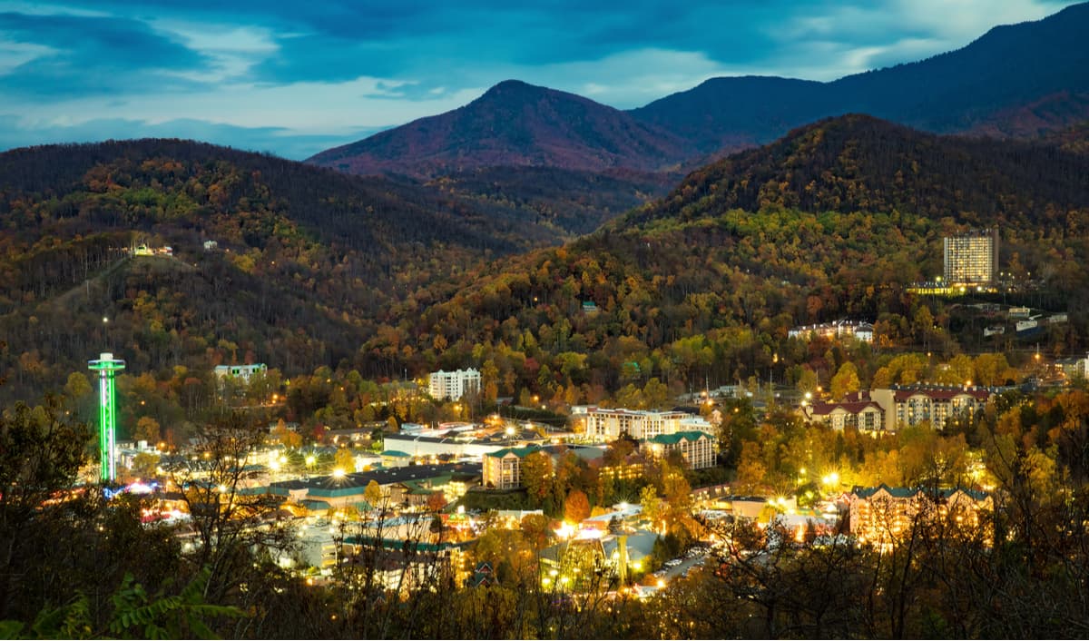
Gatlinburg is easily the most popular place to stop when visiting the Smoky Mountain National Park and is located as close to the park as is possible. As such, it is incredibly populated by tourists and could be downright odd for AT thru hikers. Gatlinburg is home to the Ripley’s Believe It or Not Museums, ski resorts, wedding chapels, and everything in between. Gatlinburg can be a good town stop for thru hikers, however, due to its popularity, can be very expensive, especially during the high season. Most hikers would be better staying in nearby Smoky Mountain National Park campsite, though you will want to be sure to call well ahead during the high season to reserve a spot, or backcountry camping.
The Qualla Boundary is territory held as a land trust for the federally recognized Eastern Band of Cherokee Indians. However, the land was not "reserved" by the federal government like other reservations in the US, but rather was purchased by the tribe in the 1870s and it was subsequently placed under federal protective trust. Individuals can buy, own, and sell the land, as long as they are enrolled members of the Tribe of the Eastern Band of the Cherokee Indians.
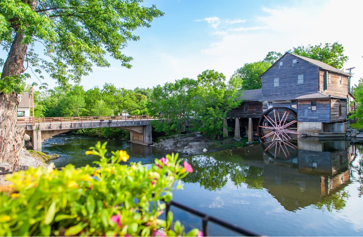
Pigeon Forge, while not as close to the Smoky Mountain National Park as other towns, is a popular, kitschy tourist stop for passers through and deserves its nickname “Gateway to the Smokies”. The majority of the attractions in Pigeon Forge are centered around entertainment over hiking and the town is home to the famous Dollywood theme park. Additionally, Pigeon Forge is home to a number of outdoor adventure companies that will take visitors on various trips around the national park and surrounding areas.
Townsend is known as "The Peaceful Side of the Smokies" and has the least traffic of the three main entrances to the national park. As a much quieter alternative to Gatlinburg, Townsend has a handful of inexpensive restaurants and motels and several businesses geared toward outdoor sports.
Bryson City sits just south of the Smoky Mountains National Park on the Tuckasegee River, which flows westward from the east, and Deep Creek, which flows from the south from Newfound Gap in the park. It is perhaps the least popular place to stay near the park as it has no direct access, but could be an affordable alternative for day hiking visitors.
Black bears are a somewhat famous safety hazard in the park. Driving into nearby town hikers will notice that just about everything is named after or emblazoned with a bear. The park has created a home for black bears as one of the largest protected areas in the eastern United States where they can live freely in their natural habitat.
Black bears are by and large people shy and do not pose much of a threat to hikers, however, in and around the park, bears have become somewhat accustomed to tourists in the region and have taken to feasting in nearby dumpsters in town, which means, unfortunately, that they are accustomed enough to tourists to go into and around nearby towns, but are still wild enough to be a safety concern and should not be approached in any way. The National Park website states:
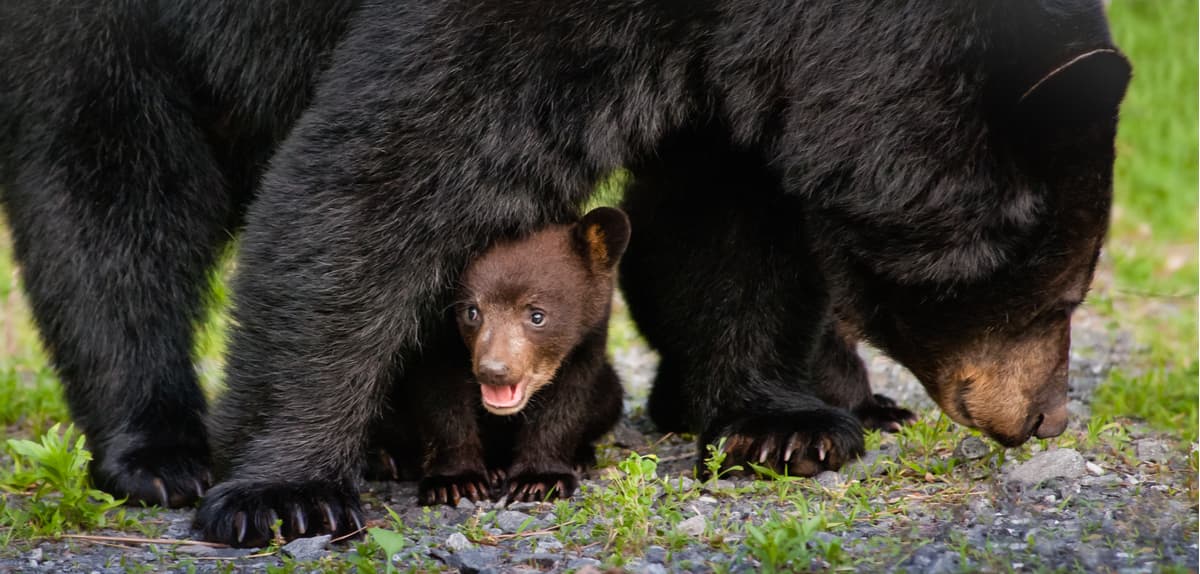
Bears are wild animals that are dangerous and unpredictable. Do not approach bears or allow them to approach you! Willfully approaching within 50 yards (150 feet), or any distance that disturbs or displaces a bear, is illegal in the park. Violation of this federal regulation can result in fines and arrest. Use binoculars, telephoto lens, or a spotting scope to view the animals.
Often the national park will post "Bear Closures" and "Bear Warnings" in parts of the park depending on activity.
As is outlined by the National Park Website:
It is very important to use a bear bag when you are backpacking in the Smoky Mountains National Park, not only to keep bears away from your campsite, but also mice. The park is full of field mice and they will not hesitate to chew through your tent in search of a bite to eat.
The National Park forest service and the Appalachian Piedmont Zone fire management staff take great care to manage the fire ecology in the park. Often there are controlled burns in different areas of the park at different times of year so be sure to get updated on when and where controlled burns are planned before you take your trip. Controlled burns are often done during the spring and fall under specific prescription parameters to safely reduce fuels, restore meadow habitats, and maintain the historic landscapes and to help perpetuate native herbaceous species that provide high quality cover and foraging opportunities for a diversity of wildlife including deer, turkeys, and ground nesting birds.
Similarly, pay attention to the fire warnings in the park and do not light a fire if conditions are not safe. Many campsites have fire pits that are contained and safe to use. You will have to check with the National Park as to whether or not backcountry fires are permitted during your trip.
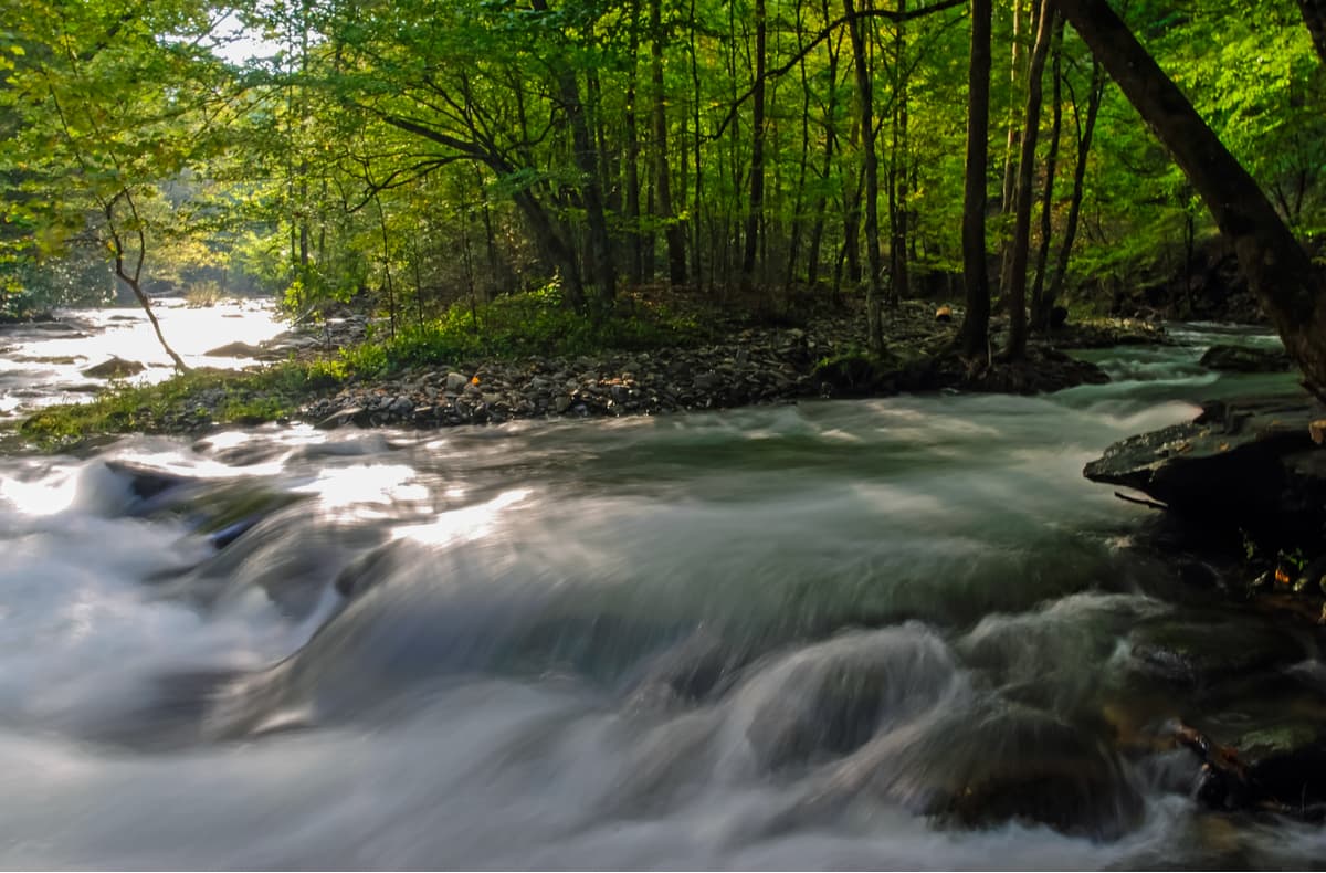
The park does not advise water recreation as it is one of the leading causes of death and serious water-related injuries occur every year. The two leading water related causes of death are drowning in attempts for ford swollen streams and hypothermia (even in summer).
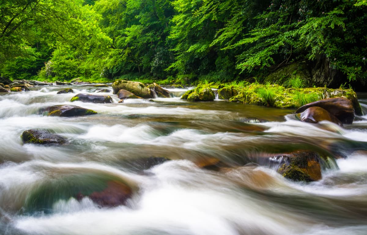
The Smoky Mountains have a variety of fast moving and voluminous rapids that can pose a serious threat for those who are not accustomed to them. One of the largest threats in the park is the rapid increase of water flowing through streams after rainfall or even localized thunderstorms that increase the amount of water at the high reaches of the park and funnel down into the valleys.
The Smoky Mountains National Park advises:
Additionally, because many of the streams are fed by mountains they can be much colder than many hikers are accustomed to and can lead to hypothermia.
Water treatment is also a big concern for those hiking in the Smoky Mountains so if you are relying on water points for longer hikes be sure to bring a filter. Giardia lamblia can be present in the park’s water and can absolutely end a thru hike or section hiking trip.
While hiking, keep an eye out for careless motorcyclists. Motorcycling is one of the most popular ways for motor vehiclists to explore the park, however many are unaccustomed to the very windy roads and mountainous weather conditions. In addition to drowning, motorcycle accidents are the leading cause of death in the park.
There are two types of venomous snakes in the Smoky Mountains; the northern copperhead and timber rattlesnake. However, relatively few snake bites occur each year and no recorded fatalities have occurred in the park. Hikers are advised to take care around old buildings and stone fences.
Yellowjacket wasps are the greatest concern in the park and often build their nests in the ground along trails and streams and are aggressive when disturbed. Avoid perfume, powder, and scented deodorants and be sure to carry an epipen on you if you are allergic.
According to the park’s website the following factors often result in backcountry emergencies in the Smokies:
While these advisories are not an issue for the most seasoned hikers, the Smokies, and the Appalachian Mountain range in general, is renowned for its ability to disorient even the most seasoned hiker if they go to far off the trail (the most famous and most difficult trail race, arguably, in the world is not far from the Smoky Mountains in Frozen Head State Park near Wartburg, Tennessee, called the Barkley Marathons. The race was created in response to the 1977 escape of James Earl Ray, the assassin of Martin Luther King Jr., from nearby Brushy Mountain State Penitentiary who only covered 8 miles (13 km) after 55 hours in the woods. Cantrell joked, "I could do at least 100 miles", mocking Ray's low mileage and created the race in response.). Unlike alpine hiking, the woods of the Smoky Mountains are thick and many are old growth so the option to orient from higher ground is removed.
The Peakvisor 3D maps can alleviate many of these problems by showing the typology, dynamically including grass, forests, water surfaces, glaciers, and many other things, and giving you a good idea of what your hike will look like before you hit the trail. The mountain identification tool in the app also lets you orient yourself throughout the hike and gage how many miles you have to go, as well as what elevation you will have to complete.
Similarly, if you buy the $4.49 version of the app you can download your maps to reference while you are hiking, which will help address the issues with cell phone and GPS coverage mentioned above.
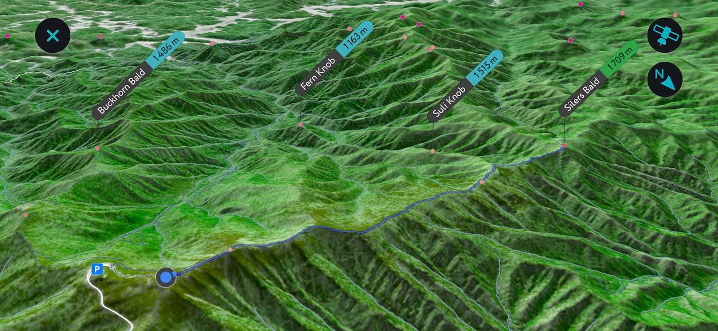
The 3D map is available by double tapping on the compass when you open the app which could be visible when you point your phone down. Use two fingers movements to rotate and zoom the 3D map. This flyover mode allows you to quickly grasp surrounding landscape and better understand your progress toward a goal.
A few additional basic tips for safe hiking in the park as advised by the park’s website include, in part:


southern-appalachian-6000ers
nc-5000ers
tennessee-4500ers
south-beyond-6000
carolina-lookout-tower-challenge
fred-beckey-great-peaks
southern-appalachian-6000ers
nc-5000ers
tennessee-4500ers
south-beyond-6000
southern-appalachian-6000ers
nc-5000ers
tennessee-4500ers
south-beyond-6000
southern-appalachian-6000ers
nc-5000ers
tennessee-4500ers
south-beyond-6000
carolina-lookout-tower-challenge
fred-beckey-great-peaks
southern-appalachian-6000ers
nc-5000ers
tennessee-4500ers
south-beyond-6000


