Scan the QR code and open PeakVisor on your phone
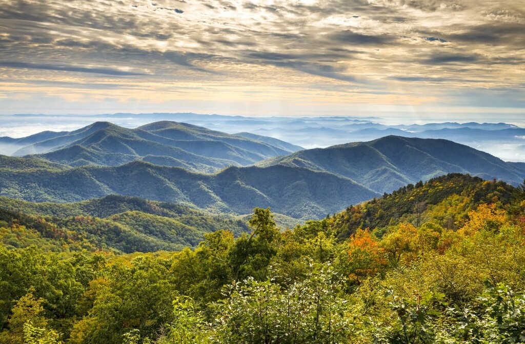
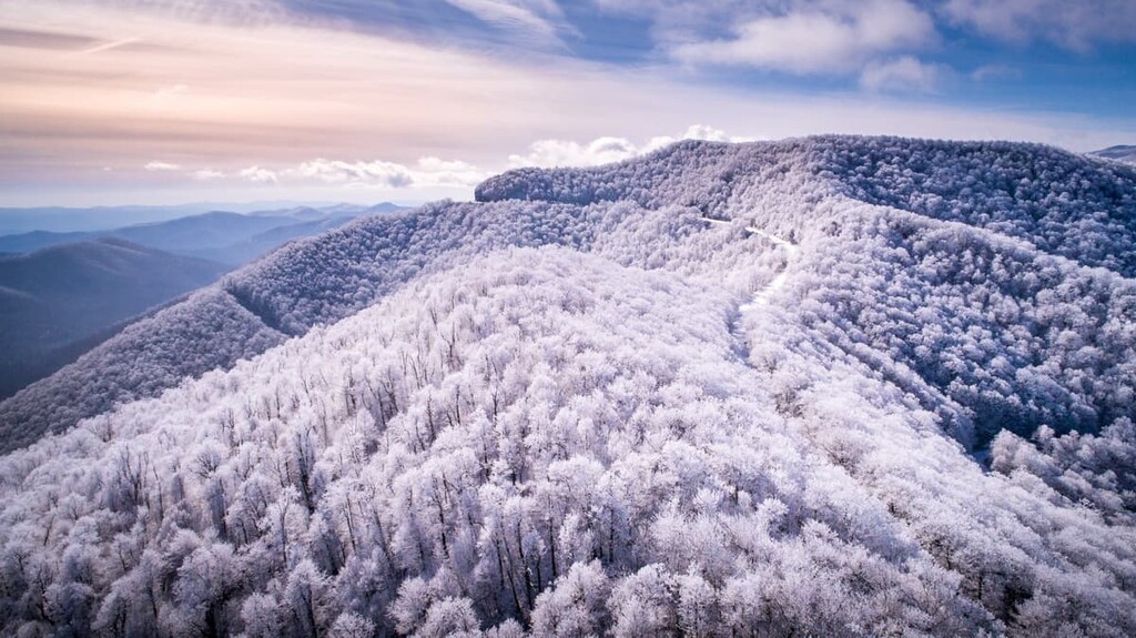
One of the United States’ most famous national parkways, the Blue Ridge Parkway is a scenic drive and protected area that runs along the main spine of the Blue Ridge Mountains. Stretching from southern North Carolina into central Virginia, the Blue Ridge Parkway contains 168 named mountains, the highest and most prominent of which is Richland Balsam (6,401 ft/1,951 m).
The Blue Ridge Parkway is an All-American Road and a National Parkway that extends down the spine of the Blue Ridge Mountains in the southeastern United States.
It begins near Waynesboro, Virginia at the southern edge of Shenandoah National Park and extends southward toward Great Smoky Mountains National Park near Cherokee, North Carolina over the course of 469 windy and scenic miles (755 km).
Although the Blue Ridge Parkway is, first and foremost, a road, it is also a park. In fact, it’s considered to be a linear park as the protected region around the road is only slightly wider than the road itself.
Nevertheless, the Blue Ridge Parkway is managed by the National Park Service as a protected area and scenic byway. The park service also manages a number of visitor centers and outdoor recreation opportunities, both along the parkway and in adjoining parks and protected areas.
With dozens of excellent attractions to check out along the Blue Ridge Parkway, the best way for us to explore the geography of the park is to start at the northern terminus of the road and make our way southward. Here’s what you need to know.
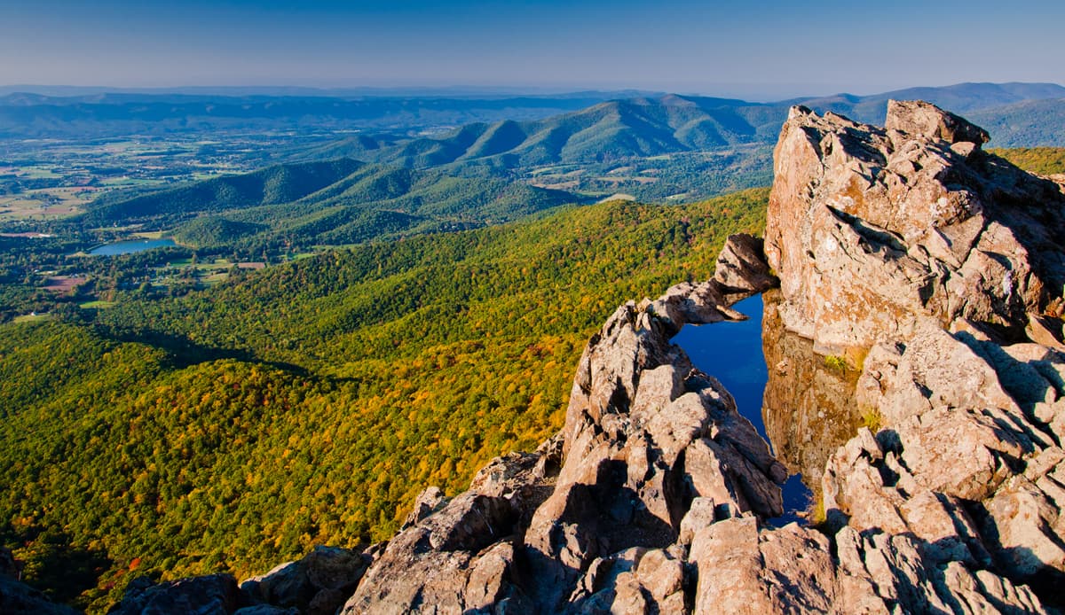
The Blue Ridge Parkway starts near the city of Waynesboro, Virginia. Mile 0 of the parkway is located at Rockfish Gap, which is also the southern terminus of Skyline Drive—a scenic byway that stretches the length of Shenandoah National Park.
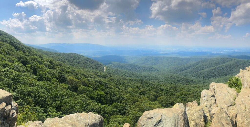
From here, the road meanders its way southward, past the popular hiking trails at Humpback Rock. After passing by views of the Shenandoah Valley to the west, the road ventures into George Washington National Forest.
Eventually the Blue Ridge Parkway comes across the Peaks of Otter (Sharp Top, Flat Top, and Harkening Hill), which offer iconic views of the region. Afterward, visitors can check out Roanoke Mountain or continue onward to the historic Mabry Mill.
Right before crossing into North Carolina, the Blue Ridge Parkway pases by the town of Galax and the Blue Ridge Music Center, the latter of which provides an opportunity to learn more about Appalachian folk music.
After 216.9 miles (349.1 km) in Virginia, the Blue Ridge Parkway crosses into North Carolina. Not long afterward, the road pases by Cumberland Knob and then ventures into Doughton Park. If you’re looking for a place to stay for the night, Doughton Park’s campground is a solid choice.
The North Carolina section of the parkway passes through or near a number of smaller parks, including E. B. Jeffress Park. Moses H. Cone Memorial Park, and Julian Price Memorial Park. Eventually it crosses into the Linville Falls Recreation Area, which has views of Linville Gorge.
For a bit of an adventure, a side trip to Mount Mitchell State Park is worth considering around mile 355 (571 km) of the parkway. Mount Mitchell is the highest peak to the east of the Mississippi, so it’s a fun hiking activity.
Heading further south, the parkway passes by the Folk Art Center and the Blue Ridge Parkway Visitor Center. There are also a number of overlooks where you can get a view of Looking Glass Rock during this stretch of the road.
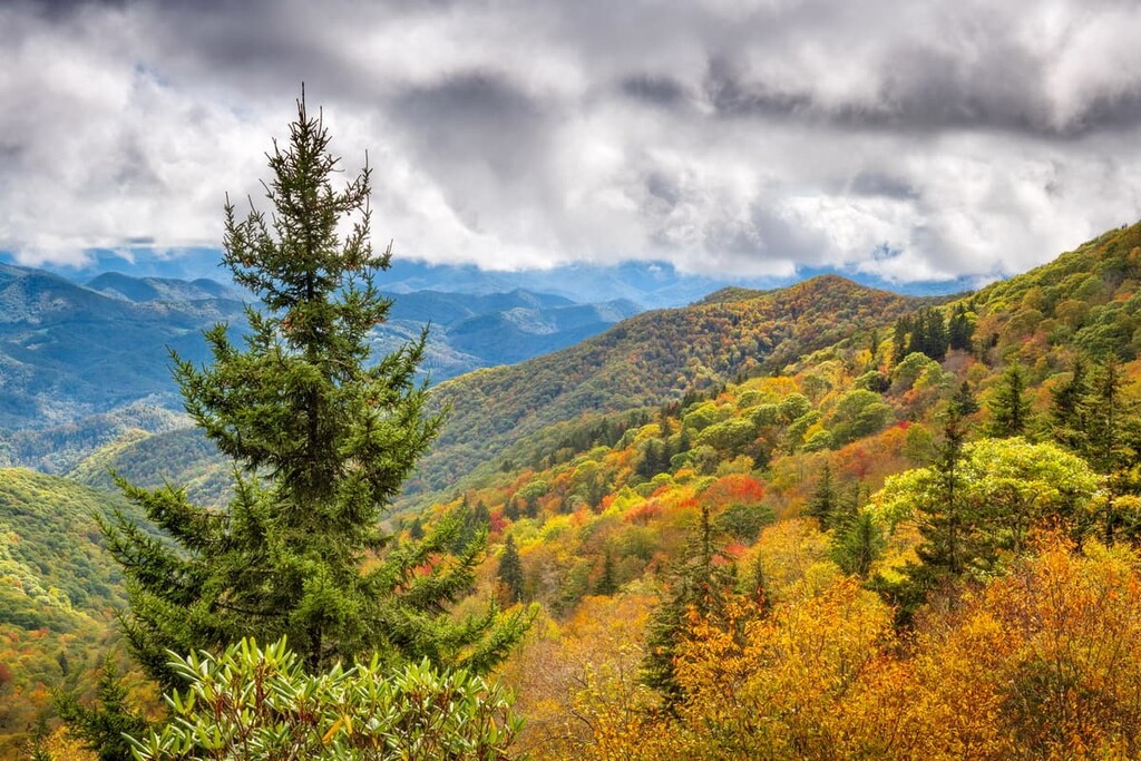
The last 50 miles (80 km) or so of the parkway take visitors past Shining Rock Wilderness, Pisgah National Forest, and impressive high points like Black Balsam Knob, Cold Mountain, Devil’s Courthouse, and Richland Balsam.
Eventually, the road reaches US 441, which is the southern terminus of the Blue Ridge Parkway. At this point, the road enters Great Smoky Mountains National Park, where more hiking adventures await.
Aptly named, the Blue Ridge Parkway travels down the main crest of the Blue Ridge Mountains, which is a subrange of the greater Appalachian Mountains. While the Appalachian Mountains extend from the US state of Alabama to the province of Newfoundland and Labrador in Canada, the Blue Ridge Mountains stretch from northern Georgia to southern Pennsylvania.
The range itself is ancient and much of the rock within the Blue Ridge Mountains is highly metamorphosed rock that dates back to the Precambrian. Some of the most common rocks in the range include schists, slates, gneisses, and quartzites.
That being said, the Blue Ridge Mountains started to take their current shape over the course of a number of mountain building events, including the Grenville and Alleghenian orogenies. These mountain building events took place from about 1.1 billion to 250 million years ago and helped give the range the shape that we see today.
Some of the major peaks along the Blue Ridge Parkway include Richland Balsam, Waterrock Knob, the Peaks of Otter, Craggy Dome, Roanoke Mountain, and Mount Hardy.
Like the rest of the Blue Ridge Mountains, the area adjacent to the Blue Ridge Parkway is home to ecosystems that are part of the larger Blue Ridge Mountain ecoregion. This ecoregion is widely considered to be one of the most ecologically diverse broadleaf forests in the entire world.
It’s believed that there are at least 1,400 species of vascular plants found in the lands surrounding the Blue Ridge Parkway, though the true number of species could be as high as 2,000.
The parkway covers a range of different plant communities due to its large total area. Indeed, the species found in the northern part of the parkway are often quite different to those in the south.
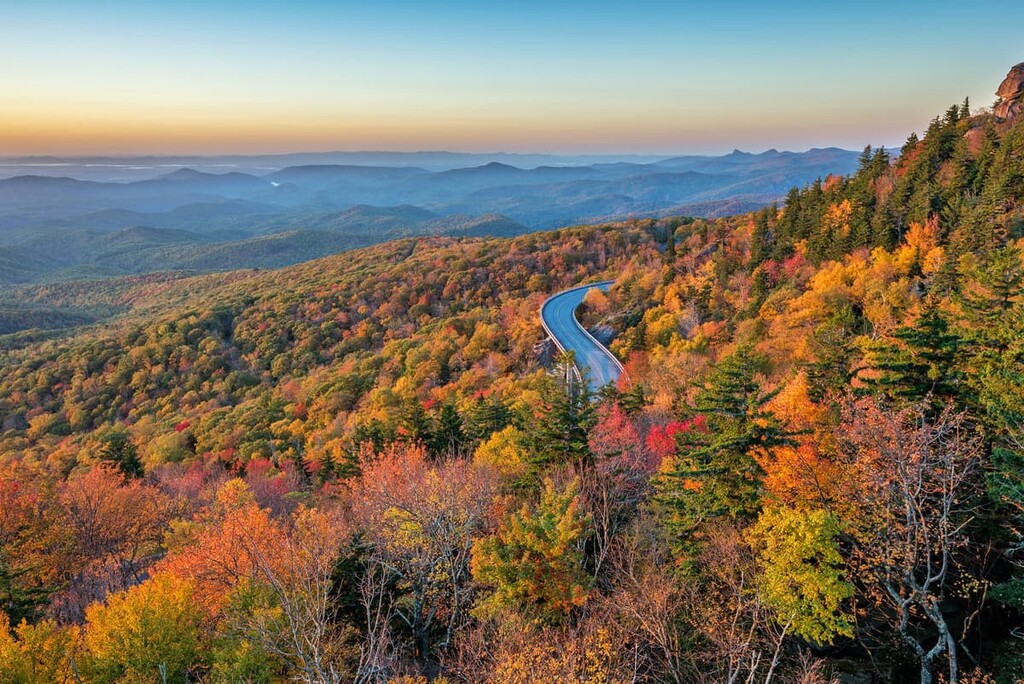
During the fall months, the foliage of the parkway’s trees turn to bright oranges, yellows, and reds. This makes an autumn drive along the road particularly fantastic during the month of October. But, don’t forget to keep your eyes on the road along the way!
The real nature-based showstopper in the park, however, is the Blue Ridge Parkway’s many wildflowers. In fact, it’s believed that about 80 percent of the total vascular plants in the park are wildflowers, so visiting in the spring and summer is always a fun activity.
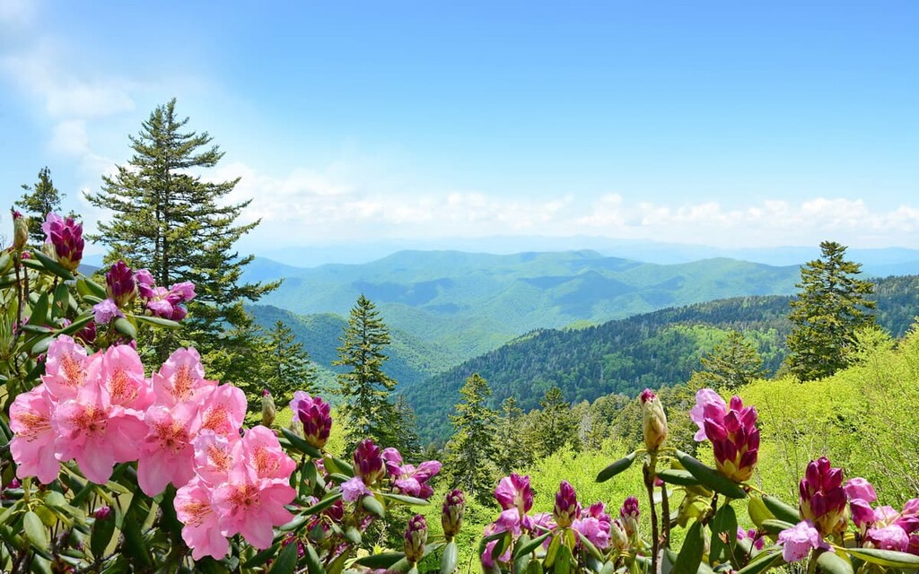
The National Park Service even offers a bloom calendar that you can download before your journey. This calendar gives you insight into the peak bloom seasons for each of the major wildflowers in the park and some information as to where you can find the flowers during your drive.
In addition to thousands of plant species, the Blue Ridge Parkway also passes through the habitats of hundreds of animal species. Indeed, the National Park Service estimates that there are about 43 amphibian, 99 fish, 70 mammal, 225 bird, and 31 reptile species found along the parkway.
Some of the most notable mammals found along the parkway include Virginia opossums, coyotes, gray and red foxes, bobcats, northern river otters, American minks, elk, white-tailed deer, feral pigs, and black bears.
We should also note that there are two species of venomous snakes found in the park. This includes the timber rattlesnake and the copperhead. Neither of these snake species are particularly aggressive and most individuals want nothing to do with humans.
However, people do get bitten by snakes every year, mostly as a result of trying to get too close to them. So, it’s best not to approach or handle snakes, unless you’re trained to do so.

Last but not least, keep in mind that the land around the Blue Ridge Parkway is home to a number of turtles. Snapping turtles are found in waterways throughout the region. Unfortunately, many of these turtles are killed every year on the road as they get run over while attempting to cross the parkway. So, drive slowly and keep an eye out for the turtles!
The modern day Blue Ridge Parkway passes through lands that have been inhabited since time immemorial. What is now mostly federally managed land is the traditional territory and ancestral homelands of many Indigenous peoples, including the Eastern Band of Cherokee Indians.
People of European descent started arriving in the region around what is now the Blue Ridge Parkway sometime during the seventeenth through eighteenth centuries, bringing with them many enslaved peoples. However, due to the ruggedness of the terrain, people of European descent rarely crossed the Blue Ridge Mountains until after Daniel Boone established what is known as the Wilderness Road through the Cumberland Gap.
By the early nineteenth century, immigration into the region by European-Americans was causing widespread conflict with Indigenous tribal nations. In 1830, the passage of the Indian Removal Act led to the forced removal of countless Indigenous peoples from their ancestral homelands in the region.
While many of the Cherokee were forced to march to what is now Oklahoma along the Trail of Tears, some members of what is now the Eastern Band of Cherokee Indians managed to stay in the region. Many more managed to walk back from Oklahoma to their homelands.

The Eastern Band of Cherokee Indians continues to maintain a territory known as the Qualla Boundary (which is not a reservation but is held in trust by the US government) at the southernmost edge of the Blue Ridge Parkway.
The idea for the Blue Ridge Parkway (then called the Appalachian Scenic Highway) was first introduced during the 1930s. It was originally intended to connect Great Smoky Mountains National Park to Shenandoah National Park, which made it the longest road in the United States that was initially planned as a single unit.
Unlike at Skyline Drive in Shenandoah National Park, much of the initial work on the Blue Ridge Parkway was done by private contractors—not the Civilian Conservation Corps (CCC). However, some of the later work on the road was completed by CCC crews and, later, conscientious objectors during World War II.
Although the parkway was designed to help create jobs in the region, it’s worth pointing out that it did have some downsides. The road displaced many residents in the region and it increased regulations on building and agriculture in some adjacent landholdings. Furthermore, the road is not open for commercial travel, so anyone other than sightseers needs to take sideroads around the parkway.
Additionally, the Eastern Band of Cherokee Indians was initially unhappy about having the parkway crossing their land in the Qualla Boundary. Eventually, the tribal nation did gain more favorable conditions for the road in an agreement with the US government.
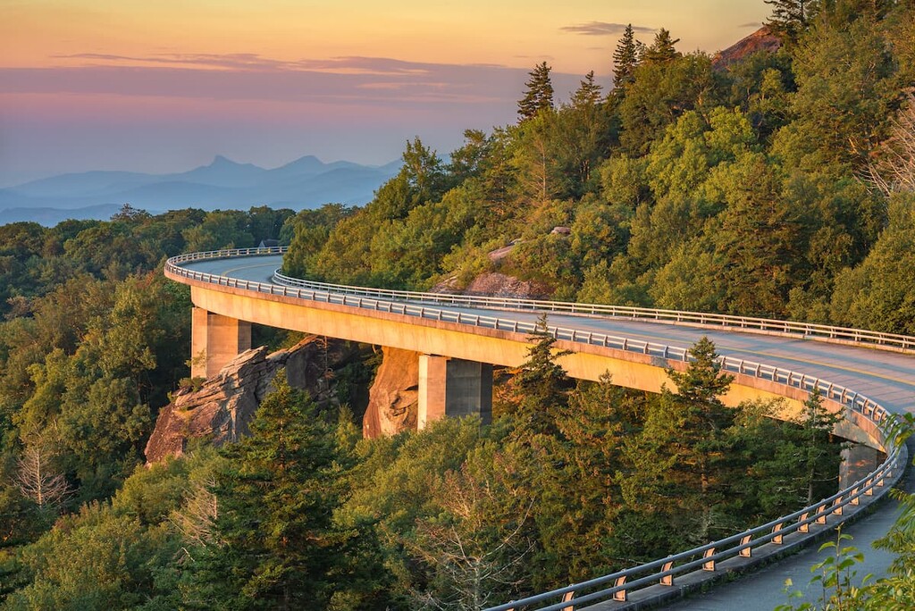
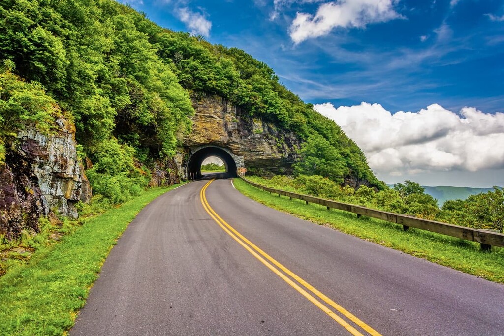
By 1966, the bulk of the parkway was open and operational. However, the 7.7 mile (12.4 km) section of the parkway that travels through the Linn Cove Viaduct didn’t open until 1987. This means that it took a total of 52 years to build the road.

Driving the Blue Ridge Parkway is an amazing experience. However, as with any long-distance drive or scenic route, there are a few things you ought to know before you leave home. Here are some key considerations to take into account before driving the Blue Ridge Parkway:
The Blue Ridge Parkway is a scenic byway that’s traversed by tens of thousands of motorists each year. Nevertheless, safety is always a concern when driving on windy mountain roads. Here are a few safety considerations to keep in mind:
There are a number of visitor’s centers, museums, and similar destinations located along the Blue Ridge Parkway. The National Park Service–operated visitor’s centers along the parkway include:
Note that the milepost numbers start at 0 at the northern terminus of the parkway near Shenandoah National Park.
In addition to these National Park Service–operated visitor’s centers, the parkway is also home to a number of other museums and destinations. These include:

Keep in mind that the bulk of the visitor’s centers and attractions on the Blue Ridge Parkway are open only from about May through October. However, with the exception of Thanksgiving, Christmas Day (December 25), and New Year’s Day, the Blue Ridge Parkway Visitor Center, the Museum of North Carolina Minerals, and the Folk Art Center are usually open.
Over the course of its 496 mile (755 km) route, the Blue Ridge Parkway is home to dozens of excellent hiking opportunities. Here are some of the best hiking areas to check out while driving this scenic byway:
Located at Milepost 5.8, Humpback Rocks is one of the first hiking destinations you come to when driving southbound on the Blue Ridge Parkway. The Humpback Rocks area offers a range of exciting activity options, including a visitor’s center and a chance to see the historic farm in the area.
There are also three hiking trails in the Humpback Rocks area. This includes the Humpback Rocks Trail, the Mountain Farm Trail, and a section of the Appalachian Trail.
One of the most iconic views on the parkway, the Peaks of Otter at Milepost 85.6 have long been a tourist destination. The area is home to a campground, visitor center, picnic area, historic farm, and the Peaks of Otter Lodge.
While at Peaks of Otter, you can hike on six different trails. Potential hiking options include a trek up the Sharp Top Trail or the Elk Run Loop, Harkening Hill Loop, Flat Top Trail, and the Johnson Farm Trails.
Situated at Milepost 297, Julian Price Memorial Park is a large recreational retreat that offers lots of opportunity for outdoor adventure. The park contains Price Lake, which is open for canoeing and kayaking.
Additionally, Julian Price Memorial Park contains a campground and a picnic area. There are a number of hiking trails in the park, too, including the Green Knob Trail, Boone Fork Trail, Mountains-to-Sea Trail, Price Lake Trail, and the Tanawha Trail.

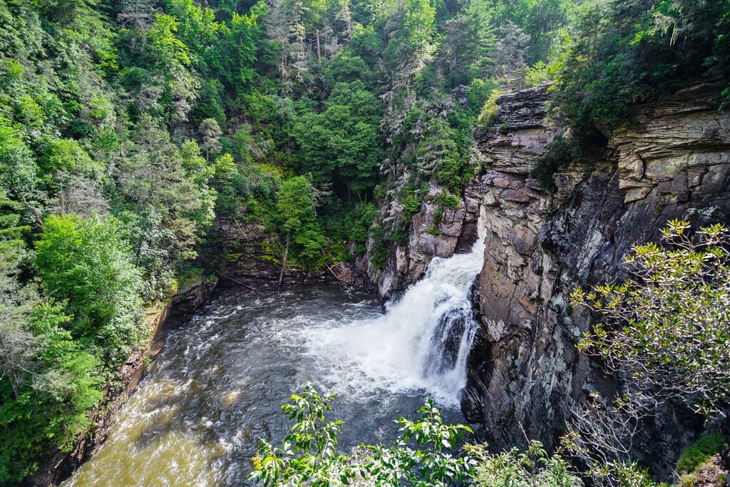
One of the major destinations in the southern portion of the parkway, Linville Falls is one of the most impressive sights along the entire journey. The falls are located near milepost 316 and they offer a chance to see some truly stunning scenery.
Near the falls, there is a visitor center, campground, and picnic area. There are also multiple hiking trails, including the Erwin's View Trail and Linville Gorge Trail.
Although much of the Blue Ridge Parkway traverses remote regions of North Carolina and Virginia, there are a number of major cities and bustling mountain towns located nearby. Here are some of the best places to check out before, during, and after your drive down the Blue Ridge Parkway:
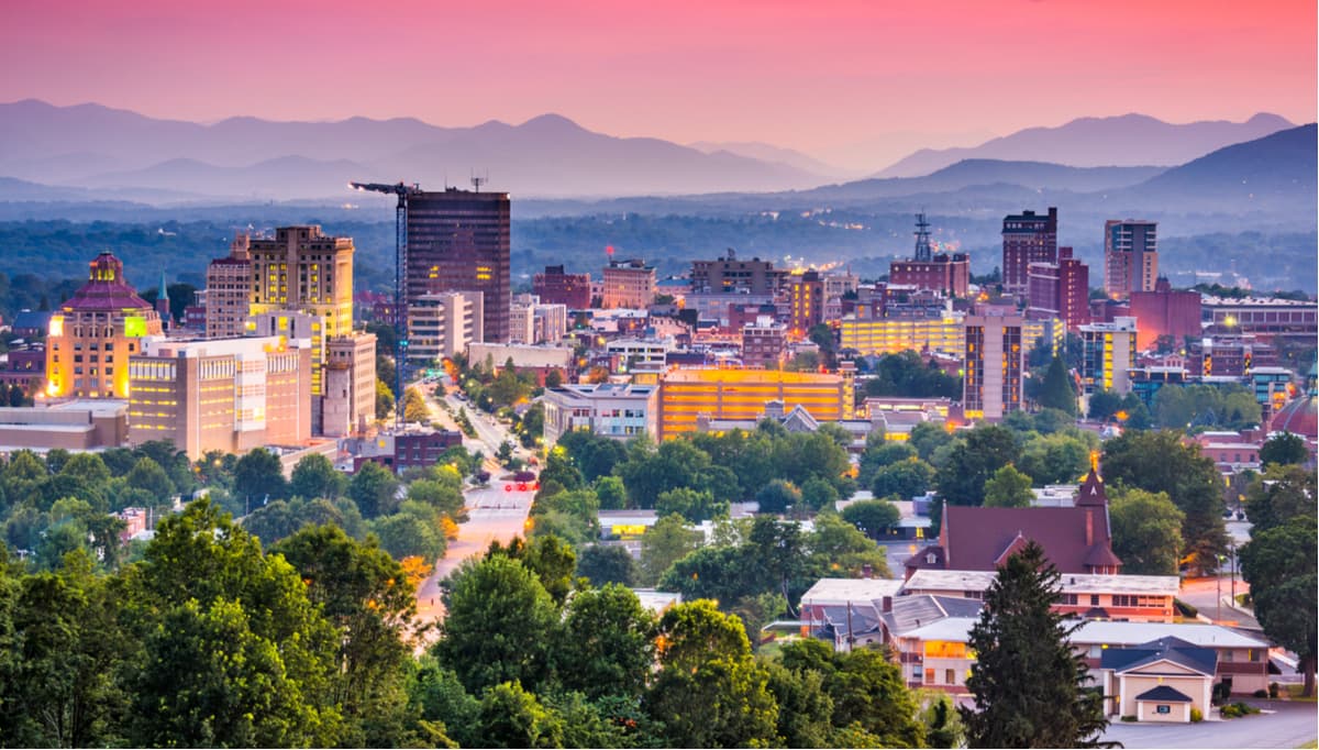
One of the largest cities in western North Carolina, Asheville is a community of some 93,000 people located in Buncombe County at the confluence of the Swannanoa and French Broad rivers.
The city has long been a popular tourist destination, thanks to its bustling arts scene and proximity to a number of outdoor recreation locations. Asheville is located in the southern part of the Blue Ridge Parkway, near its southern terminus.
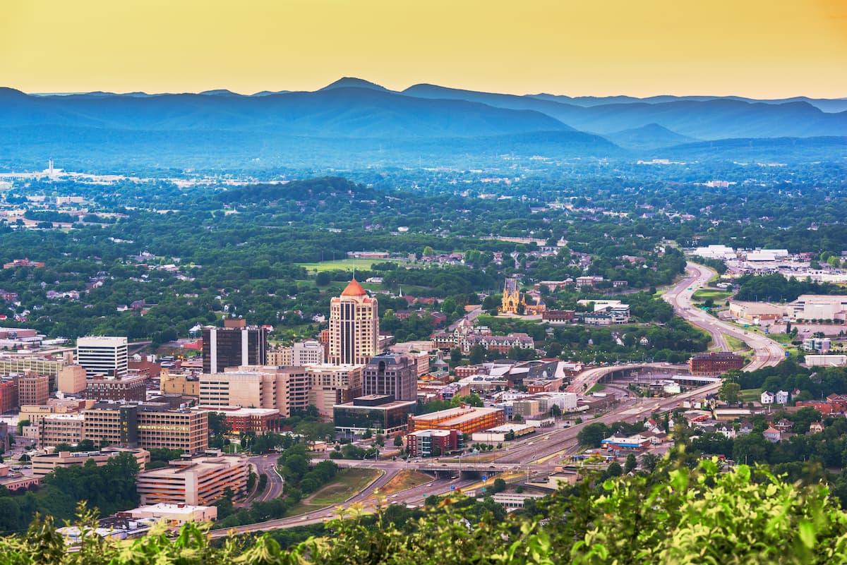
The largest city in Virginia located to the west of the state capital, Richmond, the city of Roanoke is home to some 97,000 people who live in the southwestern part of the state. Roanoke is considered to be one of the cultural hubs of the region and it offers good transportation connections, thanks to its airport and many roadways.
Roanoke is located in the northern portion of the Blue Ridge Parkway, just outside the George Washington and Jefferson National Forests. The city is also home to a number of museums, as well as the Hopkins Planetarium, so it makes for a good place to stop during your journey.
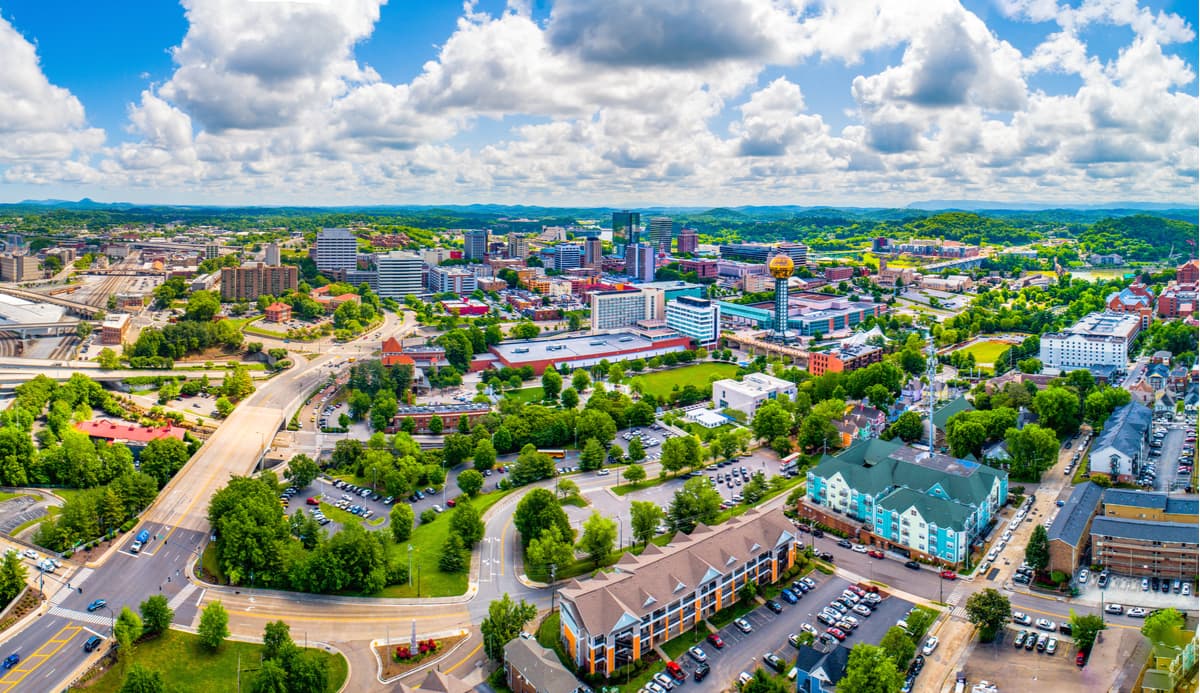
Although it’s not technically on the Blue Ridge Parkway, Knoxville is one of the largest cities in the region. Situated in eastern Tennessee, Knoxville is home to about 190,000 people, which makes it the third biggest city in the state.
Knoxville is often considered to be a gateway city to the Great Smoky Mountains and, as such, it’s a great place to fly into if you’re coming from further afield. From Knoxville, you can check out Great Smoky Mountains National Park before hopping on the Blue Ridge Parkway and making your way north.
The city of Waynesboro is more or less located at the northern terminus of the Blue Ridge Parkway. It’s home to about 21,000 residents and it is an important cultural center in the Shenandoah Valley.
Although Waynesboro made its fame by being the home of the laboratory that invented spandex (brand name Lycra), the city has now become a major tourism destination in the region. The city’s proximity to Shenandoah National Park and the Blue Ridge Parkway have helped it become a popular stopping point for visitors to the area.
Often considered the southern terminus of the Blue Ridge Parkway, the community of Cherokee (ᏣᎳᎩ) is situated in southeastern North Carolina, just outside of Great Smoky Mountains National Park.
The community is located within the borders of the Qualla Boundary, which is the territory of the Eastern Band of Cherokee Indians (ᏣᎳᎩᏱ ᏕᏣᏓᏂᎸᎩ, Tsalagiyi Detsadanilvgi). Cherokee is considered the capital of the tribal nation and it is part of the nation’s ancestral homelands.
Due to the community’s proximity to both the Blue Ridge Parkway and Great Smoky Mountains National Park, it is also a popular tourist destination. The community is also home to a number of other attractions, including the Cherokee Botanical Garden and Nature Trail as well as the Harrah's Cherokee Casino.