
Scan the QR code and open PeakVisor on your phone
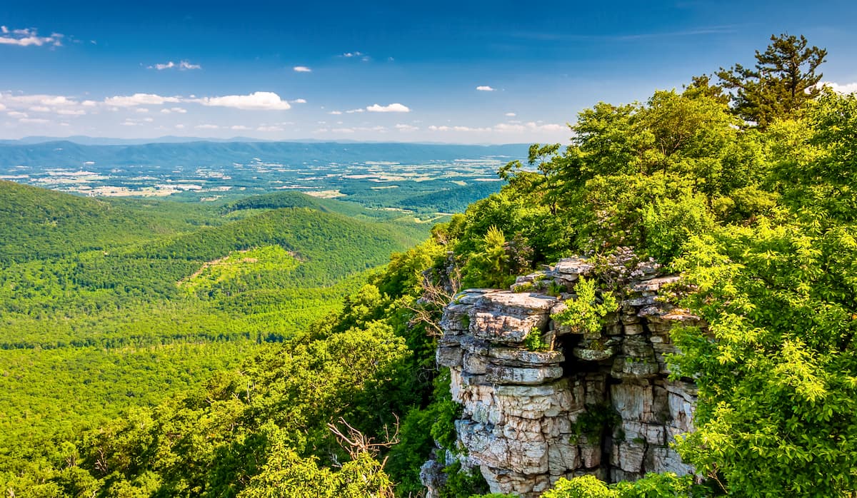
Home to rugged peaks and old-growth forests, the George Washington National Forest is a federally protected area that straddles the border of the US states of West Virginia and Virginia. The forest contains 326 named mountains, the highest of which is Paddy Knob (4,478ft/1,365m), and the most prominent of which is Elliot Knob (4,459ft/1,359m).
George Washington National Forest is situated partially in West Virginia and partially within Virginia. It is managed as a single unit by the US Forest Service alongside Jefferson National Forest.
Shenandoah National Park is located to the east of George Washington National Forest. Meanwhile, the bulk of Jefferson National Forest forms George Wahsington’s southern border and extends into the state of Kentucky. Furthermore, the forest is bordered to the west by the Monongahela National Forest of West Virginia.
George Washington National Forest encompasses some 1,662.9 square miles (4,307 sq. km) of land in 17 different counties. However, the bulk of the forest is within Augusta, Bath, Alleghany, and Rockingham Counties. It is substantially larger than the Jefferson National Forest, which contains 1,135 square miles (2,941 sq. km) of land.
Interestingly, both Jefferson and George Washington National Forests are managed by Ranger Districts which are headquartered in the state of Virginia. However, the forest supervisor office is located outside the forest in Roanoke, Virginia.
The forest includes 8 different wilderness areas, including:
Major summits in the forest include Paddy Knob, Bald Knob, Elliott Knob, Hogback, and Reddish Knob.
The peaks within George Washington National Forest are part of the Appalachian Mountains, which stretch from the state of Alabama all the way to the province of Newfoundland and Labrador in Canada.
Moreover, they are part of the Appalachian Ridges or the “Ridge-and-Valley Appalachians.” This sub-range extends from the southeastern portion of New York, through the states of New Jersey and Pennsylvania, all the way south to Maryland, Virginia, West Virginia, Kentucky, Tennessee, and Georgia before terminating in Alabama.
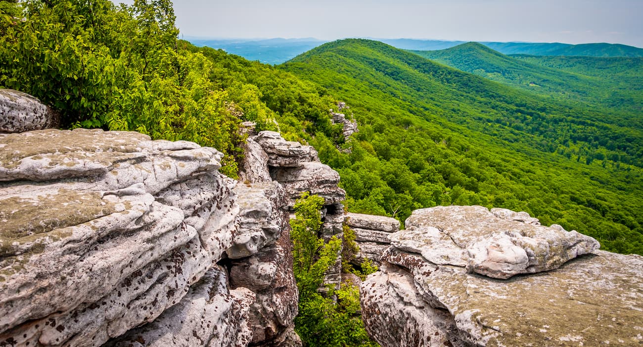
They are located to the east of the Appalachian Plateaus and to the west of the Blue Ridge Mountains. For the most part, the region is dominated by alternating patterns of long ridges and long valleys.
Geologists believe that these ridges are the result of ancient fold and thru-st belts that formed during the Alleghanian orogeny, which was a major mountain building event that was partially responsible for the creation of the Appalachian Mountains that we see today.
Interestingly, the region that is now George Washington National Forest experienced minimal metamorphism and intrusions, though plenty of westward folded layers of sedimentary rock. Indeed, the ridges consist of the most erosion-resistant layers, while the valleys in the region used to be covered by more erodible rock.
Perhaps the most interesting geologic disparity is between that of the George Washington Forest and Shenandoah National Park to the east. While George Washington is within the Appalachian Ridges province, Shenandoah is part of the Blue Ridge Mountains.
So, despite their close geographic proximity, Shenandoah consists mostly of gneisses, granites and highly metamorphosed rocks that offer a stark contrast to the sedimentary layers located in George Washington National Forest.
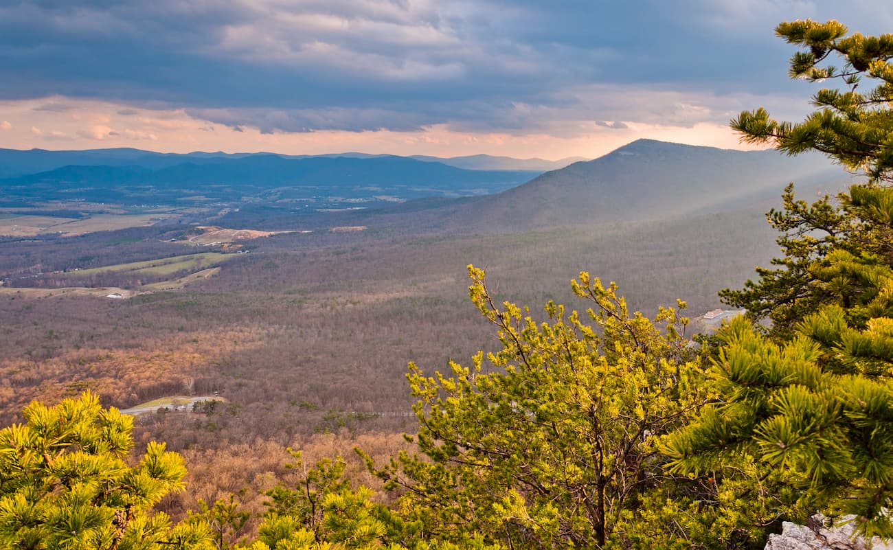
Within the George Washington National Forest, the landscape is dominated by the Appalachian-Blue Ridge forests ecoregion. This ecoregion extends throughout the Appalachian Ridges and the Blue Ridge Mountains, covering some 61,500 square miles (159,000 sq. km) of land in the eastern United States.
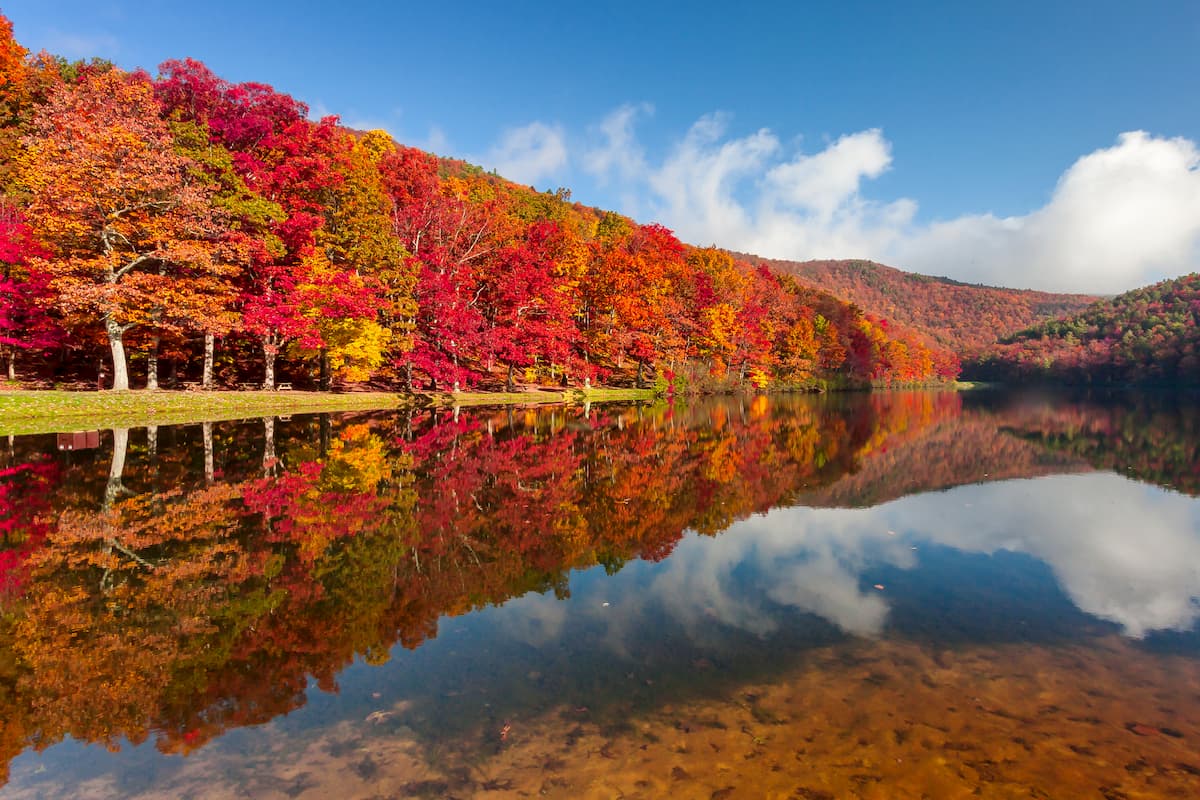
Moreover, the region is renowned for its biodiversity as it is home to a large number of plants and wildlife. In the George Washington National Forest, in particular, there are over 2,000 species of herbaceous plants (e.g., flowers) and shrubs. Additionally, there are more than 50 species of trees within the forest.
While the region experienced extensive logging in the past, there are about 360 square miles (930 sq. km) of old growth forest within the combined George Washington National Forest and Jefferson National Forest boundaries.
Major wildlife species include white-tailed deer, otters, martens, weasels, bobcats, and black bears.
Humans have lived within the region that is now George Washington National Forest for thousands of years. Long before the arrival of Europeans in the 17th century, groups, including the Monacan, Mannahoac, Tutelo, Cherokee, and Sapony, among countless others, called the region home.
The region has long been seen as an important natural area. It was among the earliest national forests to be established in the Eastern United States having been originally designated as the Shenandoah National Forest in 1918. It was later renamed George Washington National Forest in 1932 and was combined with Jefferson National Forest in 1995.
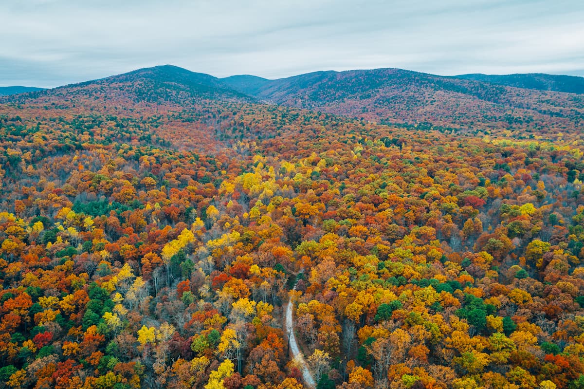
The George Washington National Forest is home to hundreds of miles of trails, many of which are particularly popular among trail runners. In fact, the forest is a commonly used location for ultramarathons, including the Old Dominion 100 and the Massanutten Mountain Trails 100.
Here are some great hiking areas to check out during your next visit:
The Wild Oak National Recreation Trail is a popular backcountry hiking loop that’s 27.1mi (33.8km) long. It offers great views, remote wilderness, and classic Appalachian forests for hikers to enjoy. The trail is also used by a local running club as the site for a 100 mile (160km) ultramarathon each February.
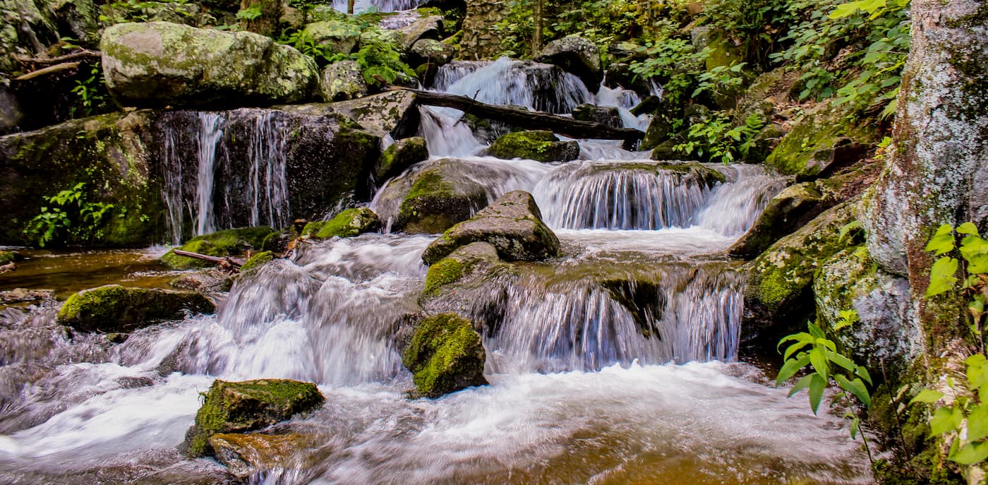
The uber-popular Crabtree Falls Trail is 2.8 miles (4.5km) long and offers a moderately strenuous hike to a stunning waterfall from the Blue Ridge Parkway. There are multiple viewpoints along the way, the first of which has paved trail access. It’s a great family-friendly hike for people looking for a shorter outdoor adventure.
The 13.4 mile (21.6km) long Three Ridges Loop Trail is a strenuous hike that offers fantastic views of the Appalachian Ridges and Blue Ridges. It starts on the Appalachian Trail and ventures into the Three Ridges Wilderness. Along the way, there are plenty of great lookout points, as well as a few shelters for overnight stays.
Here are some of the best cities to check out before or after your trip into the George Washington National Forest:
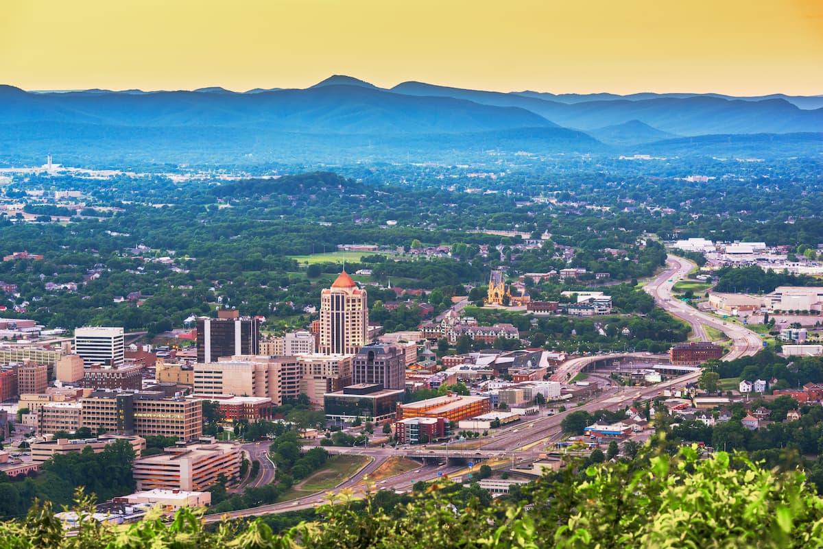
Located just east of the George Washington National Forest, Roanoke is the largest city in southwestern Virginia with a population of nearly 100,000 people. It is a major commercial and cultural center of southern West Virginia and southwestern Virginia. The city also has a small regional airport, as well as good highway connections to other major cities.
The city of Richmond is the capital of the Commonwealth of Virginia. It is the fourth-most populous city in the state with over 230,000 residents.
Due to its proximity to Washington, D.C. and the cities of Charlottesville, Williamsburg, and Lynchburg, it is a major transportation hub for the region. It has an international airport as well as intercity bus connections to other major cities on the Eastern Seaboard.

Charleston, West Virginia Situated to the west of the forest, Charleston is the capital and largest city of the state of West Virginia. It is home to over 46,000 people and is one of the state’s most important economic, educational, and transportational hubs. Charleston has the largest airport in the state, as well as Amtrak passenger rail service to New York City and Chicago via the Cardinal line.


