
Scan the QR code and open PeakVisor on your phone
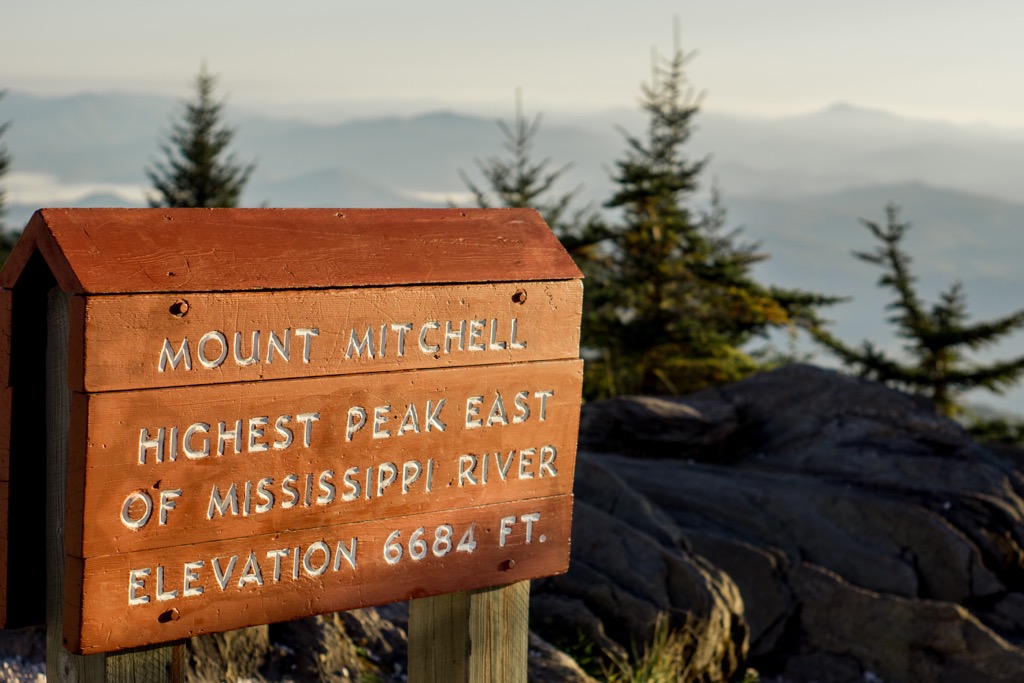
Mount Mitchell State Park in North Carolina, USA, covers 4,789 acres (1,938 ha) within Pisgah National Forest. The state park was created in 1915 and encompasses 12 peaks of the Black Mountains, a subrange of the Appalachians. At 6,686 ft (2,038 m), Mount Mitchell is the tallest point in the United States east of the Mississippi River. It has a prominence of 6,109 ft (1,862 m).
Located 30 mi (48 km) northeast of Asheville, North Carolina, in Yancey County, Mount Mitchell State Park encompasses 4,789 acres (1,938 ha) and is surrounded by Pisgah National Forest. The state park includes part of the Black Mountains, a subrange of the Appalachians. Mount Mitchell (6,686 ft/2,038 m), the park’s namesake, is the tallest peak east of the Mississippi River in the United States.
The park contains 40 mi (64 km) of hiking trails, including a handful of easy, scenic summit trails through Fraser fir forest. There are also more challenging trails that summit Mount Mitchell, cross a portion of the Black Mountains ridgeline, and run into the neighboring Pisgah National Forest.
Mount Mitchell first gained recognition in the 1830s when a University of North Carolina professor set out to prove it was the tallest peak in the eastern US. Using mathematical equations and barometric pressure readings, Elisha Mitchell came within about 12 ft (3.7 m) accuracy of the mountain’s actual height. The state park was established in 1915 as North Carolina’s first state park.
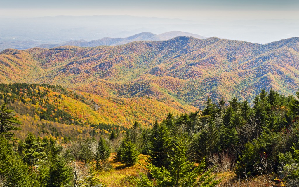
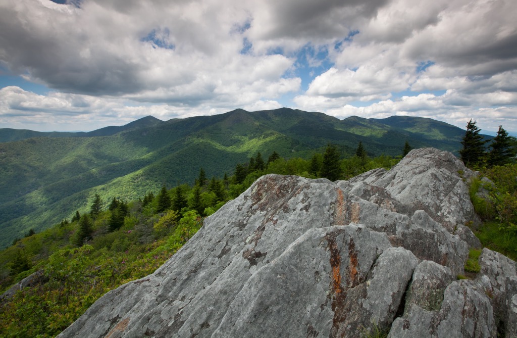
The Black Mountains extend approximately 15 mi (24 km) and are a subrange of the Appalachian Mountains. They contain five of the ten tallest peaks east of the Mississippi River. The range is primarily composed of Precambrian gneiss and schists that are more than one billion years old. The mountains themselves rose between 400 and 200 million years ago during the Alleghanian orogeny.
During the last Ice Age 20,000 to 16,000 years ago, glaciers did not advance across the Black Mountains but the temperature changes did alter the forests, pushing hardwoods towards warmer coastal areas, spruce-fir forests to lower elevations, and leaving summits relatively bare.
As temperatures rose again, hardwoods returned to the valleys and lower slopes and spruce-fir forests began to appear at higher elevations. Today the spruce-fir forest on the Black Mountains is one of about ten “islands” of spruce-fir forests in Southern Appalachia.
Two prominent forest types within the state park are hardwood forests and spruce-fir forests. Hardwood forests contain mountain maples, mountain ash, birch, and beech trees. Stands of spruce-fir forests grow at higher elevations. Keeping their dark color year-round, the Black Mountains are named for the spruce-fir forests growing on the upper slopes.
Common mammals in the ecosystem include coyotes, gray and red foxes, beavers, white-tailed deer, bobcats, black bears, cottontails, skunks, voles, mice, weasels, raccoons, shrews, squirrels, and bats. Birds that live or pass through seasonally include Canada geese, ruffed grouse, ruby-throated hummingbirds, flycatchers, vireos, blue jays, finches, tanagers, cardinals, warblers, meadowlarks, peregrine falcons, sharp-shinned hawks, and turkey vultures.
The Cherokee hunted, foraged, and lived in the Black Mountains prior to the arrival of European settlers. The Cherokee name for Mount Mitchell is Attakulla. After the Revolutionary War, the Cherokee were forced from their homeland, many along the often fatal Trail of Tears, by an overwhelming influx of white settlers. These early settlers favored North Carolina’s fertile valleys for agriculture.
Several botanists carried out studies in the Black Mountains, helping catalog some of the region’s rich biodiversity. One botanist was John Fraser after whom the Fraser fir is named.
Mount Mitchell is named after University of North Carolina professor Elisha Mitchell who surveyed the mountain in 1835. His work proved that Mount Mitchell was the tallest peak east of the Mississippi, rather than in the White Mountains of New Hampshire. Mitchell died in a fall on the mountain in 1857 and was buried at the top.
Mount Mitchell State Park was established in 1915, becoming North Carolina’s first state park.
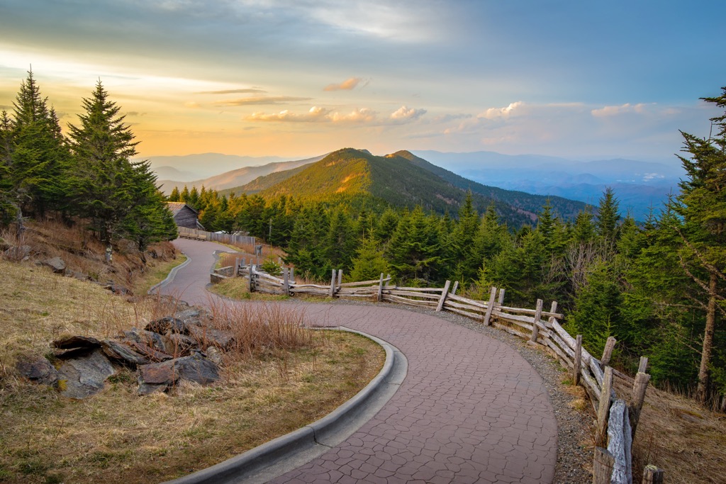
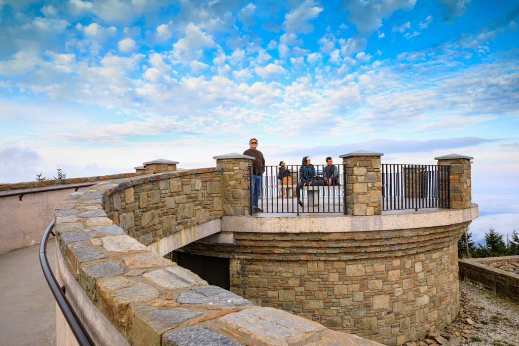
There is a parking lot near the summit of Mount Mitchell with a paved path to the observation tower at the top. The Balsam Nature Trail is an easy loop around the summit through a spruce-fir forest. A summary of trails can be found on the state park website.
Three trails can be mixed and matched to form a short or long out and back, or a loop that is rated moderate. The first leg of the trail is Camp Alice, a 2.1 mi (3.4 km) out and back. From the terminus of Camp Alice, one can connect to the Commissary Trail. Completing Camp Alice and Commissary Trail as an out and back is 3.6 mi (5.8 km) round trip with 360 ft (110 m) of elevation gain.
A loop can be made by beginning or ending with the Old Mitchell Trail. The trail leaves from the park restaurant and climbs about 2 mi (3.2 km) to the summit, gaining 975 ft (297 m) in elevation along the way. There are raspberries and blackberries along the trail in July and August. The trail passes through Fraser fir forest, red spruce, mountain maples, mountain ash, birch, and beech.
For a more challenging option take the Mount Mitchell Trail. It starts at Black Mountain Campground along Toe River and ascends 3,000 ft (914 m) over 5.5 mi (8.9 km) to reach the summit path. It intersects with the 18.5 mi (30 km) Buncombe Horse Range Trail along the way.
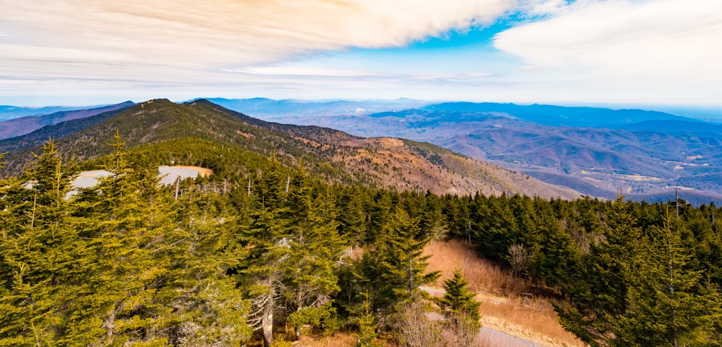
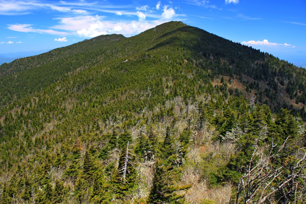
This trail begins in the state park and ends in Pisgah National Forest. Beginning at the picnic area along the ridge top, it passes over Mount Craig (6,637 ft/2,023 m), the second highest peak in the Appalachian Mountains. The trail starts off easy and becomes more difficult as it crosses through Deep Gap and into Pisgah National Forest. Outside of Mount Mitchell State Park, it connects with several other trails in the national forest to ultimately descend the mountain range into the valley below.
The Mountains to Sea Trail is a nearly 1,200 mi (1,930 km) trail that runs from Clingman’s Dome in the Great Smoky Mountains to Jockey’s Ridge on the Outer Banks. A section runs through the state park and crosses through parts of Buncombe Horse Range, Camp Alice, and Mount Mitchell.
Mount Mitchell State Park has an established campground and a restaurant. There are several small towns nearby with amenities and lodgings, such as the town of Black Mountain.
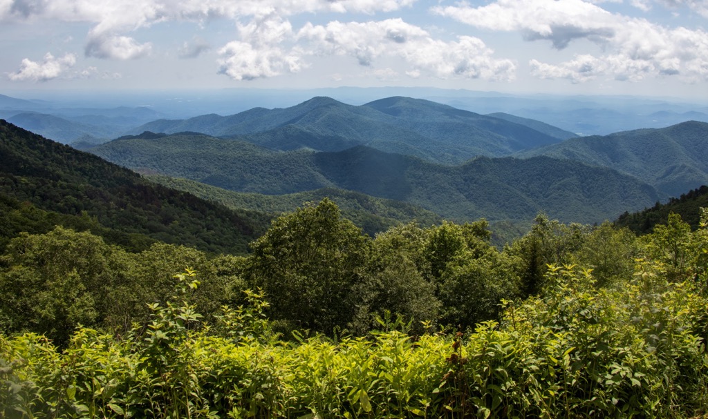
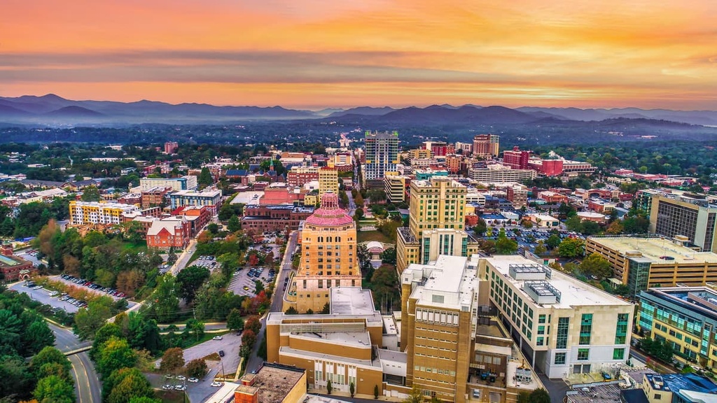
Located 30 mi (50 km) to the southwest is Asheville, North Carolina, with a population of 92,000 people. The Blue Ridge Parkway is in the city’s backyard and, more than just a scenic drive, provides easy access to a number of trails. The area is known for some spectacular waterfalls, as well as the sliding rock natural waterslide in Pisgah National Forest. Great Smoky Mountains National Park is less than 40 mi (65 km) to the west with lots of trails to hike and backpack.
The Biltmore Estate, constructed by a member of the Vanderbilt family, has 250-rooms and an 8,000 acre (3,237 ha) estate. As well as mansion tours, there are garden tours, shops, restaurants and upscale lodging on the property. Asheville has a blossoming glass art scene, lots of live music, and a number of festivals throughout the summer that celebrate Latin American culture, ideas and the great thinkers of our time, Celtic music, bluegrass music and dance, and much more.
The city hosts many farmers markets and a number of restaurants utilize products from local farmers or locally foraged. Asheville has a solid reputation as being a foodie city. Chai Pani is an award winning Indian restaurant in the city, as is Cúrate, a tapas restaurant. There are a number of breweries, cafes, pubs as well. The city has a wide selection of lodging for all preferences – budget, fancy, historic, cozy, or a peaceful retreat in the mountains.
Charlotte, North Carolina, lies 125 mi (200 km) east of the state park and has a population of 875,000 people. The city is brimming with things to experience such as farmers markets, live music, outdoor movies, pop-up shops, breweries, and art and performance festivals.

There are more than 50 mi (80 km) of trails in the area for running, walking, and biking. Charlotte is also home to the U.S. National Whitewater Center which includes 45 mi (72 km) of trails. The Charlotte Trail Guide offers detailed information on trails, neighborhoods, and top attractions around the city.
The city is home to a vibrant dining scene. In addition to American and southern classics, there are also Cuban, Ethiopian, vegan options and much more. Accommodation options are abundant, whether you are looking to stay in the city for cheap, treat yourself to an upscale hotel, or find a charming B&B.


ultra
southern-appalachian-6000ers
nc-5000ers
south-beyond-6000
carolina-lookout-tower-challenge
ultra
southern-appalachian-6000ers
nc-5000ers
south-beyond-6000
carolina-lookout-tower-challenge


