Scan the QR code and open PeakVisor on your phone
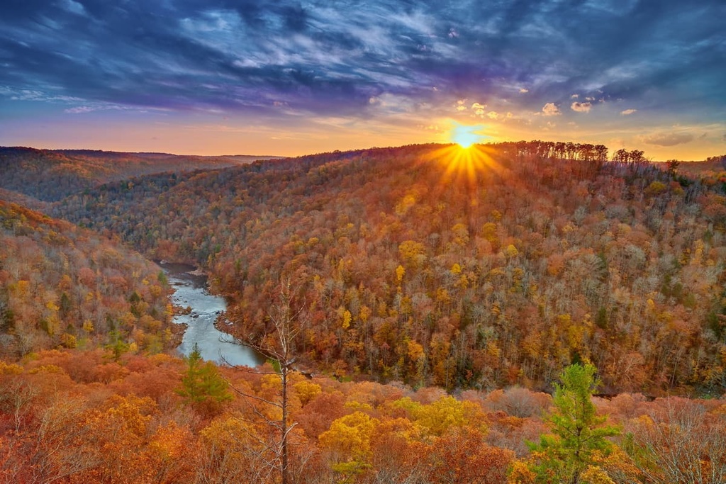
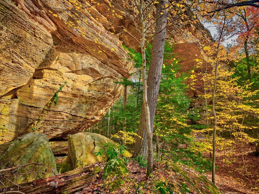
Home to spectacular gorges, steep sandstone bluffs, and an abundance of rock arches, Big South Fork National River and Recreation Area is a true hiker and paddler’s paradise. The recreation area is located in the northeastern part of Tennessee and the southeastern part of Kentucky in the eastern US. It contains 35 named high points, the highest of which is Buffalo Arch (1,611 ft/491 m) and the most prominent of which is Burke Knob (1,388 ft/423 m).
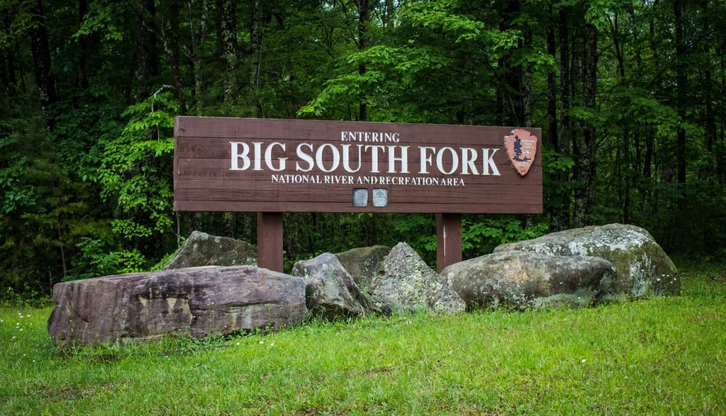
Big South Fork National River and Recreation Area is situated in southeastern Kentucky and northeastern Tennessee in the outskirts of Appalachia in the eastern United States.
The recreation area is located in Morgan, Pickett, Fentress, and Scott counties in Tennessee and in a part of McCreary County in Kentucky. In total, Big South Fork encompasses about 125,310 acres (50,711 ha) of land and water that’s managed by the US National Park Service.
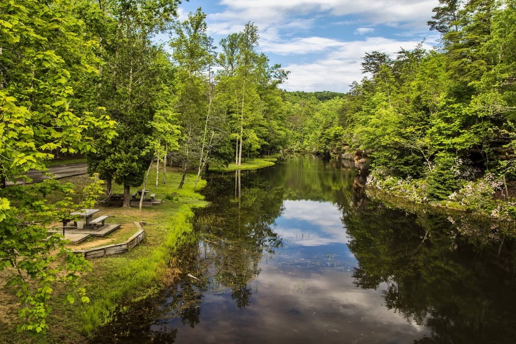
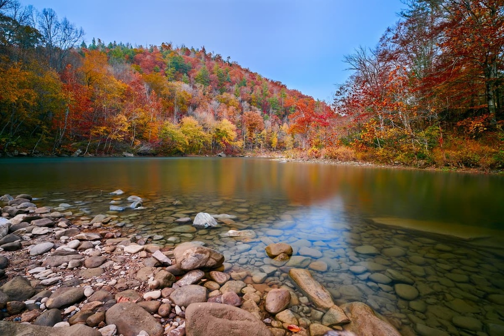
As its name suggests, the recreation area is situated along the Big South Fork of the Cumberland River. This tributary to the Cumberland is about 76 miles (122 km) long and it carves a huge canyon through the Cumberland Plateau.
Including the Big South Fork of the Cumberland, the recreation area contains over 244 miles (393 km) of rivers and streams. The recreation area also encompasses over 90 miles (144 km) of scenic gorges, so there’s something for everyone to love in the park.
Much of the area that surrounds Big South Fork National River and Recreation Area is privately owned land. However, Daniel Boone National Forest is located just a short drive away from the recreation area. There are also other smaller areas of public land around the recreation area including Pogue Creek Canyon State Natural Area and Green River Lake Wildlife Management Area.
Note that the recreation area is bisected by the line that separates the Eastern Time Zone from the Central Time Zone. The eastern half of the recreation area operates in Eastern Time while the western half is in Central Time. Keep this in mind when traveling to the area as this can affect the opening and closing time of certain amenities.

Geologically, the most important feature in the Big South Fork National River and Recreation Area is the Cumberland Plateau, which dominates much of the region.
The Cumberland Plateau is actually the southernmost part of the greater Appalachian Plateau, which itself is a part of the Appalachian Mountains. It is situated to the southwest of the Cumberland Mountains and to the south of the Allegheny Plateau.
As is the case with other plateaus in the Appalachians, the Cumberland Plateau is deeply dissected and it features stunning bluffs that tower above the valleys below. Most of the plateau is dominated by sandstone and other sedimentary rocks, most of which date back to the Mississippian and Pennsylvanian. There are also some deposits of bituminous coal on the plateau.
The Cumberland River is the main drainage for the plateau and the Big South Fork is one of the river’s largest tributaries. The Big South Fork drains an area that’s over 1,120 sq. mi (2,910 sq. km) in size, less than 20 percent of which is encompassed by the national recreation area.
In addition to the large gorge carved out by the Big South Fork, the national recreation area contains a surprisingly big collection of natural rock arches. While sandstone arches are more commonly seen in the Desert Southwest, such as in Arches National Park in Utah, the recreation area likely contains more rock arches than any other place in the eastern US.

Some of the many rock arches in the national recreation area include:

One of these arches, Buffalo Arch, is actually the highest point in the recreation area. Other notable high points include Burke Knob, Nats Knob, Pilot Rock, Hatfield Ridge, and Split Bow Arch.
Although it’s now known primarily as a recreation area, Big South Fork was initially protected in an attempt to protect the region’s rich ecological diversity.
Big South Fork and its surrounding watershed contain a range of different ecosystems, including everything from floodplains to dense deciduous forests. Along the river and in the river valley, the primary forest type is mixed oak with stands of sugar maple, yellow birch, and beech.
That said, the vast majority of the region was heavily clear-cut and logged prior to the establishment of the Big South Fork National River and Recreation Area. Little old growth forest remains and much of the region is second-growth forest that looks very different from what used to exist before colonization by European settlers.
As far as animals go, the Big South Fork doesn’t disappoint. The recreation area is home to an excellent array of birds that includes barred owls, red-shouldered hawks, wild turkeys, ruffed grouse, red-eyed vireo, and hooded warblers.
The park is also home to black bears, though many of the bears that now live in the region are descendants of bears that were actually introduced in the park in the 1990s. These bears originally came from Great Smoky Mountains National Park in an attempt to help the species thrive on the Cumberland Plateau.
The Big South Fork of the Cumberland River was also once home to a plethora of fish. However, contamination from centuries of coal mining have wreaked ecological havoc on the river.
There are currently three federally protected fish species that live in the region: duskytail darter, blackside dace, and palezone shiner.
While these fish are illegal to capture, there are plenty of game fish that you’re allowed to cast lines for in the park. Popular species include rock bass, smallmouth bass, striped bass, brown trout, rainbow trout, brook trout, crappie, spotted bass, white bass, rock bass, muskie, longear sunfish, and flathead catfish.
The land that is now part of the Big South Fork National River and Recreation Area has been home to humans since time immemorial. The recreation area is located on the ancestral homelands and traditional territory of the Eastern Band of Cherokee Indians and the Yuchi (many of whom are now enrolled citizens of the Muscogee Nation), among others.
It’s unclear when the first peoples of European descent traveled through the region. Some of the first European-American settlers in the area around Big South Fork were farmers and hunters who arrived in the 1770s.
The arrival of these colonists and settlers to the region led to the forced removal of many Indigneous communities from their homelands. The region was also the site of much fighting between the newly formed US government and local tribal nations.
In 1798, the First Treaty of Tellico was signed by representatives of the US and more than three dozen Cherokee leaders. As part of this treaty, tribal leaders believed they would receive goods, financial compensation, and protection from the US government in perpetuity in exchange for ceding their land. However, the US failed to uphold its promises.
After the treaty, the land went fairly unnoticed by settlers as it wasn’t particularly conducive to agriculture. However, a number of wealthy landowners attempted to establish farms in the region during the early nineteenth century. They relied heavily on the forced labor of enslaved Black people until emancipation and the Civil War.
In the 1880s, an English author by the name of Thomas Hughes tried to start a utopian colony in the region called Rugby. The colony was known for its Victorian architecture and picturesque setting, but it failed fairly quickly due to a typhoid epidemic, land title issues, and poor agricultural conditions. It was mostly abandoned before the turn of the century.
Other than the failed Rugby Colony, the other major attempts at US settlement in the region in the late nineteenth century focused on the timber and logging industry. Many logging companies hired recently emancipated Black workers to power their logging activities.
Coal mining started to boom in the region toward the late nineteenth century and the early twentieth century. The Blue Heron Mine, which was established in 1937, was one of the most famous and most productive coal mines to have operated in the region.
Blue Heron was owned by the Stearns Coal and Lumber Company and it was operated as a mining town for the workers of the company’s many underground mines. In its heyday, the town housed hundreds of people and it was home to everything from a church and school house to a general store. The mine closed in the 1960s after it became unprofitable.

Big South Fork National River and Recreation Area was officially designated by Congress in 1974 as part of the Water Resources Department Act of 1974. When it was established, Big South Fork became the first National River and National Recreation Area in the US National Park System.
As both a National River and a National Recreation Area, the mandate of the National Park Service when managing Big South Fork is two-fold.
First, the Park Service is tasked with protecting the region’s unique ecological, hydrological, geological, historical, and cultural features. Additionally, Big South Fork is designed to be a place where everyone can recreate and enjoy the great outdoors, making it an excellent place to venture to if you’re looking to hike, paddle, or horseback ride in Appalachia.
As its name suggests, the Big South Fork National River and Recreation Area is a haven for outdoor recreation. The park offers a lifetime of activity for outdoor enthusiasts including 141 miles (227 km) of hiking trails, 182 miles (291 km) of horseback riding trails, and 24 miles (39 km) of mountain biking trails.
Here are some of the best hikes to check out in the recreation area:
The Shellowtree Trace National Recreation Trail is a 290 mile (467 km) long backcountry hiking trail that traverses the Big South Fork National River and Recreation Area as well as the Daniel Boone National Forest.
It begins in northern Kentucky and crosses some of the most rugged terrain in the state before ending in Pickett State Park in Tennessee to the south. The trail offers a chance to see gorgeous woodlands as well as countless historic sites.
Hikers are welcome throughout the entire trail, including on the sections in the national recreation area. Remember that backcountry permits are required if you want to camp along the trail in Big South Fork.
The 4 mile (6.4 km) long Angel Falls Rapids Trail is a popular day hike that’s perfect for the whole family. This trail starts at the lower end of the Leatherwood Ford parking area and then follows a casual path toward the Angel Falls Rapids.
If you visit during the late spring and early summer months, you may also get a chance to hike the trail while the region's wildflowers are in full bloom.
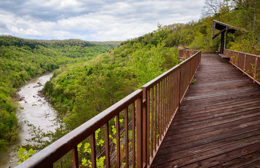
Offering a great chance to see the 113 foot (34 m) high Yahoo Falls, this 1.2 mile (1.9 km) long casual trail is a great little day trip that most hikers can enjoy. It is relatively flat with the exception of a steep set of metal steps that you need to climb to get to the falls.
Interestingly, this trail actually passes behind the falls themselves and under a large rock shelter. Keep in mind that the overall water volume in the falls can get quite low during extended periods of dry weather.
The Twin Arches Loops are a set of two trails that offer access to the scenic Twin Arches, which are the largest natural rock arches in the states of Tennessee and Kentucky.
The Upper Twin Arches Loop is 1.2 miles (1.9 km) long and takes most hikers about 1.5 hours to complete. Meanwhile, the more challenging Lower Twin Arches Loop is about 4.1 miles (6.6 km) long and it takes approximately half a day to hike. The Lower loop is particularly cenic as it takes you past the Charit Creek Lodge before you arrive at the falls.
Big South Fork is known for much more than its hiking trails (though those are pretty great, too, if you ask us!). In fact, Big South Fork is one of the region’s premier outdoor recreation areas. Some of the other outdoor activities you can enjoy in the park include:
Visitors to the park are also welcome to enjoy a selection of ranger-led programs. The activities on offer vary from season to season, but they normally include interpretive walks and other educational activities. You can learn more about these ranger-led programs at one of the park’s visitors centers.

Visitors to Big South Fork National River and Recreation Area have a number of accommodation options to choose from. Here are some great ways to spend a night within the recreation area:
Backcountry camping is allowed in Big South Fork National River and Recreation Area, however all overnight visitors who want to sleep outside a designated campground need a backcountry camping permit.
You can get a backcountry permit for groups of 24 or fewer people either online or at one of the park’s visitors centers. Groups larger than 25 people require a Special Use Permit to camp in the recreation area.
Backcountry campers can spend up to 14 nights in a row at the recreation area, but you’re limited to the number of nights allotted to you on your permit.
There are no designated backcountry campsites in the recreation area. You can camp almost wherever you’d like so long as you are more than 100 feet (30 m) from a parking area (except the Leatherwood Ford Day Use Area, which has a 300 ft/90 m buffer). You must also camp more than 100 feet (30 m) from all rock arches, caves, grave sites, historic structures, or cultural sites.
Additionally, there’s a no-camping zone in the Brandy Creek Fee Area where dispersed backcountry camping is prohibited.
Here are some other backcountry camping-related guidelines to keep in mind when in the recreation area:
NOTE: Hunting is allowed at Big South Fork National River and Recreation Area. If you’re hiking in the backcountry during big game hunting season, be sure to wear blaze orange to help reduce the risk of an accident. Keep in mind that hunting seasons are determined by each state, so the Tennessee and Kentucky sections of the park may have different season start and end dates.
In addition to backcountry dispersed camping, Big South Fork boasts a handful of designated and developed campgrounds for visitors to enjoy. There are 3 primary campgrounds with a total of 233 campsites for tents and RVs and 2 equestrian campgrounds that feature a total of 29 sites with stalls, water, and electric hook-ups in the recreation area.
These campgrounds are:
Note that all of the recreation area’s campgrounds, except for Alum Ford, accept reservations made online at Recreation.gov. Reservations are highly recommended, especially if you plan to visit during a summer weekend.

There are no rental cabins within Big South Fork National River and Recreation Area that are operated by the National Park Service. However, there is the privately owned Charit Creek Lodge, which is located in the recreation area within the Station Camp Creek drainage in the Eastern Time Zone.
The lodge is only accessible on foot, bike, or horseback. There is a parking lot available on Fork Ridge Road that gives you good access to the lodge. The hiking trail is approximately 1.1 miles (1.8 km) long while the horse trail is approximately 1.5 miles (2.4 km) long.
Keep in mind that Charit Creek Lodge is a rustic wilderness lodge. Many of the buildings at the lodge are potential candidates for inclusion on the National Historic Register and the entire complex is very remote.
Additionally, Charit Creek Lodge operates completely off the grid. There is no electricity at the lodge, so you’ll have lanterns and a wood-burning stove in your cabin. That said, the lodge does have modern bathroom and shower facilities and it serves a family-style breakfast and dinner for all guests.
There are a handful of cabins available at the lodge that can accommodate between 2 and 12 guests. Rates vary depending on the room that you book, but adult cabin stays are approximately $120 per person, per night, including meals.
The lodge also offers day-use rates and meals for guests that aren’t staying in a cabin as well as horse stabling. You can actually camp at the lodge, too, if you get the appropriate backcountry permit from the National Park Service.
Looking for a place to stay during your next trip to Big South Fork National River and Recreation Area? Here are some of the best cities and towns to check out in the region:
The city of Williamsburg is located just to the east of the park in Kentucky. It is home to approximately 5,500 residents and it serves as an excellent homebase for trips into Big South Fork.
In addition to Big South Fork, Williamsburg is located close to the Kentucky Splash Waterpark, the Cumberland Falls State Resort Park, and the Daniel Boone National Forest. Williamsburg also hosts an annual bluegrass festival (Sally Gap Bluegrass Festival) as well as an off-roading event called the Jeep Jamboree.
Jamestown is a city of approximately 2,000 people located to the southwest of Big South Fork. It is one of the largest communities near the Tennessee side of the park.

These days, Jamestown is known for its historic buildings and its proximity to Big South Fork. The town also has its own municipal airport and it’s home to the oldest winery in the state of Tennessee.
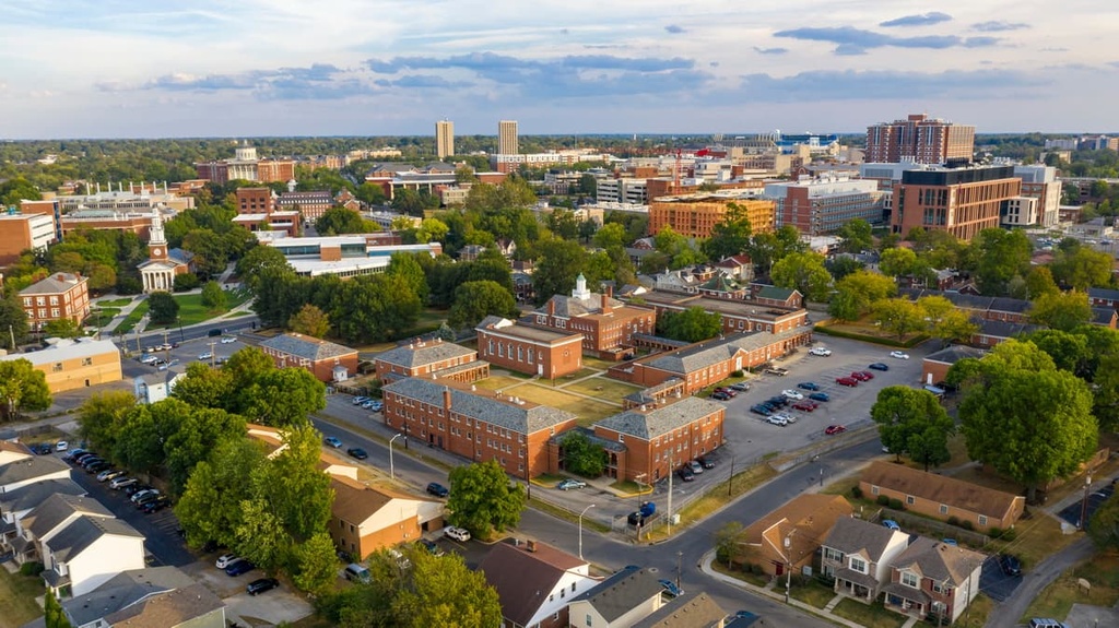
The city of Lexington is home to approximately 330,000 residents, making it the second-largest community in the state. It is known as the “Horse Capital of the World” due to the fact that Churchill Downs, the racetrack that hosts the Kentucky Derby, is located in the city.
Lexington is also the heart of the Bluegrass region of Kentucky and it’s one of the state’s major cultural hubs. The city is also home to the University of Kentucky and the university’s home basketball court, Rupp Arena.
If you’re traveling from further afield, Lexington is a great first stop in Kentucky. It has its own regional airport (Blue Grass Airport) that offers flights to major cities in the eastern US.