Scan the QR code and open PeakVisor on your phone
The Shoal Creek District of the Talladega National Forest is a protected region that’s located in the northeastern region of the US state of Alabama. This portion of the forest covers terrain in the rugged Talladega Mountains. There are 25 named mountains in the forest district with Dugger Mountain being the tallest at 2,133 feet (650 m) and the most prominent with 1,181 feet (360 m) of prominence.
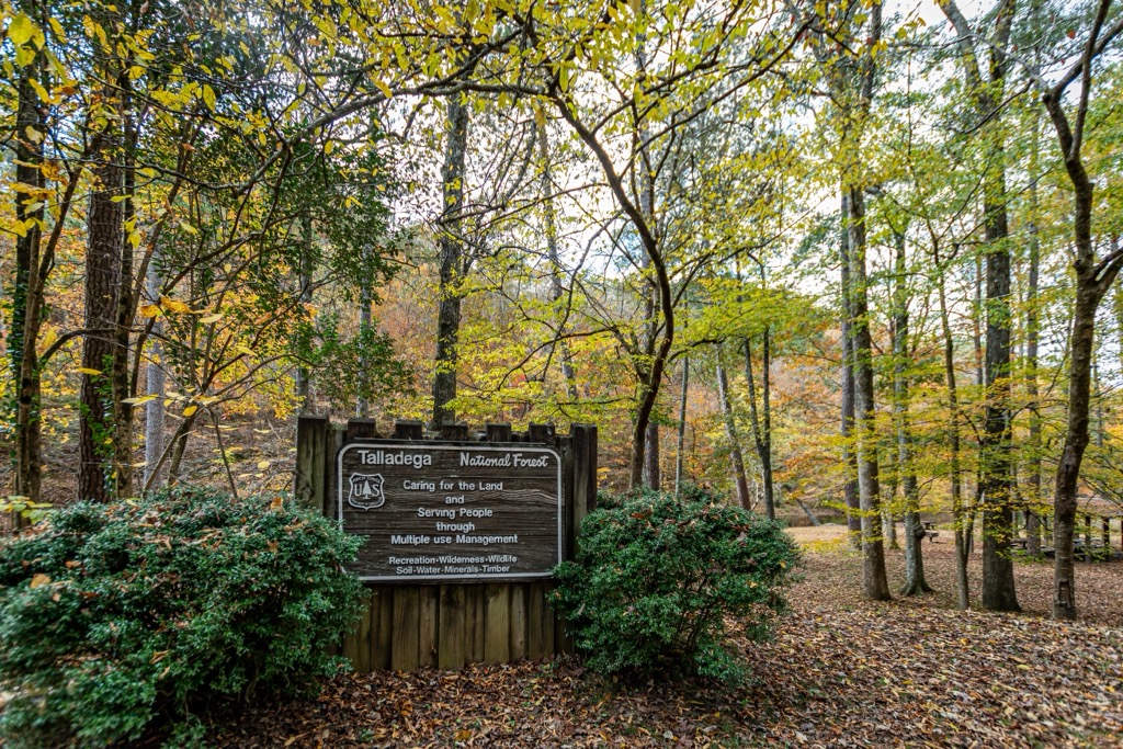
The Shoal Creek District is part of the larger Talladega National Forest which spans across the eastern region of the US state of Alabama. It is one of four national forests in the entire state.
The entire forest spans 392,567 acres (158,866 ha) marking the largest national forest in Alabama. Talladega National Forest is broken into three ranger districts; Shoal Creek, Talladega, and Oakmulgee. The Oakmulgee District lies in the central region of the state.
The Talladega District lies just south of the Shoal Creek District. Together these two districts cover land in Talladega, Clay, Cleburne, Cherokee, and Calhoun counties and share similar terrain. The landscape in the Shoal Creek District is marked by upland hills and low mountains.
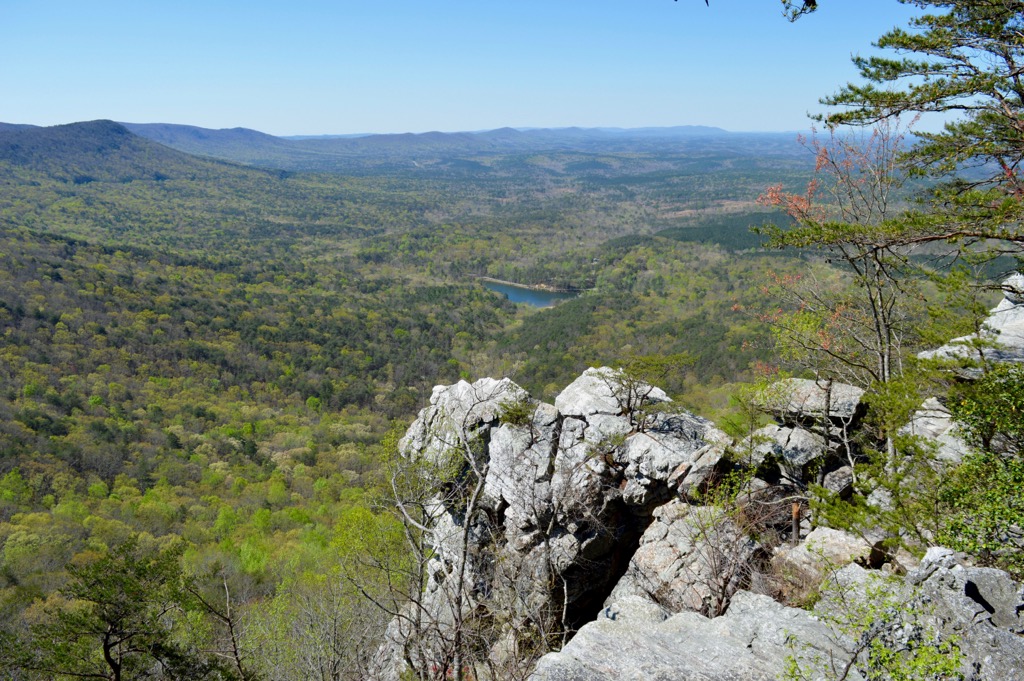
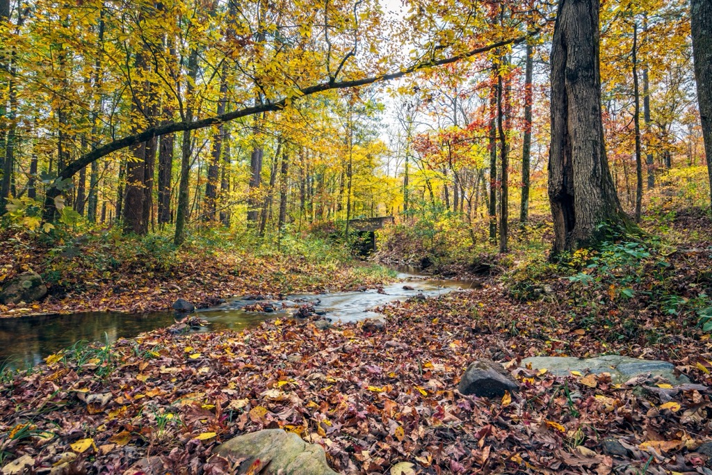
Despite the relatively low peaks, the district features many steep slopes throughout. Terrapin Creek cuts across the northern section of the district while Whitesides Mill Lake is located along the southwestern edge of the Shoal Creek District.
Other nearby bodies of water include the Tallapoosa River and Little Tallapoosa River to the southeast while Choccolocco Creek is situated in the southern stretches of the district. A majority of the district features a forested landscape.
The district covers land in a northeast to southwest direction, with the northern stretches lying near the state’s border with Georgia. Further north of the district lies Weiss Lake situated along the Coosa River.
Additionally, the Shoal Creek District is surrounded by popular outdoor recreation areas. Within the district lies a majority of Choccolocco State Forest and the Dugger Mountain Wilderness. The Mountain Longleaf National Wildlife Refuge is situated directly west. The Talladega District lies directly south with Little River Canyon National Preserve situated to the north.
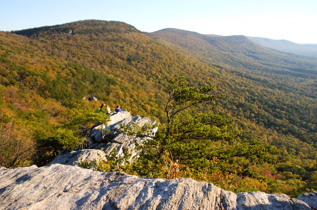
The peaks and ridgelines found in the Shoal Creek District are part of the Talladega Mountains, which are part of the Appalachian Ridges. These ridges are a further subrange of the Appalachian Mountains which span from the US state of Alabama up to the Canadian province of Newfoundland and Labrador.
Terrain in the region is geologically part of the Piedmont Upland region. This expansive area covers land throughout east-central Alabama, characterized by a gentle sloping plateau.
Layers of rocks in the area have been built up over millions of years with the oldest being metamorphic rocks from the Precambrian period. Common rock types in the region include gneisses, slates, schists, marbles, and quartzites.
The Appalachian Mountains mark one of the oldest ranges in the world, having begun forming roughly 480 million years ago. Millions of years of erosion have slowly carved out the landscape, leaving behind the relatively low peaks visible today.
Discovery of gold and ore in the surrounding mountains led to widespread mining during the 19th and 20th centuries. Some of the steeper ridgelines and valleys found in the forest were formed by thrust faulting.
Major peaks within the Shoal Creek District include Dugger Mountain, Oakey Mountain, Augusta Mine Ridge, and Hurricane Mountain.
Ecology is similar throughout the Shoal Creek and Talladega Districts of the national forest. The region marks an important territory for mixed mesophytic forests which includes oak, holly, ash, hackberry, eastern red cedar, and hemlock trees.
The region has been heavily logged over the past few centuries. Much of the forested sections of terrain feature second growth instead of old growth.
A variety of wildlife is able to thrive in Talladega National Forest. Larger mammals in the region include black bears, coyotes, foxes, and white tailed deer. Some common birds are the wild turkey and bobwhite quail. Threatened or endangered animals that inhabit the forest include the gopher tortoise, flattened musk turtle, and red-cocked woodpecker.
The land within and surrounding the Shoal Creek District has a human history dating back thousands of years. Long before the arrival of European colonization, this land was home to many Indigenous peoples, especially the Muscogee (Creek) Nation.
Throughout the 17th and 18th centuries various European countries, including Britain, France, and Spain, claimed ownership of present-day Alabama. Early settlements in the state were predominantly in the southern region of Alabama, providing easy access to the Pacific Ocean.
Populations of settlers steadily began to rise following the American Revolutionary War with Alabama eventually becoming a state in 1819. This increased population led to numerous disputes between the Indigenous peoples and the US government.
Despite their continual resistance, the Indigenous peoples were repeatedly harassed, attacked, displaced, and murdered as they fought to protect their native homelands. In 1830, the Indian Removal Act resulted in the forced systematic removal of the Tribes in the region, relocating them to present-day Oklahoma. An estimated quarter of the Indigenous people who made this journey died en route, in what would later be known as the Trail of Tears.
During the 19th century, the forested sections of present-day Alabama were heavily logged and mined. These widespread practices threatened the ecosystems throughout the region. The Weeks Act was passed in 1911, allowing the US Forest Service to purchase land encompassing important headwaters throughout the country.
In 1935, the US Forest Service purchased a 422,000 acre (170,000 ha) plot of land that was named the Talladega Purchase Unit. The Civilian Conservation Corps dedicated the following years to restoring the forested landscape while building roads and trails throughout the region.
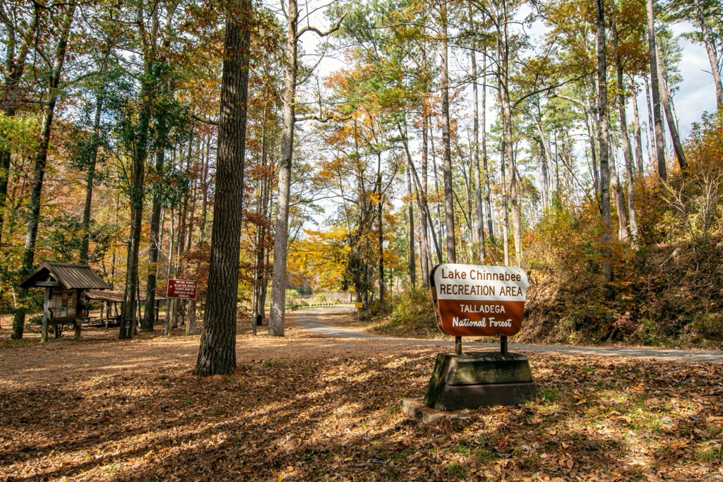
Talladega National Forest was officially designated in 1936 by President Franklin Roosevelt. The Talladega Unit was split into the Shoal Creek and Talladega Districts in 1945. Today, the forest district is a popular spot for hiking, hunting, and camping.
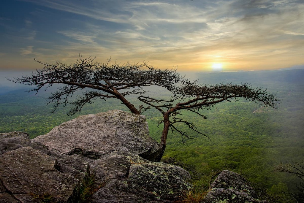
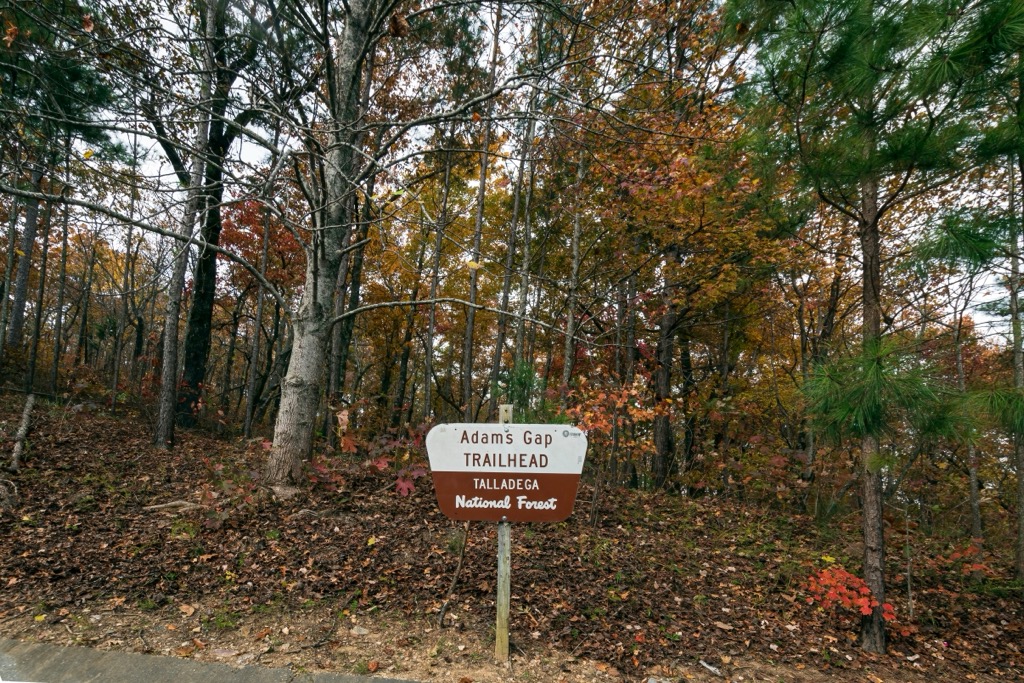
There are numerous hiking trails throughout the Shoal Creek District. Here are some of the best hikes to check out during your next trip to the region:
The Pinhoti Trail is a National Recreation Trail that extends through the Talladega Forest and into the state of Georgia before connecting with the Appalachian Trail.
This section of the Pinhoti Trail lies in the southern section of the Shoal Creek District. The route features numerous small climbs and descents along with creek crossings and small waterfalls. The out and back trail is 6 miles (9.7 km) long and features 810 feet (247 m) of elevation gain.
Dugger Mountain marks the tallest and most prominent peak in this portion of the Talladega National Forest. Situated in the Dugger Mountain Wilderness this trail climbs gradually up to the summit of the peak.
The trail winds through the forested landscape, featuring a creek crossing and views of an old plane wreck. Hikers should note this area is known for its high presence of ticks. The out and back trail is 5.1 miles (8.2 km) long and features 1,272 feet (388 m) of elevation gain.
Coleman Lake is a small lake located near the center of the Shoal Creek District. This loop route follows along the shores of the quaint lake. Hikers also have opportunities for fishing and camping at the lake. The loop is 1.8 miles (2.9 km) long and features 65 feet (20 m) of elevation gain.
Looking for a place to stay near the Shoal Creek District? Here are some of the best cities and villages to check out in the region.
Birmingham, Alabama, lies an hour's drive west of the national forest. With a metro population of over one million, Birmingham marks the most populous region in the state and acts as a hub for the surrounding region. The city is known for its fresh local cuisine, including its barbeque and outdoor markets.
Those visiting the region can explore the Birmingham Botanical Gardens, Birmingham Museum of Art, and the Birmingham Civil Rights Institute. Every year Birmingham hosts festivals such as the Southern Heritage Festival and the Taste of 4th Avenue Jazz Festival.

Numerous foot paths and parks can be found throughout the city. The downtown streets are lined with restaurants showcasing local cuisine, breweries, and cocktail lounges making Birmingham a popular destination for foodies.
Atlanta lies just over an hour's drive east of the Shoal Creek District. Home to a metro population of over six million, Atlanta marks the most populous city and the capital city of the state. Atlanta serves as an economic and cultural hub for the southern US.
The city’s rich history can be seen throughout its numerous historical and cultural sites. Some places worth visiting include the Martin Luther King, Jr. National Historical Park, High Museum of Art, Centennial Olympic Park, Piedmont Park, and the Atlanta Botanical Garden. A plethora of local restaurants showcase a variety of southern cuisine.