Scan the QR code and open PeakVisor on your phone
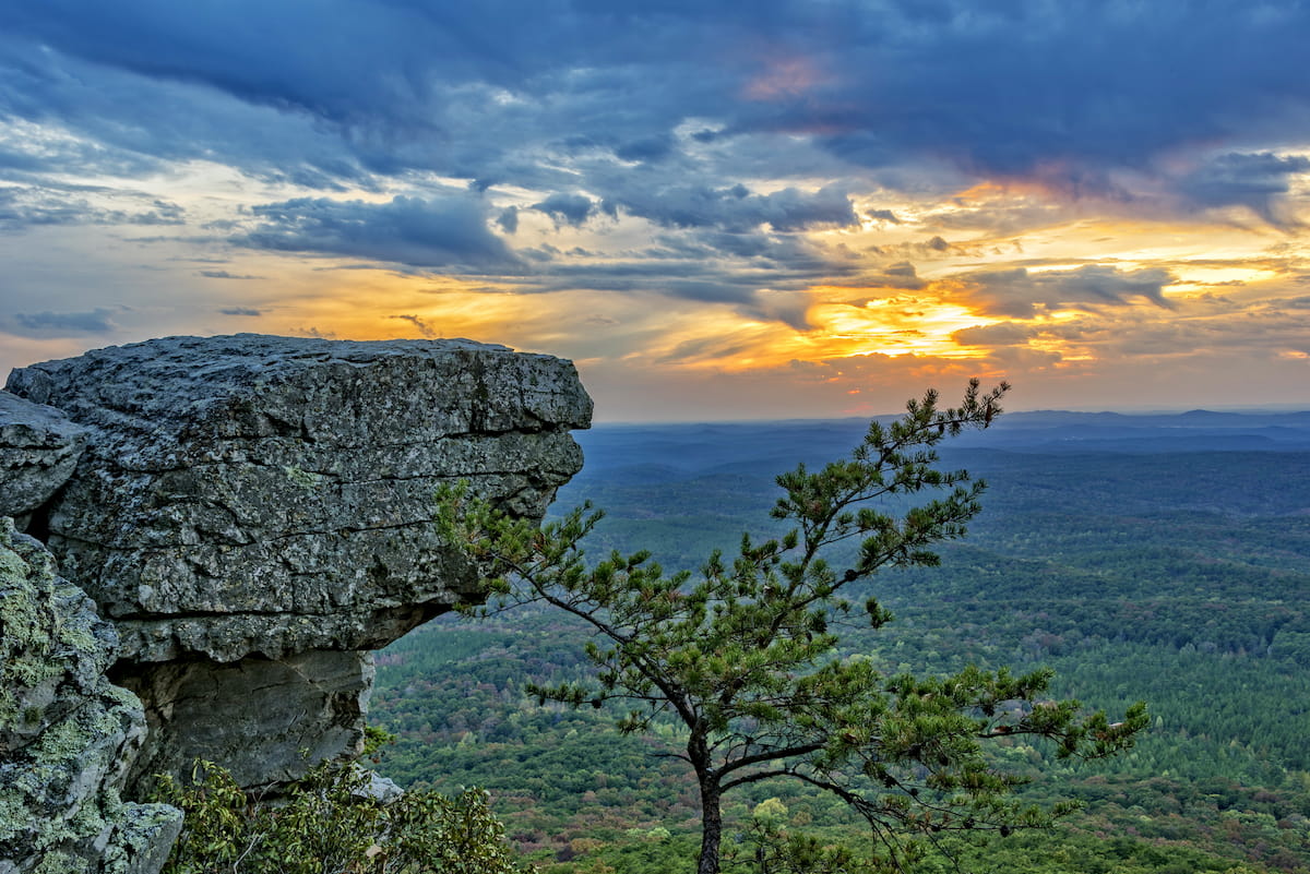
Featuring picturesque vistas and ecologically rich woodlands, the Talladega National Forest (Talladega Division) is a hiker’s paradise in the east-central part of the US state of Alabama. The Talladega Division of Talladega National Forest is home to 28 named mountains, the highest and most prominent of which is Cheaha Mountain (2,405ft/733m), the Alabama’s state high point.
Talladega National Forest is situated in the east-central part of the US state of Alabama, just to the southeast of the city of Birmingham.
At nearly 400,000 acres (161,000 ha) in size, Talladega National Forest is by far the largest national forest in the state (the others are Tuskegee, Conecuh, and William B. Bankhead). However, all 4 of these national forests are administratively managed together as part of the “National Forests in Alabama”
Within Talladega National Forest there are 3 ranger districts, Talladega and Shoal Creek - which are located to the southeast of Birmingham in Talladega, Clay, Cleburne, Cherokee, and Calhoun counties - and the Oakmulgee District which is situated further to the west in Perry, Dallas, Chilton, Tuscaloosa, and Hale counties.
It’s also worth noting that the Talladega National Forest (Talladega Division) completely surrounds Cheaha State Park, which, as the name suggests, is situated around Cheaha Mountain. The state park is a bit of an enclave within the National Forest and it is situated just to the north of the forest’s Cheaha Wilderness.
The forest itself is fairly isolated from other public lands in the state of Alabama. Although the Oakmulgee District of the Talladega National Forest is situated to the southwest of the Talladega District, the only nearby parks include Oak Mountain State Park and Mountain Longleaf National Wildlife Refuge to the west and Wind Creek State Park to the south.
Meanwhile, Georgia’s Chattahoochee Bend State Park is located to the east, and both Lake Guntersville State Park and Little River Canyon National Preserve are to the north. Moreover, William B. Bankhead National Forest is situated to the northwest of the Talladega National Forest, though it’s quite a distance away.
As far as mountains go, the peaks in Talladega National Forest are part of the Appalachian Ridges subsystem of the Appalachian Mountains. This is more or less the case throughout most of east-central part of Alabama, though you can also find the Cumberland Plateau to the west, the Piedmont-Southeast Coast to the south, and the rest of the Appalachian Ridges to the north and east.
The mountains in the Talladega National Forest are part of the Appalachian Mountains system, which stretches from Alabama all the way up to the province of Newfoundland and Labrador in Canada. Within the Appalachian Mountains, these peaks are also part of a region known as the Appalachian Ridges, which covers an area between Alabama and New York.
From a geological perspective, the mountains within Talladega National Forest’s Talladega Division’s Clay and Cleburne counties are mostly part of a physiographic region known as the Piedmont Upland. This region includes much of east-central Alabama and it is characterized by a large, gently sloping plateau.
Here, there are many layers of rock that have built up over the years. The oldest of these rocks are highly metamorphosed and they date back to the Precambrian. In fact, you can usually find schists, quartzites, marbles, gneisses, and slates throughout this region.
During the 19th and 20th centuries, this part of Alabama was heavily mined, due to its sizable concentration of natural resources. It once had a decent number of gold veins, too, though these have long since been mined.
Additionally, some parts of the forest, particularly in Talladega and Calhoun counties, are actually part of the Valley and Ridge physiographic region. This region is mostly characterized by sedimentary rock that dates back to the Paleozoic, making it younger than the Piedmont Upland.
In this part of the forest, you can find quite a few ridges and steep valleys, which have been thrust faulted and eroded over the years. Like the Piedmont Upland, the Valley and Ridge area was also heavily mined, but for iron ore rather than gold.
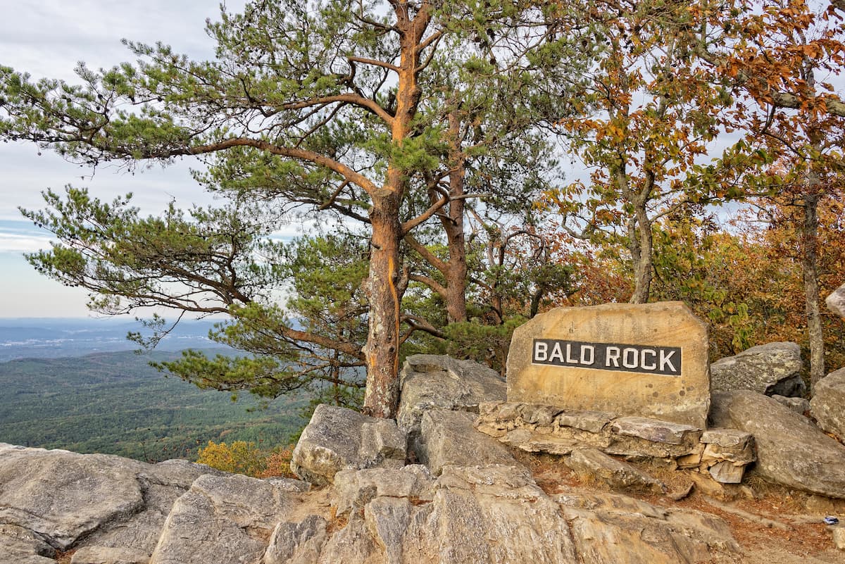
Major peaks include Cheaha Mountain, Hernandez Peak, Odum Point, Horn Mountain, and Burgess Point.
Aptly named, Talladega National Forest is heavily forested and it is a major refuge for the region’s Appalachian mixed mesophytic forests. This forest is mostly home to pines, though you can also find stands of populous, oak, ash, eastern red cedar, holly, hackberry, and hemlock.
That being said, the region that is now part of the Talladega National Forest was heavily logged in years past, so much of the forest is second growth rather than old growth.
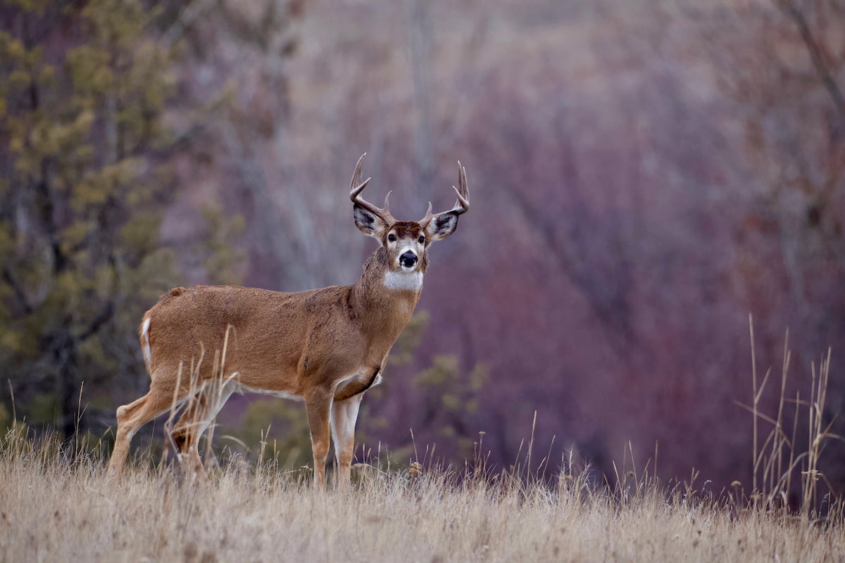
Nevertheless, the forest is home to a great mix of wildlife species, including black bears, white-tailed deer, coyotes, turkeys, raccoons, foxes, and even bobwhite quail. Some of the endangered or threatened animals in the forest also include red-cocked woodpecker, flattened musk turtle, and gopher tortoises.
The land within what is now called the Talladega National Forest has a long and storied history of human inhabitation. It is considered the ancestral homelands of many Indigenous peoples, most notably the Muscogee (Creek) Nation.
Although various European countries, such as Britain, France, and Spain, all claimed what is now Alabama as their own during the 17th and 18th centuries, much of the European settlement in the region was concentrated in the southern part of the state near what is now the city of Mobile.
After the American Revolutionary war, Americans of European descent started to establish much larger settlements in the northern and central parts of the region and Alabama eventually achieved statehood in 1819. Not long after, the 1830 Indian Removal Act instigated the forced and systematic removal of Indenous peoples from their land throughout the state and within the boundaries of what is now Talladega National Forest.
Throughout the 19th century, the region in and around the Talladega National Forest was logged and mined heavily, leading to widespread degradation of the land. By 1911, the passage of the Weeks Act made it possible for the newly formed US Forest Service to purchase land that would help protect the headwaters of important rivers in the US.
As a result of this legislation, and after the Clarke-McNary Act of 1924, which made it easier for the US Forest Service to purchase land from private citizens, the US Forest Service was able to purchase a 422,000 acre (170,000 ha) plot of land in Alabama called the Talladega Purchase Unit in 1935.
Due to the timing of this purchase in the mid-1930s, the Civilian Conservation Corps was called in to help reforest the region, which was nearly 3/4ths clear-cut at the time of its acquisition. They also helped to build many miles of roads, bridges, and basic amenities in the forest.
Just one year later, in 1936, President Franklin Roosevelt officially created Talladega National Forest. The Civilian Conservation Corps continued their efforts throughout the forest, helping to create campgrounds, picnic shelters, fire towers, and even a large man-made lake for recreation in the region until the CCC program was discontinued in the early 1940s.
In 1945, the Talladega Unit was split up into 2 districts - Shoal Creek and Talladega. Combined with the Oakmulgee Ranger District, which was established in 1935, these 3 districts form the Talladega National Forest, which has remained relatively unchanged boundary-wise over the last 8+ decades.
These days, the Talladega National Forest is a major destination for outdoor recreation in the state of Alabama. It is a popular retreat for hikers, campers, hunters, and anglers, alike, who flock to the forest for some refuge from city life.

The Talladega National Forest (Talladega Division) is a great place to hike and enjoy the outdoors. Here are some of the most popular trails to check out in the region:
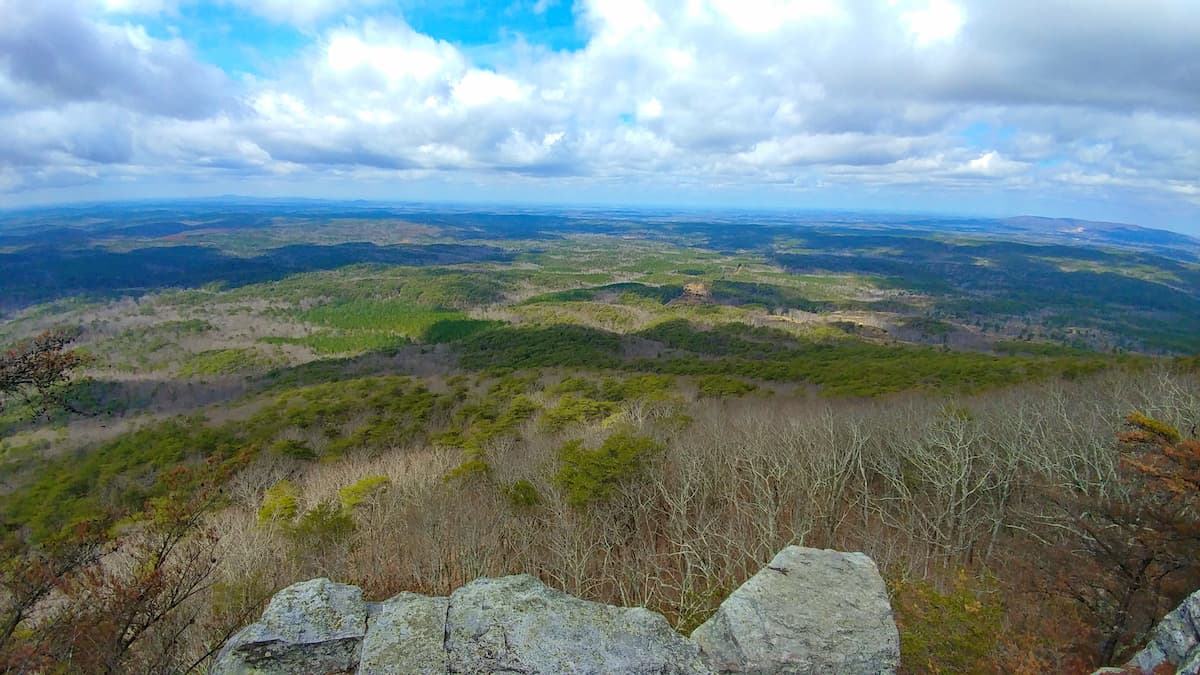
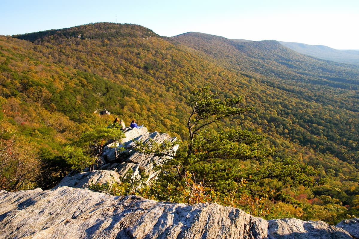
The Pinhoti Trail System is a collection of different hiking paths that includes more than 100 miles (160km) of walking opportunities. It offers excellent views of the region’s mountains, as well as a chance to enjoy the beauty of Talladega’s pine and hardwood forests.

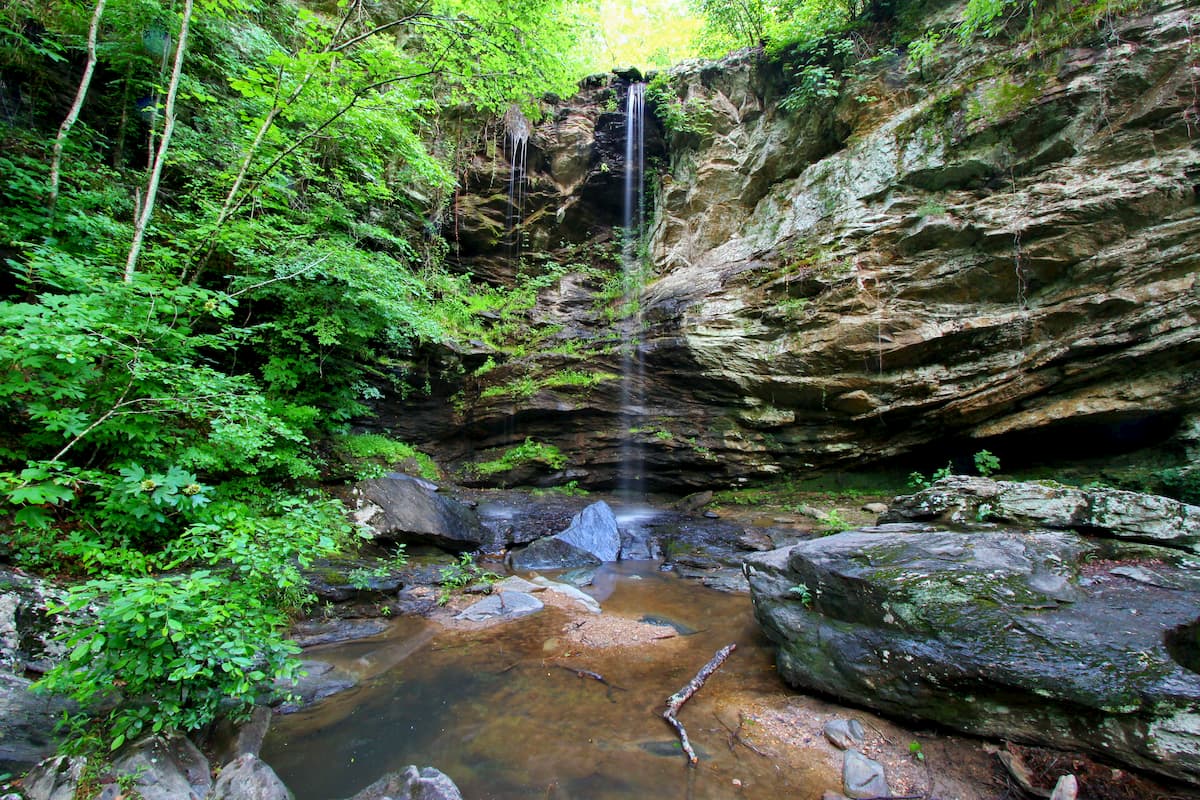
One of the most popular long day hikes in Talladega National Forest, the Skyway Loop Trail is about 17.2 miles (27.7km) long and it provides opportunities to check out some of the most beautiful vistas in the region, as well as some stunning waterfalls.
As a loop trail, you can hike this path in either direction, though many hikers find that completing the trek in a clockwise direction makes the ending more exciting.
Featuring fantastic waterfalls, large lakes, and babbling streams, the Chinnabee Silent Trail is a popular 6 mile (9.7km) hike in Talladega National Forest. Due to the trail’s relatively mild elevation gain, it is a fun family hike in the Cheaha Wilderness, particularly on a hot summer’s day.

Here are some of the best places to stay before or after your trip to the Talladega National Forest:
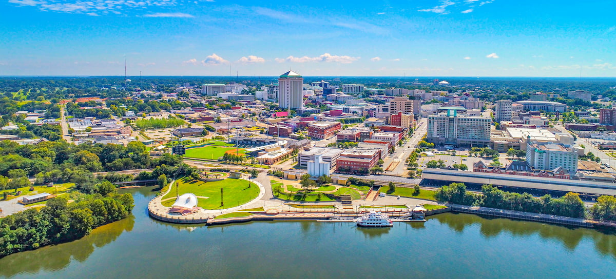
Located to the northwest of the Talladega Division of the Talladega National Forest, the city of Birmingham is a bustling metropolitan area that’s well worth a visit. The city is home to around 1.2 million residents and it is the largest city in Alabama. It is also the location of Alabama’s busiest airport, Birmingham-Shuttlesworth International.

The city of Montgomery is situated due south of Talladega National Forest’s Talladega Division. Montgomery has about 200,000 residents and it is famous for its role in the Civil Rights Movement. Both Alabama State and Auburn have campuses in the city, so it’s also a major destination for fans of American football.