
Scan the QR code and open PeakVisor on your phone
Located at the foothills of the Appalachian Mountains, the Piedmont is a physiographic province that stretches for roughly 1,000 miles (1,609 km) from the US state of Alabama to the southern part of the state of New York. There are 1777 named mountains in the Piedmont physiographic province, the highest and most prominent of which is Moores Knob.
The Piedmont physiographic province is located along the eastern edge of the United States. It is situated between the Appalachian Mountains to the north and the Atlantic Coastal Plain to the south.
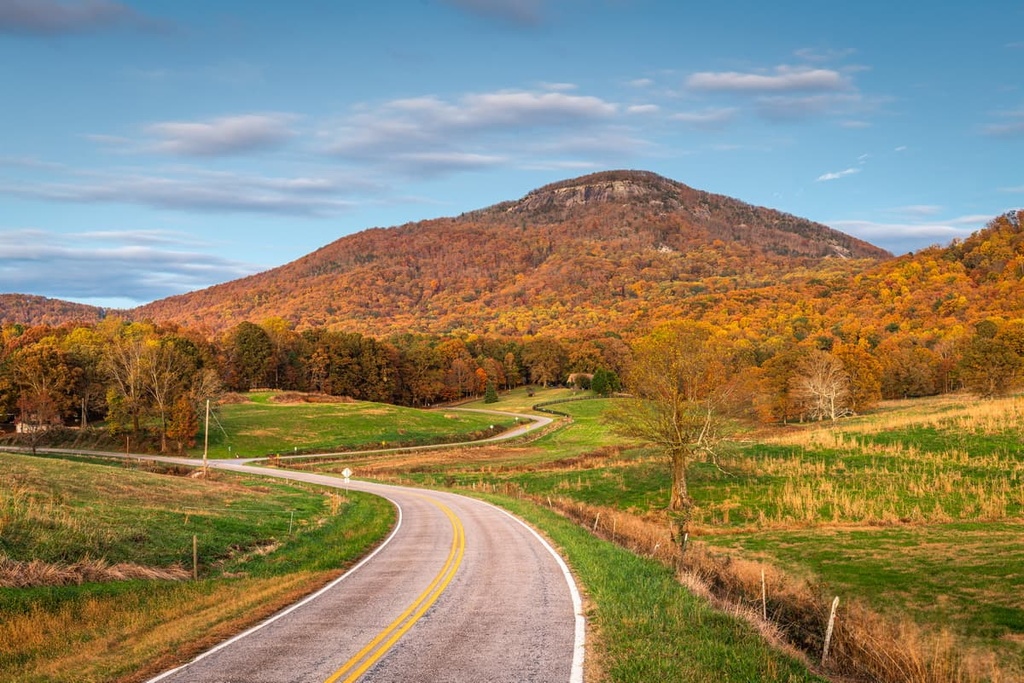
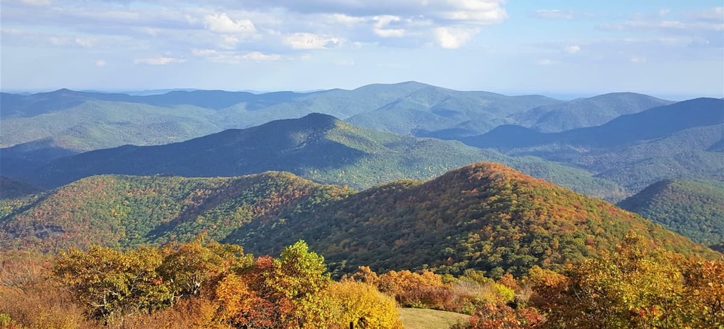
Rolling hills with broad ridges and isolated rock formations are typical of the Piedmont province. Elevations within the Piedmont region range anywhere from 500 to 1,500 feet (152 m to 457 m). Its width varies from about 16 miles (26 km) at the New York border to over 30 miles (48 km) at the Delaware River.
Several landforms are particularly notable in the Piedmont region. In North Carolina, the Uwharrie Mountains, which form the backbone of Uwharrie National Forest, are the remnants of an ancient coastal mountain range that is believed to have once risen to over 20,000 feet (6,096 m) in elevation. Today, after millions of years of erosion, the range barely reaches an elevation of 1,000 feet (305 m) above the Piedmont lowlands.

The South Mountains, the highest and most rugged mountain chain in the Piedmont region of North Carolina, are also the remnants of an ancient and eroded mountain range. The range’s highest point, Icy Knob, rises to an impressive 3,000 feet (914 m) above sea level.
In Georgia, large, isolated, rock outcrops, known as monadnocks, represent the cores of 300 to 350-million-year-old eroded mountain chains. Prominent monadnocks like Pine Mountain, Arabia Mountain, Panola Mountain, and Stone Mountain serve as excellent representations of exposed bedrock in the Piedmont region.
The Blue Ridge Mountains border the western Piedmont from northern Georgia to southern Pennsylvania. Some of the Appalachian Mountains’ most imposing summits and subranges lie in the Blue Ridge region, including the Great Smoky Mountains and the Black Mountains.
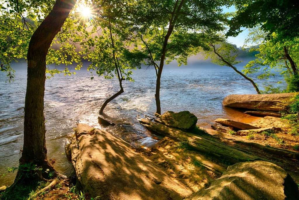
The eastern boundary of the Piedmont region is shaped by the 900-mile (1,450 km) long Atlantic Seaboard fall line. Here, the flat and relatively sandy Atlantic Coastal Plains region gives way to the rugged bedrock of the Piedmont province. A series of turbulent rapids and waterfalls lie at the boundary between these two physiographic regions.
The geologic history of the Piedmont province is highly complex. That said, geologists generally agree that the region was shaped by several major mountain-building events.
The ‘basement’ of the Piedmont province formed during the Grenville orogeny, a mountain-building event associated with the creation of the supercontinent Rodinia.
As far as specific rock types go, 1-billion-year-old gneisses from the Grenville orogeny have been identified in the Piedmont regions of Georgia and Alabama. Younger metamorphosed rocks formed in the region during the Taconic, Neo-Acadian, and Alleghanian orogenies.
The last major event to impact the Piedmont province was the break-up of Pangea. When Pangea split up, large basins formed from the rifting and were subsequently filled by sediments shed from the surrounding higher ground. The 20,000-foot-high (6,096 m) mountains that once occupied the region eroded away over the next 250 million years, thereby exposing the bedrock found in the Piedmont region to this day.
The bedrock of the Piedmont province includes a variety of Proterozoic to Paleozoic igneous and metamorphic rocks that form the deep core of the ancient Appalachian Mountain belt. In this region, the underlying rocks are primarily Paleozoic gneisses and granites.
A few particularly hard rocks in the region have resisted the forces of erosion over the course of millions of years and now exist as monadnocks throughout the Piedmont. The best-known of these monadnocks are Stone Mountain, a 750-foot (229 m) dome of slightly metamorphosed intrusive igneous rock, and Pine Mountain, a linear monadnock of quartzite that stretches for nearly 60 miles (97 km) across western Georgia.
Located between the Blue Ridge Escarpment and Atlantic Coastal Plain, the Piedmont province acts as a key link between diverse ecoregions. As a result, the Piedmont sustains a wide variety of endemic species and communities. Natural vegetation in this region has, however, been heavily modified and impacted by agriculture and other human activity.
The Piedmont ecoregion, as defined by the US Environmental Protection Agency (EPA) and Commission for Environmental Cooperation (CEC), is dominated by deciduous and evergreen forests and native grasslands. Longleaf pine woodlands occur throughout the Piedmont province. Some excellent examples of Longleaf pine woodlands can be found in the Uwharrie Mountains and on Burks Mountain.
Monadnocks that rise abruptly from the surrounding plain, particularly in the Upper Piedmont region, support a distinctive ecosystem. Here, the growth of lichen and minor erosion has resulted in the creation of vernal pools and solution pits. These monadnock ecosystems rely heavily on these pools and pits for sustenance.
Plants and animals living in the Monadnock ecosystem include diamorpha flowers, the federally threatened pool sprite, and the endangered black-spored quillwort. Frogs and salamanders are also known to make use of vernal pools in the region, while trees often thrive in larger solution pits.
The Piedmont province has been inhabited for thousands of years. Long before the arrival of European settlers, many Indigenous peoples called the vast Piedmont province home. Some of the major Tribes that have ancestral ties to the region include the Catawba, Monacan, Manahoac, Occaneechi, Saponi, Chowanoc, Waxhaw, and Tuscarora, among countless others.
The first push for European settlement of the Piedmont came from English colonists living along the eastern seaboard of what is now the US. However, when European settlers first arrived in North America from the Atlantic, they encountered impassable rapids and waterfalls where the Atlantic Coastal Plain met the rugged Piedmont province.
This natural barrier, known as the Atlantic Seaboard Fall Line, prevented early European settlers from sailing any further to the west and initially discouraged migration into the Piedmont from the Coastal Plain.
Throughout the eighteenth and nineteenth centuries, however, canals, like the Chesapeake and Ohio Canal, were dug to bypass falls and rapids. Locks were also constructed to lift boats up over the fall line and into the Piedmont.
The head of navigation, or the point where a river becomes too rocky or shallow for ocean-going ships to sail, became an important terminus for commerce in the region. Major communities formed along the fall line due to the easy river transportation to seaports that these locations afforded.
Communities in the region also took advantage of the availability of waterpower from the fall line to operate mills and factories. Today, some of the most populous cities in the Piedmont province lie along the fall line.
Historically, the Piedmont region has also been valued for its mineral resources. Between 1840 and 1934, gold was extracted from the Brevard Fault Zone and the northern Piedmont region of Alabama. The first substantial gold strike in the US also occurred in North Carolina’s Uwharrie Mountains during the nineteenth century.
Granite has been commercially quarried from sites throughout the Piedmont, including Stone Mountain, Pine Mountain, and Arabia Mountain in Georgia, for decades. Graves Mountain was also a significant location for mineral collection in the region as it had deposits of lazulite, gem-quality rutile, and kyanite.
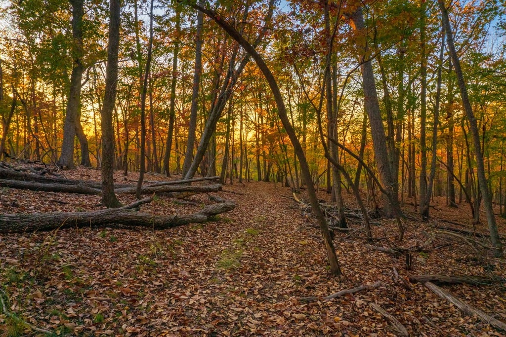
There are thousands of miles of hiking trails and hundreds of lakes and waterways scattered across the Piedmont province, making it a premier destination for outdoor recreation. As the region is also rich in human history, the Piedmont also contains a huge variety of historical sites and parks for visitors to enjoy.
Here are some of the best places in the Piedmont Region to check out during your next visit to the area.
At just over 11,000 acres (4,452 ha) in size, Tuskegee National Forest is one of the smallest national forests in the country. Despite its modest size, however, Tuskegee offers a wide range of outdoor recreation opportunities for visitors, including camping, hiking, fishing, and mountain biking.
One of the best trails in the region is the Bartram National Recreation Trail, which runs for about 8 miles (13 km) through the heart of the forest. It provides an opportunity for visitors to immerse themselves in the natural beauty of the area.
Established in 1978, the Chattahoochee River National Recreation Area preserves a series of historical sites along a 48-mile (77 km) stretch of the Chattahoochee River in Georgia. The park is rich in natural and human history.
For centuries, the Chattahoochee River has been used for food and transportation. In more recent years, it has also been used to sustain the mills, factories, and homes built along its banks. Today, visitors to the park can float down the river, hike on nearby trails, or fly fish in the region’s cold waters.
Located at the bend of the Chattahoochee River, Chattahoochee Bend State Park is a haven for paddlers, hikers, campers, and anglers alike. Protecting 2,910 acres (1,178 ha) of wilderness and 5 miles (8 km) of river frontage, Chattahoochee Bend is one of Georgia’s largest and most beloved state parks.
Popular attractions and trails in the park include the Riverside Trail, Turkey Hill Trail, and Brown Thrasher Trail. Friends of Chattahoochee Bend State Park also regularly offers guided kayaking excursions on the Chattahoochee River.
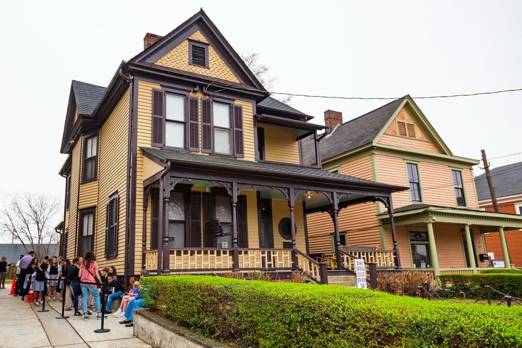
The Martin Luther King, Jr. National Historical Park covers about 35 acres (14 ha) of land in Georgia and protects several historic sites related to the life and work of Dr. Martin Luther King, Jr.
The park contains Dr. King’s boyhood home, the original Ebenezer Baptist Church where Dr. King was baptized and where he was pastor, as well as the Martin Luther King, Jr. Center for Nonviolent Social Change.
There is no fee to enter the park, which is located in various areas of Atlanta, though you may need to sign up for a ranger-led tour to visit some of the park’s historic sites.
Together, the Chattahoochee and Oconee National Forests protect 867,000 acres (350,862 ha) of Georgian wilderness that’s organized into four ranger districts: Chattooga, Conasauga, Oconee, and Blue Ridge. Located about 60 miles (97 km) to the southeast of Atlanta, the Oconee District contains many hiking trails, campsites, and recreation areas for visitors to enjoy.
There are two major human-made lakes on the Oconee River, making this a popular destination for water-based recreation. Popular hiking areas and attractions in the national forest include the Lake Sinclair Recreation Area, Miller Creek Lake Recreation Area, Ocmulgee Bluff Horse Bike and Hike trail system, and the Scull Shoals Historic Site.
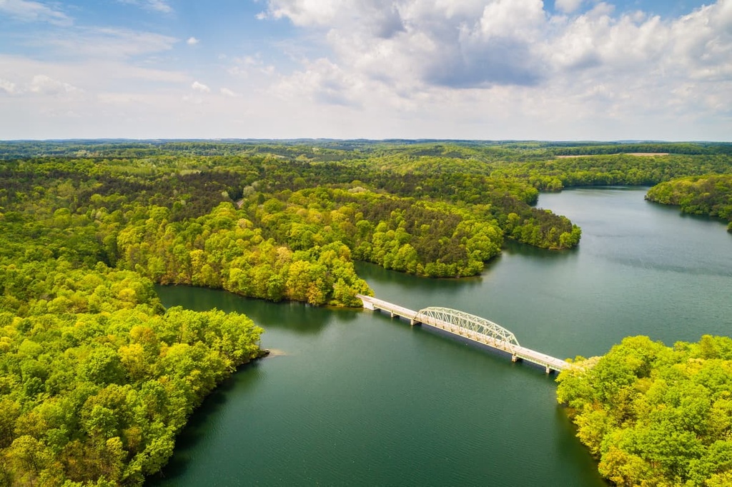
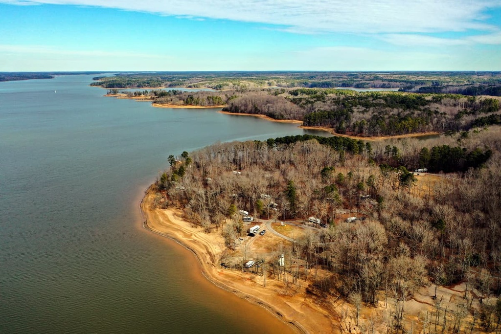
The Kerr Lake State Recreation Area is a collective of seven access points scattered around the shoreline of Lake Kerr, a 50,000-acre (20,234 ha) reservoir that stretches into nearby Virginia. Kerr Lake is a popular destination for camping, fishing, swimming, boating, and hiking.
There are five boat ramps in the Kerr Lake State Recreation Area that offer visitors 24-hour access to the reservoir. Popular hiking trails in the park include the Kerr Lake Track Trail, Ole Still Trail, and Big Popular Trail.
Located in the Uwharrie Mountains, Morrow Mountain State Park encompasses roughly 5,881 acres (2,380 ha) of terrain in Stanly County, North Carolina. The park not only protects the tallest peak in the Uwharrie Mountains, Morrow Mountain, but also contains the Yadkin-Pee Dee River, one of central North Carolina’s largest river systems.
One of the most popular attractions in Morrow Mountain State Park is a scenic overlook at the summit of Morrow Mountain. The park also contains many hiking trails, campgrounds, and picnic areas, as well a variety of water-based recreation options on Lake Tillery.
Medoc Mountain State Park is a 3,893-acre (1,575 ha) park located in Halifax County, North Carolina. The park’s namesake summit, Medoc Mountain is the remnants of a once-lofty mountain range that has been eroded over the course of millions of years.
Anglers and paddlers frequent Medoc Mountain State Park’s Fishing Creek, which is one of the cleanest streams in the region. Meanwhile, hikers often explore the park’s 10 miles (16 km) of maintained trails.
The Uwharrie National Forest covers roughly about 52,000 acres (21,044 ha) of land in central North Carolina, making it the smallest of the state’s four national forests. The forest contains one officially designated wilderness area, the 5,025-acre (2,024 ha) Birkhead Mountains Wilderness, and more than 1,700 miles (2,740 km) of trails.
Horseback riding, mountain biking, camping, and water-based recreation are all popular activities in the area. Popular trails and attractions in the national forest include the Dutchman’s Creek Trail, the Uwharrie National Recreation Trail, and Badin Lake.
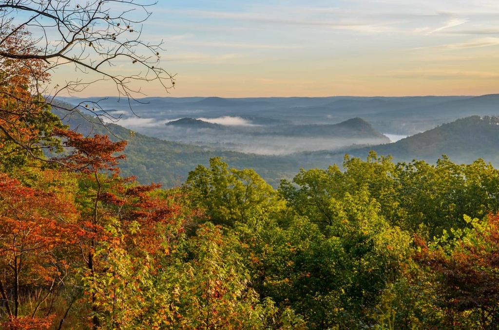
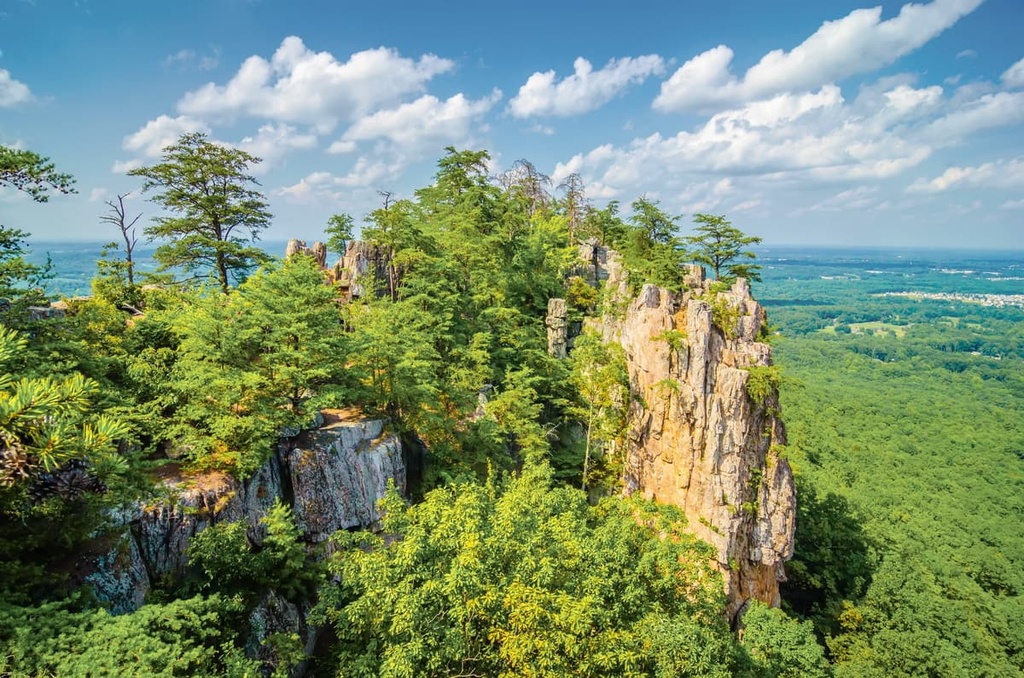
South Mountains State Park covers roughly 20,949 acres (8,478 ha) of some of North Carolina’s most rugged terrain. The South Mountains themselves reach an impressive 3,000 feet (914 m) in elevation above the surrounding terrain.
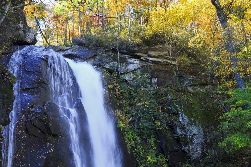
Hikers, mountain bikers, and equestrians in the park can utilize its more than 40 miles (64 km) of trails to soak in the region’s expansive views. Popular trails and attractions in the South Mountains include High Shoals Falls, the Chestnut Knob Loop, the Shinny Creek Trail, and the hike to Hidden Cove.
There are many major metropolitan areas and hundreds of small communities located in the Piedmont province. Here are some great places to stay during your next trip to the Piedmont region of the eastern US.
With over 490,000 people living within the city limits, Atlanta is Georgia’s most populous city and the heartbeat of the broader Atlanta metropolitan area. The city’s location at the foothills of the Appalachian Mountains and its broad range of amenities and accommodations makes it an excellent destination for exploring some of Georgia’s most prized natural and historic treasures.
Some of the many parks, monuments, and natural attractions located around Atlanta include the Martin Luther King, Jr. National Historic Park, Chattahoochee River National Recreation Area, Stone Mountain Park, Sweetwater Creek State Park, and Kennesaw Mountain National Battlefield Park, among many others.

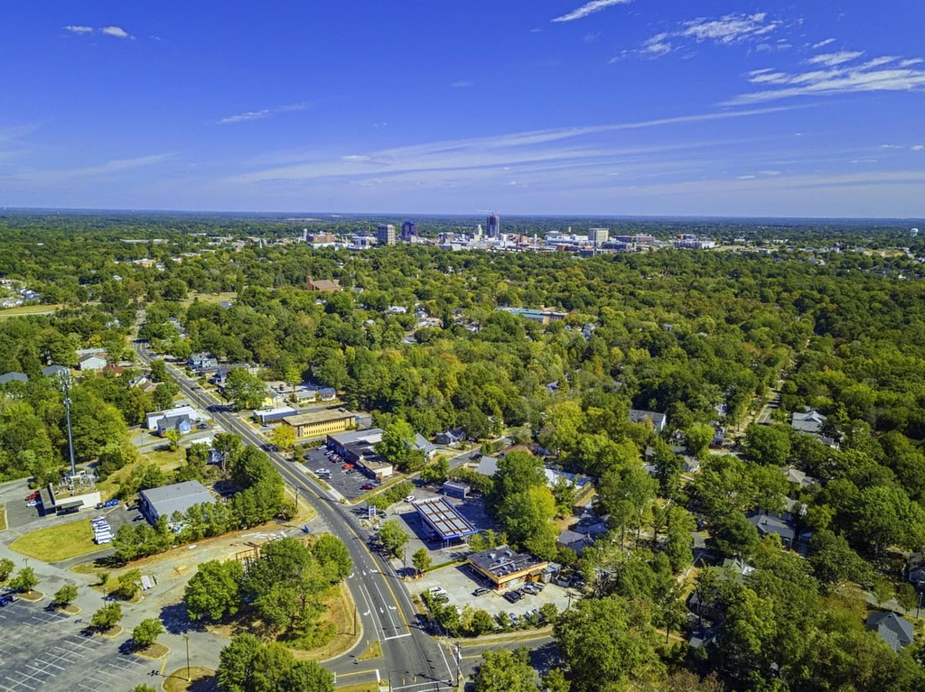
Charlotte is the most populous city in North Carolina, and it serves as the cultural, economic, and transportation center of the Charlotte Metropolitan area. Known as ‘The Queen City,'' Charlotte is home to many acres of stunning urban forests and greenways, as well as a wide range of urban amenities.
Additionally, the US National Whitewater Center is located just to the west of the main urban area of Charlotte near the Catawba River. It is one of the most popular outdoor recreation destinations in the area and it gives visitors a chance to paddle or raft on one of the world’s largest human-made whitewater rivers.

Home to roughly 300,000 residents, Greensboro is one of the largest cities in North Carolina’s Piedmont Triad metropolitan region. The city’s location between the Blue Ridge Mountains and the Great Smoky Mountains makes it an excellent destination for outdoor recreation.
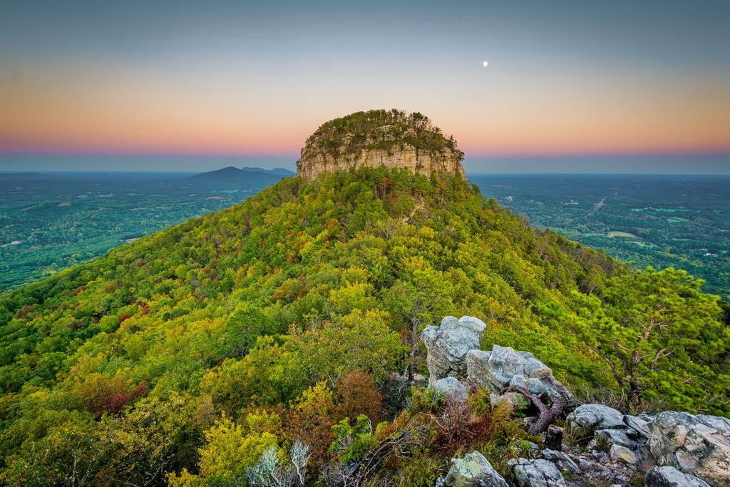
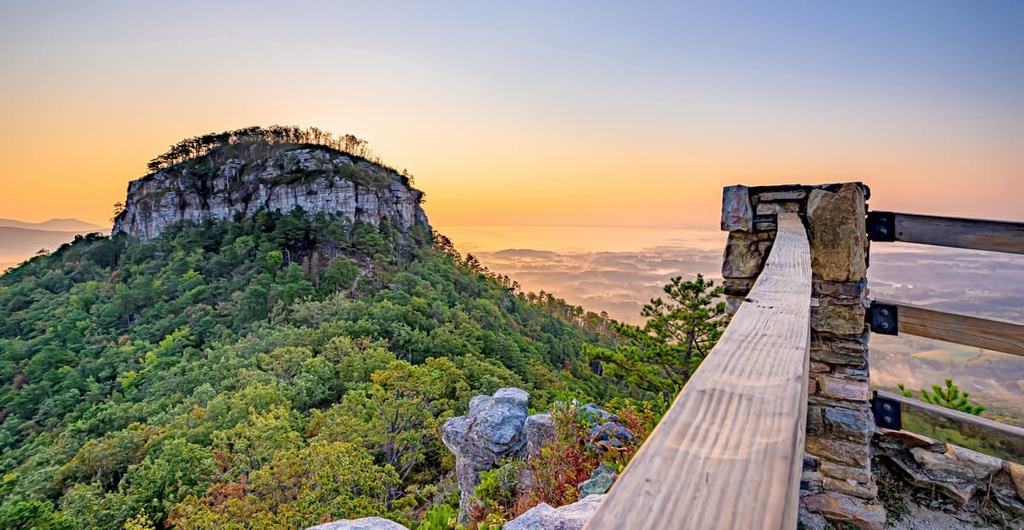
Some of the many parks and natural attractions located around Greensboro include the Birkhead Mountains Wilderness, Hanging Rock State Park, Mayo River State Park, Watershed Lakes, and Pilot Mountain.

Richmond, the capital of Virginia, is located at the heart of the broader Richmond Metropolitan Area, which is home to over 1.2 million residents. As it is situated at the fall line of the James River, Richmond is packed with natural beauty.
In fact, visitors to the city can whitewater raft class III and IV rapids directly through downtown. Richmond also hosts a wide range of cultural and historic attractions, including the Virginia Museum of Fine Arts, the Edgar Allen Poe Museum, and the American Civil War Museum at Historic Tredegar.

Baltimore is the most populous city in Maryland, and it is located in the north-central part of the state along the Patapsco River and the Chesapeake Bay. The city has a long and storied past as an important seaport community due to its strategic location and proximity to Washington, DC.
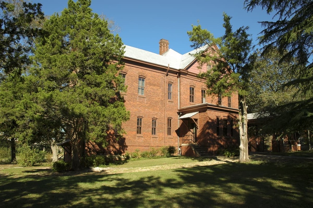
Baltimore is divided into “lower city” and “upper city” by the Atlantic Seaboard fall line. The city of Baltimore contains more than 65,000 properties that are designated as historic buildings and listed on the National Register of Historic Places, which is more than any other US city.

Additionally, the city boasts over 4,900 acres (1,983 ha) of parkland and is home to the Fort McHenry National Monument and Historic Shrine, a star-shaped fort known for its role in the War of 1812. Baltimore also boasts an excellent collection of restaurants, shops, and museums, and it is easy to get to via road, rail, or air.


