Scan the QR code and open PeakVisor on your phone
Hanging Rock State Park is an outdoor recreation destination located in the northwestern region of the US state of North Carolina. The park lies within the isolated Sauratown Mountains, encompassing 11 named peaks. The tallest and most prominent peak is Moores Knob at 2,572 feet (784 m) tall with 1,440 feet (439 m) of prominence.
Hanging Rock State Park lies in the northeastern region of the US state of North Carolina, near the state’s border with Virginia. The park spans 9,011 acres (3,647 ha) across Stokes County within the Sauratown Mountain Range.
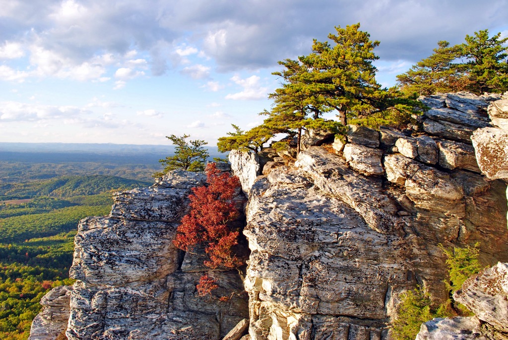
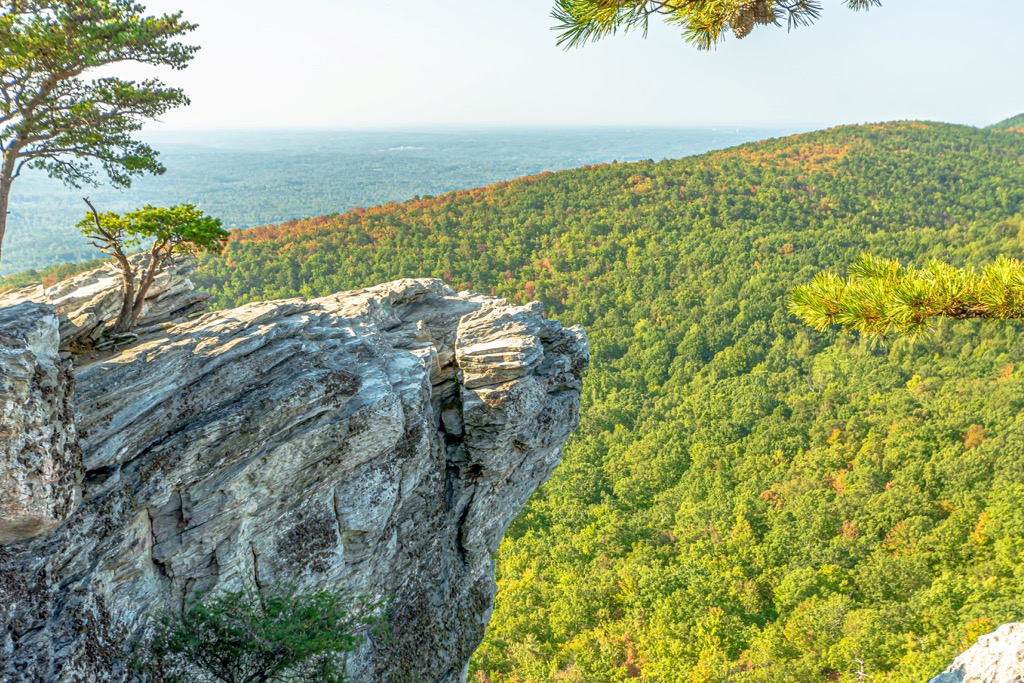
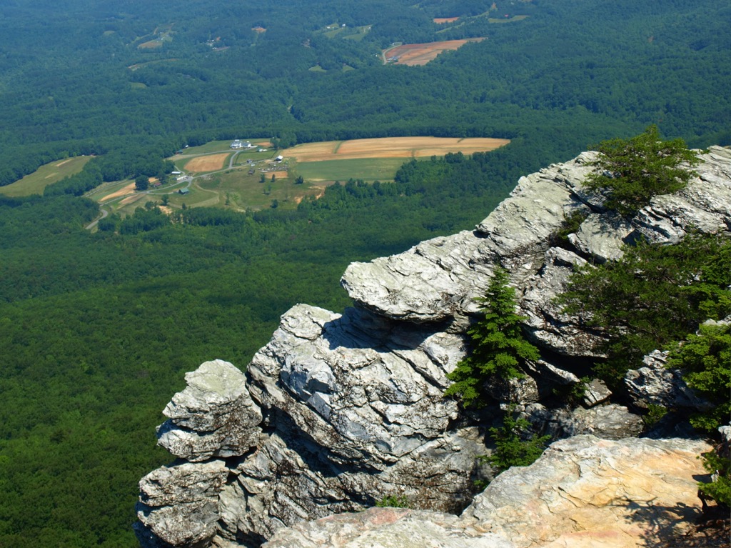
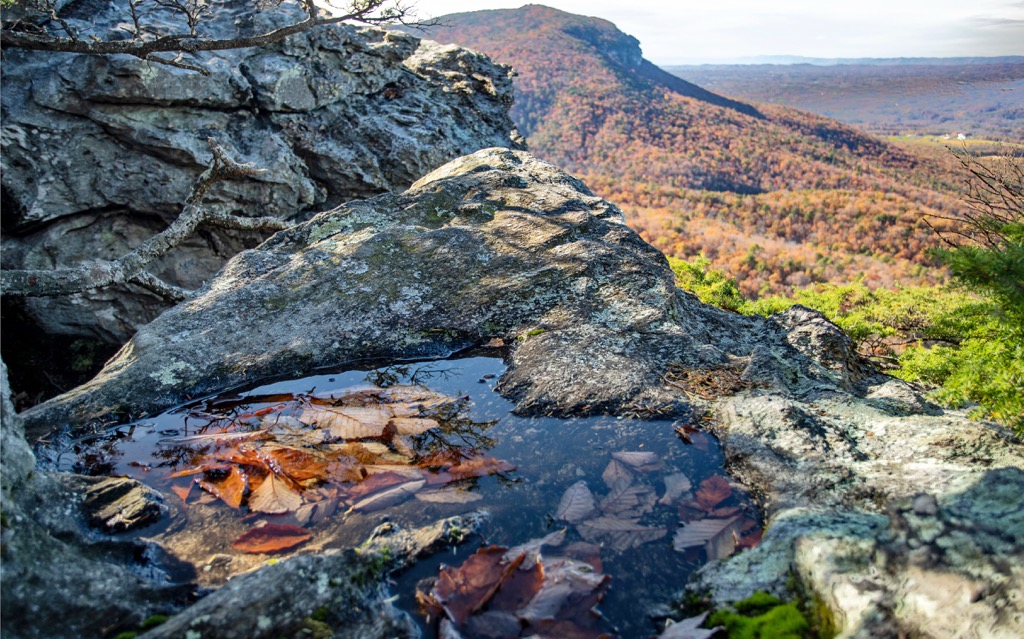
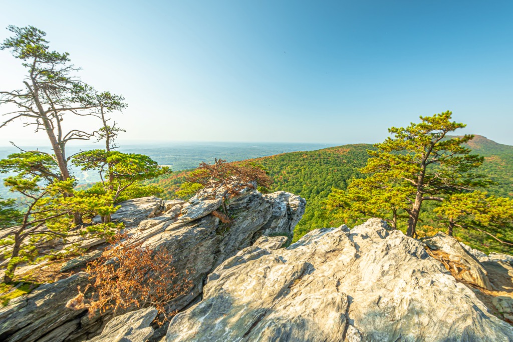
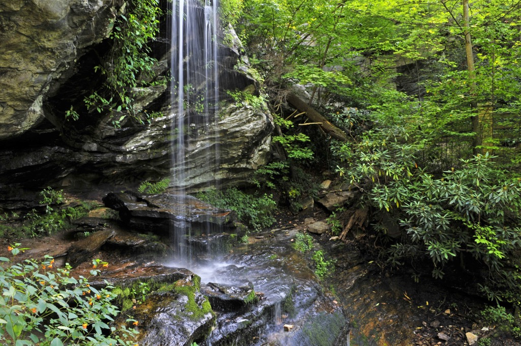
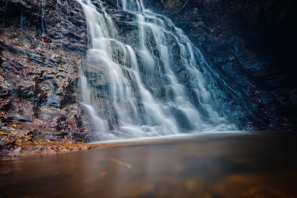
Amidst the rolling hillsides of the region lie sheer climbs and rugged peaks. Waterfalls and quaint forested sections are met with various viewpoints of the surrounding Piedmont plateau which stretches into the distance.
The Dan River lies in the northern stretches of the state park, along with Big Creek. A small lake is located near the center of Hanging Rock State Park, offering opportunities for both swimming and fishing.
Rock outcroppings and a mountain cave can be found amidst the mountainous landscape. Many of the highest named peaks are free of tree coverage, providing hikers with sweeping views of the surrounding landscape, which is relatively flat compared to terrain within the park.
Various small creeks and streams run through the park, flowing into the Dan River in the north and the Yadkin River which is located to the southwest.
Additionally, Hanging Rock State Park is located near numerous other regions for outdoor recreation. Pilot Mountain State Park is situated to the southwest while Mayo River State Park lies to the northeast. Belews Lake Park and Cascades Preserve are located to the southeast.
The peaks within Hanging Rock State Park are part of the Sauratown Mountains, which are often referred to as “the mountains away from the mountains”. This isolated mountain range has a unique geological history.
Around 800 million years ago, the Iapetus Sea was located along the east coast of what was once North America. This region’s close proximity to the sea resulted in layers of sediment and sandstone being deposited.
Roughly 500 million years ago, the continental plates of North America and Africa moved towards one another, closing off the Iapetus Sea. Folding of the Earth’s crust compacted the layers of sandstone. Today, quartzite, schist, and gneiss rocks are all common in the range.
Continual shifting and folding tilted the Sauratown Mountains, thrusting older layers of rock upwards. As the continents of North America and Africa drifted apart from one another, around 220 million years ago, the Atlantic Ocean was formed. During this time erosion and weathering drastically reduced the height of the range.
Sediments of the range are still being eroded today, exposing the harder rocks in the region. The range lies upon a massive fold in the Earth’s crust, which allowed them to form away from other major mountain ranges.
Major peaks within Hanging Rock State Park include Moores Knob, Flat Shoal Mountain, Devils Chimney, and Hanging Rock.
Despite this mountain region being rather isolated, the flora and fauna found in the park is similar to that found in the Blue Ridge Mountains of western North Carolina.
The forested hillsides feature populations of various species of hemlock. During the spring months visitors can enjoy the blooming mountain laurel, azalea and rhododendron. The oak hickory forest is dominated by stands of chestnut oak.
White-tailed deer and wild turkey are common throughout Hanging Rock State Park. Popular bird species include peregrine falcons, ravens, and vultures. Other unique fauna includes the rare Wehrle’s salamander as well as the venomous copperhead and timber rattlesnake.
The land in and surrounding Hanging Rock State Park is part of the ancestral homelands of the Cheraw (also known as Saraw and Saura peoples) and Catawba peoples. These tribes inhabited this region of land for thousands of years before the arrival of European colonizers.
Descendants of these Tribes are part of the Sumter Tribe of Cheraw Indians, Florida Tribe of Cheraw Indians, and the Catawba Indian Nation. The Cheraw people inhabited land throughout the Piedmont region of present-day North Carolina, particularly near the Yadkin River.
The first people of European descent arrived in the region in 1540. The earliest recorded expedition was by the Spaniard Hernando De Soto who traveled throughout the southern United States.
Repeated attacks on the Cheraw (Saraw or Saura) Tribe by the colonizers during the seventeenth and eighteenth centuries, forced the tribe to travel southeast near the Pee Dee River.
The nearby city of Winston-Salem, was first established by people of European descent in 1753.
As populations continued to grow throughout the region, the Indigenous peoples were repeatedly attacked, harassed, displaced, and killed as they fought to protect their ancestral lands.
The Indian Removal Act of 1830 forced the Indigenous people throughout the eastern US to relocate onto reservations, west of the Mississippi River. In what would later be known as the Trail of Tears, thousands of Indigenous people died along this journey.
After the Winston-Salem was connected to the North Carolina Railroad at the end of the nineteenth century, populations began to rapidly rise. During this time numerous tobacco factories were constructed in the region, helping the town be established as an official port of entry for the country. By 1916 the town marked the eighth-largest port of entry in the US.
During this time much of the Sauratown Mountain Range, which is named after the Indigenous peoples of the region, was set to be developed into a mountain resort. In 1936, 3,096 acres (1,253 ha) of land were donated by the Winston-Salem Foundation and the Stokes County Committee for Hanging Rock in order to establish a state park.
The Civilian Conservation Corps (CCC) constructed facilities in the region between 1935 and 1942. The CCC built a man-made lake in the park that marks the starting point for many major hiking trails. Over the following decades the park was expanded to its current size.
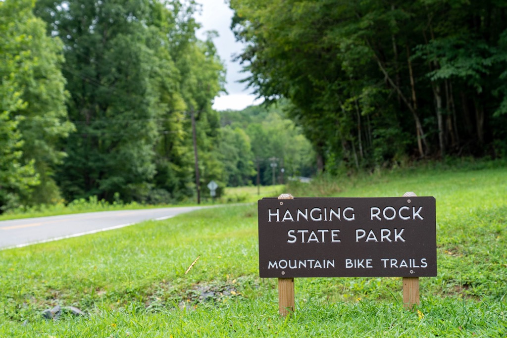
Hanging Rock State Park is home to numerous hiking trails and opportunities for outdoor recreation. Here are a few of the best hikes located within the park that are well worth checking out during your next visit.
True to its name, this trail takes hikers up to the summit of Hanging Rock. The route begins near the shores of Hanging Rock Park Lake and climbs steadily through the forested landscape. Once hikers reach the summit, the forest canopy opens up, revealing sweeping views of the Sauratown Mountains and the Piedmont region which extends to the south. This out and back route is 2.4 miles (3.9 km) in length and features 603 feet (184 m) of elevation gain.
Moores Knob marks the tallest and most prominent peak in the park. The route to the summit begins along the southern shores of Hanging Rock Park Lake before climbing steadily up a forested ridgeline. During the spring the trail features numerous species of blooming shrubs and wildflowers. A lookout tower at the summit provides hikers with panoramic views of the park, including Hanging Rock which is located to the east. This loop route is 4.3 miles (7 km) long and features 954 feet (291 m) of elevation gain.
This shorter out and back route begins in the same parking lot as the Hanging Rock Trail. The trail to the falls gradually descends, following along Indian Creek, before reaching views of the falls. The waterfall cascades down a series of rock steps before descending further to the north. The out and back trail is 1.2 miles (1.9 km) long and features 288 feet (88 m) of total elevation gain.
Looking for a place to stay near Hanging Rock State Park? Here are some of the best cities and villages to check out in the region.
The city of Winston-Salem marks the closest major city to the state park. Situated along the banks of Salem Creek, the city lies within the Piedmont area of North Carolina. Home to 250,000 residents, it marks the fifth most populous city in the state.
Popular sites in the city include the Bethabara Historic District, Old Salem, Kaleideum North, and the New Winston Museum among others. Each year the city hosts the National Black Theatre Festival, RiverRun International Film Festival, and the Reynolda Film Festival. Winston-Salem is known for its thriving arts and music scene.

The city of Greensboro lies east of Winston-Salem. With a population of 300,000 residents, Greensboro marks the third most populous city in North Carolina. North Buffalo Creek runs through the city with numerous major rivers and lakes located nearby.
Greensboro lies midway between the Blue Ridge Mountains of western North Carolina, and the Atlantic beaches along the coast of eastern North Carolina. The downtown streets are home to numerous colleges and universities as well as a thriving arts and music scene. Some of the popular attractions include the International Civil Rights Center and Museum, Greensboro Arboretum, Greensboro Science Center, and the Wet ‘n Wild Emerald Pointe water park.