
Scan the QR code and open PeakVisor on your phone
The Saint Francois Mountains include 133 named peaks. The highest is Taum Sauk Mountain at 540 m. Other notable peaks include Wildcat Mountain, Buford Mountain and Russell Mountain.
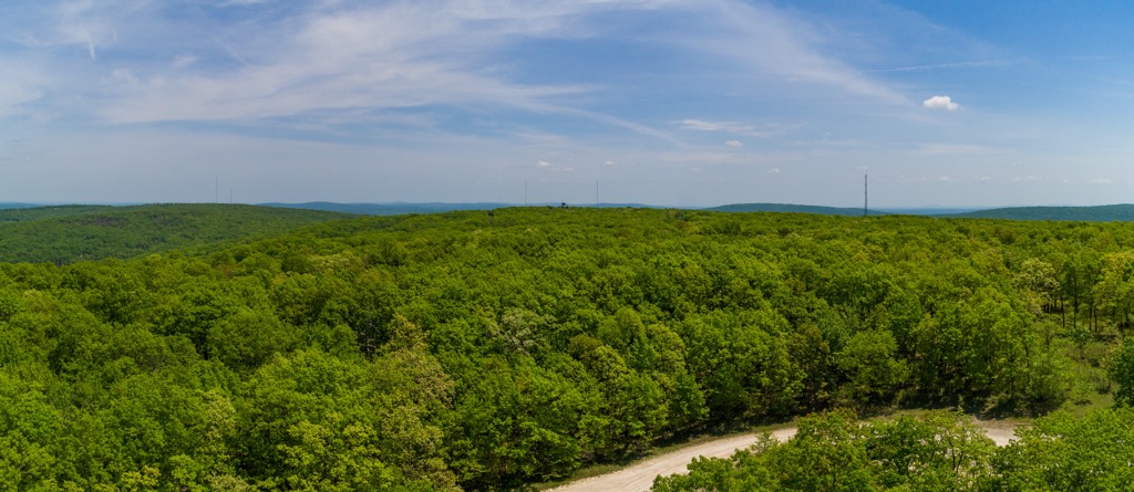
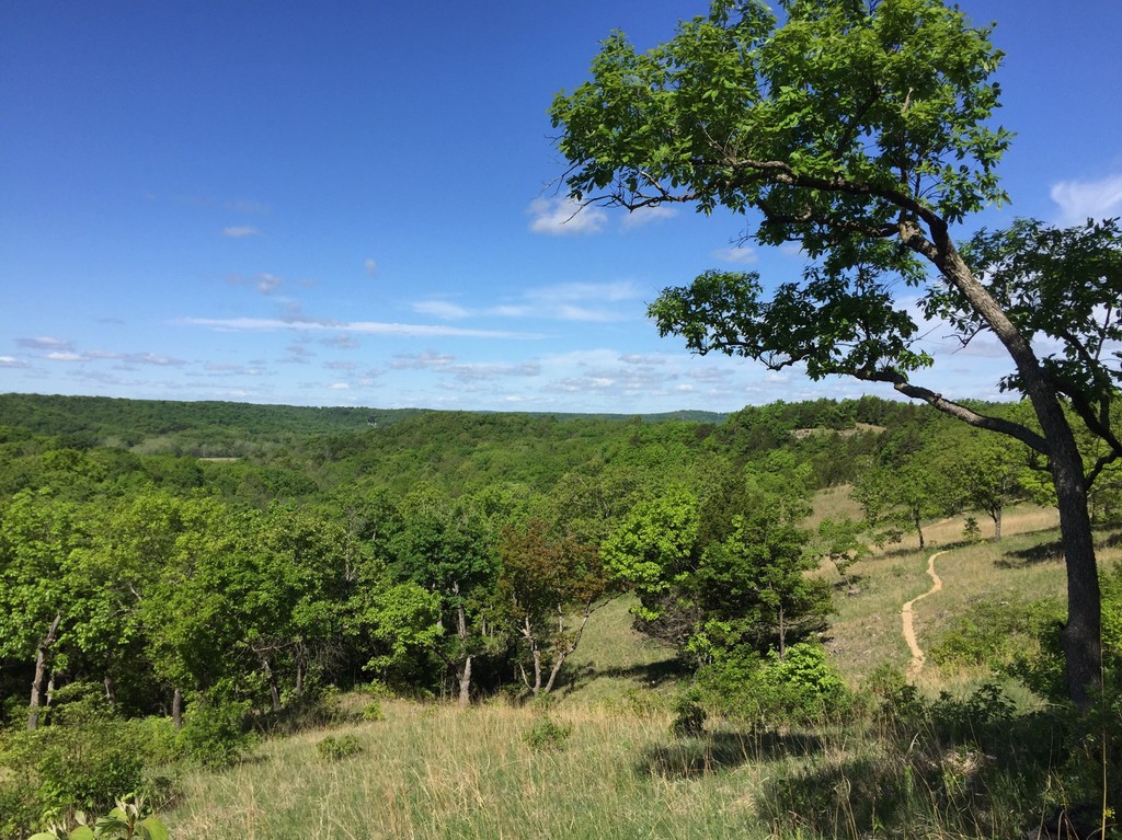
The Saint Francois Mountains are located in southeastern Missouri in the United States. Notable for their unique geologic history and for containing the tallest peak and waterfall in the state, the range attracts hikers, mountain bikers, backpackers, and horseback riders to explore the forested slopes. There are 133 mountains in the range. Taum Sauk Mountain (1,772 ft/540 m) is the highest in both the range and the state. Buford Mountain (1,742 ft/531 m) is the most prominent (643 ft/196 m).
The Saint Francois Mountains span across Madison, Iron, Wayne, Reynolds, St. Francois, and Washington counties in southeastern Missouri. Portions of the range fall within four state parks – Johnson’s Shut-Ins, Taum Sauk Mountain, Sam A. Baker, and Elephant Rocks. The Buford Mountain Conservation Area also overlaps with a section of the range. The area is popular for hiking, backpacking, birding, hunting, fishing, kayaking, canoeing, boating, horseback riding, and mountain biking.
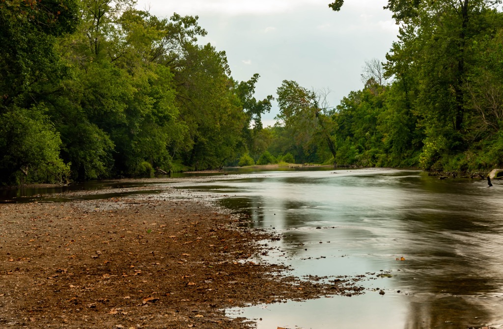
The mountains hold the distinction of having the tallest point in Missouri – Taum Sauk Mountain (1,772 ft/540 m), the state’s tallest waterfall – Mina Sauk Falls, and the state’s deepest valley. The mountains encompass the upper part of the Black River watershed in the heart of the largest contiguous forest in Missouri and the lower midwest. The Black River, St. Francis River, and Castor River are the three main rivers in the area.
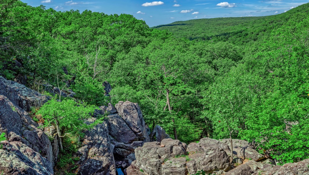
The Saint Francois Mountains have distinct rock formations called shut-ins where streams have carved pools, rapids, and rivulets into the rocks. Two of the best known are Johnson’s Shut-Ins and Castor River Shut-Ins, a beautiful set of pools and rapids carved through pink granite.
The range lies near Mark Twain National Forest and is part of the Ozark Highlands.
The St. Francois Mountains have a unique geologic history compared to other mountains in the region and dating back more than one billion years. Rather than eroding from uplifted land masses, the St. Francois Mountains formed as a result of volcanism. The region was previously a volcanic field surrounded by a shallow sea. Rocks in the mountains are predominantly rhyolite that formed as lava flowed across the earth’s surface. Geologists speculate that these mountains are one of the oldest outcroppings of Precambrian rock in North America.
Mining drew many people to the mountains beginning in the early 1700s and was a major industry for a while. Lead was the first element to be mined, but subsequently iron, baryte, zinc, silver, manganese, cobalt, and nickel ores have all been mined from the range.
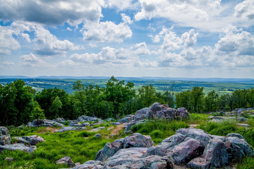
Nearly 400 native plant species have been documented in the range, some of which are threatened in the state. Igneous glades provide ideal conditions for one of the largest and most diverse Mead’s milkweed populations. This habitat is also favored by collared lizards, a species of concern in the state.
The landscape consists of oak-hickory woodlands with both white and black oak, shortleaf pines, bluffs, and rocky glades. Legumes and goldenrods occupy the ground level and the acidic woodland soils support low bush blueberry and farkleberry.
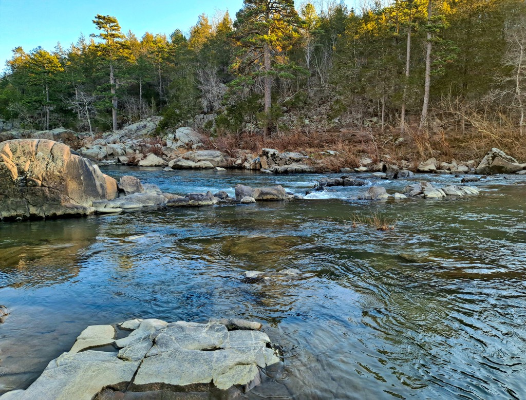
Mesic forest grows along the lower slopes and near Taum Sauk Creek with sugar maples and pawpaws. Taum Sauk Creek itself contains eight native fish species such as the southern redbelly dace and creek chub. Sedges and mosses along the range support four-toed salamanders.
The mountains are part of an Audubon Important Bird Area because many songbirds such as Acadian flycatchers, ovenbirds, and worm-eating warblers depend on the woodlands. The glades support blue-winged and prairie warblers, the wooded valleys give home to Kentucky warblers, and the forest slopes provide shaded habitat for summer and scarlet tanagers, black-and-white warblers, and whip-poor-wills.
Native Americans and their ancestors have occupied the land for at least 12,000 years. The earliest humans hunted big game before megafauna began to die off and hunters shifted their focus to smaller game and foraging.
From 900 to 1700, humans in the region depended on rivers and valleys for hunting, fishing, and cultivating crops in fertile river soil. After 1700, the area became hunting territory for a number of tribes, among them the Kickapoo, Shawnee, Delaware, Piankashaw, and Osage.
The Osage are thought to be the only tribe native to the state. Other tribes originally lived further east but were driven westward by encroaching settlers. In 1808, the Osage signed a treaty that relinquished their claim on the Ozarks Plateau. With the passage of the Indian Removal Act of 1830, the Trail of Tears passed through the region.
Mining was the first major industry of settlers in the region. Agriculture, logging, and milling were also common livelihoods for early settlers.
Part of the Ozark Trail runs through the mountains. The most popular section crosses between Taum Sauk and Proffit Mountain. Spread across the range are campgrounds, group camping areas, and picnic areas.
The Taum Sauk portion of the Ozark Trail is 35 mi (56 km) long. A popular smaller section is 14.5 mi (23.3 km) between Taum Sauk Mountain State Park and Johnson’s Shut-Ins State Park.
The trail begins on Mina Sauk Falls Trail with a steep climb past Missouri’s tallest waterfall. After the falls, the Ozark Trail follows the valley down (while the Mina Sauk Falls trail loops up). About one mile (0.6 km) past the falls is Devil’s Tollgate - an 8 ft (2.4 m) passage through 50 ft (15 m) of volcanic rhyolite that towers 30 ft (9 m) high.
There are several creek crossings to reach Johnson’s Shut-Ins State Park. After this state park, the trail connects with the Scour Trail and Goggins Mountain Equestrian Trail. Green and white OT signs mark the trail. It is best to carry water because there may not be treatable water along the way.
The Mina Sauk Falls Trail is a 2.9 mi (4.7 km) loop and leads to Missouri’s highest point and tallest waterfall. A parking area near the summit of Taum Sauk offers wheel-chair-friendly access to the top.
Beyond the summit, the trail becomes rougher. It roves through oak-hickory woodlands, past rocky glades, and offers stunning views across the surrounding mountains. The trail passes along the top of the 132 ft (40 m) waterfall. After the waterfall, the trail wraps around back to the trailhead.
The Buford Mountain Trail is located within the Buford Mountain Conservation Area. The 10.5 mi (16.9 km) loop is not too strenuous, but does provide excellent views and falls just shy of being Missouri’s highest point. Camping is permitted throughout the conservation area and the mountain top has scenic spots to set up camp. Make the most of the area by exploring the nearby ponds and rock glades.
The Saint Francois Mountains are surrounded by a number of small historic towns including Fredericktown, Marquand, Ironton, and Arcadia. These towns offer all basic amenities, historic sites, and access to the beautiful Ozarks.
Saint Louis, Missouri has a population of 305,000 people and a range of activities for visitors of all ages. Take a 630 ft (192 m) ride up the iconic Gateway Arch or visit Forest Park, home to the 1904 World’s Fair. The 1,300 acres (525 ha) park not only has trails and golf courses, but also houses the Saint Louis Zoo, Saint Louis Art Museum, Missouri History Museum, and the Saint Louis Science Center – all with free entry!

The city is well known for its breweries and one can visit the clydesdales or get a behind-the-scenes tour at the Anheuser-Busch brewery. The city is a foodie destination with a number of innovative chefs creating locally inspired dishes and representing a wide array of cuisines. Lodging options in the city are numerous with hotels ranging from historic to standard brands, cute B&Bs, and rustic campgrounds.
Springfield, Missouri has a population of 170,000 and contains classics such as the Wonder of Wildlife National Museum & Aquarium and the Missouri Sports Hall of Fame. The city is dotted with parks with miles of trails, playgrounds, farms, public gardens, and canoe rentals.

There are many farm-to-table options coming from the fertile surrounding landscape and many other options such as steakhouses, sushi, pizza, and barbecue. You won’t be at a loss of where to stay as the city has elegant hotels, budget motels, and peaceful B&Bs to choose from.
With a population of 150,000, Memphis, Tennessee has a rich history and music scene. Explore Elvis Presley’s Graceland, the Stax Museum of American Soul Music, and the National Civil Rights Museum. Beale Street celebrates its musical roots and is home to the Memphis Rock ‘n’ Soul Museum, the Memphis Music Hall of Fame, and the Blues Hall of Fame.
Hands down the city’s specialty is barbecue and Memphis boasts more than 100 BBQ restaurants. You can also find soul food, fine dining, Southern classics, Italian, Mexican, burgers, vegan and vegetarian restaurants. Choose to stay over at a boutique hotel, charming B&B, rental property, RV park, or campground.


The highest peak in the Saint Francois Mountains is Taum Sauk Mountain, at 540 m.
The Saint Francois Mountains have 133 named peaks.


