
Scan the QR code and open PeakVisor on your phone
There is a total of 1975 named mountains in the Provence-Alpes-Côte d'Azur. The Provence-Alpes-Côte d'Azur region is situated in the south-west of France and contains the Provence-Alps and Prealps and the Dauphine Alps mountain ranges. The area is further divided into the departments of the Hautes-Alpes (north), Vaucluse (central-east), Alpes-de-Haute-Provence (central), Maritime Alps (central-west), Bouches-du-Rhône (south-east) and the Var (south-central).
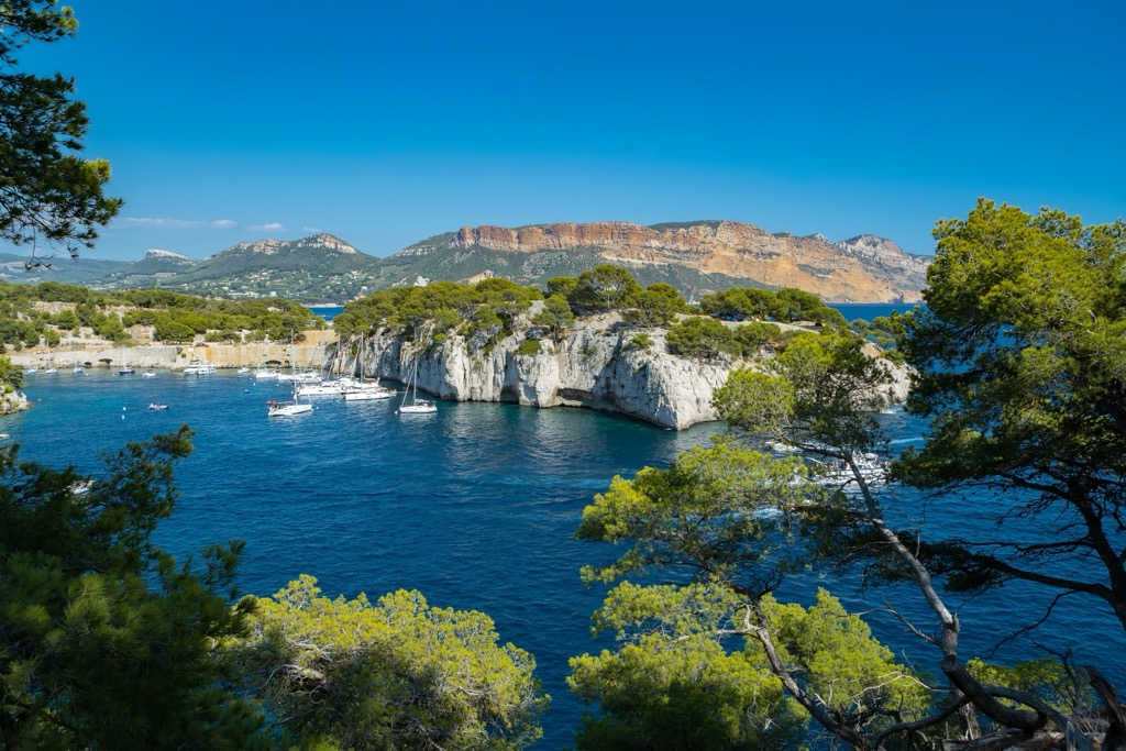
The region is one of the most popular holiday destinations in the south of France. Provence-Alpes-Côte d’Azur includes the French Riviera and is famous for its sunny weather, food, wine and the Mediterranean coastline.
The majority of the mountains are located to the north west in the Hautes-Alpes region but also spread south into the Alpes-de-Haute-Provence.
The highest and the most prominent mountain in the region is the Barre des Écrins at 4,102m altitude. It is the most southerly alpine in Europe that is higher than 4,000m, and it is the only mountain higher than 4,000m in France that is not part of the Mont Blanc Massif. Before the annexation of Savoy in 1860 it was the highest mountain in France.
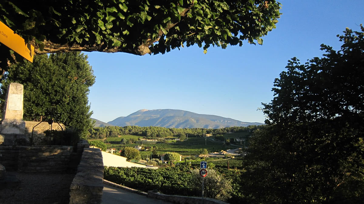
One of most famous of the peaks within the region, despite not being the highest peak, is Mont Ventoux (1909m). Nonetheless the ‘Giant of Provence’ dominates the horizon, at some distance from the closest mountain, and is visible from afar in each direction. The bare limescale surface of the summit has resulted in the mountain being referred to as ‘The Bald Mountain’.
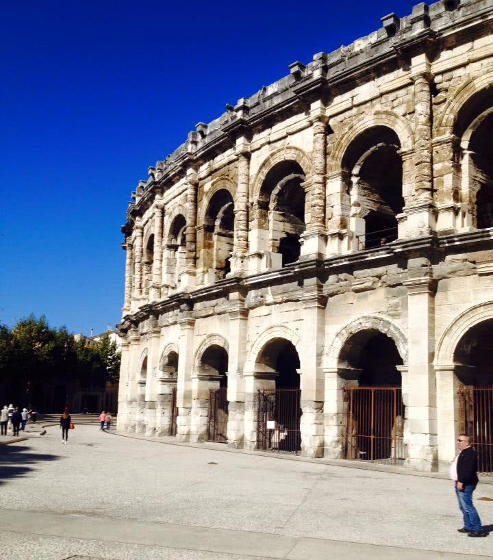
The architecture in the south of France differs slightly from that of the north. There is a greater quantity of monuments from the Roman Empire. Notably Arles (situated in the Bouches-du-Rhône), Orange (Vaucluse) and Marseille (Bouches-du-Rhône) were old Roman settlements. Arles is one of Europe’s best preserved Roman cities - there remains an arena, a museum and a theatre among other buildings. Marseille (Massalia) was founded by the Greeks in 600BC, then became a Roman city in the centuries that followed.
The region is renowned for its hot temperatures and pleasant climate throughout the year and its dry and sunny weather during the summer months. The winter months are on average some of the warmest in France. The region benefits from 2835 sunshine hours per year and is the hottest region in France as a result. The yearly cycle stage race of the Paris-Nice, in March, is as such known as the ‘race to the sun’. As a whole region is very dry due to its Mediterranean climate and this is reflected in its flora.
The majority of images associated with the region are from the summer months. Yet wintertime in Provence can offer some alternative benefits - in the winter, there are fewer tourists and the cost of accommodation is reduced.
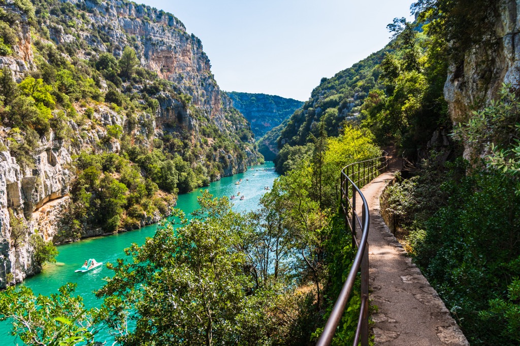
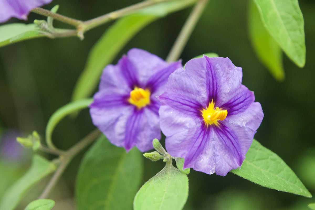
The region offers a wide range of landscapes from the high mountain ranges to the north, to the rolling hills in the south. There are evergreen forests, vineyards, orchards and olive groves throughout. The flora profits from the warm weather - almond, citrus and fig trees flourish.
The region is home to the ‘perfume capital of the world’ - the city of Grasse. The flowers and plants local to Provence produce oils in order to protect themselves from the heat - these oils are highly scented (jasmine, lavender etc) and used in the production of perfumes.
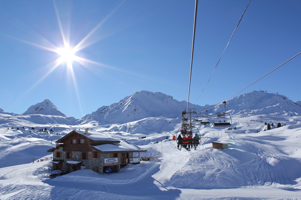
For skiing and snowboarding enthusiasts, there are more than 45 ski resorts in Provence-Alpes-Côte D'Azur. They are located in the northwest of the region on the border with Italy and Switzerland. It is not only one of the main areas for skiing in the French Alps but also in the Italian Alps and the Swiss Alps as well as in the Alps and Europe in general.
The largest ski resort in Provence-Alpes-Côte D'Azur is Serre Chevalier (Briançon, Chantemerle, Villeneuve-la-Salle, and Le Monêtier-les-Bains) with more than 250 km (155 mi) of slopes and more than 55 ski lifts. The region is also famous because of Montgenèvre with more than 50 km (31 mi) of slopes and more than 20 ski lifts, which is one (and only French) of five resorts in the larger Via Lattea Ski Area, which also includes Sestriere, Sauze d’Oulx, San Sicario, and Claviere resorts in Italy. Altogether they offer more than 400 km (249 mi) of slopes and more than 70 ski lifts.
Other major areas for skiing in Provence-Alpes-Côte D'Azur with more than 100 km (62 mi) of slopes and more than 20 ski lifts each include the following 15 in descending order of size:
The main ski resort near Marseille, the capital of the region, is Mont Serein/Mont Ventoux Nord with more than 10 km (6 mi) of slopes and more than 5 ski lifts. The main ski resort near Nice is Valberg/Beuil les Launes with more than 40 km (25 mi) of slopes and more than 20 ski lifts, but the much larger Isola 2000 is just nearby.
Check the Provence-Alpes-Côte D'Azur ski resorts map as well as the larger France ski resorts map in the World Mountain Lifts section of the site. It includes information about open ski lifts / slopes in Provence-Alpes-Côte D'Azur in real-time with opening dates and hours. There are also year-round cable cars, funiculars, cog railways, aerial tramways, and all other types of mountain lifts.
There are a number of major and minor cities in the Provence-Alpes-Côte d'Azur region. Each of the cities have exceptional historical and cultural value - even if the mountains are not as prominent in this area of France as others.
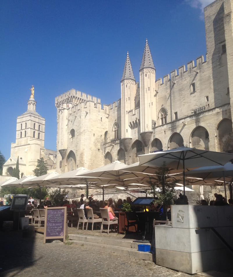
Avignon is a city in the Vaucluse departement on the left bank of the Rhône river. Both the historic centre of Avignon and the medieval bridge, the Pont Saint-Bénézet, are classified UNESCO world heritage sites. The famous bridge was once the only crossing of the Rhône river. It was built in 1177, was 920 metres long and formed of 22 arches. With frequent flooding the arches often collapsed and were rebuilt until the 17th century when it was deemed too costly to repair. There are 4 arches of the bridge which remain on the eastern bank.
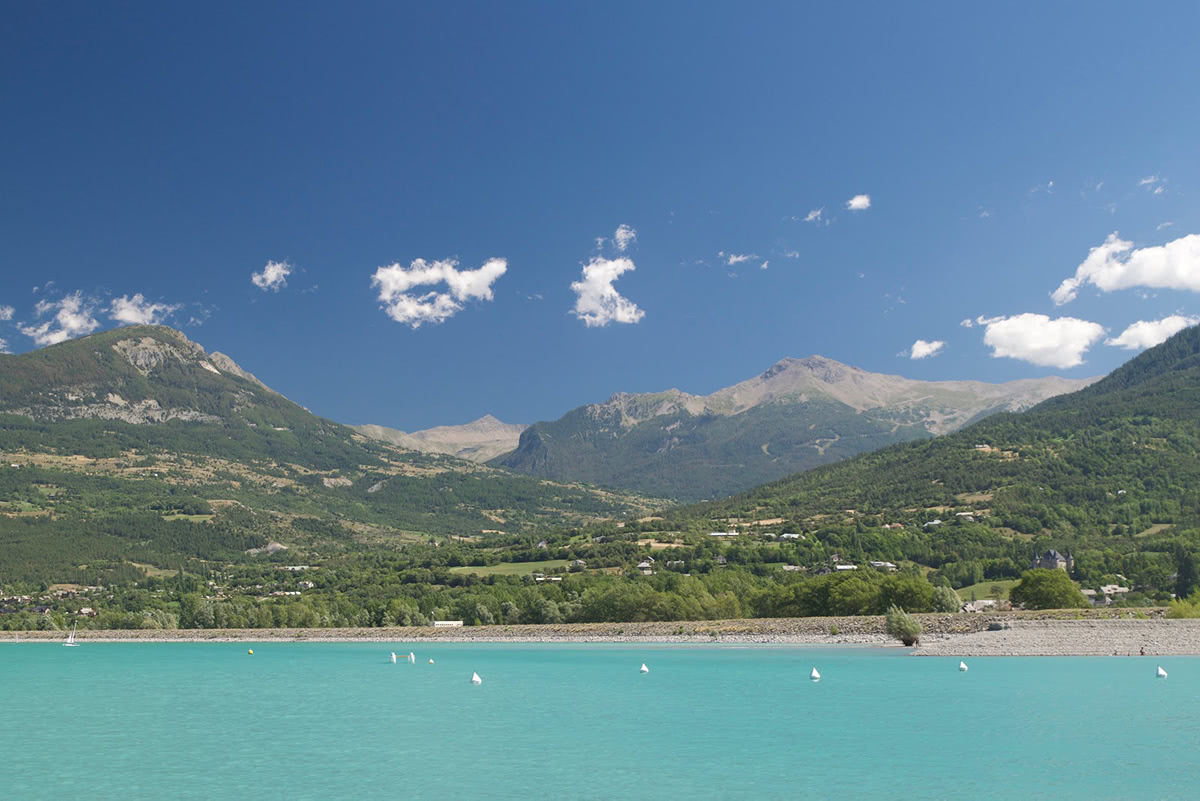
Barcelonnette - Is a town in the Alpes-de-Haute-Provence department, within the Provence-Alpes-Côte d’Azur region. It is located in the southern French Alps, between Provence, Piedmont and the Dauphiné. In between Barcelonnette and Gap is Lac de Serre-Ponçon, which offers a different perspective on the distant mountains to the south.
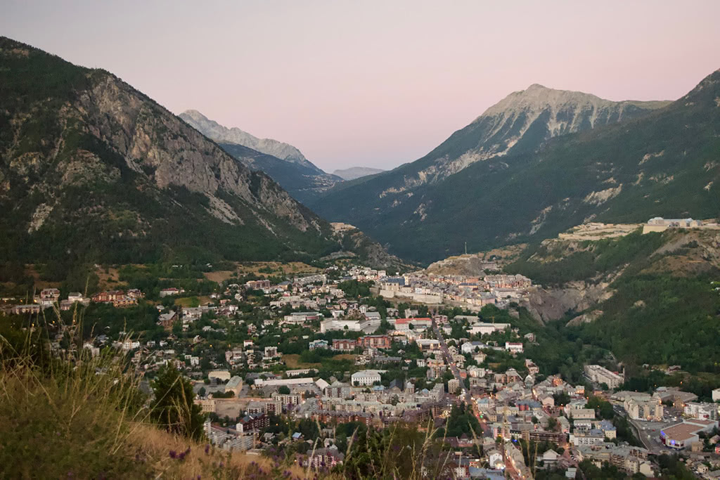
Briançon is a commune in the Haute-Alpes department. At an altitude of 1,326m it is the highest city in France. Briançon is only 14km from the border to Italy via the ski resort of Montgenèvre. The cable car from Briançon allows easy access to the Crête du Rocher Blanc at 2,550m or the Sommet du Prorel at 2,556m. From the peak there are spectacular panoramas in every direction.
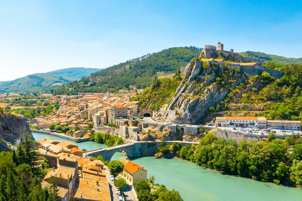
Digne Les Bains - A small town situated in the Alpes-de-Haute-Provence region, Digne as it is known locally, is a gateway to the UNESCO Geo-Park of Haute-Provence.
Gap is the largest city within the area and is ideally placed between the Dauhpiné Alps, Provence-Alps and Prealps mountain ranges. The city is situated along the famous route de Napoleon, a road symbolic of Napoleon’s northern journey through the Alps. Gap offers an ideal location for excursions into the mountains which surround the city. One of the most prominent peaks visible from Gap is the Pic de Bure. It is accessible on foot and via cable car in both the winter and summer months.
Marseille - The capital of the Provence-Alpes-Côte-d’Azur region. It is the second largest city in France. Marseille is both a commercial port and a hub for Mediterranean cruises. It is also the birthplace of the French national anthem: the Marseillaise.
Nice - The capital of the Alpes-Maritimes department and the fifth largest city in France, Nice is situated on the beautiful Mediterranean coast, within the French Riviera. Nice is a popular destination throughout the year, with temperatures in the winter months remaining comparatively warm. Nice’s position in the south of the region allows for expeditions Natural Park of the Prealps d’Azur, created in 2012.
Orange - A commune in the Vaucluse Department in the Provence-Alpes-Côte-d’Azur region in southeastern France. Orange is a major passing point for traversing France, whether that be to the north, Spain in the west, or Italy in the east. Once an old Roman settlement, some of the impressive architecture remains - notably one of the best conserved Roman theatres in the world. Orange is also a renowned agricultural region with the famous Châteuneuf du Pape wine produced a short distance away.
Toulon - The capital of the Var department, Toulon has a large military harbour, facilitating access to the Mediterranean sea.
There are airports across the region in Avignon, Nice, Marseille and Toulon. The cities are also well served by France’s expansive bus and train networks. In addition, the coastal cities are also accessible by boat.


top50
ultra
glacier
alps-4000ers
france-ultras
top50
ultra
glacier
alps-4000ers
france-ultras


