
Scan the QR code and open PeakVisor on your phone
There are 3024 named mountains in Auvergne-Rhône-Alpes. The highest and the most prominent mountain is Mont Blanc - Monte Bianco.Formed in 2015 after France's departmental reforms, Auvergne-Rhône-Alpes is a regrouping of the two respective regions. Within the new region there are 12 departments. The largest cities in the region are that of Lyon and Grenoble. The department spreads across central, southern France in an easterly direction towards to the Alps. The region covers an area of 69,711 square kilometers making it the third largest in France. Within the region there are 9998 named mountains which form part of the Dauphine Alps, Dauphine Prealps and Savoy Prealps mountain ranges (as classified by the SOIUSA system). It is thus one of the most mountainous areas in France and Europe as a whole.
Mont Blanc, or Monte Bianco in Italian, is the highest mountain in the Auvergne-Rhône-Alpes region and the highest in Europe west of Russia’s Caucasus peaks. At 4,810m above sea level it is ranked 11th in the world in topographic prominence. There are three towns which surround the base of the mountain with Saint-Gervais-les-Bains and Chamonix in Haute-Savoie, France and Courmayeur in the Aosta Valley, Italy. There are several ways of traversing the mountain: A cable crosses the mountain range from Chamonix to Courmayeur over the Col du Géant, and the 11 km Mont Blanc Tunnel runs beneath and connects France to Italy.
The region has something to offer no matter what the season. Spring and Autumn are good times to visit as there are not too many tourists yet and the weather is usually quite good. For hikes in the high mountains it is best to wait until the snow has started to thaw in the spring as some of the mountain passes will stick be blocked to cars. In the Autumn, October is usually an ideal month because the temperatures are still good with the added bonus of an autumnal colour palette.
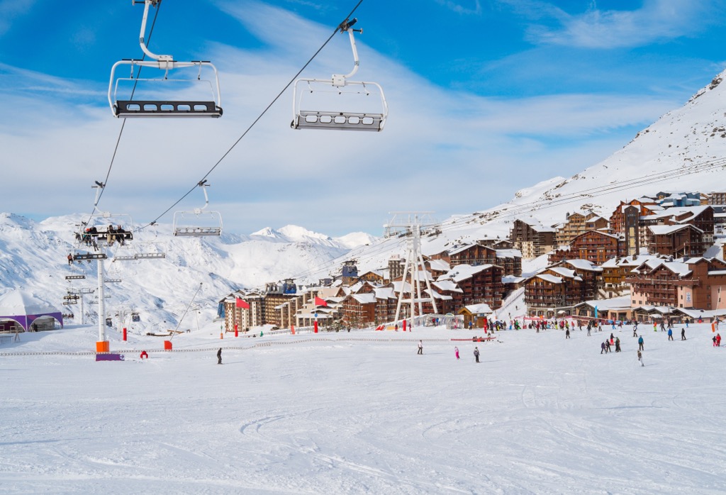
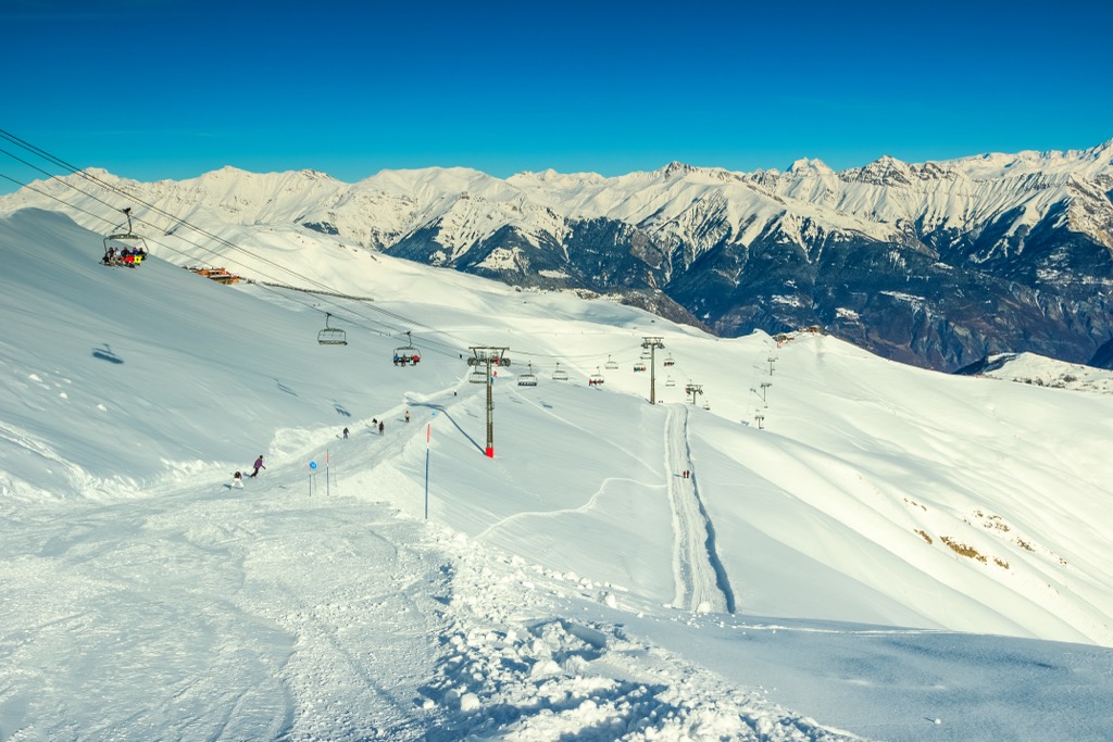
During the winter months the Auvergne-Rhône-Alpes region is a haven for winter sports enthusiasts, with countless ski-resorts, cross-country and biathlon trails. The Alps contain the majority of France's world famous winter ski-resorts, such as Val d'Isère, Alpe d'Huez, Chamonix, Courchevel, Morzine and Val Thorens to name but a few.
The ‘Eagle of Napoleon’ (right centre) south of Grenoble
During the long summer months the area's natural beauty attracts road cyclists, mountain bikers, hikers and hang gliders alike. The Tour de France frequently passes through the area, bringing with it all of the spectacle of the worlds largest cycling race. There are also a number of Grande Randonnées which span the region – the Tour of Mont Blanc being one of the most frequented.
There are an estimated 30,000 animal species in the Alps. The altitude plays a role in which animals exist where. Some have adapted to the higher altitudes found in the region, whereas others have flourished in the lower altitudes.
The majority of the animals that live at altitude hibernate during the winter months, like the marmotte. If you are lucky you may catch a glimpse of them in the high mountain plains during the summer months, however they are quite elusive. You are more likely to hear them before you see them with their unique cry.
On the other hand, the alpine ibex does not hibernate. They can be found on very steep slopes and rugged rock faces. The ibex rivals even the best hikers for their ability to climb to difficult to reach places.
Not to be outdone by an ibex, this is a local cat who accompanied us during a hike in the Grenoble region from Sappey en Chartreuse to the Fort de Saint-Eynard. The views on this route are more than enough in terms of a reward, however this hike had the added the bonus of our new furry friend who followed us the entire 5km to the summit! After a picnic at the summit our little friend made his way back home (with the help of a couple of hikers going back the same direction.

With several thousand different species within the region, the flora of Auvergne-Rhône-Alpes is extremely varied. This diverse selection of flora is protected and it is therefore forbidden to pick them. In this instance it is certainly best to leave no trace whilst hiking and leave the local nature untouched for future generations to enjoy as well.
The flora in the region dates back millions of years. It has adapted to the sometimes cold and unforgiving climate and the increasing altitude of the Alps as they were formed. Like most other mountainous regions, the alpine flora varies with altitude, number of sunlight hours (due to the direction of the rising and setting sun in relation to the proximal mountains, some plants are in permanent shade) and the type of soil. The flora is categorised by five different ecosystems according to their elevation: alpine, sub-alpine, collineum, eternal snow and mountain. The distinctions between ecosystems unfortunately becoming blurred as a result of global warming.
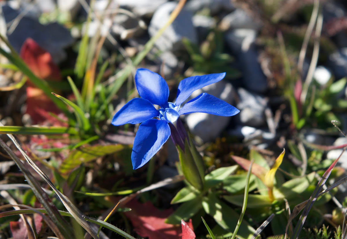
Spring Gentian flower
For skiing and snowboarding enthusiasts, there are more than 110 ski resorts in Auvergne-Rhône-Alpes, among which 20 can be called "monster resorts", in the sense of huge. They are located on the eastern border of the region with Italy and Switzerland. It is not only the main area for skiing in the French Alps but also in the Italian Alps, the Swiss Alps, and the Alps in general.
The largest ski resort in Auvergne-Rhône-Alpes is Les 3 Vallées (Les Trois Vallées) or "The Three Valleys" in English. These are Saint-Bon, Allues, and Belleville valleys—the core of the area since 1990, to which the fourth, Maurienne valley, was added in 1997.
The area consists of four major and three additional "smaller" ski resorts with more than 600 km (373 mi) of connected slopes and more than 155 ski lifts with one single ski pass. So here they are:
This makes Les 3 Vallées the largest ski area in the entire world, slightly ahead of the relatively neighboring Les Portes du Soleil (Morzine, Avoriaz, Les Gets, Châtel, Morgins, and Champéry) with more than 580 km (360 mi) of slopes and more than 165 ski lifts.
Other major areas for skiing in Auvergne-Rhône-Alpes, which are located which are in whole or in part in the region, with more than 100 km (62 mi) of slopes and more than 20 ski lifts each include the following 17 in descending order of size:
The two largest ski resorts in Auvergne-Rhône-Alpes outside this huge skiing area are Le Lioran with more than 60 km (37 mi) of slopes and more than 15 ski lifts and SuperBesse–Puy de Sancy with more than 40 km (29 mi) of slopes and more than 20 ski lifts. They are located in the west of the region in the Massif Central mountains.
The main ski resort near Lyon, the largest city of Auvergne-Rhône-Alpes, are Terre Ronde/La Praille–Plateau d’Hauteville and Chalmazel to the east and west of it, respectively, with more than 10 km (6 mi) of slopes and more than 5 ski lifts each. However, the Three Valleys are also nearby.
Check the Auvergne-Rhône-Alpes ski resorts map as well as the larger France ski resorts map in the World Mountain Lifts section of the site. It includes information about open ski lifts / slopes in Auvergne-Rhône-Alpes in real-time with opening dates and hours. There are also year-round cable cars, funiculars, cog railways, aerial tramways, and all other types of mountain lifts.
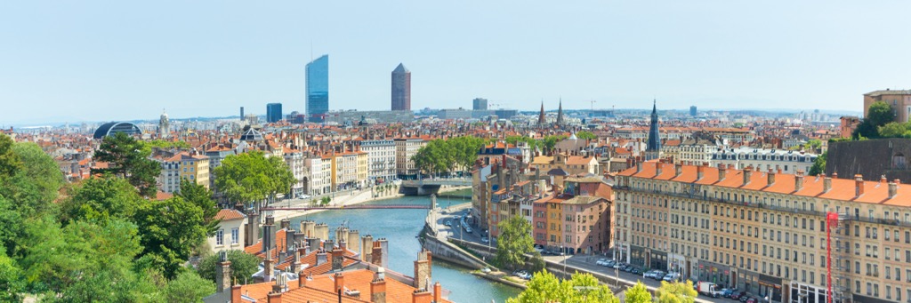
There are several major cities in the region of Auvergne-Rhône-Alpes: Lyon, Grenoble, Saint Étienne, Clermont-Ferrand, Chambéry and Annecy. The cities of Chambéry, Grenoble and Lyon are best suited to provide access to the mountain ranges of the region.
Grenoble airport is open all year round, however, primarily catering ski-resorts in the winter, the summer flights are limited to around 3 per day. Lyon airport is slightly farther away from the Alps however, but has a much more expansive destination area with frequent transfers to Grenoble.


top10
ultra
glacier
europe-4500ers
alps-4000ers
italy-ultras
france-ultras
top10
ultra
glacier
europe-4500ers
alps-4000ers
italy-ultras
france-ultras


