
Scan the QR code and open PeakVisor on your phone
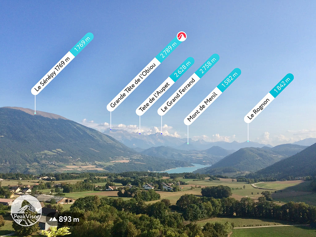
The Dauphine Prealps include 2,357 named peaks. The highest is Grande Tête de l'Obiou at 2,789 m. Other notable peaks include Le Grand Ferrand, Petit Ferrand and Crête de la Laisse.
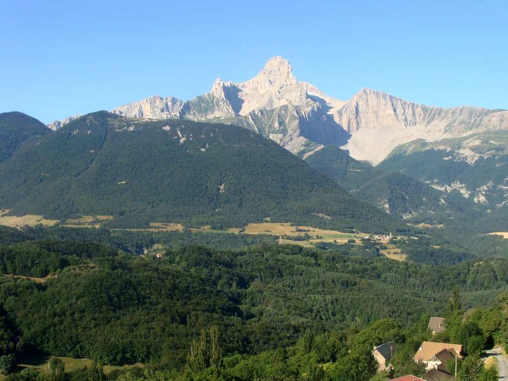
Dauphiné Prealps (Préalpes du Dauhpiné in French) are a mountain range in the south-western part of the Alps with 394 named mountains. These mountains are primarily located in the Auvergne-Rhône-Alpes region, but also spread into Provence-Alpes-Côte d'Azur (south-eastern France). The Dauphiné Prealps name is derived from the epinonimous former province whose previous area roughly corresponds to that of the present day départements of the Isère, Drôme and Haute-Alpes.
The Dauphiné Prealps consist of the Vercors Natural Park in the west, the Dévoluy Mountains in the east and the Ceüse-Aujour, Diois and Baronnies Massifs in the south.
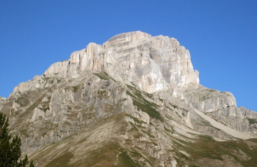
The highest mountain in the Dauphiné Prealps is the Grande Tête de l’Obiou, situated in Dévoluy Mountains. It is visible from both Grenoble to the north, and Gap to the south. With a prominence of 1,542m this mountain is classified as an Ultra and is ranked the seventh most prominent summit of metropolitan France.
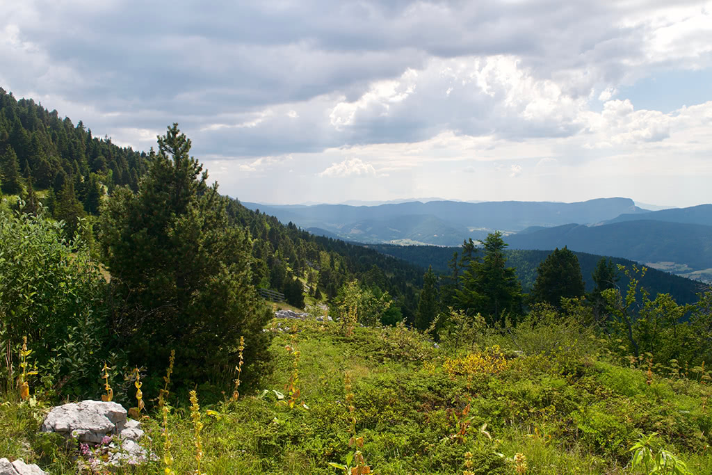
During the winter months, the Dauphiné Prealps are a haven for winter sports enthusiasts, with countless ski-resorts, cross-country, and biathlon trails. During the long summer months, the area's natural beauty attracts road cyclists, mountain bikers, hikers, and hang gliders alike. The gorges of the Vercors, the high alpine peaks of the Grande Tête de l'Obiou and the mountain lakes which area scattered throughout the region make the Dauphiné Prealps a must-see for any outdoor lover!
With the ski-resorts, there are a number of cable cars offering a simple way to shortcut the distance to some of the peaks. The lifts in the resorts of Villard de Lans, Lans en Vercors and Corrençon en Vercors on the Vercors plateau are open during the summer to cater both hikers and mountain bikers. Smaller stations such as Gresse en Vercors and the Col de l'Arzelier operate primarily during the winter months.
Pic Saint-Michel offers magnificent views of the Vercors Natural Park and a large part of the Alps. This beautiful hike in the mountains allows you take in the plateau and its fine pastures. The trail of 8.8km with 656m of vertical elevation is classified blue and ideal for beginners. (est. time 4h30m)
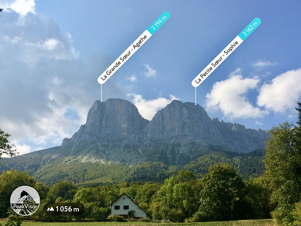
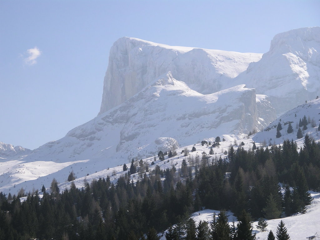
The Tour of Mont Aiguille is a beautiful and long hike allowing endurance hikers to closely observe one of the Seven Wonders of the Dauphiné region from all angles. There is an astonishing diversity to the landscapes surrounding it. At 18km in length with 1110m of vertical elevation, this red classified trail is for experienced hikers. (Est. time 7h45m)
From Col de Toutes Aures to Col Lachard there is a change of scenery from the high mountains, the wooded hills of Chambaran to one of the largest forests in the region to explore. The panorama opens on the great plain of the Bievre and the imposing Vercors massif on the other side of the valley to the south. At 7.6km in length with only 150m of vertical elevation, this walk is perfect for families. (est. time 2h20m)
Notre Dame de La Salette: La Grande Combe. This peaceful four-hour loop in the heart of the alpine pastures will take you to the Sanctuary of Notre-Dame de la Salette, a major pilgrimage site. At 8.5km long with only 485m of vertical elevation, this route is ideal for beginners. (est. time 4h)
The Pierced Stone hike takes you to the Pierced Stone (La Pierre percée in French), a natural arch located at 1220m above sea level. From this vantage point you can enjoy magnificent views across the Matheysine plateau. Within a stone's throw from the end of the trail, the three mountain lakes of Laffrey, Pétichet and Pierre-Châtel provide a perfect place to cool off in the summer. At 8km in length with 300m of vertical elevation, this walk is ideal for beginners.
The Sénépi trail is along the largest organised alpine pasture in France. At its summit, the Sénépi offers one of the most beautiful panoramas of the Isère. The terrain opens up an exceptional panorama, with views of the Grande Tête de l'Obiou, Mont Aiguille, and the Taillefer. At 13.8km long with 625m of vertical elevation, this long but steady hike is ideal for intermediates. (est. time 5h25m)
Grande Tête de l'Obiou is a glorious route, reserved for highly experienced hikers (with the use of headgear strongly advised). The vertiginous paths in the Dévoluy massif offer breathtaking panoramas across the Dauphiné Prealps region. At 10km in length with 1320m of vertical elevation, this black classified trail is reserved for highly experienced hikers. It is also advised to only attempt it in good weather. (est. time 6h)
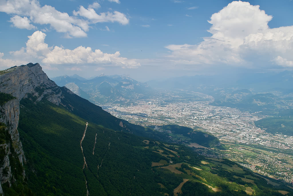
Moucherotte is the emblematic summit of the eastern ridge of the Vercors overlooking Grenoble. With views to the north of the Chartreuse region and to the Belledonne to the east, this climb offers a unique perspective to the mountain city, that is Grenoble. Note, this route goes up one Moucherotte slope and comes down the other. There are buses available at Lans en Vercors to take you back to Grenoble. At 18km in length with 1730m of vertical elevation, this route is recommended for experienced hikers. (est. time 9h15m)
Tour of Grand Veymont. This two-day adventure tour is epic. With breathtaking views across the Vercors Natural Park, the Grand Veymont and Mont Aiguille, this route showcases the best of what the Dauphiné Prealps has to offer. At 18.45km in length and with 1839m of vertical elevation, this difficult hike is for those looking for an once-in-a-lifetime experience in the mountains.
There are two major cities in the Dauphiné Prealps: Grenoble and Lyon.
Whilst Lyon is the larger of the two, it is also the farther from the mountains. Grenoble is a much more compatible location in this regard. It is ideally suited as a basecamp for not only excursions in the Dauphiné Prealps, but also for the trips to the Savoy Prealps to the north and the Dauphiné Alps to the south.
Grenoble airport is the closest airport to the Dauphiné Prealps and is open all year round, however, primarily catering ski-resorts in the winter, the summer flights are limited to around 3 per day. Lyon airport is slightly farther away, but has a much more expansive destination area with frequent transfers to Grenoble.


The Dauphine Prealps are part of the Alps.
The highest peak in the Dauphine Prealps is Grande Tête de l'Obiou, at 2,789 m.
The Dauphine Prealps have 2,357 named peaks.


