
Scan the QR code and open PeakVisor on your phone
Southern Savonia is home to 36 named mountains. The highest is Tornikangas at 281 m.
Southern Savonia or South Savo is one of Finland's 19 counties. It is located in the east of the country and the main feature of the region is Punkaharju Esker Ridge, which is one of Finland's 27 national landscapes. South Savo is also the heart of the Finnish Lakeland, which is famous for its magnificent scenery and endless opportunities for outdoor activities. There are 36 named peaks in the county, the highest and most prominent of which is Tornikangas (281 m / 922 ft).
The name of the county of Southern Savonia comes from its location in the south of the historical province of Savonia (the other part of Savonia is Northern Savonia or North Savo). The Finnish name for the South Savo region is Etelä-Savon.
There are many similarities between the two parts of the historical province. Check out the guide to Northern Savonia to learn more about the etymology, geography, human history, cultural heritage and some common natural features of the region as a whole.
The region of Southern Savonia is located in the east of Finland. Its total area is 18,768 sq km (7,246 sq mi), which is 2,000 sq km (922 sq mi) less than North Savo. This means that the two parts of Savonia are almost equal in area.
The region of Southern Savonia borders a number of other regions, including North Savo in the north, Central Finland in the west, Päijät-Häme (Päijänne Tavastia) in the southwest, South Karelia in the south, and North Karelia in the east.
At the same time, the region is part of one of Finland’s four major tourist regions called Finnish Lakeland, which is sometimes referred to as the Finnish Lake District.
The largest city in the region of South Savo is Mikkeli. It is located on the southwest of the region on a major road that also leads to Kuopio, the capital of North Savo.
To reach Mikkeli from Helsinki by car, it will take you about 2:40 hours (230 km / 142.9 miles). You can also get here from St. Petersburg, Russia, (4:20 hours, 300 km / 186.4 miles) and Sortavala (3:50 hours, 287 km / 178.3 miles), the latter of which is the capital of the Republic of Karelia in Russia.

Public transport in Finland to South Savo and elsewhere is available on Matkahuolto or OnniBus buses and VR.fi trains. If you’re traveling from Russia, check out the Lux Express buses and Allegro trains.
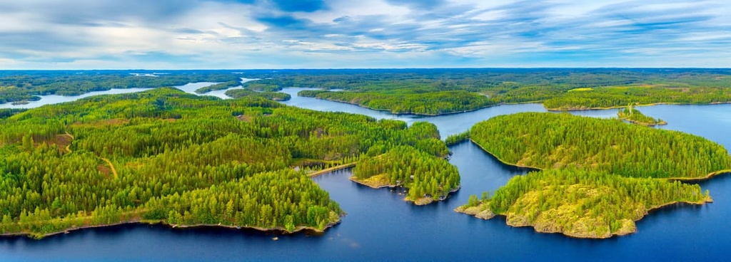
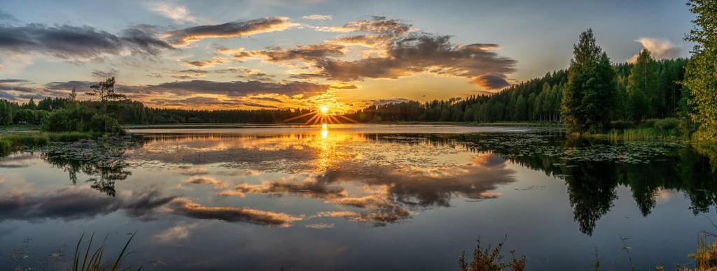
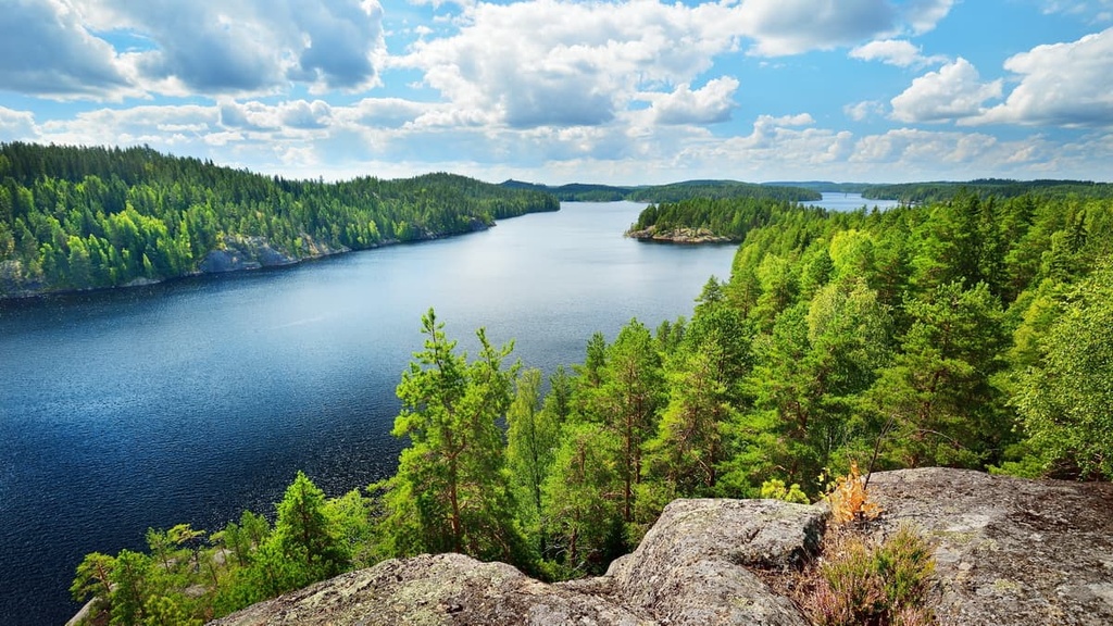
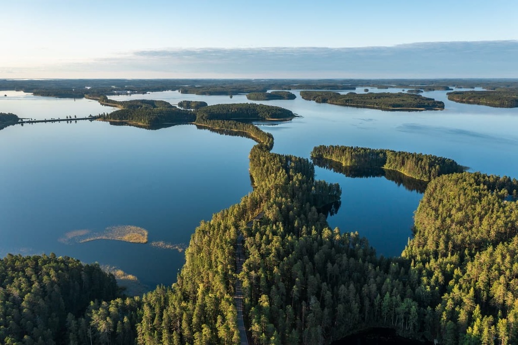
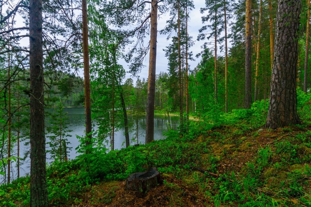
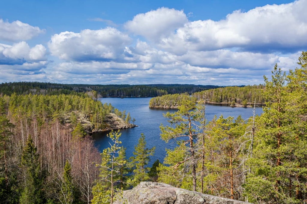
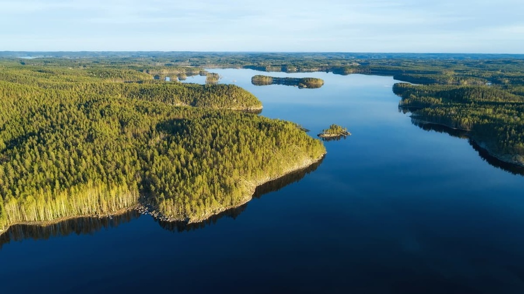
The main feature of the Southern Savonia region’s landscape is that it is located in the heart of the Finnish Lakeland, which is also referred to as the Finnish Lake District. It is the largest such region not only in Finland but in all of Europe, and it contains most of the 190,000 lakes in the country.
You can get an overview of Lakeland in the guide to North Savo, so here we will talk about the three main landscape features of the southern part of the Savonia region. There’s a lot to talk about landscape-wise here as South Savo is home to three of Finland’s 27 national landscapes.
Punkaharju Esker Ridge is a narrow and long ridge that’s 8 to 12 km (4.9 to 7.4 mi) in length. It is overgrown with pine forests separating two large lakes, Utrasselkä and Kukkosalmi, both of which are part of the large Saimaa Lake system.
The ridge was formed as a result of retreating glaciers some 10,000 years ago. This picturesque place is not only associated with the South Savo but with the whole Lake District of Finland and the country in general. It has attracted thousands of local and foreign tourists all year long for at least the last 200 years.
It’s not hard to find the ridge on a map or in person as it is an old travel route that has been used by animals and humans for thousands of years. In the past, the ridge offered a natural pathway between lake systems.
The first modern road was built on the ridge by Russians in the 1700s. The road connecting the town of Savonlinna to Vyborg (the latter of which is now in Russia) also used to run through Punkaharju.
Additionally, the ridge is located in Punkaharju Nature Reserve. This is one of the oldest protected areas, not only in Finland, but in the world.
The first iteration of the reserve was established in 1843, long before the first national parks were created in the country in 1938 (Pallas-Ounastunturi and Pyhätunturi, which are now today known as Pallas-Yllästunturi and Pyhä-Luosto). Meanwhile, the first national park in the United States, Yellowstone, wasn’t established until 1872.
Furthermore, the reserve includes the Finnish Forest Museum “Lusto” and the Finnish Forest Research Institute, which, in turn, hosts the Laukansaari Research Park. You can also find some of the tallest trees in Finland in the park, too, including pines that reach heights of up to 40 meters (130 ft).
The reserve itself is obviously a must-see destination. But there are many other notable attractions located near the reserve, including several historical hotels and villas (Hotel Punkaharju or Valtionhotelli—the oldest in Finland, Hotel Finlandia and Empress’ Villa), Old Railroad Station, Pususilta Bridge, The Salpa-Line Fortification, Karjalankallio Beach, and Punkaharju Church, among others.
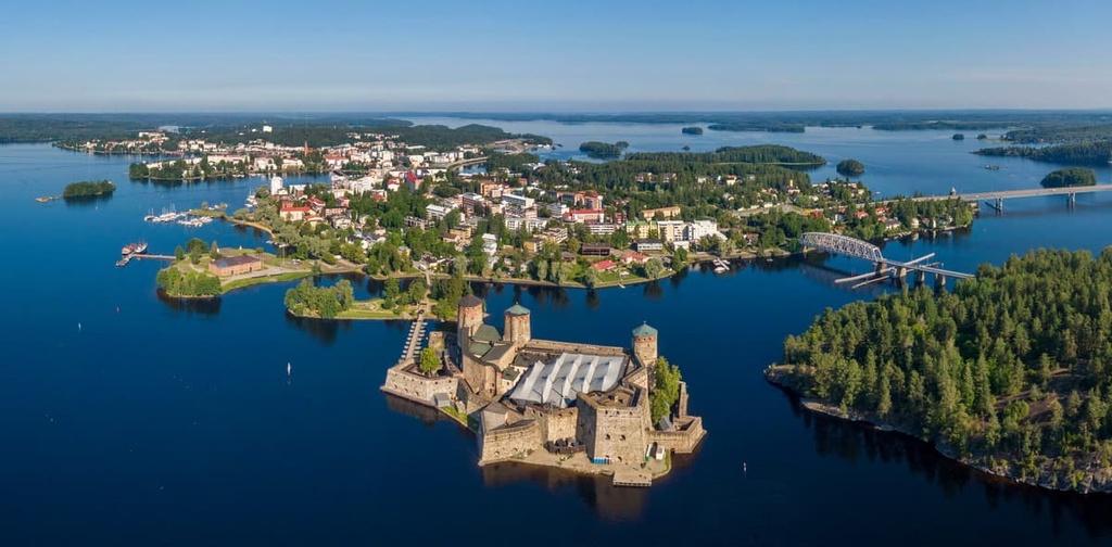
Olavinlinna Castle and Pihlajavesi Lake are two fantastic destinations that are included on the list of 27 national landscapes of Finland. (Note that they are included as one landscape rather than as two separate locations.)
Olavinlinna Castle is a medieval Swedish fortress with three huge defensive towers. It was built in 1475 on an island in the Kyrönsalmi Strait that connects the lakes Haukivesi and Pihlajavesi to protect the eastern borders of Sweden (Finland a part of Sweden at the time), from Russia.
Pihlajavesi Lake, on the other hand, is the sixth largest lake in Finland. The lake is also part of the Pihlajavesi Nature Reserve.
Note that Pihlajavesi should not be confused with the lake of the same name in the neighboring region of Central Finland. Generally, if people are referring to the lake in South Savo, it will be written as Pihlajavesi (Saimaa). Alternatively, if you’re referring to the lake in Central Finland, it may be written as Pihlajavesi (Keuruu).

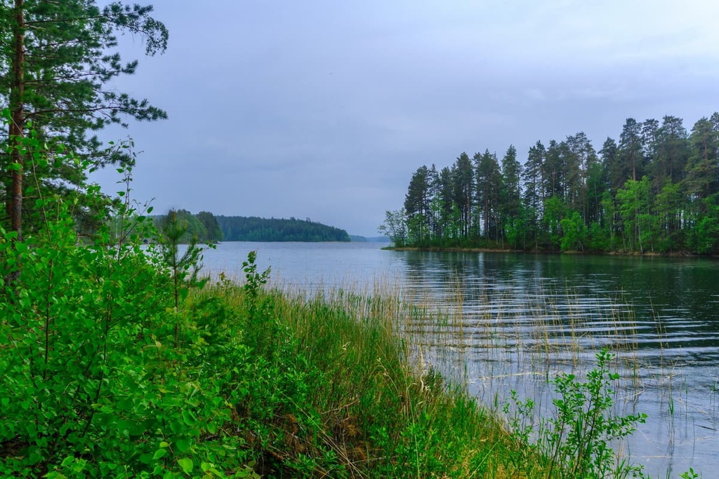
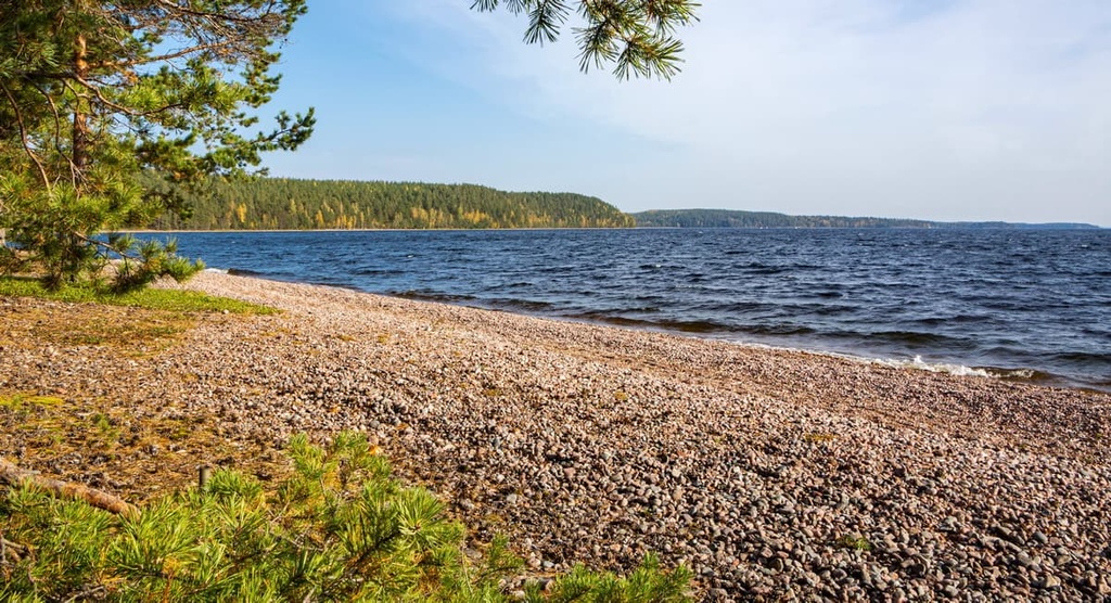
That said, Pihlajavesi is not the only lake in the region. There are more large lakes in South Savo, including Haukivesi (the eighth largest lake in FInland), Puruvesi, and Saimaa. Another isolated lake, Puula, is the largest in the western part of the region, and it is located to the west of Mikkeli.
The third of South Savo’s three sites on the list of 27 landscapes of Finland is the Heinävesi Route (Heinäveden reitti in Finnish).
Heinävesi Routeis a unique engineering system located on the shores of the Kermajärvi Lake in the northern part of South Savo. It connects the cities of Kuopio and Savonlinna through a system of six channels: Karvio, Kerma, Vihovuonne, Pilppa, Varistaipale, and Taivallahti.
The canals were built between 1896 and 1916. They made it easier for people to travel through the region despite the different water levels in the various lakes. In particular, the Varistaipale Channel has the greatest height difference of 14.5 meters (47.5 feet). The canals are still used for their intended purpose today by providing passenger transportation and cruises.
You can also pass the central part of the Heinävesi Route by kayak along the famous Heinävesi Seal Trail from Kermajärvi Lake to Kolovesi National Park, which is also located entirely on water.
Along the way, you will pass all six canals. The trail distance of this route is 66.3 km (41.1 mi) or about 12 hours of constant paddling (up to six days on the road with overnight stays). You can continue the trail to Joutenvesi and Linnansaari National Park, though this involves an additional 35 km (21.7 mi) of traveling.
The municipality of Heinävesi is also famous because of the New Valamo Monastery and Lintula Holy Trinity Convent. These are the only Orthodox monasteries in Finland (but there are also Orthodox cathedrals and churches in the country).
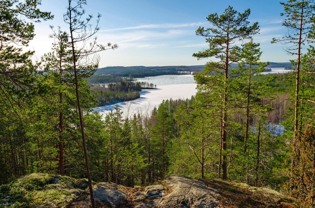
The mountains of Southern Savonia belong to the Karelides range, which was named after the region of Karelia. In fact, the Karelides mountains no longer exist as they once did as they’re now just hills of up to 300 meters (feet) in height that are located in the eastern part of the country.
The Karelides extend to the northern borders of Lapland, where they reach 800 meters (2624 feet) in elevation. But many millennia ago, these mountains were as high as the Alps and even surpassed them a bit.
Here are some of the main summits in the county of South Savo that are worth keeping in mind during your travels.
Tornikangas (281 m / 922 ft) is the highest peak in the region of South Savo. It is located in the northern part of the county on the border with Central Finland near Kivinen Lake. You can reach the mountain by turning off the main road between the towns of Pieksämäki and Hankasalmi to admire the views of the lake and the surrounding forests.
Neitvuori (184 m / 603 ft) is the second-highest mountain in the region and the best known. It is even called the “Switzerland of Savo” because of the views that it offers of the Saimaa Lake System from its summit.
The mountain is situated to the east of the capital of Mikkeli on the shores of Luonteri Lake. There is a hiking trail to the summit, which we’ll discuss later on in this guide.
Kolmikannanmäki (170 m / 557 ft) is the third highest mountain in the region and one of the southernmost hills in the county. However, it is easiest to reach the mountain from the town of Saari in South Karelia than from South Savo.
Runeberg Hill or Runeberg Mound (25 m / 82 ft) is the highest point of Punkaharju Esker Ridge. When hiking in the reserve, be sure to climb it as the views are worth the effort.
The mountain is named after a famous Finnish poet, Johan Ludvig Runeberg. At the summit, there is a 3.5 m (11.4 ft) tall stone monument in honor of Runeberg with a verse from one of his poems printed on the side.
There are several impressive mountains to visit in the region’s national parks. In Repovesi National Park, you can find:
Meanwhile, in Linnansaari National Park, you can find Linnavuori (129 m / 423 ft). Finally, in Kolovesi National Park, you can find Ukonvuori (143 m / 469 ft), Havukkavuori and Vieruvuori in Kolovesi National Park. Furthermore, on all three of the peaks in Kolovesi, you can find rock drawings that are around 5,000 years old.
There are at least five main hiking areas with marked trails of various lengths in the Southern Savonia region:
First, you can visit Punkaharju Nature Reserve, which has 25 km (15.5 miles) of trails in total. The longest trails are Puulajireitti (5.3 km / 3.2 mi) and Hakinkierros (7.7 km / 4.7 mi) loop trails on the Laukansaari Island, which borders the reserve.
Two other similar natural protected areas in the region are Kermajärvi Nature Reserve (no hiking trails, but there is Hiihtoreitit ski route, which is 9 km / 5.5 mi in length) and Pihlajavesi Nature Reserve (Iso-Kankaisen polku Trail, 2.3 km / 1.4 mi).
Second, in South Savo, there are 3 of the 40 Finnish national parks: Kolovesi National Park, Linnansaari National Park, and Repovesi National Park on the border with the Kymenlaakso region. All three are located on peninsulas and islands, and they feature incredible lake scenery.
The longest loop trail in Kolovesi is Mäntysalo Trail (3.8 km / 2.3 mi), in Linnansaari it is the Linnavuori Trail (7 km / 4.3 mi), and in Repovesi it is both Koppelonkierros (8.3 km / 5.1 mi) and Kaakkurinkierros (26 km / 16.1 mi).
Saimaa Geopark is an interesting alternative to the above-listed places. It is the newest of the three geoparks of the country, as it was established on April 22, 2021. (The other two geoparks are Rokua National Park and Geopark and Lauhanvuori-Hämeenkangas.)
The longest trail in geopark is the Geological Trail of the Saimaa Ringed Seal in the town of Puumala (11 km / 6.8 mi).
There are also two great trails in the Neitvuori-Luonteri Area. The first one, Hiijje silimukka (4 km / 2.4 mi), is a trail around Neitvuori that leads to its summit. You can combine it with the Hiidenkierros Trail, which is 12 km (7.4 mi) long and takes you through the area of Hiidenmaa farm.
At Kontiosuo, there is also a connection to the Metsänväkitaipale Trail, which you can hike all the way to Siikakoski or the village of Koikkala.
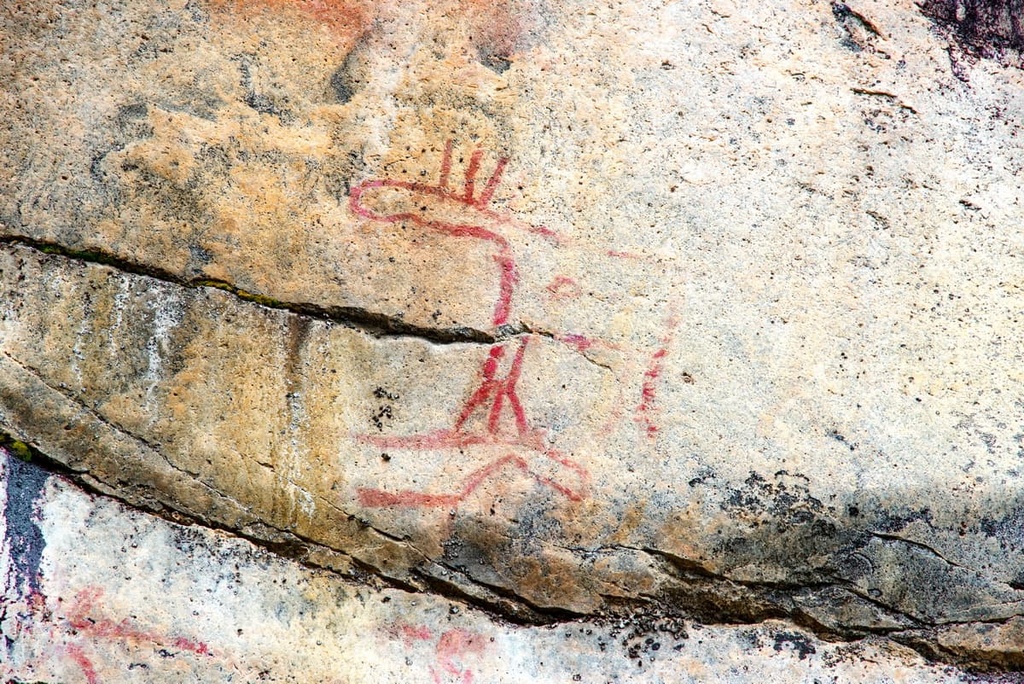
While in South Savo, you can also visit the Astuvansalmi Rock Paintings, which are one of the largest such sites in all of the Nordic countries.
These artifacts are about 4,500–5,000 years old and were made by ancient hunters and fishermen on a giant cliff on the shore of a lake. They depict elk, human hands, animal tracks, boats, and more.
The site can be reached by a 3 km (1.8 mi) walking path from a parking lot located about 20 km (12.4 mi) from the nearest largest town, Ristiina. You will likely need a car in order to travel to the area.
The area around the town of Pieksämäki, the third most important town in the region, is also a great place for hiking, which I discovered by chance in August 2018.
In particular, you can hike three great loop trails: the Tahinlampi Loop Trail around the Tahinlampi swamp, the Nikkarilan kankaat lähtöpaikka Trail around Kukkarojärvi Lake, and a trail around Salvonen Lake in Partaharju Recreational Area. You can also walk along Pieksänjärvi Lake in the city itself.
These are very beautiful places in which, except for you, probably there will not be other tourists and just a few locals.
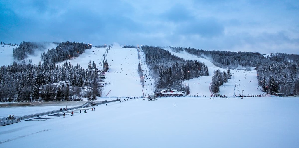
There are several ski resorts in the Savonia region where you can enjoy some Alpine and cross-country skiing.
The largest of these ski resorts is the Tahko Ski Resort in North Savo. It has 24 blue, red and black slopes (half of which are blue and red) with a total distance of 20 km (12.4 mi) and 15 ski lifts: 2 chair lifts, 4 buttons and 1 carpet lift.
There are also 42 km (26 mi) of cross-country trails at the resort, including a 20 km (12.4 mi) illuminated trail that’s open for night skiing until 10 pm in the winter months. With 62 km (38.5 mi) of trails, Tahko is the fourth biggest ski resort in Finland.
Additionally, the Tahko Ski Resort has a ski school, equipment rental, ski maintenance shops, five on-slope restaurants, and seven shelters for visitors to enjoy.
There is also the quite large Häkärinteet Ski Resort, which features 6.5 km (4mi) of slopes of all levels plus 5 ski lifts. It is located in Central Finland on the region’s border with North Savo.
The rest of the resorts in Savonia are smaller and are located mostly in South Savo, including:
To learn more about ski resorts in Finland, visit the World Mountains Lifts page on PeakVisor.
During your trip to South Savonia, be sure to visit the Mikkeli Tourist Information office, which is located in the Mikkeli city center. Here, you can get maps of the region and get travel advice.
Mikkeli Tourist Information
Maaherrankatu, 22, 50100, Mikkeli, Finland
+358447945669
Opening Hours:
There are also similar offices in the towns of Mäntyharju, Puumala, Pertunmaa, Kangasniemi, Hirvensalmi and Juva.
Visit the Lakeland region page on the official tourist site of Finland for more general information about the Eastern Finland.

When hiking in the South Savo national parks, you can stay at one of the region’s camping sites, which usually include a place to pitch a tent and build a fire with a firewood supply. You may also find a lean-to-shelter or even a small cabin to sleep in. However, these buildings will have no windows or doors, so bring a warm sleeping bag.
For example, in Repovesi National Park, which is one of the most popular hiking areas in the region, you will find 14 such places, including Lapinsalmi Sound, Kapiavesi, a site on the eastern shore of the Katajajärvi Lake, and Kuutinkanava Canal, among others.
Before and after your hike, kayaking trip, or other outdoor activity you can also easily find accommodation in one of the cities in the region. If you have a large travel group, consider renting a cottage in the countryside as these tend to be quite cost-effective.
There are 12 municipalities in Southern Savonia, the largest of which are Mikkeli (52,000 residents), Savonlinna (33,000 residents), and Pieksämäk (17,000 residents). Other notable municipalities, such as Juva, Kangasniemi, and Mäntyharju, have around 5,000 residents each.
Here’s a quick overview of the main cities and resorts in the region that are worth checking out during your next trip.
Mikkeli is the capital of the South Savo region. It is located in the southeastern part of the region on the shores of the Saimaa Lake.
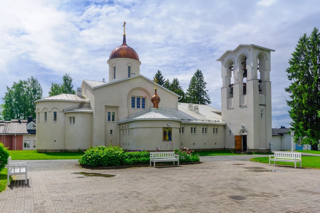
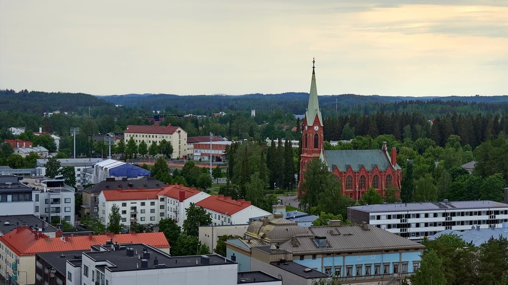
The city is one of the educational, cultural, and recreational centers of this part of Finland, and it is easily recognizable thanks to its main attraction—Mikkeli Cathedral, which was built between 1896 and 1897 in the Gothic Revival style.
Other main cultural and architectural attractions of the city include:
For more information, check out the official tourist website of Mikkeli: VisitMikkeli.fi
Savonlinna is the second most important city in the region. However, historically it surpasses Mikkeli in importance, because its history goes back to the Middle Ages (1475), with the construction of the Swedish castle Olavinlinna.
The castle is known not only as a building but also because of the Savonlinna Opera Festival, which has been held since the summer of 1912. The castle and the festival attract thousands of tourists every year.
Other main cultural and architectural attractions in the city include:
For more information, head to the official tourist website of Savonlinna: VisitSavonlinna.fi
Pieksämäki is the regional center and an important transportation hub of South Savo. It is located on the railway line between Kouvola and Kuopio.
The station itself is the main attraction of the city and includes the Savo Railway Line Museum. The city is also famous for the Big Wheels Pieksamaki, which is one of the biggest open-air automotive round-ups in Finland since 2002 with 10,000 visitors. Otherwise, it is a very small town.
Other main cultural and architectural attractions of the city include:
Head to the official tourist website of Pieksämäki for more information: VisitPieksamaki.fi


Yes. Southern Savonia has 36 named mountains. The highest is Tornikangas at 281 m.
The highest mountain in Southern Savonia is Tornikangas, at 281 m.
Southern Savonia has 36 named mountains.


