Scan the QR code and open PeakVisor on your phone
Pyhä-Luosto National Park is one of Finland’s 40 national parks. It is located in the far north of the country in the Lapland region and it is the oldest national park in Finland, having been originally founded in 1938. There are also two ski resorts in the park where you can ski and do other winter outdoor activities. The park contains 12 named mountains, the highest and the most prominent of which is Noitatunturi (539 m / 1,121 ft).
The double name of Pyhä-Luosto National Park comes from the name of the two primary mountains in the area: Pyhätunturi (506 m / 1,660 ft) and Luosto (510 m / 1,670 ft).
Additionally, the park gets its name from the two national parks, Pyhä and Luosto, which were merged in 2005 to create the park we have today. For a long time, this park was one of the youngest national parks in Finland, until Hossa (2017), Southern Konnevesi (2014) Teijo (2015), Bothnian Sea (2011) parks were created after 2005.
The first part of the park’s name, Pyhä, comes from the language of the Sámi—the Indigenous peoples of Lapland. The exact meaning of the word is unknown, but it can often be translated as "holy."
The second name, Luosto, is a Finnish word that comes from the word “luostâg” (“Inari Sami” where Inari is one of the largest Sámi villages) or “luosttat” (“North Sami”). Both of these words can also be understood to mean a "reindeer that has light-colored stripes”.
In general, the naming of a park after the hills in the area is very typical for the national parks of Lapland because these low and beautiful mountains are the main natural feature of this region, alongside the sprawling tundra landscape.
Pyhä-Luosto National Park is located in the provinces of Kemijärvi, Pelkosenniemi, and Sodankylä in the Lapland region, almost in the geographical center of the region, but just south of it. The total area of the park is 142 sq. km (54.8 sq. mi).
The park stretches from northwest to southeast and consists of two roughly equal areas, each centered on either the Pyhä and Luosto fells.
Getting to this park is only a 1.5 hour (137 km / 85 mi) drive by car from Rovaniemi, the capital and largest city in the region. Undoubtedly, this is a great touristic advantage of the park compared to remote parks like Pallas-Yllästunturi or Urho Kekkonon, both of which are located in northern Lapland.
Buses and special ski-shuttles go in the direction of the park several times a day, all year round, as well as between the ski resorts to help tourists travel around the area.
From Helsinki to Rovaniemi, you can also travel by buses of the two main Finnish companies: Matkahuolto and the low-cost Onnibus. There is also the national VR train, or you can catch a flight serviced by the local airline company, Finavia.
Other nearby national parks are mostly located in the south, such as Oulanka and Riisitunturi. There is also the Arctic Circle National Hiking Area closer to Rovaniemi if you’re looking to extend your adventure.
Geologically, the entire territory of Scandinavia, including Finland, is located on the Baltic Shield (a segment of the Earth’s crust), which is 1.5 to 3 billion years old. The main rocks here are various kinds of granite, gneisses, shales, and quartzites, including some of the oldest in Europe.
Therefore, there are many granite rocks and huge boulders in the forests all over the country, many of which seem like something scattered them on purpose. However, these are traces of the glaciers that once covered all of northern Europe.
Additionally, in this park, there are some fairly large deposits of amethyst. Amethyst is a rare transparent type of purple quartz. Quartz, in turn, is one of the most common minerals in the Earth's crust, alongside feldspar.
This mineral has been found at Lampivaara in the Luosto part of the park. Today, there is the working Lampivaara Amethyst Mine, which takes this mineral from the Earth in order to sell it as a gem in the jewelry industry.
You can even visit the mine during your trip as it is also one of the only jewel mines in the world where visitors are permitted. In summer, the Amethyst Mine is open every day from 21st of June to 30th of September, and in October from Tuesday to Saturday.
The ticket with the transportation from the Visitor Center of the park cost €83 for adults and €42 for children (3–12 years) as of 2021. Tours are in English and in Finnish. Tickets can be bought in the online shop on the website or in the visitor center when you arrive.
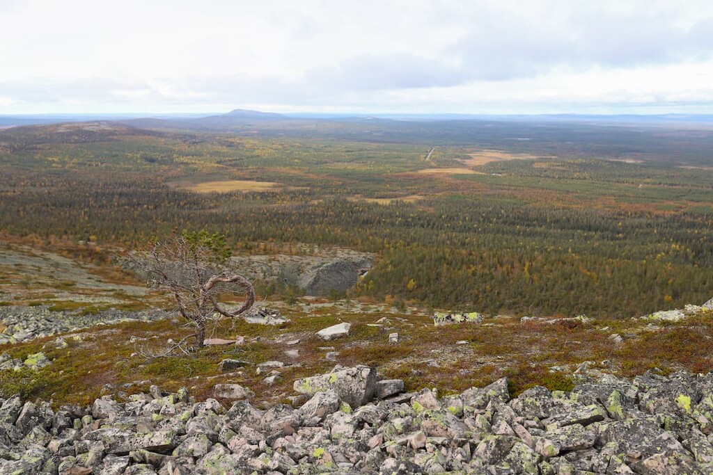
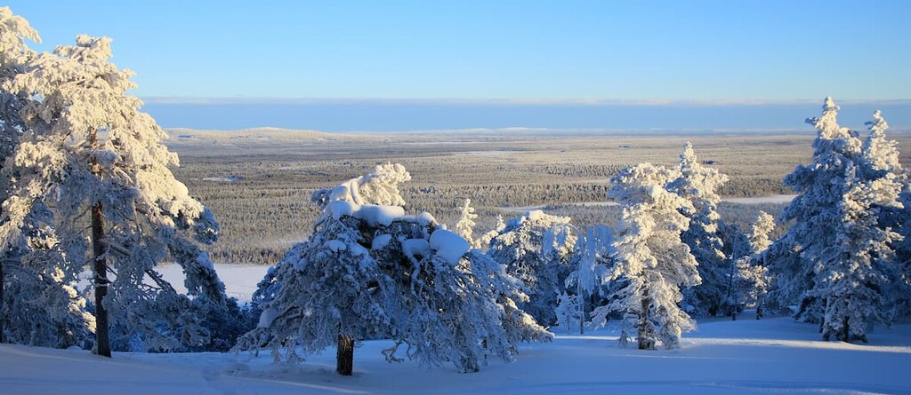
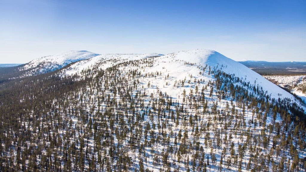
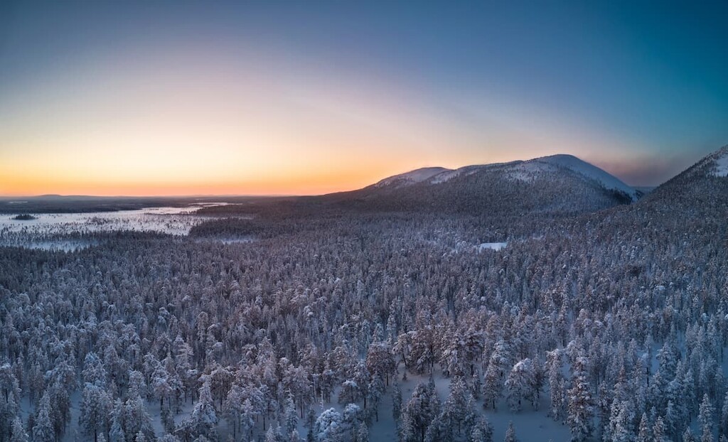
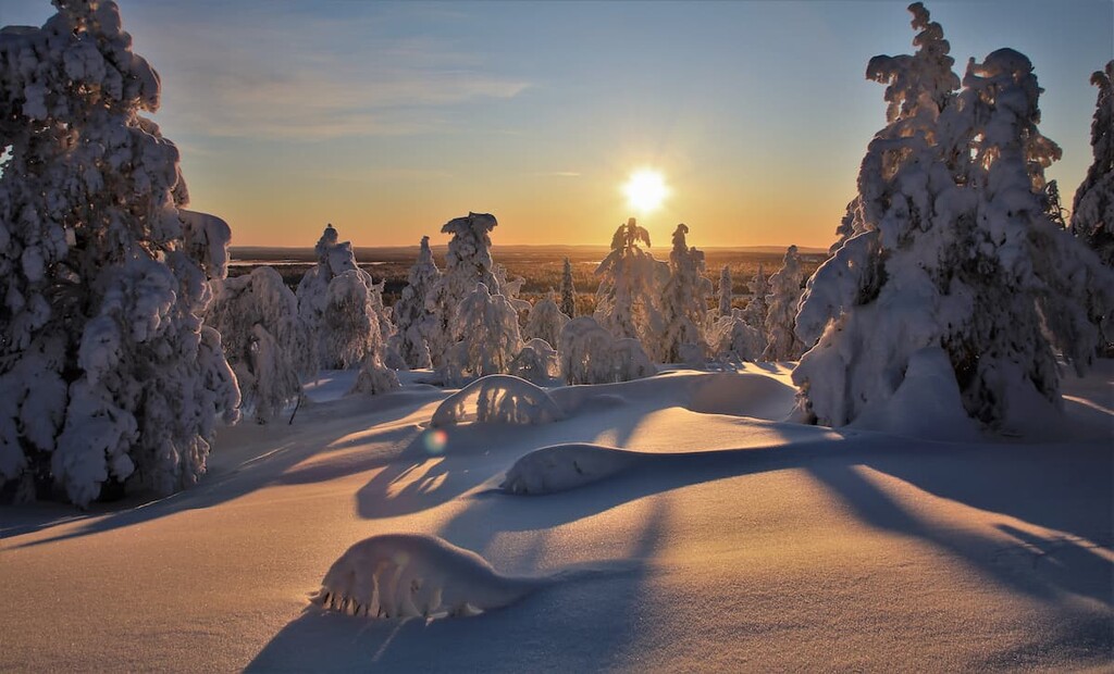
The main feature of the landscape of the Pyhä-Luosto National Park is the chain of fells, which stretches for 35 km (21.7 mi). In general, each of the fells is similar in appearance to the other: It is a low mountain covered with shrubs, the top of which, however, usually has a rocky surface. Because of the high concentration of granite and quartzite in the bedrock of the hills, there is almost no vegetation growing on them.
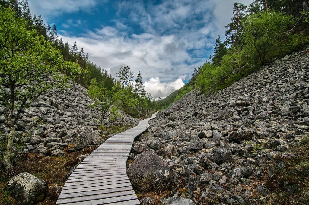
The second feature is the Isokuru Gorge, which is about 220 m (721.7 ft) deep and is located between the Kultakero and Ukonhattu fells. This is the deepest gorge in all of Finland. In the park there are also many other deep ravines, steep slopes, and quarries—all are the traces of the same glaciers.
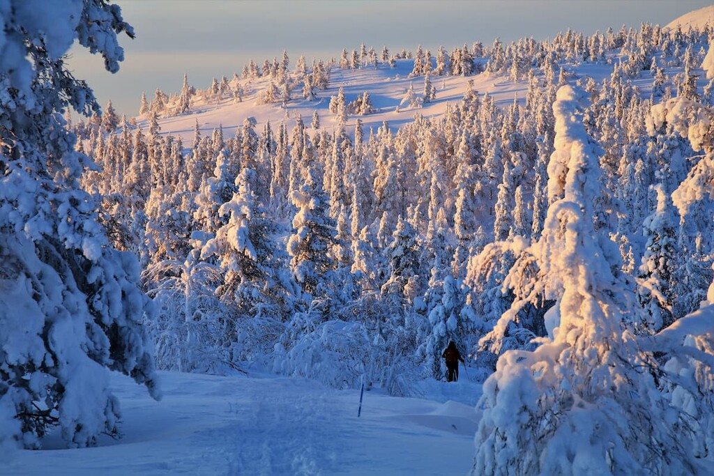
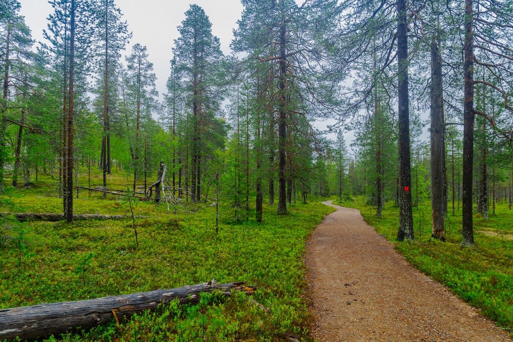
However, like everywhere in Lapland, there are many highland old-growth pine and spruce forests, growing at a height of about 320–400 m (1,049–1,312 ft) in elevation. There are also many different types of large and small swamps, and many water resources like springs, streams, lakes (Huttujärvi, Pyhäjärvi, and others), ponds, and rivers (Siurunjoki, Pyhäjoki, Kitine, and others). The park also has a large waterfall that’s worth checking out.
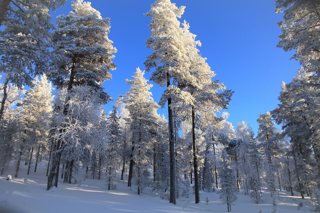
In particular, on the southern slopes of the same Lampivaara Fell in the Luosto area, there are forests with huge pine trees that are 400 years old. They were not cut down for timber, so they have since been able to grow to extraordinary heights.

The many different plants of Pyhä-Luosto National Park are typical of Lapland. In the forests of the park, you can see black bearberry, the alpine clubmoss, the trailing azalea, and the blue heath, among others. As elsewhere, mosses and lichens abound here—especially in the swamps.
The easiest plants to find (and taste) in the region are blueberries, lingonberries, cloudberries, and other berries, and different edible mushrooms. Mushrooms and berries grow throughout Finland at about the same time of year, around the end of July. They can be picked and enjoyed until the first frosts in October.
The main animal of the Pyhä-Luosto National park is a small Siberian Jay bird, which is even pictured on the park’s logo. (The logo also shows a standing dead pine tree without branches—another common feature of the Finnish landscape.)
The Siberian Jay is a small bird that usually travels in flocks of several individuals. It looks a lot like a sparrow because of its size and the similar brown coloration. However, the Siberian jay is distinguished from sparrows by bright orange feathers on its wings and tail.
This bird is also distinguished by the fact that it eats almost everything: berries, seeds, insects, and even tourist food, which it can drag away to its hollow in a tree, preparing in advance for the winter. The bird does not fly south to warmer lands for the winter but lives in the park all year round.
In total, scientists have counted more than 128 different species of birds in the park. There are also a number of large animals that permanently inhabit the park, such as the European otter, brown bear, moose, reindeer, fox, and hare, among others.
The territory of the Finnish part of Lapland is a vast area of land with small mountains and hills, or fells, as they are called, up to about 1,000 m (3,280 ft) in elevation.
These fells are the remnants of the ancient mountains, the Karelides, that existed in Finland 2 to 3 billion years ago, extending to the Finnish part of the Karelia region, which is divided into North Karelia and South Karelia in the southeastern part of the country.
Nowadays, we can only see the bases of these giant mountains. But when they were at their highest, they were as tall as the modern-day Alps, where the highest mountain is Mont Blanc (4,807 m / 15,774 ft).
Here’s a little bit more information about the most famous peaks of the park:
Noitatunturi, the name of the highest peak of the park, means "The Witch Fell." Like many other names in this area and Lapland in general, it refers to pre-Christian times, when these territories were inhabited only by the Sámi people.
The fells are traditionally considered to be sacred by the Sámi, a place of the gods (and people's worship of them) and some other beings, such as witches. Indeed, the Sámi often used the hilltops for sacrifices in the hope of successful hunting and fishing. The process of Christianization of these places did not take place until 1648.
The main peak of Pyhätunturi is located in the southern part of the park. As the southern part of the park is one of the most popular tourist spots in Lapland, this peak is a common starting point for mountain travel in the area.
Ukko-Luosto is the main summit in the northern part of the park. There's a challenging trail leading to the summit that involves climbing some 670 steps that have been carved into the cliffside.
In addition to the stunning views, there is a weather radar on the fell’s top—a special meteorological device that collects data about the state of the atmosphere (temperature, wind, precipitation, and others). Radars, in particular, are used to make real-time weather forecasts, when you can see on the application screen, for example, that the rain will start or stop in 30 minutes.
Some of the other high peaks in the park that are worth mentioning include:
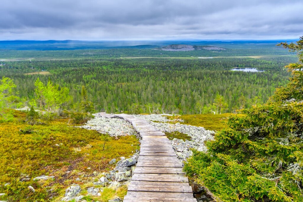
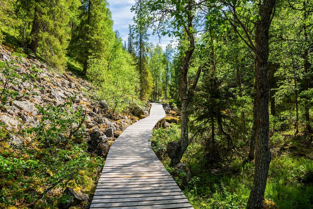
Pyhä-Luosto National Park has 74 km (46 mi) of marked hiking trails of varying lengths, from half-day hikes to multi-day backpacking adventures in the wilderness.
Starting points for hiking in the park are the parking lot at the Luosto Ski Resort and the Pyhä-Luosto Visitor Centre “Naava.” You can also access some of the park's trails from the forest road leading to Huttujärvi Lake and in the areas around Rykimäkero and Luostonloma.
The Noitatunturi Fell Top Trail is a demanding hike because it features an abundance of roots and rocks on the path that leads to the summit of the highest fell in the whole park. The route also includes approximately 70 m (229 ft) of metal duckboards in Oravalampi wetland, too.
From the summit of the fell, you will have great 360-degree views of the surrounding area, which includes the other peaks of the park, endless pine and spruce forests, swamps, lakes, and rivers.
The Isokuru Gorge Trail is a moderate trail through the largest and the most famous gorge of the Pyhä-Luosto National Park, where you will learn more about the history and geology of the gorge on special information boards.
You won't have to climb many rocks along the way as many of the duckboards in the area are comfortable and safe enough to walk on. However, you can’t step off these trails during the hike because the gorge is a restricted area that’s designed to protect the unique nature.
The gorge can only be visited in summer because in winter it is closed due to the danger of avalanches. (Important: the gorge will be closed during the summer and autumn of 2021 due to the rehabilitation of trail structures.)
The trail will eventually lead you to Pyhänkasteenlampi Lake and to the Pyhänkasteenputous Waterfall, the latter of which is 17 m (55.7 ft) high and is formed by flowing into the lake from another gorge in the park, Karhukuru Gorge.
From there you can go back along the loop route back to the trailhead.
The Pyhä–Luosto Trail is a long backpacking trail between two parts of the park, its two main peaks (not including the highest Noitatunturi), and its two ski centers. A truly perfect adventure.
Along this trail, you will visit some of the most remarkable places: Ukko-Luosto Fell, Lampivaara Amethyst Mine, Isokuru Gorge, Pyhänkasteenputous Waterfall, and Pyhänkasteenlampi Pond.
The trail can be hiked even by new hikers both in summer and winter on skis. The distance between resting points and overnight accommodations is short. You can rest on the trail in several day-trip huts and in traditional Sámi huts, or you can stay overnight in one of the open wilderness huts or even lean-to-shelters if you hike in mid-summer.
In addition to hiking in the Pyhä-Luosto National Park, you can do some other sports and outdoor activities, such as geocaching, swimming, boating, fishing, cycling and mountain biking (100 km/60 mi of marked trails), bird and wildlife watching, picking berries and mushrooms, seeing the sights, and enjoying the sauna.
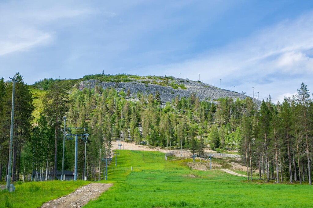
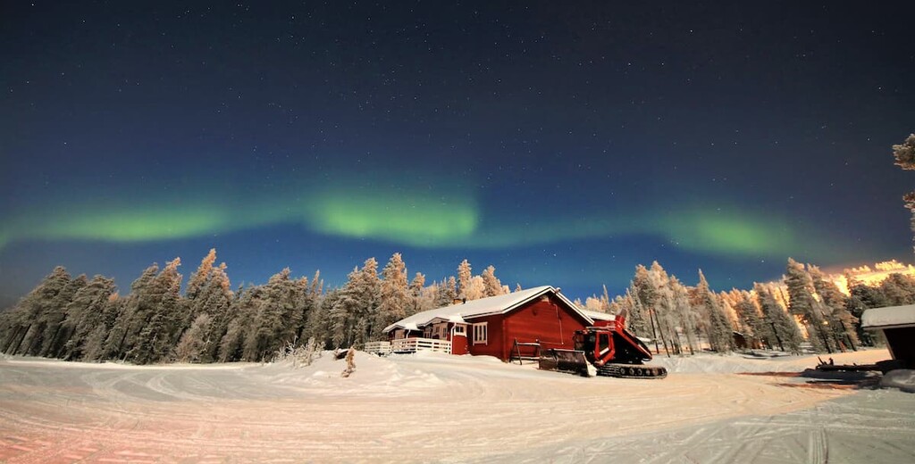
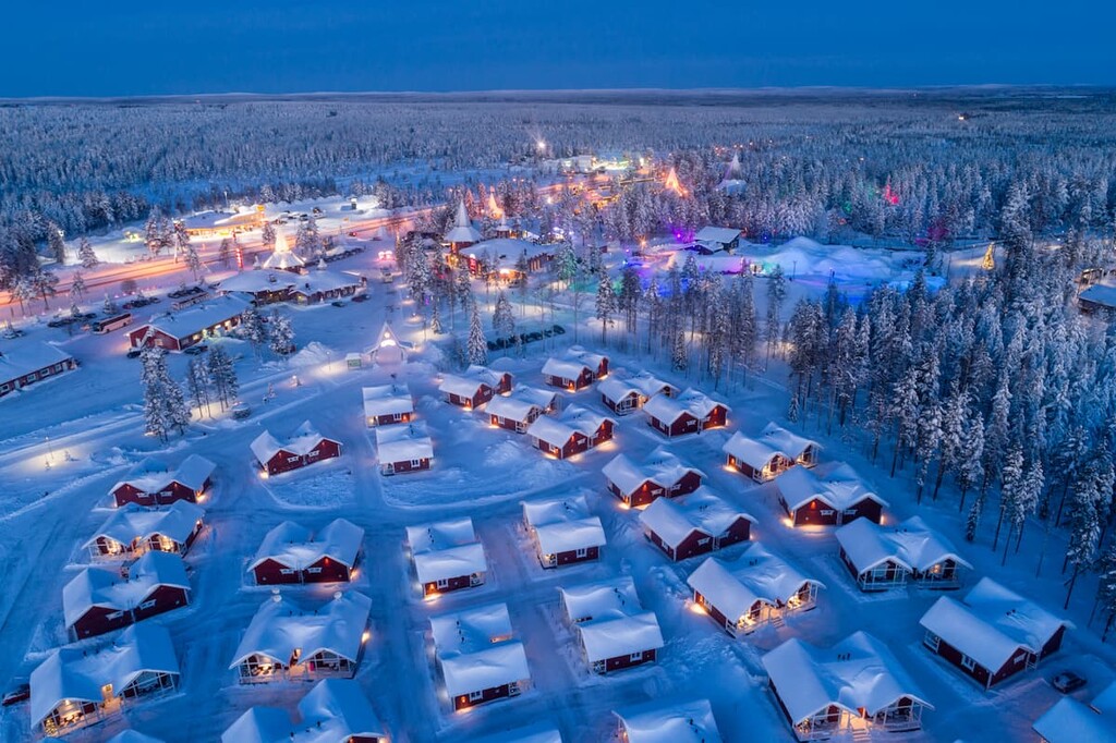
In winter, you can go skiing in the park. In fact, you can ski here for more than 200 days a year, so long as there is snow in Lapland. The season starts around November and ends in March. There are a total of 26 slopes and 13 lifts at the park's two resorts: Pyhä and Luosto. The longest slope is 1,800 m (5,095 ft) and there are more than 150 km (93.2 mi) of cross-country skiing trails, too.
The park has winter hiking trails and opportunities for snowshoeing (19 km/11.8 mi) of marked trails), as well as winter trails for biking and fat-biking.
The park's visitor center is called “Naava” and it is located in the south of the park in the Pyhä area near the ski resort of the same name at the foot of Kultakero Fell.
In the visitor center, there is a permanent exhibition where you can learn more about the nature of the region, get a free map of the routes, and ask the staff of the center for advice. In the center, there is also a souvenir store, NaavaShop, and Café Loimu, where you can try Finnish pastries.
Pyhä-Luosto Visitor Centre Naava
Luontotie 1, 98530, Pyhätunturi (Pelkosenniemi), Finland
General opening hours: Mon–Fri from 9 am to 5 pm, Sat–Sun from 10 am to 5 pm. During the skiing season (February 16–March 10): Mon–Fri from 9 am to 6 pm, and Sat–Sun from 10 am to 6 pm.
+358206397302
In Finland’s national parks, there are some simple rules of conduct and responsible travel that are important to know and follow:
You can:
You can also do the following, but with some restrictions:
You can't:
When hiking and backpacking in Finland’s national parks, you can stay overnight in one of several basic types of temporary accommodation. In total, there are about a dozen of them. They differ in terms of conditions and rules, quantity, and cost.
In Pyhä-Luosto National Park, there are three open wilderness huts (Huttuloma, Yli-Luosto, and Salmiaapa) with free beds for 1–2 nights and around 15 lean-to shelters. It is a kind of a shelter with a roof, but no doors and windows. But, it is possible to sleep in a lean-to during warm summer nights when there aren’t many insects (July to August).
There are also three rental huts (Huttujärvi, Kuukkeli, and Yrjölä) for €50–60/day. They have saunas, too. You can rent these huts for up to three days at a time. Also, don't forget that another option for an overnight stay here is to pitch a tent in any of the many camping sites found around the park.
You can find out more about overnight stays in the parks in the “Services” section of each park’s page on the official website of the national parks of Finland.
All the villages around the Pyhä-Luosto National Park offer rental cabins, campgrounds, hotels, and B&Bs, too, so you shouldn’t have a problem finding a place to sleep before and after hiking in the region.
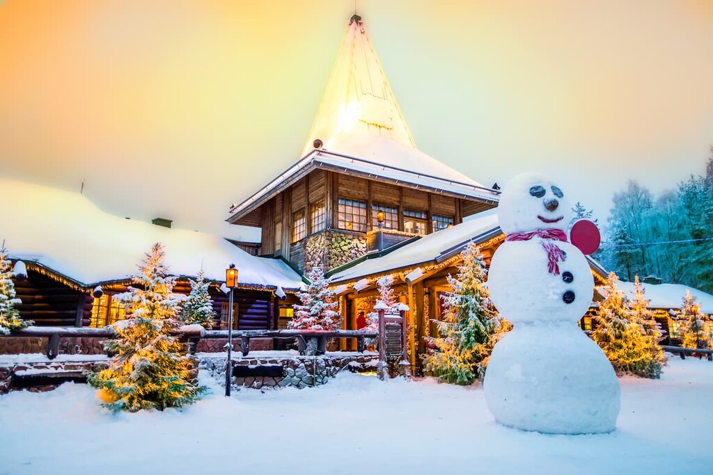
The first tourists began to come to the Pyhätunturi area of the park back in the 1920s. Not long afterward, the second part of the park was opened by these same tourists in the 1960s. For the past 60 years, both parts have been a popular tourist destination largely because of the location of Rovaniemi, the capital of Lapland.
The closest large town to the borders of the park is called Kemijärvi. Officially it is the northernmost city in Finland of this size. The town is located less than an hour's drive from the Pyhä area on the large and beautiful lake of the same name, where you can fish to catch pike, perch, and brown trout.
The community includes 30 smaller settlements. Today it has 7,167 inhabitants as of 2021. However, the bulk of the people in the region only speak Finnish, so take a dictionary with you. That being said, in a hotel or store, you will probably find someone who knows a phrase or two in English.
The main attractions of the city, in addition to the lake are:
Other towns in the vicinity of this city and park are Pelkosenniemi in the north, Salla in the east, Posio in the south, and Rovaniemi in the west.
The official tourist website of Kemijärvi is VisitKemijarvi.fi.