Scan the QR code and open PeakVisor on your phone
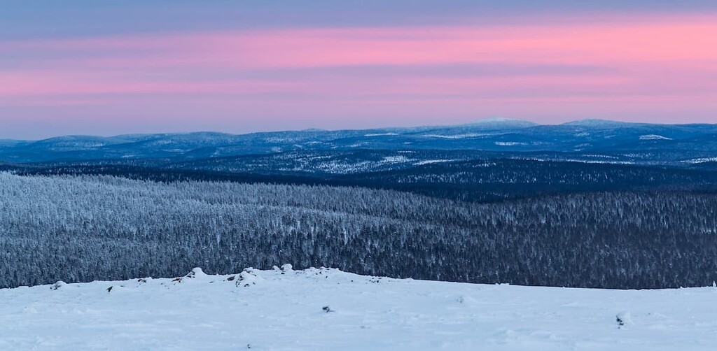
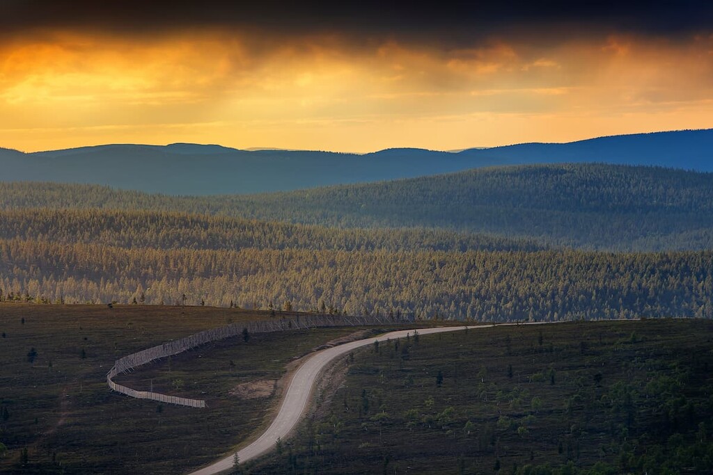
Urho Kekkonen National Park is one of Finland’s 40 national parks, located in the far north of the country in Lapland. The main feature of the park is its mountains; indeed, it is the most mountainous national park in Finland. There are 99 named peaks in Urho Kekkonen National Park, including Korvatunturi Fell (486 m / 1,594 ft), where, as it said, Finland’s Santa Claus lives. But the highest and the most prominent mountain is Sokosti (718 m / 2,355 ft).
Urho Kekkonen National Park was founded in 1983. It is located in the Sodankylä, Savukoski, and Inari communities in the eastern part of the Lapland region along Finland’s border with Russia. It is both the second-largest (2,550 km² / 984 mi²), and second most popular park in the country (almost 300,000 people annually).
The park is divided into two parts. The main part, located in the Saariselkä area, where the main tourist and most hiking trails begin, is mostly popular for short one-day walks. Meanwhile, in the Kemin—Sompio and Nuortti parts of the park, you can go on long hikes in the wilderness.
From Helsinki to the village of Saariselkä, on the northwestern borders of the park, it is 1,068 km (663 mi) or about 13 hours by car. The village can also be reached by bus from Rovaniemi, the capital of Lapland, where you can arrive by train or fly from Helsinki in just 2 hours. There are also flights to the town of Ivalo, which is located fairly close to the park.
I have been to Finland 10 times and traveled through it by all possible means of transport. For traveling around the country I highly recommend overland transport, not by air.
This is because Finland is stunningly beautiful and topographically interesting, but you won’t see anything from the airplane. In particular, if you are traveling to Lapland, you can easily meet a moose or other wildlife on the road, making the drive much more interesting. So, by driving, you can see not only the north of the country, but also other natural landscapes along the way.
It’s also worth noting that, to the west of the park, there are two other famous parks: Lemmenjoki National Park and Pallas—Yllästunturi National Park. There are also several wilderness areas for hiking. The park also has quite a long border with Russia near the Lapland Biosphere Reserve.
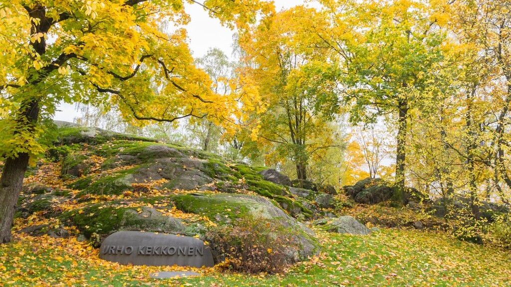
The park is named after Urho Kekkonen, Finland’s sixth president, who led the country for 25 consecutive years from 1956 to 1981.
As the author of this article, he was a journalist. He continued to write in local newspapers and magazines even after he became president. Kekkonen was also a great athlete, when he was young: He ran and participated in the high jump, and he was even a national champion that set many national records.
Urho Kekkonen also loved fishing and skiing, and in 1969 when Urho was already 69 years old, he hiked 200 km (124 mi) through the Caucasus Mountains, meaning he also loved adventures in the mountains. I would even go as far as to say that he was a strong man by all reasons and certainly one who deserves to have an entire national park named after him.
The symbol and logo of the park is a golden eagle, which characterizes its rugged nature and plentiful wildlife spotting opportunities.
Geologically, the entire territory of Scandinavia, including Finland, is located on the Baltic Shield (a segment of the Earth’s crust), which is 1.5 to 3 billion years old.
The main rocks here are various kinds of granite, gneisses, shales, and quartzites, some of which are among the oldest in Europe. There are also many substantial boulders distributed around this region, most of which are remnants of the glaciers that once covered all of northern Europe.
As I said in the beginning, the main feature of the Urho Kekkonen National Park's landscape is that it is the most mountainous such a park in Finland. There are 99 peaks—nine more than in Pallas—Yllästunturi National Park, the second in the list.
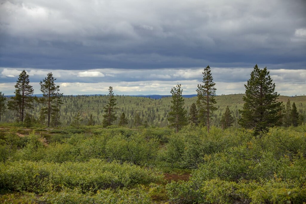
The park also has many pine and spruce forests in the northern part and numerous swamps and other wetlands in the south.
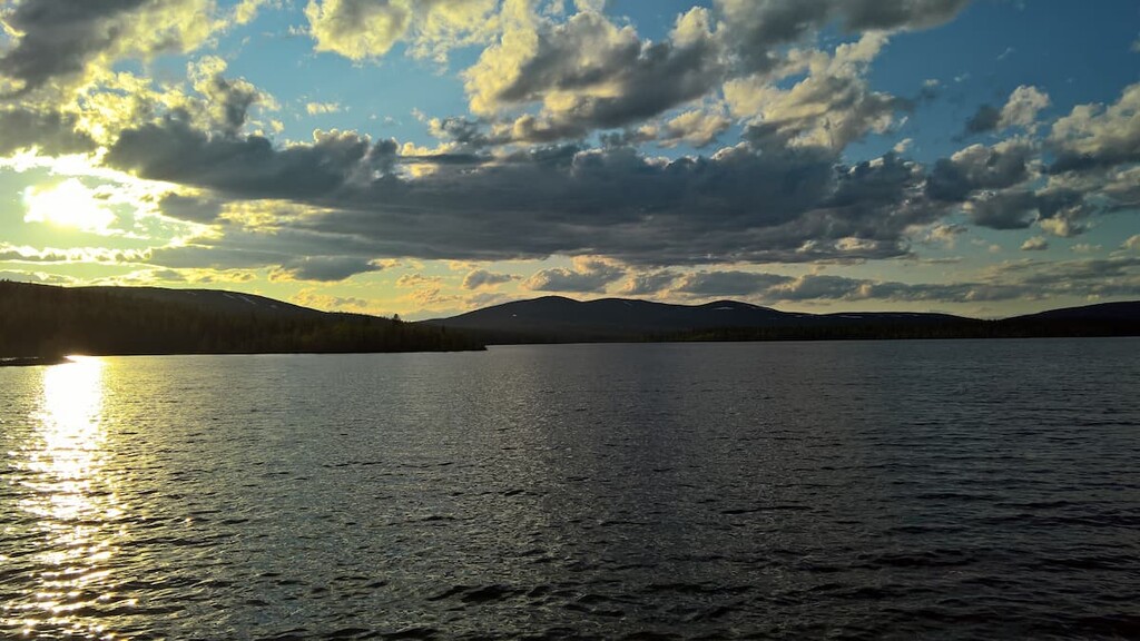
The park, in general, has a lot of water—small lakes, rivers named Luirojoki, Kopsusjoki, Repojoki, Suomujoki, streams and channels.
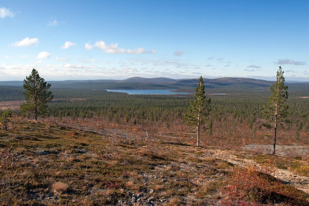
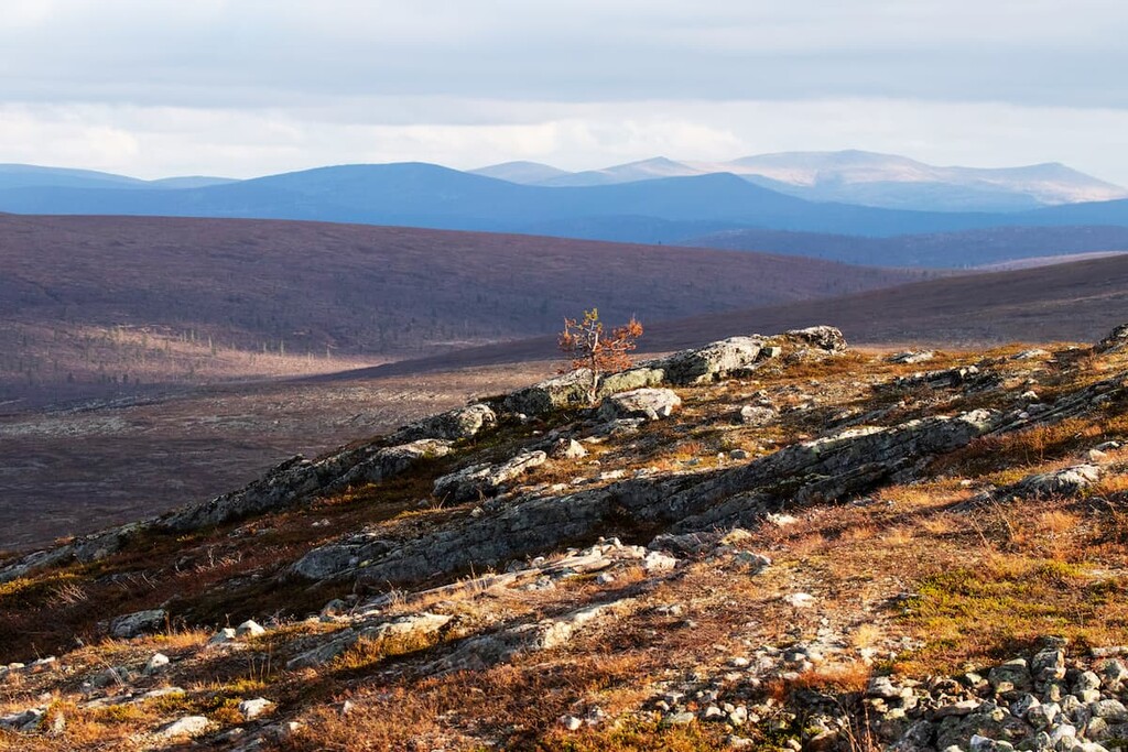
The territory of the Finnish part of Lapland is vast area of land with small mountains, or hills, or fells, as they are called, up to 1,000 m (3,280 ft).
The fells are the remnants of very ancient mountains, the Karelides, that were in Finland some 2 to 3 billion years ago. During this time, they extended as far south as the Finnish part of the Karelia region, which is divided into North Karelia and South Karelia in the southeastern part of the country.
Nowadays, we can only see the bases of these mountains. But, when they were at their highest, they were as tall as the modern-day Alps, where the highest mountain is Mont Blanc (4,807 m / 15,774 ft).
The highest and the most prominent mountain is Sokosti (718 m / 2,355 ft). However, a much lower Korvatunturi Fell (486 m / 1,594 ft), where according to legend, Finnish Santa Claus lives, took the title of the most popular peak of the park since no one can beat Santa in popularity.
If you would like to contact him, you can reach Finnish Santa at the following address: Santa Claus, Santa Claus’s Main Post Office, 96930, Napapiiri (Arctic Circle), Finland.
If you have not heard anything about this "Santa peak" (unlike, for example, the village of Santa Claus in Rovaniemi), then you have nothing to worry about. Many people have not heard of the peak as you can't climb the hill on your own without the special written permission of the border guards.
This is because it is located in a remote part of the park called Itäkaira on the Finnish border with Russia, so access is limited for security reasons. But, you can climb the neighboring fell on one of the trails through the national park.
The other highest peaks of the Urho Kekkonen National Park are:
All of these peaks offer stunning views of the national park. The Finns like to mention that this is one of the last wilderness areas in Europe, so hiking in this region is an experience to remember. I agree with them.
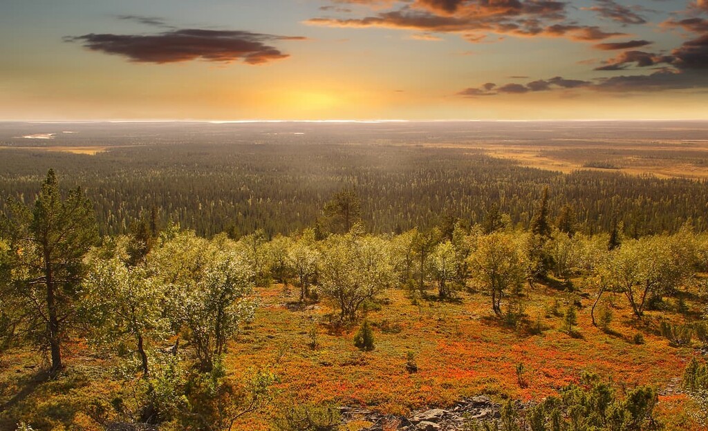
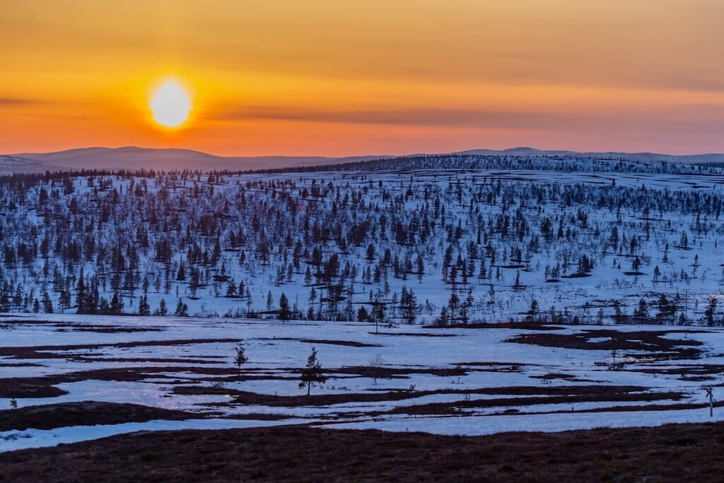
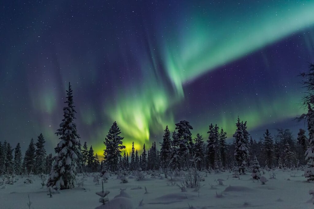
In the park’s swamps, you might find 30 different species of peat moss. The moss also grows on the tops of the fells together with sedge grass, low-growing dwarf shrubs like the crowberry (Empetrum nigrum) and Alpine bearberry (Arctous alpina), which turn red during the autumn color show in Lapland. This makes Lapland a particularly great place to visit during the autumn months.
The bulk of the park is occupied by pine and spruce forests—mostly pristine and wild, with no traces of human presence. As the climate gets warmer, pine and spruce are spread further north and grow at higher elevations on fells. This is already evident in Urho Kekkonen National Park.
Everywhere in the forecast, you can pick berries and mushrooms in the park—two main features of Finland's natural heritage.
The park's vast forests are excellent habitats for numerous northern birds, which spend time here every summer: brambling, common redstart, Siberian jay, grey-headed chickadee, Eurasian three-toed woodpecker, and other birds. A total of 130 species of birds live in the park.
That being said, while it is easy not to notice these tiny birds, the symbol of the park—the golden eagle—is hard to overlook. They are huge birds weighing up to 5 kg (11 pounds) and up to 100 cm (39.3 in) long. It is interesting that females are larger than males as this isn’t common among birds.
Golden eagles hunt hares and other small mammals. Plus, although it sounds unbelievable, golden eagles also hunt deer. Today there are about 20 pairs of eagles living in the park, and in total in Finland, there are around 350–400 birds.
There are over 20 mammals in the park including large carnivores, such as the brown bear, wolverine, wolf, and lynx. But you are more likely to meet reindeer, moose, hares, and foxes. Reindeer husbandry has been the main source of livelihood of the local Sámi people for centuries. The park is also home to shrews, voles, martens, weasels.
In the waters of the park, there are many otters. You could easily see their tracks on the shores of the lakes they leave behind from their fishing. Beavers are less common, but they are there, too. Of course, like everywhere else in Finland, the park has a lot of fish: salmon, trout, kumzha, and others.
But the most interesting inhabitant of the park's water is the freshwater pearl mussel. They live only in very clean water, which indicates the purity of the park’s waterways. When you walk along rivers and streams, look closely—at the bottom may lie not only stones, but also the pearl mussel. But don't take these creatures out, they are very rare and may soon disappear as a species.
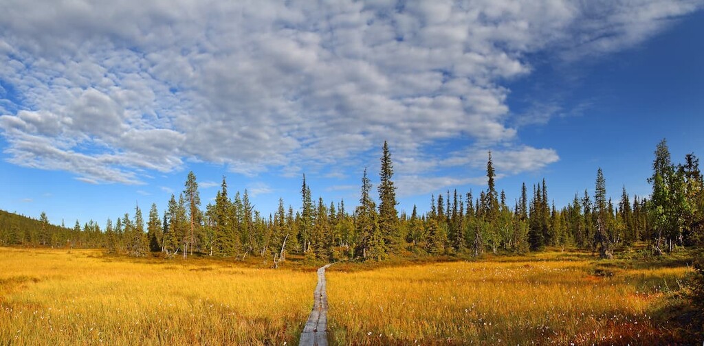
The park has 200 km (124 mi) of marked hiking trails of varying lengths, from half-day hikes to multi-day backpacking hikes in the wilderness.
All hiking trails in the park are divided into “Out to the Fell” trails, which are less than 10–20 km long (6.2–12.4 mi), marked, easy, themed, and ideal for day hikes; and “Out to the Wilderness” trails, which are multi-day trips that are more than 20 km (12.4 mi) long, unmarked, wild, and more challenging for experienced hikers.
Thus, walking the "Out to the Wilderness trails" requires a map, compass, and good orienteering skills. In the wilderness, GPS alone is not enough. At the same time, there are several established trails along with most of these wild destinations.
The most popular “Out on the Fell” trails start in the two villages of Saariselkä and Kiilopää fell center in the north of the park, such as these:
The Rumakuru Gorge Trail begins in the Saariselkä village, a well-known hiking center, just 30 km (19 mi) or so from Ivalo Airport. It has been popular with hikers for decades, long before the park was established.
The reason for this popularity is Kullervo Kemppinen, a lawyer, nature explorer, and writer, who is considered a major early proponent of Saariselkä. Thanks to his books with wonderful descriptions of nature, tour stories, and hiking instructions and tips, the area became popular among hikers. In particular, his first book “The Snow Gorge” (“Lumikuru”, 1958) anchors the hiking and nature experiences in the very heart of the Saariselkä fell area.
From Saariselkä, the trail leads right to this steep-walled gorge from the book created by meltwaters during the last major glaciation. The gorge is now the must-see natural attraction of the area.
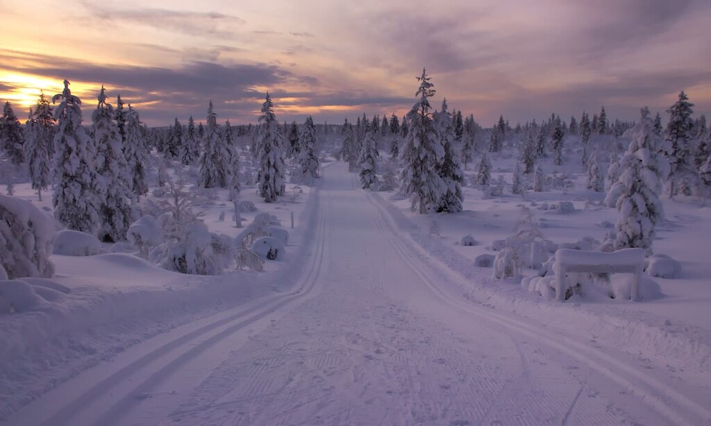
In winter, like many other trails in Lapland, this trail becomes a cross-country skiing trail. From here we have the title of the book, “The Snow Gorge,” which is a testament to this region’s wintertime beauty.
At the end of the trail, there is also a day-hut with the same name, where you can have lunch before heading back. The trail can be hiked in both directions.
The Rautulampi Trail is another classic hiking trail in the park with spectacular landscapes, particularly when you are at the tops of Niilanpää and Rautupää Fells.
On the way, keep a lookout for the old traditional reindeer round-up site (corral) nearby the Niilanpää day-trip-hut. Before the hiking boom, and still today, this area, as well as to Lapland in general, belonged to Inari Lapland and Sami people. The ancient livelihood of reindeer herding is still a major business in the area.
The route offers many more attractions, like, for example, a bridge over the Rautuoja River. But I will not tell you about them all here so that you can discover them on your own.
Luirojärvi Lake Trail is a multi-day unmarked trail through the wilderness areas to the “Pearl of the Urho Kekkonen National Park”—Luirojärvi Lake. The trip requires not only courage and endurance but also orienteering skills.
The route begins and ends at the parking lot at Kiilopääs in the western part of the park. After entering the wild Finnish nature, you will return in about 4–6 days.
The National Parks of Finland staff recommend that visitors hike in these stages:
Along the way, you will see a lot of sights, such as rivers, lakes, ponds, swamps, reindeer pastures, and many fells, including the Sokosti Fell (718 m / 2,355 ft), the highest fell in the park right next to the Luirojärvi Lake. It’s worth staying one day there to climb the fell, before going back to civilization.
On the way, you can stay overnight in one of the forest huts. In any case, it is better to have a tent and other things for backpacking.
In addition to hiking in the park, you can do other sports and outdoor activities, such as boating, fishing, cycling and mountain biking, horseback riding, canoeing and rowing, bird and wildlife watching, picking berries and mushrooms, and enjoy the sauna.
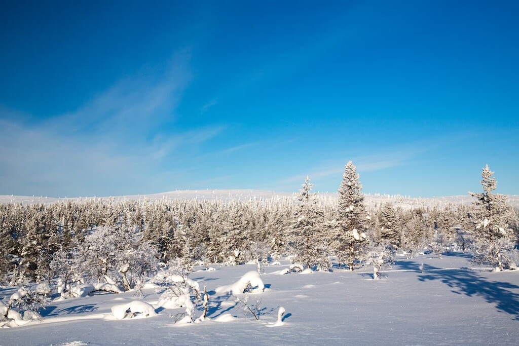
In winter, skiers can make trips within a ski trail network in the Saariselkä, Kiilopää, and Kakslauttanen areas. The total length of maintained ski trails is 200 km (124 mi), of which 70 km (43.4 mi) is located in the park's recreational and nature tourism zone.
The Urho Kekkonen National Park's visitor center is located in Saariselkä village in the building of the hotel named "Santa's Hotel Tunturi." There, you can get information about trails, visit exhibits, buy paper maps, book forest huts, and just ask for advice from the incredibly helpful local staff:
Saariselkä Customer Service
Lutontie 16, 99830, Saariselkä (Inari), Finland
Open all year round with varying hours
+358206397200
You can also check out the park’s page on the official website of the National Parks of Finland.
In Finland’s national parks, there are some simple rules of conduct and responsible travel that are important to know and follow:
You can:
You can also do the following, but with some restrictions:
You can't:
When hiking in Finland’s national parks, you can stay overnight in one of several basic types of temporary accommodation. In total, there are about a dozen of them. They differ in terms of conditions and rules, quantity, cost...
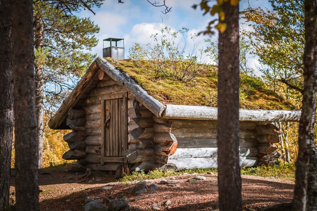
In this park, there are 17 open wilderness huts with free beds for 1-2 nights and 27 lean-to shelters. Lean-tos are a kind of shelter with a roof and with no doors or windows, but it is possible to sleep in them during warm summer nights.
There are also 13 reservable wilderness huts with a bed for €12 a person/night and three rental huts for €30 to €50 euros for 12 or 24 hours, respectively. Don't forget that another option for overnight stays here is to camp in a tent.
You can find out more about overnight stays in the parks in the “Services” section of each park’s page on the official website of the national parks of Finland.
Before and after the hike, you can find accommodation at the Saariselkä village, Ivalo, or in the Inari villages.
There are no large or even medium-sized towns near the borders of the park, but, as I said before, the small village of Saariselkä is considered a local tourist center. The name translates as “saari” for “island” and selkä for “ridge”.
The village is part of the Inari community, a population center of the Indigenous people of Lapland, the Sami. It has 350 residents as of 2011.
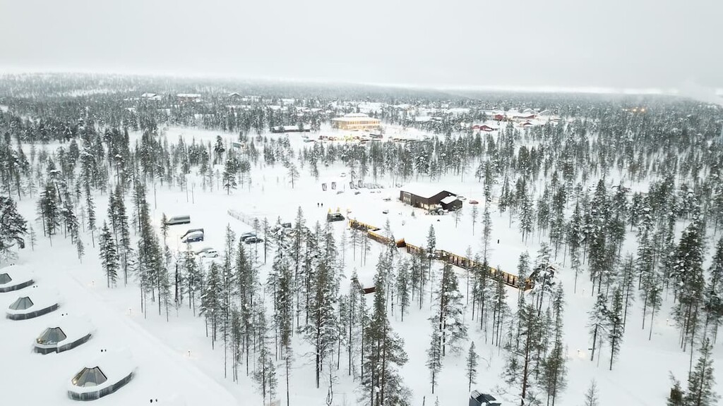
However, the town has about 13,500 beds available for tourists each night. Actually, it is the place with Lapland’s largest selection of nature activities, routes, and guided programs, and Europe’s northernmost outdoor resort of such importance.
It is popular both for summer and winter activities. In winter, there is downhill skiing resort with 15 slopes, Finland’s longest tobogganing slope, and six lifts on two fells, about 200 km (124 mi) of well-maintained cross-country skiing tracks, and other winter activities including a spa-center and many saunas.
The main cultural attractions in the village are "Siula" Business Center; the Kakslauttanen Hotel & Igloo Village, where you can sleep in small rooms made of ice and snow and drink in an ice bar with ice tables and chairs, and other similar hotels.
There are also the two chapels of Pyhän Olavin Kappeli (St. Olaf's Chapel) and Tievakappeli (Tieva Chapel), where it is customary to hold so-called “white weddings” in Lapland when there is only snow around. You can also witness the many reindeer fences and Sámi farms.
The main natural attraction in the village is Kaunispää Fell (438 m / 1,437 ft), the most recognizable of Saariselkä’s fells. There is an observation tower at the top from where you will see the national park, Sompio Nature Reserve, and the endless areas around. You can climb to the top on foot, on skis or by bicycle.
The official tourist website of Saariselkä is https://www.inarisaariselka.fi.